


Marilyn Bridges and the Exotic Restricted Areas of the US Military
Text by Matthew Coolidge
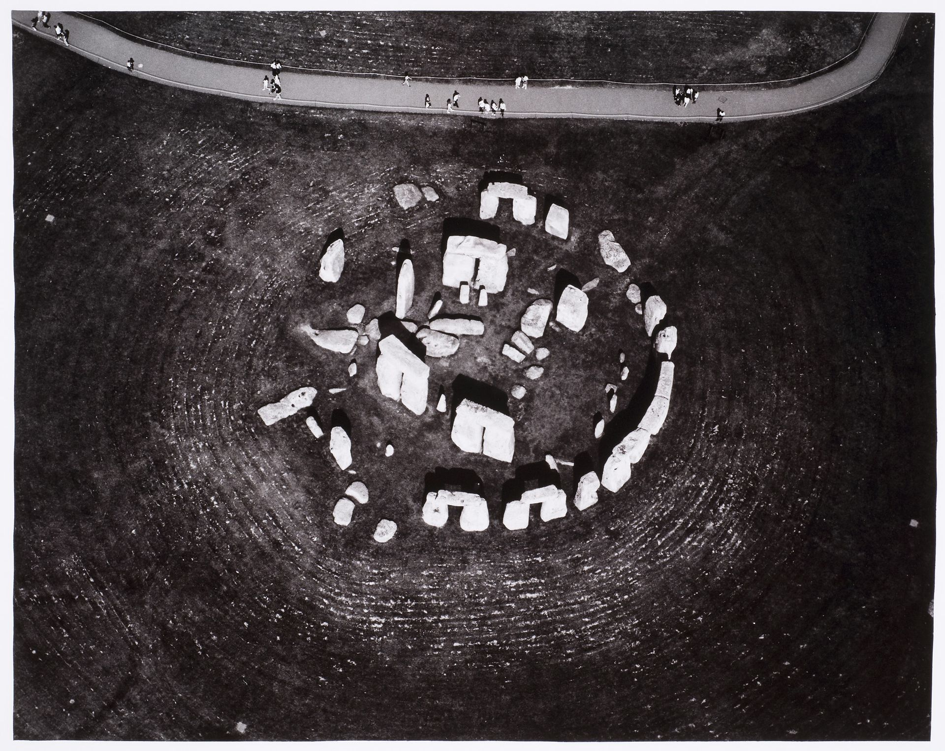
Marilyn Bridges. Aerial view of Stonehenge, near Amesbury, Wiltshire, England. 1985. PH1986:0448
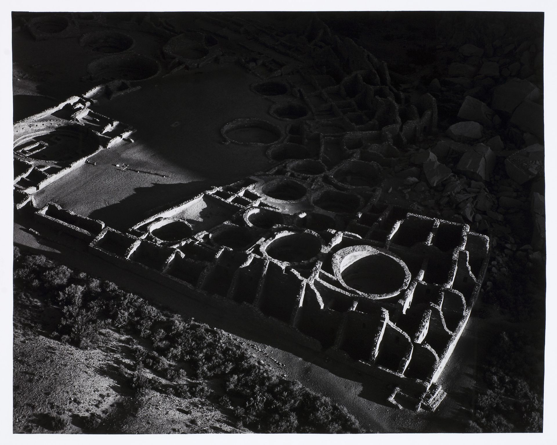
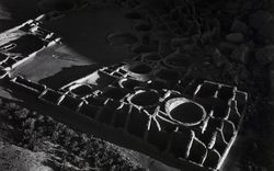
Marilyn Bridges. Aerial view of Pueblo Bonita, Chaco Canyon, New Mexico, United States. 1983. PH1985:0682
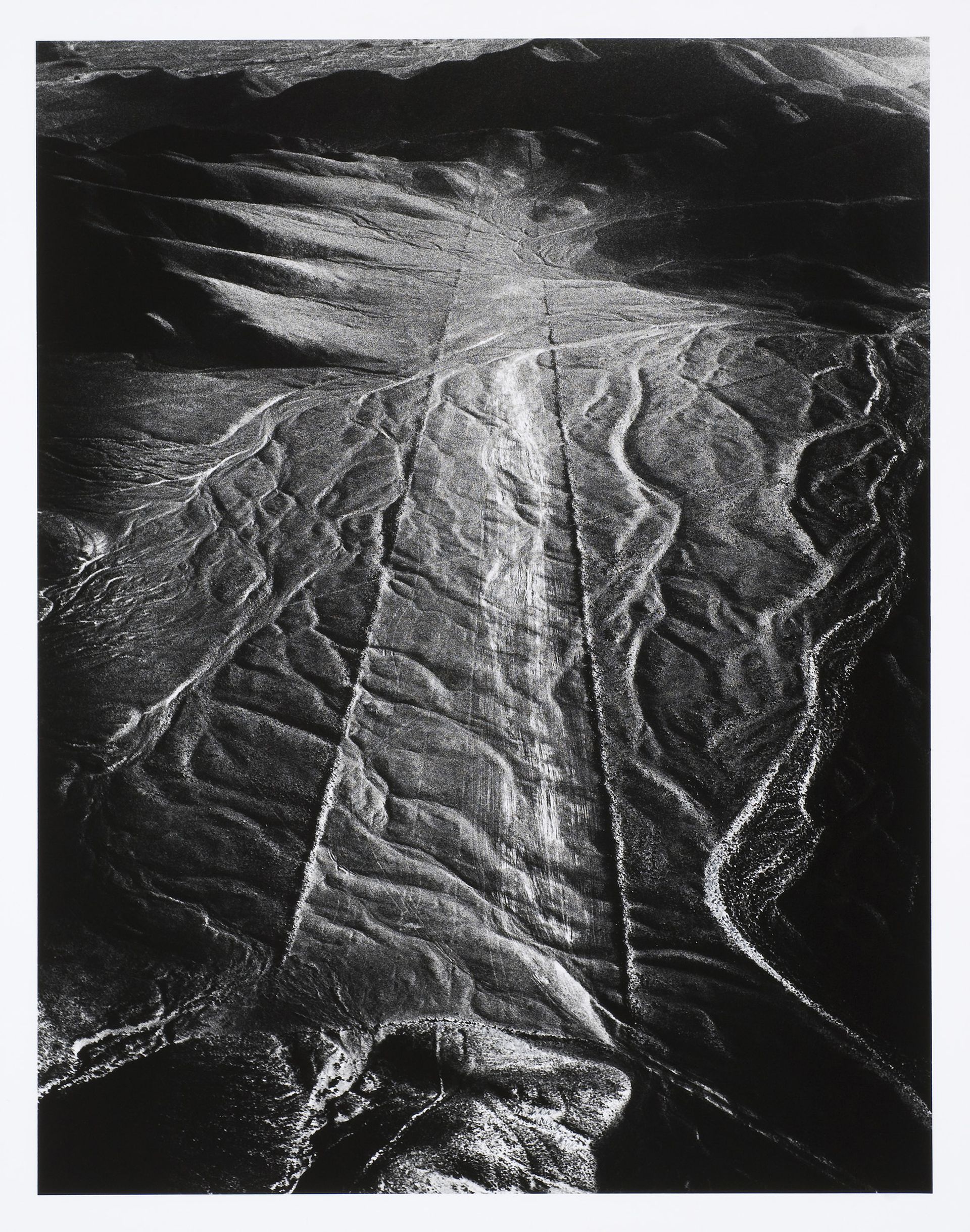
Marilyn Bridges. Aerial view of the ancient earthwork “Pathway to Infinity”, Nazca, Peru. 1979. PH1980:1187
When Marilyn Bridges, working as a commercial photographer, first flew over the Nazca lines in Peru to capture illustrations for a travel story about them, she was so taken by their scale and form, provided by the aerial perspective, that she decided to devote herself to aerial photography in a creative way. She enrolled at the Rochester Institute of Technology in the city in upstate New York dominated by the Kodak Company. Her training allowed her to photograph many famous archaeological sites from the air, like the Egyptian pyramids. Her technique of using high contrast light and a silver gelatin printing process emphasizes the shadows and contrast of the images. She is one of several famous contemporary photographers that photograph the ground from above, like Emmet Gowin, Michael Light, and David Maisel, who apply meticulous printing techniques to enhance the drama of the image, and the thing depicted, making the views more opaque, and subjective. The idea that aerial photography is the last frontier of landscape photography is now playing out.
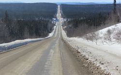
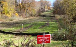
Marilyn Bridges’ photos of archaeological sites have interesting parallels and unintentional antecedents with the testing and training ranges of the southwestern United States. These ranges have large scale lines and shapes, some stretching for miles, that are exposed blatantly on the treeless ground and overlay the preexisting erosional surface textures of the desert. Some of these ranges have full size replicas of roadways, settlements, and landing fields found in past, present, and possible war zones like Korea, Vietnam, and Iraq. Their civilian, aviation, and defense sites are supporting and defending more ancient cultures, but are duplicated in the arid lands of the New World like specimens to be studied, and integrated into scenarios of global dominance. Other forms are present too, such as those for electronic warfare training and targeting, but remain more enigmatic. They exist inside the exotic restricted areas of the US Military, a terra incognita for most people. Besides being politically loaded, these forms are like interpretive inscriptions traced on the ground. They are made simply by moving the soil: terrestrial sketchings on a huge scale. And they can say much about what we think, how we see the world and our role in it.
The evocations of distant and extemporaneous places seen from the air conceptually and formally coincide where the Nazca lines and the bombing target approach lines overlap. The concentric circles of pre-columbian amphitheatres look like open pit mines in Utah (and Peru for that matter). Archaeology and military strategy have driven aerial photography since the beginning. People like Bill Fox and Dennis Cosgrove have written about how the Italian army photographed Roman ruins from the air as early as in 1908, and how the British army’s World War One aerial surveys of the Middle East found traces of ancient settlements that were not on their maps. Later, British military pilots did aerial surveys of their own landscape that revealed Neolithic archaeological sites that were otherwise invisible. In fact the Nazca lines were “discovered” by aviation – they were unknown to modern world until commercial pilots saw them from the air in the 1920s.
Nowadays, with satellite imagery and systems to access it easily like Google Earth, the search for meaning in—and interpretations of—images of landscape has expanded. The global surface has again become a new frontier, echoing the excitement of discovery by explorers heading West into uncharted territory, and again when NASA finally turned around from its expansionist obsessions and took a photo of the planet they came from, where we all have to live and get along.
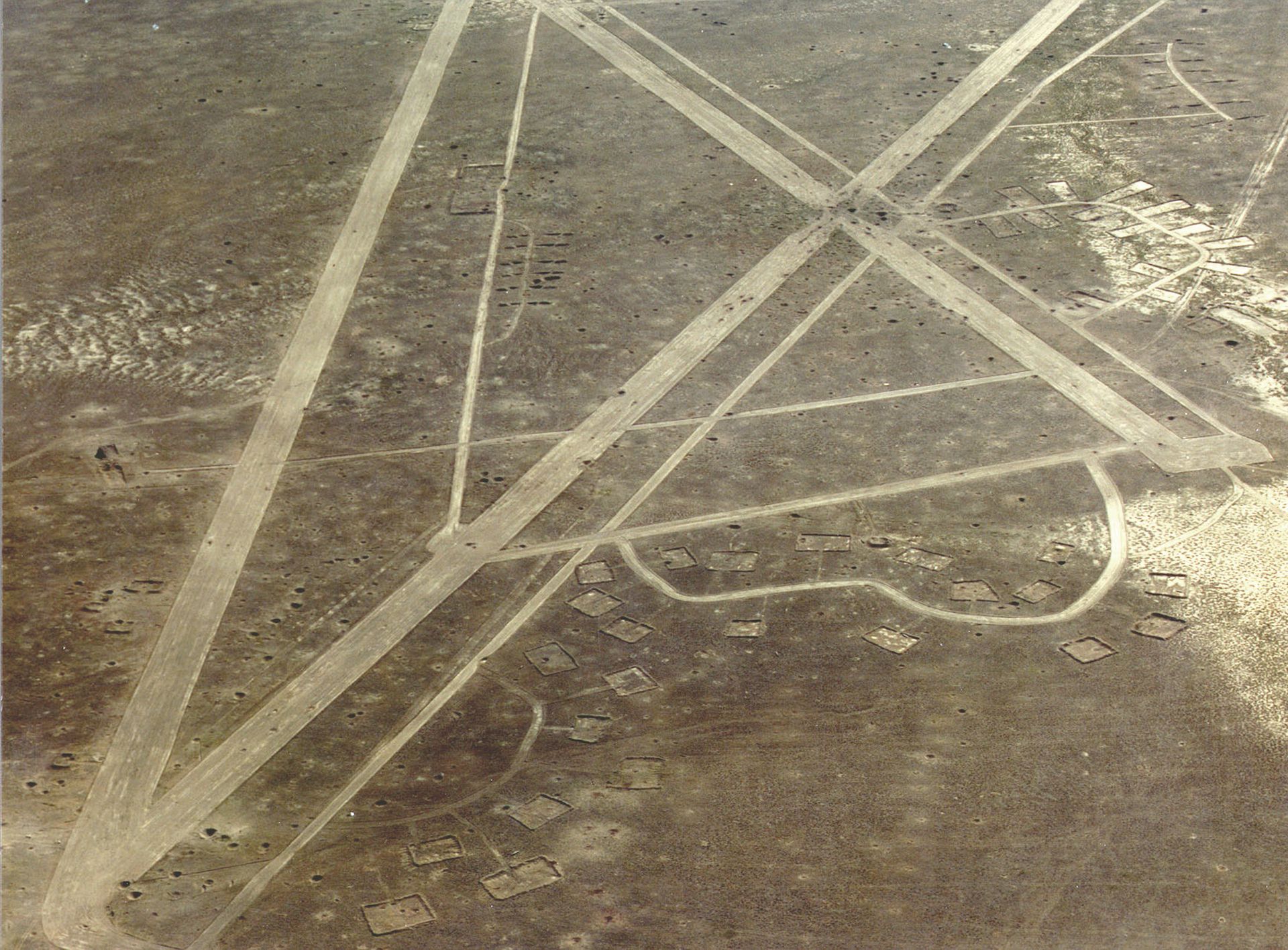
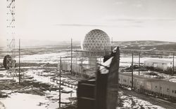
United States Air Force photo of a target airfield at Nellis Range, Nevada, n.d.
Matthew Coolidge wrote this article after taking part in the Testing at Home event series accompanying the exhibition Other Space Odysseys: Greg Lynn, Michael Maltzan, Alessandro Poli.