Whatever Powers are Required
Sian Lathrop on Kahnawà:ke’s expropriation and the construction of the St. Lawrence Seaway
The river now known as the Saint Lawrence runs 3 058 kilometres from the farthest south-western headwater to its mouth, draining the Great Lakes Basin into the Atlantic Ocean. It is into this natural channel that the Saint Lawrence Seaway and Hydroelectric Project is embedded. The finalized project was one of the major engineering undertakings of the twentieth century, generating nearly 1 880 megawatts of power and allowing 20 000-ton ships passage into the Great Lakes. It combined the magnificent natural landscape of the St. Lawrence—one of the earth’s largest water systems formed in an ancient geologic depression—with a mechanized series of locks and channels, a hybrid waterscape fantastic in scale. By expanding the size of existing waterways and constructing new infrastructures, the St. Lawrence Seaway would allow ocean vessels to travel from the sea to the Great Lakes and back again.
Constructed between 1955–1959 and financed jointly by the Canadian and American federal governments, the Seaway was celebrated in the press and by the public. Spectator stands were built to watch the construction crews dig out vast amounts of earth and rock, and the opening celebration was designed by an architecture firm and christened by Queen Elizabeth.
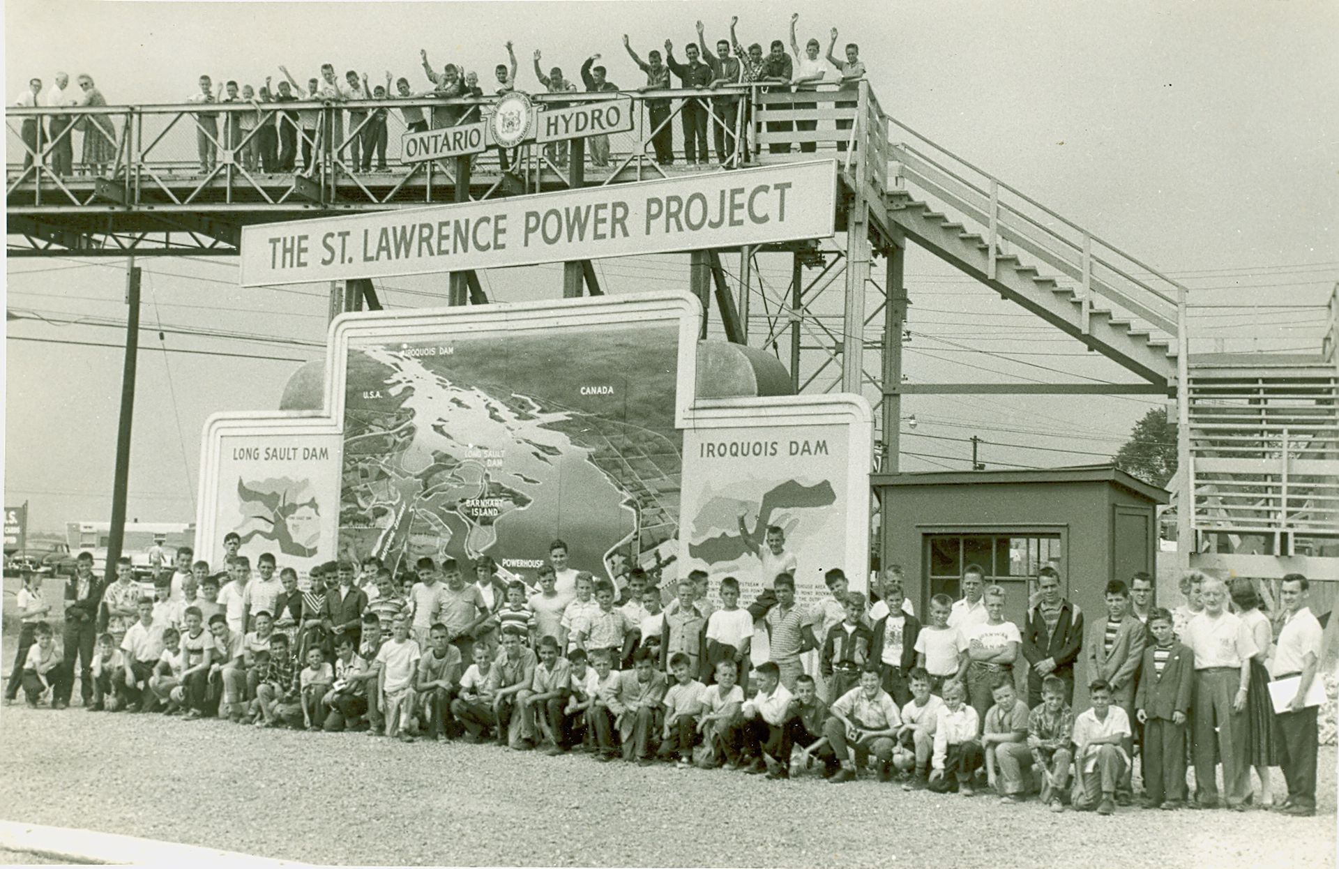
Spectator stands built to watch the Seaway being constructed near Cornwall, Ontario. From the archive at the Cornwall community museum
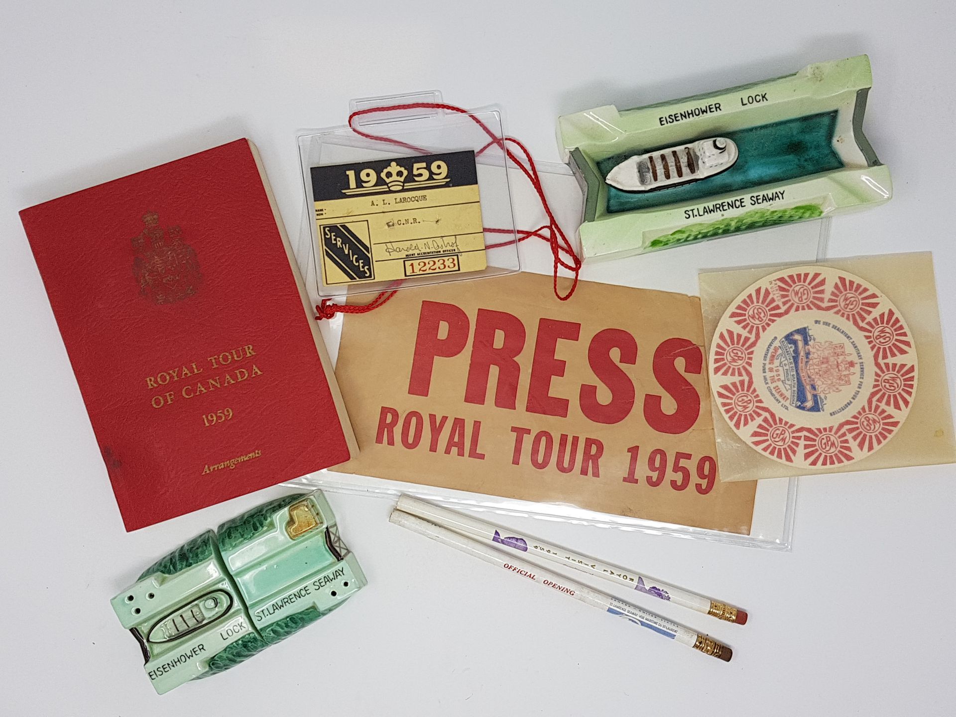
Commemorative memorabilia at the Cornwall community museum
This year, the CCA has dedicated their hall case exhibition to spaces understood as middlegrounds: politically contested sites of settler colonial dispossession that have been created and maintained through design interventions. A critical reading of these middlegrounds can help to reveal the roles of architects, engineers, and designers in the settler colonial project, and help to site the settler record while centring Indigenous lands and legal practices.
The concept of a middleground as a contested space appropriated by settler spatial practitioners requires a critical engagement with what the archive may initially seem to valorize as a feat of design ingenuity. One such site is located just a fifteen-minute drive across the Mercier Bridge from Tiohtià:ke (Montréal). At this place in 1955, a triumph of engineering was achieved while constructing the Saint Lawrence Seaway: the largest bridge raising effort ever attempted to that date.1 It is also the former waterfront of the community of Kahnwà:ke, whose land was forcibly taken to construct one of the Seaway’s many new navigation channels. Kahnawà:ke, which means “on the rapids” in Kanien’kéha, is a Mohawk community and village that has existed across the river from Montréal since 1680.
The Seaway was specifically designed to facilitate the economic, ideological, and industrial growth of the Canadian state through the movement of coal, timber, and raw material from the East Coast into the middle of North America. This nationalist agenda was incorporated into the project’s physical footprint, as the Seaway Authority chose to construct the channel closest to Montréal not on the undeveloped North Shore, but rather on the south side of the Saint Lawrence, a decision that decimated the waterfront and part of the village in Kahnawà:ke Mohawk Reserve.
At the time of its completion, the Saint Lawrence Seaway was the largest federal infrastructure undertaking constructed within the last century, a design project whose physical footprint spanned 306 kilometres from Montréal all the way to Lake Erie. The archival imprint of this infrastructure is similar in scale, with an extensive collection of documents and photographs found in national libraries and cultural institutions across Canada, including the CCA. The Seaway has also left its mark in local spaces and archives, including the photo archive at Kanien’kehá:ka Onkwawén:na Raotitióhkwa Language and Cultural Center, where images of spaces and places affected by the Seaway present an alternative story about land taken to be common ground.
-
To read more about this bridge raising, see Daniel Macfarlane, “Caught between Two Fires,” in Negotiating a River (Vancouver, UBC Press, 2014). ↩
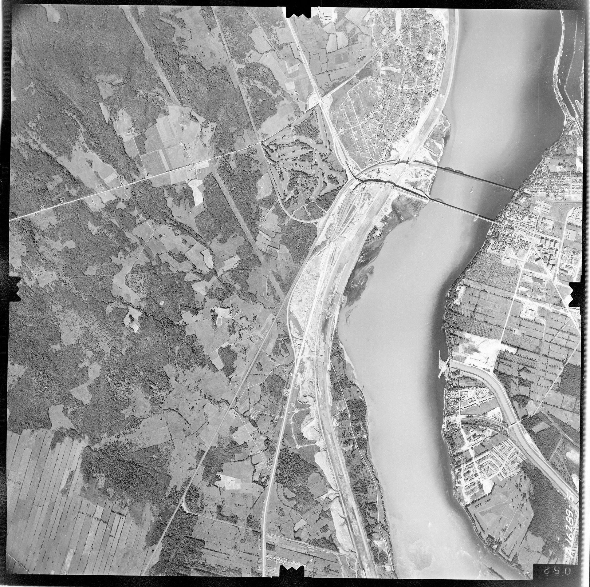
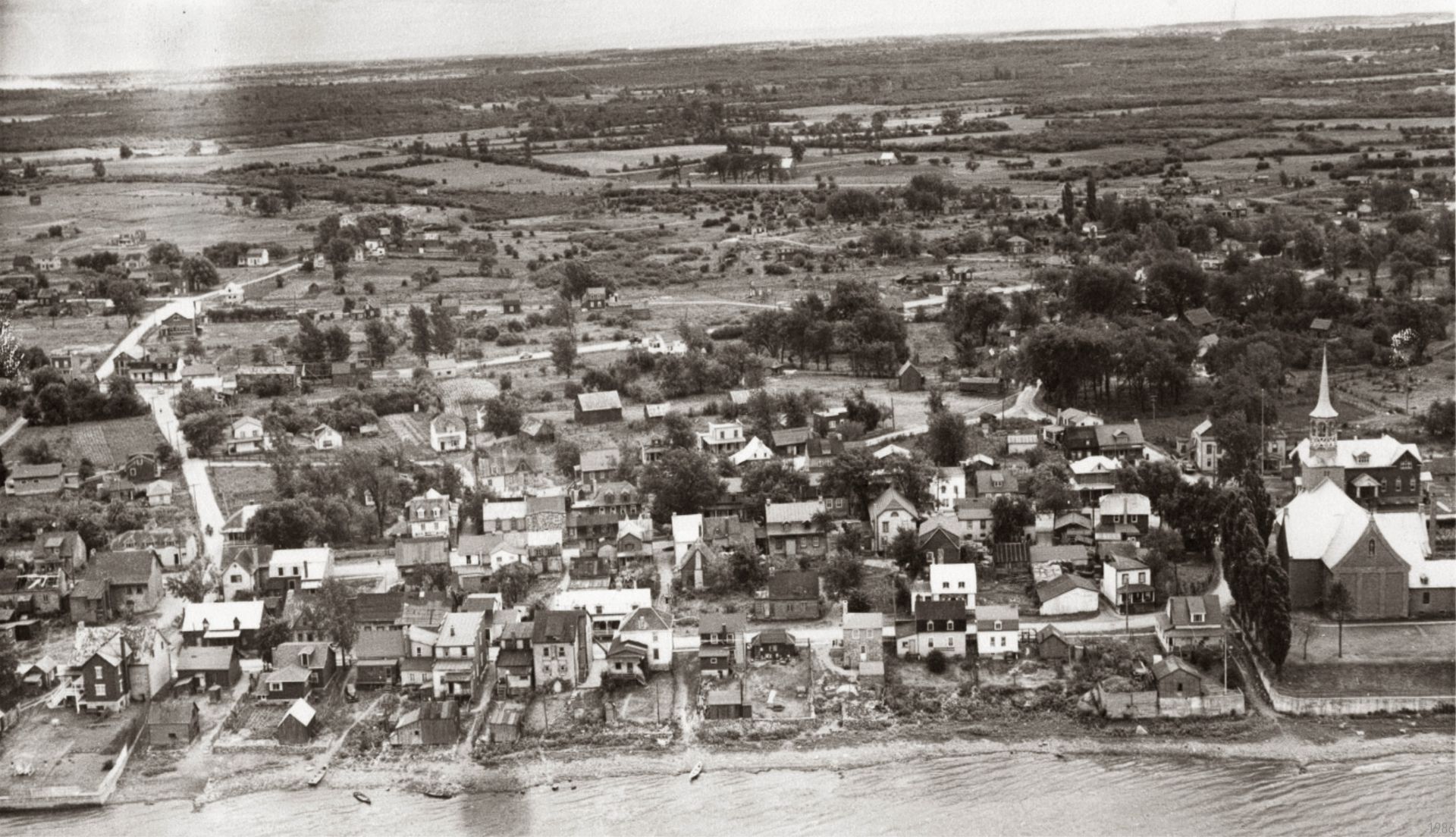
Kahnàwa:ke in 1959 – from the National Air Photo Library, accession number A 16289_051 © Government of Canada
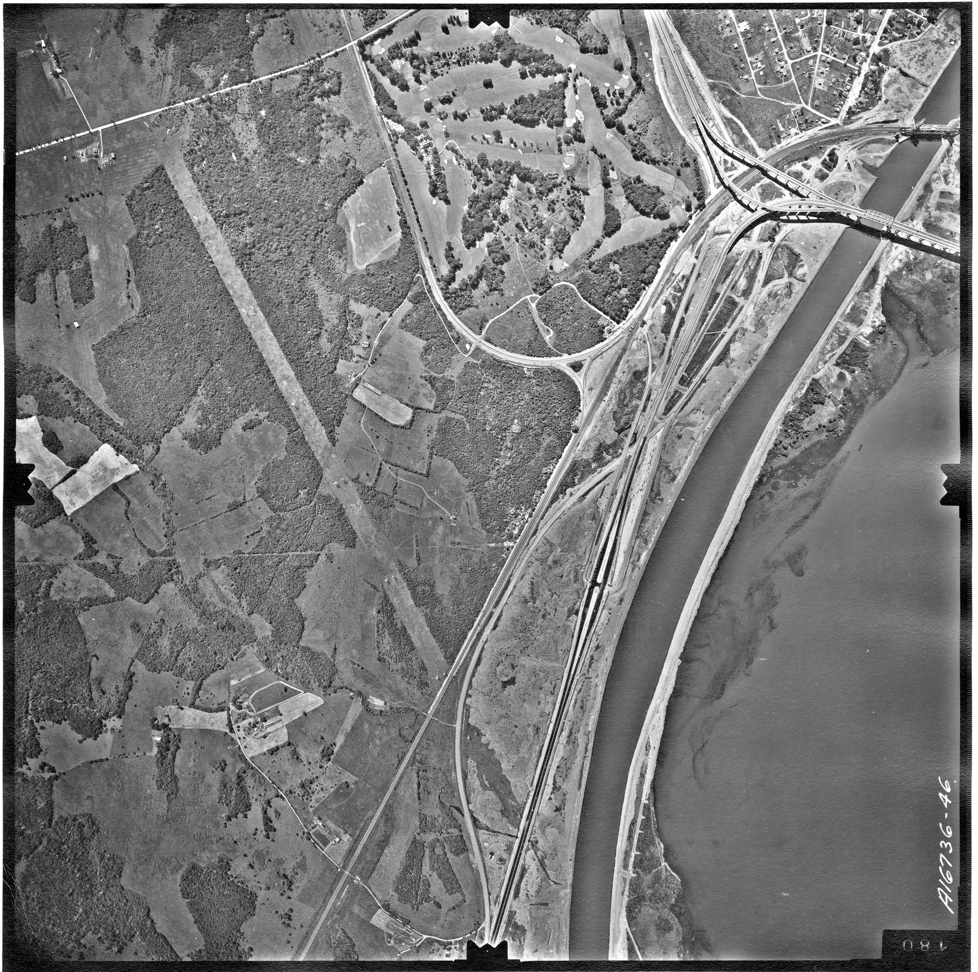
Kahnàwa:ke in 1959 – from the National Air Photo Library, accession number A 16736_046 © Government of Canada
Archival image from Kanien’kehá:ka Onkwawén:na Raotitióhkwa Language and Cultural Center. Kahnawake in 1949. Photo by Roy Montour
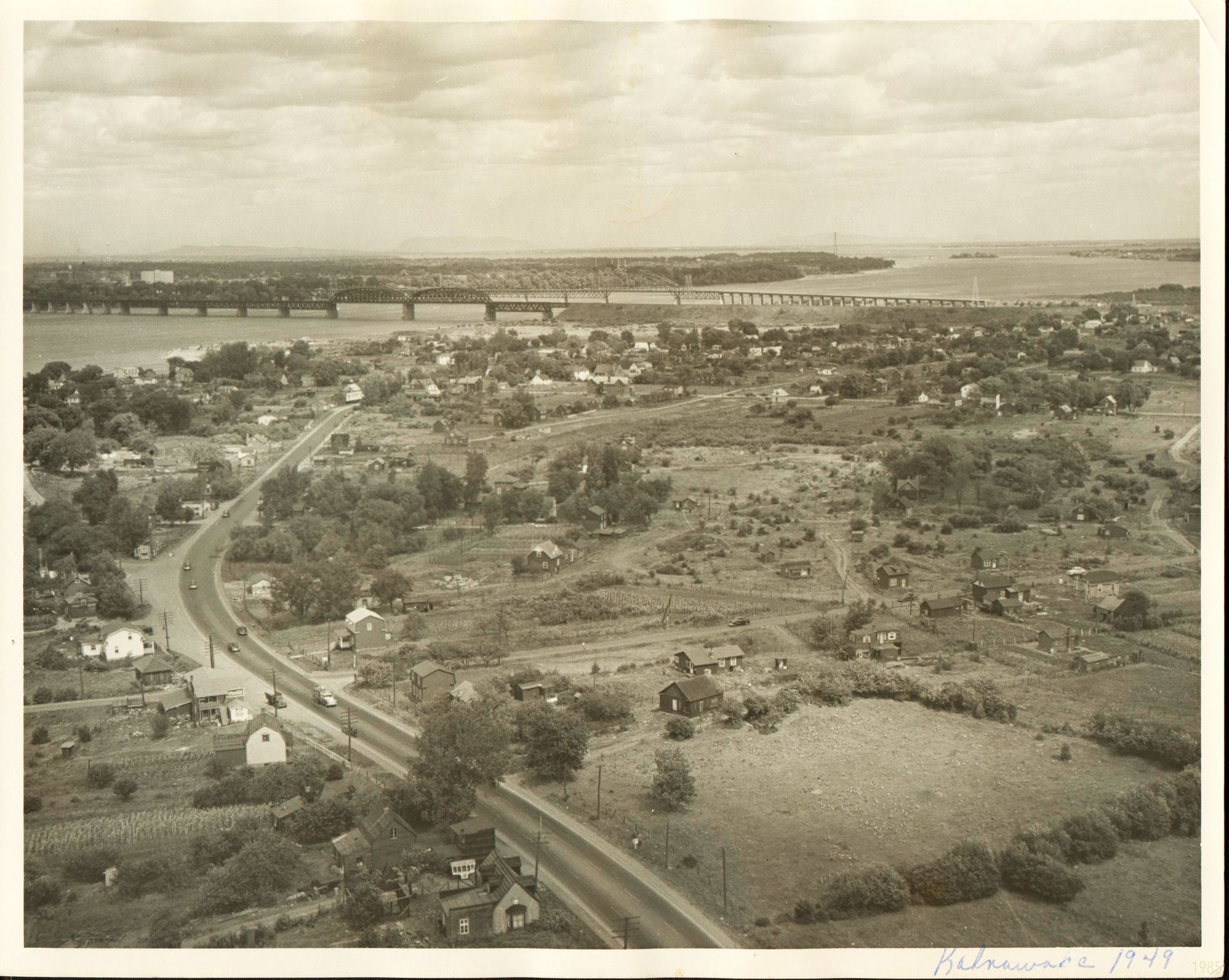
Archival image from Kanien’kehá:ka Onkwawén:na Raotitióhkwa Language and Cultural Center. Kahnawake in 1949. Photo by Roy Montour
More recently, a re-reading of this archive (and many others) has recontextualized infrastructure projects such as the Saint Lawrence Seaway as evidence of settler-colonial displacement and violence. The construction of hydroelectric dams, transportation networks, and extractive sites disproportionally affects Indigenous communities, whose land stewardship is undermined in the name of national development. The collection of design materials related to these infrastructure projects can thus serve as a meticulously documented account of colonization and the seizure of Indigenous land, a seizure legitimized by the promise of national development and accomplished through innovations in design practices. These large-scale infrastructure projects have historically employed the rhetoric of progress, nation-building, and public good to justify their expropriation of Indigenous land, and to mask the private economic interest explicit in the exchange of commodity built into them. Indigenous communities were, and still often are, disenfranchised by these practices of capitalist exchange, and yet they routinely bear the brunt of the environmental degradation resulting from these infrastructure projects.
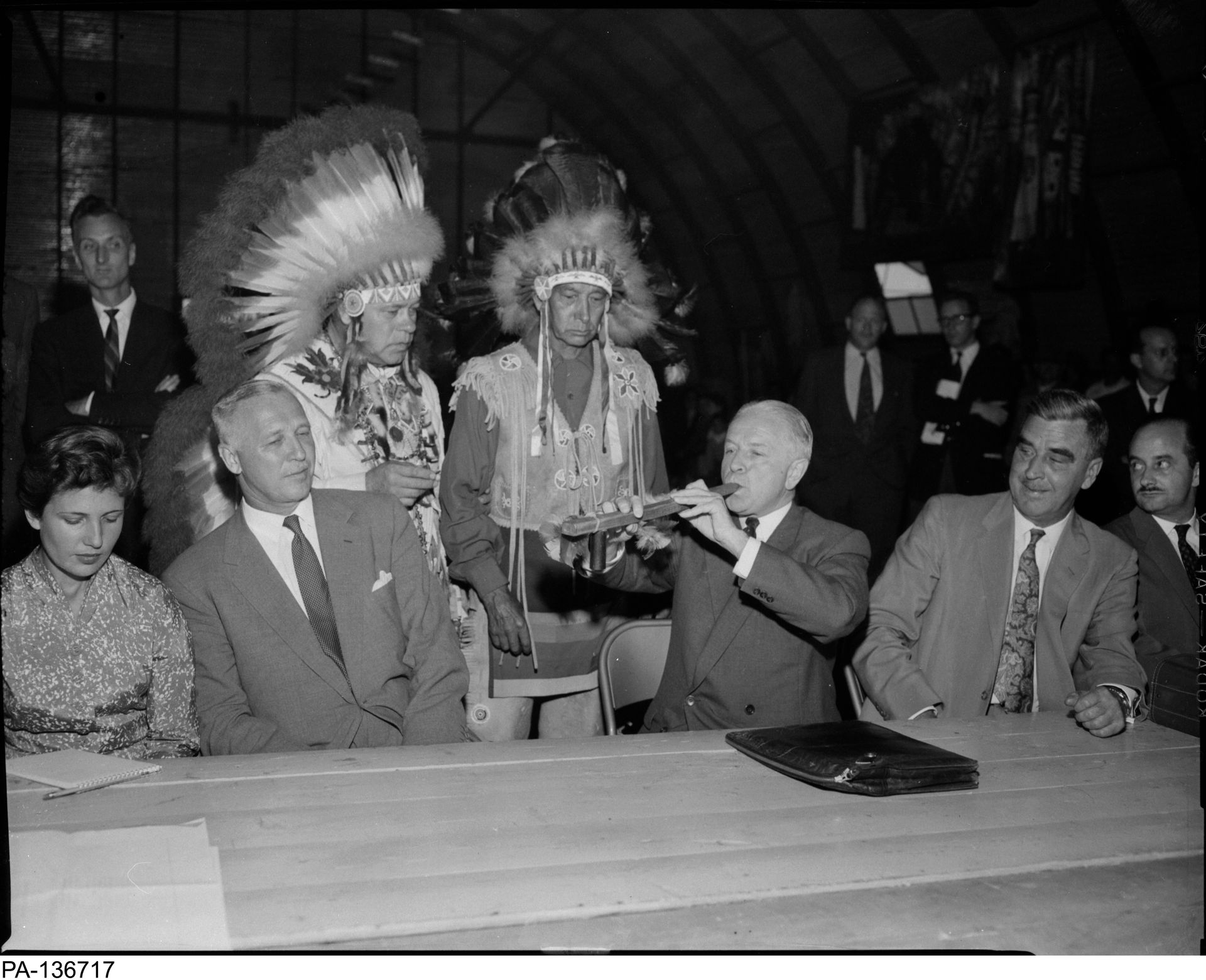
From the Library and Archive of Canada, “picture of Hon. Lionel Chevrier, Chairman of the St. Lawrence Seaway Authority, smoking a pipe of peace with residents of Caughnawaga July 25, 1956.” From the Montreal Star fonds
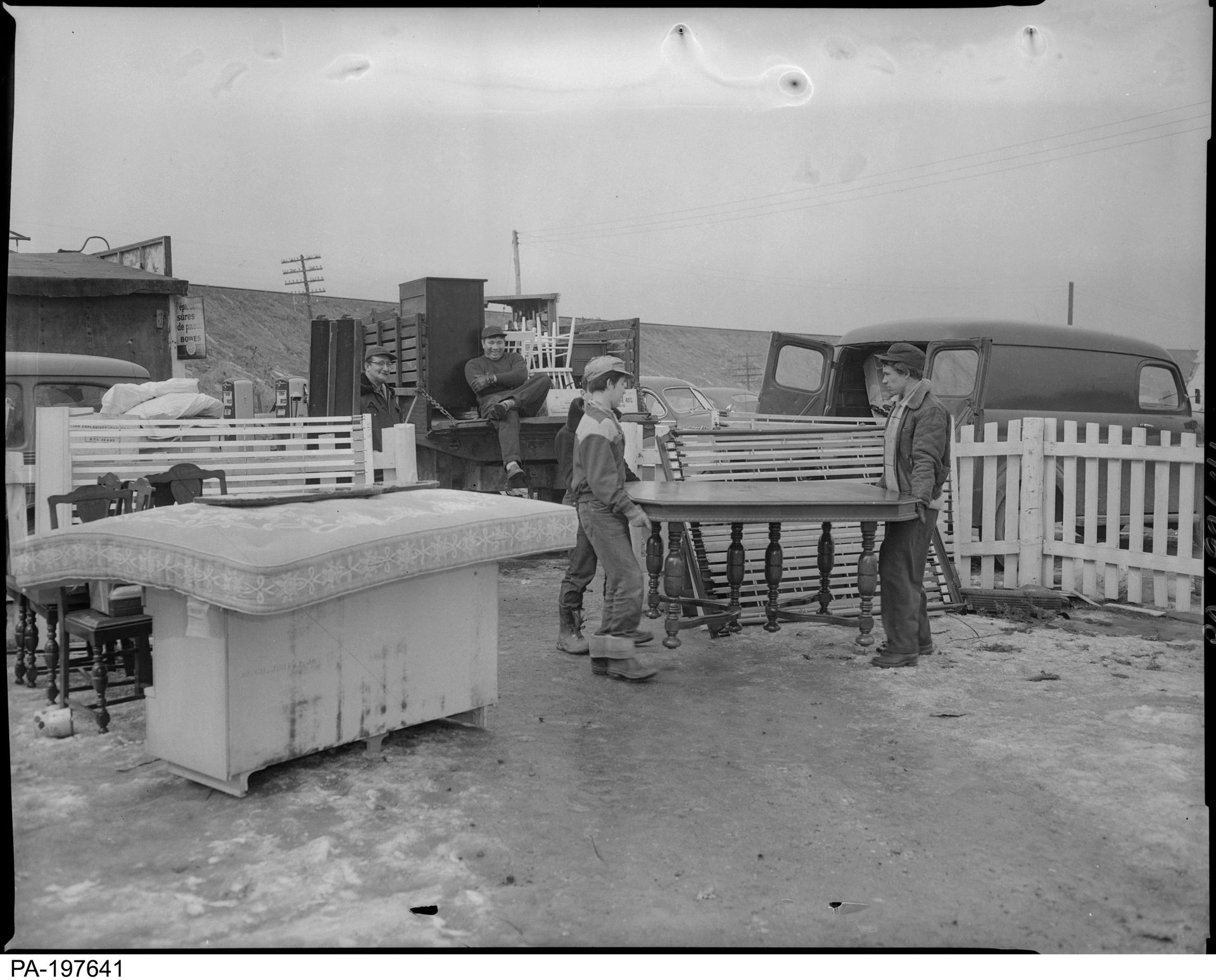
From the Library and Archive of Canada, “Caughnawaga Indians evicted from home 8 March 1957, St. Lawrence Seaway roadway, men with table” From the Montreal Star fonds – reference number PA-197641
The massive reconstruction of the existing locks and channels enabled another simultaneous feat of engineering, a hydroelectric project benefiting Ontario and the state of New York. Together, the Saint Lawrence Seaway and Power project took three years and cost both governments close to one billion dollars to complete. Although treaties had existed between the United States and Canada ensuring both nations had access to the river from as early as 1812, plans for joint infrastructure development were constantly interrupted by world wars and hesitancy on the part of the Americans.1 Both countries had participated in decades of negotiations, but it was Canadian historians and economists who centred the Seaway in their ideological approach to Canadian national development.
-
See Lionel Chevrier’s speech at the Empire Club, 3 February 1955, https://speeches.empireclub.org/details.asp?ID=62584. ↩
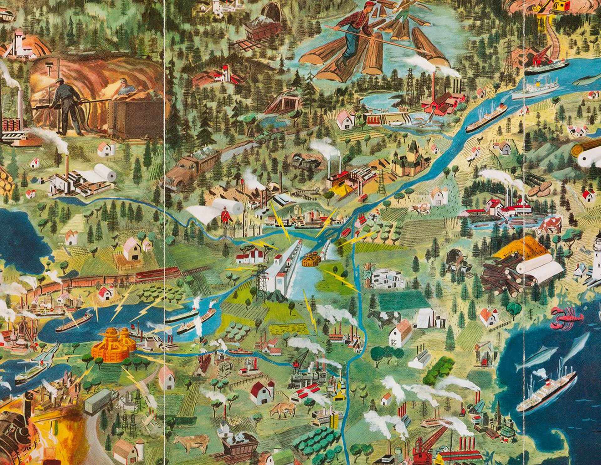
Detail from The St. Lawrence Seaway and Power Project. Painting by Grant Tigner, from The St. Lawrence Seaway: The Realization of a Mighty Dream (Montreal: Seagrams Limited, 1954). ID PO7903 TC427.S3 CAN; ID:88-B12931 Canadian Centre for Architecture
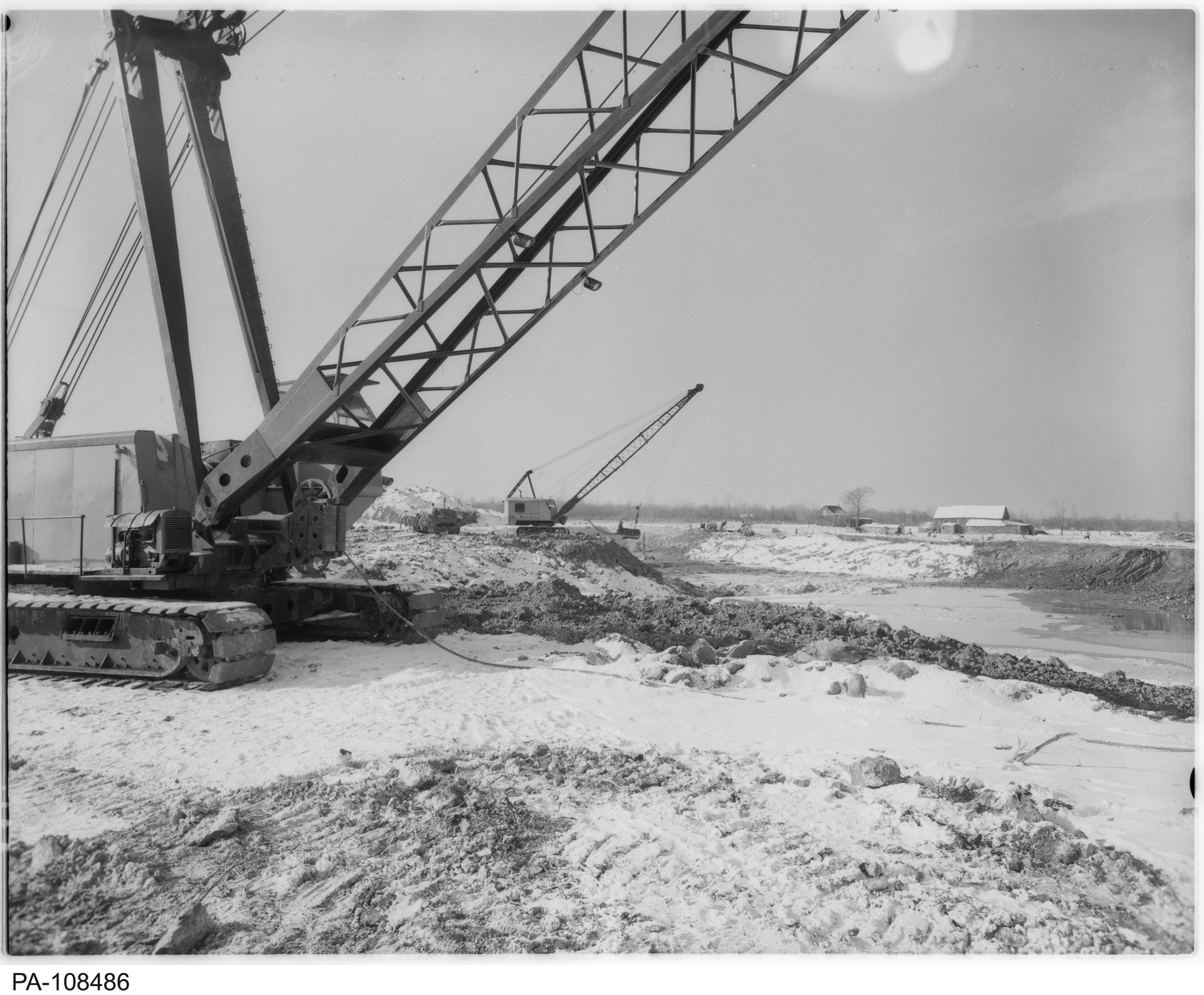
From the Library and Archive of Canada, St. Lawrence Seaway Construction, Caughnawaga Reserve, Quebec] - From the Montreal Star fonds – reference number: PA-108486
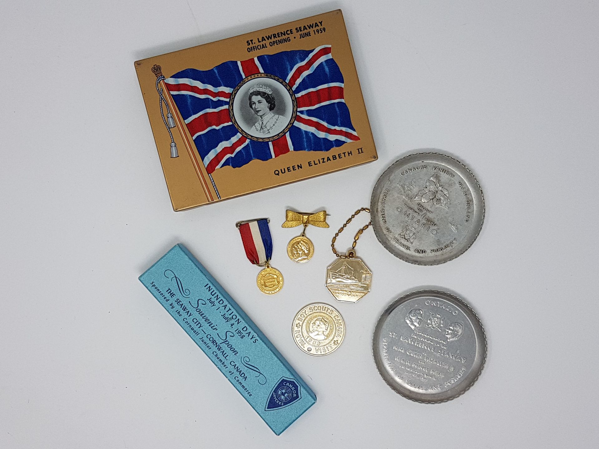
Commemorative memorabilia at the Cornwall community museum
Canadian nationalism and the Seaway’s design were closely linked. In fact, many engineers working for the Canadian Department of Transport were also members of the St. Lawrence interdepartmental committee. This committee argued that the most “efficient, rational and productive usage of the river basin” was to find a way to prevent the waters from running “wasted to the sea.”1 Canadian academics had long argued that the Canadian economy needed to expand and distinguish itself from England through the exploitation of Canadian natural resources.2 As a trade route, the river would facilitate this expansion. Canadian national identity was deeply tied up in the construction of the Seaway, and Indigenous sovereignty was brushed aside in the name of enriching the Canadian nation state. Private economic interests were privileged above the treaties and agreements between the Mohawks and the Canadian Government, which were bypassed using the legal loopholes and amendments to existing acts.3
In 1954, the decades-long dream to build a Seaway became a reality. In May, President Eisenhower signed the Wiley-Dondero bill.4 The Canadian government followed, passing the St. Lawrence Seaway Authority Act in June. The project required hundreds of engineering firms and independent contractors, who were hired from around the world. It also required the manipulation of the river at a scale never previously attempted. Until the early 1950s, most plans had called for the seaway channel near Montréal to run along the undeveloped land of the city’s North Shore.5 Right before the construction of the seaway, that plan was changed, and a new channel was approved by the Saint Lawrence Seaway Authority (SLSA). This new channel required the expropriation of 1 262 acres of land from Kahnwà:ke, including a large portion of the community’s village and the waterfront. The move from the North Shore to the South was justified by the St. Lawrence Seaway Authority by claiming that the land to the North would be needed for future development and could be valuable to industry in years to come. This shift in construction prioritized potential future profit over the already extent buildings and community in Kahnawà:ke Village and reserve.
-
For more on the role of Engineer as Hero during the construction of the Seaway, see Macfarlane, “Caught between Two Fires.” ↩
-
See the Laurentian Thesis, a theory of economic development put forward by Canadian academics (specifically Donald Creighton) in the 1930s, and widely accepted until the late fifties, https://www.thecanadianencyclopedia.ca/en/article/laurentian-thesis. ↩
-
Library and Archives Canada: RG2, Privy Council Office Fonds, Series A-5-a. ↩
-
The Wiley-Dondero bill approved the construction of the seaway in the House of Representatives, two years after Chevrier and the Canadian government had threatened to undertake the project alone. It cemented that the St. Lawrence Seaway was a project to be undertaken jointly. ↩
-
To read more on the environmental racism inherent in this decision, see Lily Ieroniaw:kon Deer, “Plus Ten Percent for Forcible Taking: Construction of the St. Lawrence Seaway as Environmental Racism on Kahnawà:ke.” The Journal of History and Political Science 5 (2017): 13-25. ↩
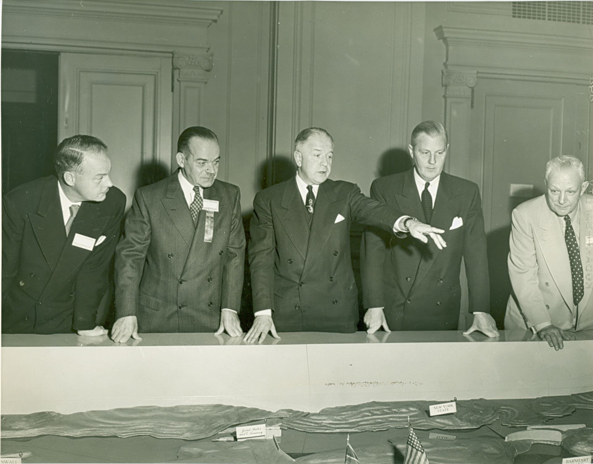
St. Lawrence Seaway Authority President Lionel Chevrier, centre showing officials a topographic model of the St. Lawrence Seaway. From the archive at the Cornwall community museum
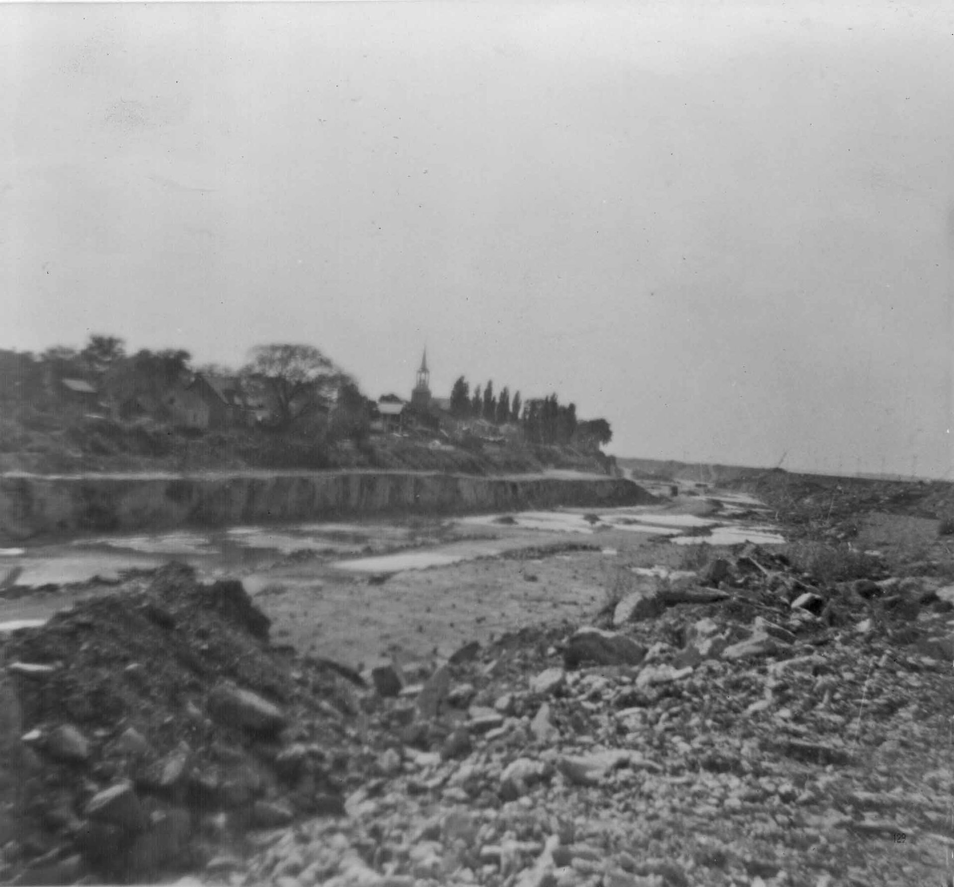
Image of construction taken by a community member in Kahnàwa:ke c. 1957. Archival image from Kanien’kehá:ka Onkwawén:na Raotitióhkwa Language and Cultural Center. Photographer unknown
Another more nefarious reason for the change in plans was the cost of expropriation on the North Shore. The government valued land in Kahnawà:ke at a much lower rate than the settler-owned land in similar proximity to Montréal. In a 1956 article from The Globe and Mail, a lawyer representing Kahnawa’kehró:non who felt their land had been undervalued pointed out that even the highest recorded settlement, $70,000 for an elderly farmer who had refused to vacate his property, worked out to a few cents per square foot.1 This was a small sum compared to the settlements paid to landowners in Lasalle, who received up to $1 per square foot. Initially, the Seaway Authority had valued the Kahnawà:ke land at six cents per square foot, and their initial offers reflected this appraisal. An independent appraiser from Warnock Hersey Co. valued Kahnawa’kehró:non land at twenty cents per foot, still less than the land in Cote-St-Catharine and Lasalle.2 After the land surveys were completed, and the difference in appraisal was pointed out to the press, representatives from the Seaway Authority argued that any offers outside of Kahnawàke had no bearing on the SLSA’s valuation of Indigenous land. This argument was backed by a clause in the Indian Act, which establishes that treaty land is not held in fee simple but is rather owned by the Crown which then grants usufructuary rights. Thus, any land outside of the reserve evaluated in fee simple cannot be used as a precedent.3 In the case of the SLSA’s valuation, this meant that the government had the legal right to evaluate the land in any way they saw fit.
The reaction in Kahnàwa:ke was not uniform.4 Some in the community were willing to negotiate with the SLSA, while others felt that the deal was inherently exploitative. However, it was widely acknowledged that they were losing a site of extreme cultural importance. Kahnawà:ke’s waterfront was central to the life of the community. It was a meeting place in the summer, when families would gather and cook, swim, and do laundry. In the winter, people would sled and skate on the frozen river.5 The river was also a source of food and income in the community, with fish being both eaten and sold. Some families rented out their cottages in the summer to non-Indigenous people who came for summer holidays. The severance of the community from its riverfront was devastating, and people in the community still speak of it to this day.6
-
Clark Davey, “Indians Plan to Fight: $70,000 Land Payment Turns Into Boomerang,” The Globe and Mail, 5 June 1956. ↩
-
“The Times Sees Lesson in Indian’s Seaway Appeal,” The Montreal Gazette, 25 April 1956. ↩
-
Owning land in fee simple refers to an individual’s complete ownership of real property—it is the most complete ownership an individual can have. Usufructuary rights, on the other hand, split up the legal rights that constitute ownership. They allow an individual to possess the land and enjoy its current income but leave naked ownership in the hands of another body—in this case The Crown. ↩
-
To read more on the complex inter-community politics that were at play during the construction of the seaway, see Stephanie Phillips, “The Kahnàwa:ke Mohawks and the Saint Lawrence Seaway,” (Master’s thesis, McGill University, 2000). ↩
-
Read first person accounts of life in Kahnawà:ke before the Seaway’s construction in Phillips, “The Kahnàwa:ke Mohawks and the Saint Lawrence Seaway.” ↩
-
To hear first person accounts see the documentary series Kahnawà:ke Revisited, produced by the Mohawk Council of Kahnawà:ke. ↩
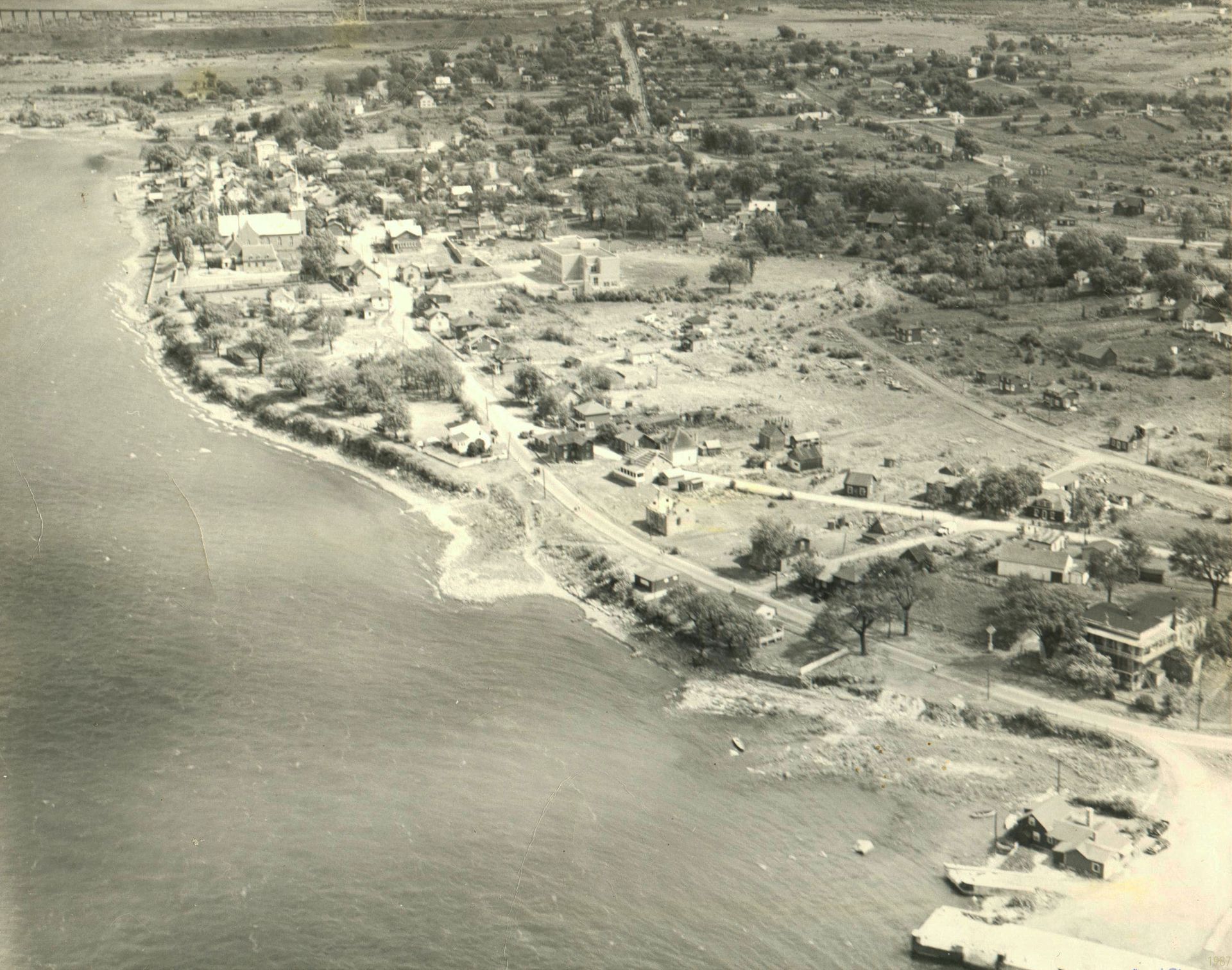
Image of Kahnàwa:ke in the 1940s. Archival image from Kanien’kehá:ka Onkwawén:na Raotitióhkwa Language and Cultural Center. Photo by Roy Montour
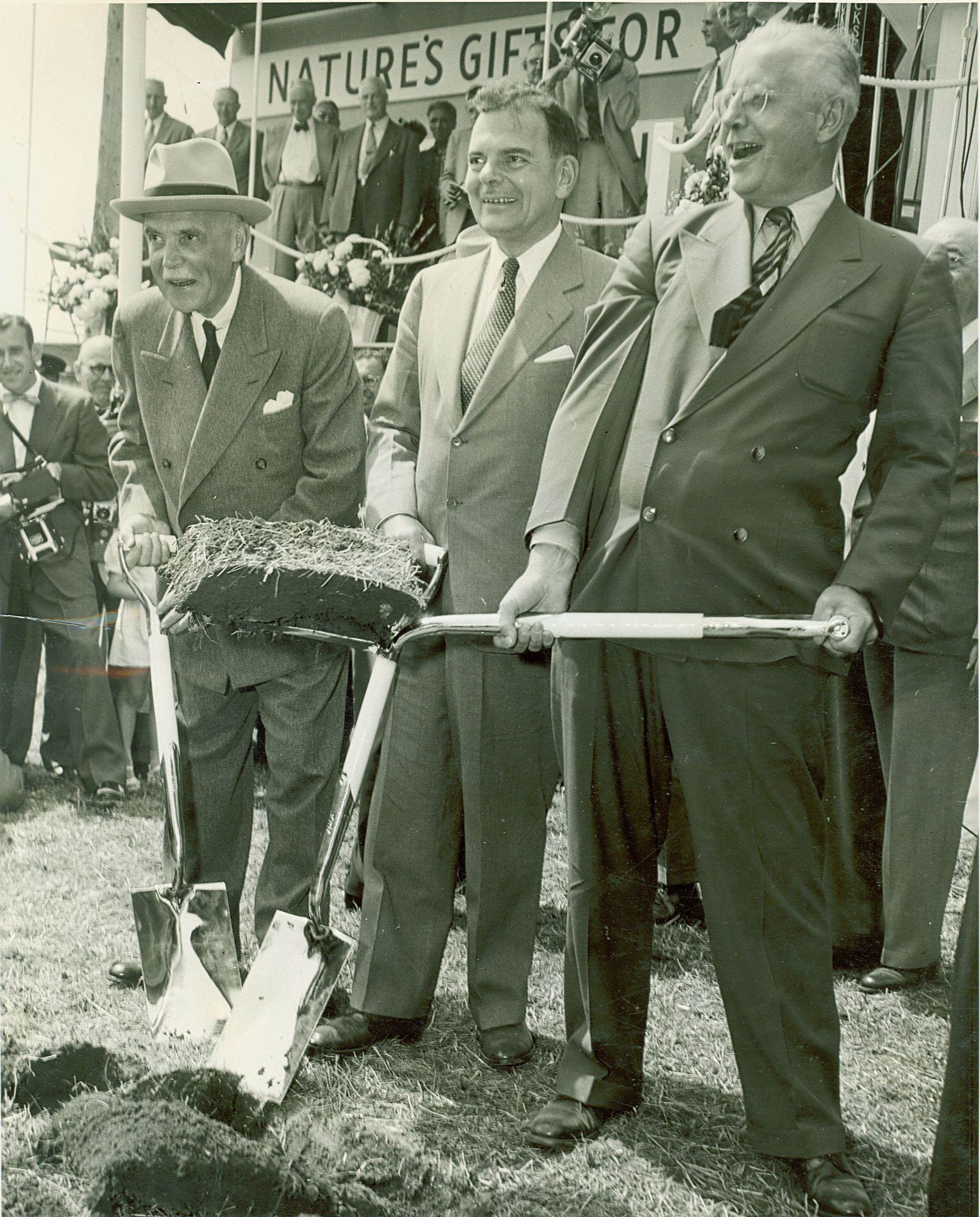
Canadian Prime Minister Louis St. Laurent (on the left), New York Governor Dewey and Ontario Premier Leslie Frost turn the first sod, August 10, 1954. Astarting work on the St. Lawrence Seaway and Ontario Hydro Power Project. From the archive at the Cornwall community museum
On 21 April 1955, despite protest from many members of the community, Lionel Chevrier—President of the SLSA—signed the contract that began the dig around Kahnawà:ke. In response to the outcry, Chevrier said “we have the authority, by an act of parliament, to proceed as we are proceeding.”1 This was a half-truth, as construction began in Kahnawà:ke before the act had been finalized. In a cabinet meeting in May 1955, a member of parliament said that “existing statutory powers were insufficient to expropriate certain Indian lands in the Caughnawaga2 reserve near Montreal for the purposes of the St. Lawrence Seaway.”3 After recognizing the legal difficulty of the situation at hand, the committee proposed that they amend the St. Lawrence Seaway Act to retroactively provide whatever legal powers they needed.
And so, construction in Kahnawà:ke began, without the proper notification of its residents, and with the technical legality of the expropriation in question. Officials from the Indian Affairs department noted that “contractors started work on the reserve properties before Indian Affairs officials expected them or were ready for them.”4 Families who refused to vacate before a clear deal was reached were cut off from water and the rest of town. One elderly farming couple, the Diabos, were initially offered $8,000 for their home and farm. In April 1955, negative press swirled around the interaction, with newspapers reporting that the elderly Mrs. Diabo was forced to walk hours each day just to fetch clean water. In a gesture of “good will,” the Seaway Authority offered the Diabos $70,000.5 When others demanded similar compensation, an Indian Affairs officer was quoted as saying “if they all think they can inflate the price that much then where is this going to end…”6
-
“Indian Criticism Of Seaway Plan Fails to Halt Start,” The Globe and Mail, 22 April 1955. ↩
-
Anglicized spelling of Kahnàwa:ke. ↩
-
Library and Archives Canada: RG2, Privy Council Office Fonds, Series A-5-a, Volume 2658. ↩
-
Clark Davey,“Indians Ask Work Halt Till Seaway Terms Set,” The Globe and Mail, 24 February 1956 ↩
-
Davey, “Indians Ask Work Halt Till Seaway Terms Set.” ↩
-
Davey, “Indians Plan to Fight: $70,000 Land Payment Turns Into Boomerang.” ↩
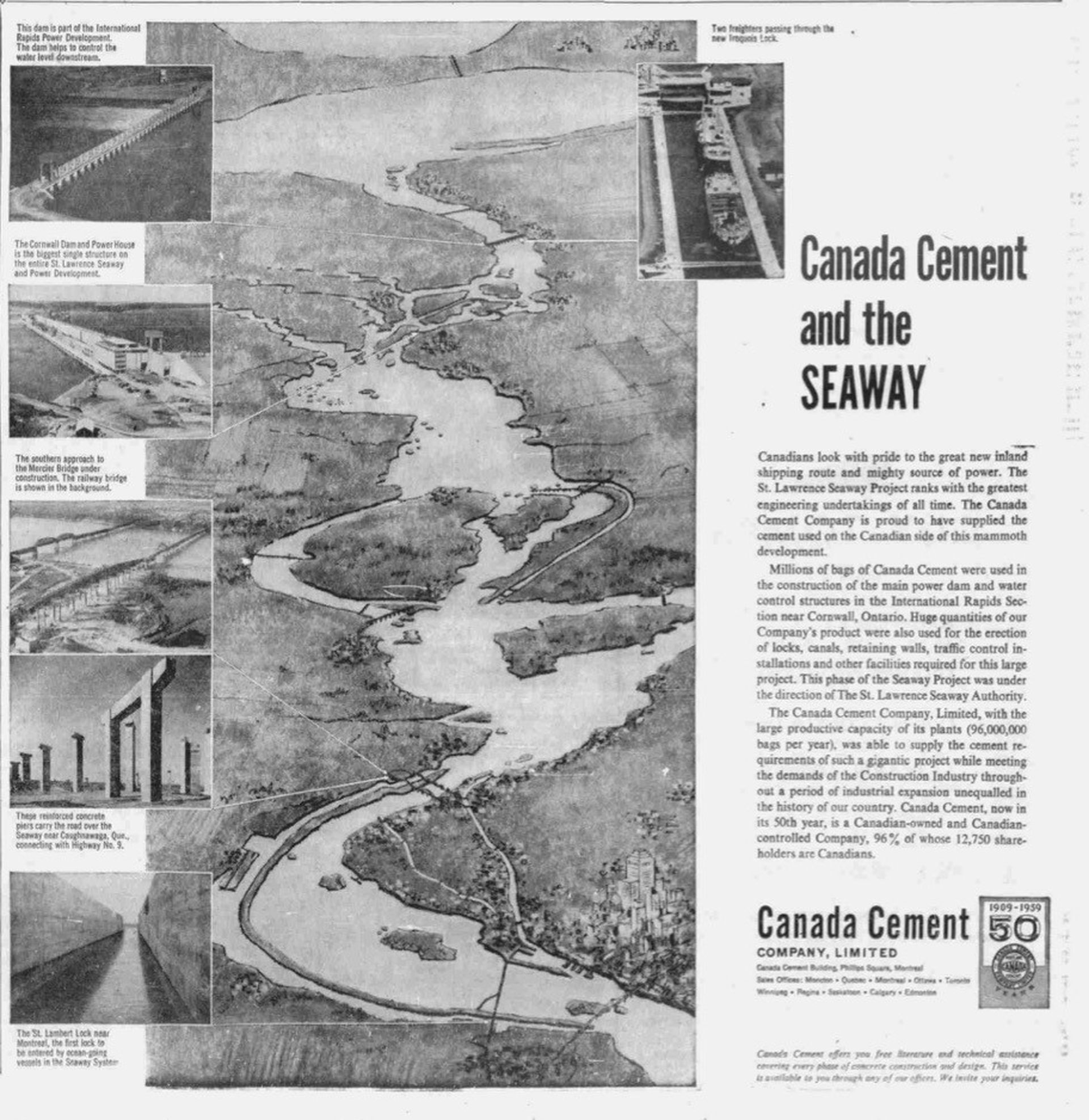
Advertisement of Canada Cement Company Limited, 1959. From the Montreal Gazette, 16 June 25, 1959. © Canada Cement Lafarge
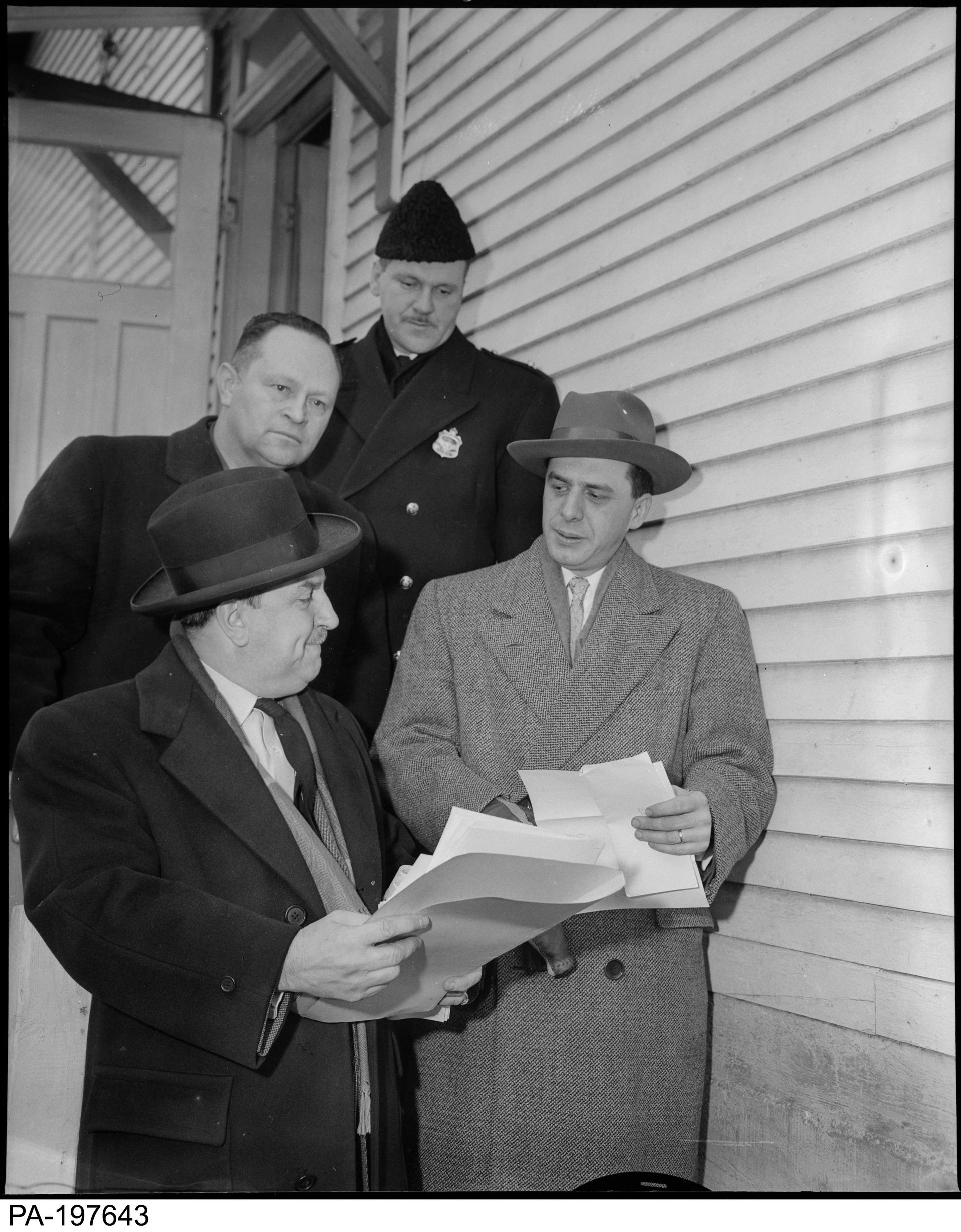
From the Library and Archive of Canada, “Caughnawaga indians evicted from home 8 March 1957, St. Lawrence Seaway roadway, (4 men leaving)” From the Montreal Star fonds – reference number: PA-197643
Any sympathy that the press surrounding the Diabos had garnered for the people of Kahnawà:ke was quickly forgotten. In April 1956, an article in The Globe and Mail claimed that only “about 1 200 acres of the reserve Is required for the navigation channel” and that “the Saint Lawrence Seaway authority paid a number of Indians as much as $70,000 for their property.”1 By framing the people of Kahnawà:ke as roadblocks on the path to economic progress, the press helped the Seaway Authority assert their right to expropriate. Despite the injunctions applied for by newly-elected chief councillor Matthew Lazar, and the appeals that he lodged to the United Nations,2 the Seaway’s construction continued with little interference.3 In Chief Lazar’s petition to the UN, he stated “in violation of Treaties between the Six Nations and Britain, and in contradiction to principles of international law, the Canadian authorities have deprived and continue to deprive our people of their inherent rights of possession of their land and property by confiscating real and personal property without due process of law and without just, adequate and prompt compensation, in connection with the opening of the St. Lawrence Seaway.”4 Although UN delegates seemed sympathetic, they ultimately chose not to put any pressure the Canadian government.
-
“Indian Criticism Of Seaway Plan Fails to Halt Start,” The Globe and Mail, 22 April 1955. ↩
-
Stuart Shaw, “Call Canada Before UN: Montreal Indians Wronged, Egyptian Lawyer Maintains,” The Globe and Mail (1936-2016), 12 August 1961. ↩
-
This is not to say that legal action was not taken by people in Kahnàwa:ke. Too read about the lawsuit filed by the community, see Joan Holmes & Associates, “St. Lawrence Seaway Expropriations on the Kahnawake (Caughnawaga) Reserve No. 14 (1954-1978),” August 1999, http://kahnawakeclaims.com/wp-content/uploads/2014/11/Seaway-ExecSumm-Aug1999.pdf. ↩
-
Omar Ghobashy, The Caughnawaga Indians and the St. Lawrence Seaway (New York: Devin-Adair, 1961), 58. ↩
Commemorative memorabilia at the Cornwall community museum
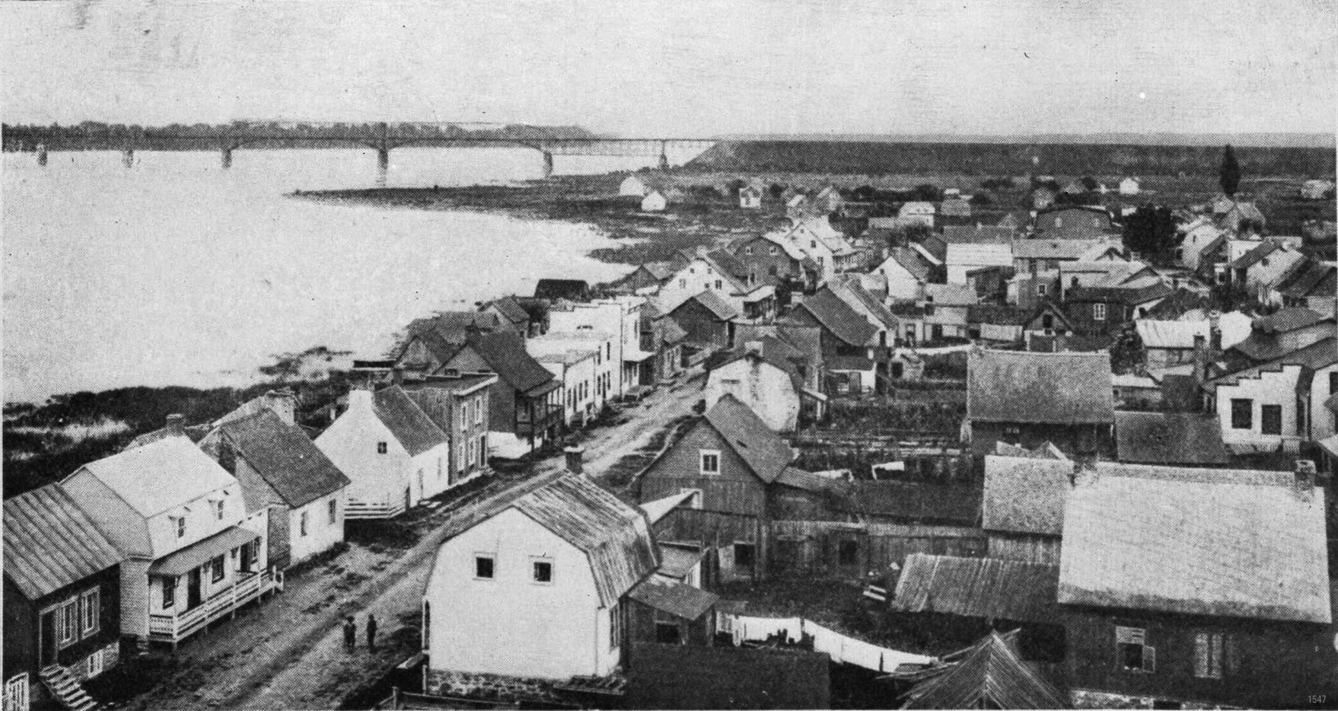
Image of Kahnàwa:ke in the 1930s. Title: “LE VILLAGE ACTUEL DE CAUGHNAWAGA (partie est)— Vue prise du clocher de l’eglise” or “The village of Caughnawaga (east side)—View from the church bell” Archival image from Kanien’kehá:ka Onkwawén:na Raotitióhkwa Language and Cultural Center
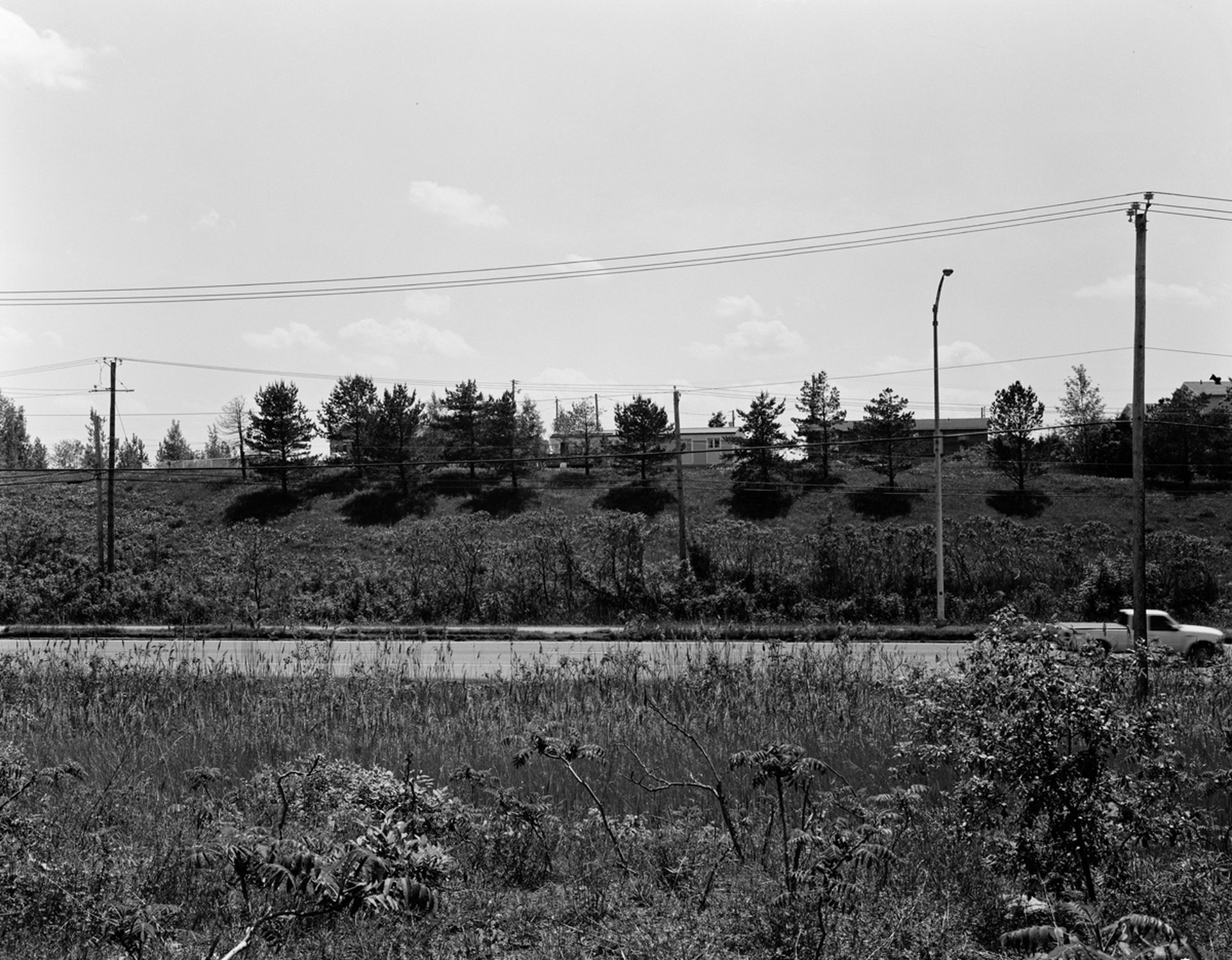
Photograph of Clay Mountain, The name comes from the massive piles of clay and gravel that were dumped on this area of previously fertile farmland in the 1950’s, as a result of the excavation of land for the Seaway. Photo taken by Scott Berwick in 2012
Today, Kahnawà:ke is a community still affected by the Seaway’s presence. What once was a beachfront is now dangerous to swim, and the pollution and sediment buildup from ocean liners makes fishing a health hazard. The community pool, something the SLSA promised in exchange for Kahnawà:ke’s riverfront, was never built.
As we reflect on the design and construction of the Seaway, we must acknowledge the way in which this project, a site of settler dispossession, undermined the pre-existing and sovereign rights of the Kanien’keha community of Kahnawà:ke. At the opening of the Saint Lawrence Seaway, Queen Elizabeth noted: “This then is a moment to look ahead, ahead with the people of this great seaway. This day belongs to them, and to their river, the St. Lawrence.”1 The people whose traditional territory the Saint Lawrence ran through, however, no longer benefit from access to that river.
Reflection and acknowledgement are not reconciliation. Although certain community members were given settlements twenty years after expropriation,2 a key connection to the river was severed by the design and construction of the Saint Lawrence Seaway. How, then, can special practitioners work to restore the land in Kahnawà:ke, and undo some of the damage done by this colonial project? Some of that work has already begun—lead by the environmental design team at the Kahnawà:ke Environmental Protection Office and funded by the federal government.3 The Tekakwitha Island and Bay Restoration Project will be completed in 2021, giving community members access to a new beach, improving the flow of water to reduce sediment build up, and naturalizing the shoreline and existing wetlands for wildlife. By designing a long-term solution through community consultation, the Kahnawà:ke Environmental Protection Office has used this restoration project to protect the interests of the community and to “increase the beauty, accessibility and biodiversity of the area.”4 Spatial practitioners in Kahnawà:ke are leading this project and are reclaiming a shared space for the community that was once a site dispossessed by settler government.
While the funding of community-based initiatives is a step toward environmental restoration, it is far from reconciliation. Leanne Betasamosake Simpson, a Niishnaabeg scholar, asserts that any form of reconciliation between Indigenous people and the Canadian state is difficult, “when the majority of Canadians do not understand the historic or contemporary injustices of dispossession and occupation, particularly when the state has expressed its unwillingness to make any adjustments to the unjust relationship.”5 Any decolonization project must be expansive and involve a political resurgence and regeneration of Indigenous languages and governance. To point to any one restoration project and call it reconciliation is to undermine the potential for any reconciliation to occur. After her historic Senate Chamber appointment ceremony, the Right Honourable Mary Simon, Canada’s first Inuk Governor, stated: “A lot of people think that reconciliation will be completed through projects and services. My view is that reconciliation is a way of life and requires work every day.”6 Reconciliation is not a project you can design or pay for, but a decolonization of the structures and systems of governance that allowed spatial practitioners to expropriate land in the first place.
-
See “Queen Elizabeth officially opens St. Lawrence Seaway,” CBC Digital Archives, 26 June 1959, https://www.cbc.ca/archives/entry/queen-elizabeth-officially-opens-the-st-lawrence-seaway. ↩
-
Joan Holmes & Associates, “St. Lawrence Seaway Expropriations on the Kahnawake (Caughnawaga) Reserve No. 14 (1954-1978).” ↩
-
Ka’nhehsí:io Deer, “By the Rapids: Restoring Kahnawake’s Bay and Life on the Water,” CBC News, 18 October 2020, https://newsinteractives.cbc.ca/longform/by-the-rapids. ↩
-
See Updates on the restoration project at https://kahnawakeenvironment.com/project/tekakwithabayandislandrestoration/. ↩
-
For more, see Leanne Betasamosake Simpson, Dancing on Our Turtle’s Back: Stories of Nishnaabeg Re-Creation, Resergence and a New Emergence (Winnipeg: Arbeiter Ring Pub., 2011). ↩
-
For more about Mary Simpson’s appointment, see Lindsay Richardson, “’Our Climate Allows our Society to be Possible’: Governor General Mary Simon Talks Reconciliation, Environment at Installation,” APTN National News, 26 July 2021, https://www.aptnnews.ca/national-news/governor-general-mary-simon-installation-ottawa-parliament/. ↩
This kind of re-reading and recontextualizing of the archive could not happen without the work of organizations like Kanien’kehá:ka Onkwawén:na Raotitióhkwa Language and Cultural Center (KOR). KOR funds projects like the The Kahnawà:ke Photography Archive, which works with the people in Kahnawà:ke to collect and restore photographs, the The Kahnawà:ke Beadwork Oral History Project, which records oral histories related to this skilled artform, and the Kanien’kéha Radio Show, an all Kanien’kéha talk show broadcasted weekly. Without the work of these archivists to preserve community memory, projects like this article would not be possible.
Sian Lathrop wrote this article as an extension of our Hall Case exhibition Middleground: Siting Dispossession.