115 Results
Form:
books
books
Price:
$65.00
(available in store)
Summary:
''Architectural Drawings'' casts light on the magnificent architectural drawings of neo-classical architect, teacher and collector, Sir John Soane that are otherwise concealed in archives. This book, featuring artworks handpicked from what was probably the first comprehensive collection of architectural drawings in the world, numbering 30,000 at the time of his death in(...)
Title:
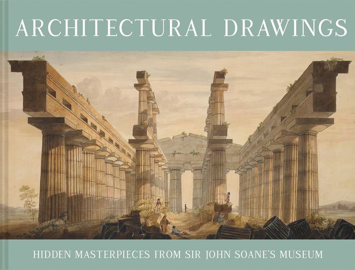
Architectural drawings: Hidden masterpieces From Sir John Soane's museum
Actions:
Price:
$65.00
(available in store)
Summary:
''Architectural Drawings'' casts light on the magnificent architectural drawings of neo-classical architect, teacher and collector, Sir John Soane that are otherwise concealed in archives. This book, featuring artworks handpicked from what was probably the first comprehensive collection of architectural drawings in the world, numbering 30,000 at the time of his death in 1837, celebrates a life spent procuring curiosities.
Form:
books
books
Publication:
September 2021
September 2021
Subject:
Architectural Drawing
Architectural Drawing
Form:
books
books
Price:
$75.00
(available to order)
Summary:
Today the world is focusing unprecedented attention on Asia and the Middle East, rediscovering a cultural, political, and geographical landscape that has fascinated and frustrated Westerners since the time of Alexander the Great. "Mapping the Silk Road and Beyond", traces the history of the European age of exploration and its lasting effects on these regions through(...)
Subject:
Architectural Drawing
Architectural Drawing
Publication:
September 2004, London, New York
September 2004, London, New York
Title:
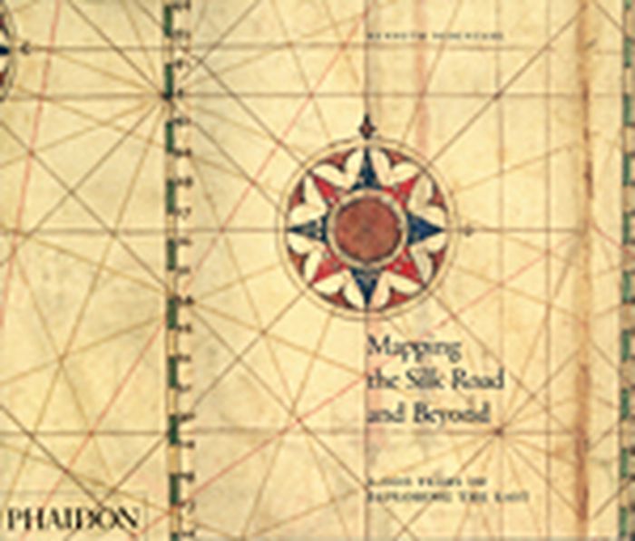
Mapping the silk road and beyond : 2000 years of exploring the east
Actions:
Price:
$75.00
(available to order)
Summary:
Today the world is focusing unprecedented attention on Asia and the Middle East, rediscovering a cultural, political, and geographical landscape that has fascinated and frustrated Westerners since the time of Alexander the Great. "Mapping the Silk Road and Beyond", traces the history of the European age of exploration and its lasting effects on these regions through beautifully rendered and imaginative maps drawn by explorers, merchants, and colonial administrators of the time. The book focuses on both maritime exploration and overland discovery via the ancient Silk Road, a network of trading posts that encompassed China, Tibet, Pakistan, India, Kurdistan, Iraq, Ethiopia, Eritrea, and dozens of other places known in ancient times by fabled names, including Abyssinia, Malacca, Macassar, Siam, and Cathay. The maps provide visual keys to the fascinating history of Asia and the Middle East; illuminating a cast of historical figures ranging from great leaders (the Queen of Sheba, Mohammed the prophet, King Charles V) to legendary explorers (Marco Polo, Columbus, Magellan, Sir Francis Drake, Capt. James Cook) and influential cartographers. "Mapping the Silk Road and Beyond", depicts over eighty maps organized chronologically, from Alexander the Great’s map of the world, first created in 323 BC and reproduced in a sixteenth-century atlas, to maps from the nineteenth century by French and Dutch explorers that detail the growing interaction between Europeans and Eastern cultures. The maps represent the finest examples in existence in museums, libraries, and archives around the world, chosen because they depict the most important milestones in the mapping of Asia.
Form:
books
books
Publication:
September 2004, London, New York
September 2004, London, New York
Subject:
Architectural Drawing
Architectural Drawing
Form:
books
books
Title:
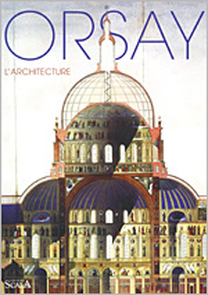
Orsay : l'architecture
Orsay : l'architecture
Actions:
Price:
$29.50
(available to order)
Summary:
Moins connus que les collections de peinture ou de sculpture, les dessins d'architecture du musée d'Orsay comptent plus de dix-huit mille pièces parmi lesquelles on peut distinguer deux ensembles exceptionnels le fonds Eiffel et le fonds Guimard. L'idée de constituer une "galerie de dessins d'architecture" avait germé dès 1890, mais, malgré différents dons et la collecte(...)
Title:
Orsay : l'architecture
Actions:
Price:
$29.50
(available to order)
Summary:
Moins connus que les collections de peinture ou de sculpture, les dessins d'architecture du musée d'Orsay comptent plus de dix-huit mille pièces parmi lesquelles on peut distinguer deux ensembles exceptionnels le fonds Eiffel et le fonds Guimard. L'idée de constituer une "galerie de dessins d'architecture" avait germé dès 1890, mais, malgré différents dons et la collecte de quelques dizaines dé dessins, cette galerie permanente ne vit jamais le jour. Ce n'est qu'un siècle plus tard, avec la création du musée d'Orsay, que l'architecture trouva sa place dans un musée pluridisciplinaire consacré à cette période si riche de la deuxième moitié du XIXe siècle et du début du XXe siècle. Sous le Second Empire et plus encore sous la Troisième République, la société industrielle en plein essor réclame toujours plus de nouveaux bâtiments publics, d'églises, de prisons, de théâtres et d'immeubles. Parallèlement, les Expositions universelles sont un creuset d'imaginations fertiles : la tour Eiffel reste l'exemple le plus emblématique. Enfin, au tournant du siècle, l'Art nouveau fait souffler un vent d'émancipation et d'innovation. Cet ouvrage fait enfin connaître ce fonds aux richesses insoupçonnées, à travers quatre-vingts œuvres choisies et présentées par leur conservateur.
Form:
books
books
Publication:
November 2003, Paris
November 2003, Paris
Subject:
Architectural Drawing
Architectural Drawing
Form:
books
books
Title:
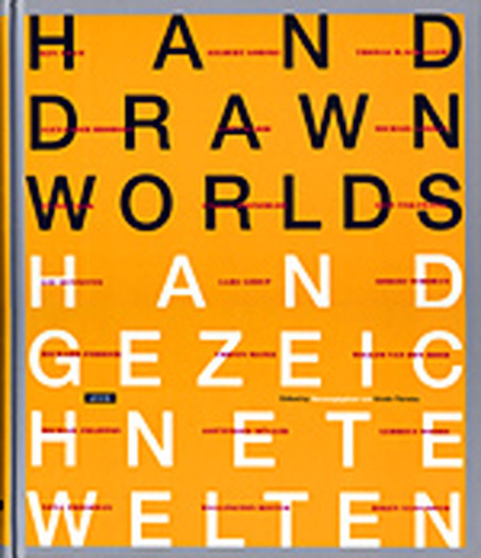
Hand-drawn worlds
Hand-drawn worlds
Actions:
Price:
$66.50
(available to order)
Summary:
Not all architectural renderings are done by straight edge or CAD program; not all spaces are visually related through blueprints. Impressive architectural spaces, spaces of atmospheric density, are also, and often to highly suggestive effect, created by hand. "Hand-Drawn Worlds" presents exemplary architectural drawings by 20 internationally-recognized contemporary(...)
Title:
Hand-drawn worlds
Actions:
Price:
$66.50
(available to order)
Summary:
Not all architectural renderings are done by straight edge or CAD program; not all spaces are visually related through blueprints. Impressive architectural spaces, spaces of atmospheric density, are also, and often to highly suggestive effect, created by hand. "Hand-Drawn Worlds" presents exemplary architectural drawings by 20 internationally-recognized contemporary architects and artists, among them Ken Adam, Alexander Brodskij, Lee Dunnette, Richard Ferrier, Zaha Hadid, Willem van den Hoed, Steven Holl, Syd Mead, Gottfried Müller, and Michael Sorkin. Flanked by related essays, fantastic rooms of great perfection and unmistakable character rise in more than 140 large-format illustrations. An essay on the history of architectural drawings completes the volume.
Form:
books
books
Publication:
March 2004, Berlin
March 2004, Berlin
Subject:
Architectural Drawing
Architectural Drawing
Form:
books
books
Actions:
Price:
$34.95
(available to order)
Summary:
In "Apollo's Eye", geographer Denis Cosgrove examines the historical implications for the West of conceiving and representing the earth as a globe: a unified, spherical body. Cosgrove traces how ideas of globalism and globalization have shifted historically in relation to changing images of the earth, from antiquity to the Space Age. He connects the evolving image(...)
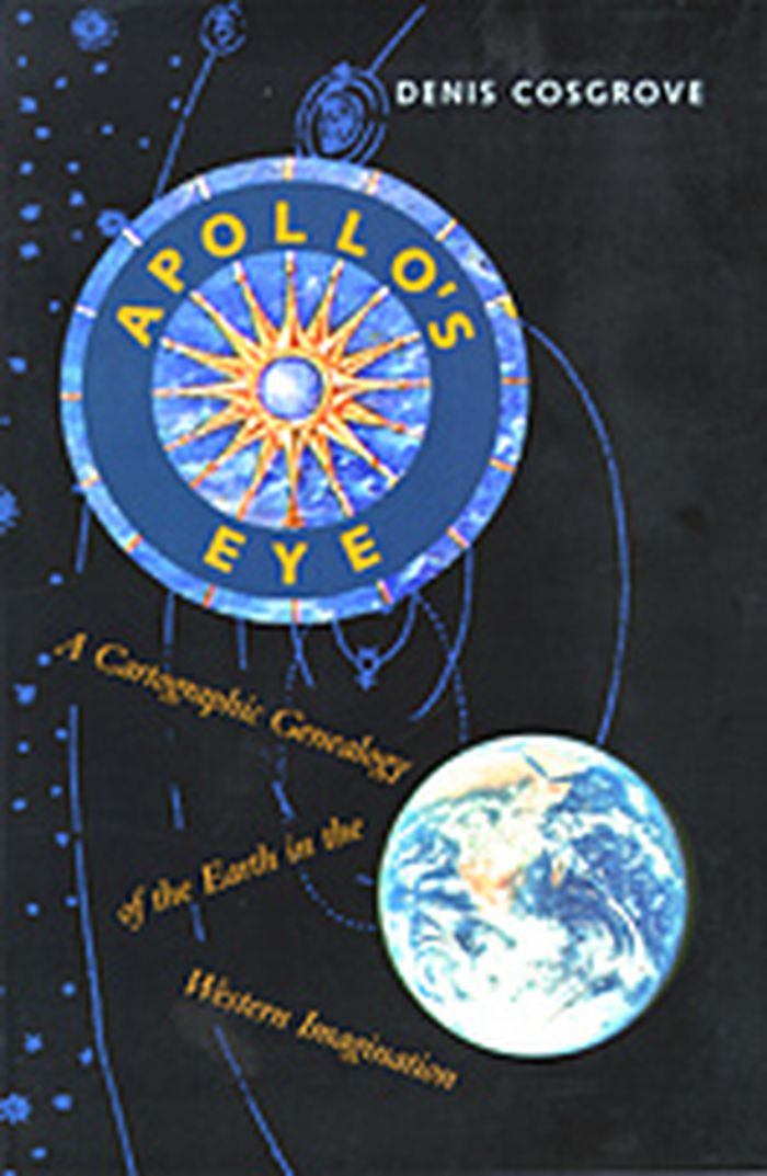
Title:
Apollo's eye : a cartographic genealogy of the earth in the Western imagination
Actions:
Price:
$34.95
(available to order)
Summary:
In "Apollo's Eye", geographer Denis Cosgrove examines the historical implications for the West of conceiving and representing the earth as a globe: a unified, spherical body. Cosgrove traces how ideas of globalism and globalization have shifted historically in relation to changing images of the earth, from antiquity to the Space Age. He connects the evolving image of a unified globe to politically powerful conceptions of human unity. Cosgrove constructs a genealogy of global images from classical Greece and Rome to the present, giving special attention to the early sixteenth century, when Europeans circumnavigated the earth, relocated it within their understanding of the cosmos, and revolutionized its representation in models and maps. Each chapter focuses on specific images of the globe or whole earth, reproduced in a wealth of illustrations. Cosgrove's analysis traces a pattern of associations between global images and the formation of Western identities, paying tribute to the complex cosmographic tradition out of which today's geographical imagination has emerged.
Form:
books
books
Publication:
October 2003, Baltimore
October 2003, Baltimore
Subject:
Architectural Drawing
Architectural Drawing
Form:
books
books
Title:
Maps and politics
Maps and politics
Actions:
Price:
$22.00
(available to order)
Summary:
Do maps accurately and objectively present the information we expect them to portray, or are they instead colored by the political purposes of their makers? In this lively and well-illustrated book, Jeremy Black investigates this dangerous territory, arguing persuasively that the supposed "objectivity" of the map-making and map-using process cannot be divorced from(...)
Title:
Maps and politics
Actions:
Price:
$22.00
(available to order)
Summary:
Do maps accurately and objectively present the information we expect them to portray, or are they instead colored by the political purposes of their makers? In this lively and well-illustrated book, Jeremy Black investigates this dangerous territory, arguing persuasively that the supposed "objectivity" of the map-making and map-using process cannot be divorced from aspects of the politics of representation.
Form:
books
books
Publication:
October 2003, Chicago / London
October 2003, Chicago / London
Subject:
Architectural Drawing
Architectural Drawing
Form:
books
books
Actions:
Price:
$55.00
(available to order)
Summary:
Why did early modern architects continue copying drawings long after the invention of print should have made such copying obsolete? Carolyn Yerkes answers that question in a fresh investigation into the status of architectural drawing in the sixteenth and seventeenth centuries. Her book explores a vast network of manuscripts and drawings that each have information about(...)
Title:
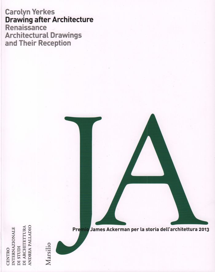
Drawing after architecture: Renaissance architectural drawings and their reception
Actions:
Price:
$55.00
(available to order)
Summary:
Why did early modern architects continue copying drawings long after the invention of print should have made such copying obsolete? Carolyn Yerkes answers that question in a fresh investigation into the status of architectural drawing in the sixteenth and seventeenth centuries. Her book explores a vast network of manuscripts and drawings that each have information about ancient and modern buildings—including the Pantheon and Saint Peter’s—that is not known from any other sources. The drawings also show how the information was recorded, transferred, and analyzed by others. Yerkes examines the nature of architectural evidence to understand how Renaissance architects used images to explore structures, create biographies, and write history.
Form:
books
books
Publication:
February 2018
February 2018
Subject:
Architectural Drawing
Architectural Drawing
Form:
books
books
Actions:
Price:
$48.00
(available to order)
Summary:
Prior to the 1970s, buildings were commonly understood to be the goal of architectural practice; architectural drawings were seen simply as a means to an end. But, just as the boundaries of architecture itself were shifting at the end of the twentieth century, the perception of architectural drawings was also shifting; they began to be seen as autonomous objects outside(...)
Title:
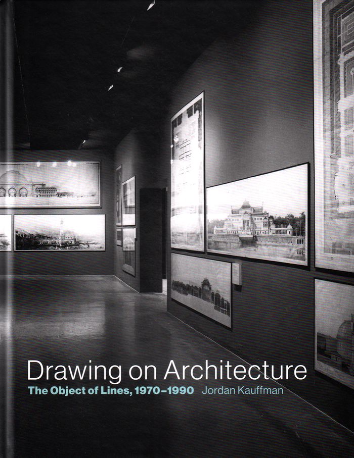
Drawing on architecture: the object of lives, 1970-1990
Actions:
Price:
$48.00
(available to order)
Summary:
Prior to the 1970s, buildings were commonly understood to be the goal of architectural practice; architectural drawings were seen simply as a means to an end. But, just as the boundaries of architecture itself were shifting at the end of the twentieth century, the perception of architectural drawings was also shifting; they began to be seen as autonomous objects outside the process of building. In Drawing on Architecture, Jordan Kauffman offers an account of how architectural drawings—promoted by a network of galleries and collectors, exhibitions and events—emerged as aesthetic objects and ultimately attained status as important cultural and historical artifacts, and how this was both emblematic of changes in architecture and a catalyst for these changes.
Form:
books
books
Publication:
June 2018
June 2018
Subject:
Architectural Drawing
Architectural Drawing
Form:
books
books
Actions:
Price:
$97.90
(available in store)
Summary:
The sketch is a window into the architects mind. As creative designers, architects are interested in how other architects, particularly successful ones, think through the use of drawings to approach their work. Historically designers have sought inspiration for their own work through an insight into the minds and workings of people they often regard as geniuses. This(...)
Title:
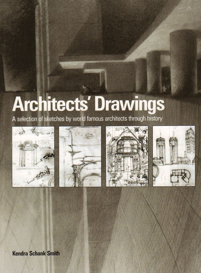
Architects' drawings: a selection of sketches by world famous archittects through history
Actions:
Price:
$97.90
(available in store)
Summary:
The sketch is a window into the architects mind. As creative designers, architects are interested in how other architects, particularly successful ones, think through the use of drawings to approach their work. Historically designers have sought inspiration for their own work through an insight into the minds and workings of people they often regard as geniuses. This collection of sketches aims to provide this insight. Here for the first time, a wide range of world famous architects' sketches from the Renaissance to the present day can be seen in a single volume. The sketches have been selected to represent the concepts or philosophies of the key movements in architecture in order to develop an overall picture of the role of the sketch in the development of architecture. The book illustrates the work of designers as diverse as Andrea Palladio, Erich Mendelsohn, Sir Edwin Lutyens, Gianlorenzo Bernini, Le Corbusier, Michelangelo, Alvar Aalto, Sir John Soane, Francesco Borromini, Walter Gropius, and contemporary architects Tadao Ando, Zaha Hadid and Frank Gehry to name but a few. Each chronologically placed sketch is accompanied by text providing details about the architect’s life, a look at the sketch in context, and the connection to specific buildings where appropriate. Style, media and meaning are also discussed, developing an explanation of the architect’s thinking and intentions.
Form:
books
books
Publication:
February 2016
February 2016
Subject:
Architectural Drawing
Architectural Drawing
Form:
books
books
Actions:
Price:
$34.99
(available to order)
Summary:
This compendium of projects, writings and interviews focuses on how the field of drawing expands synchronously alongside technological and computational developments. Despite numerous developments in technological manufacture and computational design that provide new grounds for designers, the act of drawing still plays a central role as a vehicle for speculation. In(...)
Title:
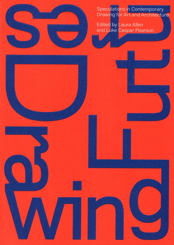
Drawing futures: speculations in contemporary drawing for art and architecture
Actions:
Price:
$34.99
(available to order)
Summary:
This compendium of projects, writings and interviews focuses on how the field of drawing expands synchronously alongside technological and computational developments. Despite numerous developments in technological manufacture and computational design that provide new grounds for designers, the act of drawing still plays a central role as a vehicle for speculation. In reflection of a society now underpinned by computational networks and interfaces allowing hitherto unprecedented views of the world, the changing status of the drawing and its representation as a political act demands a platform for reflection and innovation. "Drawing futures" critically reassess the act of drawing and where its future may lie. Bringing together practitioners from many creative fields, the book discusses how drawing is changing in relation to new technologies for the production and dissemination of ideas. Drawings seduce, and the drawings in this book are tantalising evidence of this. Yet the aim of Drawing Futures is to illustrate how drawing works as an abundantly rich, diverse, inventive, critical and serious research domain. In this regard, it is a ground-breaking study of the point and promise of drawing; a first of its kind, which both explores the microscopic detail of the craft and envisions the radical possibilities inherent in its expression. The academics, artists and architects whose work lies within conceive of drawing as a rigorous, liberating form of expression. Their contributions work together as a manifesto for the future of an artform that is capable of both utter simplicity and infinite complexity.
Form:
books
books
Publication:
December 2016
December 2016
Subject:
Architectural Drawing
Architectural Drawing