109 Results
Form:
books
books
Title:
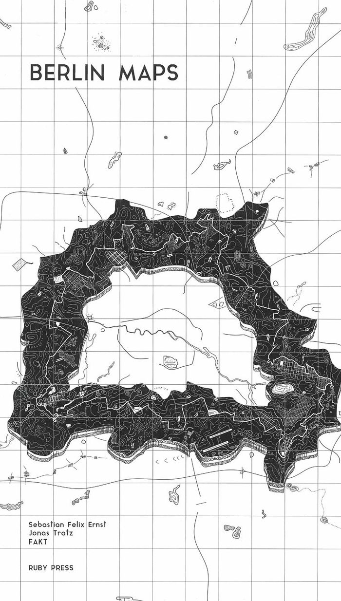
Berlin Maps
Berlin Maps
Actions:
Price:
$48.00
(available to order)
Summary:
Over the past century, Berlin has undergone countless transformations. Rapid growth, destruction, survival, and finally a halting revival as a twin city reunited once more. This last phase has been characterised by stagnation and even shrinkage, which in turn strengthened Berlin’s unusual configuration as a polycentric settlement with no clear core. This atlas of the(...)
Subject:
Architectural Plans and Cartography
Architectural Plans and Cartography
Publication:
March 2021
March 2021
Title:
Berlin Maps
Actions:
Price:
$48.00
(available to order)
Summary:
Over the past century, Berlin has undergone countless transformations. Rapid growth, destruction, survival, and finally a halting revival as a twin city reunited once more. This last phase has been characterised by stagnation and even shrinkage, which in turn strengthened Berlin’s unusual configuration as a polycentric settlement with no clear core. This atlas of the special, strange, or undiscovered phenomena of the German capital is structured in eighteen chapters and offers a fascinating insider’s look at its architectural geography, urban history, political upheavals, scenic spaces, curiosities, and more.
Form:
books
books
Publication:
March 2021
March 2021
Subject:
Architectural Plans and Cartography
Architectural Plans and Cartography
Form:
books
books
Price:
$38.99
(available in store)
Summary:
It is perhaps the eighth wonder of our world that despite modern mapping and satellite photography our planet continues to surprise us. Hidden lairs beneath layers of rock, forgotten cities rising out of deserted lands and even mankind's own feats of engineering eccentricity lie in the most unusual of destinations. Travis Elborough goes in search of the obscure and(...)
Title:
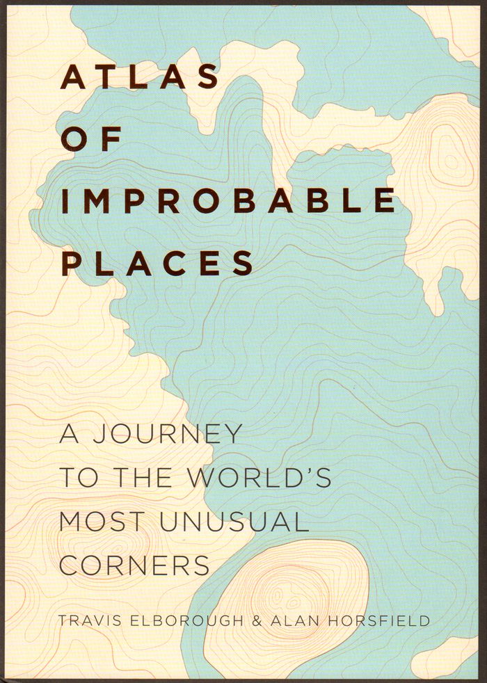
Atlas of improbable places: a journey to the world's most unusual corners
Actions:
Price:
$38.99
(available in store)
Summary:
It is perhaps the eighth wonder of our world that despite modern mapping and satellite photography our planet continues to surprise us. Hidden lairs beneath layers of rock, forgotten cities rising out of deserted lands and even mankind's own feats of engineering eccentricity lie in the most unusual of destinations. Travis Elborough goes in search of the obscure and bizarre, the beautiful and estranged. Taking in the defiant relics of ancient cities such as Ani, a once thriving metropolis lost to conquered lands, and the church tower of San Juan Parangaricuto, that miraculously stands as the sole survivor of a town sunk by lava. Through the labyrinths of Berlin and Beijing - underground realms dug for refuge, espionage and even, as Canada's Moose Jaw, used as the playground for gangsters trading liquor and money over cards. Never forgetting the freaks and wonders of nature's own unusual masterpieces: the magical underground river shaped like a dragon's mouth in the Philippines and the floating world of Palmerston. With beautiful maps and stunning photography illustrating each destination, Atlas of Improbable Places is a fascinating voyage to the world's most incredible destinations. As the Island of Dolls and the hauntingly titled Door to Hell - an inextinguishable fire pit - attest, mystery is never far away. The truths and myths behind their creation are as varied as the destinations themselves. Standing as symbols of worship, testaments to kingships or even the strange and wonderful traditions of old and new, these curious places are not just extraordinary sights but reflections on man's own relationship with the world around us
Form:
books
books
Publication:
October 2016
October 2016
Subject:
Architectural Plans and Cartography
Architectural Plans and Cartography
Form:
books
books
Actions:
Price:
$109.00
(available to order)
Summary:
"Third coast atlas: prelude to a plan" describes the conditions for urbanization across the Great Lakes region. It assembles a multi-layered, empirical description of urbanization processes within the drainage basins of the five Great Lakes and the Saint Lawrence River. This thick description encompasses a range of representational forms including maps, plans, diagrams,(...)
Subject:
Architectural Plans and Cartography
Architectural Plans and Cartography
Publication:
June 2017
June 2017
Title:
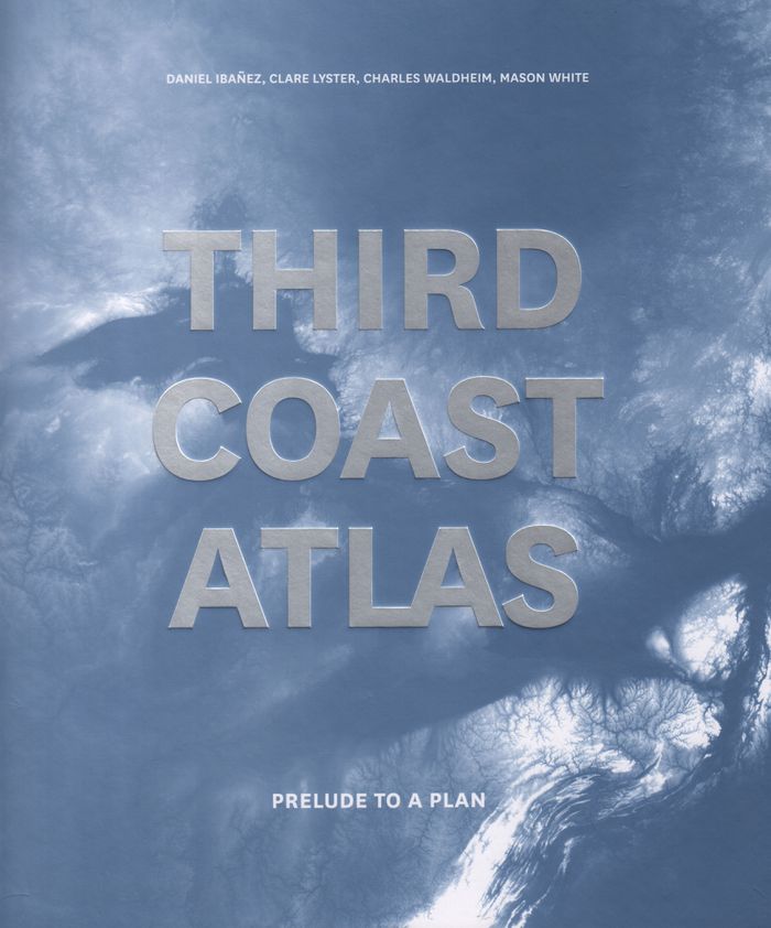
Third coast atlas: prelude to a plan
Actions:
Price:
$109.00
(available to order)
Summary:
"Third coast atlas: prelude to a plan" describes the conditions for urbanization across the Great Lakes region. It assembles a multi-layered, empirical description of urbanization processes within the drainage basins of the five Great Lakes and the Saint Lawrence River. This thick description encompasses a range of representational forms including maps, plans, diagrams, timelines, and photographs, as well as speculative design research projects and critical texts. Postponing diagnosis, let alone treatment of these conditions, Third Coast Atlas aspires to simply describe. It proposes a new geographic gestalt for urban analysis. Superimposed upon the North American continent, and with easily recognizable yet divergent political and geological borders, this megaregion traverses portions of eight U.S. states and two Canadian provinces, as well as the world’s largest collection of surficial fresh water. Third Coast Atlas characterizes the littoral edge as a distinct field of urbanization, and constructs a reading of the region both specific and speculative.
Form:
books
books
Publication:
June 2017
June 2017
Subject:
Architectural Plans and Cartography
Architectural Plans and Cartography
Form:
books
books
Actions:
Price:
$63.95
(available to order)
Summary:
Instructive, amusing, colorful—pictorial maps have been used and admired since the first medieval cartographer put pen to paper depicting mountains and trees across countries, people and objects around margins, and sea monsters in oceans. More recent generations of pictorial map artists have continued that traditional mixture of whimsy and fact, combining cartographic(...)
Title:
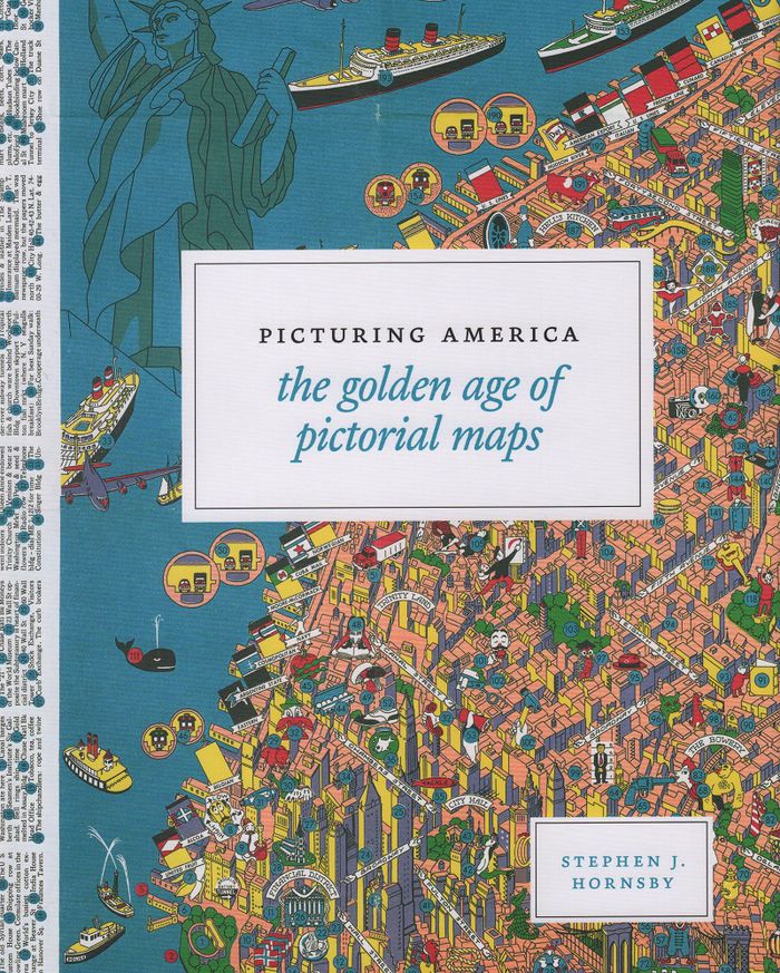
Picturing America: the golden age of pictorial maps
Actions:
Price:
$63.95
(available to order)
Summary:
Instructive, amusing, colorful—pictorial maps have been used and admired since the first medieval cartographer put pen to paper depicting mountains and trees across countries, people and objects around margins, and sea monsters in oceans. More recent generations of pictorial map artists have continued that traditional mixture of whimsy and fact, combining cartographic elements with text and images and featuring bold and arresting designs, bright and cheerful colors, and lively detail. In the United States, the art form flourished from the 1920s through the 1970s, when thousands of innovative maps were mass-produced for use as advertisements and decorative objects—the golden age of American pictorial maps. "Picturing America" is the first book to showcase this vivid and popular genre of maps. Geographer Stephen J. Hornsby gathers together 158 delightful pictorial jewels, most drawn from the extensive collections of the Library of Congress. In his informative introduction, Hornsby outlines the development of the cartographic form, identifies several representative artists, describes the process of creating a pictorial map, and considers the significance of the form in the history of Western cartography. Organized into six thematic sections, "Picturing America" covers a vast swath of the pictorial map tradition during its golden age, ranging from “Maps to Amuse” to “Maps for War.” Hornsby has unearthed the most fascinating and visually striking maps the United States has to offer: Disney cartoon maps, college campus maps, kooky state tourism ads, World War II promotional posters, and many more.
Form:
books
books
Publication:
March 2017
March 2017
Subject:
Architectural Plans and Cartography
Architectural Plans and Cartography
Form:
books
books
Actions:
Price:
$57.00
(available to order)
Summary:
Three hundred detailed and colorful illustrations from around the world cover an encyclopedic array of subjects'architecture, urban planning, fine art, design, fashion, technology, religion, cartography, biology, astronomy, and physics, all based on the circle, the universal symbol of unity, wholeness, infinity, enlightenment, and perfection.
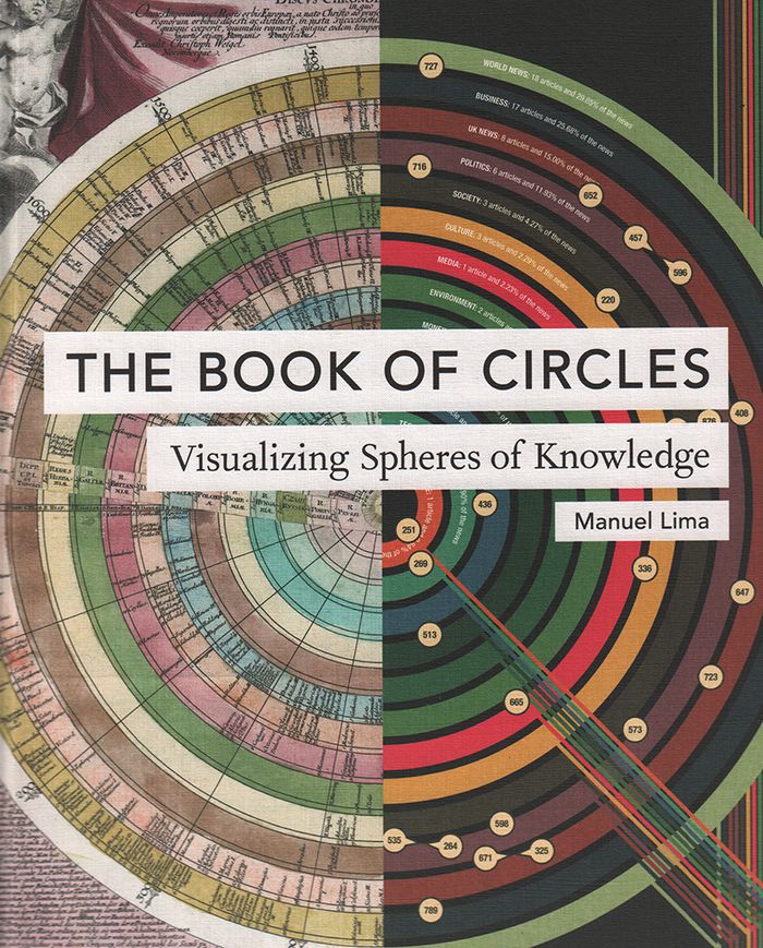
Title:
The book of circles: visualizing spheres of knowdlege
Actions:
Price:
$57.00
(available to order)
Summary:
Three hundred detailed and colorful illustrations from around the world cover an encyclopedic array of subjects'architecture, urban planning, fine art, design, fashion, technology, religion, cartography, biology, astronomy, and physics, all based on the circle, the universal symbol of unity, wholeness, infinity, enlightenment, and perfection.
Form:
books
books
Publication:
May 2017
May 2017
Form:
books
books
Title:
Écrits cartographiques
Écrits cartographiques
Actions:
Price:
$22.95
(available to order)
Summary:
'Écrits cartographiques' rassemble les écrits cartographiques majeurs, pour une part inédits, d’Élisée Reclus et de ses proches collaborateurs, Paul Reclus, Charles Perron et Franz Schrader. Aujourd’hui, plus que jamais, nous avons besoin d’une cartographie capable de donner à sentir et percevoir l’unité terrestre, en son tout et en ses parties. Les objets (globes,(...)
Title:
Écrits cartographiques
Actions:
Price:
$22.95
(available to order)
Summary:
'Écrits cartographiques' rassemble les écrits cartographiques majeurs, pour une part inédits, d’Élisée Reclus et de ses proches collaborateurs, Paul Reclus, Charles Perron et Franz Schrader. Aujourd’hui, plus que jamais, nous avons besoin d’une cartographie capable de donner à sentir et percevoir l’unité terrestre, en son tout et en ses parties. Les objets (globes, cartes, reliefs) conçus et imaginés par Reclus et ses proches l’ont été dans ce but.
Form:
books
books
Publication:
January 2016
January 2016
Subject:
Architectural Plans and Cartography
Architectural Plans and Cartography
Form:
books
books
Title:
Le temps de l'île
Le temps de l'île
Actions:
Price:
$67.95
(available to order)
Summary:
Hommage aux îles dans les arts. En tant que lieu périphérique et marginal figurant l'autre et l'ailleurs, l'espace îlien interroge les savoirs, les sociétés, la philosophie, le cinéma, la poésie ou encore la politique.
$67.95
(available to order)
Summary:
Hommage aux îles dans les arts. En tant que lieu périphérique et marginal figurant l'autre et l'ailleurs, l'espace îlien interroge les savoirs, les sociétés, la philosophie, le cinéma, la poésie ou encore la politique.
Subject:
Architectural Plans and Cartography
Architectural Plans and Cartography
Publication:
August 2019
August 2019
Title:
Le temps de l'île
Actions:
Price:
$67.95
(available to order)
Summary:
Hommage aux îles dans les arts. En tant que lieu périphérique et marginal figurant l'autre et l'ailleurs, l'espace îlien interroge les savoirs, les sociétés, la philosophie, le cinéma, la poésie ou encore la politique.
Le temps de l'île
Actions:
Price:
$67.95
(available to order)
Summary:
Hommage aux îles dans les arts. En tant que lieu périphérique et marginal figurant l'autre et l'ailleurs, l'espace îlien interroge les savoirs, les sociétés, la philosophie, le cinéma, la poésie ou encore la politique.
Form:
books
books
Publication:
August 2019
August 2019
Subject:
Architectural Plans and Cartography
Architectural Plans and Cartography
Form:
books
books
Actions:
Price:
$131.00
(available to order)
Summary:
In the late nineteenth century, Charles Booth’s landmark social and economic survey found that 35 percent of Londoners were living in abject poverty. Booth’s team of social investigators interviewed Londoners from all walks of life, recording their comments, together with their own unrestrained remarks and statistical information, in 450 notebooks. Their findings formed(...)
Subject:
Architectural Plans and Cartography
Architectural Plans and Cartography
Publication:
November 2019
November 2019
Title:
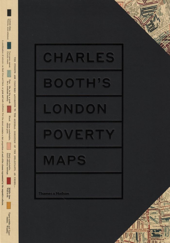
Charles Booth's London poverty maps: a landmark reasessment of Booth's social survey
Actions:
Price:
$131.00
(available to order)
Summary:
In the late nineteenth century, Charles Booth’s landmark social and economic survey found that 35 percent of Londoners were living in abject poverty. Booth’s team of social investigators interviewed Londoners from all walks of life, recording their comments, together with their own unrestrained remarks and statistical information, in 450 notebooks. Their findings formed the basis of Booth’s colour-coded social mapping (from vicious and semi-criminal to wealthy) and his seventeen-volume survey "Inquiry into the Life and Labour of the People of London, 1886–1903". Organized into six geographical sections, "Charles Booth’s London poverty map"s presents the hand-coloured preparatory and printed social mapping of London. Accompanying the maps are reproductions of pages from the original notebooks, containing anecdotes and observations too judgmental for Booth to include in his final published survey. An introduction by professor Mary S. Morgan clarifies the aims and methodology of Booth’s survey and six themed essays contextualize the the survey’s findings, accompanied by evocative period photographs.
Form:
books
books
Publication:
November 2019
November 2019
Subject:
Architectural Plans and Cartography
Architectural Plans and Cartography
Form:
books
books
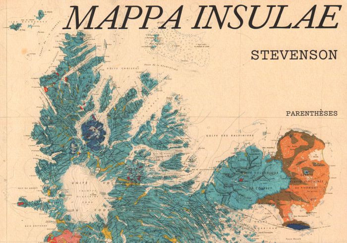
Title:
Mappa insulae
Mappa insulae
Actions:
Price:
$35.95
(available to order)
Summary:
Dans l'univers sans fin des cartes, les cartes d'îles possèdent un charme tout particulier. Les deux mondes, des cartes et des îles, s'y croisent, laissant émerger des formes riches et colorées. Cinq artistes, collectionneurs, chercheurs ont formé le collectif Stevenson pour en explorer et en célébrer les beautés, les incongruités, les fantaisies autant que la précision(...)
Title:
Mappa insulae
Actions:
Price:
$35.95
(available to order)
Summary:
Dans l'univers sans fin des cartes, les cartes d'îles possèdent un charme tout particulier. Les deux mondes, des cartes et des îles, s'y croisent, laissant émerger des formes riches et colorées. Cinq artistes, collectionneurs, chercheurs ont formé le collectif Stevenson pour en explorer et en célébrer les beautés, les incongruités, les fantaisies autant que la précision et la finesse. De la mise en commun de leurs trésors cartographiques chinés, dénichés, inhumés et patiemment amassés, est né Mappa insulae. Les îles s'y montrent parfois dans leur isolement absolu, cerclées d'une épaisseur bleue qui les sépare du reste du monde ; parfois en archipel, éparpillées "comme autant de pépins crachés dans l'eau" ; parfois encore simplement suggérées, récifs tapis sous des noms calligraphiés sur les flots. De carte en carte, d'île en île, de pensées en poèmes, nous voilà embarqués pour une traversée érudite et insolite.
Form:
books
books
Publication:
September 2019
September 2019
Subject:
Architectural Plans and Cartography
Architectural Plans and Cartography
Form:
books
books
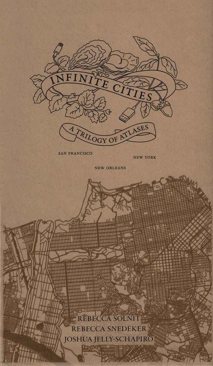
Actions:
Price:
$100.00
(available to order)
Summary:
In the past decade, Rebecca Solnit, Rebecca Snedeker, and Joshua Jelly-Schapiro—aided by local writers, artists, historians, urbanists, ethnographers, and cartographers—have compiled three atlases that have radically changed the way we think about place. Each atlas provides a vivid, complex look at the multi-faceted nature of a city—San Francisco, New Orleans, and New(...)
Title:
Inifinite cities: a trilogy of Atlases. San Francisco, New Orleans, New York
Actions:
Price:
$100.00
(available to order)
Summary:
In the past decade, Rebecca Solnit, Rebecca Snedeker, and Joshua Jelly-Schapiro—aided by local writers, artists, historians, urbanists, ethnographers, and cartographers—have compiled three atlases that have radically changed the way we think about place. Each atlas provides a vivid, complex look at the multi-faceted nature of a city—San Francisco, New Orleans, and New York—as experienced by its different inhabitants, replete with the celebrations and contradictions that make up urban life.
Form:
books
books
Publication:
September 2019
September 2019
Subject:
Architectural Plans and Cartography
Architectural Plans and Cartography