115 Results
Form:
books
books
Title:
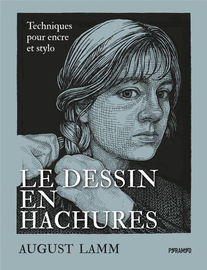
Le dessin en hachures
Le dessin en hachures
Actions:
Price:
$42.95
(available to order)
Summary:
Technique de dessin développée au Moyen Âge et popularisée par les grands maîtres tels que Dürer et Rembrandt, l’art des hachures connaît un regain artistique mérité. Cet ouvrage vous invite à développer les compétences clés nécessaires pour aborder avec confiance cette technique particulière et élargir votre répertoire créatif. Ce guide complet vous accompagnera à(...)
Title:
Le dessin en hachures
Actions:
Price:
$42.95
(available to order)
Summary:
Technique de dessin développée au Moyen Âge et popularisée par les grands maîtres tels que Dürer et Rembrandt, l’art des hachures connaît un regain artistique mérité. Cet ouvrage vous invite à développer les compétences clés nécessaires pour aborder avec confiance cette technique particulière et élargir votre répertoire créatif. Ce guide complet vous accompagnera à chaque étape du processus de création, de la conception à l’exécution. Des pas-à-pas accessibles vous permettront d’aborder n’importe quel sujet, d’une simple nature morte jusqu’aux portraits et paysages complexes. Des exemples de dessins en hachures tirés des grands maîtres et de l’histoire de l’art ainsi que du travail personnel de l’autrice vous fourniront de nombreuses sources d’inspiration.
Form:
books
books
Publication:
April 2023
April 2023
Subject:
Architectural Drawing
Architectural Drawing
Form:
books
books
Actions:
Price:
$85.00
(available to order)
Summary:
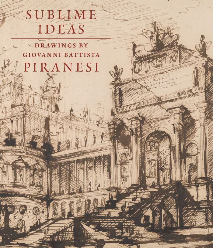
In a letter written near the end of his life, Giovanni Battista Piranesi (1720–1778) explained that he left his native Venice because no patrons were willing to support "the sublimity of [his] ideas." Residing in Rome, he became internationally famous as a printmaker and designer, among other numerous pursuits. While Piranesi’s notoriety stems from his etchings, he was(...)
$85.00
(available to order)
Summary:
In a letter written near the end of his life, Giovanni Battista Piranesi (1720–1778) explained that he left his native Venice because no patrons were willing to support "the sublimity of [his] ideas." Residing in Rome, he became internationally famous as a printmaker and designer, among other numerous pursuits. While Piranesi’s notoriety stems from his etchings, he was(...)
Title:
Sublime ideas: Drawings by Giovanni Battista Piranesi
Actions:
Price:
$85.00
(available to order)
Summary:
In a letter written near the end of his life, Giovanni Battista Piranesi (1720–1778) explained that he left his native Venice because no patrons were willing to support "the sublimity of [his] ideas." Residing in Rome, he became internationally famous as a printmaker and designer, among other numerous pursuits. While Piranesi’s notoriety stems from his etchings, he was also an accomplished draftsman who first developed much of his work in drawings. This is the most comprehensive, updated study of Piranesi’s drawings with over two hundred illustrations offering insight into his life and creative endeavors. Coinciding with the Morgan’s Spring 2023 exhibition, the volume diligently surveys the artist’s enduring work as an artistic force.
Form:
books
books
Publication:
May 2023
May 2023
Subject:
Architectural Drawing
Architectural Drawing
Form:
books
books
Actions:
Price:
$50.00
(available to order)
Summary:
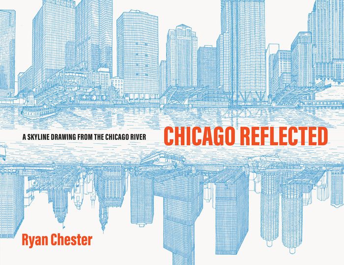
In March 2020, architect Ryan Chester began drawing the Chicago River for at least one hour every day. Using only a pen, he moved methodically along a single massive roll of paper. As each chaotic, isolating day of the COVID-19 pandemic passed, he stayed connected with his adopted city by carefully documenting by hand the beautiful intricacies of Chicago’s riverfront(...)
$50.00
(available to order)
Summary:
In March 2020, architect Ryan Chester began drawing the Chicago River for at least one hour every day. Using only a pen, he moved methodically along a single massive roll of paper. As each chaotic, isolating day of the COVID-19 pandemic passed, he stayed connected with his adopted city by carefully documenting by hand the beautiful intricacies of Chicago’s riverfront(...)
Title:
Chicago reflected: A skyline drawing from the Chicago river
Actions:
Price:
$50.00
(available to order)
Summary:
In March 2020, architect Ryan Chester began drawing the Chicago River for at least one hour every day. Using only a pen, he moved methodically along a single massive roll of paper. As each chaotic, isolating day of the COVID-19 pandemic passed, he stayed connected with his adopted city by carefully documenting by hand the beautiful intricacies of Chicago’s riverfront architecture, boats, and bridges.
Form:
books
books
Publication:
October 2023
October 2023
Subject:
Architectural Drawing
Architectural Drawing
Form:
books
books
Actions:
Price:
$45.95
(available to order)
Summary:
Destiné aux archivistes non spécialisés en archives de l'architecture-- ainsi qu'aux architectes et aux curieux-- ce manuel éclaire les étapes successives d'un programme de travail consacré aux archives modernes d'architecture. L'accent est mis beaucoup plus sur les documents graphiques et sur les maquettes que sur les dossiers écrits, très comparables à ceux qui(...)
Subject:
Architectural Drawing
Architectural Drawing
Publication:
January 1900, Paris
January 1900, Paris
Title:
Manuel de traitement des archives d'architecture
Actions:
Price:
$45.95
(available to order)
Summary:
Destiné aux archivistes non spécialisés en archives de l'architecture-- ainsi qu'aux architectes et aux curieux-- ce manuel éclaire les étapes successives d'un programme de travail consacré aux archives modernes d'architecture. L'accent est mis beaucoup plus sur les documents graphiques et sur les maquettes que sur les dossiers écrits, très comparables à ceux qui constituent des archives.
Form:
books
books
Publication:
January 1900, Paris
January 1900, Paris
Subject:
Architectural Drawing
Architectural Drawing
Form:
books
books
Title:
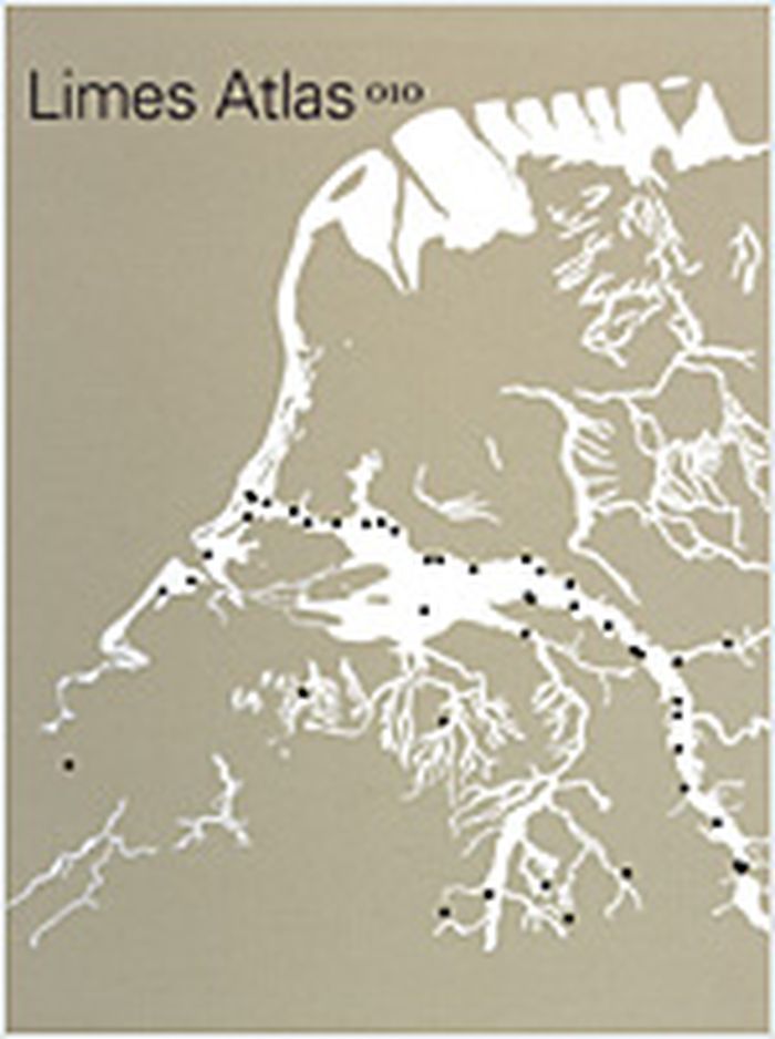
Limes atlas
Limes atlas
Actions:
Price:
$83.95
(available to order)
Summary:
This atlas shows the significance today of the Northern border zone of the Roman Empire in the Netherlands. Illustrated with maps and photographs throughout. With summaries in English and German.
$83.95
(available to order)
Summary:
This atlas shows the significance today of the Northern border zone of the Roman Empire in the Netherlands. Illustrated with maps and photographs throughout. With summaries in English and German.
Title:
Limes atlas
Actions:
Price:
$83.95
(available to order)
Summary:
This atlas shows the significance today of the Northern border zone of the Roman Empire in the Netherlands. Illustrated with maps and photographs throughout. With summaries in English and German.
Limes atlas
Actions:
Price:
$83.95
(available to order)
Summary:
This atlas shows the significance today of the Northern border zone of the Roman Empire in the Netherlands. Illustrated with maps and photographs throughout. With summaries in English and German.
Form:
books
books
Publication:
June 2005, Rotterdam
June 2005, Rotterdam
Subject:
Architectural Drawing
Architectural Drawing
Form:
books
books
Actions:
Price:
$37.50
(available to order)
Summary:
Patrick Maynard surveys the rich and varied practices of drawing, from the earliest markings on cave walls to the complex technical schematics that make the modern world possible, from cartoons and the first efforts of preschoolers to the works of skilled draftspeople and the greatest artists, East and West. Despite, or perhaps because of, its ubiquity, drawing as such(...)
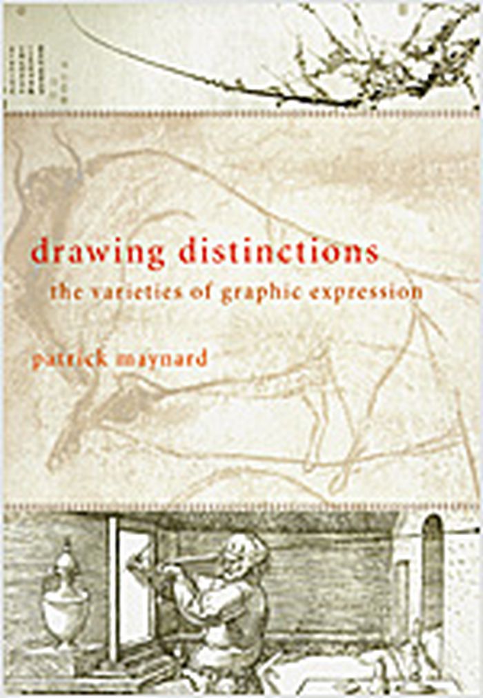
Title:
Drawing distinctions : the varieties of graphic expression
Actions:
Price:
$37.50
(available to order)
Summary:
Patrick Maynard surveys the rich and varied practices of drawing, from the earliest markings on cave walls to the complex technical schematics that make the modern world possible, from cartoons and the first efforts of preschoolers to the works of skilled draftspeople and the greatest artists, East and West. Despite, or perhaps because of, its ubiquity, drawing as such has provoked remarkably little philosophical reflection. Nonphilosophical writing on the topic tends to be divided between specialties such as art history and mechanics. In this book, Maynard reveals the interconnections and developments that unite this fundamental autonomous human activity in all its diversity. Informed by close discussion of work in art history, art criticism, cognitive and developmental psychology, and aesthetics, Drawing Distinctions presents a theoretically sophisticated yet approachable argument that will improve comprehension and appreciation of drawing in its many forms, uses, and meanings.
Form:
books
books
Publication:
November 2005, Ithaca, New York
November 2005, Ithaca, New York
Subject:
Architectural Drawing
Architectural Drawing
Form:
books
books
Actions:
Price:
$70.00
(available in store)
Summary:
"Chicago in maps" is an illustrated cartographic history of Chicago, known for centuries as the gateway city to the West. The documents reproduced here offer an unprecedented avenue to the city's past - a fascinating collective portrait of the evolution of one of America's great towns. Among the seventy-four maps featured, many are seminal exemplars of this timeless art(...)
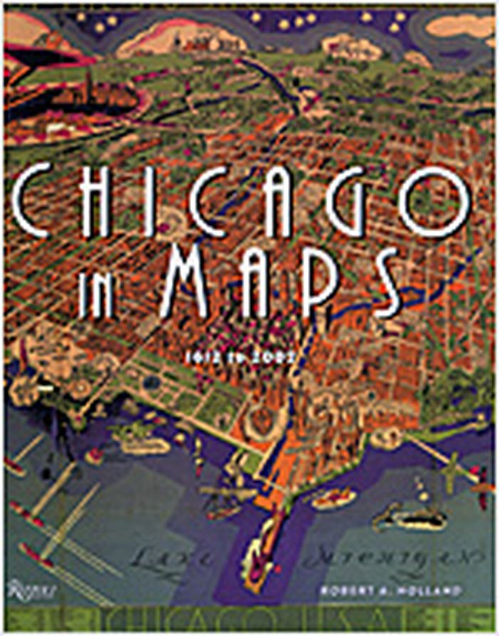
Title:
Chicago in maps, 1612 to 2002
Actions:
Price:
$70.00
(available in store)
Summary:
"Chicago in maps" is an illustrated cartographic history of Chicago, known for centuries as the gateway city to the West. The documents reproduced here offer an unprecedented avenue to the city's past - a fascinating collective portrait of the evolution of one of America's great towns. Among the seventy-four maps featured, many are seminal exemplars of this timeless art form: the "Kinzie Map," which accompanied the Narrative of the Massacre of 1812; the Rand McNally "View of the World's Columbian Exposition" of 1893; Daniel Burnham's influential "Chicago Plan" of 1909, which epitomized the ambitions of the City Beautiful Movement; W. T. Stead's "Map of Sin"; and Bruce-Roberts' 1931 "Gangland Map" - a tongue-in-cheek "exposé" of a city populated by such powerful underworld figures as Al Capone, "Baby Face" Nelson, "Machine Gun" Kelly, and others, indicating various gang territories and warehouses.
Form:
books
books
Publication:
November 2005, New York
November 2005, New York
Subject:
Architectural Drawing
Architectural Drawing
Form:
books
books
Title:
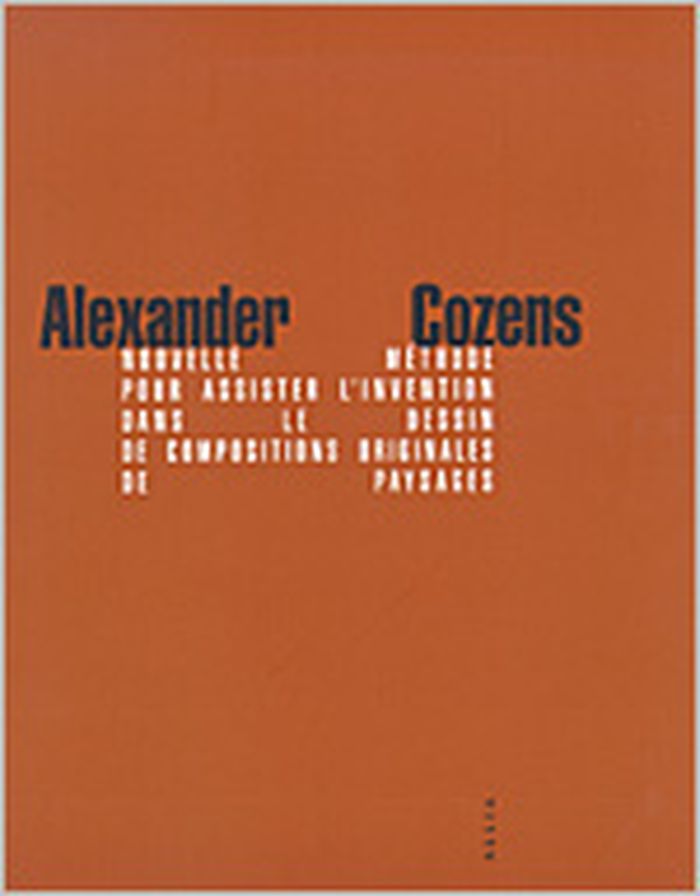
Nouvelle méthode pour assister l'invention dans le dessin de compositions originales de paysages
Nouvelle méthode pour assister l'invention dans le dessin de compositions originales de paysages
Actions:
Price:
$17.95
(available to order)
Summary:
Édition bilingue français-anglais. Bilingual edition in French and English.
$17.95
(available to order)
Summary:
Édition bilingue français-anglais. Bilingual edition in French and English.
Title:
Nouvelle méthode pour assister l'invention dans le dessin de compositions originales de paysages
Actions:
Price:
$17.95
(available to order)
Summary:
Édition bilingue français-anglais. Bilingual edition in French and English.
Nouvelle méthode pour assister l'invention dans le dessin de compositions originales de paysages
Actions:
Price:
$17.95
(available to order)
Summary:
Édition bilingue français-anglais. Bilingual edition in French and English.
Form:
books
books
Publication:
May 2005, Paris
May 2005, Paris
Subject:
Architectural Drawing
Architectural Drawing
Form:
books
books
Price:
$65.00
(available in store)
Summary:
''Architectural Drawings'' casts light on the magnificent architectural drawings of neo-classical architect, teacher and collector, Sir John Soane that are otherwise concealed in archives. This book, featuring artworks handpicked from what was probably the first comprehensive collection of architectural drawings in the world, numbering 30,000 at the time of his death in(...)
Title:
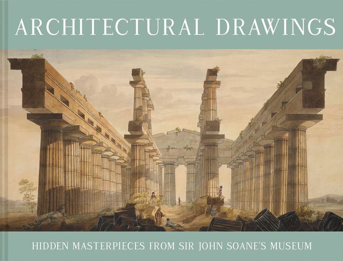
Architectural drawings: Hidden masterpieces From Sir John Soane's museum
Actions:
Price:
$65.00
(available in store)
Summary:
''Architectural Drawings'' casts light on the magnificent architectural drawings of neo-classical architect, teacher and collector, Sir John Soane that are otherwise concealed in archives. This book, featuring artworks handpicked from what was probably the first comprehensive collection of architectural drawings in the world, numbering 30,000 at the time of his death in 1837, celebrates a life spent procuring curiosities.
Form:
books
books
Publication:
September 2021
September 2021
Subject:
Architectural Drawing
Architectural Drawing
Form:
books
books
Actions:
Price:
$68.95
(available to order)
Summary:
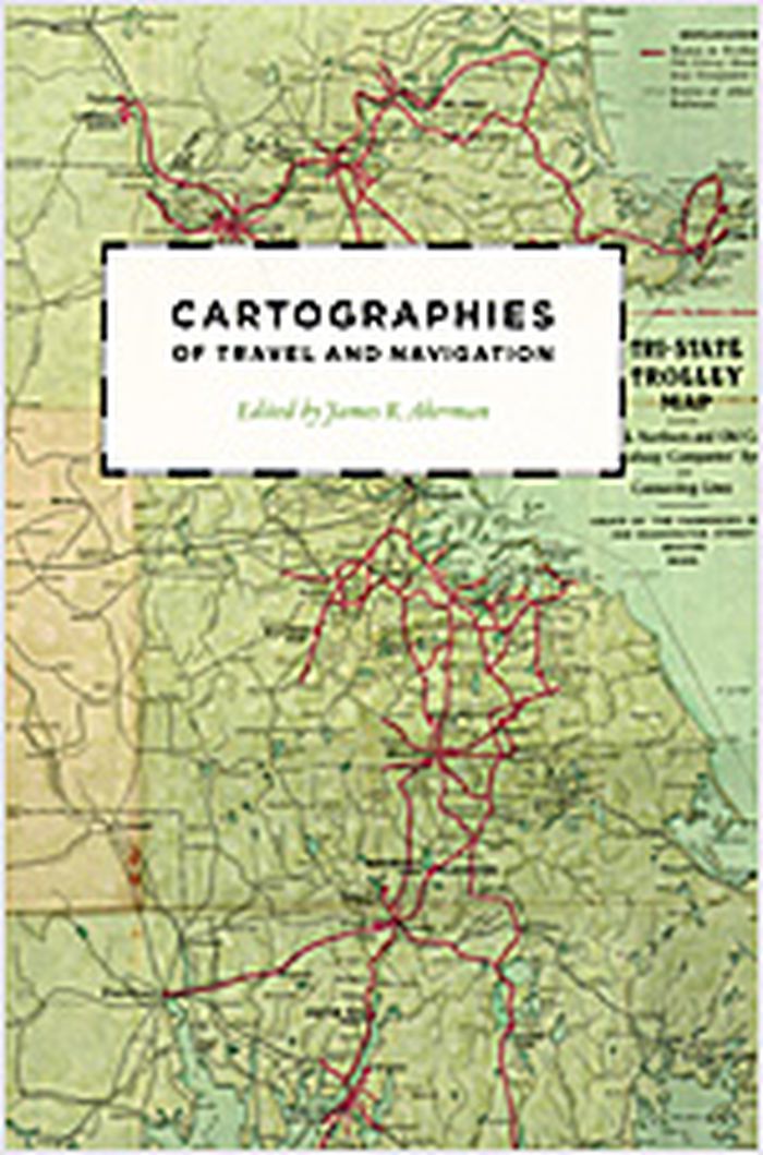
Finding one’s way with a map is a relatively recent phenomenon. In premodern times, maps were used, if at all, mainly for planning journeys in advance, not for guiding travelers on the road. With the exception of navigational sea charts, the use of maps by travelers only became common in the modern era; indeed, in the last two hundred years, maps have become the most(...)
$68.95
(available to order)
Summary:
Finding one’s way with a map is a relatively recent phenomenon. In premodern times, maps were used, if at all, mainly for planning journeys in advance, not for guiding travelers on the road. With the exception of navigational sea charts, the use of maps by travelers only became common in the modern era; indeed, in the last two hundred years, maps have become the most(...)
Title:
Cartographies of travel and navigation
Actions:
Price:
$68.95
(available to order)
Summary:
Finding one’s way with a map is a relatively recent phenomenon. In premodern times, maps were used, if at all, mainly for planning journeys in advance, not for guiding travelers on the road. With the exception of navigational sea charts, the use of maps by travelers only became common in the modern era; indeed, in the last two hundred years, maps have become the most ubiquitous and familiar genre of modern cartography. Examining the historical relationship between travelers, navigation, and maps, "Cartographies of travel and navigation" considers the cartographic response to the new modalities of modern travel brought about by technological and institutional developments in the twentieth century. Highlighting the ways in which the travelers, operators, and planners of modern transportation systems value maps as both navigation tools and as representatives of a radical new mobility, this collection brings the cartography of travel—by road, sea, rail, and air—to the forefront, placing maps at the center of the history of travel and movement.
Form:
books
books
Publication:
August 2006, Chicago, London
August 2006, Chicago, London
Subject:
Architectural Drawing
Architectural Drawing