108 Results
Form:
books
books
Price:
$57.95
(available to order)
Summary:
Pour ce quatrième volume de la collection, Travis Elborough a repris la route en quête de lieux disparus, évanouis, volatilisés – en tout ou parties. On le suit classiquement à Alexandrie, Tombouctou ou Venise, mais aussi sur les pentes des glaciers du Montana, sur les rives du Danube, le long de la rivière souterraine de Londres, jusqu’aux confins de l’Inde, de la Libye,(...)
Subject:
Architectural Plans and Cartography
Architectural Plans and Cartography
Publication:
September 2022
September 2022
Title:
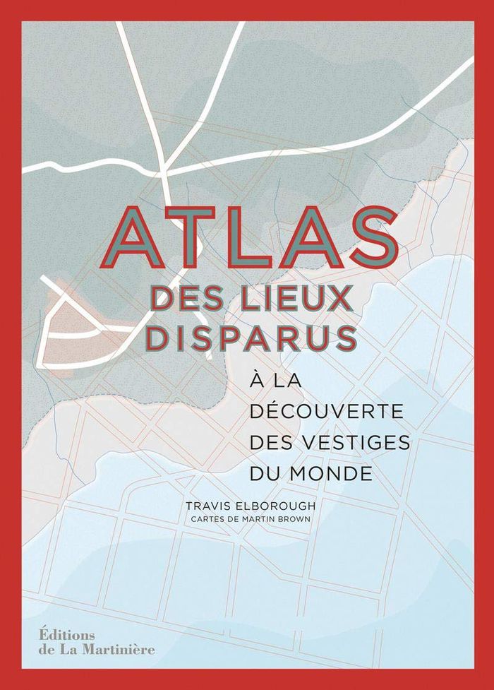
Atlas des lieux disparus : À la découverte des vestiges du monde
Actions:
Price:
$57.95
(available to order)
Summary:
Pour ce quatrième volume de la collection, Travis Elborough a repris la route en quête de lieux disparus, évanouis, volatilisés – en tout ou parties. On le suit classiquement à Alexandrie, Tombouctou ou Venise, mais aussi sur les pentes des glaciers du Montana, sur les rives du Danube, le long de la rivière souterraine de Londres, jusqu’aux confins de l’Inde, de la Libye, de la Colombie, de la Chine ou de la Jamaïque. Chemin faisant, il redonne aux lieux visités leur visage d’antan. Photographies et cartes – signées Martin Brown – révèlent alors les merveilles du passé et les comparent aux vestiges du présent.
Form:
books
books
Publication:
September 2022
September 2022
Subject:
Architectural Plans and Cartography
Architectural Plans and Cartography
Form:
books
books
Title:
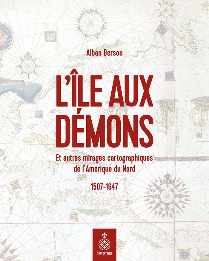
L'île aux démons
L'île aux démons
Actions:
Price:
$39.95
(available to order)
Summary:
L'île aux Démons, la mer de Verrazano, les cités de Norumbega et de Cibola ou encore le lac de Conibas ont ceci en commun : ils n'existent pas. Pourtant, ces lieux ont longtemps été représentés sur les cartes géographiques de l'Amérique du Nord et décrits dans les textes qui les accompagnent. Comment ces mirages cartographiques ont-il pu apparaître et persister aussi(...)
Title:
L'île aux démons
Actions:
Price:
$39.95
(available to order)
Summary:
L'île aux Démons, la mer de Verrazano, les cités de Norumbega et de Cibola ou encore le lac de Conibas ont ceci en commun : ils n'existent pas. Pourtant, ces lieux ont longtemps été représentés sur les cartes géographiques de l'Amérique du Nord et décrits dans les textes qui les accompagnent. Comment ces mirages cartographiques ont-il pu apparaître et persister aussi longtemps? Alban Berson, cartothécaire à Bibliothèque et Archives nationales du Québec, nous conduit dans l'atelier d'un graveur vénitien, dans la mâture d'une caraque normande d'où un marin fourbu aperçoit une promesse, dans le sillage funeste d'un conquistador, près d'un village autochtone où un homme trace pour la première fois sur du papier l'image qu'il se fait de son monde.
Form:
books
books
Publication:
October 2022
October 2022
Subject:
Architectural Plans and Cartography
Architectural Plans and Cartography
Form:
books
books
Title:
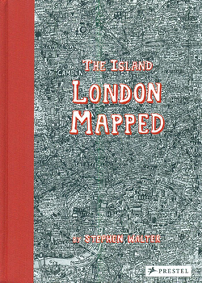
The island: London mapped
The island: London mapped
Actions:
Price:
$38.95
(available to order)
Summary:
London's streets, built up over more than two thousand years, are a maze of history, cultures and stories. In his fantastically detailed maps of the city, Stephen Walter translates these elements into a tangle of insightful yet humorous words and symbols that make up a complex of hidden meanings and wider contradictions. Testament to Walter's skill and importance as a(...)
Title:
The island: London mapped
Actions:
Price:
$38.95
(available to order)
Summary:
London's streets, built up over more than two thousand years, are a maze of history, cultures and stories. In his fantastically detailed maps of the city, Stephen Walter translates these elements into a tangle of insightful yet humorous words and symbols that make up a complex of hidden meanings and wider contradictions. Testament to Walter's skill and importance as a cartographer, his groundbreaking, oversized map The Island was one of only two works by contemporary artists to feature in the seminal Magnificent Maps exhibition held at the British Library in 2010, the other by Grayson Perry and was exhibited together with some of the most important maps in history, such as Pierre Desceliers's 1550 world map.
Form:
books
books
Publication:
February 2015
February 2015
Subject:
Architectural Plans and Cartography
Architectural Plans and Cartography
Form:
books
books
Title:
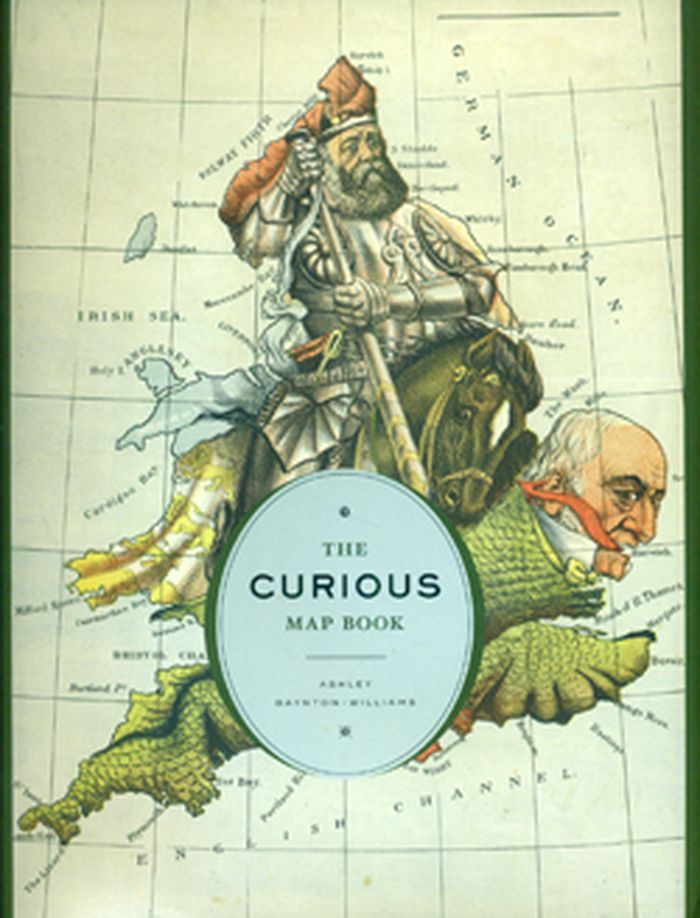
The Curious Map Book
The Curious Map Book
Actions:
Price:
$54.95
(available to order)
Summary:
Over the centuries, maps have served many varied purposes; far from mere guides for reaching a destination, they are unique artistic forms, aides in planning commercial routes, literary devices for illuminating a story. Accuracy—or inaccuracy—of maps has been the make-or-break factor in countless military battles throughout history. They have graced the walls of homes,(...)
Subject:
Architectural Plans and Cartography
Architectural Plans and Cartography
Publication:
October 2015
October 2015
Title:
The Curious Map Book
Actions:
Price:
$54.95
(available to order)
Summary:
Over the centuries, maps have served many varied purposes; far from mere guides for reaching a destination, they are unique artistic forms, aides in planning commercial routes, literary devices for illuminating a story. Accuracy—or inaccuracy—of maps has been the make-or-break factor in countless military battles throughout history. They have graced the walls of homes, bringing prestige and elegance to their owners. They track the mountains, oceans, and stars of our existence. Maps help us make sense of our worlds both real and imaginary—they bring order to the seeming chaos of our surroundings. With The Curious Map Book, Ashley Baynton-Williams gathers a chronologically ordered variety of cartographic gems, mainly from the vast collection of the British Library
Form:
books
books
Publication:
October 2015
October 2015
Subject:
Architectural Plans and Cartography
Architectural Plans and Cartography
Form:
books
books
Actions:
Price:
$118.95
(available to order)
Summary:
Maps of the Dieppe school, commissioned for wealthy households rather than for use in navigation, often presented explorers’ latest discoveries alongside fantastical creatures and allusions to myth. In 1550 cartographer Pierre Desceliers presented to France’s King Henry II one such map, a work of extraordinary beauty and value showing the world as it was known at the(...)
Title:
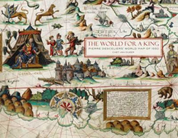
The world for a king: Pierre Desceliers map of 1550
Actions:
Price:
$118.95
(available to order)
Summary:
Maps of the Dieppe school, commissioned for wealthy households rather than for use in navigation, often presented explorers’ latest discoveries alongside fantastical creatures and allusions to myth. In 1550 cartographer Pierre Desceliers presented to France’s King Henry II one such map, a work of extraordinary beauty and value showing the world as it was known at the time. This map, one of the most important of the Dieppe school, includes descriptions of French attempts to colonize Canada and the conquest of Peru by the Spanish in addition to descriptions of the legendary king Prester John in Ethiopia and a race of Amazons in Russia.
Form:
books
books
Publication:
October 2015
October 2015
Subject:
Architectural Plans and Cartography
Architectural Plans and Cartography
Form:
books
books
Title:
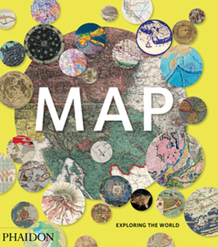
Map: exploring the world
Map: exploring the world
Actions:
Price:
$69.95
(available to order)
Summary:
Map: Exploring the World brings together more than 300 maps from the birth of cartography to cutting-edge digital maps of the twenty-fist century. The book reveals how the history of our attempts to make flat representations of the world has been full of beauty, ingenuity and innovation.
Title:
Map: exploring the world
Actions:
Price:
$69.95
(available to order)
Summary:
Map: Exploring the World brings together more than 300 maps from the birth of cartography to cutting-edge digital maps of the twenty-fist century. The book reveals how the history of our attempts to make flat representations of the world has been full of beauty, ingenuity and innovation.
Form:
books
books
Publication:
September 2015
September 2015
Subject:
Architectural Plans and Cartography
Architectural Plans and Cartography
Form:
books
books
Actions:
Price:
$72.00
(available to order)
Summary:
In our age of visual storytelling, cartography has become more prevalent and innovative. Maps can be illustrated by hand for magazine stories or display in the home or customized for screens of mobile devices that can guide us on urban safaris or isolated hikes. Mind the Map is a showcase that reflects the broad range of work now being created by a new generation(...)
Subject:
Architectural Plans and Cartography
Architectural Plans and Cartography
Publication:
September 2015
September 2015
Title:
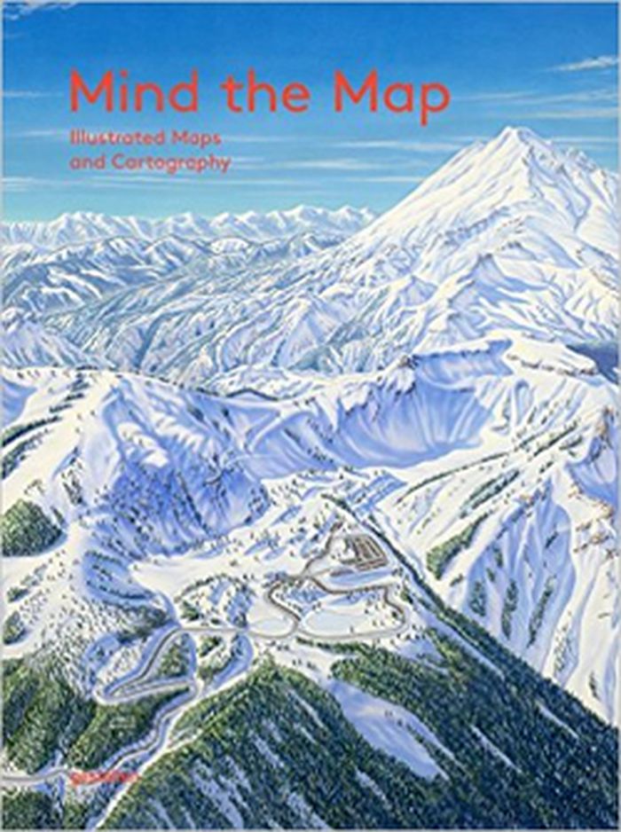
Mind the map: illustrated maps and cartography
Actions:
Price:
$72.00
(available to order)
Summary:
In our age of visual storytelling, cartography has become more prevalent and innovative. Maps can be illustrated by hand for magazine stories or display in the home or customized for screens of mobile devices that can guide us on urban safaris or isolated hikes. Mind the Map is a showcase that reflects the broad range of work now being created by a new generation of mapmakers from around the world including classically legible maps, artistic experiments, editorial illustrations, city views, vacation guides, and global overviews.
Form:
books
books
Publication:
September 2015
September 2015
Subject:
Architectural Plans and Cartography
Architectural Plans and Cartography
Form:
books
books

Actions:
Price:
$115.00
(available to order)
Summary:
The Netherlands is the most densely urbanised country in Europe. Its crowded landscape of greater and smaller, older and younger towns was formed in the course of a millennium. What were the roots of this urban landscape, and how did it develop? What do the urbanisation histories of the Netherlands and the rest of Europe have in common, and how do they differ? This book(...)
Subject:
Architectural Plans and Cartography
Architectural Plans and Cartography
Publication:
December 2015
December 2015
Title:
Atlas of the Dutch urban landscape
Actions:
Price:
$115.00
(available to order)
Summary:
The Netherlands is the most densely urbanised country in Europe. Its crowded landscape of greater and smaller, older and younger towns was formed in the course of a millennium. What were the roots of this urban landscape, and how did it develop? What do the urbanisation histories of the Netherlands and the rest of Europe have in common, and how do they differ? This book contains a comprehensive synthesis of a millennium of spatial development in the Netherlands. Series of maps, photos and paintings clearly illustrate processes of growth, stagnation and decline in Dutch towns and place them in an international perspective.
Form:
books
books
Publication:
December 2015
December 2015
Subject:
Architectural Plans and Cartography
Architectural Plans and Cartography