108 Results
Form:
books
books
Price:
$33.95
(available to order)
Summary:
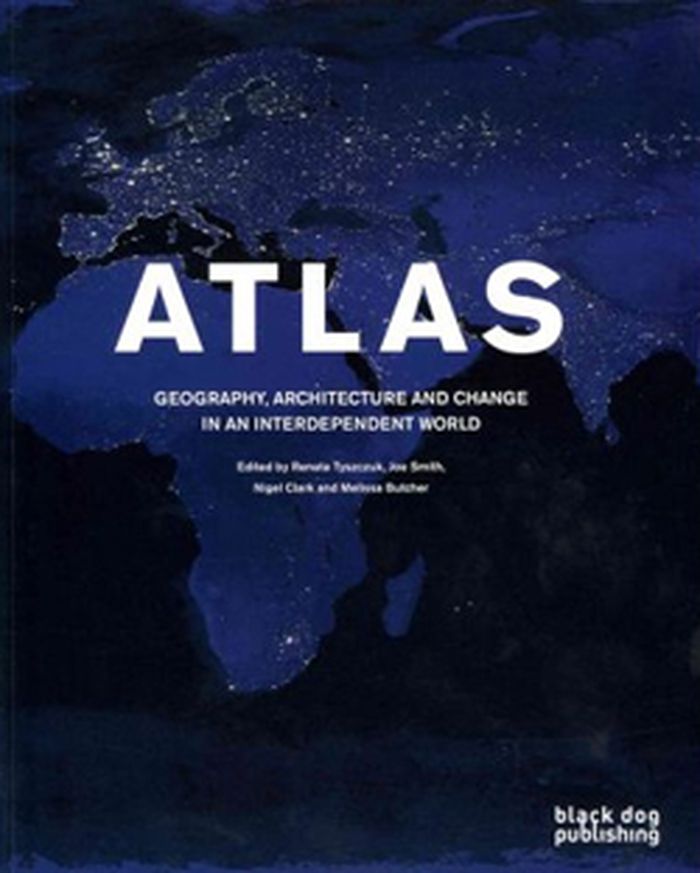
Atlas: Geography, Architecture and Change in an Interdependent World helps readers find their way through the practical and ethical challenges presented by globalisation and global environmental change. This publication combines recent thinking on human geography and architecture on global environmental change issues, setting out to develop a reinterpretation of(...)
$33.95
(available to order)
Summary:
Atlas: Geography, Architecture and Change in an Interdependent World helps readers find their way through the practical and ethical challenges presented by globalisation and global environmental change. This publication combines recent thinking on human geography and architecture on global environmental change issues, setting out to develop a reinterpretation of(...)
Subject:
Architectural Plans and Cartography
Architectural Plans and Cartography
Publication:
February 2012
February 2012
Title:
Atlas: geography, architecture and change in an independent world
Actions:
Price:
$33.95
(available to order)
Summary:
Atlas: Geography, Architecture and Change in an Interdependent World helps readers find their way through the practical and ethical challenges presented by globalisation and global environmental change. This publication combines recent thinking on human geography and architecture on global environmental change issues, setting out to develop a reinterpretation of cartography and a reframing of sustainability. The aim is to find a re-drawing of the earth and the making of new maps. With a focus on the growth and remaking of cities it offers an innovative mix of essays and shorter texts, original artworks and distinctive re-mappings. The Atlas arises out of a collaboration between scholars and practitioners from architecture and human geography.
Form:
books
books
Publication:
February 2012
February 2012
Subject:
Architectural Plans and Cartography
Architectural Plans and Cartography
Form:
books
books
Actions:
Price:
$52.95
(available to order)
Summary:
In the seventeenth century, a map of the plague suggested a radical idea—that the disease was carried and spread by humans. In the nineteenth century, maps of cholera cases were used to prove its waterborne nature. More recently, maps charting the swine flu pandemic caused worldwide panic and sent shockwaves through the medical community. In Disease Maps, Tom Koch(...)
Title:
Disease maps: epidemics on the ground
Actions:
Price:
$52.95
(available to order)
Summary:
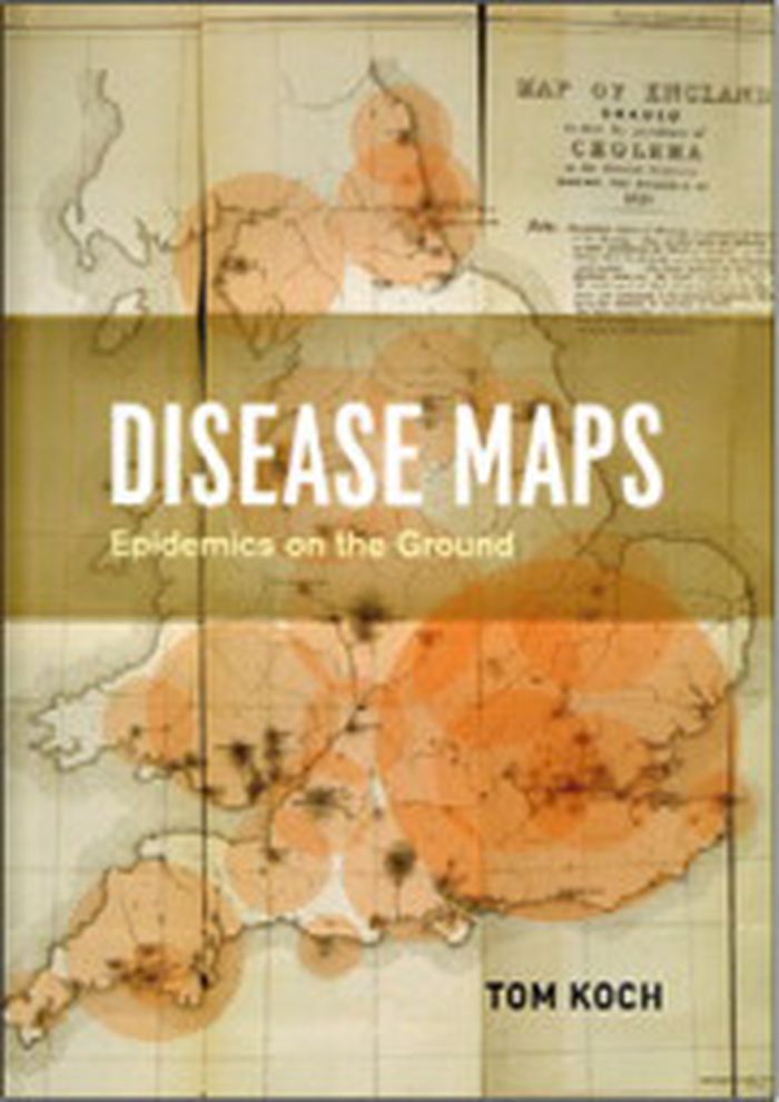
In the seventeenth century, a map of the plague suggested a radical idea—that the disease was carried and spread by humans. In the nineteenth century, maps of cholera cases were used to prove its waterborne nature. More recently, maps charting the swine flu pandemic caused worldwide panic and sent shockwaves through the medical community. In Disease Maps, Tom Koch contends that to understand epidemics and their history we need to think about maps of varying scale, from the individual body to shared symptoms evidenced across cities, nations, and the world. Disease Maps begins with a brief review of epidemic mapping today and a detailed example of its power. Koch then traces the early history of medical cartography, including pandemics such as European plague and yellow fever, and the advancements in anatomy, printing, and world atlases that paved the way for their mapping. Moving on to the scourge of the nineteenth century—cholera—Koch considers the many choleras argued into existence by the maps of the day, including a new perspective on John Snow’s science and legacy. Finally, Koch addresses contemporary outbreaks such as AIDS, cancer, and H1N1, and reaches into the future, toward the coming epidemics.
Disease maps: epidemics on the ground
Actions:
Price:
$52.95
(available to order)
Summary:
In the seventeenth century, a map of the plague suggested a radical idea—that the disease was carried and spread by humans. In the nineteenth century, maps of cholera cases were used to prove its waterborne nature. More recently, maps charting the swine flu pandemic caused worldwide panic and sent shockwaves through the medical community. In Disease Maps, Tom Koch contends that to understand epidemics and their history we need to think about maps of varying scale, from the individual body to shared symptoms evidenced across cities, nations, and the world. Disease Maps begins with a brief review of epidemic mapping today and a detailed example of its power. Koch then traces the early history of medical cartography, including pandemics such as European plague and yellow fever, and the advancements in anatomy, printing, and world atlases that paved the way for their mapping. Moving on to the scourge of the nineteenth century—cholera—Koch considers the many choleras argued into existence by the maps of the day, including a new perspective on John Snow’s science and legacy. Finally, Koch addresses contemporary outbreaks such as AIDS, cancer, and H1N1, and reaches into the future, toward the coming epidemics.
Form:
books
books
Publication:
August 2011
August 2011
Subject:
Architectural Plans and Cartography
Architectural Plans and Cartography
Form:
books
books

Actions:
Price:
$48.95
(available to order)
Summary:
Carried out by designers Moniek Driesse and Annelys de Vet, along with Analía Solomonoff, the Subjective Atlas of Mexico is part of a series of previous subjective atlases where a varied group of artists, designers and photographers who choose personal topics as a starting point to map their cultural identity. Each were asked: what makes a Mexican? what are our likenesses(...)
Subject:
Architectural Plans and Cartography
Architectural Plans and Cartography
Publication:
June 2012
June 2012
Title:
Atlas subjectivo de México / subjective atlas of Mexico
Actions:
Price:
$48.95
(available to order)
Summary:
Carried out by designers Moniek Driesse and Annelys de Vet, along with Analía Solomonoff, the Subjective Atlas of Mexico is part of a series of previous subjective atlases where a varied group of artists, designers and photographers who choose personal topics as a starting point to map their cultural identity. Each were asked: what makes a Mexican? what are our likenesses and what differences do we share? Through its pages the scope of Mexico as a country limited by its borders and its latitudes suddenly vanishes and everyday practices take on new meaning. We can find Mexico reflected in the world, and the world reflected in Mexico. A DVD is included.
Form:
books
books
Publication:
June 2012
June 2012
Subject:
Architectural Plans and Cartography
Architectural Plans and Cartography
Form:
books
books
Title:
Subjective atlas of Hungary
Subjective atlas of Hungary
Actions:
Price:
$36.95
(available to order)
Summary:
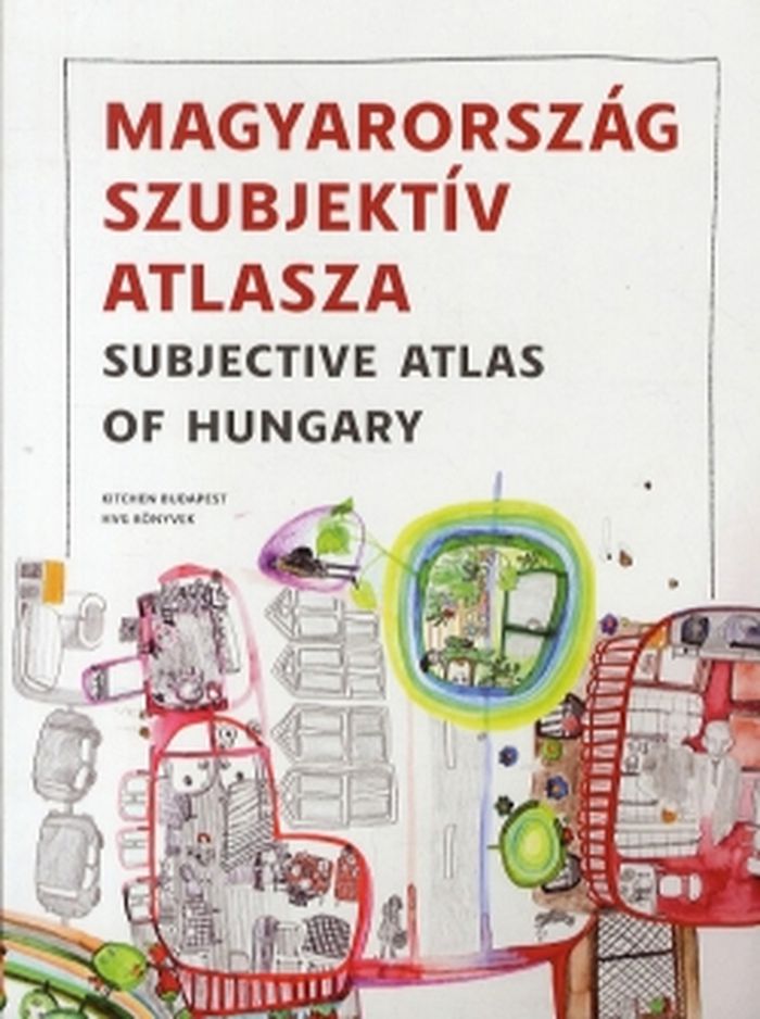
Is it possible to draw a portrait of contemporary Hungary with only one pencil, held by many? Could we map this country at all with its controversial optimism and pessimism, proud and poetry in one single book? Fifty young visual authors were invited by new media lab Kitchen and Dutch designer Annelys de Vet to put their homeland in perspective. Together they shed light(...)
$36.95
(available to order)
Summary:
Is it possible to draw a portrait of contemporary Hungary with only one pencil, held by many? Could we map this country at all with its controversial optimism and pessimism, proud and poetry in one single book? Fifty young visual authors were invited by new media lab Kitchen and Dutch designer Annelys de Vet to put their homeland in perspective. Together they shed light(...)
Title:
Subjective atlas of Hungary
Actions:
Price:
$36.95
(available to order)
Summary:
Is it possible to draw a portrait of contemporary Hungary with only one pencil, held by many? Could we map this country at all with its controversial optimism and pessimism, proud and poetry in one single book? Fifty young visual authors were invited by new media lab Kitchen and Dutch designer Annelys de Vet to put their homeland in perspective. Together they shed light on the Hungarian spirit, today, from the most characteristic vernacular buildings to waterside houses and recycled fences, from wine spritzer and salty sticks to vegetable gardens and sold-out products.
Form:
books
books
Publication:
June 2012
June 2012
Subject:
Architectural Plans and Cartography
Architectural Plans and Cartography
Form:
books
books
Price:
$85.00
(available to order)
Summary:
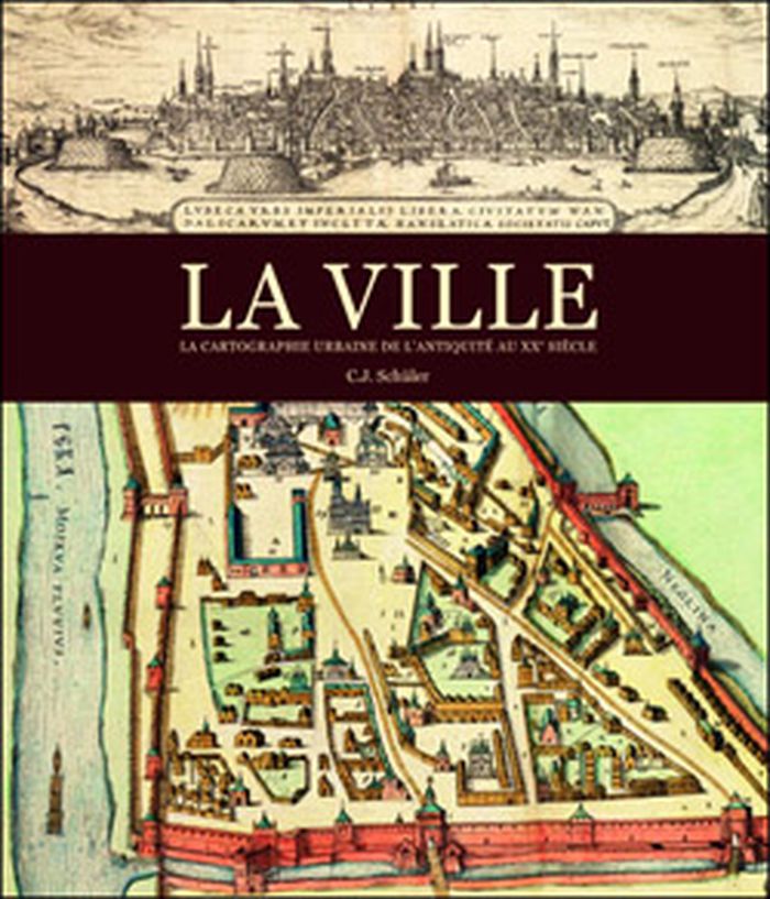
La ville a offert de multiples visages depuis son apparition en Mésopotamie et dans la vallée de l'Indus, voici environ 10 000 ans, et héberge aujourd'hui la moitié de l'humanité. L'appréhension du milieu urbain fut toutefois progressive et plurielle. Les quelque 200 cartes de la collection exceptionnelle de la Royal Geographical Society nous montrent comment l'homme a(...)
$85.00
(available to order)
Summary:
La ville a offert de multiples visages depuis son apparition en Mésopotamie et dans la vallée de l'Indus, voici environ 10 000 ans, et héberge aujourd'hui la moitié de l'humanité. L'appréhension du milieu urbain fut toutefois progressive et plurielle. Les quelque 200 cartes de la collection exceptionnelle de la Royal Geographical Society nous montrent comment l'homme a(...)
Title:
La ville: la cartographie urbaine de l'antiquité au XXe siècle
Actions:
Price:
$85.00
(available to order)
Summary:
La ville a offert de multiples visages depuis son apparition en Mésopotamie et dans la vallée de l'Indus, voici environ 10 000 ans, et héberge aujourd'hui la moitié de l'humanité. L'appréhension du milieu urbain fut toutefois progressive et plurielle. Les quelque 200 cartes de la collection exceptionnelle de la Royal Geographical Society nous montrent comment l'homme a imaginé, puis dessiné la ville. Par les tablettes en terre cuite des Babyloniens aux plans très précis du milieu du XXe siècle, en passant par les peintures et les enluminures médiévales, ce livre nous entraîne dans les cités, les bourgs et les métropoles de différentes époques.
Form:
books
books
Publication:
September 2012
September 2012
Subject:
Architectural Plans and Cartography
Architectural Plans and Cartography
Form:
books
books
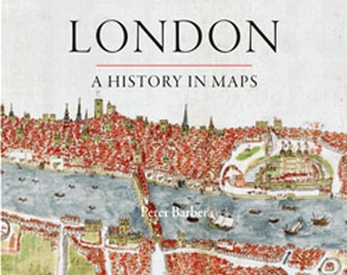
Title:
London: a history in maps
London: a history in maps
Actions:
Price:
$49.95
(available to order)
Summary:
Over the past two thousand years London has developed from a small town into one of the world's largest and most dynamic cities. This book charts that growth and the city's transformation through hundreds of maps culled from the collection of the British Library's Map Library. Including official documents, individual endeavors, hand-drawn renditions, and technologically(...)
Title:
London: a history in maps
Actions:
Price:
$49.95
(available to order)
Summary:
Over the past two thousand years London has developed from a small town into one of the world's largest and most dynamic cities. This book charts that growth and the city's transformation through hundreds of maps culled from the collection of the British Library's Map Library. Including official documents, individual endeavors, hand-drawn renditions, and technologically advanced replicas, these maps represent a variety of perspectives. Utilitarian maps show the city as it is and serve to elucidate its inner workings, while carefully wrought plans show the city as it was envisioned. This book reveals the inside story of the creation, growth, and change of London.
Form:
books
books
Publication:
September 2012
September 2012
Subject:
Architectural Plans and Cartography
Architectural Plans and Cartography
Form:
books
books
Actions:
Price:
$95.00
(available to order)
Summary:
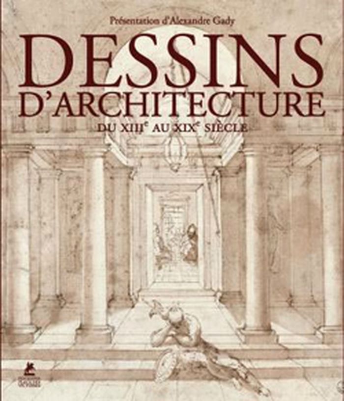
Les illustrations de cet ouvrage entraînent les lecteurs du Moyen Âge au XIXe siècle, sur les traces des bâtisseurs, architectes, décorateurs, utopistes ou simples témoins d'un passé dont ne subsistent parfois que des ruines. Ils ont pour noms Villard de Honnecourt, Jacques Androuet du Cerceau, Etienne Dupérac, Palladio, le Bernin, Borromini, Viollet-le-Duc, entre autres.
$95.00
(available to order)
Summary:
Les illustrations de cet ouvrage entraînent les lecteurs du Moyen Âge au XIXe siècle, sur les traces des bâtisseurs, architectes, décorateurs, utopistes ou simples témoins d'un passé dont ne subsistent parfois que des ruines. Ils ont pour noms Villard de Honnecourt, Jacques Androuet du Cerceau, Etienne Dupérac, Palladio, le Bernin, Borromini, Viollet-le-Duc, entre autres.
Title:
Dessins d'architecture, du Moyen-Âge au XIXe siècle
Actions:
Price:
$95.00
(available to order)
Summary:
Les illustrations de cet ouvrage entraînent les lecteurs du Moyen Âge au XIXe siècle, sur les traces des bâtisseurs, architectes, décorateurs, utopistes ou simples témoins d'un passé dont ne subsistent parfois que des ruines. Ils ont pour noms Villard de Honnecourt, Jacques Androuet du Cerceau, Etienne Dupérac, Palladio, le Bernin, Borromini, Viollet-le-Duc, entre autres.
Form:
books
books
Publication:
November 2012
November 2012
Subject:
Architectural Plans and Cartography
Architectural Plans and Cartography
Form:
books
books
Actions:
Price:
$32.00
(available to order)
Summary:
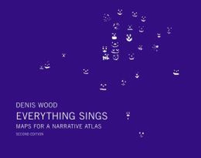
The acclaimed geographer Denis Wood has written numerous books (including the influential bestseller The Power of Maps) that reorient his readers to our neighborhoods, homes and bodies. At the heart of Wood’s investigations is a near-legendary endeavor: the Boylan Heights maps, begun in 1982, and first presented in Everything Sings (2010). This second edition includes(...)
$32.00
(available to order)
Summary:
The acclaimed geographer Denis Wood has written numerous books (including the influential bestseller The Power of Maps) that reorient his readers to our neighborhoods, homes and bodies. At the heart of Wood’s investigations is a near-legendary endeavor: the Boylan Heights maps, begun in 1982, and first presented in Everything Sings (2010). This second edition includes(...)
Title:
Denis Wood : everything sings, maps for a narrative atlas, 2nd revised edition
Actions:
Price:
$32.00
(available to order)
Summary:
The acclaimed geographer Denis Wood has written numerous books (including the influential bestseller The Power of Maps) that reorient his readers to our neighborhoods, homes and bodies. At the heart of Wood’s investigations is a near-legendary endeavor: the Boylan Heights maps, begun in 1982, and first presented in Everything Sings (2010). This second edition includes eight new maps (including one of barking dogs!), other new visual material plus original essays by Ander Monson and Albert Mobilio and an interview with Blake Butler.
Form:
books
books
Publication:
June 2013
June 2013
Subject:
Architectural Plans and Cartography
Architectural Plans and Cartography
Form:
books
books
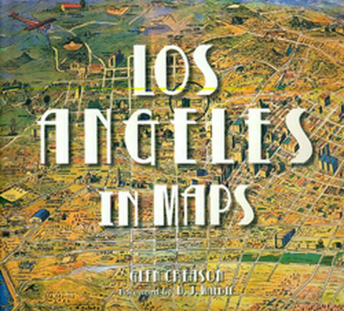
Title:
Los Angeles in maps
Los Angeles in maps
Actions:
Price:
$60.00
(available to order)
Summary:
An illustrated cartographic history of the City of Angels from the colonial era to the present. Los Angeles inhabits a place of the mind as much as it does a physical geographic space. Through seventy reproductions of seminal and historic documents, Los Angeles in Maps presents the evolution of this almost mythical place. Maps featured include historic Spanish explorers’(...)
Title:
Los Angeles in maps
Actions:
Price:
$60.00
(available to order)
Summary:
An illustrated cartographic history of the City of Angels from the colonial era to the present. Los Angeles inhabits a place of the mind as much as it does a physical geographic space. Through seventy reproductions of seminal and historic documents, Los Angeles in Maps presents the evolution of this almost mythical place. Maps featured include historic Spanish explorers’ charts from as early as 1791, as well as more recent topographic surveys, tourist guides, real estate maps, bird’s-eye views, and more. Like the course of the Los Angeles River, the book winds through essential terrain: the discovery of oil, the rise of Hollywood, the streetcar system, Los Angeles Harbor, earthquakes, sprawl, and splendor.
Form:
books
books
Publication:
October 2010
October 2010
Subject:
Architectural Plans and Cartography
Architectural Plans and Cartography
Form:
books
books
Actions:
Price:
$54.95
(available to order)
Summary:
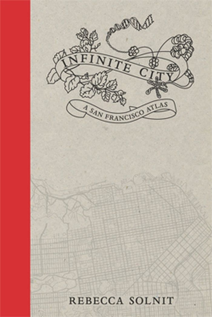
Infinite City, Rebecca Solnit’s reinvention of the traditional atlas, examines the many layers of meaning in one place, the San Francisco Bay Area. Aided by artists, writers, cartographers, and twenty-two gorgeous color maps, each of which illuminates the city and its surroundings as experienced by different inhabitants.
$54.95
(available to order)
Summary:
Infinite City, Rebecca Solnit’s reinvention of the traditional atlas, examines the many layers of meaning in one place, the San Francisco Bay Area. Aided by artists, writers, cartographers, and twenty-two gorgeous color maps, each of which illuminates the city and its surroundings as experienced by different inhabitants.
Publication:
November 2010
November 2010
Title:
Infinite city: a San Francisco atlas
Actions:
Price:
$54.95
(available to order)
Summary:
Infinite City, Rebecca Solnit’s reinvention of the traditional atlas, examines the many layers of meaning in one place, the San Francisco Bay Area. Aided by artists, writers, cartographers, and twenty-two gorgeous color maps, each of which illuminates the city and its surroundings as experienced by different inhabitants.
Form:
books
books
Publication:
November 2010
November 2010