87 Results
Form:
maps, drawings
maps, drawings
Actions:
Reference number:
ARCH279656
ARCH279656
People:
Date:
1978
1978
Form:
maps, drawings
maps, drawings
Date:
1978
1978
People:
Form:
maps, drawings
maps, drawings
Actions:
Reference number:
ARCH279657
ARCH279657
People:
Date:
1978
1978
Form:
maps, drawings
maps, drawings
Date:
1978
1978
People:
Form:
maps, drawings
maps, drawings
Actions:
Reference number:
ARCH279648
ARCH279648
People:
Date:
1983
1983
Form:
maps, drawings
maps, drawings
Date:
1983
1983
People:
Form:
drawings
drawings
Actions:
Reference number:
ARCH279649
ARCH279649
People:
Date:
ca. 1978
ca. 1978
Form:
drawings
drawings
Date:
ca. 1978
ca. 1978
People:
Form:
photographs
photographs
Reference number:
CD035.S1.1979.PR01.005.2
CD035.S1.1979.PR01.005.2
People:
Date:
1978
1978
Form:
photographs
photographs
Date:
1978
1978
People:
Form:
maps
maps
Actions:
Reference number:
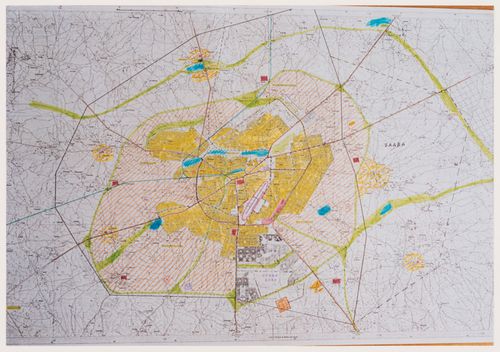
CD035.S1.1979.PR01.006
Description:
Documents previously stored in a box labelled "BEEKER / OUAGA / SDAV 2000 / HASKOOING" / 1983-1985". Includes maps for the aerial photographs shoots, maps of vacants and occupied lots and maps of infrastructure for wateraccess and electricity.
CD035.S1.1979.PR01.006
Description:
Documents previously stored in a box labelled "BEEKER / OUAGA / SDAV 2000 / HASKOOING" / 1983-1985". Includes maps for the aerial photographs shoots, maps of vacants and occupied lots and maps of infrastructure for wateraccess and electricity.
People:
Date:
2000
2000
Title:
Survey maps of the Ouagadougou area, Burkina Faso
Actions:
CD035.S1.1979.PR01.006
Description:
Documents previously stored in a box labelled "BEEKER / OUAGA / SDAV 2000 / HASKOOING" / 1983-1985". Includes maps for the aerial photographs shoots, maps of vacants and occupied lots and maps of infrastructure for wateraccess and electricity.
Form:
maps
maps
Date:
2000
2000
People:
Form:
photographs
photographs
Reference number:
CD035.S1.1979.PR01.025
CD035.S1.1979.PR01.025
People:
Date:
1988
1988
Form:
photographs
photographs
Date:
1988
1988
People:
Form:
photographs
photographs
Actions:
Reference number:
CD035.S1.1979.PR01.027
Description:
Also contains the aerial survey maps.
CD035.S1.1979.PR01.027
Description:
Also contains the aerial survey maps.
People:
Date:
ca. 1979
ca. 1979
Title:
Aerial photographs of the Ouagadougou area, Burkina Faso
Actions:
CD035.S1.1979.PR01.027
Description:
Also contains the aerial survey maps.
Aerial photographs of the Ouagadougou area, Burkina Faso
Actions:
CD035.S1.1979.PR01.027
Description:
Also contains the aerial survey maps.
Form:
photographs
photographs
Date:
ca. 1979
ca. 1979
People:
Form:
photographs
photographs
Actions:
Reference number:
CD035.S1.1979.PR01.030
CD035.S1.1979.PR01.030
People:
Date:
1990s
1990s
Title:
Photographs of spontaneous neighbourhoods of Ouagadougou, Burkina Faso
Actions:
CD035.S1.1979.PR01.030
Photographs of spontaneous neighbourhoods of Ouagadougou, Burkina Faso
Actions:
CD035.S1.1979.PR01.030
Form:
photographs
photographs
Date:
1990s
1990s
People:
Form:
maps, photographs
maps, photographs
Actions:
Reference number:
ARCH279652
ARCH279652
People:
Date:
1990s
1990s
Form:
maps, photographs
maps, photographs
Date:
1990s
1990s
People: