2698 Results
Form:
books
books
Actions:
Price:
$50.95
(available to order)
Summary:
ImageSingulières est un festival de photographie documentaire créé en 2009 à Sète. Chaque année un photographe est invité à porter son regard sur la ville, ce qui fait l’objet d'un livre. En 2022, la carte blanche est confiée à Gabrielle Duplantier. Dans ses images d'un noir et blanc lumineux, la puissance des formes, souvenir d’un apprentissage de peintre, s’allie à la(...)
Title:
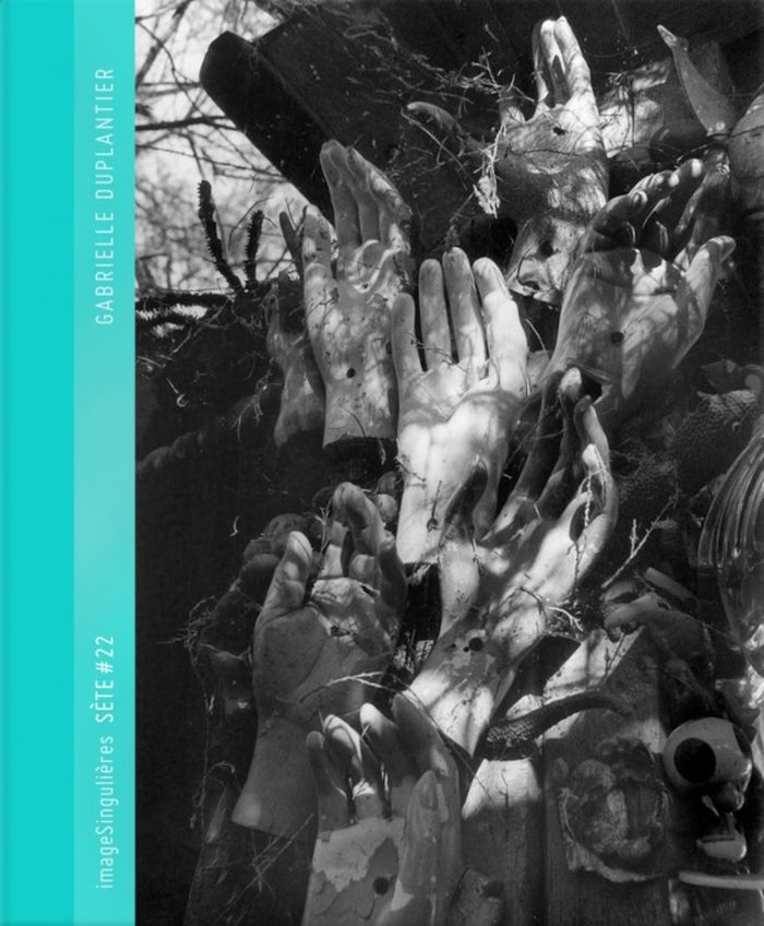
Gabrielle Duplantier : Sète #22
Actions:
Price:
$50.95
(available to order)
Summary:
ImageSingulières est un festival de photographie documentaire créé en 2009 à Sète. Chaque année un photographe est invité à porter son regard sur la ville, ce qui fait l’objet d'un livre. En 2022, la carte blanche est confiée à Gabrielle Duplantier. Dans ses images d'un noir et blanc lumineux, la puissance des formes, souvenir d’un apprentissage de peintre, s’allie à la fragilité des figures. Mouvements suspendus, paysages organiques, instants crépusculaires, portraits habités de femmes et d’enfants... Gabrielle Duplantier poursuit l’affirmation, inquiète et obstinée, d’un point de vue moins attaché à figer la réalité qu’à lui réclamer un droit de regard. Ses photographies sont empreintes de délicatesse autant que d’une force brutale. Le livre s’accompagne d’un texte de Christian Caujolle.
Form:
books
books
Publication:
July 2022
July 2022
Subject:
Photography monographs
Photography monographs
Form:
books
books
Title:
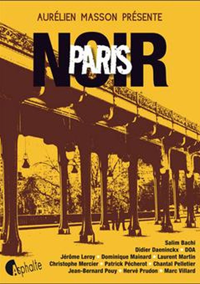
Paris noir
Paris noir
Actions:
Price:
$37.95
(available to order)
Summary:
En douze nouvelles, Paris Noir est une exploration urbaine du côté sombre de la Ville lumière, mettant en scène serveurs, flics, prostituées, malfrats, stars en devenir... Des Halles à Oberkampf, de Belleville aux Batignolles, en passant par le Quartier latin et la place des Vosges : un tableau haut en couleurs, tourmenté et engagé, qui n'a rien d'une carte postale. (...)
Title:
Paris noir
Actions:
Price:
$37.95
(available to order)
Summary:
En douze nouvelles, Paris Noir est une exploration urbaine du côté sombre de la Ville lumière, mettant en scène serveurs, flics, prostituées, malfrats, stars en devenir... Des Halles à Oberkampf, de Belleville aux Batignolles, en passant par le Quartier latin et la place des Vosges : un tableau haut en couleurs, tourmenté et engagé, qui n'a rien d'une carte postale. « Paris Noir a été conçu comme une auberge espagnole. L'envie était de mélanger les genres, de faire se côtoyer des pointures du roman noir avec des auteurs plus classiques, que l'on a davantage l'habitude de retrouver dans les collections de littérature dite " blanche ". De faire cohabiter dans un même livre des raconteurs d'histoire et des ciseleurs de mots. » Aurélien Masson
Form:
books
books
Publication:
December 2012
December 2012
Subject:
City Guides
City Guides
Form:
books
books
Title:
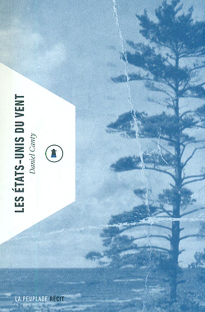
Les États-Unis du vent
Les États-Unis du vent
Actions:
Price:
$24.95
(available to order)
Summary:
Fin 2010. De l'automne tardif au début de l'hiver, Daniel Canty devient chercheur de vent. À bord de la Blue Rider, un vénérable camion d'un bleu de minuit coiffé d'une girouette, il s'abandonne à une dérive entièrement dictée par la fluidité des courants aériens. L'aventure l'emporte des plaines herbeuses du Midwest à Chicago la venteuse, il s'engouffre dans le wind(...)
Title:
Les États-Unis du vent
Actions:
Price:
$24.95
(available to order)
Summary:
Fin 2010. De l'automne tardif au début de l'hiver, Daniel Canty devient chercheur de vent. À bord de la Blue Rider, un vénérable camion d'un bleu de minuit coiffé d'une girouette, il s'abandonne à une dérive entièrement dictée par la fluidité des courants aériens. L'aventure l'emporte des plaines herbeuses du Midwest à Chicago la venteuse, il s'engouffre dans le wind tunnel des Grands Lacs, découvre les cités d'industrie perdue de la rust belt, bifurque par les pastoraux territoires amish vers les forêts de Pennsylvanie, terres d'or noir et de guerre civile. Entre travelogue et fabulation, Les États-Unis du vent est un livre aux pieds ailés, où transparaît la carte d'une Amérique invisible, nappée par la lumière des révélations.
Form:
books
books
Publication:
April 2014
April 2014
Subject:
Literature and poetry
Literature and poetry
Form:
maps
maps
Actions:
Holdings:
Description:
1 folded sheet : illustrations, maps ; 59 x 45 cm folded to 11 x 15 cm
Description:
1 folded sheet : illustrations, maps ; 59 x 45 cm folded to 11 x 15 cm
Author:
Subject:
Publication:
[Ekaterinburg (Russia)] : [publisher not identified], [2003]
[Ekaterinburg (Russia)] : [publisher not identified], [2003]
Title:
Priglashaem v Ekaterinburg : karta-suvenir = Welcome to Yekaterinburg : souvenir map / avtor proekta, Anna Bugachevskai︠a︡ ; foto, Ilʹdar Ziganshin, A.G. Semehin.
Actions:
Holdings:
Description:
1 folded sheet : illustrations, maps ; 59 x 45 cm folded to 11 x 15 cm
Priglashaem v Ekaterinburg : karta-suvenir = Welcome to Yekaterinburg : souvenir map / avtor proekta, Anna Bugachevskai︠a︡ ; foto, Ilʹdar Ziganshin, A.G. Semehin.
Actions:
Holdings:
Description:
1 folded sheet : illustrations, maps ; 59 x 45 cm folded to 11 x 15 cm
Form:
maps
maps
Publication:
[Ekaterinburg (Russia)] : [publisher not identified], [2003]
[Ekaterinburg (Russia)] : [publisher not identified], [2003]
Author:
Subject:
Form:
books
books
Actions:
Holdings:
Description:
76 pages : plates, folded maps, maps on lining papers ; 19 cm
Description:
76 pages : plates, folded maps, maps on lining papers ; 19 cm
Author:
Subject:
Publication:
Shanghai : Kelly & Walsh, 1936.
Shanghai : Kelly & Walsh, 1936.
Title:
Soochow, the Garden City / by F.R. Nance.
Actions:
Holdings:
Description:
76 pages : plates, folded maps, maps on lining papers ; 19 cm
Soochow, the Garden City / by F.R. Nance.
Actions:
Holdings:
Description:
76 pages : plates, folded maps, maps on lining papers ; 19 cm
Form:
books
books
Publication:
Shanghai : Kelly & Walsh, 1936.
Shanghai : Kelly & Walsh, 1936.
Author:
Subject:
Form:
books
books
Actions:
Holdings:
Description:
150 p. : ill. (some col.), plans ; 26 cm.
Description:
150 p. : ill. (some col.), plans ; 26 cm.
Author:
Subject:
Publication:
London : E. & F.N. Spon, 1891.
London : E. & F.N. Spon, 1891.
Title:
The draughtsman's handbook of plan and map drawing : including instructions for the preparation of engineering, architectural, and mechanical drawings : with numerous illustrations and coloured examples / by George G. André.
Actions:
Holdings:
Description:
150 p. : ill. (some col.), plans ; 26 cm.
The draughtsman's handbook of plan and map drawing : including instructions for the preparation of engineering, architectural, and mechanical drawings : with numerous illustrations and coloured examples / by George G. André.
Actions:
Holdings:
Description:
150 p. : ill. (some col.), plans ; 26 cm.
Form:
books
books
Publication:
London : E. & F.N. Spon, 1891.
London : E. & F.N. Spon, 1891.
Author:
Subject:
Form:
books
books
Actions:
Holdings:
Description:
105 pages 24 cm
Description:
105 pages 24 cm
Author:
Subject:
Publication:
Roma, Bardi, 1969.
Roma, Bardi, 1969.
Title:
Saggio di bibliografia ragionata delle piante icongrafiche e prospettiche di Roma dal 1551 al 1748. [Di] Christian Huelsen.
Actions:
Holdings:
Description:
105 pages 24 cm
Saggio di bibliografia ragionata delle piante icongrafiche e prospettiche di Roma dal 1551 al 1748. [Di] Christian Huelsen.
Actions:
Holdings:
Description:
105 pages 24 cm
Form:
books
books
Publication:
Roma, Bardi, 1969.
Roma, Bardi, 1969.
Author:
Subject:
Form:
books
books
Title:
Atlas historique du Canada.
Atlas historique du Canada.
Actions:
Holdings:
Description:
3 volumes ; 38 cm
Description:
3 volumes ; 38 cm
Author:
Subject:
Publication:
Montréal : Les Presses de l'Université de Montréal, 1987-1993.
Montréal : Les Presses de l'Université de Montréal, 1987-1993.
Form:
books
books
Publication:
Montréal : Les Presses de l'Université de Montréal, 1987-1993.
Montréal : Les Presses de l'Université de Montréal, 1987-1993.
Author:
Subject:
Form:
books
books
Actions:
Holdings:
Description:
224 pages : illustrations (some color), color maps ; 27 cm
Description:
224 pages : illustrations (some color), color maps ; 27 cm
Author:
Subject:
Publication:
London ; New York, N.Y. : Thames and Hudson, 1990.
London ; New York, N.Y. : Thames and Hudson, 1990.
Title:
The complete Tutankhamun : the king, the tomb, the royal treasure / by Nicholas Reeves ; foreword by the Seventh Earl of Carnarvon.
Actions:
Holdings:
Description:
224 pages : illustrations (some color), color maps ; 27 cm
The complete Tutankhamun : the king, the tomb, the royal treasure / by Nicholas Reeves ; foreword by the Seventh Earl of Carnarvon.
Actions:
Holdings:
Description:
224 pages : illustrations (some color), color maps ; 27 cm
Form:
books
books
Publication:
London ; New York, N.Y. : Thames and Hudson, 1990.
London ; New York, N.Y. : Thames and Hudson, 1990.
Author:
Subject:
Form:
maps
maps
Holdings:
Description:
1 map ; 107 x 121 cm, folded approximately 26 x 20 cm
Description:
1 map ; 107 x 121 cm, folded approximately 26 x 20 cm
Author:
Subject:
Publication:
[Raleigh] : [Raleigh City Council], 1986.
[Raleigh] : [Raleigh City Council], 1986.
Title:
Capital Area Greenway master plan : City of Raleigh, North Carolina.
Actions:
Holdings:
Description:
1 map ; 107 x 121 cm, folded approximately 26 x 20 cm
Capital Area Greenway master plan : City of Raleigh, North Carolina.
Actions:
Holdings:
Description:
1 map ; 107 x 121 cm, folded approximately 26 x 20 cm
Form:
maps
maps
Publication:
[Raleigh] : [Raleigh City Council], 1986.
[Raleigh] : [Raleigh City Council], 1986.
Author:
Subject: