2698 Results
Form:
books
books
Actions:
Holdings:
Description:
200 pages, 3 leaves plans (some folded) 29 cm
Description:
200 pages, 3 leaves plans (some folded) 29 cm
Author:
Subject:
Publication:
México [Impreso en los talleres de la editorial "Cvltvra"] 1938.
México [Impreso en los talleres de la editorial "Cvltvra"] 1938.
Title:
Planos de la ciudad de México: siglos XVI y XVII, estudio histórico, urbanístico y bibliográfico por Manuel Toussaint, Federico Gómez de Orozco [y] Justino Fernández. XVI Congreso internacional de planificación y de la habitación.
Actions:
Holdings:
Description:
200 pages, 3 leaves plans (some folded) 29 cm
Form:
books
books
Publication:
México [Impreso en los talleres de la editorial "Cvltvra"] 1938.
México [Impreso en los talleres de la editorial "Cvltvra"] 1938.
Author:
Subject:
Form:
books
books
Actions:
Holdings:
Description:
xviii, 357 pages : illustrations, maps ; 27 cm
Description:
xviii, 357 pages : illustrations, maps ; 27 cm
Author:
Subject:
Publication:
Cambridge ; New York : Cambridge University Press, 2010.
Cambridge ; New York : Cambridge University Press, 2010.
Title:
Rome's world : the Peutinger map reconsidered / Richard J.A. Talbert ; in association with Tom Elliott ; assisted by Nora Harris [and others] ; with a contribution by Martin Steinmann.
Actions:
Holdings:
Description:
xviii, 357 pages : illustrations, maps ; 27 cm
Rome's world : the Peutinger map reconsidered / Richard J.A. Talbert ; in association with Tom Elliott ; assisted by Nora Harris [and others] ; with a contribution by Martin Steinmann.
Actions:
Holdings:
Description:
xviii, 357 pages : illustrations, maps ; 27 cm
Form:
books
books
Publication:
Cambridge ; New York : Cambridge University Press, 2010.
Cambridge ; New York : Cambridge University Press, 2010.
Author:
Subject:
Form:
books
books
Title:
The Mapping of America / [compiled by] R.V. Tooley ; with an index compiled by Douglas Matthews.
The Mapping of America / [compiled by] R.V. Tooley ; with an index compiled by Douglas Matthews.
Actions:
Holdings:
Description:
xi, 519 pages : illustrations ; 25 cm.
Description:
xi, 519 pages : illustrations ; 25 cm.
Author:
Subject:
Publication:
London : Holland Press ; New York : R.B. Arkway ; King of Prussia, Pa. : Distributed by W.G. Arader III, 1980.
London : Holland Press ; New York : R.B. Arkway ; King of Prussia, Pa. : Distributed by W.G. Arader III, 1980.
Title:
The Mapping of America / [compiled by] R.V. Tooley ; with an index compiled by Douglas Matthews.
Actions:
Holdings:
Description:
xi, 519 pages : illustrations ; 25 cm.
The Mapping of America / [compiled by] R.V. Tooley ; with an index compiled by Douglas Matthews.
Actions:
Holdings:
Description:
xi, 519 pages : illustrations ; 25 cm.
Form:
books
books
Publication:
London : Holland Press ; New York : R.B. Arkway ; King of Prussia, Pa. : Distributed by W.G. Arader III, 1980.
London : Holland Press ; New York : R.B. Arkway ; King of Prussia, Pa. : Distributed by W.G. Arader III, 1980.
Author:
Subject:
Form:
books
books
Title:
From here to there : a curious collection from the Hand Drawn Map Association / Kris Harzinski.
From here to there : a curious collection from the Hand Drawn Map Association / Kris Harzinski.
Actions:
Holdings:
Description:
223 pages : illustrations (some color), maps (some color) ; 19 cm
Description:
223 pages : illustrations (some color), maps (some color) ; 19 cm
Author:
Subject:
Publication:
New York, New York : Princeton Architectural Press, [2010]
New York, New York : Princeton Architectural Press, [2010]
Title:
From here to there : a curious collection from the Hand Drawn Map Association / Kris Harzinski.
Actions:
Holdings:
Description:
223 pages : illustrations (some color), maps (some color) ; 19 cm
From here to there : a curious collection from the Hand Drawn Map Association / Kris Harzinski.
Actions:
Holdings:
Description:
223 pages : illustrations (some color), maps (some color) ; 19 cm
Form:
books
books
Publication:
New York, New York : Princeton Architectural Press, [2010]
New York, New York : Princeton Architectural Press, [2010]
Author:
Subject:
Form:
books
books
Actions:
Holdings:
Description:
310 pages : illustrations, map ; 22 cm
Description:
310 pages : illustrations, map ; 22 cm
Author:
Subject:
Publication:
Toronto : Coach House Books, ©2010.
Toronto : Coach House Books, ©2010.
Title:
Stroll : psychogeographic walking tours of Toronto / by Shawn Micallef ; illustrations by Marlena Zuber.
Actions:
Holdings:
Description:
310 pages : illustrations, map ; 22 cm
Stroll : psychogeographic walking tours of Toronto / by Shawn Micallef ; illustrations by Marlena Zuber.
Actions:
Holdings:
Description:
310 pages : illustrations, map ; 22 cm
Form:
books
books
Publication:
Toronto : Coach House Books, ©2010.
Toronto : Coach House Books, ©2010.
Author:
Subject:
Form:
maps
maps
Actions:
Holdings:
Description:
1 atlas (xl, 270 pages, 120 pages of plates) : color maps ; 30 cm
Description:
1 atlas (xl, 270 pages, 120 pages of plates) : color maps ; 30 cm
Author:
Subject:
Publication:
Edinburgh : J. Bartholomew, 1986.
Edinburgh : J. Bartholomew, 1986.
Title:
Bartholomew gazetteer of places in Britain / compiled by Oliver Mason.
Actions:
Holdings:
Description:
1 atlas (xl, 270 pages, 120 pages of plates) : color maps ; 30 cm
Bartholomew gazetteer of places in Britain / compiled by Oliver Mason.
Actions:
Holdings:
Description:
1 atlas (xl, 270 pages, 120 pages of plates) : color maps ; 30 cm
Form:
maps
maps
Publication:
Edinburgh : J. Bartholomew, 1986.
Edinburgh : J. Bartholomew, 1986.
Author:
Subject:
Form:
books
books
Holdings:
Description:
377 pages : color illustrations ; 28 cm
Description:
377 pages : color illustrations ; 28 cm
Author:
Subject:
Publication:
New York : Rizzoli, 1987.
New York : Rizzoli, 1987.
Title:
Art nouveau postcards / Giovanni Fanelli and Ezio Godoli.
Actions:
Holdings:
Description:
377 pages : color illustrations ; 28 cm
Art nouveau postcards / Giovanni Fanelli and Ezio Godoli.
Actions:
Holdings:
Description:
377 pages : color illustrations ; 28 cm
Form:
books
books
Publication:
New York : Rizzoli, 1987.
New York : Rizzoli, 1987.
Author:
Subject:
Form:
maps
maps
Actions:
Holdings:
Description:
1 atlas (15, 132 leaves) ; 46 x 51 cm
Description:
1 atlas (15, 132 leaves) ; 46 x 51 cm
Author:
Subject:
Publication:
Nairobi ; New York : Oxford University Press, 1965.
Nairobi ; New York : Oxford University Press, 1965.
Title:
The climate of Africa / B.W. Thompson.
Actions:
Holdings:
Description:
1 atlas (15, 132 leaves) ; 46 x 51 cm
The climate of Africa / B.W. Thompson.
Actions:
Holdings:
Description:
1 atlas (15, 132 leaves) ; 46 x 51 cm
Form:
maps
maps
Publication:
Nairobi ; New York : Oxford University Press, 1965.
Nairobi ; New York : Oxford University Press, 1965.
Author:
Subject:
Form:
books
books
Price:
$66.95
(available to order)
Summary:
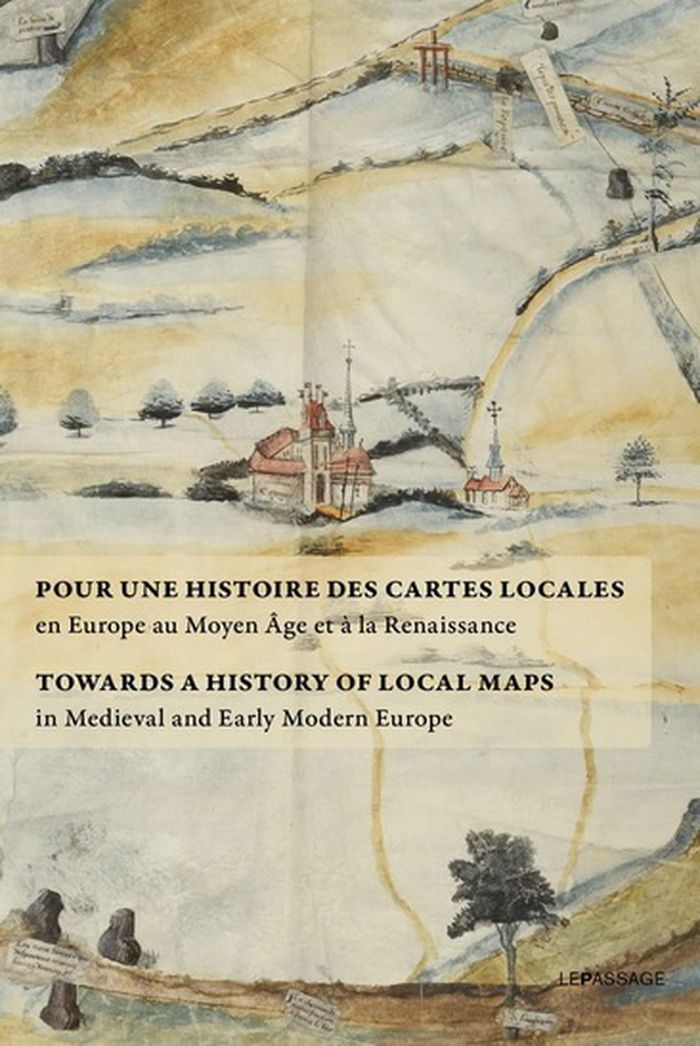
Rassemblant des textes rédigés par les meilleurs spécialistes du sujet, J. Dumasy-Rabineau met en évidence l'ampleur du corpus cartographique des XVe et XVIe siècles et engage une étude comparée à l'échelle européenne. Ce recueil fait suite à une exposition aux archives nationales en 2019 qui présentait des cartes locales issues de collections françaises.
$66.95
(available to order)
Summary:
Rassemblant des textes rédigés par les meilleurs spécialistes du sujet, J. Dumasy-Rabineau met en évidence l'ampleur du corpus cartographique des XVe et XVIe siècles et engage une étude comparée à l'échelle européenne. Ce recueil fait suite à une exposition aux archives nationales en 2019 qui présentait des cartes locales issues de collections françaises.
Subject:
Architectural Plans and Cartography
Architectural Plans and Cartography
Publication:
September 2022
September 2022
Title:
Pour une histoire des cartes locales / Towards a history of local maps
Actions:
Price:
$66.95
(available to order)
Summary:
Rassemblant des textes rédigés par les meilleurs spécialistes du sujet, J. Dumasy-Rabineau met en évidence l'ampleur du corpus cartographique des XVe et XVIe siècles et engage une étude comparée à l'échelle européenne. Ce recueil fait suite à une exposition aux archives nationales en 2019 qui présentait des cartes locales issues de collections françaises.
Form:
books
books
Publication:
September 2022
September 2022
Subject:
Architectural Plans and Cartography
Architectural Plans and Cartography
Form:
books
books
Actions:
Holdings:
Description:
xii, 205 pages ; 24 cm
Description:
xii, 205 pages ; 24 cm
Author:
Subject:
Publication:
London : Britain-Tanzania Society in association with J. Currey ; Dar es Salaam : Mkuki na Nyota ; Trenton, N.J. : Africa World Press, 1995.
London : Britain-Tanzania Society in association with J. Currey ; Dar es Salaam : Mkuki na Nyota ; Trenton, N.J. : Africa World Press, 1995.
Title:
Mwalimu : the influence of Nyerere / edited by Colin Legum & Geoffrey Mmari.
Actions:
Holdings:
Description:
xii, 205 pages ; 24 cm
Mwalimu : the influence of Nyerere / edited by Colin Legum & Geoffrey Mmari.
Actions:
Holdings:
Description:
xii, 205 pages ; 24 cm
Form:
books
books
Publication:
London : Britain-Tanzania Society in association with J. Currey ; Dar es Salaam : Mkuki na Nyota ; Trenton, N.J. : Africa World Press, 1995.
London : Britain-Tanzania Society in association with J. Currey ; Dar es Salaam : Mkuki na Nyota ; Trenton, N.J. : Africa World Press, 1995.
Author:
Subject: