2699 Results
Form:
maps
maps
Actions:
Holdings:
Description:
1 map : color ; 42 x 60 cm, folded to 22 x 16 cm in paper band 10 x 16 cm
Description:
1 map : color ; 42 x 60 cm, folded to 22 x 16 cm in paper band 10 x 16 cm
Author:
Subject:
- Architecture Australia Melbourne (Vic.) Maps.,
- Concrete construction Australia Melbourne (Vic.) Maps.,
- Architecture,
- Buildings,
- Concrete construction,
- Melbourne (Vic.) Buildings, structures, etc. Maps.,
- Victoria Melbourne,
- Maps.,
- thematic maps.,
- Thematic maps,
- Cartes thématiques.
(See more)
Publication:
[London] : Blue Crow Media, [2019], ©2019
[London] : Blue Crow Media, [2019], ©2019
Title:
Concrete Melbourne map / edited by Glenn Harper ; photography by Clinton Weaver ; design by Supergroup Studios.
Actions:
Holdings:
Description:
1 map : color ; 42 x 60 cm, folded to 22 x 16 cm in paper band 10 x 16 cm
Concrete Melbourne map / edited by Glenn Harper ; photography by Clinton Weaver ; design by Supergroup Studios.
Actions:
Holdings:
Description:
1 map : color ; 42 x 60 cm, folded to 22 x 16 cm in paper band 10 x 16 cm
Form:
maps
maps
Publication:
[London] : Blue Crow Media, [2019], ©2019
[London] : Blue Crow Media, [2019], ©2019
Subject:
- Architecture Australia Melbourne (Vic.) Maps.,
- Concrete construction Australia Melbourne (Vic.) Maps.,
- Architecture,
- Buildings,
- Concrete construction,
- Melbourne (Vic.) Buildings, structures, etc. Maps.,
- Victoria Melbourne,
- Maps.,
- thematic maps.,
- Thematic maps,
- Cartes thématiques.
(See more)
Form:
maps
maps
Actions:
Holdings:
Description:
1 atlas (400 pages) : illustrations (some color), maps (some color) ; 46 cm
- Library main m 269303 | BIB 201476 | Available
- Library main m 269813 | BIB 201476 | slipcase | Available
(See more)
Description:
1 atlas (400 pages) : illustrations (some color), maps (some color) ; 46 cm
Author:
Subject:
- Scotland Maps Early works to 1800 Facsimiles.,
- Scotland,
- Maps.,
- Atlases.,
- atlases.,
- gazetteers (dictionaries),
- manuscript maps.,
- facsimiles (reproductions),
- Early works,
- Facsimiles,
- Gazetteers,
- Manuscript maps,
- Atlas.,
- Répertoires géographiques.,
- Cartes manuscrites.,
- Fac-similés.
(See more)
Publication:
Edinburgh : Birlinn Ltd. ; London : British Library ; Edinburgh : National Library of Scotland, 2007.
Edinburgh : Birlinn Ltd. ; London : British Library ; Edinburgh : National Library of Scotland, 2007.
Title:
The great map : the military survey of Scotland, 1747-55 / William Roy ; with introductory essays by Yolande Hodson, Chris Tabraham, and Charles Withers.
Actions:
Holdings:
Description:
1 atlas (400 pages) : illustrations (some color), maps (some color) ; 46 cm
The great map : the military survey of Scotland, 1747-55 / William Roy ; with introductory essays by Yolande Hodson, Chris Tabraham, and Charles Withers.
Actions:
Holdings:
- Library main m 269303 | BIB 201476 | Available
- Library main m 269813 | BIB 201476 | slipcase | Available
(See more)
Description:
1 atlas (400 pages) : illustrations (some color), maps (some color) ; 46 cm
Form:
maps
maps
Publication:
Edinburgh : Birlinn Ltd. ; London : British Library ; Edinburgh : National Library of Scotland, 2007.
Edinburgh : Birlinn Ltd. ; London : British Library ; Edinburgh : National Library of Scotland, 2007.
Subject:
- Scotland Maps Early works to 1800 Facsimiles.,
- Scotland,
- Maps.,
- Atlases.,
- atlases.,
- gazetteers (dictionaries),
- manuscript maps.,
- facsimiles (reproductions),
- Early works,
- Facsimiles,
- Gazetteers,
- Manuscript maps,
- Atlas.,
- Répertoires géographiques.,
- Cartes manuscrites.,
- Fac-similés.
(See more)
Form:
books
books
Actions:
Price:
$27.95
(available to order)
Summary:
FICHE DÉTAILLÉE Le ministère de la Culture et de la Communication a créé en 2011 un nouveau label : "Maisons des Illustres". Aujourd’hui, 212 maisons sont labellisées. Toutes conservent et transmettent la mémoire de femmes et d’hommes qui les ont habitées et se sont illustrés dans l’histoire politique, sociale et culturelle de la France. Certaines sont des(...)
Title:
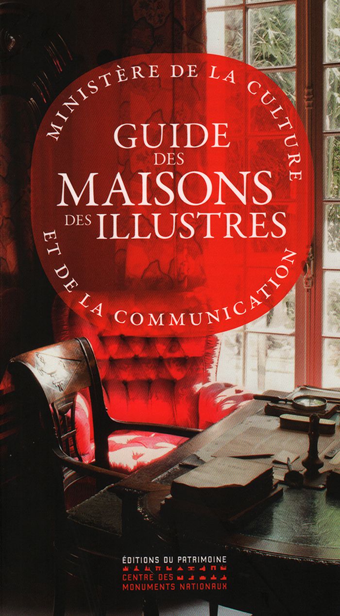
Guide des maisons des illustres
Actions:
Price:
$27.95
(available to order)
Summary:
FICHE DÉTAILLÉE Le ministère de la Culture et de la Communication a créé en 2011 un nouveau label : "Maisons des Illustres". Aujourd’hui, 212 maisons sont labellisées. Toutes conservent et transmettent la mémoire de femmes et d’hommes qui les ont habitées et se sont illustrés dans l’histoire politique, sociale et culturelle de la France. Certaines sont des maisons-musées permettant d'entrer dans l'intimité de ces personnages illustres à travers des objets et un mobilier conservés dans leur cadre d’origine. D’autres sont des maisons-archives qui présentent et valorisent divers documents et témoignages. D’autres encore, des maisons-créations où carte blanche a été donnée à un artiste pour une évocation esthétique. D’autres enfin perpétuent l’esprit de leur hôte par l’accueil en résidence d’écrivains, de peintres ou de comédiens. Du domaine au studio, du château à l’appartement, de la maison à l’atelier, ces lieux authentiques invitent le lecteur à explorer un patrimoine inédit. Ce guide est la première publication qui les rassemble. 212 idées de visites à travers la France entière et les départements d'outre-mer, de Jeanne d’Albret (Lot-et-Garonne) au Facteur Cheval (Drôme), d'Auguste Escoffier (Alpes-Maritimes) à Henri Matisse (Aisne), de François Rabelais (Indre-et-Loire) à Christian Dior (Manche), de James Norman Hall (Polynésie-Française) à Colette (Yonne)...
Form:
books
books
Publication:
May 2017
May 2017
Subject:
History until 1900, France
History until 1900, France
Form:
maps
maps
Actions:
Holdings:
Description:
1 map on 36 sheets : color ; sheets 34 x 31 cm
Description:
1 map on 36 sheets : color ; sheets 34 x 31 cm
Subject:
- Fire risk assessment Manitoba Winnipeg Maps.,
- Real property Manitoba Winnipeg Maps.,
- Assurance-incendie Manitoba Winnipeg Plans.,
- Plans cadastraux Manitoba Winnipeg.,
- Assurance-incendie Manitoba Winnipeg Cartes.,
- Fire risk assessment.,
- Real property.,
- St. James (Winnipeg, Man.) Maps.,
- Winnipeg (Man.) Maps.,
- St. James (Winnipeg, Man.) Plans.,
- Winnipeg (Man.) Plans.,
- Manitoba Winnipeg.,
- Fire insurance maps.,
- Maps.
(See more)
Publication:
[Toronto] : Underwriters' Survey Bureau, [1958-1961]
[Toronto] : Underwriters' Survey Bureau, [1958-1961]
Title:
Insurance plan of the city of St. James, Man., population 30,550 : plan dated December 1958, partially revised to April 1961.
Actions:
Holdings:
Description:
1 map on 36 sheets : color ; sheets 34 x 31 cm
Insurance plan of the city of St. James, Man., population 30,550 : plan dated December 1958, partially revised to April 1961.
Actions:
Holdings:
Description:
1 map on 36 sheets : color ; sheets 34 x 31 cm
Form:
maps
maps
Publication:
[Toronto] : Underwriters' Survey Bureau, [1958-1961]
[Toronto] : Underwriters' Survey Bureau, [1958-1961]
Subject:
- Fire risk assessment Manitoba Winnipeg Maps.,
- Real property Manitoba Winnipeg Maps.,
- Assurance-incendie Manitoba Winnipeg Plans.,
- Plans cadastraux Manitoba Winnipeg.,
- Assurance-incendie Manitoba Winnipeg Cartes.,
- Fire risk assessment.,
- Real property.,
- St. James (Winnipeg, Man.) Maps.,
- Winnipeg (Man.) Maps.,
- St. James (Winnipeg, Man.) Plans.,
- Winnipeg (Man.) Plans.,
- Manitoba Winnipeg.,
- Fire insurance maps.,
- Maps.
(See more)
Form:
books
books
Actions:
Holdings:
Description:
215 pages ; 24 cm
Description:
215 pages ; 24 cm
Subject:
- Cities and towns Congresses.,
- City planning Congresses.,
- Cities and towns History Congresses.,
- Urban geography Congresses.,
- Villes Histoire Congrès.,
- Urbanisme Cartes Histoire Congrès.,
- Géographie urbaine Congrès.,
- Villes Congrès.,
- Urban geography,
- Cities and towns,
- City planning,
- Planejamento territorial urbano (congressos),
- Villes Plans Congrès.,
- Urbanisme Dessins et plans Congrès.,
- Conference publications.,
- History,
- Conference papers and proceedings
(See more)
Publication:
Paris : Picard, ©1997.
Paris : Picard, ©1997.
Form:
books
books
Publication:
Paris : Picard, ©1997.
Paris : Picard, ©1997.
Subject:
- Cities and towns Congresses.,
- City planning Congresses.,
- Cities and towns History Congresses.,
- Urban geography Congresses.,
- Villes Histoire Congrès.,
- Urbanisme Cartes Histoire Congrès.,
- Géographie urbaine Congrès.,
- Villes Congrès.,
- Urban geography,
- Cities and towns,
- City planning,
- Planejamento territorial urbano (congressos),
- Villes Plans Congrès.,
- Urbanisme Dessins et plans Congrès.,
- Conference publications.,
- History,
- Conference papers and proceedings
(See more)
Form:
maps
maps
Actions:
Holdings:
Description:
1 map on 4 sheets : color ; sheets 34 x 31 cm
Description:
1 map on 4 sheets : color ; sheets 34 x 31 cm
Subject:
- Fire risk assessment Ontario Timmins Maps.,
- Real property Ontario Timmins Maps.,
- Assurance-incendie Ontario Timmins Plans.,
- Plans cadastraux Ontario Timmins.,
- Assurance-incendie Ontario Timmins Cartes.,
- Fire risk assessment.,
- Real property.,
- South Porcupine (Timmins, Ont.) Maps.,
- Timmins (Ont.) Maps.,
- South Porcupine (Timmins, Ont.) Plans.,
- Timmins (Ont.) Plans.,
- Ontario Timmins.,
- Ontario Timmins South Porcupine.,
- Fire insurance maps.,
- Maps.
(See more)
Publication:
Toronto : Underwriters' Survey Bureau, [1952]
Toronto : Underwriters' Survey Bureau, [1952]
Title:
Insurance plan of South Porcupine, Ont., Tisdale Township, Timiskaming County, population 4,240 : plan dated October 1952.
Actions:
Holdings:
Description:
1 map on 4 sheets : color ; sheets 34 x 31 cm
Insurance plan of South Porcupine, Ont., Tisdale Township, Timiskaming County, population 4,240 : plan dated October 1952.
Actions:
Holdings:
Description:
1 map on 4 sheets : color ; sheets 34 x 31 cm
Form:
maps
maps
Publication:
Toronto : Underwriters' Survey Bureau, [1952]
Toronto : Underwriters' Survey Bureau, [1952]
Subject:
- Fire risk assessment Ontario Timmins Maps.,
- Real property Ontario Timmins Maps.,
- Assurance-incendie Ontario Timmins Plans.,
- Plans cadastraux Ontario Timmins.,
- Assurance-incendie Ontario Timmins Cartes.,
- Fire risk assessment.,
- Real property.,
- South Porcupine (Timmins, Ont.) Maps.,
- Timmins (Ont.) Maps.,
- South Porcupine (Timmins, Ont.) Plans.,
- Timmins (Ont.) Plans.,
- Ontario Timmins.,
- Ontario Timmins South Porcupine.,
- Fire insurance maps.,
- Maps.
(See more)
Form:
maps
maps
Actions:
Holdings:
Description:
1 map on 33 sheets : color ; sheets 34 x 31 cm
Description:
1 map on 33 sheets : color ; sheets 34 x 31 cm
Subject:
- Fire risk assessment Québec (Province) Montréal Maps.,
- Real property Québec (Province) Montréal Maps.,
- Assurance-incendie Québec (Province) Montréal Plans.,
- Plans cadastraux Québec (Province) Montréal.,
- Assurance-incendie Québec (Province) Montréal Cartes.,
- Fire risk assessment.,
- Real property.,
- Montréal-Est (Québec) Maps.,
- Montréal (Québec) Maps.,
- Montréal-Est (Québec) Plans.,
- Montréal (Québec) Plans.,
- Québec Montréal.,
- Fire insurance maps.,
- Maps.
(See more)
Publication:
Toronto : Canadian Underwriters' Association, [1966]
Toronto : Canadian Underwriters' Association, [1966]
Title:
Insurance plan of the city of Montréal. Volume 19 : plan dated January 1966.
Actions:
Holdings:
Description:
1 map on 33 sheets : color ; sheets 34 x 31 cm
Insurance plan of the city of Montréal. Volume 19 : plan dated January 1966.
Actions:
Holdings:
Description:
1 map on 33 sheets : color ; sheets 34 x 31 cm
Form:
maps
maps
Publication:
Toronto : Canadian Underwriters' Association, [1966]
Toronto : Canadian Underwriters' Association, [1966]
Subject:
- Fire risk assessment Québec (Province) Montréal Maps.,
- Real property Québec (Province) Montréal Maps.,
- Assurance-incendie Québec (Province) Montréal Plans.,
- Plans cadastraux Québec (Province) Montréal.,
- Assurance-incendie Québec (Province) Montréal Cartes.,
- Fire risk assessment.,
- Real property.,
- Montréal-Est (Québec) Maps.,
- Montréal (Québec) Maps.,
- Montréal-Est (Québec) Plans.,
- Montréal (Québec) Plans.,
- Québec Montréal.,
- Fire insurance maps.,
- Maps.
(See more)
Form:
maps
maps
Actions:
Holdings:
Description:
1 atlas (221 pages) : illustrations, color maps (1 folded) ; 36 cm
Description:
1 atlas (221 pages) : illustrations, color maps (1 folded) ; 36 cm
Author:
Subject:
- Classical geography Maps.,
- Civilization,
- Classical geography,
- Greece Civilization Pictorial works.,
- Greece Civilization Maps.,
- Rome Civilization Pictorial works.,
- Rome Civilization Maps.,
- Grèce Civilisation Ouvrages illustrés.,
- Rome Civilisation Ouvrages illustrés.,
- WORLD. History Atlases 1959.,
- Greece,
- Rome (Empire),
- illustrated books.,
- Illustrated works,
- Maps,
- Pictorial works,
- Cartes géographiques.,
- Ouvrages illustrés.
(See more)
Publication:
[London] ; [New York] : Nelson, 1959., ©1959
[London] ; [New York] : Nelson, 1959., ©1959
Title:
Atlas of the classical world / edited by A.A.M. van der Heyden and H.H. Scullard.
Actions:
Holdings:
Description:
1 atlas (221 pages) : illustrations, color maps (1 folded) ; 36 cm
Atlas of the classical world / edited by A.A.M. van der Heyden and H.H. Scullard.
Actions:
Holdings:
Description:
1 atlas (221 pages) : illustrations, color maps (1 folded) ; 36 cm
Form:
maps
maps
Publication:
[London] ; [New York] : Nelson, 1959., ©1959
[London] ; [New York] : Nelson, 1959., ©1959
Subject:
- Classical geography Maps.,
- Civilization,
- Classical geography,
- Greece Civilization Pictorial works.,
- Greece Civilization Maps.,
- Rome Civilization Pictorial works.,
- Rome Civilization Maps.,
- Grèce Civilisation Ouvrages illustrés.,
- Rome Civilisation Ouvrages illustrés.,
- WORLD. History Atlases 1959.,
- Greece,
- Rome (Empire),
- illustrated books.,
- Illustrated works,
- Maps,
- Pictorial works,
- Cartes géographiques.,
- Ouvrages illustrés.
(See more)
Form:
maps
maps
Actions:
Holdings:
Description:
1 map on 41 sheets : color ; sheets 34 x 31 cm
Description:
1 map on 41 sheets : color ; sheets 34 x 31 cm
Subject:
- Fire risk assessment Québec (Province) Drummondville Maps.,
- Real property Québec (Province) Drummondville Maps.,
- Assurance-incendie Québec (Province) Drummondville Cartes.,
- Plans cadastraux Québec (Province) Drummondville.,
- Fire risk assessment,
- Real property,
- Drummondville (Québec) Maps.,
- Drummondville (Québec) Plans.,
- Québec Drummondville,
- fire insurance maps.,
- Fire insurance maps,
- Maps,
- Plans d'assurance incendie.
(See more)
Publication:
Toronto : The Bureau, [1962]
Toronto : The Bureau, [1962]
Title:
Insurance plan of the city of Drummondville & District, Que., populations, city of Drummondville 27,000, Drummondville South 7,290, St. Charles de Drummond 1,800, village of Drummondville West 1,700 : plan dated January 1962 / compiled and issued by Underwriter's Survey Bureau, Limited.
Actions:
Holdings:
Description:
1 map on 41 sheets : color ; sheets 34 x 31 cm
Form:
maps
maps
Publication:
Toronto : The Bureau, [1962]
Toronto : The Bureau, [1962]
Subject:
- Fire risk assessment Québec (Province) Drummondville Maps.,
- Real property Québec (Province) Drummondville Maps.,
- Assurance-incendie Québec (Province) Drummondville Cartes.,
- Plans cadastraux Québec (Province) Drummondville.,
- Fire risk assessment,
- Real property,
- Drummondville (Québec) Maps.,
- Drummondville (Québec) Plans.,
- Québec Drummondville,
- fire insurance maps.,
- Fire insurance maps,
- Maps,
- Plans d'assurance incendie.
(See more)
Form:
books
books
Actions:
Holdings:
Description:
273 pages : illustrations (chiefly color) ; 28 x 34 cm
Description:
273 pages : illustrations (chiefly color) ; 28 x 34 cm
Author:
Subject:
- Misrach, Richard, 1949- Exhibitions.,
- Galindo, Guillermo, 1960- Performances Exhibitions.,
- Misrach, Richard, 1949- Expositions.,
- Galindo, Guillermo, 1960- Expositions.,
- Galindo, Guillermo, 1960-,
- Misrach, Richard, 1949-,
- Galindo, Guillermo 1960-,
- Misrach, Richard 1949-,
- Umschulungswerkstätten für Siedler und Auswanderer Bitterfeld,
- Documentary photography.,
- Performance art Mexican-American Border Region.,
- Multimedia (Art) Mexican-American Border Region.,
- Musical instrument makers Mexican-American Border Region.,
- Région frontalière mexicano-américaine Ouvrages illustrés Expositions.,
- Région frontalière mexicano-américaine Dans l'art Expositions.,
- Photographie documentaire.,
- Œuvres multimédias (Art) Région frontalière mexicano-américaine.,
- Facteurs d'instruments de musique Région frontalière mexicano-américaine.,
- Manœuvre artistique Région frontalière mexicano-américaine.,
- documentary photography.,
- Emigration and immigration Political aspects,
- Emigration and immigration Social aspects,
- Multimedia (Art),
- Musical instrument makers,
- Performance art,
- Performances,
- Fotografie,
- Klangkunst,
- Grenze,
- Mexican-American Border Region Emigration and immigration Social aspects.,
- Mexican-American Border Region Emigration and immigration Political aspects.,
- Mexican-American Border Region Pictorial works Exhibitions.,
- Mexican-American Border Region In art Exhibitions.,
- Mexican-American Border Region Pictorial works.,
- Région frontalière mexicano-américaine Émigration et immigration Aspect social.,
- Région frontalière mexicano-américaine Émigration et immigration Aspect politique.,
- Région frontalière mexicano-américaine Ouvrages illustrés.,
- North America Mexican-American Border Region,
- Mexiko,
- Informal musical instruments.,
- Exhibition catalogues.,
- exhibition catalogs.,
- Exhibition catalogs,
- Exhibition, pictorial works,
- Pictorial works,
- Catalogues d'exposition.
(See more)
Publication:
New York : Aperture, [2016], Italy : Trifolio, ©2016
New York : Aperture, [2016], Italy : Trifolio, ©2016
Title:
Border cantos / Richard Misrach, Guillermo Galindo ; introduction and epilogue = introducción y epílogo, Josh Kun.
Actions:
Holdings:
Description:
273 pages : illustrations (chiefly color) ; 28 x 34 cm
Border cantos / Richard Misrach, Guillermo Galindo ; introduction and epilogue = introducción y epílogo, Josh Kun.
Actions:
Holdings:
Description:
273 pages : illustrations (chiefly color) ; 28 x 34 cm
Form:
books
books
Publication:
New York : Aperture, [2016], Italy : Trifolio, ©2016
New York : Aperture, [2016], Italy : Trifolio, ©2016
Subject:
- Misrach, Richard, 1949- Exhibitions.,
- Galindo, Guillermo, 1960- Performances Exhibitions.,
- Misrach, Richard, 1949- Expositions.,
- Galindo, Guillermo, 1960- Expositions.,
- Galindo, Guillermo, 1960-,
- Misrach, Richard, 1949-,
- Galindo, Guillermo 1960-,
- Misrach, Richard 1949-,
- Umschulungswerkstätten für Siedler und Auswanderer Bitterfeld,
- Documentary photography.,
- Performance art Mexican-American Border Region.,
- Multimedia (Art) Mexican-American Border Region.,
- Musical instrument makers Mexican-American Border Region.,
- Région frontalière mexicano-américaine Ouvrages illustrés Expositions.,
- Région frontalière mexicano-américaine Dans l'art Expositions.,
- Photographie documentaire.,
- Œuvres multimédias (Art) Région frontalière mexicano-américaine.,
- Facteurs d'instruments de musique Région frontalière mexicano-américaine.,
- Manœuvre artistique Région frontalière mexicano-américaine.,
- documentary photography.,
- Emigration and immigration Political aspects,
- Emigration and immigration Social aspects,
- Multimedia (Art),
- Musical instrument makers,
- Performance art,
- Performances,
- Fotografie,
- Klangkunst,
- Grenze,
- Mexican-American Border Region Emigration and immigration Social aspects.,
- Mexican-American Border Region Emigration and immigration Political aspects.,
- Mexican-American Border Region Pictorial works Exhibitions.,
- Mexican-American Border Region In art Exhibitions.,
- Mexican-American Border Region Pictorial works.,
- Région frontalière mexicano-américaine Émigration et immigration Aspect social.,
- Région frontalière mexicano-américaine Émigration et immigration Aspect politique.,
- Région frontalière mexicano-américaine Ouvrages illustrés.,
- North America Mexican-American Border Region,
- Mexiko,
- Informal musical instruments.,
- Exhibition catalogues.,
- exhibition catalogs.,
- Exhibition catalogs,
- Exhibition, pictorial works,
- Pictorial works,
- Catalogues d'exposition.
(See more)