


9541 Results
Form:
photographs
photographs
Actions:
Reference number:
PH1986:0347:001
Description:
- This photograph was taken from the base of the White Pagoda [Bai Ta] (now also known as the White Dagoba), Western Garden [Xi Yuan] (now Beihai Park), Peking (now Beijing), China (Harris, p. 147). Jingshan [Hill of Commanding Views] (also known as Coal Hill [Meishan] and Prospect Hill) is visible at upper left, the Ta-kao hsuan Hall (now Dagaoxuan Dian) temple complex is visible from centre left to centre right, and Shengwumen [Gate of Divine Might], the northern gate to the Forbidden City, is visible at extreme centre right.
PH1986:0347:001
Description:
- This photograph was taken from the base of the White Pagoda [Bai Ta] (now also known as the White Dagoba), Western Garden [Xi Yuan] (now Beihai Park), Peking (now Beijing), China (Harris, p. 147). Jingshan [Hill of Commanding Views] (also known as Coal Hill [Meishan] and Prospect Hill) is visible at upper left, the Ta-kao hsuan Hall (now Dagaoxuan Dian) temple complex is visible from centre left to centre right, and Shengwumen [Gate of Divine Might], the northern gate to the Forbidden City, is visible at extreme centre right.
People:
Subject:
architecture, landscape architecture
architecture, landscape architecture
Date:
after 24 October 1860 and before 16 November 1860
after 24 October 1860 and before 16 November 1860
Title:
View of Jingshan (also known as Coal Hill or Prospect Hill) and Ta-kao hsuan Hall (now Dagaoxuan Dian) temple complex showing part of the Forbidden City (also known as Zijincheng and the Imperial Palace; now the Palace Museum), Peking (now Beijing), China
Actions:
PH1986:0347:001
Description:
- This photograph was taken from the base of the White Pagoda [Bai Ta] (now also known as the White Dagoba), Western Garden [Xi Yuan] (now Beihai Park), Peking (now Beijing), China (Harris, p. 147). Jingshan [Hill of Commanding Views] (also known as Coal Hill [Meishan] and Prospect Hill) is visible at upper left, the Ta-kao hsuan Hall (now Dagaoxuan Dian) temple complex is visible from centre left to centre right, and Shengwumen [Gate of Divine Might], the northern gate to the Forbidden City, is visible at extreme centre right.
View of Jingshan (also known as Coal Hill or Prospect Hill) and Ta-kao hsuan Hall (now Dagaoxuan Dian) temple complex showing part of the Forbidden City (also known as Zijincheng and the Imperial Palace; now the Palace Museum), Peking (now Beijing), China
Actions:
PH1986:0347:001
Description:
- This photograph was taken from the base of the White Pagoda [Bai Ta] (now also known as the White Dagoba), Western Garden [Xi Yuan] (now Beihai Park), Peking (now Beijing), China (Harris, p. 147). Jingshan [Hill of Commanding Views] (also known as Coal Hill [Meishan] and Prospect Hill) is visible at upper left, the Ta-kao hsuan Hall (now Dagaoxuan Dian) temple complex is visible from centre left to centre right, and Shengwumen [Gate of Divine Might], the northern gate to the Forbidden City, is visible at extreme centre right.
Form:
photographs
photographs
Date:
after 24 October 1860 and before 16 November 1860
after 24 October 1860 and before 16 November 1860
People:
Subject:
architecture, landscape architecture
architecture, landscape architecture
Form:
photographs
photographs
Actions:
Reference number:
PH1986:0901:040:001
Description:
- This photograph was taken from the base of the White Pagoda [Bai Ta] (now also known as the White Dagoba), Western Garden [Xi Yuan] (now Beihai Park), Peking (now Beijing), China (Harris, p. 147). Jingshan [Hill of Commanding Views] (also known as Coal Hill [Meishan] and Prospect Hill) is visible at upper left, the Ta-kao hsuan Hall (now Dagaoxuan Dian) temple complex is visible from centre left to centre right, and Shengwumen [Gate of Divine Might], the northern gate to the Forbidden City, is visible at extreme centre right.
PH1986:0901:040:001
Description:
- This photograph was taken from the base of the White Pagoda [Bai Ta] (now also known as the White Dagoba), Western Garden [Xi Yuan] (now Beihai Park), Peking (now Beijing), China (Harris, p. 147). Jingshan [Hill of Commanding Views] (also known as Coal Hill [Meishan] and Prospect Hill) is visible at upper left, the Ta-kao hsuan Hall (now Dagaoxuan Dian) temple complex is visible from centre left to centre right, and Shengwumen [Gate of Divine Might], the northern gate to the Forbidden City, is visible at extreme centre right.
People:
Subject:
architecture, landscape architecture
architecture, landscape architecture
Date:
after 24 October and before 16 November 1860
after 24 October and before 16 November 1860
Title:
View of Jingshan (also known as Coal Hill or Prospect Hill) and Ta-kao hsuan Hall (now Dagaoxuan Dian) temple complex showing part of the Forbidden City (also known as Zijincheng and the Imperial Palace; now the Palace Museum), Peking (now Beijing), China
Actions:
PH1986:0901:040:001
Description:
- This photograph was taken from the base of the White Pagoda [Bai Ta] (now also known as the White Dagoba), Western Garden [Xi Yuan] (now Beihai Park), Peking (now Beijing), China (Harris, p. 147). Jingshan [Hill of Commanding Views] (also known as Coal Hill [Meishan] and Prospect Hill) is visible at upper left, the Ta-kao hsuan Hall (now Dagaoxuan Dian) temple complex is visible from centre left to centre right, and Shengwumen [Gate of Divine Might], the northern gate to the Forbidden City, is visible at extreme centre right.
View of Jingshan (also known as Coal Hill or Prospect Hill) and Ta-kao hsuan Hall (now Dagaoxuan Dian) temple complex showing part of the Forbidden City (also known as Zijincheng and the Imperial Palace; now the Palace Museum), Peking (now Beijing), China
Actions:
PH1986:0901:040:001
Description:
- This photograph was taken from the base of the White Pagoda [Bai Ta] (now also known as the White Dagoba), Western Garden [Xi Yuan] (now Beihai Park), Peking (now Beijing), China (Harris, p. 147). Jingshan [Hill of Commanding Views] (also known as Coal Hill [Meishan] and Prospect Hill) is visible at upper left, the Ta-kao hsuan Hall (now Dagaoxuan Dian) temple complex is visible from centre left to centre right, and Shengwumen [Gate of Divine Might], the northern gate to the Forbidden City, is visible at extreme centre right.
Form:
photographs
photographs
Date:
after 24 October and before 16 November 1860
after 24 October and before 16 November 1860
People:
Subject:
architecture, landscape architecture
architecture, landscape architecture
Level of archival description:
Project
Project
Actions:
Reference number:
AP056.S1.1989.PR04
Description:
This project series documents a proposal for Palmerston Place in Scarborough, Ontario from 1989-1992. The office identified the project number as 8909. This project, commissioned by Frum Development Group and headed by Bruce Kuwabara, proposed a mixed-use development that would span several blocks and integrate local transit stations. Located at the corner of Markham Road and Sheppard Avenue, the development would include residential areas, retail spaces, office buildings, a bus station and a subway station. The project investigated several schemes, all of which included the creation of a new grid road system, parks, courtyards and extensive landscaping. The development was divided into several phases to be carried out over a five to seven year period. This project was never built. The project is recorded through drawings, a site photograph and textual records dating from 1989-1991. The drawings are mostly originals and include sketches, model drawings, presentation drawings, plans, elevations and sections. A large number of the plans are schemes that investigate the general site concept. The textual records consist of a description of the project concept.
AP056.S1.1989.PR04
Description:
This project series documents a proposal for Palmerston Place in Scarborough, Ontario from 1989-1992. The office identified the project number as 8909. This project, commissioned by Frum Development Group and headed by Bruce Kuwabara, proposed a mixed-use development that would span several blocks and integrate local transit stations. Located at the corner of Markham Road and Sheppard Avenue, the development would include residential areas, retail spaces, office buildings, a bus station and a subway station. The project investigated several schemes, all of which included the creation of a new grid road system, parks, courtyards and extensive landscaping. The development was divided into several phases to be carried out over a five to seven year period. This project was never built. The project is recorded through drawings, a site photograph and textual records dating from 1989-1991. The drawings are mostly originals and include sketches, model drawings, presentation drawings, plans, elevations and sections. A large number of the plans are schemes that investigate the general site concept. The textual records consist of a description of the project concept.
People:
Date:
1989-1991
1989-1991
Title:
Palmerston Place, Scarborough, Ontario (1989-1992)
Actions:
AP056.S1.1989.PR04
Description:
This project series documents a proposal for Palmerston Place in Scarborough, Ontario from 1989-1992. The office identified the project number as 8909. This project, commissioned by Frum Development Group and headed by Bruce Kuwabara, proposed a mixed-use development that would span several blocks and integrate local transit stations. Located at the corner of Markham Road and Sheppard Avenue, the development would include residential areas, retail spaces, office buildings, a bus station and a subway station. The project investigated several schemes, all of which included the creation of a new grid road system, parks, courtyards and extensive landscaping. The development was divided into several phases to be carried out over a five to seven year period. This project was never built. The project is recorded through drawings, a site photograph and textual records dating from 1989-1991. The drawings are mostly originals and include sketches, model drawings, presentation drawings, plans, elevations and sections. A large number of the plans are schemes that investigate the general site concept. The textual records consist of a description of the project concept.
Palmerston Place, Scarborough, Ontario (1989-1992)
Actions:
AP056.S1.1989.PR04
Description:
This project series documents a proposal for Palmerston Place in Scarborough, Ontario from 1989-1992. The office identified the project number as 8909. This project, commissioned by Frum Development Group and headed by Bruce Kuwabara, proposed a mixed-use development that would span several blocks and integrate local transit stations. Located at the corner of Markham Road and Sheppard Avenue, the development would include residential areas, retail spaces, office buildings, a bus station and a subway station. The project investigated several schemes, all of which included the creation of a new grid road system, parks, courtyards and extensive landscaping. The development was divided into several phases to be carried out over a five to seven year period. This project was never built. The project is recorded through drawings, a site photograph and textual records dating from 1989-1991. The drawings are mostly originals and include sketches, model drawings, presentation drawings, plans, elevations and sections. A large number of the plans are schemes that investigate the general site concept. The textual records consist of a description of the project concept.
Level of archival description:
Project
Project
Date:
1989-1991
1989-1991
People:
Form:
drawings
drawings
Actions:
Reference number:
ARCH5576
Description:
Détails divers : détails de pierre extérieure pour le portique de la façade principale, une travée type de la façade latérale, le campanile, et l'entrée chemin Jenks Park; plans des fondations à l'avant de l'église, de l'entrée principale, de la base du campanile; plan du chœur, de la sacristie et de la chapelle des mariages montrant l'emplacement de la terre cuite; escalier à l'entrée de la chapelle-basse, vides dans l'épaisseur du mur de la nef pour recevoir les confessionnaux, salle d'entreposage sous l'escalier de la tribune de la nef (dessins 301 à 308, 309A, 309B, 310, 314, 315).
ARCH5576
Description:
Détails divers : détails de pierre extérieure pour le portique de la façade principale, une travée type de la façade latérale, le campanile, et l'entrée chemin Jenks Park; plans des fondations à l'avant de l'église, de l'entrée principale, de la base du campanile; plan du chœur, de la sacristie et de la chapelle des mariages montrant l'emplacement de la terre cuite; escalier à l'entrée de la chapelle-basse, vides dans l'épaisseur du mur de la nef pour recevoir les confessionnaux, salle d'entreposage sous l'escalier de la tribune de la nef (dessins 301 à 308, 309A, 309B, 310, 314, 315).
People:
Date:
1926
1926
Title:
Détails divers de maçonnerie et plans de fondation
Actions:
ARCH5576
Description:
Détails divers : détails de pierre extérieure pour le portique de la façade principale, une travée type de la façade latérale, le campanile, et l'entrée chemin Jenks Park; plans des fondations à l'avant de l'église, de l'entrée principale, de la base du campanile; plan du chœur, de la sacristie et de la chapelle des mariages montrant l'emplacement de la terre cuite; escalier à l'entrée de la chapelle-basse, vides dans l'épaisseur du mur de la nef pour recevoir les confessionnaux, salle d'entreposage sous l'escalier de la tribune de la nef (dessins 301 à 308, 309A, 309B, 310, 314, 315).
Détails divers de maçonnerie et plans de fondation
Actions:
ARCH5576
Description:
Détails divers : détails de pierre extérieure pour le portique de la façade principale, une travée type de la façade latérale, le campanile, et l'entrée chemin Jenks Park; plans des fondations à l'avant de l'église, de l'entrée principale, de la base du campanile; plan du chœur, de la sacristie et de la chapelle des mariages montrant l'emplacement de la terre cuite; escalier à l'entrée de la chapelle-basse, vides dans l'épaisseur du mur de la nef pour recevoir les confessionnaux, salle d'entreposage sous l'escalier de la tribune de la nef (dessins 301 à 308, 309A, 309B, 310, 314, 315).
Form:
drawings
drawings
Date:
1926
1926
People:
Level of archival description:
Project
Project
Title:
Steel House
Steel House
Reference number:
AP144.S2.D60
Description:
File documents an unsuccessful competition entry, in collaboration with Miles Park, Douglas Smith and Frank Newby, for a mass-produced housing system using steel, for a competition sponsored by the European Coal and Steel Community. Requirements called for rapid assembly/disassembly, and flexible unit plans that could be altered by home owners and appeal to a wide range of owners and their preferences. Schematic sketches include exterior elevations, floor plans, preliminary details, and charts for building components. Conceptual sketches show alternate unit and floor plan arrangements, and include network analysis plans, site maximization plans based on transportability, family breakdown diagrams, alternate internal unit layout plans based on age and other factors, functional area plans indicating separation possibilities, and charts which cross-reference factors such as transportability, construction, and assembly requirements. Design development drawings show typical plans, site plans, sections, elevations, details, axonometric drawings of structure and cladding, internal units, and components. Some material in this file was published in Price, Cedric, "Steel Housing", 'Architectural Design', vol. 37, (May 1967) 244, and Price, Cedric, 'Cedric Price-Works II' (London: Architectural Press, 1984) 36, 49-50, 113. Material in this file was produced between 1965 and 1969. 'High Authority of the European Coal and Steel Community' is the full name of the client as found in the textual records. The title of the competition is 'International Competition for the Design of Industrially Fabricated Dwellings'. File contains conceptual drawings, design development drawings, photographic material, presentation panels, textual records, and model.
AP144.S2.D60
Description:
File documents an unsuccessful competition entry, in collaboration with Miles Park, Douglas Smith and Frank Newby, for a mass-produced housing system using steel, for a competition sponsored by the European Coal and Steel Community. Requirements called for rapid assembly/disassembly, and flexible unit plans that could be altered by home owners and appeal to a wide range of owners and their preferences. Schematic sketches include exterior elevations, floor plans, preliminary details, and charts for building components. Conceptual sketches show alternate unit and floor plan arrangements, and include network analysis plans, site maximization plans based on transportability, family breakdown diagrams, alternate internal unit layout plans based on age and other factors, functional area plans indicating separation possibilities, and charts which cross-reference factors such as transportability, construction, and assembly requirements. Design development drawings show typical plans, site plans, sections, elevations, details, axonometric drawings of structure and cladding, internal units, and components. Some material in this file was published in Price, Cedric, "Steel Housing", 'Architectural Design', vol. 37, (May 1967) 244, and Price, Cedric, 'Cedric Price-Works II' (London: Architectural Press, 1984) 36, 49-50, 113. Material in this file was produced between 1965 and 1969. 'High Authority of the European Coal and Steel Community' is the full name of the client as found in the textual records. The title of the competition is 'International Competition for the Design of Industrially Fabricated Dwellings'. File contains conceptual drawings, design development drawings, photographic material, presentation panels, textual records, and model.
People:
Date:
1965-1969
1965-1969
Title:
Steel House
Actions:
AP144.S2.D60
Description:
File documents an unsuccessful competition entry, in collaboration with Miles Park, Douglas Smith and Frank Newby, for a mass-produced housing system using steel, for a competition sponsored by the European Coal and Steel Community. Requirements called for rapid assembly/disassembly, and flexible unit plans that could be altered by home owners and appeal to a wide range of owners and their preferences. Schematic sketches include exterior elevations, floor plans, preliminary details, and charts for building components. Conceptual sketches show alternate unit and floor plan arrangements, and include network analysis plans, site maximization plans based on transportability, family breakdown diagrams, alternate internal unit layout plans based on age and other factors, functional area plans indicating separation possibilities, and charts which cross-reference factors such as transportability, construction, and assembly requirements. Design development drawings show typical plans, site plans, sections, elevations, details, axonometric drawings of structure and cladding, internal units, and components. Some material in this file was published in Price, Cedric, "Steel Housing", 'Architectural Design', vol. 37, (May 1967) 244, and Price, Cedric, 'Cedric Price-Works II' (London: Architectural Press, 1984) 36, 49-50, 113. Material in this file was produced between 1965 and 1969. 'High Authority of the European Coal and Steel Community' is the full name of the client as found in the textual records. The title of the competition is 'International Competition for the Design of Industrially Fabricated Dwellings'. File contains conceptual drawings, design development drawings, photographic material, presentation panels, textual records, and model.
Steel House
Actions:
AP144.S2.D60
Description:
File documents an unsuccessful competition entry, in collaboration with Miles Park, Douglas Smith and Frank Newby, for a mass-produced housing system using steel, for a competition sponsored by the European Coal and Steel Community. Requirements called for rapid assembly/disassembly, and flexible unit plans that could be altered by home owners and appeal to a wide range of owners and their preferences. Schematic sketches include exterior elevations, floor plans, preliminary details, and charts for building components. Conceptual sketches show alternate unit and floor plan arrangements, and include network analysis plans, site maximization plans based on transportability, family breakdown diagrams, alternate internal unit layout plans based on age and other factors, functional area plans indicating separation possibilities, and charts which cross-reference factors such as transportability, construction, and assembly requirements. Design development drawings show typical plans, site plans, sections, elevations, details, axonometric drawings of structure and cladding, internal units, and components. Some material in this file was published in Price, Cedric, "Steel Housing", 'Architectural Design', vol. 37, (May 1967) 244, and Price, Cedric, 'Cedric Price-Works II' (London: Architectural Press, 1984) 36, 49-50, 113. Material in this file was produced between 1965 and 1969. 'High Authority of the European Coal and Steel Community' is the full name of the client as found in the textual records. The title of the competition is 'International Competition for the Design of Industrially Fabricated Dwellings'. File contains conceptual drawings, design development drawings, photographic material, presentation panels, textual records, and model.
Level of archival description:
File 60
File 60
Date:
1965-1969
1965-1969
People:
Form:
photographs
Quantity:
22 photograph(s)
photographs
Quantity:
22 photograph(s)
Reference number:
ARCH265118
Description:
The group consist chiefly of views of monuments and statues in Québec, including the statue of de Maisonneuve at the Place d'Armes in Montréal and the Madeleine de Verchères monument in Verchères. There are also several views of monuments in Ottawa and one view of Grand Pré Park in Nova Scotia. Several of the subjects are the work of artist Louis-Philippe Hébert. There is one photograph of the tablet erected at Sainte-Sophie d'Halifax by the Department of Mines and Resources to commemorate the birthplace of Louis-Philippe Hébert (accompanied by a letter from the Lands, Parks and Forests Branch of the Department of Mines and Resources). There is one photograph of the painting by Robert Harris of O.R. Jacobi, accompanied by a letter on letterhead of the National Gallery of Canada. The group includes a memo from the Can.Govt. Motion Picture Bureau dated Feb. 22, 1938. There are stamps and/or inscriptions on several of the photographs.
ARCH265118
Description:
The group consist chiefly of views of monuments and statues in Québec, including the statue of de Maisonneuve at the Place d'Armes in Montréal and the Madeleine de Verchères monument in Verchères. There are also several views of monuments in Ottawa and one view of Grand Pré Park in Nova Scotia. Several of the subjects are the work of artist Louis-Philippe Hébert. There is one photograph of the tablet erected at Sainte-Sophie d'Halifax by the Department of Mines and Resources to commemorate the birthplace of Louis-Philippe Hébert (accompanied by a letter from the Lands, Parks and Forests Branch of the Department of Mines and Resources). There is one photograph of the painting by Robert Harris of O.R. Jacobi, accompanied by a letter on letterhead of the National Gallery of Canada. The group includes a memo from the Can.Govt. Motion Picture Bureau dated Feb. 22, 1938. There are stamps and/or inscriptions on several of the photographs.
People:
Date:
circa 1927-1946
circa 1927-1946
Title:
Views of monuments and statues in Québec
Actions:
ARCH265118
Description:
The group consist chiefly of views of monuments and statues in Québec, including the statue of de Maisonneuve at the Place d'Armes in Montréal and the Madeleine de Verchères monument in Verchères. There are also several views of monuments in Ottawa and one view of Grand Pré Park in Nova Scotia. Several of the subjects are the work of artist Louis-Philippe Hébert. There is one photograph of the tablet erected at Sainte-Sophie d'Halifax by the Department of Mines and Resources to commemorate the birthplace of Louis-Philippe Hébert (accompanied by a letter from the Lands, Parks and Forests Branch of the Department of Mines and Resources). There is one photograph of the painting by Robert Harris of O.R. Jacobi, accompanied by a letter on letterhead of the National Gallery of Canada. The group includes a memo from the Can.Govt. Motion Picture Bureau dated Feb. 22, 1938. There are stamps and/or inscriptions on several of the photographs.
Views of monuments and statues in Québec
Actions:
ARCH265118
Description:
The group consist chiefly of views of monuments and statues in Québec, including the statue of de Maisonneuve at the Place d'Armes in Montréal and the Madeleine de Verchères monument in Verchères. There are also several views of monuments in Ottawa and one view of Grand Pré Park in Nova Scotia. Several of the subjects are the work of artist Louis-Philippe Hébert. There is one photograph of the tablet erected at Sainte-Sophie d'Halifax by the Department of Mines and Resources to commemorate the birthplace of Louis-Philippe Hébert (accompanied by a letter from the Lands, Parks and Forests Branch of the Department of Mines and Resources). There is one photograph of the painting by Robert Harris of O.R. Jacobi, accompanied by a letter on letterhead of the National Gallery of Canada. The group includes a memo from the Can.Govt. Motion Picture Bureau dated Feb. 22, 1938. There are stamps and/or inscriptions on several of the photographs.
Form:
photographs
Quantity:
22 photograph(s)
photographs
Quantity:
22 photograph(s)
Date:
circa 1927-1946
circa 1927-1946
People:
Form:
events
events
Actions:
Date:
31 May 2002
31 May 2002
Form:
events
events
Date:
31 May 2002
31 May 2002
Level of archival description:
Project
Project
Reference number:
AP075.S1.2008.PR02
Description:
Project series documents Cornelia Hahn Oberlander's project for the Inuvik School, later known as East Three School, in Inuvik, Northwest Territories. The project consisted in the landscape design and a playground design for the new school replacing the Sir Alexander MacKenzie elementary school and the Samuel Herne Secondary School. Oberlander worked on this project from 2008 to 2012 with architects Pin/Taylor. During her design process, Oberlander consulted the teachers, parents, staff and students on ways to express their culture in the landscape design. She also had to adapt her design to the extreme climate of the region. Oberlander located the play court at the angle of the two buildings of the elementary school and the secondary school, to shelter it from the wind, and allowing small children to play outside. The plant selection was made by "harvesting local site and surrounding area for plant material" [1] and was also inspired by traditional cuisine. The project was completed in 2012. The project series also includes some documents related to a project possibly unrealized of the Jim Koe Park also in Inuvik, near the school. The project series contains design development drawings and working drawings, such as planting plans, irrigation plans, grading plans, landscape sections, and site plans. The drawings also includes sets of building plans used as reference. The project is also documented through correspondence, including with architects, suppliers, and consultants, specifications, scope of work, schematic design and design reports from architectural firm, minutes of meetings, and research material. Source: [1] Herrington, Susan. Cornelia Hahn Oberlander: Making the Modern Landscape, University of Virginia Press, 2014, 304 pages, p. 197.
AP075.S1.2008.PR02
Description:
Project series documents Cornelia Hahn Oberlander's project for the Inuvik School, later known as East Three School, in Inuvik, Northwest Territories. The project consisted in the landscape design and a playground design for the new school replacing the Sir Alexander MacKenzie elementary school and the Samuel Herne Secondary School. Oberlander worked on this project from 2008 to 2012 with architects Pin/Taylor. During her design process, Oberlander consulted the teachers, parents, staff and students on ways to express their culture in the landscape design. She also had to adapt her design to the extreme climate of the region. Oberlander located the play court at the angle of the two buildings of the elementary school and the secondary school, to shelter it from the wind, and allowing small children to play outside. The plant selection was made by "harvesting local site and surrounding area for plant material" [1] and was also inspired by traditional cuisine. The project was completed in 2012. The project series also includes some documents related to a project possibly unrealized of the Jim Koe Park also in Inuvik, near the school. The project series contains design development drawings and working drawings, such as planting plans, irrigation plans, grading plans, landscape sections, and site plans. The drawings also includes sets of building plans used as reference. The project is also documented through correspondence, including with architects, suppliers, and consultants, specifications, scope of work, schematic design and design reports from architectural firm, minutes of meetings, and research material. Source: [1] Herrington, Susan. Cornelia Hahn Oberlander: Making the Modern Landscape, University of Virginia Press, 2014, 304 pages, p. 197.
People:
Date:
1999-2014
1999-2014
Title:
Inuvik School, Inuvik, Northwest Territories (2008)
Actions:
AP075.S1.2008.PR02
Description:
Project series documents Cornelia Hahn Oberlander's project for the Inuvik School, later known as East Three School, in Inuvik, Northwest Territories. The project consisted in the landscape design and a playground design for the new school replacing the Sir Alexander MacKenzie elementary school and the Samuel Herne Secondary School. Oberlander worked on this project from 2008 to 2012 with architects Pin/Taylor. During her design process, Oberlander consulted the teachers, parents, staff and students on ways to express their culture in the landscape design. She also had to adapt her design to the extreme climate of the region. Oberlander located the play court at the angle of the two buildings of the elementary school and the secondary school, to shelter it from the wind, and allowing small children to play outside. The plant selection was made by "harvesting local site and surrounding area for plant material" [1] and was also inspired by traditional cuisine. The project was completed in 2012. The project series also includes some documents related to a project possibly unrealized of the Jim Koe Park also in Inuvik, near the school. The project series contains design development drawings and working drawings, such as planting plans, irrigation plans, grading plans, landscape sections, and site plans. The drawings also includes sets of building plans used as reference. The project is also documented through correspondence, including with architects, suppliers, and consultants, specifications, scope of work, schematic design and design reports from architectural firm, minutes of meetings, and research material. Source: [1] Herrington, Susan. Cornelia Hahn Oberlander: Making the Modern Landscape, University of Virginia Press, 2014, 304 pages, p. 197.
Inuvik School, Inuvik, Northwest Territories (2008)
Actions:
AP075.S1.2008.PR02
Description:
Project series documents Cornelia Hahn Oberlander's project for the Inuvik School, later known as East Three School, in Inuvik, Northwest Territories. The project consisted in the landscape design and a playground design for the new school replacing the Sir Alexander MacKenzie elementary school and the Samuel Herne Secondary School. Oberlander worked on this project from 2008 to 2012 with architects Pin/Taylor. During her design process, Oberlander consulted the teachers, parents, staff and students on ways to express their culture in the landscape design. She also had to adapt her design to the extreme climate of the region. Oberlander located the play court at the angle of the two buildings of the elementary school and the secondary school, to shelter it from the wind, and allowing small children to play outside. The plant selection was made by "harvesting local site and surrounding area for plant material" [1] and was also inspired by traditional cuisine. The project was completed in 2012. The project series also includes some documents related to a project possibly unrealized of the Jim Koe Park also in Inuvik, near the school. The project series contains design development drawings and working drawings, such as planting plans, irrigation plans, grading plans, landscape sections, and site plans. The drawings also includes sets of building plans used as reference. The project is also documented through correspondence, including with architects, suppliers, and consultants, specifications, scope of work, schematic design and design reports from architectural firm, minutes of meetings, and research material. Source: [1] Herrington, Susan. Cornelia Hahn Oberlander: Making the Modern Landscape, University of Virginia Press, 2014, 304 pages, p. 197.
Level of archival description:
Project
Project
Date:
1999-2014
1999-2014
People:
Level of archival description:
Project
Project
Title:
Open Arena – Töölö Football Stadium, international competition entry, Helsinki, Finland (1997)
Open Arena – Töölö Football Stadium, international competition entry, Helsinki, Finland (1997)
Actions:
Reference number:
AP194.S1.1997.PR01
Description:
Project records document OCEAN North’s design for their competition entry for the Töölö Football Stadium in Helsinki in 1997. The project was titled Open Arena by OCEAN North. The site for the football stadium was in the Töölö neighbourhood and adjoining the Helsinki Olympic Stadium, located in a park area. OCEAN North’s entry was a building that would integrate with its natural surroundings while being able to accommodate a variety of activities and events. The structure has three topological surfaces that were devised through an iterative process: initial drawings made in Adobe Illustrator, modelling made with form*Z and manually transferred on Plexiglas sections, modifications made on the Plexiglas sections captured back into the CAD drawing, etc. At some point in the design process, the Channelling Systems approach was developed and used to analyze the structure’s dynamic relationship with its surroundings. Records show different stages of the design process and include at least one photograph of the Plexiglas sections referenced above. Digital files are grouped according to their function: Channelling Systems analysis, 2D graft spatial exploration, and plans and sections. There are also libraries of images and textures which may have been used for other drawings and models. Over half of the files are raster or vector images likely created by CAD software. This includes images of renderings. CAD drawings are in the native Microstation format, although one is in form*Z format. Textual records present the project and for the most part are the accompanying documentation for the competition entry, including legends for plans and sections. Timestamps for some of the digital files extend past the date of the competition. It is likely that these dates reflect when files were transferred to the Jaz drive for storage.
AP194.S1.1997.PR01
Description:
Project records document OCEAN North’s design for their competition entry for the Töölö Football Stadium in Helsinki in 1997. The project was titled Open Arena by OCEAN North. The site for the football stadium was in the Töölö neighbourhood and adjoining the Helsinki Olympic Stadium, located in a park area. OCEAN North’s entry was a building that would integrate with its natural surroundings while being able to accommodate a variety of activities and events. The structure has three topological surfaces that were devised through an iterative process: initial drawings made in Adobe Illustrator, modelling made with form*Z and manually transferred on Plexiglas sections, modifications made on the Plexiglas sections captured back into the CAD drawing, etc. At some point in the design process, the Channelling Systems approach was developed and used to analyze the structure’s dynamic relationship with its surroundings. Records show different stages of the design process and include at least one photograph of the Plexiglas sections referenced above. Digital files are grouped according to their function: Channelling Systems analysis, 2D graft spatial exploration, and plans and sections. There are also libraries of images and textures which may have been used for other drawings and models. Over half of the files are raster or vector images likely created by CAD software. This includes images of renderings. CAD drawings are in the native Microstation format, although one is in form*Z format. Textual records present the project and for the most part are the accompanying documentation for the competition entry, including legends for plans and sections. Timestamps for some of the digital files extend past the date of the competition. It is likely that these dates reflect when files were transferred to the Jaz drive for storage.
People:
Date:
1997-2000
1997-2000
Title:
Open Arena – Töölö Football Stadium, international competition entry, Helsinki, Finland (1997)
Actions:
AP194.S1.1997.PR01
Description:
Project records document OCEAN North’s design for their competition entry for the Töölö Football Stadium in Helsinki in 1997. The project was titled Open Arena by OCEAN North. The site for the football stadium was in the Töölö neighbourhood and adjoining the Helsinki Olympic Stadium, located in a park area. OCEAN North’s entry was a building that would integrate with its natural surroundings while being able to accommodate a variety of activities and events. The structure has three topological surfaces that were devised through an iterative process: initial drawings made in Adobe Illustrator, modelling made with form*Z and manually transferred on Plexiglas sections, modifications made on the Plexiglas sections captured back into the CAD drawing, etc. At some point in the design process, the Channelling Systems approach was developed and used to analyze the structure’s dynamic relationship with its surroundings. Records show different stages of the design process and include at least one photograph of the Plexiglas sections referenced above. Digital files are grouped according to their function: Channelling Systems analysis, 2D graft spatial exploration, and plans and sections. There are also libraries of images and textures which may have been used for other drawings and models. Over half of the files are raster or vector images likely created by CAD software. This includes images of renderings. CAD drawings are in the native Microstation format, although one is in form*Z format. Textual records present the project and for the most part are the accompanying documentation for the competition entry, including legends for plans and sections. Timestamps for some of the digital files extend past the date of the competition. It is likely that these dates reflect when files were transferred to the Jaz drive for storage.
Open Arena – Töölö Football Stadium, international competition entry, Helsinki, Finland (1997)
Actions:
AP194.S1.1997.PR01
Description:
Project records document OCEAN North’s design for their competition entry for the Töölö Football Stadium in Helsinki in 1997. The project was titled Open Arena by OCEAN North. The site for the football stadium was in the Töölö neighbourhood and adjoining the Helsinki Olympic Stadium, located in a park area. OCEAN North’s entry was a building that would integrate with its natural surroundings while being able to accommodate a variety of activities and events. The structure has three topological surfaces that were devised through an iterative process: initial drawings made in Adobe Illustrator, modelling made with form*Z and manually transferred on Plexiglas sections, modifications made on the Plexiglas sections captured back into the CAD drawing, etc. At some point in the design process, the Channelling Systems approach was developed and used to analyze the structure’s dynamic relationship with its surroundings. Records show different stages of the design process and include at least one photograph of the Plexiglas sections referenced above. Digital files are grouped according to their function: Channelling Systems analysis, 2D graft spatial exploration, and plans and sections. There are also libraries of images and textures which may have been used for other drawings and models. Over half of the files are raster or vector images likely created by CAD software. This includes images of renderings. CAD drawings are in the native Microstation format, although one is in form*Z format. Textual records present the project and for the most part are the accompanying documentation for the competition entry, including legends for plans and sections. Timestamps for some of the digital files extend past the date of the competition. It is likely that these dates reflect when files were transferred to the Jaz drive for storage.
Level of archival description:
Project
Project
Date:
1997-2000
1997-2000
People:
Form:
exhibitions
exhibitions
Actions:
Description:
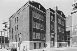
Trois Architectes, Trois Quartiers focuses on three Montréal-based architects whose work had a strong presence in a specific area of the city during the first half of the twentieth century: Ludger Lemieux (1872–1953) in St-Henri, Ernest lsbell Barott (1884–1966) in St-Antoine on the southern and western slopes of Mount Royal, and Ernest Cormier (1885–1980) at the(...)
Trois Architectes, Trois Quartiers focuses on three Montréal-based architects whose work had a strong presence in a specific area of the city during the first half of the twentieth century: Ludger Lemieux (1872–1953) in St-Henri, Ernest lsbell Barott (1884–1966) in St-Antoine on the southern and western slopes of Mount Royal, and Ernest Cormier (1885–1980) at the(...)
Location:
1440 rue Sainte-Catherine Ouest
1440 rue Sainte-Catherine Ouest
Date:
20 May 1983 to 19 August 1983
20 May 1983 to 19 August 1983
Title:
Trois architectes, trois quartiers : Ludger Lemieux (St. Henri), Ernest Cormier (Cité universitaire), Ernest Isbell Barott (St. Antoine)
Actions:
Description:
Trois Architectes, Trois Quartiers focuses on three Montréal-based architects whose work had a strong presence in a specific area of the city during the first half of the twentieth century: Ludger Lemieux (1872–1953) in St-Henri, Ernest lsbell Barott (1884–1966) in St-Antoine on the southern and western slopes of Mount Royal, and Ernest Cormier (1885–1980) at the(...)
Trois architectes, trois quartiers : Ludger Lemieux (St. Henri), Ernest Cormier (Cité universitaire), Ernest Isbell Barott (St. Antoine)
Actions:
Description:
Trois Architectes, Trois Quartiers focuses on three Montréal-based architects whose work had a strong presence in a specific area of the city during the first half of the twentieth century: Ludger Lemieux (1872–1953) in St-Henri, Ernest lsbell Barott (1884–1966) in St-Antoine on the southern and western slopes of Mount Royal, and Ernest Cormier (1885–1980) at the(...)
Form:
exhibitions
exhibitions
Date:
20 May 1983 to
19 August 1983
20 May 1983 to
19 August 1983
Location:
1440 rue Sainte-Catherine Ouest
1440 rue Sainte-Catherine Ouest


