


9835 Results
Form:
drawings, textual records
drawings, textual records
Actions:
Reference number:
DR1974:0002:025:001-059
Description:
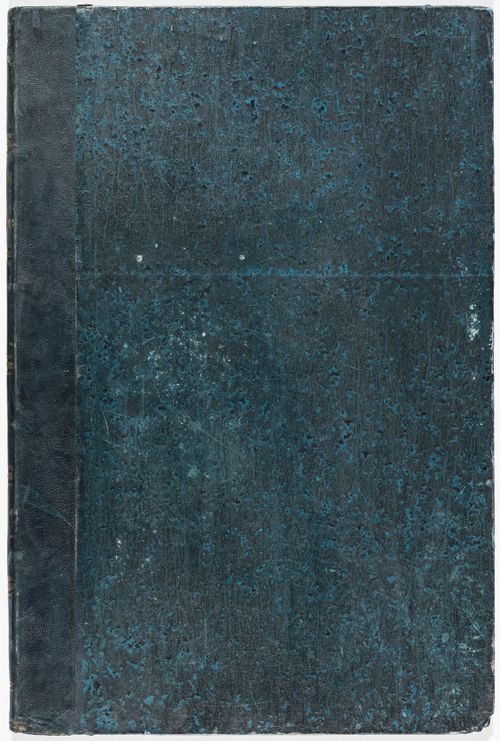
- This album contains drawings of the Domaine de La Vallée and for extensive renovations proposed by Hubert Rohault de Fleury to the house and its outbuildings, including the demolition of some portions the existing structures. The drawings vary from rough sketches to line drawings, some coloured with wash. Nine site plans for the estate depict the proposed placement of buildings, the layout of roads, and the landscaping. The original house and outbuildings are documented in five rough sketches with dimensioning, possibly measured drawings executed on site, (DR1974:0002:025:039 - DR1974:0002:025:043) and several more finished plans and elevations (DR1974:0002:025:021 R/V, DR1974:0002:025:025, and DR1974:0002:025:031). These five rough sketches include a number of thumbnail sketches, possibly preliminary ideas for the renovation. The renovation proposals for the house and outbuildings include plans, exterior and interior elevations, an axonometric sketch as well as more complete designs for a portico and a porch. Also included are Rohault de Fleury's designs for new outbuildings and other structures: a bridge, possibly with several alternate designs, a levee planted with trees, a granary, a stable, a combined stable and cowshed, a sheepfold, two schemes for a garden temple and two gates. Many of the inscriptions and written documents are illegible, but they apparently relate to construction methods, building materials, proposed alterations to existing structures, and cost calculations. There are several drawings for unidentified buildings in the album having no apparent link to the Domaine de La Vallée structures.
DR1974:0002:025:001-059
Description:
- This album contains drawings of the Domaine de La Vallée and for extensive renovations proposed by Hubert Rohault de Fleury to the house and its outbuildings, including the demolition of some portions the existing structures. The drawings vary from rough sketches to line drawings, some coloured with wash. Nine site plans for the estate depict the proposed placement of buildings, the layout of roads, and the landscaping. The original house and outbuildings are documented in five rough sketches with dimensioning, possibly measured drawings executed on site, (DR1974:0002:025:039 - DR1974:0002:025:043) and several more finished plans and elevations (DR1974:0002:025:021 R/V, DR1974:0002:025:025, and DR1974:0002:025:031). These five rough sketches include a number of thumbnail sketches, possibly preliminary ideas for the renovation. The renovation proposals for the house and outbuildings include plans, exterior and interior elevations, an axonometric sketch as well as more complete designs for a portico and a porch. Also included are Rohault de Fleury's designs for new outbuildings and other structures: a bridge, possibly with several alternate designs, a levee planted with trees, a granary, a stable, a combined stable and cowshed, a sheepfold, two schemes for a garden temple and two gates. Many of the inscriptions and written documents are illegible, but they apparently relate to construction methods, building materials, proposed alterations to existing structures, and cost calculations. There are several drawings for unidentified buildings in the album having no apparent link to the Domaine de La Vallée structures.
People:
Subject:
architecture, landscape architecture, interior design, engineering
architecture, landscape architecture, interior design, engineering
Date:
ca. 1815
ca. 1815
Title:
Album of drawings for proposed renovations to the house and outbuildings, Domaine de La Vallée, Loir-et-Cher, France
Actions:
DR1974:0002:025:001-059
Description:
- This album contains drawings of the Domaine de La Vallée and for extensive renovations proposed by Hubert Rohault de Fleury to the house and its outbuildings, including the demolition of some portions the existing structures. The drawings vary from rough sketches to line drawings, some coloured with wash. Nine site plans for the estate depict the proposed placement of buildings, the layout of roads, and the landscaping. The original house and outbuildings are documented in five rough sketches with dimensioning, possibly measured drawings executed on site, (DR1974:0002:025:039 - DR1974:0002:025:043) and several more finished plans and elevations (DR1974:0002:025:021 R/V, DR1974:0002:025:025, and DR1974:0002:025:031). These five rough sketches include a number of thumbnail sketches, possibly preliminary ideas for the renovation. The renovation proposals for the house and outbuildings include plans, exterior and interior elevations, an axonometric sketch as well as more complete designs for a portico and a porch. Also included are Rohault de Fleury's designs for new outbuildings and other structures: a bridge, possibly with several alternate designs, a levee planted with trees, a granary, a stable, a combined stable and cowshed, a sheepfold, two schemes for a garden temple and two gates. Many of the inscriptions and written documents are illegible, but they apparently relate to construction methods, building materials, proposed alterations to existing structures, and cost calculations. There are several drawings for unidentified buildings in the album having no apparent link to the Domaine de La Vallée structures.
Album of drawings for proposed renovations to the house and outbuildings, Domaine de La Vallée, Loir-et-Cher, France
Actions:
DR1974:0002:025:001-059
Description:
- This album contains drawings of the Domaine de La Vallée and for extensive renovations proposed by Hubert Rohault de Fleury to the house and its outbuildings, including the demolition of some portions the existing structures. The drawings vary from rough sketches to line drawings, some coloured with wash. Nine site plans for the estate depict the proposed placement of buildings, the layout of roads, and the landscaping. The original house and outbuildings are documented in five rough sketches with dimensioning, possibly measured drawings executed on site, (DR1974:0002:025:039 - DR1974:0002:025:043) and several more finished plans and elevations (DR1974:0002:025:021 R/V, DR1974:0002:025:025, and DR1974:0002:025:031). These five rough sketches include a number of thumbnail sketches, possibly preliminary ideas for the renovation. The renovation proposals for the house and outbuildings include plans, exterior and interior elevations, an axonometric sketch as well as more complete designs for a portico and a porch. Also included are Rohault de Fleury's designs for new outbuildings and other structures: a bridge, possibly with several alternate designs, a levee planted with trees, a granary, a stable, a combined stable and cowshed, a sheepfold, two schemes for a garden temple and two gates. Many of the inscriptions and written documents are illegible, but they apparently relate to construction methods, building materials, proposed alterations to existing structures, and cost calculations. There are several drawings for unidentified buildings in the album having no apparent link to the Domaine de La Vallée structures.
Form:
drawings, textual records
drawings, textual records
Date:
ca. 1815
ca. 1815
People:
Subject:
architecture, landscape architecture, interior design, engineering
architecture, landscape architecture, interior design, engineering
Form:
photographs
photographs
![View of the south lawn (also known as the court football [kemari] field), stepping-stones, moss and trees near the Old Shoin, Katsura Rikyu (also known as Katsura Imperial Villa), Kyoto, Japan](/img-collection/0NGLeEEQVro2qJEsn4PwXpFrVQM=/500x619/362705.jpg)
Actions:
Reference number:
PH1986:0173
Description:
- Photographs PH1986:0148 - PH1986:0283 form a sequence of views. Accession numbers follow an order established by the photographer that is based on the temporal experience of walking through the grounds of Katsura Rikyu (also known as Katsura Imperial Villa) (see acquisition file). - Yasuhiro Ishimoto returned to Katsura Rikyu (also known as Katsura Imperial Villa) in 1982 and took another series of photographs, this time with many in colour, often using the same or very similar views to those of his 1953 photographs at the same location (Ishimoto, p. 266). - This photograph was taken from the moss garden beside the broad veranda of the Old Shoin (Isozaki, et al, pp. 78, 244; Ito, p. 42, site plan; Tange, n.p., plan).
PH1986:0173
Description:
- Photographs PH1986:0148 - PH1986:0283 form a sequence of views. Accession numbers follow an order established by the photographer that is based on the temporal experience of walking through the grounds of Katsura Rikyu (also known as Katsura Imperial Villa) (see acquisition file). - Yasuhiro Ishimoto returned to Katsura Rikyu (also known as Katsura Imperial Villa) in 1982 and took another series of photographs, this time with many in colour, often using the same or very similar views to those of his 1953 photographs at the same location (Ishimoto, p. 266). - This photograph was taken from the moss garden beside the broad veranda of the Old Shoin (Isozaki, et al, pp. 78, 244; Ito, p. 42, site plan; Tange, n.p., plan).
People:
Subject:
landscape architecture
landscape architecture
Date:
1953
1953
Title:
View of the south lawn (also known as the court football [kemari] field), stepping-stones, moss and trees near the Old Shoin, Katsura Rikyu (also known as Katsura Imperial Villa), Kyoto, Japan
Actions:
PH1986:0173
Description:
- Photographs PH1986:0148 - PH1986:0283 form a sequence of views. Accession numbers follow an order established by the photographer that is based on the temporal experience of walking through the grounds of Katsura Rikyu (also known as Katsura Imperial Villa) (see acquisition file). - Yasuhiro Ishimoto returned to Katsura Rikyu (also known as Katsura Imperial Villa) in 1982 and took another series of photographs, this time with many in colour, often using the same or very similar views to those of his 1953 photographs at the same location (Ishimoto, p. 266). - This photograph was taken from the moss garden beside the broad veranda of the Old Shoin (Isozaki, et al, pp. 78, 244; Ito, p. 42, site plan; Tange, n.p., plan).
View of the south lawn (also known as the court football [kemari] field), stepping-stones, moss and trees near the Old Shoin, Katsura Rikyu (also known as Katsura Imperial Villa), Kyoto, Japan
Actions:
PH1986:0173
Description:
- Photographs PH1986:0148 - PH1986:0283 form a sequence of views. Accession numbers follow an order established by the photographer that is based on the temporal experience of walking through the grounds of Katsura Rikyu (also known as Katsura Imperial Villa) (see acquisition file). - Yasuhiro Ishimoto returned to Katsura Rikyu (also known as Katsura Imperial Villa) in 1982 and took another series of photographs, this time with many in colour, often using the same or very similar views to those of his 1953 photographs at the same location (Ishimoto, p. 266). - This photograph was taken from the moss garden beside the broad veranda of the Old Shoin (Isozaki, et al, pp. 78, 244; Ito, p. 42, site plan; Tange, n.p., plan).
Form:
photographs
photographs
Date:
1953
1953
People:
Subject:
landscape architecture
landscape architecture
Form:
photographs
photographs
Actions:
Reference number:
PH1986:0195
Description:
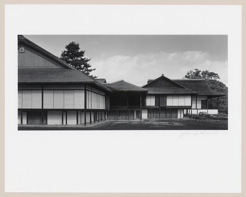
- Photographs PH1986:0148 - PH1986:0283 form a sequence of views. Accession numbers follow an order established by the photographer that is based on the temporal experience of walking through the grounds of Katsura Rikyu (also known as Katsura Imperial Villa) (see acquisition file). - After first photographing Katsura Rikyu (also known as Katsura Imperial Villa) in 1953, Yasuhiro Ishimoto returned there in 1982 and took another series of photographs, this time with many in colour, often using the same or very similar views to those of his 1953 photographs (Ishimoto, pp. 265-266). - The south lawn (also known as the court football [kemari] field) is visible in the foreground (Isozaki, et al, pp. 68-69, repr.; p. 244; Ito, site plan).
PH1986:0195
Description:
- Photographs PH1986:0148 - PH1986:0283 form a sequence of views. Accession numbers follow an order established by the photographer that is based on the temporal experience of walking through the grounds of Katsura Rikyu (also known as Katsura Imperial Villa) (see acquisition file). - After first photographing Katsura Rikyu (also known as Katsura Imperial Villa) in 1953, Yasuhiro Ishimoto returned there in 1982 and took another series of photographs, this time with many in colour, often using the same or very similar views to those of his 1953 photographs (Ishimoto, pp. 265-266). - The south lawn (also known as the court football [kemari] field) is visible in the foreground (Isozaki, et al, pp. 68-69, repr.; p. 244; Ito, site plan).
People:
Subject:
architecture, landscape architecture
architecture, landscape architecture
Date:
1982
1982
Title:
View of the Shoin complex showing the Old Shoin, the Middle Shoin and the New Palace (also known as the New Goten), Katsura Rikyu (also known as Katsura Imperial Villa), Kyoto, Japan
Actions:
PH1986:0195
Description:
- Photographs PH1986:0148 - PH1986:0283 form a sequence of views. Accession numbers follow an order established by the photographer that is based on the temporal experience of walking through the grounds of Katsura Rikyu (also known as Katsura Imperial Villa) (see acquisition file). - After first photographing Katsura Rikyu (also known as Katsura Imperial Villa) in 1953, Yasuhiro Ishimoto returned there in 1982 and took another series of photographs, this time with many in colour, often using the same or very similar views to those of his 1953 photographs (Ishimoto, pp. 265-266). - The south lawn (also known as the court football [kemari] field) is visible in the foreground (Isozaki, et al, pp. 68-69, repr.; p. 244; Ito, site plan).
View of the Shoin complex showing the Old Shoin, the Middle Shoin and the New Palace (also known as the New Goten), Katsura Rikyu (also known as Katsura Imperial Villa), Kyoto, Japan
Actions:
PH1986:0195
Description:
- Photographs PH1986:0148 - PH1986:0283 form a sequence of views. Accession numbers follow an order established by the photographer that is based on the temporal experience of walking through the grounds of Katsura Rikyu (also known as Katsura Imperial Villa) (see acquisition file). - After first photographing Katsura Rikyu (also known as Katsura Imperial Villa) in 1953, Yasuhiro Ishimoto returned there in 1982 and took another series of photographs, this time with many in colour, often using the same or very similar views to those of his 1953 photographs (Ishimoto, pp. 265-266). - The south lawn (also known as the court football [kemari] field) is visible in the foreground (Isozaki, et al, pp. 68-69, repr.; p. 244; Ito, site plan).
Form:
photographs
photographs
Date:
1982
1982
People:
Subject:
architecture, landscape architecture
architecture, landscape architecture
Form:
photographs
photographs
Actions:
Reference number:
PH1986:0268
Description:
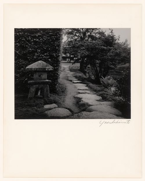
- Photographs PH1986:0148 - PH1986:0283 form a sequence of views. Accession numbers follow an order established by the photographer that is based on the temporal experience of walking through the grounds of Katsura Rikyu (also known as Katsura Imperial Villa) (see acquisition file). - Yasuhiro Ishimoto returned to Katsura Rikyu (also known as Katsura Imperial Villa) in 1982 and took another series of photographs, this time with many in colour, often using the same or very similar views to those of his 1953 photographs at the same location (Ishimoto, p. 266). - The south lawn (also known as the court football [kemari] field) and the Middle Shoin are visible in the background, (Isozaki, et al, p. 244; Ito, site plan).
PH1986:0268
Description:
- Photographs PH1986:0148 - PH1986:0283 form a sequence of views. Accession numbers follow an order established by the photographer that is based on the temporal experience of walking through the grounds of Katsura Rikyu (also known as Katsura Imperial Villa) (see acquisition file). - Yasuhiro Ishimoto returned to Katsura Rikyu (also known as Katsura Imperial Villa) in 1982 and took another series of photographs, this time with many in colour, often using the same or very similar views to those of his 1953 photographs at the same location (Ishimoto, p. 266). - The south lawn (also known as the court football [kemari] field) and the Middle Shoin are visible in the background, (Isozaki, et al, p. 244; Ito, site plan).
People:
Subject:
architecture, landscape architecture
architecture, landscape architecture
Date:
1953
1953
Title:
View of the Triangular Lantern (also known as the Snow-viewing Lantern) and stepping-stones near the Shoiken, Katsura Rikyu (also known as Katsura Imperial Villa), Kyoto, Japan
Actions:
PH1986:0268
Description:
- Photographs PH1986:0148 - PH1986:0283 form a sequence of views. Accession numbers follow an order established by the photographer that is based on the temporal experience of walking through the grounds of Katsura Rikyu (also known as Katsura Imperial Villa) (see acquisition file). - Yasuhiro Ishimoto returned to Katsura Rikyu (also known as Katsura Imperial Villa) in 1982 and took another series of photographs, this time with many in colour, often using the same or very similar views to those of his 1953 photographs at the same location (Ishimoto, p. 266). - The south lawn (also known as the court football [kemari] field) and the Middle Shoin are visible in the background, (Isozaki, et al, p. 244; Ito, site plan).
View of the Triangular Lantern (also known as the Snow-viewing Lantern) and stepping-stones near the Shoiken, Katsura Rikyu (also known as Katsura Imperial Villa), Kyoto, Japan
Actions:
PH1986:0268
Description:
- Photographs PH1986:0148 - PH1986:0283 form a sequence of views. Accession numbers follow an order established by the photographer that is based on the temporal experience of walking through the grounds of Katsura Rikyu (also known as Katsura Imperial Villa) (see acquisition file). - Yasuhiro Ishimoto returned to Katsura Rikyu (also known as Katsura Imperial Villa) in 1982 and took another series of photographs, this time with many in colour, often using the same or very similar views to those of his 1953 photographs at the same location (Ishimoto, p. 266). - The south lawn (also known as the court football [kemari] field) and the Middle Shoin are visible in the background, (Isozaki, et al, p. 244; Ito, site plan).
Form:
photographs
photographs
Date:
1953
1953
People:
Subject:
architecture, landscape architecture
architecture, landscape architecture
Level of archival description:
Project
Project
Reference number:
AP143.S4.D65
Description:
File documents the unexecuted project for the University Art Museum, Long Beach, California. Material in this file was produced between 1986 and 1988. California State University, Long Beach (CSULB), commissioned Eisenman/Robertson Architects to design an art museum adjacent to the main campus entrance. The 67,500-square-foot building was to comprise four galleries, a black-box theater, an auditorium, a cafe, conference rooms, a library, offices, preparation spaces, and storage vaults. The project, sited on a 23-acre arboretum, included landscaping; terraced sculpture courtyards, botanical gardens, and a two-acre pond. Eisenman linked the northern and southern parts of the arboretum by an elevated public walkway through the museum. Sets of drawings were presented on 8 and 30 April, 2 June, and 5 Aug. In the first design phase Eisenman explores the cartographic figures which form the basis of his artificial excavation when superposed: a series of sketches establishes the analogical relationships which fix the relative scales of the plans and produce the superpositions; another series contextualizes the superposed figures by placing them within the museum site (DR1987:0859:087-090). The second phase concerns the building; the working model shows the building carved out of a square pit, from which spring an oil derrick and a reconstruction of a recreational pier (Rainbow Pier, 1920s) used here as circulatory bridge (DR1987:0859:160). In the third phase the architect systematizes his archeological procedure by using five significant cartographic dates - 1849, 1889, 1949, 1989, 2049 - each corresponding to a specific superposition (see DR1987:0859:274-277). In the fourth phase, Eisenman simplifies the superposition of 2049 to a few iconic colour-coded forms: ranch (green), ranch house (blue), campus site (red), and water forms (river and pond) (gold). Material for the fourth phase includes three relief models, four presentation drawings, and a model (property of the CSULB) (relief models: DR1987:0859:001-003; drawings: DR1987:0859:004-008). Eisenman "inhabits" his artifical archeology by detailed planning of interior spaces, and gives substance to the cartographic traces in a series of sketch sections, perspectives, and working models. Working models reveal how the central "canal" area gradually became the museum's access point (DR1987:0859:484-490); the museum, galleries, offices, and preparation areas are on one side of this deep cut, while the cafeteria and black-box theater are on the other. The upper level was to house offices, meeting rooms, and the library. File contains audiovisual material, conceptual drawings, design development drawings, presentation drawings, reference drawings, working drawings, photographic materials, and textual records.
AP143.S4.D65
Description:
File documents the unexecuted project for the University Art Museum, Long Beach, California. Material in this file was produced between 1986 and 1988. California State University, Long Beach (CSULB), commissioned Eisenman/Robertson Architects to design an art museum adjacent to the main campus entrance. The 67,500-square-foot building was to comprise four galleries, a black-box theater, an auditorium, a cafe, conference rooms, a library, offices, preparation spaces, and storage vaults. The project, sited on a 23-acre arboretum, included landscaping; terraced sculpture courtyards, botanical gardens, and a two-acre pond. Eisenman linked the northern and southern parts of the arboretum by an elevated public walkway through the museum. Sets of drawings were presented on 8 and 30 April, 2 June, and 5 Aug. In the first design phase Eisenman explores the cartographic figures which form the basis of his artificial excavation when superposed: a series of sketches establishes the analogical relationships which fix the relative scales of the plans and produce the superpositions; another series contextualizes the superposed figures by placing them within the museum site (DR1987:0859:087-090). The second phase concerns the building; the working model shows the building carved out of a square pit, from which spring an oil derrick and a reconstruction of a recreational pier (Rainbow Pier, 1920s) used here as circulatory bridge (DR1987:0859:160). In the third phase the architect systematizes his archeological procedure by using five significant cartographic dates - 1849, 1889, 1949, 1989, 2049 - each corresponding to a specific superposition (see DR1987:0859:274-277). In the fourth phase, Eisenman simplifies the superposition of 2049 to a few iconic colour-coded forms: ranch (green), ranch house (blue), campus site (red), and water forms (river and pond) (gold). Material for the fourth phase includes three relief models, four presentation drawings, and a model (property of the CSULB) (relief models: DR1987:0859:001-003; drawings: DR1987:0859:004-008). Eisenman "inhabits" his artifical archeology by detailed planning of interior spaces, and gives substance to the cartographic traces in a series of sketch sections, perspectives, and working models. Working models reveal how the central "canal" area gradually became the museum's access point (DR1987:0859:484-490); the museum, galleries, offices, and preparation areas are on one side of this deep cut, while the cafeteria and black-box theater are on the other. The upper level was to house offices, meeting rooms, and the library. File contains audiovisual material, conceptual drawings, design development drawings, presentation drawings, reference drawings, working drawings, photographic materials, and textual records.
People:
Date:
1986-1988
1986-1988
Title:
University Art Museum
Actions:
AP143.S4.D65
Description:
File documents the unexecuted project for the University Art Museum, Long Beach, California. Material in this file was produced between 1986 and 1988. California State University, Long Beach (CSULB), commissioned Eisenman/Robertson Architects to design an art museum adjacent to the main campus entrance. The 67,500-square-foot building was to comprise four galleries, a black-box theater, an auditorium, a cafe, conference rooms, a library, offices, preparation spaces, and storage vaults. The project, sited on a 23-acre arboretum, included landscaping; terraced sculpture courtyards, botanical gardens, and a two-acre pond. Eisenman linked the northern and southern parts of the arboretum by an elevated public walkway through the museum. Sets of drawings were presented on 8 and 30 April, 2 June, and 5 Aug. In the first design phase Eisenman explores the cartographic figures which form the basis of his artificial excavation when superposed: a series of sketches establishes the analogical relationships which fix the relative scales of the plans and produce the superpositions; another series contextualizes the superposed figures by placing them within the museum site (DR1987:0859:087-090). The second phase concerns the building; the working model shows the building carved out of a square pit, from which spring an oil derrick and a reconstruction of a recreational pier (Rainbow Pier, 1920s) used here as circulatory bridge (DR1987:0859:160). In the third phase the architect systematizes his archeological procedure by using five significant cartographic dates - 1849, 1889, 1949, 1989, 2049 - each corresponding to a specific superposition (see DR1987:0859:274-277). In the fourth phase, Eisenman simplifies the superposition of 2049 to a few iconic colour-coded forms: ranch (green), ranch house (blue), campus site (red), and water forms (river and pond) (gold). Material for the fourth phase includes three relief models, four presentation drawings, and a model (property of the CSULB) (relief models: DR1987:0859:001-003; drawings: DR1987:0859:004-008). Eisenman "inhabits" his artifical archeology by detailed planning of interior spaces, and gives substance to the cartographic traces in a series of sketch sections, perspectives, and working models. Working models reveal how the central "canal" area gradually became the museum's access point (DR1987:0859:484-490); the museum, galleries, offices, and preparation areas are on one side of this deep cut, while the cafeteria and black-box theater are on the other. The upper level was to house offices, meeting rooms, and the library. File contains audiovisual material, conceptual drawings, design development drawings, presentation drawings, reference drawings, working drawings, photographic materials, and textual records.
University Art Museum
Actions:
AP143.S4.D65
Description:
File documents the unexecuted project for the University Art Museum, Long Beach, California. Material in this file was produced between 1986 and 1988. California State University, Long Beach (CSULB), commissioned Eisenman/Robertson Architects to design an art museum adjacent to the main campus entrance. The 67,500-square-foot building was to comprise four galleries, a black-box theater, an auditorium, a cafe, conference rooms, a library, offices, preparation spaces, and storage vaults. The project, sited on a 23-acre arboretum, included landscaping; terraced sculpture courtyards, botanical gardens, and a two-acre pond. Eisenman linked the northern and southern parts of the arboretum by an elevated public walkway through the museum. Sets of drawings were presented on 8 and 30 April, 2 June, and 5 Aug. In the first design phase Eisenman explores the cartographic figures which form the basis of his artificial excavation when superposed: a series of sketches establishes the analogical relationships which fix the relative scales of the plans and produce the superpositions; another series contextualizes the superposed figures by placing them within the museum site (DR1987:0859:087-090). The second phase concerns the building; the working model shows the building carved out of a square pit, from which spring an oil derrick and a reconstruction of a recreational pier (Rainbow Pier, 1920s) used here as circulatory bridge (DR1987:0859:160). In the third phase the architect systematizes his archeological procedure by using five significant cartographic dates - 1849, 1889, 1949, 1989, 2049 - each corresponding to a specific superposition (see DR1987:0859:274-277). In the fourth phase, Eisenman simplifies the superposition of 2049 to a few iconic colour-coded forms: ranch (green), ranch house (blue), campus site (red), and water forms (river and pond) (gold). Material for the fourth phase includes three relief models, four presentation drawings, and a model (property of the CSULB) (relief models: DR1987:0859:001-003; drawings: DR1987:0859:004-008). Eisenman "inhabits" his artifical archeology by detailed planning of interior spaces, and gives substance to the cartographic traces in a series of sketch sections, perspectives, and working models. Working models reveal how the central "canal" area gradually became the museum's access point (DR1987:0859:484-490); the museum, galleries, offices, and preparation areas are on one side of this deep cut, while the cafeteria and black-box theater are on the other. The upper level was to house offices, meeting rooms, and the library. File contains audiovisual material, conceptual drawings, design development drawings, presentation drawings, reference drawings, working drawings, photographic materials, and textual records.
Level of archival description:
File 65
File 65
Date:
1986-1988
1986-1988
People:
Form:
archives
Level of archival description:
Fonds
archives
Level of archival description:
Fonds
Actions:
Reference number:
AP218
Synopsis:
The Gillian Hopwood and John Godwin fonds documents Hopwood and Godwin’s architectural projects from the early 1950s to the late 1980s, as well as their training to become architects, the administration of their architecture practice, and their career as architectural consultants, and their writing from the 1940s to 2023. The fonds mostly contains material related to their architectural projects, over 450 of them, mostly in Nigeria and some from their practice in the United Kingdom.
AP218
Synopsis:
The Gillian Hopwood and John Godwin fonds documents Hopwood and Godwin’s architectural projects from the early 1950s to the late 1980s, as well as their training to become architects, the administration of their architecture practice, and their career as architectural consultants, and their writing from the 1940s to 2023. The fonds mostly contains material related to their architectural projects, over 450 of them, mostly in Nigeria and some from their practice in the United Kingdom.
People:
Date:
1940-2025
1940-2025
Title:
Gillian Hopwood and John Godwin fonds
Actions:
AP218
Synopsis:
The Gillian Hopwood and John Godwin fonds documents Hopwood and Godwin’s architectural projects from the early 1950s to the late 1980s, as well as their training to become architects, the administration of their architecture practice, and their career as architectural consultants, and their writing from the 1940s to 2023. The fonds mostly contains material related to their architectural projects, over 450 of them, mostly in Nigeria and some from their practice in the United Kingdom.
Gillian Hopwood and John Godwin fonds
Actions:
AP218
Synopsis:
The Gillian Hopwood and John Godwin fonds documents Hopwood and Godwin’s architectural projects from the early 1950s to the late 1980s, as well as their training to become architects, the administration of their architecture practice, and their career as architectural consultants, and their writing from the 1940s to 2023. The fonds mostly contains material related to their architectural projects, over 450 of them, mostly in Nigeria and some from their practice in the United Kingdom.
Form:
archives
Level of archival description:
Fonds
archives
Level of archival description:
Fonds
Date:
1940-2025
1940-2025
People:
Form:
archives
Level of archival description:
Fonds
archives
Level of archival description:
Fonds
Title:
Arthur Erickson fonds
Arthur Erickson fonds
Reference number:
AP022
Synopsis:
The Arthur Erickson fonds documents the work and activities of Canadian architect Arthur Erickson between 1947 and 2002 (predominant dates 1963-ca. 2000). It comprises architecture projects records with three hundred ninety-seven projects by Erickson / Massey, Arthur Erickson Architects and Arthur Erickson as a design consultant are documented with drawings, photographs, textual documents and other material. It also includes project administration records, records from Erickson's Toronto, Los Angeles and Vancouver offices, records related to Erickson's professional activities, material related to some of Erickson's student projects, and personal papers.
AP022
Synopsis:
The Arthur Erickson fonds documents the work and activities of Canadian architect Arthur Erickson between 1947 and 2002 (predominant dates 1963-ca. 2000). It comprises architecture projects records with three hundred ninety-seven projects by Erickson / Massey, Arthur Erickson Architects and Arthur Erickson as a design consultant are documented with drawings, photographs, textual documents and other material. It also includes project administration records, records from Erickson's Toronto, Los Angeles and Vancouver offices, records related to Erickson's professional activities, material related to some of Erickson's student projects, and personal papers.
People:
Date:
1947-2002 (predominant 1963-2000)
1947-2002 (predominant 1963-2000)
Title:
Arthur Erickson fonds
Actions:
AP022
Synopsis:
The Arthur Erickson fonds documents the work and activities of Canadian architect Arthur Erickson between 1947 and 2002 (predominant dates 1963-ca. 2000). It comprises architecture projects records with three hundred ninety-seven projects by Erickson / Massey, Arthur Erickson Architects and Arthur Erickson as a design consultant are documented with drawings, photographs, textual documents and other material. It also includes project administration records, records from Erickson's Toronto, Los Angeles and Vancouver offices, records related to Erickson's professional activities, material related to some of Erickson's student projects, and personal papers.
Arthur Erickson fonds
Actions:
AP022
Synopsis:
The Arthur Erickson fonds documents the work and activities of Canadian architect Arthur Erickson between 1947 and 2002 (predominant dates 1963-ca. 2000). It comprises architecture projects records with three hundred ninety-seven projects by Erickson / Massey, Arthur Erickson Architects and Arthur Erickson as a design consultant are documented with drawings, photographs, textual documents and other material. It also includes project administration records, records from Erickson's Toronto, Los Angeles and Vancouver offices, records related to Erickson's professional activities, material related to some of Erickson's student projects, and personal papers.
Form:
archives
Level of archival description:
Fonds
archives
Level of archival description:
Fonds
Date:
1947-2002 (predominant 1963-2000)
1947-2002 (predominant 1963-2000)
People:
Level of archival description:
Project
Project
Reference number:
AP207.S1.1978.PR01
Description:
The project series documents "La Mia Casa All'Elba", Pettena's house in Viticcio on the Island of Elba. The project, started in 1978, remained an ongoing project as the house has undergone many transformations over the years. The residence "is conditioned by its relationship with the physical context, the material and the working of space." [1] Pettena even reused some of the material already on site to build the residence. The house is comprised of different pavilions and spaces interconnected by small paths: "The house has progressively been defined as a sequence of spaces connected by routes, just like in a village. So it goes on growing almost like a primitive village, through intentions, successive organizations of spaces that define one another and are linked together." [2] The project series contains a sketch, plans, perspective drawings of the house and later additions. The project series is also comprised of photographs, including interior views showing artworks, photographs of Elba possibly used for research, and two videocassettes possibly with recordings of TV shows presenting the house. Source: [1] Gianni Pettena website, https://www.giannipettena.it/italiano/opere-1/arch-my-house-on-elba-1978-12/ (last accessed 12 November 2019) [2] Gianni Pettena website, https://www.giannipettena.it/italiano/opere-1/arch-my-house-on-elba-1978-12/ (last accessed 12 November 2019)
AP207.S1.1978.PR01
Description:
The project series documents "La Mia Casa All'Elba", Pettena's house in Viticcio on the Island of Elba. The project, started in 1978, remained an ongoing project as the house has undergone many transformations over the years. The residence "is conditioned by its relationship with the physical context, the material and the working of space." [1] Pettena even reused some of the material already on site to build the residence. The house is comprised of different pavilions and spaces interconnected by small paths: "The house has progressively been defined as a sequence of spaces connected by routes, just like in a village. So it goes on growing almost like a primitive village, through intentions, successive organizations of spaces that define one another and are linked together." [2] The project series contains a sketch, plans, perspective drawings of the house and later additions. The project series is also comprised of photographs, including interior views showing artworks, photographs of Elba possibly used for research, and two videocassettes possibly with recordings of TV shows presenting the house. Source: [1] Gianni Pettena website, https://www.giannipettena.it/italiano/opere-1/arch-my-house-on-elba-1978-12/ (last accessed 12 November 2019) [2] Gianni Pettena website, https://www.giannipettena.it/italiano/opere-1/arch-my-house-on-elba-1978-12/ (last accessed 12 November 2019)
People:
Date:
circa 1978-2018
circa 1978-2018
Title:
La Mia Casa All'Elba [My House on Elba], Vittocio, Italy (1978-2012)
Actions:
AP207.S1.1978.PR01
Description:
The project series documents "La Mia Casa All'Elba", Pettena's house in Viticcio on the Island of Elba. The project, started in 1978, remained an ongoing project as the house has undergone many transformations over the years. The residence "is conditioned by its relationship with the physical context, the material and the working of space." [1] Pettena even reused some of the material already on site to build the residence. The house is comprised of different pavilions and spaces interconnected by small paths: "The house has progressively been defined as a sequence of spaces connected by routes, just like in a village. So it goes on growing almost like a primitive village, through intentions, successive organizations of spaces that define one another and are linked together." [2] The project series contains a sketch, plans, perspective drawings of the house and later additions. The project series is also comprised of photographs, including interior views showing artworks, photographs of Elba possibly used for research, and two videocassettes possibly with recordings of TV shows presenting the house. Source: [1] Gianni Pettena website, https://www.giannipettena.it/italiano/opere-1/arch-my-house-on-elba-1978-12/ (last accessed 12 November 2019) [2] Gianni Pettena website, https://www.giannipettena.it/italiano/opere-1/arch-my-house-on-elba-1978-12/ (last accessed 12 November 2019)
La Mia Casa All'Elba [My House on Elba], Vittocio, Italy (1978-2012)
Actions:
AP207.S1.1978.PR01
Description:
The project series documents "La Mia Casa All'Elba", Pettena's house in Viticcio on the Island of Elba. The project, started in 1978, remained an ongoing project as the house has undergone many transformations over the years. The residence "is conditioned by its relationship with the physical context, the material and the working of space." [1] Pettena even reused some of the material already on site to build the residence. The house is comprised of different pavilions and spaces interconnected by small paths: "The house has progressively been defined as a sequence of spaces connected by routes, just like in a village. So it goes on growing almost like a primitive village, through intentions, successive organizations of spaces that define one another and are linked together." [2] The project series contains a sketch, plans, perspective drawings of the house and later additions. The project series is also comprised of photographs, including interior views showing artworks, photographs of Elba possibly used for research, and two videocassettes possibly with recordings of TV shows presenting the house. Source: [1] Gianni Pettena website, https://www.giannipettena.it/italiano/opere-1/arch-my-house-on-elba-1978-12/ (last accessed 12 November 2019) [2] Gianni Pettena website, https://www.giannipettena.it/italiano/opere-1/arch-my-house-on-elba-1978-12/ (last accessed 12 November 2019)
Level of archival description:
Project
Project
Date:
circa 1978-2018
circa 1978-2018
People:
Level of archival description:
Project
Project
Actions:
Reference number:
AP207.S1.1991.PR02
Description:
The project series documents Pettena's work for the Nuovo Municipio, a new town hall building in Canazei in Italy, from 1990 to 1997. The project consisted of preserving and restoring a historic building designed by Ettore Sottsass in the 1930s and adding a new construction built in a gap between two sections of the building the two volumes of the building. "Through the glazed connection, the new volume maintains a certain distance from the existing volume and is itself split into two parts, creating in practice a pedestrian intersection between the new and the old building and between the two sections of the new building: a pedestrian intersection that is laid out on two distinct levels." [1] The project series contains sketches, site plans, floor plans, elevations and sections. It is also comprised of research material, such as copies of building plans by Ettore Sottsass Sr. The project is also documented through proposals and project descriptions, reports, contracts with the city of Canazei, correspondence with engineers, photographs of the construction, and videos of the building. The project series also includes press clippings about the project and an unidentified videorecording. Source: [1] Gianni Pettena website, https://www.giannipettena.it/italiano/opere-1/arch-new-town-hall-1990-97/ (last accessed 21 January 2020).
AP207.S1.1991.PR02
Description:
The project series documents Pettena's work for the Nuovo Municipio, a new town hall building in Canazei in Italy, from 1990 to 1997. The project consisted of preserving and restoring a historic building designed by Ettore Sottsass in the 1930s and adding a new construction built in a gap between two sections of the building the two volumes of the building. "Through the glazed connection, the new volume maintains a certain distance from the existing volume and is itself split into two parts, creating in practice a pedestrian intersection between the new and the old building and between the two sections of the new building: a pedestrian intersection that is laid out on two distinct levels." [1] The project series contains sketches, site plans, floor plans, elevations and sections. It is also comprised of research material, such as copies of building plans by Ettore Sottsass Sr. The project is also documented through proposals and project descriptions, reports, contracts with the city of Canazei, correspondence with engineers, photographs of the construction, and videos of the building. The project series also includes press clippings about the project and an unidentified videorecording. Source: [1] Gianni Pettena website, https://www.giannipettena.it/italiano/opere-1/arch-new-town-hall-1990-97/ (last accessed 21 January 2020).
People:
Date:
1989-2015
1989-2015
Title:
Nuovo Municipio [New Town Hall of Canazei], Canazei, Italy (1991)
Actions:
AP207.S1.1991.PR02
Description:
The project series documents Pettena's work for the Nuovo Municipio, a new town hall building in Canazei in Italy, from 1990 to 1997. The project consisted of preserving and restoring a historic building designed by Ettore Sottsass in the 1930s and adding a new construction built in a gap between two sections of the building the two volumes of the building. "Through the glazed connection, the new volume maintains a certain distance from the existing volume and is itself split into two parts, creating in practice a pedestrian intersection between the new and the old building and between the two sections of the new building: a pedestrian intersection that is laid out on two distinct levels." [1] The project series contains sketches, site plans, floor plans, elevations and sections. It is also comprised of research material, such as copies of building plans by Ettore Sottsass Sr. The project is also documented through proposals and project descriptions, reports, contracts with the city of Canazei, correspondence with engineers, photographs of the construction, and videos of the building. The project series also includes press clippings about the project and an unidentified videorecording. Source: [1] Gianni Pettena website, https://www.giannipettena.it/italiano/opere-1/arch-new-town-hall-1990-97/ (last accessed 21 January 2020).
Nuovo Municipio [New Town Hall of Canazei], Canazei, Italy (1991)
Actions:
AP207.S1.1991.PR02
Description:
The project series documents Pettena's work for the Nuovo Municipio, a new town hall building in Canazei in Italy, from 1990 to 1997. The project consisted of preserving and restoring a historic building designed by Ettore Sottsass in the 1930s and adding a new construction built in a gap between two sections of the building the two volumes of the building. "Through the glazed connection, the new volume maintains a certain distance from the existing volume and is itself split into two parts, creating in practice a pedestrian intersection between the new and the old building and between the two sections of the new building: a pedestrian intersection that is laid out on two distinct levels." [1] The project series contains sketches, site plans, floor plans, elevations and sections. It is also comprised of research material, such as copies of building plans by Ettore Sottsass Sr. The project is also documented through proposals and project descriptions, reports, contracts with the city of Canazei, correspondence with engineers, photographs of the construction, and videos of the building. The project series also includes press clippings about the project and an unidentified videorecording. Source: [1] Gianni Pettena website, https://www.giannipettena.it/italiano/opere-1/arch-new-town-hall-1990-97/ (last accessed 21 January 2020).
Level of archival description:
Project
Project
Date:
1989-2015
1989-2015
People:
Level of archival description:
Project
Project
Reference number:
AP166.S1.1991.PR2
Description:
This project series documents the project "Glass Station", a gas station constructed on an irregularly-shaped site at the entrance to the town of Oguni in Kumamoto Prefecture, Japan. The project was completed in 1993. The office, pumps, shop and work space of the service station are covered by an undulating canopy composed of asymmetrical concrete arches that form the boundaries of a lattice of pretensioned steel rods and aluminum channels into which panels of glass bonded to sheets of perforated stainless steel were inserted, sealed with polyester film, and secured with structural silicon. The project series is chiefly composed of design development drawings. It includes numbered sets of architectural drawings and structural drawings and some mechanical and electrical drawings. There is a set of unnumbered ink drawings and reproductions related to the geometry of the canopy. There are also some images of the canopy that are output from a computer file or files (wireframes and renderings). There is a small amount of textual material related to technical data and form finding for the canopy. The file also includes 2 study models. There are some graphic design documents for the name of the project and for the name "IDEX". Material in this file was created between 1990 and 1993.
AP166.S1.1991.PR2
Description:
This project series documents the project "Glass Station", a gas station constructed on an irregularly-shaped site at the entrance to the town of Oguni in Kumamoto Prefecture, Japan. The project was completed in 1993. The office, pumps, shop and work space of the service station are covered by an undulating canopy composed of asymmetrical concrete arches that form the boundaries of a lattice of pretensioned steel rods and aluminum channels into which panels of glass bonded to sheets of perforated stainless steel were inserted, sealed with polyester film, and secured with structural silicon. The project series is chiefly composed of design development drawings. It includes numbered sets of architectural drawings and structural drawings and some mechanical and electrical drawings. There is a set of unnumbered ink drawings and reproductions related to the geometry of the canopy. There are also some images of the canopy that are output from a computer file or files (wireframes and renderings). There is a small amount of textual material related to technical data and form finding for the canopy. The file also includes 2 study models. There are some graphic design documents for the name of the project and for the name "IDEX". Material in this file was created between 1990 and 1993.
People:
Date:
1990-1993
1990-1993
Title:
Glass Station, Oguni, Japan (1990-1993)
Actions:
AP166.S1.1991.PR2
Description:
This project series documents the project "Glass Station", a gas station constructed on an irregularly-shaped site at the entrance to the town of Oguni in Kumamoto Prefecture, Japan. The project was completed in 1993. The office, pumps, shop and work space of the service station are covered by an undulating canopy composed of asymmetrical concrete arches that form the boundaries of a lattice of pretensioned steel rods and aluminum channels into which panels of glass bonded to sheets of perforated stainless steel were inserted, sealed with polyester film, and secured with structural silicon. The project series is chiefly composed of design development drawings. It includes numbered sets of architectural drawings and structural drawings and some mechanical and electrical drawings. There is a set of unnumbered ink drawings and reproductions related to the geometry of the canopy. There are also some images of the canopy that are output from a computer file or files (wireframes and renderings). There is a small amount of textual material related to technical data and form finding for the canopy. The file also includes 2 study models. There are some graphic design documents for the name of the project and for the name "IDEX". Material in this file was created between 1990 and 1993.
Glass Station, Oguni, Japan (1990-1993)
Actions:
AP166.S1.1991.PR2
Description:
This project series documents the project "Glass Station", a gas station constructed on an irregularly-shaped site at the entrance to the town of Oguni in Kumamoto Prefecture, Japan. The project was completed in 1993. The office, pumps, shop and work space of the service station are covered by an undulating canopy composed of asymmetrical concrete arches that form the boundaries of a lattice of pretensioned steel rods and aluminum channels into which panels of glass bonded to sheets of perforated stainless steel were inserted, sealed with polyester film, and secured with structural silicon. The project series is chiefly composed of design development drawings. It includes numbered sets of architectural drawings and structural drawings and some mechanical and electrical drawings. There is a set of unnumbered ink drawings and reproductions related to the geometry of the canopy. There are also some images of the canopy that are output from a computer file or files (wireframes and renderings). There is a small amount of textual material related to technical data and form finding for the canopy. The file also includes 2 study models. There are some graphic design documents for the name of the project and for the name "IDEX". Material in this file was created between 1990 and 1993.
Level of archival description:
project
project
Date:
1990-1993
1990-1993
People:


