705 Results
Form:
books
books
Actions:
Holdings:
Description:
2 volumes : illustrations (some color), maps (some color) ; 29 cm
Description:
2 volumes : illustrations (some color), maps (some color) ; 29 cm
Subject:
- Cities and towns in art.,
- Art, Italian.,
- Art, European.,
- Cities and towns Italy Campania Maps.,
- Cartography Italy Campania History.,
- Art italien.,
- Art européen.,
- Cartographie Italie Campanie Histoire.,
- Cartography,
- Cities and towns,
- Campania (Italy) In art.,
- Campanie (Italie) Dans l'art.,
- Italy Campania,
- Art,
- History,
- Maps,
- Cartes géographiques.
(See more)
Publication:
[Naples] : Electa Napoli, ©2006-©2007.
[Naples] : Electa Napoli, ©2006-©2007.
Title:
Iconografia delle città in Campania / a cura di Cesare De Seta e Alfredo Buccaro.
Actions:
Holdings:
Description:
2 volumes : illustrations (some color), maps (some color) ; 29 cm
Iconografia delle città in Campania / a cura di Cesare De Seta e Alfredo Buccaro.
Actions:
Holdings:
Description:
2 volumes : illustrations (some color), maps (some color) ; 29 cm
Form:
books
books
Publication:
[Naples] : Electa Napoli, ©2006-©2007.
[Naples] : Electa Napoli, ©2006-©2007.
Subject:
- Cities and towns in art.,
- Art, Italian.,
- Art, European.,
- Cities and towns Italy Campania Maps.,
- Cartography Italy Campania History.,
- Art italien.,
- Art européen.,
- Cartographie Italie Campanie Histoire.,
- Cartography,
- Cities and towns,
- Campania (Italy) In art.,
- Campanie (Italie) Dans l'art.,
- Italy Campania,
- Art,
- History,
- Maps,
- Cartes géographiques.
(See more)
Form:
books
books
Actions:
Holdings:
Description:
9 portfolios : illustrations, facsimiles, maps, portraits ; 41 x 57 cm + texts (9 volumes : illustrations, maps ; 25-40 cm)
- Library main m 285466 | ID:87-B4589 | index | Available
- Library main m 15471 | ID:87-B4589 | v. 1 plates | Available
- Library main m 15472 | ID:87-B4589 | v. 1 text | Available
- Library main m 15469 | ID:87-B4589 | v. 2 plates | Available
- Library main m 15470 | ID:87-B4589 | v. 2 text | Available
- Library main m 15467 | ID:87-B4589 | v. 3 plates | Available
- Library main m 15468 | ID:87-B4589 | v. 3 text | Available
- Library main m 15465 | ID:87-B4589 | v. 4 plates | Available
- Library main m 15466 | ID:87-B4589 | v. 4 text | Available
- Library main m 15464 | ID:87-B4589 | v. 5 plates | Available
- Library main m 15463 | ID:87-B4589 | v. 5 text | Available
- Library main m 214051 | ID:87-B4589 | v. 6 plates | Available
- Library main m 214052 | ID:87-B4589 | v. 6 text | Available
- Library main m 228661 | ID:87-B4589 | v. 7 plates | Available
- Library main m 258335 | ID:87-B4589 | v. 7 text | Available
- Library main m 258324 | ID:87-B4589 | v. 8 plates | Available
- Library main m 258325 | ID:87-B4589 | v. 8 text | Available
- Library main m 285464 | ID:87-B4589 | v. 9 plates | Available
- Library main m 285465 | ID:87-B4589 | v. 9 text | Available
(See more)
Description:
9 portfolios : illustrations, facsimiles, maps, portraits ; 41 x 57 cm + texts (9 volumes : illustrations, maps ; 25-40 cm)
Subject:
Publication:
Alphen aan den Rijn : Uitgeverij "Canaletto", 1986-2013.
Alphen aan den Rijn : Uitgeverij "Canaletto", 1986-2013.
Title:
Monumenta cartographica Neerlandica / Günter Schilder.
Actions:
Holdings:
Description:
9 portfolios : illustrations, facsimiles, maps, portraits ; 41 x 57 cm + texts (9 volumes : illustrations, maps ; 25-40 cm)
Monumenta cartographica Neerlandica / Günter Schilder.
Actions:
Holdings:
- Library main m 285466 | ID:87-B4589 | index | Available
- Library main m 15471 | ID:87-B4589 | v. 1 plates | Available
- Library main m 15472 | ID:87-B4589 | v. 1 text | Available
- Library main m 15469 | ID:87-B4589 | v. 2 plates | Available
- Library main m 15470 | ID:87-B4589 | v. 2 text | Available
- Library main m 15467 | ID:87-B4589 | v. 3 plates | Available
- Library main m 15468 | ID:87-B4589 | v. 3 text | Available
- Library main m 15465 | ID:87-B4589 | v. 4 plates | Available
- Library main m 15466 | ID:87-B4589 | v. 4 text | Available
- Library main m 15464 | ID:87-B4589 | v. 5 plates | Available
- Library main m 15463 | ID:87-B4589 | v. 5 text | Available
- Library main m 214051 | ID:87-B4589 | v. 6 plates | Available
- Library main m 214052 | ID:87-B4589 | v. 6 text | Available
- Library main m 228661 | ID:87-B4589 | v. 7 plates | Available
- Library main m 258335 | ID:87-B4589 | v. 7 text | Available
- Library main m 258324 | ID:87-B4589 | v. 8 plates | Available
- Library main m 258325 | ID:87-B4589 | v. 8 text | Available
- Library main m 285464 | ID:87-B4589 | v. 9 plates | Available
- Library main m 285465 | ID:87-B4589 | v. 9 text | Available
(See more)
Description:
9 portfolios : illustrations, facsimiles, maps, portraits ; 41 x 57 cm + texts (9 volumes : illustrations, maps ; 25-40 cm)
Form:
books
books
Publication:
Alphen aan den Rijn : Uitgeverij "Canaletto", 1986-2013.
Alphen aan den Rijn : Uitgeverij "Canaletto", 1986-2013.
Form:
books
books
Actions:
Holdings:
Description:
ix, 400 pages : illustrations (chiefly color), maps (chiefly color) ; 29 cm
Description:
ix, 400 pages : illustrations (chiefly color), maps (chiefly color) ; 29 cm
Author:
Subject:
Publication:
Chicago : University of Chicago Press, 2007, ©2007
Chicago : University of Chicago Press, 2007, ©2007
Title:
Maps : finding our place in the world / edited by James R. Akerman and Robert W. Karrow, Jr.
Actions:
Holdings:
Description:
ix, 400 pages : illustrations (chiefly color), maps (chiefly color) ; 29 cm
Maps : finding our place in the world / edited by James R. Akerman and Robert W. Karrow, Jr.
Actions:
Holdings:
Description:
ix, 400 pages : illustrations (chiefly color), maps (chiefly color) ; 29 cm
Form:
books
books
Publication:
Chicago : University of Chicago Press, 2007, ©2007
Chicago : University of Chicago Press, 2007, ©2007
Form:
books
books
Actions:
Holdings:
Description:
xxxiv, 568 pages : maps (some color) ; 37 cm
Description:
xxxiv, 568 pages : maps (some color) ; 37 cm
Author:
Subject:
- Cartography North America History.,
- Cartographie Amérique du Nord Histoire.,
- Cartography,
- Historical geography,
- North America Maps Early works to 1800 Facsimiles.,
- North America Maps Bibliography.,
- Amérique du Nord Atlas Fac-similés.,
- North America,
- Maps.,
- bibliographies.,
- facsimiles (reproductions),
- Facsimiles,
- History,
- Bibliographies.,
- Early maps.,
- Fac-similés.,
- Cartes anciennes.
(See more)
Publication:
Rickmansworth, Herts : Raleigh Publications, [1996]
Rickmansworth, Herts : Raleigh Publications, [1996]
Title:
The mapping of North America. A list of printed maps, 1511-1670 / by Philip D. Burden.
Actions:
Holdings:
Description:
xxxiv, 568 pages : maps (some color) ; 37 cm
The mapping of North America. A list of printed maps, 1511-1670 / by Philip D. Burden.
Actions:
Holdings:
Description:
xxxiv, 568 pages : maps (some color) ; 37 cm
Form:
books
books
Publication:
Rickmansworth, Herts : Raleigh Publications, [1996]
Rickmansworth, Herts : Raleigh Publications, [1996]
Subject:
- Cartography North America History.,
- Cartographie Amérique du Nord Histoire.,
- Cartography,
- Historical geography,
- North America Maps Early works to 1800 Facsimiles.,
- North America Maps Bibliography.,
- Amérique du Nord Atlas Fac-similés.,
- North America,
- Maps.,
- bibliographies.,
- facsimiles (reproductions),
- Facsimiles,
- History,
- Bibliographies.,
- Early maps.,
- Fac-similés.,
- Cartes anciennes.
(See more)
Form:
books
books
Actions:
Holdings:
Description:
25 pages : illustrations, maps ; 30 cm
- Library main 322065 | 322065 | Available
- Library main 322065-1 | 322065 | Related ephemera | Available
(See more)
Description:
25 pages : illustrations, maps ; 30 cm
Author:
Subject:
Publication:
[Santiago de Compostela] : Xunta de Galicia, Consellería de Cultura e Xuventude, Dirección Xeral do Patrimonio Histórico e Documental, [1995]
[Santiago de Compostela] : Xunta de Galicia, Consellería de Cultura e Xuventude, Dirección Xeral do Patrimonio Histórico e Documental, [1995]
Title:
Guía de documentos cartográficos (mapas, planos y dibujos) en el Archivo del Reino de Galicia / dirección, Pedro López Gómez ; realización Pedro López Gómez, Olimpia López Rodríguez, María del Carmen Prieto Ramos.
Actions:
Holdings:
Description:
25 pages : illustrations, maps ; 30 cm
Guía de documentos cartográficos (mapas, planos y dibujos) en el Archivo del Reino de Galicia / dirección, Pedro López Gómez ; realización Pedro López Gómez, Olimpia López Rodríguez, María del Carmen Prieto Ramos.
Actions:
Holdings:
- Library main 322065 | 322065 | Available
- Library main 322065-1 | 322065 | Related ephemera | Available
(See more)
Description:
25 pages : illustrations, maps ; 30 cm
Form:
books
books
Publication:
[Santiago de Compostela] : Xunta de Galicia, Consellería de Cultura e Xuventude, Dirección Xeral do Patrimonio Histórico e Documental, [1995]
[Santiago de Compostela] : Xunta de Galicia, Consellería de Cultura e Xuventude, Dirección Xeral do Patrimonio Histórico e Documental, [1995]
Form:
books
books
Actions:
Holdings:
Description:
1 preliminary leaf, 5-343 pages, 1 leaf including illustrations (including portraits) tables, diagram maps (1 double) 38 cm
Description:
1 preliminary leaf, 5-343 pages, 1 leaf including illustrations (including portraits) tables, diagram maps (1 double) 38 cm
Subject:
Publication:
Paris, Librarie ancienne Honoré Champion, 1931.
Paris, Librarie ancienne Honoré Champion, 1931.
Title:
Le livre d'or de l'Exposition coloniale de Paris, 1931, publié sous le patronage officiel du Commissariat général de l'Exposition, par la Fédération français des anciens coloniaux. Préface de monsieur le maréchal Lyautey ... introduction de monsieur Paul Reynaud ... avant-propos de monsieur Marcel Olivier ... Couverture en couleurs de Paul Jouve; gravure sur bois de Camille Peltrand; cartographie nouvelle de la Maison Forest.
Actions:
Holdings:
Description:
1 preliminary leaf, 5-343 pages, 1 leaf including illustrations (including portraits) tables, diagram maps (1 double) 38 cm
Form:
books
books
Publication:
Paris, Librarie ancienne Honoré Champion, 1931.
Paris, Librarie ancienne Honoré Champion, 1931.
Form:
books
books
Actions:
Holdings:
Description:
ix, 198 pages, 16 unnumbered pages of plates : illustrations (some colour), maps ; 29 cm
Description:
ix, 198 pages, 16 unnumbered pages of plates : illustrations (some colour), maps ; 29 cm
Subject:
- Shakers United States History 19th century Maps.,
- Shakers United States Maps 19th century.,
- Shakers,
- Cartography New Hampshire History 19th century.,
- Cartographie New Hampshire Histoire 19e siècle.,
- Cartography,
- United States Pictorial works.,
- New Hampshire,
- United States,
- American drawings Special subjects: Shaker villages, 1800-1899,
- History,
- Maps,
- Illustrated works,
- Aerial views.,
- Vues aériennes.
(See more)
Publication:
Hanover, NH : University Press of New England, 1987.
Hanover, NH : University Press of New England, 1987.
Title:
Shaker village views : illustrated maps and landscape drawings by Shaker artists of the nineteenth century / Robert P. Emlen.
Actions:
Holdings:
Description:
ix, 198 pages, 16 unnumbered pages of plates : illustrations (some colour), maps ; 29 cm
Shaker village views : illustrated maps and landscape drawings by Shaker artists of the nineteenth century / Robert P. Emlen.
Actions:
Holdings:
Description:
ix, 198 pages, 16 unnumbered pages of plates : illustrations (some colour), maps ; 29 cm
Form:
books
books
Publication:
Hanover, NH : University Press of New England, 1987.
Hanover, NH : University Press of New England, 1987.
Subject:
- Shakers United States History 19th century Maps.,
- Shakers United States Maps 19th century.,
- Shakers,
- Cartography New Hampshire History 19th century.,
- Cartographie New Hampshire Histoire 19e siècle.,
- Cartography,
- United States Pictorial works.,
- New Hampshire,
- United States,
- American drawings Special subjects: Shaker villages, 1800-1899,
- History,
- Maps,
- Illustrated works,
- Aerial views.,
- Vues aériennes.
(See more)
Form:
books
books
Actions:
Holdings:
Description:
< 6 volumes in 12 > : illustrations (some color), maps (some color) ; 29 cm
- Library study room 198909 | GA201 .H5 1987 | v. 1 | Available
- Library study room 198908 | GA201 .H5 1987 | v. 2, bk. 1 | Available
- Library study room 198907 | GA201 .H5 1987 | v. 2, bk. 2 | Available
- Library study room 198906 | GA201 .H5 1987 | v. 2, bk. 3 | Available
- Library study room 253226 | GA201 .H5 1987 | v. 3, pt. 1 | Available
- Library study room 253227 | GA201 .H5 1987 | v. 3, pt. 2 | Available
- Library study room 308296 | GA201 .H5 1987 | v. 4, pt. 1 | Available
- Library study room 308297 | GA201 .H5 1987 | v. 4, pt. 2 | Available
- Library study room 290007 | GA201 .H5 1987 | v. 6, pt. 1 | Available
- Library study room 290008 | GA201 .H5 1987 | v. 6, pt. 2 | Available
(See more)
Description:
< 6 volumes in 12 > : illustrations (some color), maps (some color) ; 29 cm
Author:
- edited by J. B. Harley and David Woodward -- edited by J. B. Harley and David Woodward -- edited by J. B. Harley and David Woodward -- David Woodward -- David Woodward -- edited by Matthew H. Edney and Mary Sponberg Pedley -- edited by Mark Monmonier ; associate editors Peter Collier, Karen Severud Cook, A. Jon Kimerling, Joel L. Morrison.,
- Harley, J. B. (John Brian),,
- Woodward, David, 1942-2004,,
- Edney, Matthew H.,,
- Pedley, Mary Sponberg,,
- Monmonier, Mark S.,,
- Cartography in prehistoric, ancient, and medieval Europe and the Mediterranean.,
- Cartography in the traditional Islamic and South Asian societies.,
- Cartography in the traditional East and Southeast Asian societies.,
- Cartography in the traditional African, American, Arctic, Australian, and Pacific societies.,
- Cartography in the European Renaissance.,
- Cartography in the European Enlightenment.,
- Cartography in the nineteenth century.,
- Cartography in the twentieth century.
(See more)
Subject:
Publication:
Chicago : University of Chicago Press, 1987-, ©1987-
Chicago : University of Chicago Press, 1987-, ©1987-
Title:
The history of cartography / edited by J.B. Harley and David Woodward.
Actions:
Holdings:
Description:
< 6 volumes in 12 > : illustrations (some color), maps (some color) ; 29 cm
The history of cartography / edited by J.B. Harley and David Woodward.
Actions:
Holdings:
- Library study room 198909 | GA201 .H5 1987 | v. 1 | Available
- Library study room 198908 | GA201 .H5 1987 | v. 2, bk. 1 | Available
- Library study room 198907 | GA201 .H5 1987 | v. 2, bk. 2 | Available
- Library study room 198906 | GA201 .H5 1987 | v. 2, bk. 3 | Available
- Library study room 253226 | GA201 .H5 1987 | v. 3, pt. 1 | Available
- Library study room 253227 | GA201 .H5 1987 | v. 3, pt. 2 | Available
- Library study room 308296 | GA201 .H5 1987 | v. 4, pt. 1 | Available
- Library study room 308297 | GA201 .H5 1987 | v. 4, pt. 2 | Available
- Library study room 290007 | GA201 .H5 1987 | v. 6, pt. 1 | Available
- Library study room 290008 | GA201 .H5 1987 | v. 6, pt. 2 | Available
(See more)
Description:
< 6 volumes in 12 > : illustrations (some color), maps (some color) ; 29 cm
Form:
books
books
Publication:
Chicago : University of Chicago Press, 1987-, ©1987-
Chicago : University of Chicago Press, 1987-, ©1987-
Author:
- edited by J. B. Harley and David Woodward -- edited by J. B. Harley and David Woodward -- edited by J. B. Harley and David Woodward -- David Woodward -- David Woodward -- edited by Matthew H. Edney and Mary Sponberg Pedley -- edited by Mark Monmonier ; associate editors Peter Collier, Karen Severud Cook, A. Jon Kimerling, Joel L. Morrison.,
- Harley, J. B. (John Brian),,
- Woodward, David, 1942-2004,,
- Edney, Matthew H.,,
- Pedley, Mary Sponberg,,
- Monmonier, Mark S.,,
- Cartography in prehistoric, ancient, and medieval Europe and the Mediterranean.,
- Cartography in the traditional Islamic and South Asian societies.,
- Cartography in the traditional East and Southeast Asian societies.,
- Cartography in the traditional African, American, Arctic, Australian, and Pacific societies.,
- Cartography in the European Renaissance.,
- Cartography in the European Enlightenment.,
- Cartography in the nineteenth century.,
- Cartography in the twentieth century.
(See more)
Form:
books
books
Price:
$85.00
(available to order)
Summary:
La ville a offert de multiples visages depuis son apparition en Mésopotamie et dans la vallée de l'Indus, voici environ 10 000 ans, et héberge aujourd'hui la moitié de l'humanité. L'appréhension du milieu urbain fut toutefois progressive et plurielle. Les quelque 200 cartes de la collection exceptionnelle de la Royal Geographical Society nous montrent comment l'homme a(...)
Title:
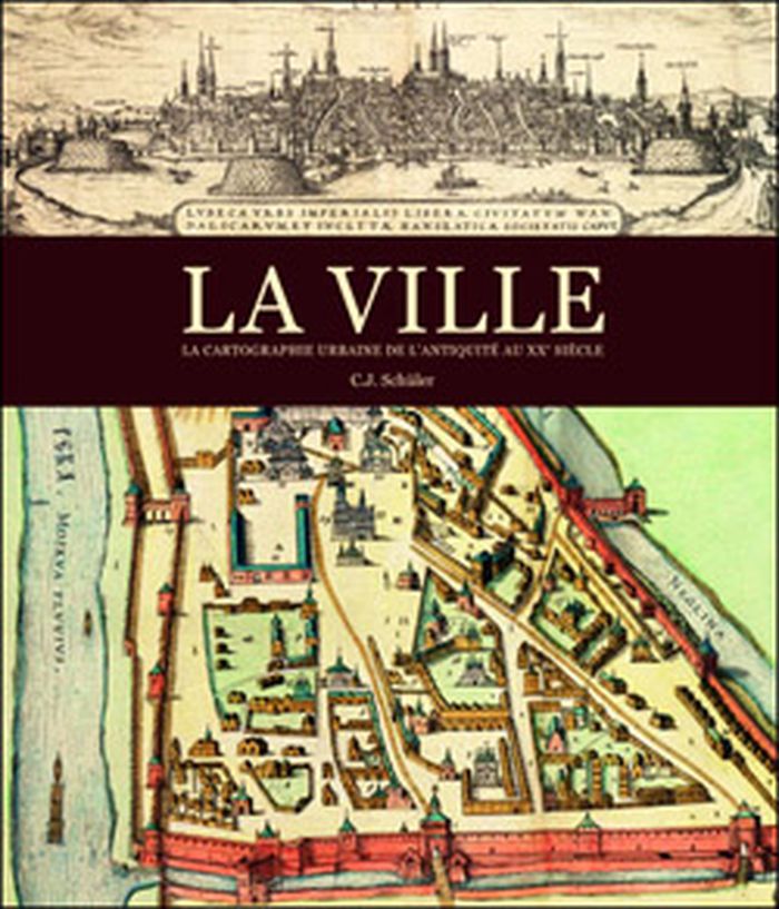
La ville: la cartographie urbaine de l'antiquité au XXe siècle
Actions:
Price:
$85.00
(available to order)
Summary:
La ville a offert de multiples visages depuis son apparition en Mésopotamie et dans la vallée de l'Indus, voici environ 10 000 ans, et héberge aujourd'hui la moitié de l'humanité. L'appréhension du milieu urbain fut toutefois progressive et plurielle. Les quelque 200 cartes de la collection exceptionnelle de la Royal Geographical Society nous montrent comment l'homme a imaginé, puis dessiné la ville. Par les tablettes en terre cuite des Babyloniens aux plans très précis du milieu du XXe siècle, en passant par les peintures et les enluminures médiévales, ce livre nous entraîne dans les cités, les bourgs et les métropoles de différentes époques.
Form:
books
books
Publication:
September 2012
September 2012
Subject:
Architectural Plans and Cartography
Architectural Plans and Cartography
Form:
books
books
Actions:
Holdings:
Description:
299 pages : illustrations (chiefly color), maps ; 27 cm.
Description:
299 pages : illustrations (chiefly color), maps ; 27 cm.
Author:
Subject:
- Architecture France History 19th century.,
- Architecture France History 20th century.,
- Building, Brick France Île-de-France History 19th century.,
- Building, Brick France Île-de-France History 20th century.,
- Brick houses France Île-de-France History 19th century.,
- Brick houses France Île-de-France History 20th century.,
- Brickwork France Île-de-France History 19th century.,
- Brickwork France Île-de-France History 20th century.,
- Architecture France Histoire 19e siècle.,
- Architecture France Histoire 20e siècle.,
- Construction en brique France Île-de-France Histoire 19e siècle.,
- Construction en brique France Île-de-France Histoire 20e siècle.,
- Briquetages France Île-de-France Histoire 19e siècle.,
- Briquetages France Île-de-France Histoire 20e siècle.,
- Maisons en brique France Île-de-France Histoire 19e siècle.,
- Maisons en brique France Île-de-France Histoire 20e siècle.,
- Architecture,
- Brick houses,
- Brickwork,
- Building, Brick,
- France,
- France Île-de-France,
- France Île-de-France Architecture Brick buildings 19th-20th century,
- History
(See more)
Publication:
Paris : Somogy éditions d'art, [2014]
Paris : Somogy éditions d'art, [2014]
Title:
Architectures de brique en Île-de-France : 1850-1950 : Île-de-France / Antoine Le Bas ; sous la direction de Arlette Auduc ; photographies, Jean-Bernard Vialles, ainsi que Stéphane Asseline [and five others] ; plans et cartographie, Diane Betored, Sharareh Rezaï Amin.
Actions:
Holdings:
Description:
299 pages : illustrations (chiefly color), maps ; 27 cm.
Form:
books
books
Publication:
Paris : Somogy éditions d'art, [2014]
Paris : Somogy éditions d'art, [2014]
Subject:
- Architecture France History 19th century.,
- Architecture France History 20th century.,
- Building, Brick France Île-de-France History 19th century.,
- Building, Brick France Île-de-France History 20th century.,
- Brick houses France Île-de-France History 19th century.,
- Brick houses France Île-de-France History 20th century.,
- Brickwork France Île-de-France History 19th century.,
- Brickwork France Île-de-France History 20th century.,
- Architecture France Histoire 19e siècle.,
- Architecture France Histoire 20e siècle.,
- Construction en brique France Île-de-France Histoire 19e siècle.,
- Construction en brique France Île-de-France Histoire 20e siècle.,
- Briquetages France Île-de-France Histoire 19e siècle.,
- Briquetages France Île-de-France Histoire 20e siècle.,
- Maisons en brique France Île-de-France Histoire 19e siècle.,
- Maisons en brique France Île-de-France Histoire 20e siècle.,
- Architecture,
- Brick houses,
- Brickwork,
- Building, Brick,
- France,
- France Île-de-France,
- France Île-de-France Architecture Brick buildings 19th-20th century,
- History
(See more)