705 Results
Form:
books
books
Actions:
Holdings:
Description:
208 pages : illustrations (some color), maps (some color) ; 29 x 32 cm
Description:
208 pages : illustrations (some color), maps (some color) ; 29 x 32 cm
Author:
Subject:
- Atlases History 19th century.,
- Mountain mapping History 19th century.,
- Stream mapping History 19th century.,
- Prints, European 19th century Themes, motives.,
- Mountains in art.,
- Rivers in art.,
- Atlas Histoire 19e siècle.,
- Cartographie des montagnes Histoire 19e siècle.,
- Cartographie des cours d'eau Histoire 19e siècle.,
- Estampe européenne 19e siècle Thèmes, motifs.,
- Montagnes dans l'art.,
- Atlases,
- Mountain mapping,
- Prints, European Themes, motives,
- Stream mapping,
- Atlas,
- Berg,
- Fluss,
- Flusslandschaft,
- Geologie,
- Karte,
- Kartografie,
- Topografie,
- atlases.,
- prints (visual works),
- works of art.,
- Prints,
- Informational works,
- Illustrated works,
- Art,
- History,
- Estampes.,
- Œuvres d'art.,
- Ouvrages illustrés.,
- Documents d'information.
(See more)
Publication:
New York : Princeton Architectural Press, [2019], ©2019
New York : Princeton Architectural Press, [2019], ©2019
Title:
An atlas of geographical wonders : from mountaintops to riverbeds : a selection of comparative maps and tableaux / Jean-Christophe Bailly, Jean-Marc Besse, Philippe Grand, Gilles Palsky.
Actions:
Holdings:
Description:
208 pages : illustrations (some color), maps (some color) ; 29 x 32 cm
An atlas of geographical wonders : from mountaintops to riverbeds : a selection of comparative maps and tableaux / Jean-Christophe Bailly, Jean-Marc Besse, Philippe Grand, Gilles Palsky.
Actions:
Holdings:
Description:
208 pages : illustrations (some color), maps (some color) ; 29 x 32 cm
Form:
books
books
Publication:
New York : Princeton Architectural Press, [2019], ©2019
New York : Princeton Architectural Press, [2019], ©2019
Subject:
- Atlases History 19th century.,
- Mountain mapping History 19th century.,
- Stream mapping History 19th century.,
- Prints, European 19th century Themes, motives.,
- Mountains in art.,
- Rivers in art.,
- Atlas Histoire 19e siècle.,
- Cartographie des montagnes Histoire 19e siècle.,
- Cartographie des cours d'eau Histoire 19e siècle.,
- Estampe européenne 19e siècle Thèmes, motifs.,
- Montagnes dans l'art.,
- Atlases,
- Mountain mapping,
- Prints, European Themes, motives,
- Stream mapping,
- Atlas,
- Berg,
- Fluss,
- Flusslandschaft,
- Geologie,
- Karte,
- Kartografie,
- Topografie,
- atlases.,
- prints (visual works),
- works of art.,
- Prints,
- Informational works,
- Illustrated works,
- Art,
- History,
- Estampes.,
- Œuvres d'art.,
- Ouvrages illustrés.,
- Documents d'information.
(See more)
Form:
books
books
Actions:
Holdings:
Description:
408 pages : illustrations (chiefly color), color maps ; 27 cm.
Description:
408 pages : illustrations (chiefly color), color maps ; 27 cm.
Author:
Subject:
- Farm buildings France Alpes de Haute-Provence.,
- Architecture, Domestic France Alpes de Haute-Provence.,
- Land use, Rural France.,
- Landscape photography France Alpes de Haute-Provence.,
- Utilisation agricole du sol France.,
- Photographie de paysages France Alpes-de-Haute-Provence.,
- Architecture, Domestic,
- Buildings,
- Farm buildings,
- Land use, Rural,
- Landscape photography,
- Alpes de Haute-Provence (France) Buildings, structures, etc.,
- Alpes-de-Haute-Provence (France) Constructions.,
- France Alpes de Haute-Provence,
- Illustrated works
(See more)
Publication:
Lyon : Éditions Lieux Dits, [2019]
Lyon : Éditions Lieux Dits, [2019]
Title:
La ferme et le territoire en Haute Provence : Provence-Alpes-Côte d'Azur / textes, Marceline Brunet, Laurent Del Rosso, Alexeï Laurent, Maxence Mosseron ; photographies, Frédéric Pauvarel, Françoise Baussan ; cartographie et dessins, Sarah Bossy ; ouvrage réalisé par le Service Patrimoine, Traditions et Inventaire, Région Provence-Alpes-Côte d'Azur.
Actions:
Holdings:
Description:
408 pages : illustrations (chiefly color), color maps ; 27 cm.
Form:
books
books
Publication:
Lyon : Éditions Lieux Dits, [2019]
Lyon : Éditions Lieux Dits, [2019]
Subject:
- Farm buildings France Alpes de Haute-Provence.,
- Architecture, Domestic France Alpes de Haute-Provence.,
- Land use, Rural France.,
- Landscape photography France Alpes de Haute-Provence.,
- Utilisation agricole du sol France.,
- Photographie de paysages France Alpes-de-Haute-Provence.,
- Architecture, Domestic,
- Buildings,
- Farm buildings,
- Land use, Rural,
- Landscape photography,
- Alpes de Haute-Provence (France) Buildings, structures, etc.,
- Alpes-de-Haute-Provence (France) Constructions.,
- France Alpes de Haute-Provence,
- Illustrated works
(See more)
Form:
books
books
Actions:
Holdings:
Description:
viii, 367 pages, 8 unnumbered pages of plates : illustrations, maps (some color) ; 26 cm.
Description:
viii, 367 pages, 8 unnumbered pages of plates : illustrations, maps (some color) ; 26 cm.
Subject:
Publication:
Chicago : University of Chicago Press, 2009.
Chicago : University of Chicago Press, 2009.
Title:
The imperial map : cartography and the mastery of empire / edited by James R. Akerman.
Actions:
Holdings:
Description:
viii, 367 pages, 8 unnumbered pages of plates : illustrations, maps (some color) ; 26 cm.
The imperial map : cartography and the mastery of empire / edited by James R. Akerman.
Actions:
Holdings:
Description:
viii, 367 pages, 8 unnumbered pages of plates : illustrations, maps (some color) ; 26 cm.
Form:
books
books
Publication:
Chicago : University of Chicago Press, 2009.
Chicago : University of Chicago Press, 2009.
Form:
books
books
Actions:
Holdings:
Description:
257 pages ; 19 cm.
Description:
257 pages ; 19 cm.
Subject:
- Right and left (Political science),
- Political ecology.,
- Neo-Malthusianism.,
- Identity politics.,
- Conservatism.,
- Fascism.,
- Ecoterrorism.,
- Extrême droite.,
- Écologie politique.,
- Néomalthusianisme.,
- Politique identitaire.,
- Conservatisme.,
- Fascisme.,
- Écoterrorisme.,
- conservatism.,
- fascism.
(See more)
Publication:
Montréal (Québec) : Éditions Écosociété, [2023], ©2023
Montréal (Québec) : Éditions Écosociété, [2023], ©2023
Title:
La tentation écofasciste : écologie et extrême droite / Pierre Madelin.
Actions:
Holdings:
Description:
257 pages ; 19 cm.
La tentation écofasciste : écologie et extrême droite / Pierre Madelin.
Actions:
Holdings:
Description:
257 pages ; 19 cm.
Form:
books
books
Publication:
Montréal (Québec) : Éditions Écosociété, [2023], ©2023
Montréal (Québec) : Éditions Écosociété, [2023], ©2023
Subject:
- Right and left (Political science),
- Political ecology.,
- Neo-Malthusianism.,
- Identity politics.,
- Conservatism.,
- Fascism.,
- Ecoterrorism.,
- Extrême droite.,
- Écologie politique.,
- Néomalthusianisme.,
- Politique identitaire.,
- Conservatisme.,
- Fascisme.,
- Écoterrorisme.,
- conservatism.,
- fascism.
(See more)
Form:
books
books
Actions:
Holdings:
Description:
x, 372 pages : illustrations, maps ; 25 cm
Description:
x, 372 pages : illustrations, maps ; 25 cm
Subject:
- Randel, John, Jr.,
- Randel, John, Jr. Influence.,
- Surveyors United States Biography.,
- Surveying New York (State) New York History 19th century.,
- City planning New York (State) New York History 19th century.,
- Cartographers United States Biography.,
- Inventors United States Biography.,
- Géomètres États-Unis Biographies.,
- Cartographes États-Unis Biographies.,
- Inventeurs États-Unis Biographies.,
- Cartographers.,
- City planning.,
- Influence (Literary, artistic, etc.),
- Inventors.,
- Surveying.,
- Surveyors.,
- Vermessung,
- Manhattan (New York, N.Y.) History 19th century.,
- New York (State) New York.,
- New York (State) New York Manhattan.,
- United States.,
- New York- Manhattan,
- Biography.,
- Biographies.,
- collective biographies.,
- History.
(See more)
Publication:
New York : W.W. Norton & Company, [2013], ©2013
New York : W.W. Norton & Company, [2013], ©2013
Title:
The measure of Manhattan : the tumultuous career and surprising legacy of John Randel Jr., cartographer, surveyor, inventor / Marguerite Holloway.
Actions:
Holdings:
Description:
x, 372 pages : illustrations, maps ; 25 cm
The measure of Manhattan : the tumultuous career and surprising legacy of John Randel Jr., cartographer, surveyor, inventor / Marguerite Holloway.
Actions:
Holdings:
Description:
x, 372 pages : illustrations, maps ; 25 cm
Form:
books
books
Publication:
New York : W.W. Norton & Company, [2013], ©2013
New York : W.W. Norton & Company, [2013], ©2013
Subject:
- Randel, John, Jr.,
- Randel, John, Jr. Influence.,
- Surveyors United States Biography.,
- Surveying New York (State) New York History 19th century.,
- City planning New York (State) New York History 19th century.,
- Cartographers United States Biography.,
- Inventors United States Biography.,
- Géomètres États-Unis Biographies.,
- Cartographes États-Unis Biographies.,
- Inventeurs États-Unis Biographies.,
- Cartographers.,
- City planning.,
- Influence (Literary, artistic, etc.),
- Inventors.,
- Surveying.,
- Surveyors.,
- Vermessung,
- Manhattan (New York, N.Y.) History 19th century.,
- New York (State) New York.,
- New York (State) New York Manhattan.,
- United States.,
- New York- Manhattan,
- Biography.,
- Biographies.,
- collective biographies.,
- History.
(See more)
Form:
books
books
Actions:
Holdings:
Description:
xxxvi, 119 pages : facsimiles ; 26 cm
- Library study room 249378 | Z6724.F67 (ID:91-B3776) | c. 1 | Available
- Library acquisitions office 68534 | Z6724.F67 (ID:91-B3776) | c. 2 | Available
(See more)
Description:
xxxvi, 119 pages : facsimiles ; 26 cm
Subject:
- Newberry Library Catalogs.,
- Newberry Library,
- Fortification Europe Bibliography Catalogs.,
- Military architecture Europe History Bibliography.,
- Cartography Europe History Bibliography.,
- Architecture militaire Europe Histoire Bibliographie.,
- Cartographie Europe Histoire Bibliographie.,
- Map libraries and archives. [Catalogues].,
- Towns - Cartography. [Literature].,
- Fortification,
- Vestingbouw.,
- Steden.,
- Representatie (algemeen),
- Europe. Towns. [Literature] 1991.,
- Europe,
- Catalog,
- Bibliography,
- catalogs (documents),
- bibliographies.,
- Bibliographies,
- Catalogs,
- Catalogues.
(See more)
Publication:
Chicago : The Library, 1991.
Chicago : The Library, 1991.
Title:
Military architecture, cartography & the representation of the early modern European city : a checklist of treatises on fortification in the Newberry Library / Martha D. Pollak.
Actions:
Holdings:
Description:
xxxvi, 119 pages : facsimiles ; 26 cm
Military architecture, cartography & the representation of the early modern European city : a checklist of treatises on fortification in the Newberry Library / Martha D. Pollak.
Actions:
Holdings:
- Library study room 249378 | Z6724.F67 (ID:91-B3776) | c. 1 | Available
- Library acquisitions office 68534 | Z6724.F67 (ID:91-B3776) | c. 2 | Available
(See more)
Description:
xxxvi, 119 pages : facsimiles ; 26 cm
Form:
books
books
Publication:
Chicago : The Library, 1991.
Chicago : The Library, 1991.
Subject:
- Newberry Library Catalogs.,
- Newberry Library,
- Fortification Europe Bibliography Catalogs.,
- Military architecture Europe History Bibliography.,
- Cartography Europe History Bibliography.,
- Architecture militaire Europe Histoire Bibliographie.,
- Cartographie Europe Histoire Bibliographie.,
- Map libraries and archives. [Catalogues].,
- Towns - Cartography. [Literature].,
- Fortification,
- Vestingbouw.,
- Steden.,
- Representatie (algemeen),
- Europe. Towns. [Literature] 1991.,
- Europe,
- Catalog,
- Bibliography,
- catalogs (documents),
- bibliographies.,
- Bibliographies,
- Catalogs,
- Catalogues.
(See more)
Form:
books
books
Title:
Maps as prints in the Italian Renaissance : makers, distributors & consumers / David Woodward.
Maps as prints in the Italian Renaissance : makers, distributors & consumers / David Woodward.
Actions:
Holdings:
Description:
viii, 127 pages : illustrations ; 22 cm.
Description:
viii, 127 pages : illustrations ; 22 cm.
Subject:
- Map printing History.,
- Engraving, Italian 16th century.,
- Map industry and trade Italy History.,
- Cartography Italy History.,
- Cartes géographiques Industrie Italie Histoire.,
- Cartographie Italie Histoire.,
- Cartes géographiques Impression Histoire.,
- Gravure italienne 16e siècle.,
- Map industry and trade,
- Cartography,
- Engraving, Italian,
- Map printing,
- Historische Karte,
- Renaissance,
- Cartografie.,
- Documentation, information science and librarianship.,
- History.,
- Italy,
- Italien,
- Geschichte 1350-1650
(See more)
Publication:
London : British Library, ©1996.
London : British Library, ©1996.
Title:
Maps as prints in the Italian Renaissance : makers, distributors & consumers / David Woodward.
Actions:
Holdings:
Description:
viii, 127 pages : illustrations ; 22 cm.
Maps as prints in the Italian Renaissance : makers, distributors & consumers / David Woodward.
Actions:
Holdings:
Description:
viii, 127 pages : illustrations ; 22 cm.
Form:
books
books
Publication:
London : British Library, ©1996.
London : British Library, ©1996.
Subject:
- Map printing History.,
- Engraving, Italian 16th century.,
- Map industry and trade Italy History.,
- Cartography Italy History.,
- Cartes géographiques Industrie Italie Histoire.,
- Cartographie Italie Histoire.,
- Cartes géographiques Impression Histoire.,
- Gravure italienne 16e siècle.,
- Map industry and trade,
- Cartography,
- Engraving, Italian,
- Map printing,
- Historische Karte,
- Renaissance,
- Cartografie.,
- Documentation, information science and librarianship.,
- History.,
- Italy,
- Italien,
- Geschichte 1350-1650
(See more)
Form:
video
video
Actions:
Holdings:
Description:
1 streaming video file (1 min., 26 sec.) : sound, colour
Description:
1 streaming video file (1 min., 26 sec.) : sound, colour
Author:
Subject:
- City planning Québec (Province) Montréal.,
- Architecture Study and teaching Québec (Province) Montréal.,
- Architecture Étude et enseignement Québec (Province) Montréal.,
- Architecture Study and teaching.,
- City planning.,
- Québec Montréal.,
- Interviews.,
- Video recordings (physical artifacts),
- Streaming video.
(See more)
Publication:
[Montréal] : CCA, [2013]
[Montréal] : CCA, [2013]
Title:
ABC:MTL : Gilles Saucier + Leslie Lok.
Actions:
Holdings:
Description:
1 streaming video file (1 min., 26 sec.) : sound, colour
ABC:MTL : Gilles Saucier + Leslie Lok.
Actions:
Holdings:
Description:
1 streaming video file (1 min., 26 sec.) : sound, colour
Form:
video
video
Publication:
[Montréal] : CCA, [2013]
[Montréal] : CCA, [2013]
Subject:
- City planning Québec (Province) Montréal.,
- Architecture Study and teaching Québec (Province) Montréal.,
- Architecture Étude et enseignement Québec (Province) Montréal.,
- Architecture Study and teaching.,
- City planning.,
- Québec Montréal.,
- Interviews.,
- Video recordings (physical artifacts),
- Streaming video.
(See more)
Form:
books
books
Actions:
Price:
$35.00
(available in store)
Summary:
Comment proposer une «cartographie du Nord» par l’analyse de lieux ou d’espaces qui concentrent une ou plusieurs formes de mémoire, tout en étant parfois laissés à l’abandon, voire condamnés à l’oubli? Comment ces «territoires discursifs» se sont-ils constitués et, s’il y a lieu, ont-ils été abandonnés? Comment ont-ils été réinventés ou convoqués par l’art, la(...)
Title:
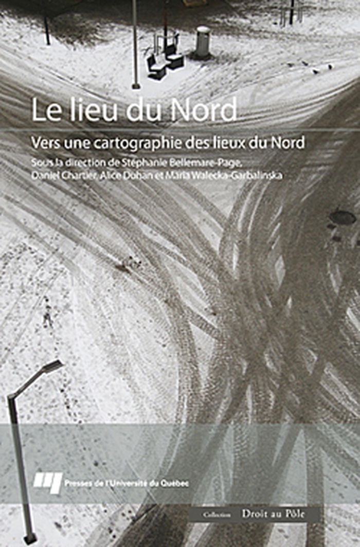
Le lieu du Nord, vers une cartographie des lieux du Nord
Actions:
Price:
$35.00
(available in store)
Summary:
Comment proposer une «cartographie du Nord» par l’analyse de lieux ou d’espaces qui concentrent une ou plusieurs formes de mémoire, tout en étant parfois laissés à l’abandon, voire condamnés à l’oubli? Comment ces «territoires discursifs» se sont-ils constitués et, s’il y a lieu, ont-ils été abandonnés? Comment ont-ils été réinventés ou convoqués par l’art, la photographie, la politique, la muséographie, le tourisme, la musique, l’architecture, le cinéma, la littérature? Sont-ils partie prenante d’une mémoire septentrionale commune à plusieurs cultures du Nord ou d’une mémoire universelle? Sont-ils aujourd’hui l’objet de visées prospectives? Les articles qui composent le présent ouvrage, provenant d’une dizaine de pays, se veulent une réponse, bien partielle, mais tout de même nouvelle, à toutes ces interrogations.
Form:
books
books
Publication:
February 2015
February 2015
Subject:
Architecture du Québec
Architecture du Québec
Form:
maps
maps
Actions:
Holdings:
Description:
1 atlas (42, 105 p.) : col. ill., col. maps ; 30 cm. + 1 booklet.
Description:
1 atlas (42, 105 p.) : col. ill., col. maps ; 30 cm. + 1 booklet.
Author:
Subject:
- Land use, Urban Spain Seville Maps.,
- Cartography Spain Seville History.,
- Cartographie Espagne Séville Histoire.,
- Cartography,
- Land use, Urban,
- Seville (Spain) Maps.,
- Seville (Spain) Remote-sensing maps.,
- Seville (Spain) Aerial photographs.,
- Spain Seville,
- Aerial photographs,
- History,
- Maps,
- Remote-sensing maps
(See more)
Publication:
[Venezia, Italia?] : Marsilio, 1992.
[Venezia, Italia?] : Marsilio, 1992.
Title:
Sevilla forma urbis : la forma del centro histórico a escala 1:1000 en el fotoplano y en el mapa / fotoplano realizado por la Compagnia Generale Ripreseaeree textos de José Núñez Castain, Rosa Bonetta, Lucinio Ferretti; [traducción española Pilar Allue Martínez].
Actions:
Holdings:
Description:
1 atlas (42, 105 p.) : col. ill., col. maps ; 30 cm. + 1 booklet.
Form:
maps
maps
Publication:
[Venezia, Italia?] : Marsilio, 1992.
[Venezia, Italia?] : Marsilio, 1992.
Subject:
- Land use, Urban Spain Seville Maps.,
- Cartography Spain Seville History.,
- Cartographie Espagne Séville Histoire.,
- Cartography,
- Land use, Urban,
- Seville (Spain) Maps.,
- Seville (Spain) Remote-sensing maps.,
- Seville (Spain) Aerial photographs.,
- Spain Seville,
- Aerial photographs,
- History,
- Maps,
- Remote-sensing maps
(See more)