34822 Results
Form:
drawings
drawings
Actions:
Reference number:
DR2004:0779
DR2004:0779
People:
Form:
drawings
drawings
People:
Form:
maps, photographs
maps, photographs
Title:
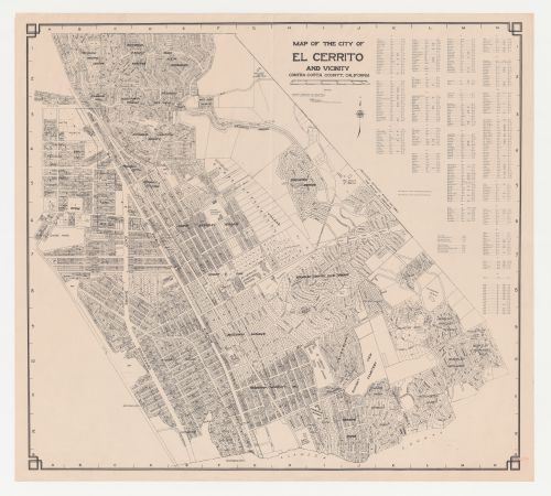
Swedenborg Memorial Chapel, El Cerrito, California: Map of the city of El Cerrito and vicinity
Swedenborg Memorial Chapel, El Cerrito, California: Map of the city of El Cerrito and vicinity
Actions:
Reference number:
DR1987:0420
DR1987:0420
People:
Subject:
topographic
topographic
Date:
printed 1950s
printed 1950s
Form:
maps, photographs
maps, photographs
Date:
printed 1950s
printed 1950s
People:
Subject:
topographic
topographic
Form:
drawings
Quantity:
15 working drawing(s)
drawings
Quantity:
15 working drawing(s)
Actions:
Reference number:
ARCH252875
ARCH252875
People:
Form:
drawings
Quantity:
15 working drawing(s)
drawings
Quantity:
15 working drawing(s)
People:
Form:
drawings
Quantity:
5 working drawing(s)
drawings
Quantity:
5 working drawing(s)
Title:
Church - ground floor plan, sections and elevations, half section, map of the Island of Montreal
Church - ground floor plan, sections and elevations, half section, map of the Island of Montreal
Actions:
Reference number:
ARCH186015
ARCH186015
People:
Form:
drawings
Quantity:
5 working drawing(s)
drawings
Quantity:
5 working drawing(s)
People:
Form:
drawings
Quantity:
3 File
drawings
Quantity:
3 File
Actions:
Reference number:
ARCH44434
ARCH44434
People:
Form:
drawings
Quantity:
3 File
drawings
Quantity:
3 File
People:
Form:
drawings
drawings
Actions:
Reference number:
DR2004:0932:006
DR2004:0932:006
People:
Date:
1990
1990
Title:
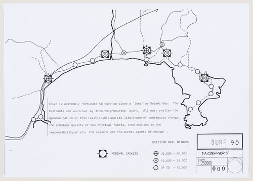
SURF 90: map of Sagami Bay delineating existing rail network and proposed "renewal caskets"
Actions:
DR2004:0932:006
SURF 90: map of Sagami Bay delineating existing rail network and proposed "renewal caskets"
Actions:
DR2004:0932:006
Form:
drawings
drawings
Date:
1990
1990
People:
Form:
maps, drawings
maps, drawings
Actions:
Reference number:
ARCH400736
ARCH400736
People:
Date:
1962
1962
Form:
maps, drawings
maps, drawings
Date:
1962
1962
People:
Form:
drawings
drawings
Title:
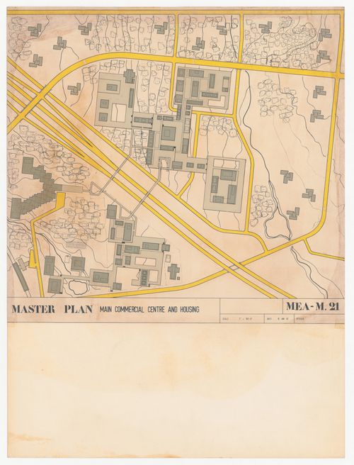
Topographic map for Place Jacques Cartier, Old Port of Montreal Master Plan, Montréal, Québec
Topographic map for Place Jacques Cartier, Old Port of Montreal Master Plan, Montréal, Québec
Actions:
Reference number:
AP046.S1.1983.PR02.020
Description:
This file includes a drawing in three pieces which join at the "trim line".
AP046.S1.1983.PR02.020
Description:
This file includes a drawing in three pieces which join at the "trim line".
People:
Date:
1983-1992
1983-1992
Title:
Topographic map for Place Jacques Cartier, Old Port of Montreal Master Plan, Montréal, Québec
Actions:
AP046.S1.1983.PR02.020
Description:
This file includes a drawing in three pieces which join at the "trim line".
Topographic map for Place Jacques Cartier, Old Port of Montreal Master Plan, Montréal, Québec
Actions:
AP046.S1.1983.PR02.020
Description:
This file includes a drawing in three pieces which join at the "trim line".
Form:
drawings
drawings
Date:
1983-1992
1983-1992
People:
Form:
maps, works of art
maps, works of art
Actions:
Reference number:
DR1999:0006
DR1999:0006
People:
Subject:
military, urban planning
military, urban planning
Date:
1853
1853
Form:
maps, works of art
maps, works of art
Date:
1853
1853
People:
Subject:
military, urban planning
military, urban planning
Form:
drawings
drawings
Actions:
Reference number:
AP140.S2.SS1.D4.P1
Description:
Outline map of the south-east area of the town of Poole showing the location of the site and two buildings of the College, and directions of views across the coastline
AP140.S2.SS1.D4.P1
Description:
Outline map of the south-east area of the town of Poole showing the location of the site and two buildings of the College, and directions of views across the coastline
People:
Date:
circa 1951-1975
circa 1951-1975
Title:
Map showing the site and the of the College, Poole College of Further Education Competition, Poole, United Kingdom
Actions:
AP140.S2.SS1.D4.P1
Description:
Outline map of the south-east area of the town of Poole showing the location of the site and two buildings of the College, and directions of views across the coastline
Form:
drawings
drawings
Date:
circa 1951-1975
circa 1951-1975
People: