968 Results
Form:
books
books
Actions:
Price:
$21.00
(available in store)
Summary:
Risk Colour Book is the result of an encounter between two bodies of work, both involved with the concept of risk. Whether we are dealing with an inventory of toxic pigments and their possible secondary effects or with a performance recreating the moment when a pedestrian is struck by a car, Gustavo Artigas explores the various possible kinds of risk, disasters and(...)
Publication:
September 2009, Montréal
September 2009, Montréal
Title:
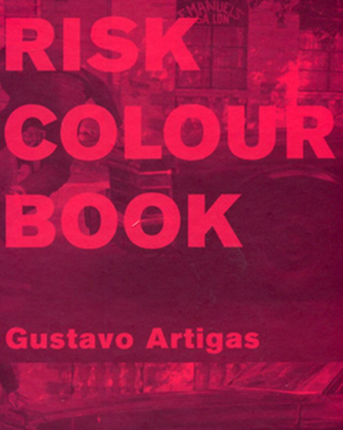
Risk colour book: Gustavo Artigas
Actions:
Price:
$21.00
(available in store)
Summary:
Risk Colour Book is the result of an encounter between two bodies of work, both involved with the concept of risk. Whether we are dealing with an inventory of toxic pigments and their possible secondary effects or with a performance recreating the moment when a pedestrian is struck by a car, Gustavo Artigas explores the various possible kinds of risk, disasters and accidents. Through recording, repetition and the staging of action, Artigas exposes the fragility of the body, subjected to a cunningly latent violence.
Form:
books
books
Publication:
September 2009, Montréal
September 2009, Montréal
Form:
maps
maps
Actions:
Holdings:
Description:
1 map on 10 sheets : color ; sheets 34 x 31 cm
Description:
1 map on 10 sheets : color ; sheets 34 x 31 cm
Subject:
- Fire risk assessment Ontario Ottawa Maps.,
- Real property Ontario Ottawa Maps.,
- Assurance-incendie Ontario Ottawa Plans.,
- Plans cadastraux Ontario Ottawa.,
- Assurance-incendie Ontario Ottawa Cartes.,
- Fire risk assessment.,
- Real property.,
- Ottawa (Ont.) Maps.,
- Ottawa (Ont.) Plans.,
- Ontario Ottawa.,
- Fire insurance maps.,
- Maps.
(See more)
Publication:
Toronto : Underwriters' Survey Bureau, [1957-1963]
Toronto : Underwriters' Survey Bureau, [1957-1963]
Title:
Insurance plan of the city of Ottawa. Volume 5 : plan dated April 1957.
Actions:
Holdings:
Description:
1 map on 10 sheets : color ; sheets 34 x 31 cm
Insurance plan of the city of Ottawa. Volume 5 : plan dated April 1957.
Actions:
Holdings:
Description:
1 map on 10 sheets : color ; sheets 34 x 31 cm
Form:
maps
maps
Publication:
Toronto : Underwriters' Survey Bureau, [1957-1963]
Toronto : Underwriters' Survey Bureau, [1957-1963]
Subject:
- Fire risk assessment Ontario Ottawa Maps.,
- Real property Ontario Ottawa Maps.,
- Assurance-incendie Ontario Ottawa Plans.,
- Plans cadastraux Ontario Ottawa.,
- Assurance-incendie Ontario Ottawa Cartes.,
- Fire risk assessment.,
- Real property.,
- Ottawa (Ont.) Maps.,
- Ottawa (Ont.) Plans.,
- Ontario Ottawa.,
- Fire insurance maps.,
- Maps.
(See more)
Form:
maps
maps
Actions:
Holdings:
Description:
1 map on 6 sheets : color ; sheets 34 x 31 cm
Description:
1 map on 6 sheets : color ; sheets 34 x 31 cm
Subject:
- Fire risk assessment Ontario Aylmer Maps.,
- Real property Ontario Aylmer Maps.,
- Assurance-incendie Ontario Aylmer Plans.,
- Plans cadastraux Ontario Aylmer.,
- Assurance-incendie Ontario Aylmer Cartes.,
- Fire risk assessment.,
- Real property.,
- Aylmer (Ont.) Maps.,
- Aylmer (Ont.) Plans.,
- Ontario Aylmer.,
- Fire insurance maps.,
- Maps.
(See more)
Publication:
Toronto : Underwriters' Survey Bureau, [1952]
Toronto : Underwriters' Survey Bureau, [1952]
Title:
Insurance plan of the town of Aylmer, Ont., population 3,600 : plan dated July, 1952.
Actions:
Holdings:
Description:
1 map on 6 sheets : color ; sheets 34 x 31 cm
Insurance plan of the town of Aylmer, Ont., population 3,600 : plan dated July, 1952.
Actions:
Holdings:
Description:
1 map on 6 sheets : color ; sheets 34 x 31 cm
Form:
maps
maps
Publication:
Toronto : Underwriters' Survey Bureau, [1952]
Toronto : Underwriters' Survey Bureau, [1952]
Subject:
- Fire risk assessment Ontario Aylmer Maps.,
- Real property Ontario Aylmer Maps.,
- Assurance-incendie Ontario Aylmer Plans.,
- Plans cadastraux Ontario Aylmer.,
- Assurance-incendie Ontario Aylmer Cartes.,
- Fire risk assessment.,
- Real property.,
- Aylmer (Ont.) Maps.,
- Aylmer (Ont.) Plans.,
- Ontario Aylmer.,
- Fire insurance maps.,
- Maps.
(See more)
Form:
books
books
Actions:
Holdings:
Description:
173 pages : illustrations (chiefly color) ; 24 cm.
Description:
173 pages : illustrations (chiefly color) ; 24 cm.
Subject:
- City planning France.,
- Regional planning France.,
- Environmental engineering France.,
- Risk management France.,
- Sustainable urban development France.,
- Aménagement du territoire France.,
- Technique de l'environnement France.,
- Gestion du risque France.,
- Urbanisme durable France.,
- City planning.,
- Environmental engineering.,
- Regional planning.,
- Risk management.,
- Sustainable urban development.,
- France.
(See more)
Publication:
Marseille : Parenthèses, [2016]
Marseille : Parenthèses, [2016]
Title:
Atout risques : des territoires exposés se réinventent / sous la direction de Fréderic Bonnet ; avec Jean-François Morel et Jenny Reuillard.
Actions:
Holdings:
Description:
173 pages : illustrations (chiefly color) ; 24 cm.
Atout risques : des territoires exposés se réinventent / sous la direction de Fréderic Bonnet ; avec Jean-François Morel et Jenny Reuillard.
Actions:
Holdings:
Description:
173 pages : illustrations (chiefly color) ; 24 cm.
Form:
books
books
Publication:
Marseille : Parenthèses, [2016]
Marseille : Parenthèses, [2016]
Subject:
- City planning France.,
- Regional planning France.,
- Environmental engineering France.,
- Risk management France.,
- Sustainable urban development France.,
- Aménagement du territoire France.,
- Technique de l'environnement France.,
- Gestion du risque France.,
- Urbanisme durable France.,
- City planning.,
- Environmental engineering.,
- Regional planning.,
- Risk management.,
- Sustainable urban development.,
- France.
(See more)
Form:
maps
maps
Actions:
Holdings:
Description:
1 map on 5 sheets : color ; sheets 34 x 31 cm
Description:
1 map on 5 sheets : color ; sheets 34 x 31 cm
Subject:
- Fire risk assessment Manitoba The Pas Maps.,
- Real property Manitoba The Pas Maps.,
- Assurance-incendie Manitoba The Pas Plans.,
- Plans cadastraux Manitoba The Pas.,
- Assurance-incendie Manitoba The Pas Cartes.,
- Fire risk assessment.,
- Real property.,
- The Pas (Man.) Maps.,
- The Pas (Man.) Plans.,
- Manitoba The Pas.,
- Fire insurance maps.,
- Maps.
(See more)
Publication:
Toronto : Underwriters' Survey Bureau, [1962]
Toronto : Underwriters' Survey Bureau, [1962]
Title:
Insurance plan of the town of The Pas, Man., population 4650 : plan dated August 1962.
Actions:
Holdings:
Description:
1 map on 5 sheets : color ; sheets 34 x 31 cm
Insurance plan of the town of The Pas, Man., population 4650 : plan dated August 1962.
Actions:
Holdings:
Description:
1 map on 5 sheets : color ; sheets 34 x 31 cm
Form:
maps
maps
Publication:
Toronto : Underwriters' Survey Bureau, [1962]
Toronto : Underwriters' Survey Bureau, [1962]
Subject:
- Fire risk assessment Manitoba The Pas Maps.,
- Real property Manitoba The Pas Maps.,
- Assurance-incendie Manitoba The Pas Plans.,
- Plans cadastraux Manitoba The Pas.,
- Assurance-incendie Manitoba The Pas Cartes.,
- Fire risk assessment.,
- Real property.,
- The Pas (Man.) Maps.,
- The Pas (Man.) Plans.,
- Manitoba The Pas.,
- Fire insurance maps.,
- Maps.
(See more)
Form:
maps
maps
Actions:
Holdings:
Description:
1 map on <6> sheets : color ; sheets 34 x 31 cm
Description:
1 map on <6> sheets : color ; sheets 34 x 31 cm
Subject:
- Fire risk assessment Alberta Calgary Maps.,
- Real property Alberta Calgary Maps.,
- Assurance-incendie Alberta Calgary Plans.,
- Plans cadastraux Alberta Calgary.,
- Assurance-incendie Alberta Calgary Cartes.,
- Fire risk assessment.,
- Real property.,
- Calgary (Alta.) Maps.,
- Calgary (Alta.) Plans.,
- Alberta Calgary.,
- Fire insurance maps.,
- Maps.
(See more)
Publication:
Toronto : Underwriters' Survey Bureau, [1954-1964]
Toronto : Underwriters' Survey Bureau, [1954-1964]
Title:
Insurance plan of the city of Calgary. Volume 4 : plan dated November 1954, partially revised October 1963.
Actions:
Holdings:
Description:
1 map on <6> sheets : color ; sheets 34 x 31 cm
Insurance plan of the city of Calgary. Volume 4 : plan dated November 1954, partially revised October 1963.
Actions:
Holdings:
Description:
1 map on <6> sheets : color ; sheets 34 x 31 cm
Form:
maps
maps
Publication:
Toronto : Underwriters' Survey Bureau, [1954-1964]
Toronto : Underwriters' Survey Bureau, [1954-1964]
Subject:
- Fire risk assessment Alberta Calgary Maps.,
- Real property Alberta Calgary Maps.,
- Assurance-incendie Alberta Calgary Plans.,
- Plans cadastraux Alberta Calgary.,
- Assurance-incendie Alberta Calgary Cartes.,
- Fire risk assessment.,
- Real property.,
- Calgary (Alta.) Maps.,
- Calgary (Alta.) Plans.,
- Alberta Calgary.,
- Fire insurance maps.,
- Maps.
(See more)
Form:
maps
maps
Actions:
Holdings:
Description:
1 atlas ([163] pages) : 40 color maps ; 54 cm
Description:
1 atlas ([163] pages) : 40 color maps ; 54 cm
Subject:
- Fire risk assessment New Hampshire Concord Maps.,
- Real property New Hampshire Concord Maps.,
- Assurance-incendie New Hampshire Concord Cartes.,
- Plans cadastraux New Hampshire Concord.,
- Fire risk assessment,
- Real property,
- Concord (N.H.) Maps.,
- Concord (N.H.) Plans.,
- New Hampshire Concord,
- Fire insurance maps.,
- Atlases.,
- Maps
(See more)
Publication:
New York : Sanborn Map Co., 1906.
New York : Sanborn Map Co., 1906.
Title:
Insurance maps of Concord, New Hampshire.
Actions:
Holdings:
Description:
1 atlas ([163] pages) : 40 color maps ; 54 cm
Insurance maps of Concord, New Hampshire.
Actions:
Holdings:
Description:
1 atlas ([163] pages) : 40 color maps ; 54 cm
Form:
maps
maps
Publication:
New York : Sanborn Map Co., 1906.
New York : Sanborn Map Co., 1906.
Subject:
- Fire risk assessment New Hampshire Concord Maps.,
- Real property New Hampshire Concord Maps.,
- Assurance-incendie New Hampshire Concord Cartes.,
- Plans cadastraux New Hampshire Concord.,
- Fire risk assessment,
- Real property,
- Concord (N.H.) Maps.,
- Concord (N.H.) Plans.,
- New Hampshire Concord,
- Fire insurance maps.,
- Atlases.,
- Maps
(See more)
Form:
maps
maps
Actions:
Holdings:
Description:
1 map on approximately 25 sheets : color ; sheets 34 x 31 cm
Description:
1 map on approximately 25 sheets : color ; sheets 34 x 31 cm
Subject:
- Fire risk assessment Alberta Edmonton Maps.,
- Real property Alberta Edmonton Maps.,
- Assurance-incendie Alberta Edmonton Plans.,
- Plans cadastraux Alberta Edmonton.,
- Assurance-incendie Alberta Edmonton Cartes.,
- Fire risk assessment.,
- Real property.,
- Edmonton (Alta.) Maps.,
- Edmonton (Alta.) Plans.,
- Alberta Edmonton.,
- Fire insurance maps.,
- Maps.
(See more)
Publication:
Toronto : Canadian Underwriters' Association, [1954-1966]
Toronto : Canadian Underwriters' Association, [1954-1966]
Title:
Insurance plan of the city of Edmonton. Volume 15 : plan dated June 1954, partially revised June 1966.
Actions:
Holdings:
Description:
1 map on approximately 25 sheets : color ; sheets 34 x 31 cm
Insurance plan of the city of Edmonton. Volume 15 : plan dated June 1954, partially revised June 1966.
Actions:
Holdings:
Description:
1 map on approximately 25 sheets : color ; sheets 34 x 31 cm
Form:
maps
maps
Publication:
Toronto : Canadian Underwriters' Association, [1954-1966]
Toronto : Canadian Underwriters' Association, [1954-1966]
Subject:
- Fire risk assessment Alberta Edmonton Maps.,
- Real property Alberta Edmonton Maps.,
- Assurance-incendie Alberta Edmonton Plans.,
- Plans cadastraux Alberta Edmonton.,
- Assurance-incendie Alberta Edmonton Cartes.,
- Fire risk assessment.,
- Real property.,
- Edmonton (Alta.) Maps.,
- Edmonton (Alta.) Plans.,
- Alberta Edmonton.,
- Fire insurance maps.,
- Maps.
(See more)
Form:
maps
maps
Actions:
Holdings:
Description:
1 map on 35 sheets : color ; sheets 34 x 31 cm
Description:
1 map on 35 sheets : color ; sheets 34 x 31 cm
Subject:
- Fire risk assessment Manitoba Winnipeg Maps.,
- Real property Manitoba Winnipeg Maps.,
- Assurance-incendie Manitoba Winnipeg Plans.,
- Plans cadastraux Manitoba Winnipeg.,
- Assurance-incendie Manitoba Winnipeg Cartes.,
- Fire risk assessment.,
- Real property.,
- Winnipeg (Man.) Maps.,
- Winnipeg (Man.) Plans.,
- Manitoba Winnipeg.,
- Fire insurance maps.,
- Maps.
(See more)
Publication:
Toronto : Canadian Underwriters' Association, [1957-1965]
Toronto : Canadian Underwriters' Association, [1957-1965]
Title:
Insurance plan of the city of Winnipeg. Volume 3 : plan dated January 1957, partially revised September 1965.
Actions:
Holdings:
Description:
1 map on 35 sheets : color ; sheets 34 x 31 cm
Insurance plan of the city of Winnipeg. Volume 3 : plan dated January 1957, partially revised September 1965.
Actions:
Holdings:
Description:
1 map on 35 sheets : color ; sheets 34 x 31 cm
Form:
maps
maps
Publication:
Toronto : Canadian Underwriters' Association, [1957-1965]
Toronto : Canadian Underwriters' Association, [1957-1965]
Subject:
- Fire risk assessment Manitoba Winnipeg Maps.,
- Real property Manitoba Winnipeg Maps.,
- Assurance-incendie Manitoba Winnipeg Plans.,
- Plans cadastraux Manitoba Winnipeg.,
- Assurance-incendie Manitoba Winnipeg Cartes.,
- Fire risk assessment.,
- Real property.,
- Winnipeg (Man.) Maps.,
- Winnipeg (Man.) Plans.,
- Manitoba Winnipeg.,
- Fire insurance maps.,
- Maps.
(See more)
Form:
maps
maps
Actions:
Holdings:
Description:
1 map on 14 sheets : color ; sheets 34 x 31 cm
Description:
1 map on 14 sheets : color ; sheets 34 x 31 cm
Subject:
- Fire risk assessment Saskatchewan Saskatoon Maps.,
- Real property Saskatchewan Saskatoon Maps.,
- Assurance-incendie Saskatchewan Saskatoon Plans.,
- Plans cadastraux Saskatchewan Saskatoon.,
- Assurance-incendie Saskatchewan Saskatoon Cartes.,
- Fire risk assessment.,
- Real property.,
- Saskatoon (Sask.) Maps.,
- Saskatoon (Sask.) Plans.,
- Saskatchewan Saskatoon.,
- Fire insurance maps.,
- Maps.
(See more)
Publication:
Toronto : Underwriters' Survey Bureau, [1958-1963]
Toronto : Underwriters' Survey Bureau, [1958-1963]
Title:
Insurance plan of the city of Saskatoon. Volume 2 : plan dated May 1958.
Actions:
Holdings:
Description:
1 map on 14 sheets : color ; sheets 34 x 31 cm
Insurance plan of the city of Saskatoon. Volume 2 : plan dated May 1958.
Actions:
Holdings:
Description:
1 map on 14 sheets : color ; sheets 34 x 31 cm
Form:
maps
maps
Publication:
Toronto : Underwriters' Survey Bureau, [1958-1963]
Toronto : Underwriters' Survey Bureau, [1958-1963]
Subject:
- Fire risk assessment Saskatchewan Saskatoon Maps.,
- Real property Saskatchewan Saskatoon Maps.,
- Assurance-incendie Saskatchewan Saskatoon Plans.,
- Plans cadastraux Saskatchewan Saskatoon.,
- Assurance-incendie Saskatchewan Saskatoon Cartes.,
- Fire risk assessment.,
- Real property.,
- Saskatoon (Sask.) Maps.,
- Saskatoon (Sask.) Plans.,
- Saskatchewan Saskatoon.,
- Fire insurance maps.,
- Maps.
(See more)