705 Results
Form:
books
books
Holdings:
Description:
xv, 248 pages : illustrations (some color) ; 23 x 26 cm
Description:
xv, 248 pages : illustrations (some color) ; 23 x 26 cm
Subject:
- Landscape assessment.,
- Geographical perception.,
- Roads.,
- Scenic byways.,
- Automobile travel.,
- Parkways.,
- Paysages Évaluation.,
- Perception géographique.,
- Routes.,
- Routes touristiques.,
- Voyages en automobile.,
- roads.,
- highways.,
- scenic byways.,
- parkways.,
- Wegebau,
- Straßenbau,
- Landschaftsgestaltung,
- Landschaftsarchitektur,
- Transport,
- Verkehr,
- Straße.,
- Reiseweg.,
- Landschaftsbewertung.,
- Umweltwahrnehmung.
(See more)
Publication:
Farnham, Surrey ; Burlington, VT. : Ashgate Pub., ©2011.
Farnham, Surrey ; Burlington, VT. : Ashgate Pub., ©2011.
Title:
Routes, roads and landscapes / edited by Mari Hvattum [and others].
Actions:
Holdings:
Description:
xv, 248 pages : illustrations (some color) ; 23 x 26 cm
Routes, roads and landscapes / edited by Mari Hvattum [and others].
Actions:
Holdings:
Description:
xv, 248 pages : illustrations (some color) ; 23 x 26 cm
Form:
books
books
Publication:
Farnham, Surrey ; Burlington, VT. : Ashgate Pub., ©2011.
Farnham, Surrey ; Burlington, VT. : Ashgate Pub., ©2011.
Subject:
- Landscape assessment.,
- Geographical perception.,
- Roads.,
- Scenic byways.,
- Automobile travel.,
- Parkways.,
- Paysages Évaluation.,
- Perception géographique.,
- Routes.,
- Routes touristiques.,
- Voyages en automobile.,
- roads.,
- highways.,
- scenic byways.,
- parkways.,
- Wegebau,
- Straßenbau,
- Landschaftsgestaltung,
- Landschaftsarchitektur,
- Transport,
- Verkehr,
- Straße.,
- Reiseweg.,
- Landschaftsbewertung.,
- Umweltwahrnehmung.
(See more)
Form:
books
books
Price:
$52.00
(available to order)
Summary:
''This Is Not an Atlas'' gathers more than forty counter-cartographies from all over the world. This collection shows how maps are created and transformed as a part of political struggle, for critical research, or in art and education; from indigenous territories in the Amazon to the anti-eviction movement in San Francisco; from defending commons in Mexico to mapping(...)
Subject:
Architectural Plans and Cartography
Architectural Plans and Cartography
Publication:
September 2019
September 2019
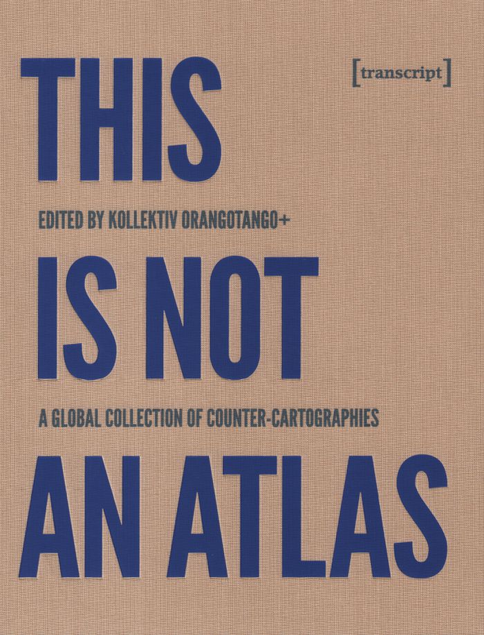
Title:
This is not an atlas: a global collection of counter-cartographies
Actions:
Price:
$52.00
(available to order)
Summary:
''This Is Not an Atlas'' gathers more than forty counter-cartographies from all over the world. This collection shows how maps are created and transformed as a part of political struggle, for critical research, or in art and education; from indigenous territories in the Amazon to the anti-eviction movement in San Francisco; from defending commons in Mexico to mapping refugee camps with balloons in Lebanon; from slums in Nairobi to squats in Berlin; and from supporting communities in the Philippines to reporting sexual harassment in Cairo. ''This Is Not an Atlas'' seeks to inspire, to document the underrepresented, and to be a useful companion when becoming a counter-cartographer yourself.
Form:
books
books
Publication:
September 2019
September 2019
Subject:
Architectural Plans and Cartography
Architectural Plans and Cartography
Form:
books
books
Actions:
Holdings:
Description:
xix, 300 pages : maps ; 24 x 31 cm
Description:
xix, 300 pages : maps ; 24 x 31 cm
Subject:
- Hudson's Bay Company Maps.,
- Hudson's Bay Company Map collections Catalogs.,
- Hudson's Bay Company Maps Catalogs.,
- Hudson's Bay Company Map collections.,
- Compagnie de la Baie d'Hudson Cartes,
- Compagnie de la Baie d'Hudson Collections de cartes Catalogues,
- Compagnie de la Baie d'Hudson Cartes Catalogues,
- Hudson's Bay Company,
- Hudson's Bay Company Cartes.,
- Cartography Canada History.,
- Cartography Hudson Bay Region.,
- Canada Historical geography Maps.,
- Cartographie Canada Histoire.,
- History of cartography. [Literature].,
- Cartography,
- Discoveries in geography British,
- Map collections,
- Maps,
- Hudson's Bay Company Archives Catalogs.,
- Hudson's Bay Company History.,
- Kaarten (geografie),
- Bonthandel.,
- 528.9(091) -- History of cartography.,
- 061.5 -- Business enterprises: Hudson's Bay Company.,
- 339 -- Trade.,
- 91(091) -- Exploration, history.,
- 93 -- History.,
- Canada Discovery and exploration British.,
- Canada Géographie historique Cartes,
- Canada Découverte et exploration britanniques,
- Canada Géographie historique Cartes Catalogues,
- Canada. [Literature] 1991.,
- Canada,
- Hudson Bay Region,
- Canada, Manitoba, Winnipeg Archives and libraries Inventories, registers, catalogs.,
- Canada Découverte et exploration britaniques.,
- (*41) -- Canada.,
- Catalogs,
- History,
- Cartes géographiques.
(See more)
Publication:
Montreal ; Buffalo : McGill-Queen's University Press, ©1991.
Montreal ; Buffalo : McGill-Queen's University Press, ©1991.
Title:
A country so interesting : the Hudson's Bay Company and two centuries of mapping, 1670-1870 / Richard I. Ruggles.
Actions:
Holdings:
Description:
xix, 300 pages : maps ; 24 x 31 cm
A country so interesting : the Hudson's Bay Company and two centuries of mapping, 1670-1870 / Richard I. Ruggles.
Actions:
Holdings:
Description:
xix, 300 pages : maps ; 24 x 31 cm
Form:
books
books
Publication:
Montreal ; Buffalo : McGill-Queen's University Press, ©1991.
Montreal ; Buffalo : McGill-Queen's University Press, ©1991.
Subject:
- Hudson's Bay Company Maps.,
- Hudson's Bay Company Map collections Catalogs.,
- Hudson's Bay Company Maps Catalogs.,
- Hudson's Bay Company Map collections.,
- Compagnie de la Baie d'Hudson Cartes,
- Compagnie de la Baie d'Hudson Collections de cartes Catalogues,
- Compagnie de la Baie d'Hudson Cartes Catalogues,
- Hudson's Bay Company,
- Hudson's Bay Company Cartes.,
- Cartography Canada History.,
- Cartography Hudson Bay Region.,
- Canada Historical geography Maps.,
- Cartographie Canada Histoire.,
- History of cartography. [Literature].,
- Cartography,
- Discoveries in geography British,
- Map collections,
- Maps,
- Hudson's Bay Company Archives Catalogs.,
- Hudson's Bay Company History.,
- Kaarten (geografie),
- Bonthandel.,
- 528.9(091) -- History of cartography.,
- 061.5 -- Business enterprises: Hudson's Bay Company.,
- 339 -- Trade.,
- 91(091) -- Exploration, history.,
- 93 -- History.,
- Canada Discovery and exploration British.,
- Canada Géographie historique Cartes,
- Canada Découverte et exploration britanniques,
- Canada Géographie historique Cartes Catalogues,
- Canada. [Literature] 1991.,
- Canada,
- Hudson Bay Region,
- Canada, Manitoba, Winnipeg Archives and libraries Inventories, registers, catalogs.,
- Canada Découverte et exploration britaniques.,
- (*41) -- Canada.,
- Catalogs,
- History,
- Cartes géographiques.
(See more)
Form:
books
books

Actions:
Price:
$64.95
(available to order)
Summary:
In this book, Karen O'Rourke explores a series of walking/mapping projects by contemporary artists. Some chart "emotional GPS"; some use GPS for creating "datascapes" while others use their legs to do "speculative mapping." Many work with scientists, designers, and engineers. O'Rourke offers close readings of these works -- many of which she was able to experience(...)
Publication:
March 2013
March 2013
Title:
Walking and mapping: artists as cartographers
Actions:
Price:
$64.95
(available to order)
Summary:
In this book, Karen O'Rourke explores a series of walking/mapping projects by contemporary artists. Some chart "emotional GPS"; some use GPS for creating "datascapes" while others use their legs to do "speculative mapping." Many work with scientists, designers, and engineers. O'Rourke offers close readings of these works -- many of which she was able to experience firsthand -- and situates them in relation to landmark works from the past half-century. She shows that the infinitesimal details of each of these projects take on more significance in conjunction with others. Together, they form a new entity, a dynamic whole greater than the sum of its parts. By alternating close study of selected projects with a broader view of their place in a bigger picture, Walking and Mapping itself maps a complex phenomena.
Form:
books
books
Publication:
March 2013
March 2013
Form:
books
books
Actions:
Holdings:
Description:
x, 116 pages : illustrations, maps, portraits ; 27 cm
Description:
x, 116 pages : illustrations, maps, portraits ; 27 cm
Author:
Subject:
Publication:
New York, N.Y. : A.R. Liss, ©1985.
New York, N.Y. : A.R. Liss, ©1985.
Title:
Tooley's Dictionary of mapmakers. Supplement / compiled by Ronald Vere Tooley.
Actions:
Holdings:
Description:
x, 116 pages : illustrations, maps, portraits ; 27 cm
Tooley's Dictionary of mapmakers. Supplement / compiled by Ronald Vere Tooley.
Actions:
Holdings:
Description:
x, 116 pages : illustrations, maps, portraits ; 27 cm
Form:
books
books
Publication:
New York, N.Y. : A.R. Liss, ©1985.
New York, N.Y. : A.R. Liss, ©1985.
Form:
books
books
Actions:
Holdings:
Description:
280, [1] pages : illustrations (some color) ; 23 cm
Description:
280, [1] pages : illustrations (some color) ; 23 cm
Subject:
- Relief (Sculpture), Romanesque France Auvergne.,
- Capitals (Architecture), Romanesque France Auvergne Themes, motives.,
- Symbolism in architecture France Auvergne.,
- Christian art and symbolism Medieval, 500-1500.,
- Church decoration and ornament France Auvergne.,
- Relief (Sculpture) roman France Auvergne.,
- Chapiteaux romans France Auvergne Thèmes, motifs.,
- Symbolisme en architecture France Auvergne.,
- Églises Décoration et ornement France Auvergne.,
- Capitals (Architecture), Romanesque Themes, motives.,
- Christian art and symbolism Medieval.,
- Church decoration and ornament.,
- Relief (Sculpture), Romanesque.,
- Symbolism in architecture.,
- Kirchenbau,
- Romanik,
- Kapitellplastik,
- Ikonographie,
- Das @Böse,
- Das @Gute,
- France Auvergne.,
- Auvergne
(See more)
Publication:
[Paris] : Arkhê, ©2012.
[Paris] : Arkhê, ©2012.
Title:
Le monde roman : par-delà le bien et le mal : une iconographie du lieu sacré / Jérôme Baschet, Jean-Claude Bonne, Pierre-Olivier Dittmar.
Actions:
Holdings:
Description:
280, [1] pages : illustrations (some color) ; 23 cm
Le monde roman : par-delà le bien et le mal : une iconographie du lieu sacré / Jérôme Baschet, Jean-Claude Bonne, Pierre-Olivier Dittmar.
Actions:
Holdings:
Description:
280, [1] pages : illustrations (some color) ; 23 cm
Form:
books
books
Publication:
[Paris] : Arkhê, ©2012.
[Paris] : Arkhê, ©2012.
Subject:
- Relief (Sculpture), Romanesque France Auvergne.,
- Capitals (Architecture), Romanesque France Auvergne Themes, motives.,
- Symbolism in architecture France Auvergne.,
- Christian art and symbolism Medieval, 500-1500.,
- Church decoration and ornament France Auvergne.,
- Relief (Sculpture) roman France Auvergne.,
- Chapiteaux romans France Auvergne Thèmes, motifs.,
- Symbolisme en architecture France Auvergne.,
- Églises Décoration et ornement France Auvergne.,
- Capitals (Architecture), Romanesque Themes, motives.,
- Christian art and symbolism Medieval.,
- Church decoration and ornament.,
- Relief (Sculpture), Romanesque.,
- Symbolism in architecture.,
- Kirchenbau,
- Romanik,
- Kapitellplastik,
- Ikonographie,
- Das @Böse,
- Das @Gute,
- France Auvergne.,
- Auvergne
(See more)
Form:
books
books
Actions:
Holdings:
Description:
2 v. : ill., facsims., map, ports. ; 24 cm.
- Library study room 112528 | ID GA923.5.P5 REF; ID:86-B2550 | 2 vols | Available
(See more)
Description:
2 v. : ill., facsims., map, ports. ; 24 cm.
Title:
Oud-nederlandsche kaartmakers in betrekking met Plantijn / door Jan Denucé.
Actions:
Holdings:
Description:
2 v. : ill., facsims., map, ports. ; 24 cm.
Oud-nederlandsche kaartmakers in betrekking met Plantijn / door Jan Denucé.
Actions:
Holdings:
- Library study room 112528 | ID GA923.5.P5 REF; ID:86-B2550 | 2 vols | Available
(See more)
Description:
2 v. : ill., facsims., map, ports. ; 24 cm.
Form:
books
books
Publication:
Amsterdam : Meridian, 1964.
Amsterdam : Meridian, 1964.
Form:
books
books
Actions:
Holdings:
Description:
237 pages : illustrations ; 24 cm
Description:
237 pages : illustrations ; 24 cm
Subject:
- Officio topografico di Napoli Biography.,
- Officio topografico di Napoli.,
- Printmakers Italy Naples Biography.,
- Cartographers Italy Naples Biography.,
- Graveurs d'estampes Italie Naples Biographies.,
- Cartographes Italie Naples Biographies.,
- Cartographers.,
- Printmakers.,
- Italy Naples.,
- Collective biographies.,
- Biographies.
(See more)
Publication:
Napoli : Paparo, ©2002.
Napoli : Paparo, ©2002.
Title:
Costruttori di immagini : disegnatori, incisori e litografi nell'Officio topografico di Napoli : 1781-1879 / Vladimiro Valerio.
Actions:
Holdings:
Description:
237 pages : illustrations ; 24 cm
Costruttori di immagini : disegnatori, incisori e litografi nell'Officio topografico di Napoli : 1781-1879 / Vladimiro Valerio.
Actions:
Holdings:
Description:
237 pages : illustrations ; 24 cm
Form:
books
books
Publication:
Napoli : Paparo, ©2002.
Napoli : Paparo, ©2002.
Subject:
- Officio topografico di Napoli Biography.,
- Officio topografico di Napoli.,
- Printmakers Italy Naples Biography.,
- Cartographers Italy Naples Biography.,
- Graveurs d'estampes Italie Naples Biographies.,
- Cartographes Italie Naples Biographies.,
- Cartographers.,
- Printmakers.,
- Italy Naples.,
- Collective biographies.,
- Biographies.
(See more)
Form:
books
books
Actions:
Holdings:
Description:
112 pages : illustrations (some color) ; 27 cm
Description:
112 pages : illustrations (some color) ; 27 cm
Author:
Subject:
- Vingboons family.,
- Art, Dutch 17th century.,
- Artists Netherlands Biography.,
- Cartographers Netherlands Biography.,
- Art néerlandais 17e siècle.,
- Artistes Pays-Bas Biographies.,
- Cartographes Pays-Bas Biographies.,
- Art, Dutch,
- Artists,
- Cartographers,
- Schilderijen.,
- Gebouwen.,
- Kunstschilders.,
- Architecten.,
- Cartografie.,
- Netherlands,
- Exhibition publications.,
- Biographies
(See more)
Publication:
Maarssen : G. Schwartz ; 's-Gravenhage : SDU : Stichting Koninklijk Paleis te Amsterdam, [1989]
Maarssen : G. Schwartz ; 's-Gravenhage : SDU : Stichting Koninklijk Paleis te Amsterdam, [1989]
Title:
Het Kunstbedrijf van de familie Vingboons : schilders, architecten en kaartmakers in de Gouden Eeuw / [samenstelling, Jacobine E. Huisken en Friso Lammertse].
Actions:
Holdings:
Description:
112 pages : illustrations (some color) ; 27 cm
Het Kunstbedrijf van de familie Vingboons : schilders, architecten en kaartmakers in de Gouden Eeuw / [samenstelling, Jacobine E. Huisken en Friso Lammertse].
Actions:
Holdings:
Description:
112 pages : illustrations (some color) ; 27 cm
Form:
books
books
Publication:
Maarssen : G. Schwartz ; 's-Gravenhage : SDU : Stichting Koninklijk Paleis te Amsterdam, [1989]
Maarssen : G. Schwartz ; 's-Gravenhage : SDU : Stichting Koninklijk Paleis te Amsterdam, [1989]
Subject:
- Vingboons family.,
- Art, Dutch 17th century.,
- Artists Netherlands Biography.,
- Cartographers Netherlands Biography.,
- Art néerlandais 17e siècle.,
- Artistes Pays-Bas Biographies.,
- Cartographes Pays-Bas Biographies.,
- Art, Dutch,
- Artists,
- Cartographers,
- Schilderijen.,
- Gebouwen.,
- Kunstschilders.,
- Architecten.,
- Cartografie.,
- Netherlands,
- Exhibition publications.,
- Biographies
(See more)
Form:
books
books
Actions:
Holdings:
Description:
2 volumes : illustrations, maps (some color) ; 26 cm
- Library study room 191880 | ID TA526.G7.D52 REF; ID:97-B2928 | v.1 | Available
- Library study room 191879 | ID TA526.G7.D52 REF; ID:97-B2928 | v.2 | Available
(See more)
Description:
2 volumes : illustrations, maps (some color) ; 26 cm
Subject:
- Cartographers Great Britain Dictionaries.,
- Cartographers Ireland Dictionaries.,
- Surveyors Great Britain Dictionaries.,
- Surveyors Ireland Dictionaries.,
- Surveying Great Britain.,
- Surveying Ireland.,
- Cartographers,
- Surveying,
- Surveyors,
- Kartograf,
- Wörterbuch,
- Cartografen.,
- Landmeters.,
- Geschichte 1530-1850.,
- Great Britain,
- Ireland,
- Britische Inseln,
- Dictionary,
- dictionaries.,
- Dictionaries,
- Dictionnaires.
(See more)
Publication:
London : British Library, 1997.
London : British Library, 1997.
Title:
Dictionary of land surveyors and local map-makers of Great Britain and Ireland 1530-1850 / compiled from a variety of sources by Francis Steer [and others] and edited by Peter Eden.
Actions:
Holdings:
Description:
2 volumes : illustrations, maps (some color) ; 26 cm
Dictionary of land surveyors and local map-makers of Great Britain and Ireland 1530-1850 / compiled from a variety of sources by Francis Steer [and others] and edited by Peter Eden.
Actions:
Holdings:
- Library study room 191880 | ID TA526.G7.D52 REF; ID:97-B2928 | v.1 | Available
- Library study room 191879 | ID TA526.G7.D52 REF; ID:97-B2928 | v.2 | Available
(See more)
Description:
2 volumes : illustrations, maps (some color) ; 26 cm
Form:
books
books
Publication:
London : British Library, 1997.
London : British Library, 1997.
Subject:
- Cartographers Great Britain Dictionaries.,
- Cartographers Ireland Dictionaries.,
- Surveyors Great Britain Dictionaries.,
- Surveyors Ireland Dictionaries.,
- Surveying Great Britain.,
- Surveying Ireland.,
- Cartographers,
- Surveying,
- Surveyors,
- Kartograf,
- Wörterbuch,
- Cartografen.,
- Landmeters.,
- Geschichte 1530-1850.,
- Great Britain,
- Ireland,
- Britische Inseln,
- Dictionary,
- dictionaries.,
- Dictionaries,
- Dictionnaires.
(See more)