705 Results
Form:
books
books
Actions:
Price:
$18.95
(available to order)
Summary:
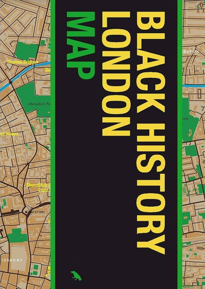
Jody Burton and Avril Nanton identify and reveal London’s most significant Black historical landmarks. Featuring fifty locations, descriptions, original photography, and an introduction to the history and impact of Black people in London, from the Roman era to Black Lives Matter, "Black History London Map" provides unique insight into an essential component of historical(...)
$18.95
(available to order)
Summary:
Jody Burton and Avril Nanton identify and reveal London’s most significant Black historical landmarks. Featuring fifty locations, descriptions, original photography, and an introduction to the history and impact of Black people in London, from the Roman era to Black Lives Matter, "Black History London Map" provides unique insight into an essential component of historical(...)
Subject:
Architectural Plans and Cartography
Architectural Plans and Cartography
Publication:
August 2025
August 2025
Title:
Black history New York map: Guide to Black historical landmarks in New York City
Actions:
Price:
$18.95
(available to order)
Summary:
Jody Burton and Avril Nanton identify and reveal London’s most significant Black historical landmarks. Featuring fifty locations, descriptions, original photography, and an introduction to the history and impact of Black people in London, from the Roman era to Black Lives Matter, "Black History London Map" provides unique insight into an essential component of historical and modern London. Featuring original photography by Jake Green.
Form:
books
books
Publication:
August 2025
August 2025
Subject:
Architectural Plans and Cartography
Architectural Plans and Cartography
Form:
books
books
Price:
$18.95
(available in store)
Summary:
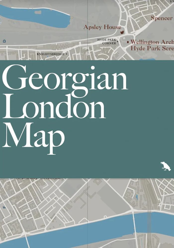
Celebrate and explore one of London’s iconic architectural eras with "Georgian London Map." Written by scholar and author Owen Hopkins, with original photography by Will Scott, the map identifies a broad variety of 18th and early 19th century buildings and squares embodying Georgian architecture. "Georgian London Map" is our latest title focused on London architecture and(...)
$18.95
(available in store)
Summary:
Celebrate and explore one of London’s iconic architectural eras with "Georgian London Map." Written by scholar and author Owen Hopkins, with original photography by Will Scott, the map identifies a broad variety of 18th and early 19th century buildings and squares embodying Georgian architecture. "Georgian London Map" is our latest title focused on London architecture and(...)
Title:
Georgian London Map: Guide to London's Georgian era architecture
Actions:
Price:
$18.95
(available in store)
Summary:
Celebrate and explore one of London’s iconic architectural eras with "Georgian London Map." Written by scholar and author Owen Hopkins, with original photography by Will Scott, the map identifies a broad variety of 18th and early 19th century buildings and squares embodying Georgian architecture. "Georgian London Map" is our latest title focused on London architecture and design, following maps dedicated to the works of Wren and Hawksmoor, and a series of 20th and 21st century guides.
Form:
books
books
Publication:
June 2025
June 2025
Subject:
Architectural Plans and Cartography
Architectural Plans and Cartography
Form:
books
books
Actions:
Price:
$18.95
(available to order)
Summary:
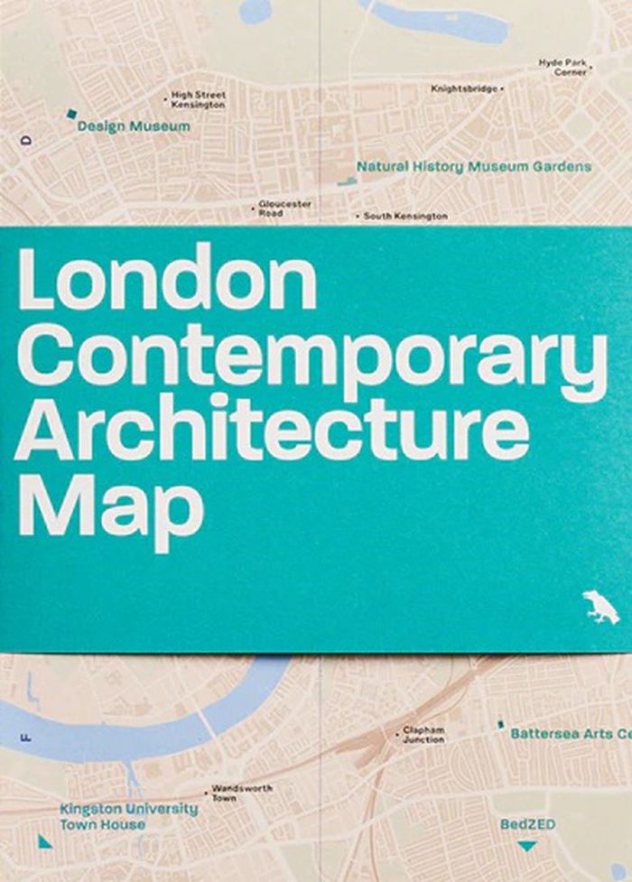
Explore highlights of contemporary architecture built across London from 2000 to 2025 with this two-sided map by Olly Wainwright. The map features 50 projects, from museums and major redevelopments to social housing and urban gardens, alongside an introduction, building details and original photography.
$18.95
(available to order)
Summary:
Explore highlights of contemporary architecture built across London from 2000 to 2025 with this two-sided map by Olly Wainwright. The map features 50 projects, from museums and major redevelopments to social housing and urban gardens, alongside an introduction, building details and original photography.
Title:
London contemporary architecture Map
Actions:
Price:
$18.95
(available to order)
Summary:
Explore highlights of contemporary architecture built across London from 2000 to 2025 with this two-sided map by Olly Wainwright. The map features 50 projects, from museums and major redevelopments to social housing and urban gardens, alongside an introduction, building details and original photography.
Form:
books
books
Publication:
June 2025
June 2025
Subject:
Architectural Plans and Cartography
Architectural Plans and Cartography
Form:
books
books
Actions:
Price:
$18.95
(available in store)
Summary:
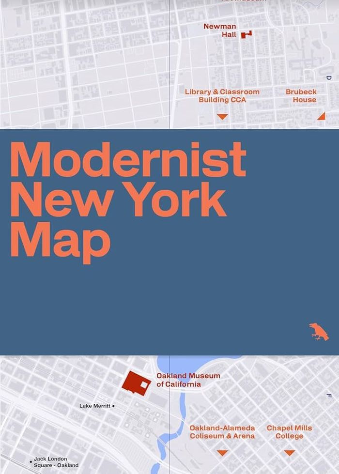
Explore New York City’s rich legacy of modernist architecture with this beautifully designed, two-sided map guide by Allison C. Meier, featuring original photography by Jason Woods. Showcasing iconic buildings by visionaries such as Philip Johnson, Ludwig Mies van der Rohe, Frank Lloyd Wright, Eero Saarinen and I.M. Pei, the guide details buildings, architects, years(...)
$18.95
(available in store)
Summary:
Explore New York City’s rich legacy of modernist architecture with this beautifully designed, two-sided map guide by Allison C. Meier, featuring original photography by Jason Woods. Showcasing iconic buildings by visionaries such as Philip Johnson, Ludwig Mies van der Rohe, Frank Lloyd Wright, Eero Saarinen and I.M. Pei, the guide details buildings, architects, years(...)
Title:
Modernist New York Map: Guide to 20th century modern architecture in New York City
Actions:
Price:
$18.95
(available in store)
Summary:
Explore New York City’s rich legacy of modernist architecture with this beautifully designed, two-sided map guide by Allison C. Meier, featuring original photography by Jason Woods. Showcasing iconic buildings by visionaries such as Philip Johnson, Ludwig Mies van der Rohe, Frank Lloyd Wright, Eero Saarinen and I.M. Pei, the guide details buildings, architects, years built and addresses. Discover works by pioneers like Louis Kahn, Marcel Breuer, Vertner Woodson Tandy and more. With an engaging introduction to 20th-century architecture in NYC, this guide is an essential companion for design enthusiasts, architects and urban explorers alike.
Form:
books
books
Publication:
July 2025
July 2025
Subject:
Architectural Plans and Cartography
Architectural Plans and Cartography
Form:
books
books
Title:
Mappa Mundi
Mappa Mundi
Actions:
Price:
$46.95
(available in store)
Summary:
Cartographier le monde, c’est plus que le mesurer : c’est l’imaginer, le raconter, le discuter. De la mappemonde médiévale aux planisphères numériques, ce florilège traverse époques et cultures pour montrer comment une image plane peut embrasser l’inconnu, dire le pouvoir, nourrir la science, la foi et les rêves de voyage. Projections, mythes, symboles : le monde s’y(...)
Subject:
Architectural Plans and Cartography
Architectural Plans and Cartography
Publication:
December 2025
December 2025
Title:
Mappa Mundi
Actions:
Price:
$46.95
(available in store)
Summary:
Cartographier le monde, c’est plus que le mesurer : c’est l’imaginer, le raconter, le discuter. De la mappemonde médiévale aux planisphères numériques, ce florilège traverse époques et cultures pour montrer comment une image plane peut embrasser l’inconnu, dire le pouvoir, nourrir la science, la foi et les rêves de voyage. Projections, mythes, symboles : le monde s’y déforme et se révèle tout à la fois. « Mappa Mundi » souligne la force des images et la nécessité de décrypter les cartes… sans oublier de faire une place à la poésie.
Form:
books
books
Publication:
December 2025
December 2025
Subject:
Architectural Plans and Cartography
Architectural Plans and Cartography
Form:
books
books
Title:
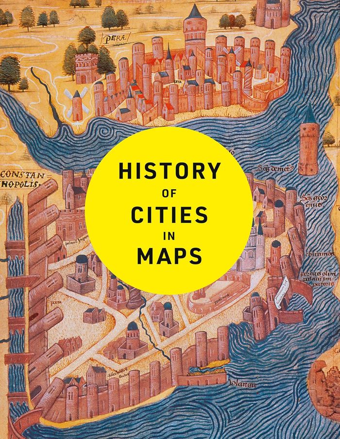
History of cities in maps
History of cities in maps
Actions:
Price:
$50.00
(available in store)
Summary:
The city: a concept nearly as old as history itself, it is a paradox of human innovation and intervention, order and conflict. From ancient civilizations to modern-day metropolises, maps have played a crucial role in urban progress. This book explores the development of cities through more than 70 captivating maps. Each map in this beautifully designed volume gives a(...)
Title:
History of cities in maps
Actions:
Price:
$50.00
(available in store)
Summary:
The city: a concept nearly as old as history itself, it is a paradox of human innovation and intervention, order and conflict. From ancient civilizations to modern-day metropolises, maps have played a crucial role in urban progress. This book explores the development of cities through more than 70 captivating maps. Each map in this beautifully designed volume gives a unique visual representation of and historical context to the city it surveys. Spanning more than 9,000 years, this book expertly curates more than 70 historical maps which tell the fascinating story of human civilization: from cities founded on sacred places, ideas and power, to early examples of town planning and later innovations such as skyscrapers and urban transport.
Form:
books
books
Publication:
January 2025
January 2025
Subject:
Architectural Plans and Cartography
Architectural Plans and Cartography
Form:
books
books
Actions:
Price:
$44.00
(available to order)
Summary:
The life and legend of New York City, from the size of its skyscrapers to the ways of its inhabitants, is vividly captured in this collection of more than 250 maps, cross sections, ?owcharts, tables, board games, cartoons and infographics, and other unique diagrams spanning 150 years. Superstars such as Saul Steinberg, Maira Kalman, Christoph Niemann, Roz Chast, and(...)
Subject:
Architectural Plans and Cartography
Architectural Plans and Cartography
Publication:
April 2021
April 2021
Title:
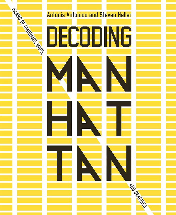
Decoding Manhattan: island of diagrams, maps, and graphics
Actions:
Price:
$44.00
(available to order)
Summary:
The life and legend of New York City, from the size of its skyscrapers to the ways of its inhabitants, is vividly captured in this collection of more than 250 maps, cross sections, ?owcharts, tables, board games, cartoons and infographics, and other unique diagrams spanning 150 years. Superstars such as Saul Steinberg, Maira Kalman, Christoph Niemann, Roz Chast, and Milton Glaser butt up against the unsung heroes of the popular press in a book that is made not only for lovers of New York but also for anyone who enjoys or works with information design.
Form:
books
books
Publication:
April 2021
April 2021
Subject:
Architectural Plans and Cartography
Architectural Plans and Cartography
Form:
books
books
Title:
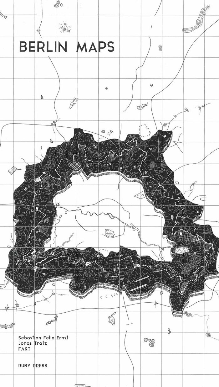
Berlin Maps
Berlin Maps
Actions:
Price:
$48.00
(available to order)
Summary:
Over the past century, Berlin has undergone countless transformations. Rapid growth, destruction, survival, and finally a halting revival as a twin city reunited once more. This last phase has been characterised by stagnation and even shrinkage, which in turn strengthened Berlin’s unusual configuration as a polycentric settlement with no clear core. This atlas of the(...)
Subject:
Architectural Plans and Cartography
Architectural Plans and Cartography
Publication:
March 2021
March 2021
Title:
Berlin Maps
Actions:
Price:
$48.00
(available to order)
Summary:
Over the past century, Berlin has undergone countless transformations. Rapid growth, destruction, survival, and finally a halting revival as a twin city reunited once more. This last phase has been characterised by stagnation and even shrinkage, which in turn strengthened Berlin’s unusual configuration as a polycentric settlement with no clear core. This atlas of the special, strange, or undiscovered phenomena of the German capital is structured in eighteen chapters and offers a fascinating insider’s look at its architectural geography, urban history, political upheavals, scenic spaces, curiosities, and more.
Form:
books
books
Publication:
March 2021
March 2021
Subject:
Architectural Plans and Cartography
Architectural Plans and Cartography
Form:
books
books
Price:
$38.99
(available in store)
Summary:
It is perhaps the eighth wonder of our world that despite modern mapping and satellite photography our planet continues to surprise us. Hidden lairs beneath layers of rock, forgotten cities rising out of deserted lands and even mankind's own feats of engineering eccentricity lie in the most unusual of destinations. Travis Elborough goes in search of the obscure and(...)
Title:
Atlas of improbable places: a journey to the world's most unusual corners
Actions:
Price:
$38.99
(available in store)
Summary:
It is perhaps the eighth wonder of our world that despite modern mapping and satellite photography our planet continues to surprise us. Hidden lairs beneath layers of rock, forgotten cities rising out of deserted lands and even mankind's own feats of engineering eccentricity lie in the most unusual of destinations. Travis Elborough goes in search of the obscure and bizarre, the beautiful and estranged. Taking in the defiant relics of ancient cities such as Ani, a once thriving metropolis lost to conquered lands, and the church tower of San Juan Parangaricuto, that miraculously stands as the sole survivor of a town sunk by lava. Through the labyrinths of Berlin and Beijing - underground realms dug for refuge, espionage and even, as Canada's Moose Jaw, used as the playground for gangsters trading liquor and money over cards. Never forgetting the freaks and wonders of nature's own unusual masterpieces: the magical underground river shaped like a dragon's mouth in the Philippines and the floating world of Palmerston. With beautiful maps and stunning photography illustrating each destination, Atlas of Improbable Places is a fascinating voyage to the world's most incredible destinations. As the Island of Dolls and the hauntingly titled Door to Hell - an inextinguishable fire pit - attest, mystery is never far away. The truths and myths behind their creation are as varied as the destinations themselves. Standing as symbols of worship, testaments to kingships or even the strange and wonderful traditions of old and new, these curious places are not just extraordinary sights but reflections on man's own relationship with the world around us
Form:
books
books
Publication:
October 2016
October 2016
Subject:
Architectural Plans and Cartography
Architectural Plans and Cartography
Form:
books
books
Actions:
Price:
$109.00
(available to order)
Summary:
"Third coast atlas: prelude to a plan" describes the conditions for urbanization across the Great Lakes region. It assembles a multi-layered, empirical description of urbanization processes within the drainage basins of the five Great Lakes and the Saint Lawrence River. This thick description encompasses a range of representational forms including maps, plans, diagrams,(...)
Subject:
Architectural Plans and Cartography
Architectural Plans and Cartography
Publication:
June 2017
June 2017
Title:
Third coast atlas: prelude to a plan
Actions:
Price:
$109.00
(available to order)
Summary:
"Third coast atlas: prelude to a plan" describes the conditions for urbanization across the Great Lakes region. It assembles a multi-layered, empirical description of urbanization processes within the drainage basins of the five Great Lakes and the Saint Lawrence River. This thick description encompasses a range of representational forms including maps, plans, diagrams, timelines, and photographs, as well as speculative design research projects and critical texts. Postponing diagnosis, let alone treatment of these conditions, Third Coast Atlas aspires to simply describe. It proposes a new geographic gestalt for urban analysis. Superimposed upon the North American continent, and with easily recognizable yet divergent political and geological borders, this megaregion traverses portions of eight U.S. states and two Canadian provinces, as well as the world’s largest collection of surficial fresh water. Third Coast Atlas characterizes the littoral edge as a distinct field of urbanization, and constructs a reading of the region both specific and speculative.
Form:
books
books
Publication:
June 2017
June 2017
Subject:
Architectural Plans and Cartography
Architectural Plans and Cartography