705 Results
Form:
books
books
Actions:
Price:
$32.95
(available to order)
Summary:
Published to coincide with an exhibition at Chicago’s Newberry Library, Mapping Manifest Destiny: Chicago and the American West charts the historic role maps have played in imagining, understanding, promoting, and exploiting the Western frontier of North America. Featuring more than sixty full-color maps and views from the sixteenth through the twentieth centuries, this(...)
Subject:
Architectural Plans and Cartography
Architectural Plans and Cartography
Publication:
August 2008, Chicago
August 2008, Chicago
Title:
Mapping manifest destiny: Chicago and the American West
Actions:
Price:
$32.95
(available to order)
Summary:
Published to coincide with an exhibition at Chicago’s Newberry Library, Mapping Manifest Destiny: Chicago and the American West charts the historic role maps have played in imagining, understanding, promoting, and exploiting the Western frontier of North America. Featuring more than sixty full-color maps and views from the sixteenth through the twentieth centuries, this fascinating book documents how maps encouraged Euro-Americans to see the West as a land of promise. Maps helped visualize a nation destined to expand across the continent to the Pacific Ocean. Curators Michael P. Conzen and Diane Dillon present an interpretively rich, carefully researched selection of items drawing on the Newberry’s superb collections of historic maps and Western Americana. They have organized the book into four sections: maps for empire, maps for building a new nation, maps for enlightenment, and maps for business.
Form:
books
books
Publication:
August 2008, Chicago
August 2008, Chicago
Subject:
Architectural Plans and Cartography
Architectural Plans and Cartography
Form:
books
books
Actions:
Price:
$71.95
(available to order)
Summary:
Critically reflecting on elements of mapping and imperialism from the late seventeenth century to the early twentieth century, the essays discuss the nature of the imperial map through a series of case studies of empires, from the Qing dynasty of China, to the Portuguese empire in South America, to American imperial pretensions in the Pacific Ocean, among others.(...)
Subject:
Architectural Plans and Cartography
Architectural Plans and Cartography
Publication:
January 2009, Chicago
January 2009, Chicago
Title:
The imperial map cartography and the mastery of empire
Actions:
Price:
$71.95
(available to order)
Summary:
Critically reflecting on elements of mapping and imperialism from the late seventeenth century to the early twentieth century, the essays discuss the nature of the imperial map through a series of case studies of empires, from the Qing dynasty of China, to the Portuguese empire in South America, to American imperial pretensions in the Pacific Ocean, among others. Collectively, the essays reveal that the relationship between mapping and imperialism, as well as the practice of political and economic domination of weak polities by stronger ones, is a rich and complex historical theme that continues to resonate in our modern day.
Form:
books
books
Publication:
January 2009, Chicago
January 2009, Chicago
Subject:
Architectural Plans and Cartography
Architectural Plans and Cartography
Form:
books
books
Actions:
Price:
$72.00
(available to order)
Summary:
Mapping London: Making Sense of the City is a beautiful, compelling anthology of over six centuries of London maps, tracing the mesmerizing evolution of the city and exploring the hopes and fears of its inhabitants as history unfolds. The book is a cartographic journey, charting the influence of Roman city planning, Saxon feudalism, Medieval tumult, imperial hubris,(...)
Title:
Mapping London: making sense of the city
Actions:
Price:
$72.00
(available to order)
Summary:
Mapping London: Making Sense of the City is a beautiful, compelling anthology of over six centuries of London maps, tracing the mesmerizing evolution of the city and exploring the hopes and fears of its inhabitants as history unfolds. The book is a cartographic journey, charting the influence of Roman city planning, Saxon feudalism, Medieval tumult, imperial hubris, contemporary town planning and more on this great metropolis. In this comprehensive survey the maps are allowed to speak for themselves, revealing not only their political and social context, but also the dreams of their makers and the drama of their creation. Often these maps are objects of great skill and beauty and the names of the greatest of their makers are still revered today. A lavishly illustrated hardback book, Mapping London explores the city through the ages in all its labyrinthine glory.
Form:
books
books
Publication:
January 2008, London
January 2008, London
Subject:
Architectural Plans and Cartography
Architectural Plans and Cartography
Form:
books
books
Title:
Transit maps of the world
Transit maps of the world
Actions:
Price:
$27.50
(available to order)
Summary:
Transit Maps of the World is the first, and only, comprehensive collection of every rapid-transit system map on earth. Using glorious graphics, Mark Ovenden traces the history of mass transit - including rare and historic maps, diagrams, and photographs, some available for the first time since their original publication. Transit Maps is a coffee-table essential for anyone(...)
Subject:
Architectural Plans and Cartography
Architectural Plans and Cartography
Publication:
October 2007, New York, Toronto, London
October 2007, New York, Toronto, London
Title:
Transit maps of the world
Actions:
Price:
$27.50
(available to order)
Summary:
Transit Maps of the World is the first, and only, comprehensive collection of every rapid-transit system map on earth. Using glorious graphics, Mark Ovenden traces the history of mass transit - including rare and historic maps, diagrams, and photographs, some available for the first time since their original publication. Transit Maps is a coffee-table essential for anyone who's ever traveled in a city, as well as a graphic designer's bible, a transport enthusiast's dream, and the ideal gift for the most challenging relative! Pick up Transit Maps of the World for a truly unusual journey.
Form:
books
books
Publication:
October 2007, New York, Toronto, London
October 2007, New York, Toronto, London
Subject:
Architectural Plans and Cartography
Architectural Plans and Cartography
Form:
books
books
Actions:
Price:
$69.95
(available to order)
Summary:
An Atlas of Agendas is a political, social and economic atlas: informing the public about socio-political power structures and activating opportunities for the self and the commons. The French research and design group Bureau d´Études has been producing maps of contemporary political, social and economic systems that allow people to inform, reposition and empower(...)
Subject:
Architectural Plans and Cartography
Architectural Plans and Cartography
Publication:
March 2020
March 2020
Title:
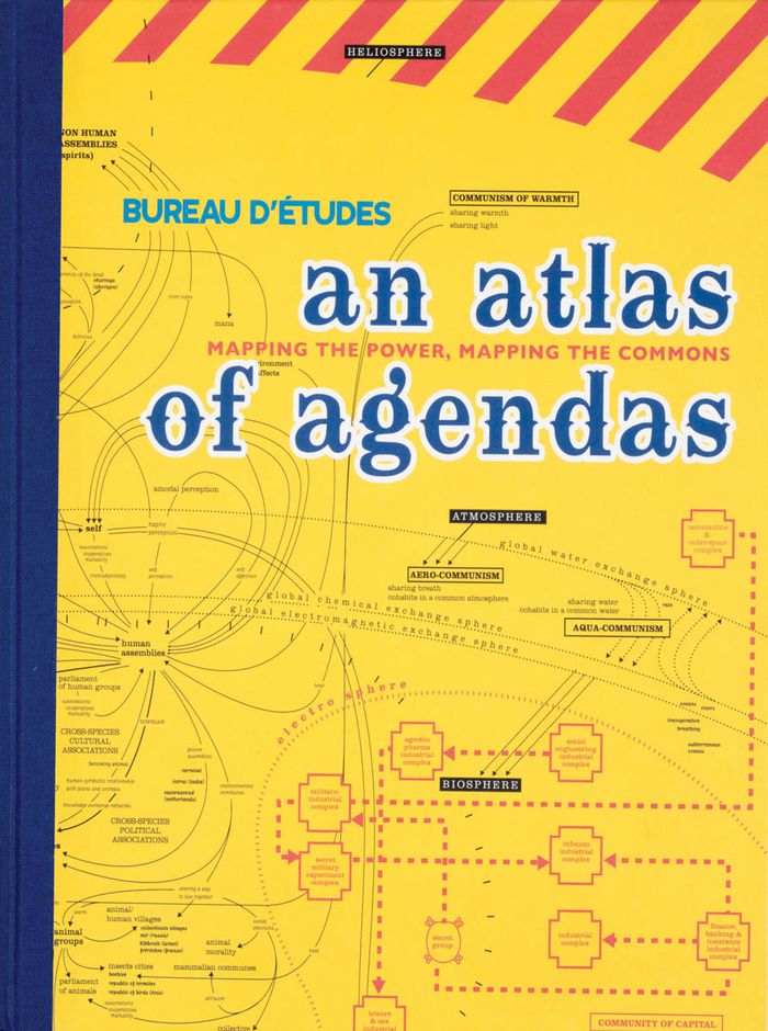
An atlas of agendas: mapping the power, mapping the commons
Actions:
Price:
$69.95
(available to order)
Summary:
An Atlas of Agendas is a political, social and economic atlas: informing the public about socio-political power structures and activating opportunities for the self and the commons. The French research and design group Bureau d´Études has been producing maps of contemporary political, social and economic systems that allow people to inform, reposition and empower themselves. Revealing what normally remains invisible, often in the shape of large-sized banners, and contextualizing apparently separate elements within new frameworks, these visualizations of interests and relations re-articulate the dominant symbolic order and actualize existing structures that otherwise remain concealed and unknown. This large-size hardcover book, panoramic in scope and theoretically both profound and accessible, is THE atlas for an emancipatory new citizenship that utilizes the opportunities of info-graphics from the local to the global and back again.
Form:
books
books
Publication:
March 2020
March 2020
Subject:
Architectural Plans and Cartography
Architectural Plans and Cartography
Form:
books
books
Price:
$124.95
(available to order)
Summary:
This atlas presents over hundred years of Ng’ambo’s history and urban development through maps, plans, surveys and images, and provides insights into its present-day cultural landscape through subjects such as architecture, toponymy, cultural activities, public recreation, places for social interaction, handcrafts and urban heritage.
Subject:
Architectural Plans and Cartography
Architectural Plans and Cartography
Publication:
January 2019
January 2019
Title:
Ng’ambo Atlas: historic urban landscape of Zanzibar town’s ‘other side’
Actions:
Price:
$124.95
(available to order)
Summary:
This atlas presents over hundred years of Ng’ambo’s history and urban development through maps, plans, surveys and images, and provides insights into its present-day cultural landscape through subjects such as architecture, toponymy, cultural activities, public recreation, places for social interaction, handcrafts and urban heritage.
Form:
books
books
Publication:
January 2019
January 2019
Subject:
Architectural Plans and Cartography
Architectural Plans and Cartography
Form:
books
books
Actions:
Price:
$44.95
(available to order)
Summary:
Many people have a love of maps. But what lies behind the process of map-making? How have cartographers through the centuries developed their craft and established a language of maps which helps them to better represent our world and help users to understand it? This book tells the story of how widely accepted mapping conventions originated and evolved—from map(...)
Title:
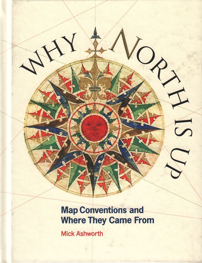
Why North is up: map conventions and where they came from
Actions:
Price:
$44.95
(available to order)
Summary:
Many people have a love of maps. But what lies behind the process of map-making? How have cartographers through the centuries developed their craft and established a language of maps which helps them to better represent our world and help users to understand it? This book tells the story of how widely accepted mapping conventions originated and evolved—from map orientation, projections, typography, and scale, to the use of color, symbols, ways of representing relief, and the treatment of boundaries and place names. It charts the fascinating story of how conventions have changed in response to new technologies and ever-changing mapping requirements, how symbols can be a matter of life or death, why universal acceptance of conventions can be difficult to achieve, and how new mapping conventions are developing to meet the needs of modern cartography. "Why North is Up" offers a guide to the sometimes hidden techniques of map-making through the centuries.
Form:
books
books
Publication:
December 2019
December 2019
Subject:
Architectural Plans and Cartography
Architectural Plans and Cartography
Form:
books
books
Title:
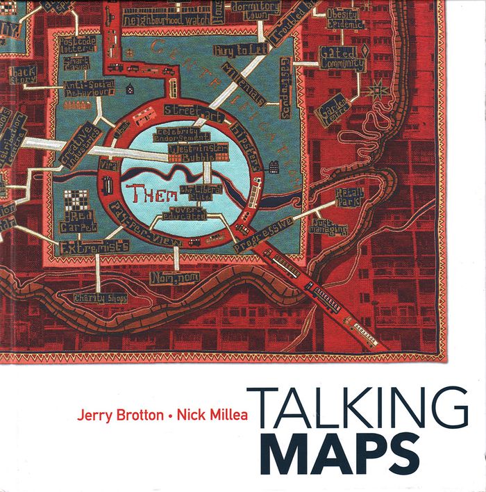
Talking maps
Talking maps
Actions:
Price:
$74.95
(available to order)
Summary:
Every map tells a story. Some provide a narrative for travelers, explorers, and surveyors or offer a visual account of changes to people’s lives and surroundings, while others tell imaginary tales, transporting us to fictional worlds created by writers and artists. In turn, maps generate more stories, taking users on new journeys in search of knowledge and adventure. By(...)
Subject:
Architectural Plans and Cartography
Architectural Plans and Cartography
Publication:
November 2019
November 2019
Title:
Talking maps
Actions:
Price:
$74.95
(available to order)
Summary:
Every map tells a story. Some provide a narrative for travelers, explorers, and surveyors or offer a visual account of changes to people’s lives and surroundings, while others tell imaginary tales, transporting us to fictional worlds created by writers and artists. In turn, maps generate more stories, taking users on new journeys in search of knowledge and adventure. By telling the stories behind the artifacts and those generated by them, "Talking Maps " reveals how each map is not just a tool for navigation but also a worldly proposal that helps us to understand who we are by describing where we are.
Form:
books
books
Publication:
November 2019
November 2019
Subject:
Architectural Plans and Cartography
Architectural Plans and Cartography
Form:
books
books
Price:
$70.00
(available to order)
Summary:
This is the first book to catalog comparative maps and tableaux that visualize the heights and lengths of the world's mountains and rivers. Produced predominantly in the nineteenth century, these maps emerged out of the tide of exploration and scientific developments in measuring techniques. Beginning with the work of explorer Alexander von Humboldt, these historic(...)
Subject:
Architectural Plans and Cartography
Architectural Plans and Cartography
Publication:
September 2019
September 2019
Title:
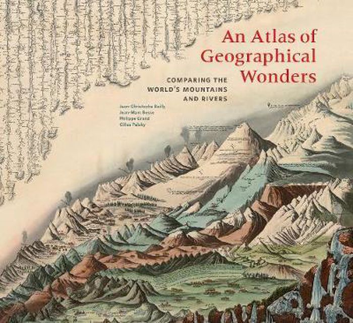
An atlas of geographical wonders: from mountaintops to riverbeds
Actions:
Price:
$70.00
(available to order)
Summary:
This is the first book to catalog comparative maps and tableaux that visualize the heights and lengths of the world's mountains and rivers. Produced predominantly in the nineteenth century, these maps emerged out of the tide of exploration and scientific developments in measuring techniques. Beginning with the work of explorer Alexander von Humboldt, these historic drawings reveal a world of artistic and imaginative difference. Many of them give way—and with visible joy—to the power of fantasy in a mesmerizing array of realistic and imaginary forms. Most of the maps are from the David Rumsey Historical Map Collection at Stanford University.
Form:
books
books
Publication:
September 2019
September 2019
Subject:
Architectural Plans and Cartography
Architectural Plans and Cartography
Form:
books
books
Actions:
Price:
$20.95
(available to order)
Summary:
Sean C. Jackson has been illustrating and exploring mazes for his own enjoyment for more than 30 years. Inspired by art, architecture, and the natural world, his colorfully detailed mazes offer imaginative and meditative journeys through village streets, garden vistas, island habitats, castle grounds, scenic towns, and gravity-defying surreal situations—each encouraging(...)
Title:
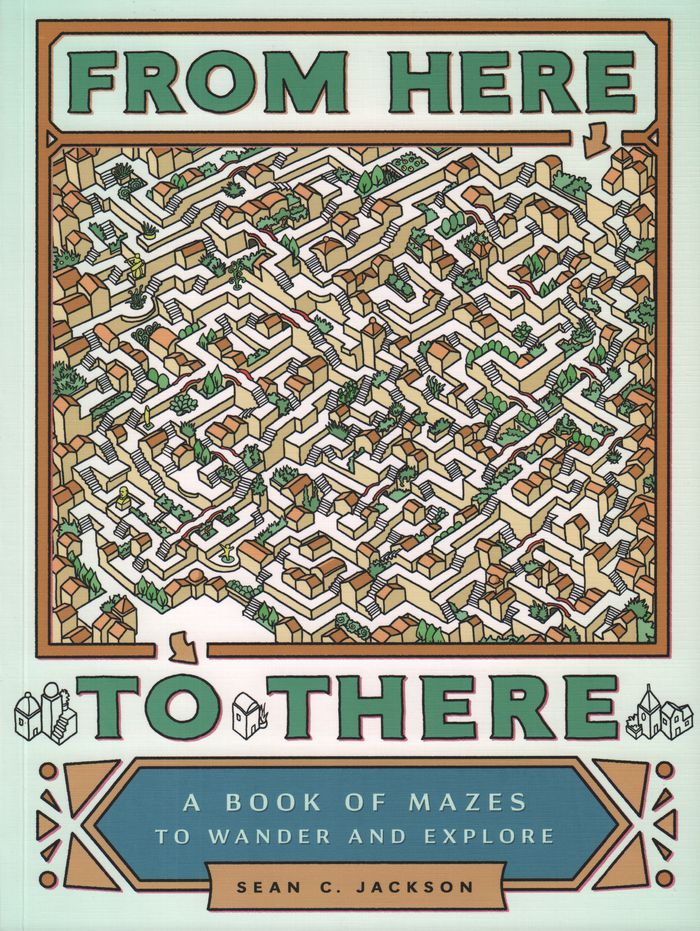
From here to there : a book of mazes to wander and explore
Actions:
Price:
$20.95
(available to order)
Summary:
Sean C. Jackson has been illustrating and exploring mazes for his own enjoyment for more than 30 years. Inspired by art, architecture, and the natural world, his colorfully detailed mazes offer imaginative and meditative journeys through village streets, garden vistas, island habitats, castle grounds, scenic towns, and gravity-defying surreal situations—each encouraging the mind to wander while following the paths. This large-format collection features nearly 50 absorbing single-page and full-spread mazes, sequenced with increasing complexity, and includes inventive bonuses such as mazes with two paths to follow and a maze that runs on the inside covers from front to back. Solutions are provided, but for those seeking mindful activity or hours of puzzle decoding entertainment, getting there will be half the fun.
Form:
books
books
Publication:
February 2017
February 2017
Subject:
Architectural Plans and Cartography
Architectural Plans and Cartography