705 Results
Form:
books
books
Actions:
Price:
$50.00
(available to order)
Summary:
This collection of maps explores the unique personalities of 28 cities around the world, shedding light on the strange and marvelous ways in which humans interact with the places they call home. Artist and creative cartographer Adam Dant dissects Manhattan in an anatomical diagram, traces the form of a Picasso nude in the streets of Monaco, and transforms the(...)
Title:
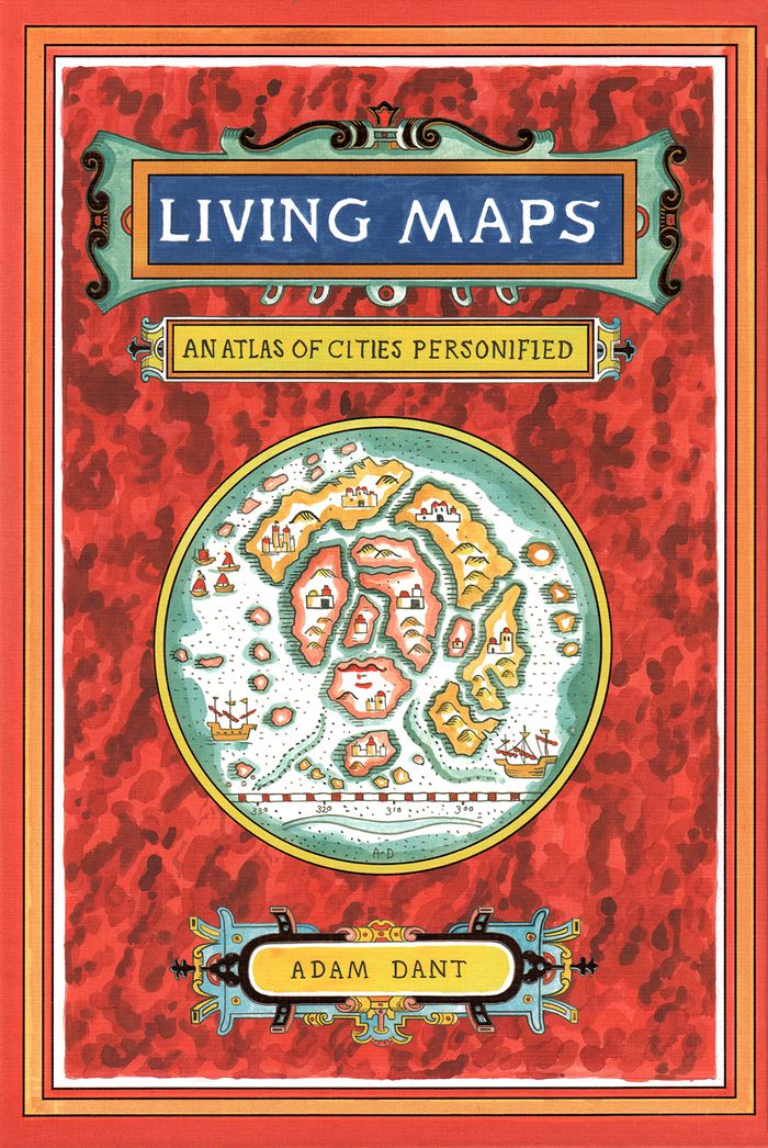
Living maps: an atlas of cities personified
Actions:
Price:
$50.00
(available to order)
Summary:
This collection of maps explores the unique personalities of 28 cities around the world, shedding light on the strange and marvelous ways in which humans interact with the places they call home. Artist and creative cartographer Adam Dant dissects Manhattan in an anatomical diagram, traces the form of a Picasso nude in the streets of Monaco, and transforms the crisscrossing paths of boats on the Bosporus into the nerves of Istanbul. Dant draws on the history, culture, and geography of each city and on the beguiling aesthetic of antique maps to create gorgeous works of cartographic art. Witty, insightful, and adorned with a gold foil–stamped cover, this book will capture the imaginations of travelers, map enthusiasts, history buffs, and dreamers.
Form:
books
books
Publication:
October 2018
October 2018
Subject:
Architectural Plans and Cartography
Architectural Plans and Cartography
Form:
books
books
Actions:
Price:
$42.99
(available to order)
Summary:
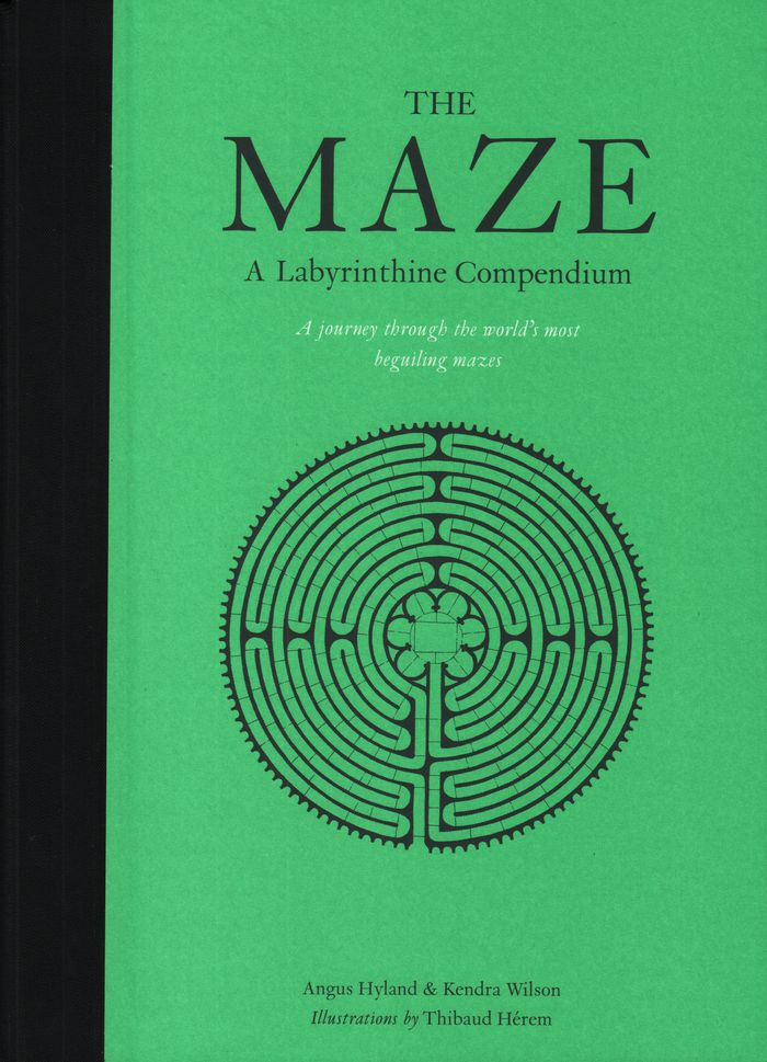
Mazes have been a part of civilization for at least 4,000 years, and there are more being built now than ever before. What is it about these magical life-size puzzles that continues to intrigue us? The illustrations represent 60 real and imagined mazes from around the world, with a bird’s eye view of each maze. Each maze is also accompanied by a short history.
$42.99
(available to order)
Summary:
Mazes have been a part of civilization for at least 4,000 years, and there are more being built now than ever before. What is it about these magical life-size puzzles that continues to intrigue us? The illustrations represent 60 real and imagined mazes from around the world, with a bird’s eye view of each maze. Each maze is also accompanied by a short history.
Subject:
Architectural Plans and Cartography
Architectural Plans and Cartography
Publication:
September 2018
September 2018
Title:
The maze: a labyrinthine compendium
Actions:
Price:
$42.99
(available to order)
Summary:
Mazes have been a part of civilization for at least 4,000 years, and there are more being built now than ever before. What is it about these magical life-size puzzles that continues to intrigue us? The illustrations represent 60 real and imagined mazes from around the world, with a bird’s eye view of each maze. Each maze is also accompanied by a short history.
Form:
books
books
Publication:
September 2018
September 2018
Subject:
Architectural Plans and Cartography
Architectural Plans and Cartography
Form:
books
books
Title:
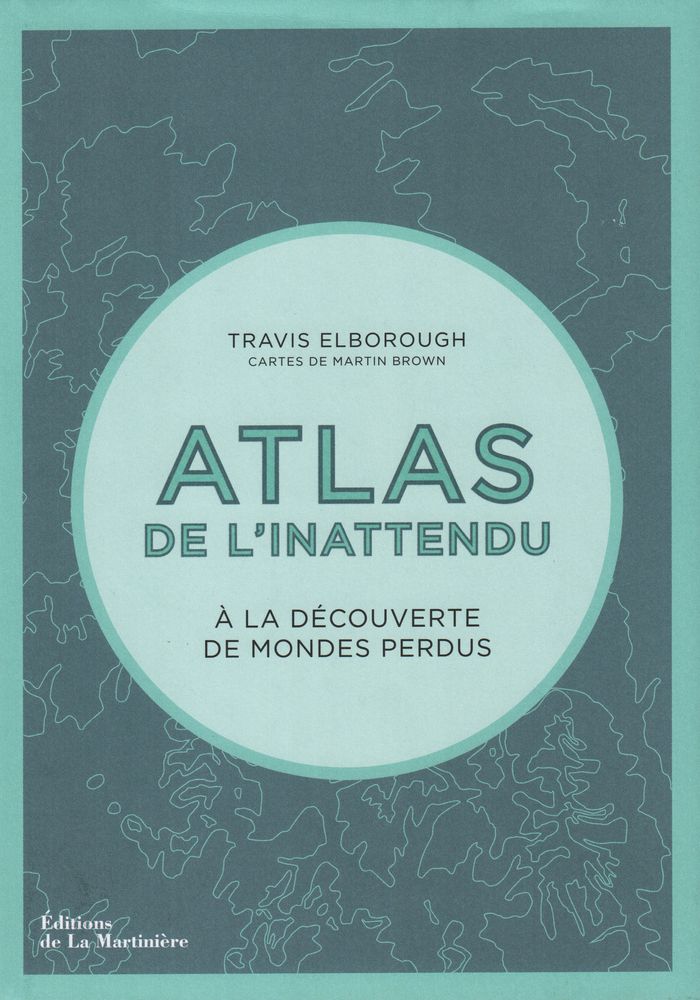
Atlas de l'inattendu
Atlas de l'inattendu
Actions:
Price:
$57.95
(available to order)
Summary:
Dans cette atlas, Travis Elborough poursuit son exploration mondiale des lieux inattendus, des bizarreries architecturales et autres curiosités de notre planète. À partir des cartes de Martin Brown et de documents photographiques, il cultive notre goût de l'insolite et du voyage. Des villages flottants du lac Titicaca aux arbres biscornus de Slope Point en(...)
Title:
Atlas de l'inattendu
Actions:
Price:
$57.95
(available to order)
Summary:
Dans cette atlas, Travis Elborough poursuit son exploration mondiale des lieux inattendus, des bizarreries architecturales et autres curiosités de notre planète. À partir des cartes de Martin Brown et de documents photographiques, il cultive notre goût de l'insolite et du voyage. Des villages flottants du lac Titicaca aux arbres biscornus de Slope Point en Nouvelle-Zélande, des hauteurs vertigineuses d'un monastère taoïste à l'écho souterrain d'une grotte aux coquillages, Travis Elborough nous raconte un monde insoupçonné.
Form:
books
books
Publication:
December 2018
December 2018
Subject:
Architectural Plans and Cartography
Architectural Plans and Cartography
Form:
books
books
Title:
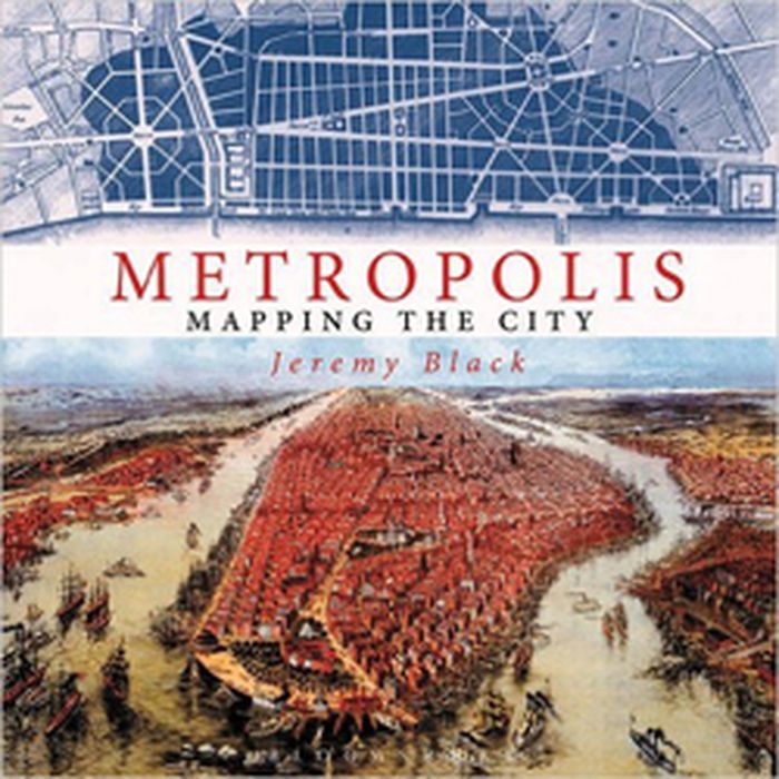
Metropolis: mapping the city
Metropolis: mapping the city
Actions:
Price:
$63.95
(available to order)
Summary:
This volume looks at the development of the mapping and representation of the city revealing how we organize the urban space. From skyline profiles, bird's eye views and panoramas, to the schematic maps of transport networks and road layouts to help us navigate, and statistical maps that can provide information on human aspirations, cities can reveal themselves in many(...)
Title:
Metropolis: mapping the city
Actions:
Price:
$63.95
(available to order)
Summary:
This volume looks at the development of the mapping and representation of the city revealing how we organize the urban space. From skyline profiles, bird's eye views and panoramas, to the schematic maps of transport networks and road layouts to help us navigate, and statistical maps that can provide information on human aspirations, cities can reveal themselves in many ways. Focusing on key points in the development of urban representation and including visions of the future of how we would be living today, this enlightening book illustrates some of the oldest, youngest, liveliest, and most contested cities in the world
Form:
books
books
Publication:
November 2015
November 2015
Subject:
Architectural Plans and Cartography
Architectural Plans and Cartography
Form:
books
books

Actions:
Price:
$59.95
(available to order)
Summary:
Parcourant le monde à travers des cartes de toutes provenances et de toutes époques, l'écrivain de voyage Francisca Mattéoli raconte une vingtaine d'histoires étonnantes sur la géographie des lieux pour comprendre comment les endroits les plus magiques de la planète ont été révélés au plus grand nombre. De la route 66 avec les premiers colons, en passant par la découverte(...)
Title:
Map stories. Histoires de cartes
Actions:
Price:
$59.95
(available to order)
Summary:
Parcourant le monde à travers des cartes de toutes provenances et de toutes époques, l'écrivain de voyage Francisca Mattéoli raconte une vingtaine d'histoires étonnantes sur la géographie des lieux pour comprendre comment les endroits les plus magiques de la planète ont été révélés au plus grand nombre. De la route 66 avec les premiers colons, en passant par la découverte tardive de Petra ou des Maldives, c'est un voyage dans le temps et dans l'espace pour mieux appréhender le monde tel qu'on le connaît aujourd'hui et la place que nous y avons.
Form:
books
books
Publication:
December 2015
December 2015
Subject:
Architectural Plans and Cartography
Architectural Plans and Cartography
Form:
books
books
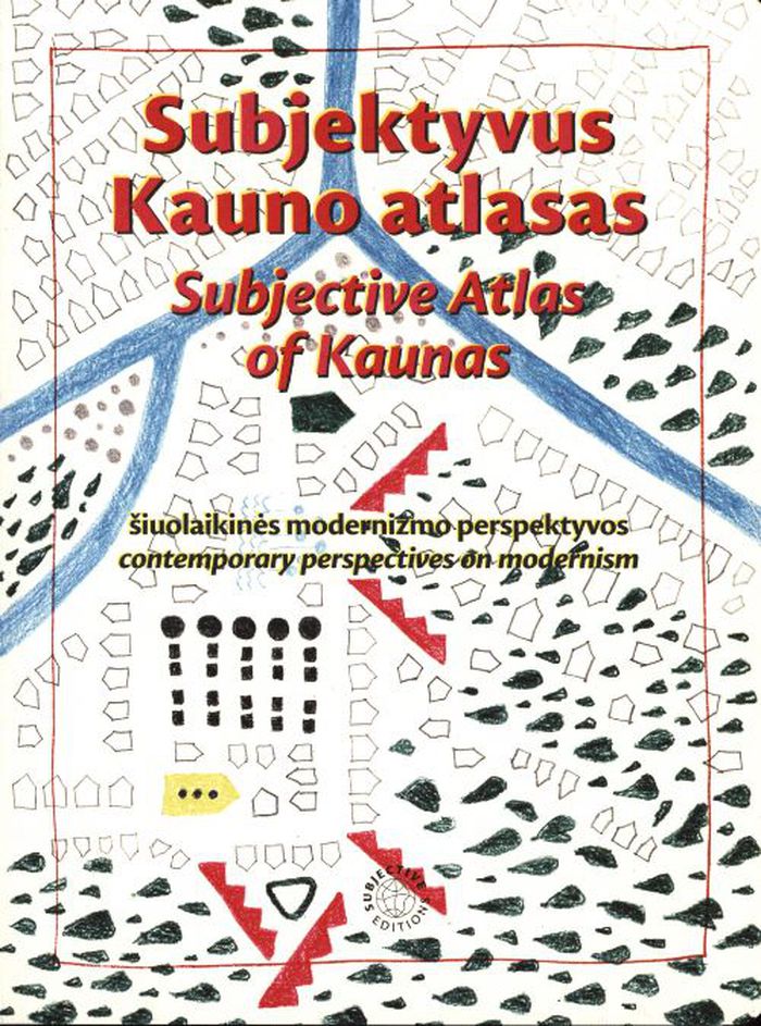
Title:
Subjective atlas of Kaunas
Subjective atlas of Kaunas
Actions:
Price:
$48.00
(available to order)
Summary:
Between 1919 and 1940, Kaunas served as Lithuania’s temporary capital, triggering a massive boom in construction that greatly increased its urban area. For this instalment of the Subjective Atlas series, a group of almost 40 creative residents mapped the contemporary identity of Kaunas through their personal interests, experiences, and domesticity, visualising the(...)
Title:
Subjective atlas of Kaunas
Actions:
Price:
$48.00
(available to order)
Summary:
Between 1919 and 1940, Kaunas served as Lithuania’s temporary capital, triggering a massive boom in construction that greatly increased its urban area. For this instalment of the Subjective Atlas series, a group of almost 40 creative residents mapped the contemporary identity of Kaunas through their personal interests, experiences, and domesticity, visualising the heritage and history of Lithuania’s second-largest city. The book highlights a surprising collection of urban, natural, and everyday spaces and artefacts, inviting readers to reflect on how this material and immaterial modernist heritage is perceived or observed, appreciated or disliked, ignored or associated with.
Form:
books
books
Publication:
March 2022
March 2022
Subject:
Architectural Plans and Cartography
Architectural Plans and Cartography
Form:
books
books
Price:
$66.95
(available to order)
Summary:
Rassemblant des textes rédigés par les meilleurs spécialistes du sujet, J. Dumasy-Rabineau met en évidence l'ampleur du corpus cartographique des XVe et XVIe siècles et engage une étude comparée à l'échelle européenne. Ce recueil fait suite à une exposition aux archives nationales en 2019 qui présentait des cartes locales issues de collections françaises.
Subject:
Architectural Plans and Cartography
Architectural Plans and Cartography
Publication:
September 2022
September 2022
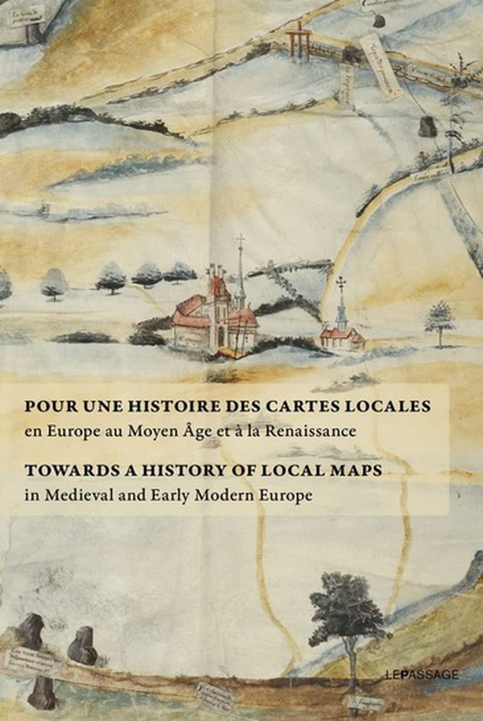
Title:
Pour une histoire des cartes locales / Towards a history of local maps
Actions:
Price:
$66.95
(available to order)
Summary:
Rassemblant des textes rédigés par les meilleurs spécialistes du sujet, J. Dumasy-Rabineau met en évidence l'ampleur du corpus cartographique des XVe et XVIe siècles et engage une étude comparée à l'échelle européenne. Ce recueil fait suite à une exposition aux archives nationales en 2019 qui présentait des cartes locales issues de collections françaises.
Form:
books
books
Publication:
September 2022
September 2022
Subject:
Architectural Plans and Cartography
Architectural Plans and Cartography
Form:
books
books

Actions:
Price:
$48.95
(available to order)
Summary:
Carried out by designers Moniek Driesse and Annelys de Vet, along with Analía Solomonoff, the Subjective Atlas of Mexico is part of a series of previous subjective atlases where a varied group of artists, designers and photographers who choose personal topics as a starting point to map their cultural identity. Each were asked: what makes a Mexican? what are our likenesses(...)
Subject:
Architectural Plans and Cartography
Architectural Plans and Cartography
Publication:
June 2012
June 2012
Title:
Atlas subjectivo de México / subjective atlas of Mexico
Actions:
Price:
$48.95
(available to order)
Summary:
Carried out by designers Moniek Driesse and Annelys de Vet, along with Analía Solomonoff, the Subjective Atlas of Mexico is part of a series of previous subjective atlases where a varied group of artists, designers and photographers who choose personal topics as a starting point to map their cultural identity. Each were asked: what makes a Mexican? what are our likenesses and what differences do we share? Through its pages the scope of Mexico as a country limited by its borders and its latitudes suddenly vanishes and everyday practices take on new meaning. We can find Mexico reflected in the world, and the world reflected in Mexico. A DVD is included.
Form:
books
books
Publication:
June 2012
June 2012
Subject:
Architectural Plans and Cartography
Architectural Plans and Cartography
Form:
books
books
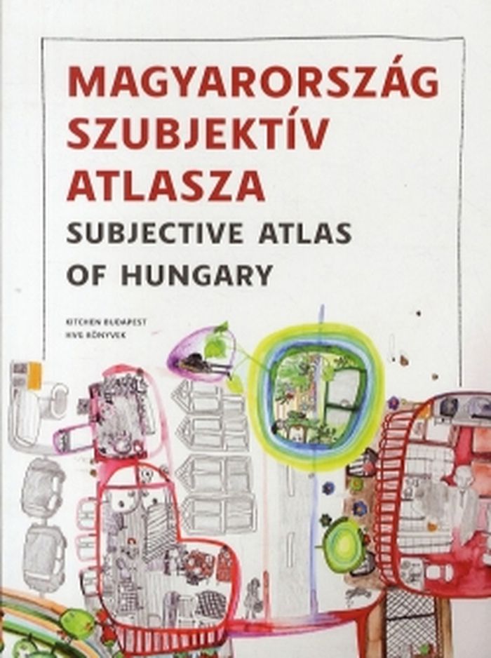
Title:
Subjective atlas of Hungary
Subjective atlas of Hungary
Actions:
Price:
$36.95
(available to order)
Summary:
Is it possible to draw a portrait of contemporary Hungary with only one pencil, held by many? Could we map this country at all with its controversial optimism and pessimism, proud and poetry in one single book? Fifty young visual authors were invited by new media lab Kitchen and Dutch designer Annelys de Vet to put their homeland in perspective. Together they shed light(...)
Title:
Subjective atlas of Hungary
Actions:
Price:
$36.95
(available to order)
Summary:
Is it possible to draw a portrait of contemporary Hungary with only one pencil, held by many? Could we map this country at all with its controversial optimism and pessimism, proud and poetry in one single book? Fifty young visual authors were invited by new media lab Kitchen and Dutch designer Annelys de Vet to put their homeland in perspective. Together they shed light on the Hungarian spirit, today, from the most characteristic vernacular buildings to waterside houses and recycled fences, from wine spritzer and salty sticks to vegetable gardens and sold-out products.
Form:
books
books
Publication:
June 2012
June 2012
Subject:
Architectural Plans and Cartography
Architectural Plans and Cartography
Form:
books
books
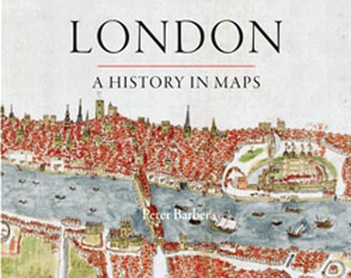
Title:
London: a history in maps
London: a history in maps
Actions:
Price:
$49.95
(available to order)
Summary:
Over the past two thousand years London has developed from a small town into one of the world's largest and most dynamic cities. This book charts that growth and the city's transformation through hundreds of maps culled from the collection of the British Library's Map Library. Including official documents, individual endeavors, hand-drawn renditions, and technologically(...)
Title:
London: a history in maps
Actions:
Price:
$49.95
(available to order)
Summary:
Over the past two thousand years London has developed from a small town into one of the world's largest and most dynamic cities. This book charts that growth and the city's transformation through hundreds of maps culled from the collection of the British Library's Map Library. Including official documents, individual endeavors, hand-drawn renditions, and technologically advanced replicas, these maps represent a variety of perspectives. Utilitarian maps show the city as it is and serve to elucidate its inner workings, while carefully wrought plans show the city as it was envisioned. This book reveals the inside story of the creation, growth, and change of London.
Form:
books
books
Publication:
September 2012
September 2012
Subject:
Architectural Plans and Cartography
Architectural Plans and Cartography