705 Results
Form:
books
books

Actions:
Price:
$43.95
(available to order)
Summary:
"Critical and Clinical Cartographies" rethinks medical and design pedagogies in the context of both the Affective and Digital Turns that are occurring under the umbrella of New Materialism. This collection is framed through Deleuze's symptomalogical approach which creates the ideal terrain for architecture and medical technologies of care to meet with robotics, alongside(...)
Title:
Critical and clinical cartographies: architecture, robotics, medicine, philosophy
Actions:
Price:
$43.95
(available to order)
Summary:
"Critical and Clinical Cartographies" rethinks medical and design pedagogies in the context of both the Affective and Digital Turns that are occurring under the umbrella of New Materialism. This collection is framed through Deleuze's symptomalogical approach which creates the ideal terrain for architecture and medical technologies of care to meet with robotics, alongside the newly emerging 'materialist landscape'.
Form:
books
books
Publication:
September 2018
September 2018
Subject:
Architectural Theory
Architectural Theory
Form:
books
books
Actions:
Price:
$25.00
(available to order)
Summary:
Le lien entre l’extrême droite et la défense de l’environnement n’a rien d’évident. Pourtant, il existe bel et bien une pensée écofasciste au sein de la grande famille des idéologies nationalistes et identitaires. Démographie, tensions entre localisme et universalisme, immigration... Les théories écofascistes sèment un certain trouble dans l’écologie politique. Et même(...)
Title:
La tentation écofaciste : Écologie et extrême droite
Actions:
Price:
$25.00
(available to order)
Summary:
Le lien entre l’extrême droite et la défense de l’environnement n’a rien d’évident. Pourtant, il existe bel et bien une pensée écofasciste au sein de la grande famille des idéologies nationalistes et identitaires. Démographie, tensions entre localisme et universalisme, immigration... Les théories écofascistes sèment un certain trouble dans l’écologie politique. Et même si aucun gouvernement ne s’en est revendiqué, la mouvance, encore embryonnaire, pourrait bien s’intensifier dans les années à venir. «?Il me semble raisonnable de penser que plus la crise écologique s’aggravera, plus les options démocratiques et émancipatrices dont nous disposons pour y faire face s’amenuiseront, et plus au contraire des solutions extrêmes, aujourd’hui encore impensables, risqueront de s’imposer?», écrit Pierre Madelin dans ce livre au carrefour de l’histoire des idées, de la cartographie intellectuelle et de la prospective politique.
Form:
books
books
Publication:
April 2023
April 2023
Subject:
Environment and environmental theory
Environment and environmental theory
Form:
books
books
Actions:
Price:
$39.95
(available to order)
Summary:
Aujourd’hui les projets de territoire, comme les journaux et les télévisions, sont pleins d’images, de cartes, de graphiques... Il ne faut pas s’en plaindre : l’iconographie est un puissant moyen d’expression et l’éventail de plus en plus large de ses outils de représentation constitue une aubaine pour tous ceux qui veulent donner à voir, préfigurer ou simplement(...)
Title:
Figures du projet territorial
Actions:
Price:
$39.95
(available to order)
Summary:
Aujourd’hui les projets de territoire, comme les journaux et les télévisions, sont pleins d’images, de cartes, de graphiques... Il ne faut pas s’en plaindre : l’iconographie est un puissant moyen d’expression et l’éventail de plus en plus large de ses outils de représentation constitue une aubaine pour tous ceux qui veulent donner à voir, préfigurer ou simplement penser ensemble un territoire. Toutefois, à y regarder de près, on acquiert vite le sentiment que le recours à la figure relève majoritairement de démarches empiriques et intuitives. Aussi cet ouvrage propose-t-il un panorama des analyses existantes sur le rôle des images – en particulier dans les démarches prospectives. Il nous présente les méthodes utilisées et une collection des expériences de cartographie participative qui ont cours aujourd’hui en Europe, aux États-Unis et en Afrique.
Form:
books
books
Publication:
April 2004,
April 2004,
Subject:
Urban Theory
Urban Theory
Form:
books
books
Actions:
Price:
$41.95
(available in store)
Summary:
Le jeu est politique. Le jeu est élévation. Il participe à l'invention d'un nouveau monde et à une réinterprétation de la vie. Prenant comme objet l'Internationale situationniste, mouvement contre-culturel culte des années 1957-1972 dont Guy Debord est l'un des fondateurs, Letizia Goretti propose dans cet ouvrage une réflexion sur la force politique et culturelle du jeu.(...)
Title:
Le vertige du jeau : Révolution, jeu et fête dans l'Internationale Situationiste
Actions:
Price:
$41.95
(available in store)
Summary:
Le jeu est politique. Le jeu est élévation. Il participe à l'invention d'un nouveau monde et à une réinterprétation de la vie. Prenant comme objet l'Internationale situationniste, mouvement contre-culturel culte des années 1957-1972 dont Guy Debord est l'un des fondateurs, Letizia Goretti propose dans cet ouvrage une réflexion sur la force politique et culturelle du jeu. Dessinant une cartographie du jeu situationniste, l'autrice nous montre comment il a été l'un des éléments moteurs du mouvement.Jeu collectif, théâtre, poésie, jeu langagier, fête, renversement des rôles, rupture dans le quotidien dans la ville. Ce sont tous ces aspects que le livre explore. Interrogeant la politisation et la réappropriation de nos sociabilités et de nos espaces de vie et de loisirs, cet ouvrage nous offre une ode au jeu comme outil de libération de l'être humain.
Form:
books
books
Publication:
February 2026
February 2026
Subject:
Critical Theory
Critical Theory
Form:
books
books
Price:
$64.95
(available to order)
Summary:
"Paris visite guidée" propose une visite de la ville dans sa constitution historique, fruit des évolutions urbaines et architecturales depuis plus de 1000 ans. Ce guide retrace les étapes successives de la transformation de Paris à travers ses rues et ses bâtiments, témoins vivants d'époques révolues, et permet à chacun de (re)découvrir de nouvelles constructions ou des(...)
Title:
Paris visite guidée : architecture, urbanisme, histoires et actualités
Actions:
Price:
$64.95
(available to order)
Summary:
"Paris visite guidée" propose une visite de la ville dans sa constitution historique, fruit des évolutions urbaines et architecturales depuis plus de 1000 ans. Ce guide retrace les étapes successives de la transformation de Paris à travers ses rues et ses bâtiments, témoins vivants d'époques révolues, et permet à chacun de (re)découvrir de nouvelles constructions ou des sites récemment aménagés. La cartographie de la datation des rues parisiennes, repérant les bâtiments remarquables, offre des promenades architecturales inédites dans Paris. Le Pavillon de l'Arsenal est le centre d'information, de documentation et d'exposition d'urbanisme et d'architecture de Paris. Créé en 1988, il a présenté 170 expositions sur l'actualité parisienne et les grands thèmes liés à l'architecture, la ville et le paysage, a organisé 170 conférences et édité plus de 80 ouvrages.
Form:
books
books
Publication:
January 2007, Paris
January 2007, Paris
Subject:
City Guides
City Guides
Form:
books
books

Title:
L'écume des amnésies
L'écume des amnésies
Actions:
Price:
$54.95
(available to order)
Summary:
Lorsqu'elle était enfant, Shiraz Bazin-Moussi passait ses vacances d'été en famille sur les îles Kerkennah, un archipel tunisien rural et préservé, qui vit naître Farhat Hached, leader indépendantiste assassiné en 1952. Il y a quelques années, elle découvre que Google a oublié de « maper » une des îles de l'archipel et que celle-ci a disparu! Depuis, l'oubli est réparé(...)
Title:
L'écume des amnésies
Actions:
Price:
$54.95
(available to order)
Summary:
Lorsqu'elle était enfant, Shiraz Bazin-Moussi passait ses vacances d'été en famille sur les îles Kerkennah, un archipel tunisien rural et préservé, qui vit naître Farhat Hached, leader indépendantiste assassiné en 1952. Il y a quelques années, elle découvre que Google a oublié de « maper » une des îles de l'archipel et que celle-ci a disparu! Depuis, l'oubli est réparé mais la photographe est retournée sur les traces de son enfance, à la recherche des images d'insouciance que sa mémoire a estompées, tout comme l'ont été les images officielles du récit national tunisien au temps de la colonisation, puis de la dictature. En utilisant le procédé du tirage Fresson, elle parvient à donner à ses photographies un caractère onirique et s'interroge aussi sur le rapport entre cartographie et pouvoir.
Form:
books
books
Publication:
February 2021
February 2021
Subject:
Photography monographs
Photography monographs
Form:
books
books
Actions:
Price:
$42.00
(available to order)
Summary:
"A Moving Border: Alpine Cartographies of Climate Change" builds upon the Italian Limes project by Studio Folder, which was devised in 2014 to survey the fluctuations of the boundary line across the Alps in real time. The book charts the effects of climate change on geopolitical understandings of border and the cartographic methods used to represent them. Locating the(...)
Subject:
Architectural Theory
Architectural Theory
Publication:
December 2018
December 2018
Title:
A moving border: alpine cartographies of climate change
Actions:
Price:
$42.00
(available to order)
Summary:
"A Moving Border: Alpine Cartographies of Climate Change" builds upon the Italian Limes project by Studio Folder, which was devised in 2014 to survey the fluctuations of the boundary line across the Alps in real time. The book charts the effects of climate change on geopolitical understandings of border and the cartographic methods used to represent them. Locating the Italian condition alongside a longer political history of boundary making, the book brings together critical essays, visualizations, and unpublished documents from state archives. By examining the nexus of nationalism and cartography, "A Moving Border" details how borders are both material and imagined, and the ways global warming challenges Western conceptions of territory. Even more, it provides a blueprint for spatial intervention in a world where ecological processes are bound to dominate geopolitical affairs.
Form:
books
books
Publication:
December 2018
December 2018
Subject:
Architectural Theory
Architectural Theory
Form:
books
books
Title:
Matières narratives
Matières narratives
Actions:
Price:
$41.95
(available in store)
Summary:
La question du récit en aménagement et urbanisme donne lieu, depuis plusieurs décennies, à une activité scientifique, éditoriale et pratique soutenue. Le sens donné au terme « récit » diffère toutefois beaucoup selon les traditions disciplinaires ou tout simplement les sensibilités des auteurs, rendant souvent difficile la mise en dialogue des contributions recensées sous(...)
Title:
Matières narratives
Actions:
Price:
$41.95
(available in store)
Summary:
La question du récit en aménagement et urbanisme donne lieu, depuis plusieurs décennies, à une activité scientifique, éditoriale et pratique soutenue. Le sens donné au terme « récit » diffère toutefois beaucoup selon les traditions disciplinaires ou tout simplement les sensibilités des auteurs, rendant souvent difficile la mise en dialogue des contributions recensées sous ce vocable. Plus qu’un exercice de clarification terminologique, cet ouvrage propose une cartographie de l’extraordinaire extension prise par le récit en aménagement et urbanisme. Selon que l’on mobilise des récits pour faire parler, pour transformer, pour comprendre ou rendre sensible, c’est une manière cohérente d’approcher les savoirs et pratiques à l’origine des formes de l’espace. Le récit apparaît, dans son effervescence, comme un temps d’utopie joyeuse, fait d’emprunts (aux autres disciplines ou arts), de revisitations (de problématisations anciennes), d’expérimentations (de méthodes) et de contestations (des modes certifiés de connaissance).
Form:
books
books
Publication:
May 2025
May 2025
Subject:
Urban Theory
Urban Theory
Form:
books
books
Actions:
Price:
$49.95
(available to order)
Summary:
L'habitat participatif a pour objet concret le « mieux construire » et le « mieux vivre ». Cet ouvrage présente un large panel d'acteurs qui ont contribué à son essor en France, en le faisant passer du monde des pionniers à celui du logement pour tous. L'habitat participatif se développe d'autant plus rapidement qu'il répond à l'urgence de la transition climatique dans(...)
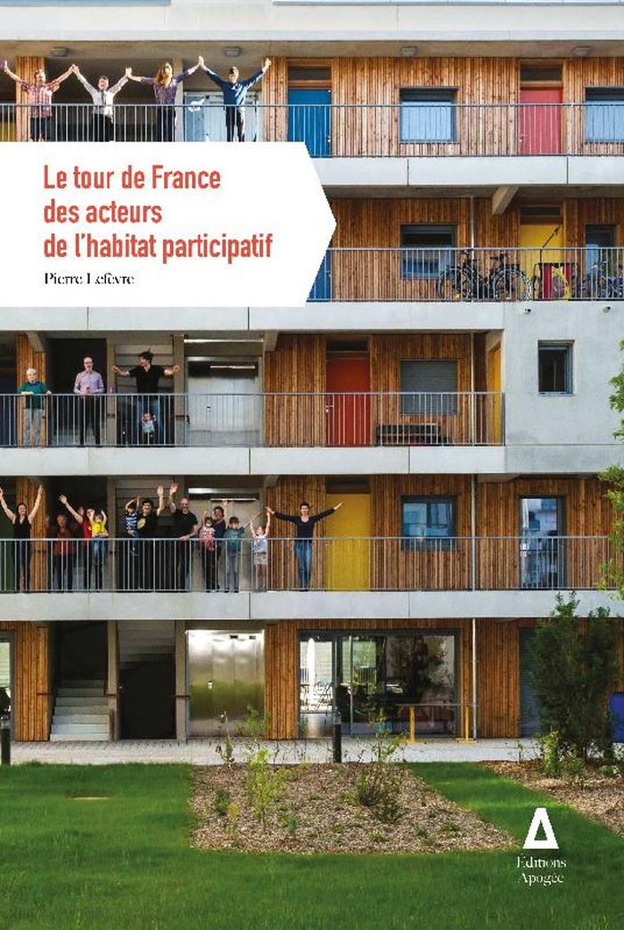
Title:
Le tour de France des acteurs de l'habitat participatif
Actions:
Price:
$49.95
(available to order)
Summary:
L'habitat participatif a pour objet concret le « mieux construire » et le « mieux vivre ». Cet ouvrage présente un large panel d'acteurs qui ont contribué à son essor en France, en le faisant passer du monde des pionniers à celui du logement pour tous. L'habitat participatif se développe d'autant plus rapidement qu'il répond à l'urgence de la transition climatique dans ses trois dimensions économique, environnementale et humaine. Grâce à une quarantaine d'entretiens (accompagnateurs de groupes, architectes, habitants...), l'ouvrage permet de faire connaissance avec la plupart de ces acteurs et repère les principaux pôles d'expertises existant sur le territoire métropolitain. Ce livre constitue à la fois un précieux carnet d'adresses et une cartographie précise des réseaux associatifs concernés. Il est une référence pour les familles et les personnes en recherche de futurs voisins, d'un quartier ou d'un site et d'un accompagnement technique avisé.
Form:
books
books
Publication:
September 2021
September 2021
Subject:
Collective Housing
Collective Housing
Form:
books
books
Actions:
Subject:
Publication:
Institute of Network Cultures 2011
Institute of Network Cultures 2011
Form:
books
books
Publication:
Institute of Network Cultures 2011
Institute of Network Cultures 2011
Subject: