


35189 Results
Form:
books
books
Actions:
Holdings:
Description:
239 pages : illustrations (some color) ; 24 cm
Description:
239 pages : illustrations (some color) ; 24 cm
Author:
Subject:
Publication:
[Novato, CA] : Applied Research and Design Publishing, an imprint of ORO Editions, [2022]
[Novato, CA] : Applied Research and Design Publishing, an imprint of ORO Editions, [2022]
Title:
Innovation in practice in theory : positioning architectural design and its agency / edited by Caterina Barioglio, Daniele Capobenedetto, Andrea Alberto Dutto, Valeria Federighi, Caterina Quaglio, Elena Todella.
Actions:
Holdings:
Description:
239 pages : illustrations (some color) ; 24 cm
Innovation in practice in theory : positioning architectural design and its agency / edited by Caterina Barioglio, Daniele Capobenedetto, Andrea Alberto Dutto, Valeria Federighi, Caterina Quaglio, Elena Todella.
Actions:
Holdings:
Description:
239 pages : illustrations (some color) ; 24 cm
Form:
books
books
Publication:
[Novato, CA] : Applied Research and Design Publishing, an imprint of ORO Editions, [2022]
[Novato, CA] : Applied Research and Design Publishing, an imprint of ORO Editions, [2022]
Author:
Subject:
Form:
books
books
Title:
Le Fort de Chambly.
Le Fort de Chambly.
Actions:
Holdings:
Description:
32 p. : ill. (some col.), map, plans ; 22 cm.
Description:
32 p. : ill. (some col.), map, plans ; 22 cm.
Author:
Publication:
[Chambly] : Cercle Joseph-Octave-Dion, 1984.
[Chambly] : Cercle Joseph-Octave-Dion, 1984.
Title:
Le Fort de Chambly.
Actions:
Holdings:
Description:
32 p. : ill. (some col.), map, plans ; 22 cm.
Le Fort de Chambly.
Actions:
Holdings:
Description:
32 p. : ill. (some col.), map, plans ; 22 cm.
Form:
books
books
Publication:
[Chambly] : Cercle Joseph-Octave-Dion, 1984.
[Chambly] : Cercle Joseph-Octave-Dion, 1984.
Author:
Form:
books
books
Actions:
Holdings:
Description:
123 pages illustrations, map 24 cm
Description:
123 pages illustrations, map 24 cm
Author:
Subject:
Publication:
Errington, B.C., ©1971.
Errington, B.C., ©1971.
Title:
Errington, Vancouver Island, British Columbia, Canada.
Actions:
Holdings:
Description:
123 pages illustrations, map 24 cm
Errington, Vancouver Island, British Columbia, Canada.
Actions:
Holdings:
Description:
123 pages illustrations, map 24 cm
Form:
books
books
Publication:
Errington, B.C., ©1971.
Errington, B.C., ©1971.
Author:
Subject:
Form:
books
books
Title:
Petrocultures : oil, energy, and culture / edited by Sheena Wilson, Adam Carlson and Imre Szeman.
Petrocultures : oil, energy, and culture / edited by Sheena Wilson, Adam Carlson and Imre Szeman.
Actions:
Holdings:
Description:
xii, 532 pages ; 24 cm
Description:
xii, 532 pages ; 24 cm
Author:
Subject:
Publication:
Montreal : McGill-Queen's University Press, [2017]
Montreal : McGill-Queen's University Press, [2017]
Title:
Petrocultures : oil, energy, and culture / edited by Sheena Wilson, Adam Carlson and Imre Szeman.
Actions:
Holdings:
Description:
xii, 532 pages ; 24 cm
Petrocultures : oil, energy, and culture / edited by Sheena Wilson, Adam Carlson and Imre Szeman.
Actions:
Holdings:
Description:
xii, 532 pages ; 24 cm
Form:
books
books
Publication:
Montreal : McGill-Queen's University Press, [2017]
Montreal : McGill-Queen's University Press, [2017]
Author:
Subject:
Form:
books
books
Title:
CSV, 1831-1981.
CSV, 1831-1981.
Actions:
Holdings:
Description:
26 unnumbered pages : illustrations, map, portraits ; 19 cm
Description:
26 unnumbered pages : illustrations, map, portraits ; 19 cm
Author:
Subject:
Publication:
[Montréal] : [CSV], [1981?]
[Montréal] : [CSV], [1981?]
Title:
CSV, 1831-1981.
Actions:
Holdings:
Description:
26 unnumbered pages : illustrations, map, portraits ; 19 cm
CSV, 1831-1981.
Actions:
Holdings:
Description:
26 unnumbered pages : illustrations, map, portraits ; 19 cm
Form:
books
books
Publication:
[Montréal] : [CSV], [1981?]
[Montréal] : [CSV], [1981?]
Author:
Subject:
Form:
books
books
Actions:
Holdings:
Description:
48 pages [14] pages of plates : illustrations, map ; 22 cm
Description:
48 pages [14] pages of plates : illustrations, map ; 22 cm
Subject:
Publication:
Windsor [England] : Published by authority of the Lord Chamberlain, 1950.
Windsor [England] : Published by authority of the Lord Chamberlain, 1950.
Title:
The Official guide to Windsor Castle.
Actions:
Holdings:
Description:
48 pages [14] pages of plates : illustrations, map ; 22 cm
The Official guide to Windsor Castle.
Actions:
Holdings:
Description:
48 pages [14] pages of plates : illustrations, map ; 22 cm
Form:
books
books
Publication:
Windsor [England] : Published by authority of the Lord Chamberlain, 1950.
Windsor [England] : Published by authority of the Lord Chamberlain, 1950.
Subject:
Form:
books
books
Title:
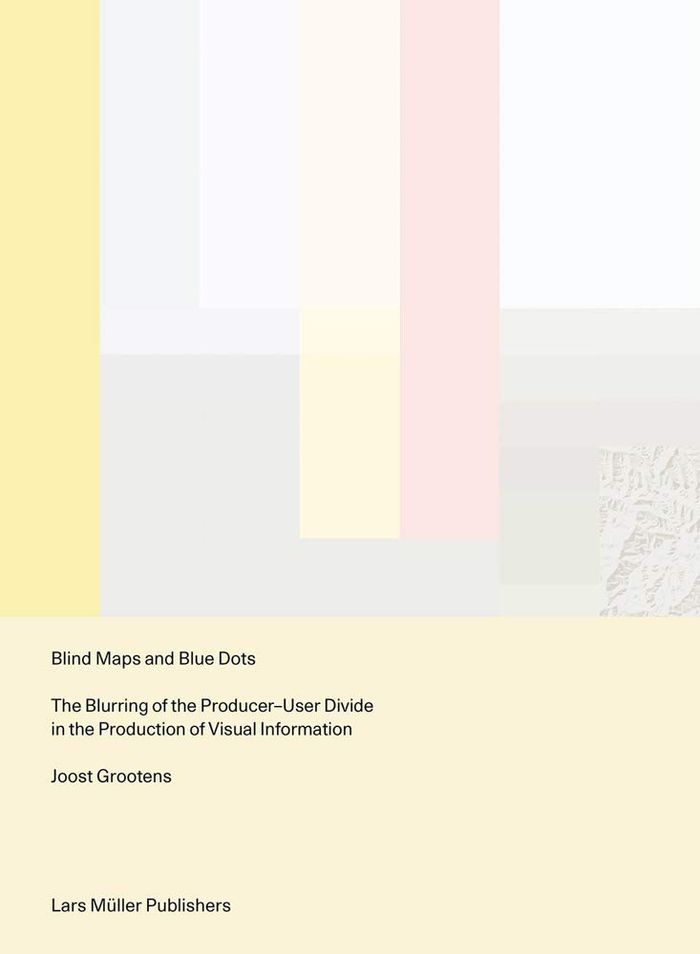
Blind maps and blue dots: the blurring of the producer-user divide in the production of visual
Blind maps and blue dots: the blurring of the producer-user divide in the production of visual
Actions:
Price:
$56.00
(available to order)
Summary:
Mapmaking has been an essential part of human development since ancient times: through the art of cartography, people have been able to record geographical explorations and communicate spatial information in relation to themselves and the land around them, using fixed points and lived experiences as references. In the digital age, maps are just as likely to convey the(...)
$56.00
(available to order)
Summary:
Mapmaking has been an essential part of human development since ancient times: through the art of cartography, people have been able to record geographical explorations and communicate spatial information in relation to themselves and the land around them, using fixed points and lived experiences as references. In the digital age, maps are just as likely to convey the(...)
Title:
Blind maps and blue dots: the blurring of the producer-user divide in the production of visual
Actions:
Price:
$56.00
(available to order)
Summary:
Mapmaking has been an essential part of human development since ancient times: through the art of cartography, people have been able to record geographical explorations and communicate spatial information in relation to themselves and the land around them, using fixed points and lived experiences as references. In the digital age, maps are just as likely to convey the relationships between individual users and amorphous data as they are to depict the relationships between human beings and the stars and planets above. "Blind maps and blue dots" examines the impact of the omnipresent computer on current understandings of data visualization and graphic design, in which the boundaries between producers and users of maps has become increasingly blurred. This text is structured around three contemporary mapmaking practices: Google Maps' location function, referred to as the Blue Dot; a global map that displays the physical activity of users of the fitness app Strava; and the 'Situation in Syria' maps series, a regularly updated map of the Syrian conflict designed by an Amsterdam teenager. Like every other field, graphic design must evolve to reflect the modern world and the needs of its people. "Blind maps and blue dots" offers a new approach that acknowledges and even encourages the breakdown of the binary between producer and user.
Blind maps and blue dots: the blurring of the producer-user divide in the production of visual
Actions:
Price:
$56.00
(available to order)
Summary:
Mapmaking has been an essential part of human development since ancient times: through the art of cartography, people have been able to record geographical explorations and communicate spatial information in relation to themselves and the land around them, using fixed points and lived experiences as references. In the digital age, maps are just as likely to convey the relationships between individual users and amorphous data as they are to depict the relationships between human beings and the stars and planets above. "Blind maps and blue dots" examines the impact of the omnipresent computer on current understandings of data visualization and graphic design, in which the boundaries between producers and users of maps has become increasingly blurred. This text is structured around three contemporary mapmaking practices: Google Maps' location function, referred to as the Blue Dot; a global map that displays the physical activity of users of the fitness app Strava; and the 'Situation in Syria' maps series, a regularly updated map of the Syrian conflict designed by an Amsterdam teenager. Like every other field, graphic design must evolve to reflect the modern world and the needs of its people. "Blind maps and blue dots" offers a new approach that acknowledges and even encourages the breakdown of the binary between producer and user.
Form:
books
books
Publication:
June 2021
June 2021
Subject:
Graphic Design and Typography
Graphic Design and Typography
Form:
books
books
Actions:
Holdings:
Description:
124 pages : illustrations, map ; 21 cm
Description:
124 pages : illustrations, map ; 21 cm
Author:
Subject:
Publication:
Windsor, N.S. : Lancelot Press, 1974.
Windsor, N.S. : Lancelot Press, 1974.
Title:
Rambling over roads and hills of Newport Township.
Actions:
Holdings:
Description:
124 pages : illustrations, map ; 21 cm
Rambling over roads and hills of Newport Township.
Actions:
Holdings:
Description:
124 pages : illustrations, map ; 21 cm
Form:
books
books
Publication:
Windsor, N.S. : Lancelot Press, 1974.
Windsor, N.S. : Lancelot Press, 1974.
Author:
Subject:
Form:
books
books
Actions:
Holdings:
Description:
75 pages : illustrations, map ; 24 cm
Description:
75 pages : illustrations, map ; 24 cm
Author:
Publication:
Youngstown : Youngstown Women's Institute, [1960]
Youngstown : Youngstown Women's Institute, [1960]
Title:
Youngstown and district pioneers / compiled and published by Youngstown Women's Institute.
Actions:
Holdings:
Description:
75 pages : illustrations, map ; 24 cm
Youngstown and district pioneers / compiled and published by Youngstown Women's Institute.
Actions:
Holdings:
Description:
75 pages : illustrations, map ; 24 cm
Form:
books
books
Publication:
Youngstown : Youngstown Women's Institute, [1960]
Youngstown : Youngstown Women's Institute, [1960]
Author:
Form:
books
books
Actions:
Holdings:
Description:
22 [1] folded leaves : illustrations (some color), map ; 31 cm
Description:
22 [1] folded leaves : illustrations (some color), map ; 31 cm
Author:
Publication:
[Place of publication not identified] : [publisher not identified], [1928?]
[Place of publication not identified] : [publisher not identified], [1928?]
Title:
Eisenwerk Witkowitz, 100 Jahre, 1828-1928.
Actions:
Holdings:
Description:
22 [1] folded leaves : illustrations (some color), map ; 31 cm
Eisenwerk Witkowitz, 100 Jahre, 1828-1928.
Actions:
Holdings:
Description:
22 [1] folded leaves : illustrations (some color), map ; 31 cm
Form:
books
books
Publication:
[Place of publication not identified] : [publisher not identified], [1928?]
[Place of publication not identified] : [publisher not identified], [1928?]
Author:


