3511 Results
Form:
textual records
textual records
Actions:
Reference number:
DR1995:0235:017-017
Description:
correspondence, proposals, clippings, notes, essays and drafts of essays, memorandums, a diagram, a bibliography of publications by Cedric Price, an announcement, a Delphi Survey report on healthcare, and a list of illustrations for the article 'Monochromatic Observations on a Polychromatic Occasion' [MOPO] (1977)
People:
Date:
1964, 1975-1977
1964, 1975-1977
Title:
X15 Correspondence, proposals, clippings, notes, essays and drafts of essays
Actions:
DR1995:0235:017-017
Description:
correspondence, proposals, clippings, notes, essays and drafts of essays, memorandums, a diagram, a bibliography of publications by Cedric Price, an announcement, a Delphi Survey report on healthcare, and a list of illustrations for the article 'Monochromatic Observations on a Polychromatic Occasion' [MOPO] (1977)
Form:
textual records
textual records
Date:
1964, 1975-1977
1964, 1975-1977
People:
Form:
artefacts, graphic materials
artefacts, graphic materials
Reference number:
DR1986:0191:001-042
Description:
- Judging by their size and shape, the two empty compartments in the tray probably contained a medium and a large ruling pen. - Instruments in the tray were listed starting at the u.l. and working clockwise, following a keyed diagram in the object file.
DR1986:0191:001-042
Description:
- Judging by their size and shape, the two empty compartments in the tray probably contained a medium and a large ruling pen. - Instruments in the tray were listed starting at the u.l. and working clockwise, following a keyed diagram in the object file.
People:
Subject:
architecture
architecture
Date:
early 20th century
early 20th century
Title:
Comprehensive set of drawing instruments in a magazine case
Actions:
DR1986:0191:001-042
Description:
- Judging by their size and shape, the two empty compartments in the tray probably contained a medium and a large ruling pen. - Instruments in the tray were listed starting at the u.l. and working clockwise, following a keyed diagram in the object file.
Form:
artefacts, graphic materials
artefacts, graphic materials
Date:
early 20th century
early 20th century
People:
Subject:
architecture
architecture
Form:
drawings
Quantity:
20 presentation drawing(s)
drawings
Quantity:
20 presentation drawing(s)
Actions:
Reference number:
DR1995:0188:282-301
Description:
tables of theatre seating analysis, axonometric drawings, plans and sections of staircase variations, circulation plans, annotated sketches, typical plan, section showing activities and infrastructure, axonometric diagram, perspective grid, St Katherine's Dock site plan, Lea Valley site plans and maps
People:
Title:
Tables of theatre seating analysis, axonometric drawings
Actions:
DR1995:0188:282-301
Description:
tables of theatre seating analysis, axonometric drawings, plans and sections of staircase variations, circulation plans, annotated sketches, typical plan, section showing activities and infrastructure, axonometric diagram, perspective grid, St Katherine's Dock site plan, Lea Valley site plans and maps
Form:
drawings
Quantity:
20 presentation drawing(s)
drawings
Quantity:
20 presentation drawing(s)
People:
Form:
drawings
Quantity:
128 design development drawing(s)
drawings
Quantity:
128 design development drawing(s)
Reference number:
DR2004:1143
Description:
sketches, some with annotations, plans, conceptual drawings, perspectives, elevations, sections, views of site, measured sketches, comparison drawings, reference drawings, site plans, axonometrics, details, maps, clippings, publication drawings, layouts for publication, printing instructions, views of model, notes, labels, diagram, grid, and memorandum
People:
Title:
Sketches, some with annotations, plans, conceptual drawings
Actions:
DR2004:1143
Description:
sketches, some with annotations, plans, conceptual drawings, perspectives, elevations, sections, views of site, measured sketches, comparison drawings, reference drawings, site plans, axonometrics, details, maps, clippings, publication drawings, layouts for publication, printing instructions, views of model, notes, labels, diagram, grid, and memorandum
Form:
drawings
Quantity:
128 design development drawing(s)
drawings
Quantity:
128 design development drawing(s)
People:
Level of archival description:
Project
Project
Actions:
Reference number:
AP206.S1.1985.PR10
Description:
This project series documents the Indira Gandhi National Open University (IGNOU) in India, likely around 1985-2000. The project was probably for the main campus, located in New Delhi. The project proposed a complete campus made up of round structures and roadways. The roads and buildings were proposed as one and the same, as both the roads and parking would make up the roofs of the buildings. This, it was said, would maximize the campus's space and separate cars from pedestrians. The project also proposed the design of energy efficient and sustainable infrastructure and processes for the campus. The drawings highlight the creation of waste management facilities, a biogas plant, sewage systems, an animal husbandry block, vegetable farming, efficient furniture and windmills mounted on the laboratories. The project is recorded through drawings, which are mostly reprographic copies, textual records and slides, likely dating from around 1985-2000. The drawings consist of a campus diagram, area survey plans, elevations, a section and details, while the textual records consist of a project proposal report. The slides show presentation plans and the project model.
People:
Date:
circa 1985-2000
circa 1985-2000
Title:
Indira Gandhi National Open University, New Delhi (circa 1985-2000)
Actions:
AP206.S1.1985.PR10
Description:
This project series documents the Indira Gandhi National Open University (IGNOU) in India, likely around 1985-2000. The project was probably for the main campus, located in New Delhi. The project proposed a complete campus made up of round structures and roadways. The roads and buildings were proposed as one and the same, as both the roads and parking would make up the roofs of the buildings. This, it was said, would maximize the campus's space and separate cars from pedestrians. The project also proposed the design of energy efficient and sustainable infrastructure and processes for the campus. The drawings highlight the creation of waste management facilities, a biogas plant, sewage systems, an animal husbandry block, vegetable farming, efficient furniture and windmills mounted on the laboratories. The project is recorded through drawings, which are mostly reprographic copies, textual records and slides, likely dating from around 1985-2000. The drawings consist of a campus diagram, area survey plans, elevations, a section and details, while the textual records consist of a project proposal report. The slides show presentation plans and the project model.
Level of archival description:
Project
Project
Date:
circa 1985-2000
circa 1985-2000
People:
Level of archival description:
Project
Project
Title:
CP Aviary
CP Aviary
Reference number:
AP144.S2.D113
Description:
File documents an unexecuted project for an aviary and laboratory for the Royal Veterinary College, Camden, London, England. The design had to be easily dismantled, transported, and re-erected, since it was possible that there would be a "Stage 2" where the aviary would be moved from its original urban site to a more open rural site. Conceptual sketches illustrate preliminary ideas for the general structure and for. Some sketches are colored with metallic ink to outline structural components. Schematic design drawings illustrate two alternate plans, probably for urban and rural sites. A schematic flow diagram shows the use of research equipment within specified laboratory zones/research modules. Design development drawings show the aviary structure for both the urban and rural site. Isometrics, axonometrics, and perspectives show spatial division and accommodation within the aviary. Duplicate reprographic copies are made from the original drawings; some are annotated with notes. Material in this file was produced between 1978 and 1989, but predominantly between 1981 and 1985. File contains conceptual drawings, design development drawings, reference drawings, other drawings, a model, photographic materials, and textual records.
People:
Date:
1978-1989, predominant 1981-1985
1978-1989, predominant 1981-1985
Title:
CP Aviary
Actions:
AP144.S2.D113
Description:
File documents an unexecuted project for an aviary and laboratory for the Royal Veterinary College, Camden, London, England. The design had to be easily dismantled, transported, and re-erected, since it was possible that there would be a "Stage 2" where the aviary would be moved from its original urban site to a more open rural site. Conceptual sketches illustrate preliminary ideas for the general structure and for. Some sketches are colored with metallic ink to outline structural components. Schematic design drawings illustrate two alternate plans, probably for urban and rural sites. A schematic flow diagram shows the use of research equipment within specified laboratory zones/research modules. Design development drawings show the aviary structure for both the urban and rural site. Isometrics, axonometrics, and perspectives show spatial division and accommodation within the aviary. Duplicate reprographic copies are made from the original drawings; some are annotated with notes. Material in this file was produced between 1978 and 1989, but predominantly between 1981 and 1985. File contains conceptual drawings, design development drawings, reference drawings, other drawings, a model, photographic materials, and textual records.
Level of archival description:
File 113
File 113
Date:
1978-1989, predominant 1981-1985
1978-1989, predominant 1981-1985
People:
Level of archival description:
Series
Series
Title:
Printed Materials
Printed Materials
Reference number:
AP144.S5
Description:
Series consists primarily of printed material including maps, posters, and other ephemera. Most maps are of locations in England, United Kingdom. Topics of posters include lectures, exhibitions, and other events, some of which relate to projects found in Series 2. Other ephemera in the series include two broadsheets, including a copy of Alexander Trocchi's poster-magazine 'The Moving Times'. This series also includes a small number of panels, photographs, drawings and diagrams, including an original drawing by Cedric Price of St. James's Square in London, England, United Kingdom which possibly relates to the Sheffield Festival project (AP144.S2.61). Material in this series was produced between 1954 and 1998. Series contains cartographic materials, posters and drawings.
People:
Date:
1954-1998
1954-1998
Title:
Printed Materials
Actions:
AP144.S5
Description:
Series consists primarily of printed material including maps, posters, and other ephemera. Most maps are of locations in England, United Kingdom. Topics of posters include lectures, exhibitions, and other events, some of which relate to projects found in Series 2. Other ephemera in the series include two broadsheets, including a copy of Alexander Trocchi's poster-magazine 'The Moving Times'. This series also includes a small number of panels, photographs, drawings and diagrams, including an original drawing by Cedric Price of St. James's Square in London, England, United Kingdom which possibly relates to the Sheffield Festival project (AP144.S2.61). Material in this series was produced between 1954 and 1998. Series contains cartographic materials, posters and drawings.
Level of archival description:
Series
Series
Date:
1954-1998
1954-1998
People:
Form:
drawings
drawings
Actions:
Reference number:
DR2004:0597
Description:
site plans, maps, sketches, plans, axonometrics, sections, elevations, details, reference drawings, conceptual drawings, views of site, schematics, perspectives, drawings labelled with both the Strate and Newlink projects, clippings, brochure, schedule diagram, memorandum labelled with the Newlink and Sidings projects, view of model, view of escalators, and proposal document
People:
Title:
Site plans, maps, sketches, plans, axonometrics, sections
Actions:
DR2004:0597
Description:
site plans, maps, sketches, plans, axonometrics, sections, elevations, details, reference drawings, conceptual drawings, views of site, schematics, perspectives, drawings labelled with both the Strate and Newlink projects, clippings, brochure, schedule diagram, memorandum labelled with the Newlink and Sidings projects, view of model, view of escalators, and proposal document
Form:
drawings
drawings
People:
Level of archival description:
Series
Series
Title:
Presentation files
Presentation files
Actions:
Reference number:
AP195.S2
Description:
Series 2: Presentation files, 1999 – 2009, contains CAD files, 3D models, renderings, and photographs used for presentation of the Phaeno Science Centre, especially during the competition and design phases. Formats include chiefly images (EXIF, JPEG, TIFF) and CAD files (AutoCAD, plotter files, EPS). This series contains a wide variety of materials used by ZHA to present Phaeno Science Centre to clients, the press, and other stakeholders. This includes 3D models and CAD files, other drawings and diagrams, and photographs. Notably, this series includes concept animations used by ZHA to develop the shape and structure of Phaeno, as well as concept sketches possibly drawn by Zaha Hadid. Other materials of interest include a digitized copy of digital plans that had been printed and given a hand-painted rendering surface.
People:
Date:
1999 - 2009
1999 - 2009
Title:
Presentation files
Actions:
AP195.S2
Description:
Series 2: Presentation files, 1999 – 2009, contains CAD files, 3D models, renderings, and photographs used for presentation of the Phaeno Science Centre, especially during the competition and design phases. Formats include chiefly images (EXIF, JPEG, TIFF) and CAD files (AutoCAD, plotter files, EPS). This series contains a wide variety of materials used by ZHA to present Phaeno Science Centre to clients, the press, and other stakeholders. This includes 3D models and CAD files, other drawings and diagrams, and photographs. Notably, this series includes concept animations used by ZHA to develop the shape and structure of Phaeno, as well as concept sketches possibly drawn by Zaha Hadid. Other materials of interest include a digitized copy of digital plans that had been printed and given a hand-painted rendering surface.
Level of archival description:
Series
Series
Date:
1999 - 2009
1999 - 2009
People:
Form:
drawings
drawings
Actions:
Reference number:
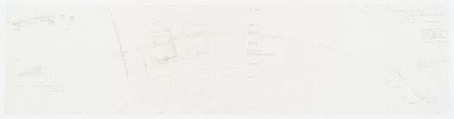
AP140.S2.SS1.D46.P4.3
Description:
Diagrams
AP140.S2.SS1.D46.P4.3
Description:
Diagrams
People:
Date:
1976
1976
Title:
Government Centre, Dawhah, Qatar: site plans with sketches
Actions:
AP140.S2.SS1.D46.P4.3
Description:
Diagrams
Government Centre, Dawhah, Qatar: site plans with sketches
Actions:
AP140.S2.SS1.D46.P4.3
Description:
Diagrams
Form:
drawings
drawings
Date:
1976
1976
People: