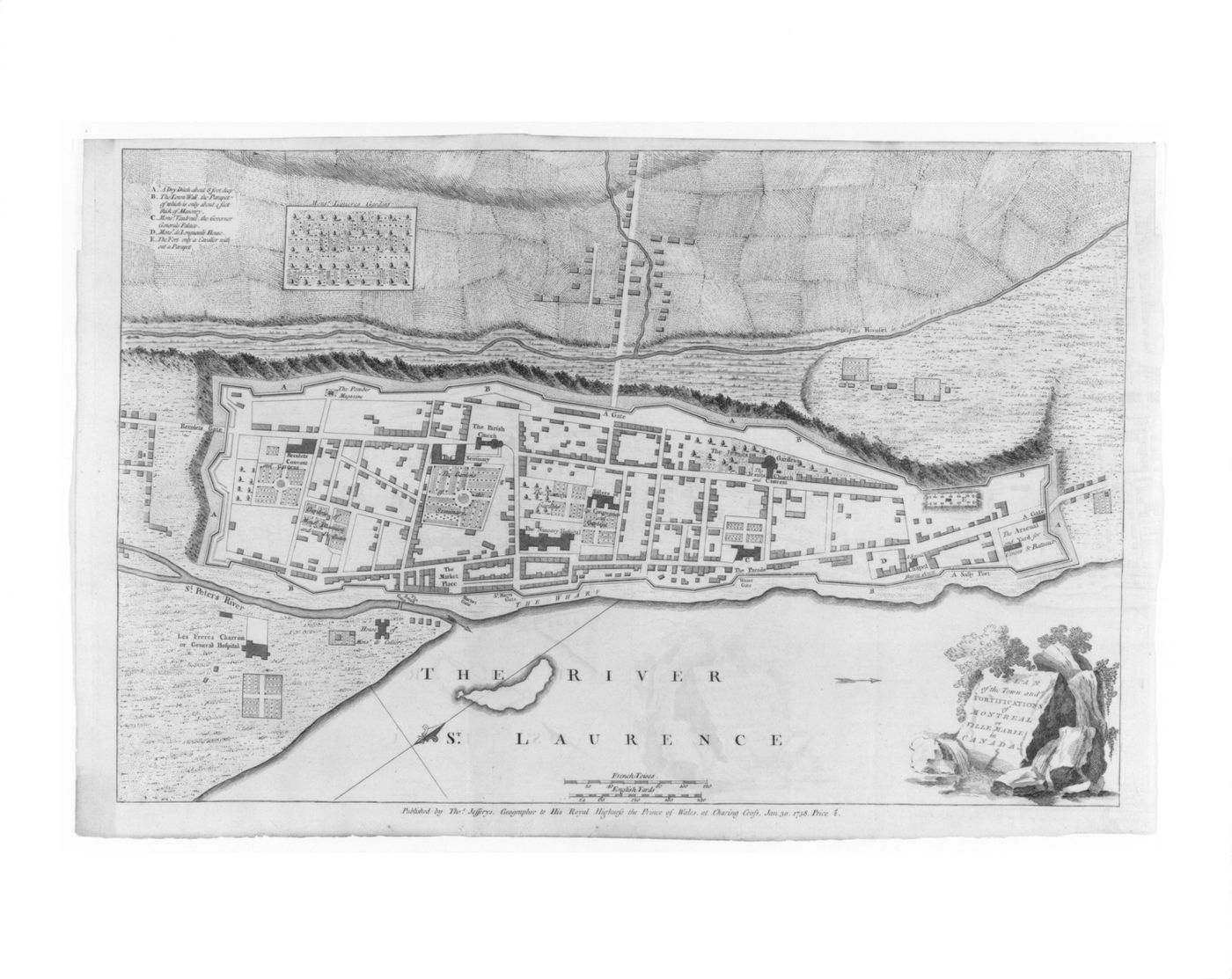
Annotated plan of Montréal
published 30 January 1758
Engraving
comp. (no plate mark): 32.8 x 50.2 cm sheet: 35 x 54 cm
DR1982:0237
imprinted - l.r., with title "PLAN / of the Town and / FORTIFICATIONS / of / MONTREAL / or / VILLE MARIE / in / CANADA" imprinted - l.c.: "Published by Tho.s Jefferys, Geographer to his Royal Highness the Prince of Wales. at Charing Cross, Jan. 30. 1758. Price 2/s." imprinted - throughout, with identifications, and with an alphabetical key to buildings, places and fortifications.
Montréal; Québec; Canada;
Sign up to get news from us
Thank you for signing up. You'll begin to receive emails from us shortly.
We’re not able to update your preferences at the moment. Please try again later.
You’ve already subscribed with this email address. If you’d like to subscribe with another, please try again.
This email was permanently deleted from our database. If you’d like to resubscribe with this email, please contact us
Please complete the form below to buy:
[Title of the book, authors]
ISBN: [ISBN of the book]
Price [Price of book]
Thank you for placing an order. We will contact you shortly.
We’re not able to process your request at the moment. Please try again later.
Your folder is empty.