115 Results
Form:
books
books
Title:
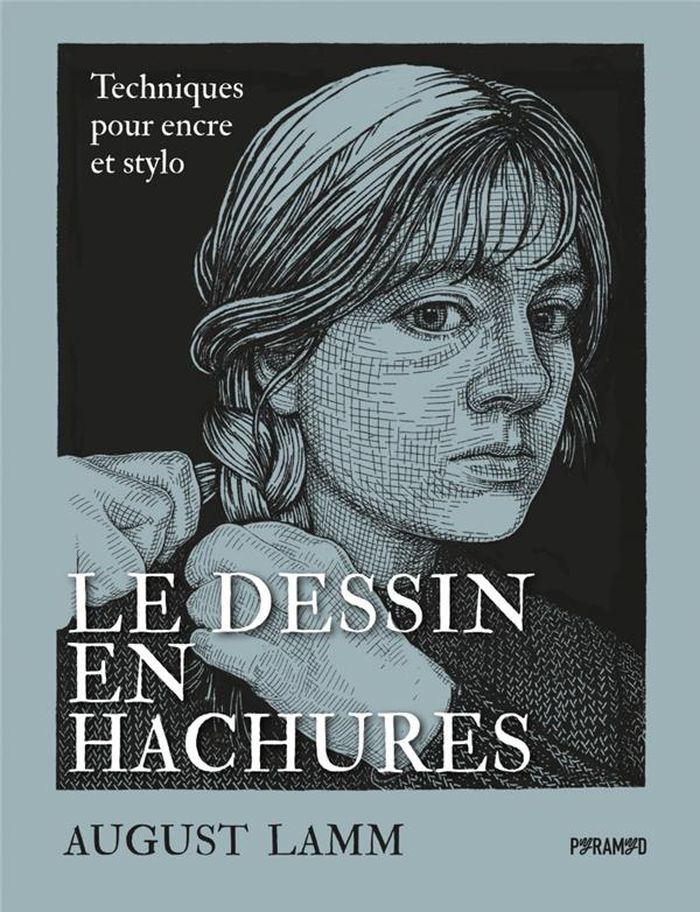
Le dessin en hachures
Le dessin en hachures
Actions:
Price:
$42.95
(available to order)
Summary:
Technique de dessin développée au Moyen Âge et popularisée par les grands maîtres tels que Dürer et Rembrandt, l’art des hachures connaît un regain artistique mérité. Cet ouvrage vous invite à développer les compétences clés nécessaires pour aborder avec confiance cette technique particulière et élargir votre répertoire créatif. Ce guide complet vous accompagnera à(...)
Title:
Le dessin en hachures
Actions:
Price:
$42.95
(available to order)
Summary:
Technique de dessin développée au Moyen Âge et popularisée par les grands maîtres tels que Dürer et Rembrandt, l’art des hachures connaît un regain artistique mérité. Cet ouvrage vous invite à développer les compétences clés nécessaires pour aborder avec confiance cette technique particulière et élargir votre répertoire créatif. Ce guide complet vous accompagnera à chaque étape du processus de création, de la conception à l’exécution. Des pas-à-pas accessibles vous permettront d’aborder n’importe quel sujet, d’une simple nature morte jusqu’aux portraits et paysages complexes. Des exemples de dessins en hachures tirés des grands maîtres et de l’histoire de l’art ainsi que du travail personnel de l’autrice vous fourniront de nombreuses sources d’inspiration.
Form:
books
books
Publication:
April 2023
April 2023
Subject:
Architectural Drawing
Architectural Drawing
Form:
books
books
Actions:
Price:
$85.00
(available to order)
Summary:
In a letter written near the end of his life, Giovanni Battista Piranesi (1720–1778) explained that he left his native Venice because no patrons were willing to support "the sublimity of [his] ideas." Residing in Rome, he became internationally famous as a printmaker and designer, among other numerous pursuits. While Piranesi’s notoriety stems from his etchings, he was(...)
Title:
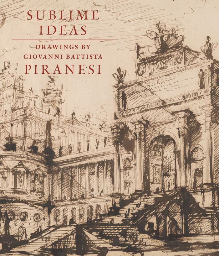
Sublime ideas: Drawings by Giovanni Battista Piranesi
Actions:
Price:
$85.00
(available to order)
Summary:
In a letter written near the end of his life, Giovanni Battista Piranesi (1720–1778) explained that he left his native Venice because no patrons were willing to support "the sublimity of [his] ideas." Residing in Rome, he became internationally famous as a printmaker and designer, among other numerous pursuits. While Piranesi’s notoriety stems from his etchings, he was also an accomplished draftsman who first developed much of his work in drawings. This is the most comprehensive, updated study of Piranesi’s drawings with over two hundred illustrations offering insight into his life and creative endeavors. Coinciding with the Morgan’s Spring 2023 exhibition, the volume diligently surveys the artist’s enduring work as an artistic force.
Form:
books
books
Publication:
May 2023
May 2023
Subject:
Architectural Drawing
Architectural Drawing
Form:
books
books
Actions:
Price:
$22.95
(available to order)
Summary:
Florenski critique ici les fondements de la perspective et, avec eux, la conception classique de l’histoire de l’art, qui voit dans la Renaissance un acmé jamais égalé. Il analyse avec une grande finesse les icônes, qui génèrent une multitude de points de vue, au diapason avec la pensée qu’elles véhiculent. Daté de 1919, cet exposé est contemporain des recherches(...)
Title:
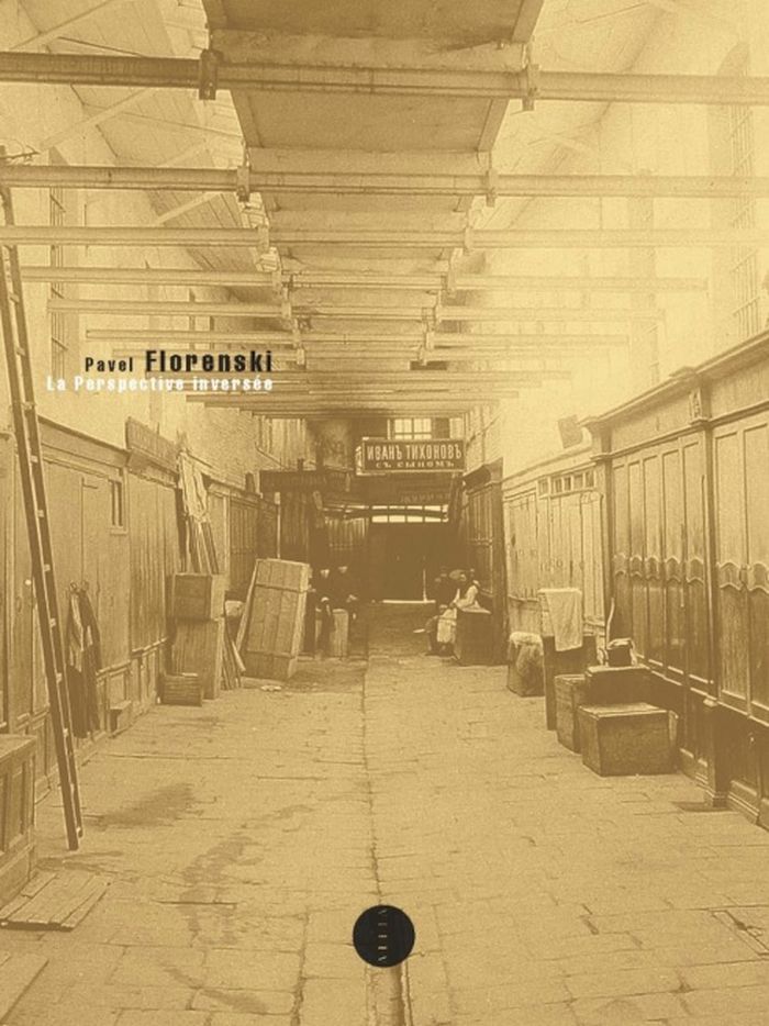
La Perspective inversée, n.é.
Actions:
Price:
$22.95
(available to order)
Summary:
Florenski critique ici les fondements de la perspective et, avec eux, la conception classique de l’histoire de l’art, qui voit dans la Renaissance un acmé jamais égalé. Il analyse avec une grande finesse les icônes, qui génèrent une multitude de points de vue, au diapason avec la pensée qu’elles véhiculent. Daté de 1919, cet exposé est contemporain des recherches plastiques de Malevitch. L’on tient là non seulement un texte précurseur de maintes recherches théoriques mais aussi un plaidoyer éminemment pédagogique en faveur d’un art ouvert à la vision subjective du spectateur.
Form:
books
books
Publication:
November 2021
November 2021
Subject:
Architectural Drawing
Architectural Drawing
Form:
books
books
Title:
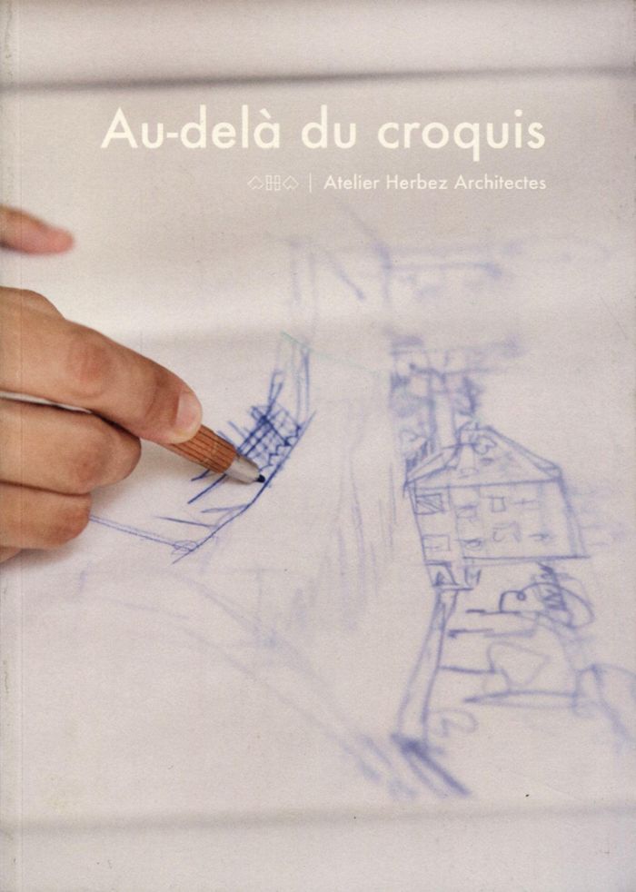
Au-delà du croquis
Au-delà du croquis
Actions:
Price:
$36.95
(available to order)
Summary:
Qu'est-ce qu'un croquis d'architecture ? Il est commun de penser que les architectes dessinent leurs projets à partir d'un croquis fondateur, qu'ils imaginent les bâtiments instantanément en griffonnant sur un bout de papier quelques lignes les déterminant définitivement.En réalité, il semble difficile de résumer un projet à une sorte d'instantané précurseur isolé de(...)
Title:
Au-delà du croquis
Actions:
Price:
$36.95
(available to order)
Summary:
Qu'est-ce qu'un croquis d'architecture ? Il est commun de penser que les architectes dessinent leurs projets à partir d'un croquis fondateur, qu'ils imaginent les bâtiments instantanément en griffonnant sur un bout de papier quelques lignes les déterminant définitivement.En réalité, il semble difficile de résumer un projet à une sorte d'instantané précurseur isolé de toute autre recherche. L'architecte n'est pas un magicien et ne détient pas l'image finale de l'objet architectural dès la genèse du projet. C'est le croquis, dessiné par sa main et son esprit, qui peu à peu, grâce à son hyper-récurrence dans le processus de conception, va forger les lignes de force du bâtiment, de son volume général jusqu'aux moindres détails. En rassemblant une foule de croquis pluriels et bavards, cet ouvrage partage l'expérience de l'Atelier Herbez Architectes pour laquelle la pratique du dessin est une valeur forte, envisagée à la fois comme la base du travail de conception et comme un champ d'expérimentation insufflant la créativité. Aller au-delà du croquis c'est en explorer les mécanismes et en chercher les limites. Croquis à main levée, croquis informatiques et croquis du regard se mêlent ici pour révéler les ressorts du médium graphique qui trouve aujourd'hui, à l'ère du numérique, de nouvelles formes d'expression.
Form:
books
books
Publication:
September 2020
September 2020
Subject:
Architectural Drawing
Architectural Drawing
Form:
books
books
Price:
$38.95
(available to order)
Summary:
Drawing is a way of constructing ideas and observations as much as it is a means of expressing them. When we are not ready or able to put our thoughts into words, we can sometimes put them down in arrangements of lines and marks. Artists, designers, architects, and others draw to generate, explore, and test perceptions and mental models. In this book, artist-educator(...)
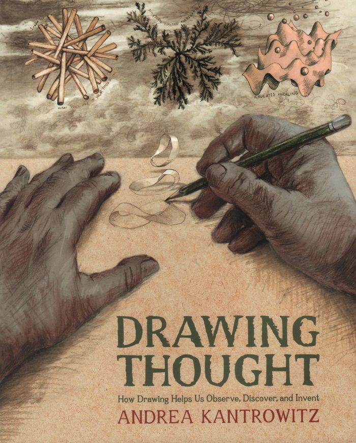
Title:
Drawing thought: How drawing helps us observe, discover and invent
Actions:
Price:
$38.95
(available to order)
Summary:
Drawing is a way of constructing ideas and observations as much as it is a means of expressing them. When we are not ready or able to put our thoughts into words, we can sometimes put them down in arrangements of lines and marks. Artists, designers, architects, and others draw to generate, explore, and test perceptions and mental models. In this book, artist-educator Andrea Kantrowitz invites readers to use drawing to extend and reflect on their own thought processes. She interweaves illuminating hand-drawn images with text, integrating recent findings in cognitive psychology and neuroscience with accounts of her own artistic and teaching practices.
Form:
books
books
Publication:
October 2022
October 2022
Subject:
Architectural Drawing
Architectural Drawing
Form:
books
books
Actions:
Price:
$66.00
(available to order)
Summary:
''Making Marks'' showcases the private sketchbooks of the world's most visually inventive architects, revealing just how much drawing by hand informs great contemporary architecture. Taking a post-digital perspective, the sixty renowned architects whose work is collected here show how drawing and new forms of manual presentation have been refined since the reawakening of(...)
Title:
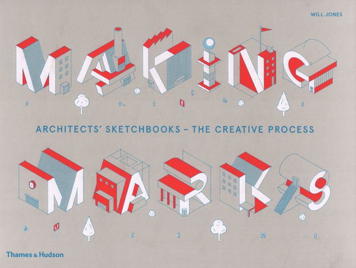
Making marks: architects' sketchbooks, the creative process
Actions:
Price:
$66.00
(available to order)
Summary:
''Making Marks'' showcases the private sketchbooks of the world's most visually inventive architects, revealing just how much drawing by hand informs great contemporary architecture. Taking a post-digital perspective, the sixty renowned architects whose work is collected here show how drawing and new forms of manual presentation have been refined since the reawakening of this basic technique. Notepads, stacks of paper, pencils and fine-point pens are as present in the architect's studio as phalanxes of screens. Revealing why and how hand-drawing still matters, this global survey presents the freehand drawings, vibrant watercolours and abstract impressions of rising talents and well-known names, including Jun Igarashi and Brian MacKay-Lyons.
Form:
books
books
Publication:
March 2019
March 2019
Subject:
Architectural Drawing
Architectural Drawing
Form:
books
books
Title:
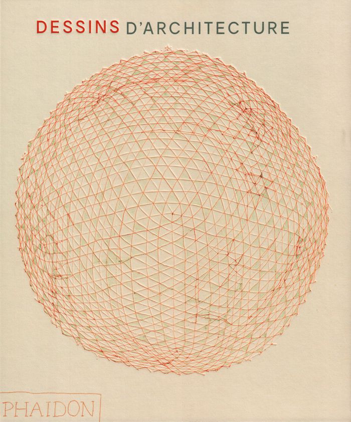
Dessins d'architecture
Dessins d'architecture
Actions:
Price:
$105.00
(available to order)
Summary:
Une découverte de l'histoire de l'architecture et de son riche patrimoine à travers une sélection de dessins, plans ou croquis de tous styles et époques, de Michel-Ange à Tadao Ando.
$105.00
(available to order)
Summary:
Une découverte de l'histoire de l'architecture et de son riche patrimoine à travers une sélection de dessins, plans ou croquis de tous styles et époques, de Michel-Ange à Tadao Ando.
Title:
Dessins d'architecture
Actions:
Price:
$105.00
(available to order)
Summary:
Une découverte de l'histoire de l'architecture et de son riche patrimoine à travers une sélection de dessins, plans ou croquis de tous styles et époques, de Michel-Ange à Tadao Ando.
Dessins d'architecture
Actions:
Price:
$105.00
(available to order)
Summary:
Une découverte de l'histoire de l'architecture et de son riche patrimoine à travers une sélection de dessins, plans ou croquis de tous styles et époques, de Michel-Ange à Tadao Ando.
Form:
books
books
Publication:
May 2019
May 2019
Subject:
Architectural Drawing
Architectural Drawing
Form:
books
books
Actions:
Price:
$59.95
(available to order)
Summary:
This book explores computation, specifically the craft of writing computer code, as a medium for drawing. Exercises, essays, algorithms, diagrams, and drawings are woven together to offer instruction, insight, and theories that are valuable to practicing architects, artists, and scholars. This book can serve as a primer for those new to programming or motivation and(...)
Title:
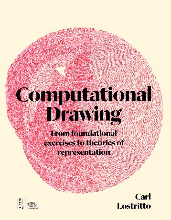
Computational drawing: from foundational exercises to theories of representation
Actions:
Price:
$59.95
(available to order)
Summary:
This book explores computation, specifically the craft of writing computer code, as a medium for drawing. Exercises, essays, algorithms, diagrams, and drawings are woven together to offer instruction, insight, and theories that are valuable to practicing architects, artists, and scholars. This book can serve as a primer for those new to programming or motivation and context for those with experience.
Form:
books
books
Publication:
June 2019
June 2019
Subject:
Architectural Drawing
Architectural Drawing
Form:
books
books
Price:
$52.95
(available to order)
Summary:
The period between the 1950s and the 1970s saw the flourishing of a number of radical movements in architecture throughout Europe, producing a wide range of experimental expression. 'Cloud ’68' presents a selection of 173 graphic pieces—including lithographs, drawings, original etchings, and ephemera—that together give a sense of the diverse approaches that thrived in(...)
Subject:
Architectural Drawing
Architectural Drawing
Publication:
October 2019
October 2019
Title:
Cloud '68: Paper voice. Smiljan Radic's collection of radical architecture
Actions:
Price:
$52.95
(available to order)
Summary:
The period between the 1950s and the 1970s saw the flourishing of a number of radical movements in architecture throughout Europe, producing a wide range of experimental expression. 'Cloud ’68' presents a selection of 173 graphic pieces—including lithographs, drawings, original etchings, and ephemera—that together give a sense of the diverse approaches that thrived in those years. Drawing from the personal collection of the Chilean architect Smiljan Radic, the book features works by Constant, Guy Debord, Asger Jorn, Haus-Rucker-Co, Archigram, Utopie, Superstudio, and many others. Apart from essays by Tom McDonough and Lara Schrijver Cloud ’68 contains interview fragments by the critic and curator Hans Ulrich Obrist, who talked to the key figures of these movements.
Form:
books
books
Publication:
October 2019
October 2019
Subject:
Architectural Drawing
Architectural Drawing
Form:
books
books
Actions:
Price:
$74.00
(available to order)
Summary:
De Jacopo Bellini à Eugène Delacroix, six cents carnets d'artistes et albums de collectionneurs, conservés au musée du Louvre, permettent de mieux comprendre le processus créatif des maîtres qui les ont exécutés, et d'apprécier le goût des amateurs qui se sont attachés à les constituer. Ces oeuvres précieuses et fragiles demeurent pour la plupart méconnues. Certaines(...)
Title:
Livre a dessiner de Pierre Henri de Valenciennes
Actions:
Price:
$74.00
(available to order)
Summary:
De Jacopo Bellini à Eugène Delacroix, six cents carnets d'artistes et albums de collectionneurs, conservés au musée du Louvre, permettent de mieux comprendre le processus créatif des maîtres qui les ont exécutés, et d'apprécier le goût des amateurs qui se sont attachés à les constituer. Ces oeuvres précieuses et fragiles demeurent pour la plupart méconnues. Certaines d'entre elles, reproduites pour la première fois dans leurs dimensions d'origine et accompagnées d'une étude inédite, invitent désormais le public le plus large possible au plaisir de la découverte. "Après un séjour de quelques années à Rome, il faut revenir dans ses foyers... Mais il faut avoir bien employé son temps et fait une ample moisson d'études et de dessins pour s'en servir à propos, quand on est éloigné des pays dont l'aspect a électrisé notre âme et agrandi notre talent." Nul doute que le jeune peintre toulousain, Pierre Flenri de Valenciennes, employa bien son temps pendant son séjour italien, entre 1777 et 1785.
Form:
books
books
Publication:
September 2019
September 2019
Subject:
Architectural Drawing
Architectural Drawing