


2186 Results
Form:
events
events
Actions:
Description:
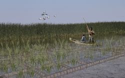
The St. Peter’s Indian Band (now Peguis First Nation) was forcibly removed from their original lands at Netley-Libau Marsh beginning in 1908, after an illegal surrender vote took place. Since then, the health of the area that was once the Peguis’s home has declined due to intense annual flooding and ice jams; the appearance of invasive species such as purple loosestrife,(...)
The St. Peter’s Indian Band (now Peguis First Nation) was forcibly removed from their original lands at Netley-Libau Marsh beginning in 1908, after an illegal surrender vote took place. Since then, the health of the area that was once the Peguis’s home has declined due to intense annual flooding and ice jams; the appearance of invasive species such as purple loosestrife,(...)
Location:
online Keyword(s):
Indigenous-led design, fellow, Peguis First Nation, land rehabilitation
online Keyword(s):
Indigenous-led design, fellow, Peguis First Nation, land rehabilitation
Date:
27 April 2023, 6:00 to 7:30 p.m.
27 April 2023, 6:00 to 7:30 p.m.
Title:
Peguis First Nation and the Netley-Libau Marsh: Documenting Indigenous Land Use and Occupancy at the Mouth of Lake Winnipeg
Actions:
Description:
The St. Peter’s Indian Band (now Peguis First Nation) was forcibly removed from their original lands at Netley-Libau Marsh beginning in 1908, after an illegal surrender vote took place. Since then, the health of the area that was once the Peguis’s home has declined due to intense annual flooding and ice jams; the appearance of invasive species such as purple loosestrife,(...)
Peguis First Nation and the Netley-Libau Marsh: Documenting Indigenous Land Use and Occupancy at the Mouth of Lake Winnipeg
Actions:
Description:
The St. Peter’s Indian Band (now Peguis First Nation) was forcibly removed from their original lands at Netley-Libau Marsh beginning in 1908, after an illegal surrender vote took place. Since then, the health of the area that was once the Peguis’s home has declined due to intense annual flooding and ice jams; the appearance of invasive species such as purple loosestrife,(...)
Form:
events
events
Date:
27 April 2023
6:00 to 7:30 p.m.
27 April 2023
6:00 to 7:30 p.m.
Location:
online Keyword(s):
Indigenous-led design, fellow, Peguis First Nation, land rehabilitation
online Keyword(s):
Indigenous-led design, fellow, Peguis First Nation, land rehabilitation
Level of archival description:
Project
Project
Actions:
Reference number:
AP207.S1.1989.PR02
Description:
The project series documents "Mappe Recinti Itinerari Territori", a rug made of eleven small tapestries hand-woven together. Pettena designed this rug for a special production for "Megalopoli" in 1989. Each of the tapestries represent four subjects: itineraries, territories, maps and enclosures. These subjects "are the means required for the definition of space inside or outside those “magic circles” that are the walls of a city, the beginning of a construction, as the rituals that are performed inside any enclosure take on a unique quality and role, different from whatever lies beyond this boundary." [1] The project series contains a reference photograph and photo montages of the eleven small tapestries forming the rug. Source: [1] Gianni Pettena website, https://www.giannipettena.it/italiano/opere-1/design-itineraries-territories-1989/ (last accessed 11 December 2019).
AP207.S1.1989.PR02
Description:
The project series documents "Mappe Recinti Itinerari Territori", a rug made of eleven small tapestries hand-woven together. Pettena designed this rug for a special production for "Megalopoli" in 1989. Each of the tapestries represent four subjects: itineraries, territories, maps and enclosures. These subjects "are the means required for the definition of space inside or outside those “magic circles” that are the walls of a city, the beginning of a construction, as the rituals that are performed inside any enclosure take on a unique quality and role, different from whatever lies beyond this boundary." [1] The project series contains a reference photograph and photo montages of the eleven small tapestries forming the rug. Source: [1] Gianni Pettena website, https://www.giannipettena.it/italiano/opere-1/design-itineraries-territories-1989/ (last accessed 11 December 2019).
People:
Date:
circa 1989-2015
circa 1989-2015
Title:
Mappe Recinti Itinerari Territori [Itineraires Territoires Maps Enclosures] (1989)
Actions:
AP207.S1.1989.PR02
Description:
The project series documents "Mappe Recinti Itinerari Territori", a rug made of eleven small tapestries hand-woven together. Pettena designed this rug for a special production for "Megalopoli" in 1989. Each of the tapestries represent four subjects: itineraries, territories, maps and enclosures. These subjects "are the means required for the definition of space inside or outside those “magic circles” that are the walls of a city, the beginning of a construction, as the rituals that are performed inside any enclosure take on a unique quality and role, different from whatever lies beyond this boundary." [1] The project series contains a reference photograph and photo montages of the eleven small tapestries forming the rug. Source: [1] Gianni Pettena website, https://www.giannipettena.it/italiano/opere-1/design-itineraries-territories-1989/ (last accessed 11 December 2019).
Mappe Recinti Itinerari Territori [Itineraires Territoires Maps Enclosures] (1989)
Actions:
AP207.S1.1989.PR02
Description:
The project series documents "Mappe Recinti Itinerari Territori", a rug made of eleven small tapestries hand-woven together. Pettena designed this rug for a special production for "Megalopoli" in 1989. Each of the tapestries represent four subjects: itineraries, territories, maps and enclosures. These subjects "are the means required for the definition of space inside or outside those “magic circles” that are the walls of a city, the beginning of a construction, as the rituals that are performed inside any enclosure take on a unique quality and role, different from whatever lies beyond this boundary." [1] The project series contains a reference photograph and photo montages of the eleven small tapestries forming the rug. Source: [1] Gianni Pettena website, https://www.giannipettena.it/italiano/opere-1/design-itineraries-territories-1989/ (last accessed 11 December 2019).
Level of archival description:
Project
Project
Date:
circa 1989-2015
circa 1989-2015
People:
Form:
articles
articles

Title:
Welcome Home
Welcome Home
Actions:
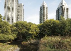
Taqralik Partridge speaks with Rafico Ruiz and Ella den Elzen about the importance of Inuit homes and homelands
Published:
6 June 2022
6 June 2022
Title:
Welcome Home
Taqralik Partridge speaks with Rafico Ruiz and Ella den Elzen about the importance of Inuit homes and homelands
Actions:
Welcome Home
Taqralik Partridge speaks with Rafico Ruiz and Ella den Elzen about the importance of Inuit homes and homelands
Actions:
Form:
events
events
Actions:
Location:
online
online
Date:
17 June, 5pm
17 June, 5pm
Form:
events
events
Date:
17 June
5pm
17 June
5pm
Location:
online
online
Form:
research
research
Actions:
Date:
June 2024 to August 2024
June 2024 to August 2024
Form:
research
research
Date:
June 2024 to
August 2024
June 2024 to
August 2024
Form:
research
research
Actions:
Date:
June 2025 to August 2025
June 2025 to August 2025
Form:
research
research
Date:
June 2025 to
August 2025
June 2025 to
August 2025
Form:
research
research
Actions:
Date:
June 2023 to August 2023
June 2023 to August 2023
Form:
research
research
Date:
June 2023 to
August 2023
June 2023 to
August 2023
Form:
events
events

Actions:
Location:
Study Room, CCA
Study Room, CCA
Date:
31 July 2025, 6pm
31 July 2025, 6pm
Form:
events
events
Date:
31 July 2025
6pm
31 July 2025
6pm
Location:
Study Room, CCA
Study Room, CCA
Form:
articles
articles
Title:
Projecting the Landscape
Projecting the Landscape
Actions:
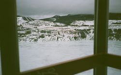
Alec White Reflects on the Role of Belvederes in the Conception of Territory
Issue:
Figuring Territory
Figuring Territory
Published:
3 January 2023
3 January 2023
Title:
Projecting the Landscape
Alec White Reflects on the Role of Belvederes in the Conception of Territory
Actions:
Projecting the Landscape
Alec White Reflects on the Role of Belvederes in the Conception of Territory
Actions:
Issue:
Figuring Territory
Figuring Territory
Form:
events
events
Description:
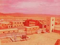
The film program turns to artists examining the ways territories are imagined, represented, and governed. Moving through simulated landscapes, aerial surveys, borders, and systems of measurement, the films trace how territory is made available to power before violence becomes visible.
The film program turns to artists examining the ways territories are imagined, represented, and governed. Moving through simulated landscapes, aerial surveys, borders, and systems of measurement, the films trace how territory is made available to power before violence becomes visible.
Date:
29 November 2026, 2pm to 4pm
29 November 2026, 2pm to 4pm
Title:
The Distance Between Us and the Ground: To Hold the Distance
Actions:
Description:
The film program turns to artists examining the ways territories are imagined, represented, and governed. Moving through simulated landscapes, aerial surveys, borders, and systems of measurement, the films trace how territory is made available to power before violence becomes visible.
The Distance Between Us and the Ground: To Hold the Distance
Actions:
Description:
The film program turns to artists examining the ways territories are imagined, represented, and governed. Moving through simulated landscapes, aerial surveys, borders, and systems of measurement, the films trace how territory is made available to power before violence becomes visible.
Form:
events
events
Date:
29 November 2026
2pm to 4pm
29 November 2026
2pm to 4pm


