


2727 Results
Form:
books
books
Actions:
Holdings:
Description:
xi, 270 pages : illustrations, cartes ; 23 cm
Description:
xi, 270 pages : illustrations, cartes ; 23 cm
Subject:
- Bouchette, Joseph, 1760-1840.,
- Bouchette, Joseph, 1774-1841.,
- Cartography Québec (Province) History.,
- Surveying Québec (Province) History.,
- Cartographie Québec (Canada ; province) Histoire.,
- Arpentage Québec (Canada ; province) Histoire.,
- Cartographie Québec (Province) Histoire.,
- Arpentage Québec (Province) Histoire.,
- Cartography.,
- Surveying.,
- Cartographie Canada Québec (Canada) (province) 18e siècle.,
- Cartographie Canada Québec (Canada) (province) 19e siècle.,
- Arpentage Canada Québec (Canada) (province) 18e siècle.,
- Arpentage Canada Québec (Canada) (province) 19e siècle.,
- Cartographie Aspect politique Canada Québec (Canada) (province) 18e siècle.,
- Cartographie Aspect politique Canada Québec (Canada) (province) 19e siècle.,
- Cartographie.,
- cartographie Québec (Canada, province) 1760 1840.,
- Québec (Province) Maps.,
- Canada History 1763-1791 Maps.,
- Québec (Canada ; province) Cartes.,
- Canada Histoire 18e siècle Cartes.,
- Québec (Canada ; province) 19e siècle Cartes.,
- Québec (Province) Cartes.,
- Canada Histoire 1763-1791 Cartes.,
- Québec, Province du (Canada) Cartes.,
- Canada.,
- Québec.,
- Québec (Canada) (province) Cartes anciennes.,
- Québec (Province),
- History.,
- Maps.
(See more)
Publication:
Sainte-Foy, Québec : Presses de l'Université Laval, 1994.
Sainte-Foy, Québec : Presses de l'Université Laval, 1994.
Title:
La cartographie au Québec, 1760-1840 / Claude Boudreau.
Actions:
Holdings:
Description:
xi, 270 pages : illustrations, cartes ; 23 cm
La cartographie au Québec, 1760-1840 / Claude Boudreau.
Actions:
Holdings:
Description:
xi, 270 pages : illustrations, cartes ; 23 cm
Form:
books
books
Publication:
Sainte-Foy, Québec : Presses de l'Université Laval, 1994.
Sainte-Foy, Québec : Presses de l'Université Laval, 1994.
Subject:
- Bouchette, Joseph, 1760-1840.,
- Bouchette, Joseph, 1774-1841.,
- Cartography Québec (Province) History.,
- Surveying Québec (Province) History.,
- Cartographie Québec (Canada ; province) Histoire.,
- Arpentage Québec (Canada ; province) Histoire.,
- Cartographie Québec (Province) Histoire.,
- Arpentage Québec (Province) Histoire.,
- Cartography.,
- Surveying.,
- Cartographie Canada Québec (Canada) (province) 18e siècle.,
- Cartographie Canada Québec (Canada) (province) 19e siècle.,
- Arpentage Canada Québec (Canada) (province) 18e siècle.,
- Arpentage Canada Québec (Canada) (province) 19e siècle.,
- Cartographie Aspect politique Canada Québec (Canada) (province) 18e siècle.,
- Cartographie Aspect politique Canada Québec (Canada) (province) 19e siècle.,
- Cartographie.,
- cartographie Québec (Canada, province) 1760 1840.,
- Québec (Province) Maps.,
- Canada History 1763-1791 Maps.,
- Québec (Canada ; province) Cartes.,
- Canada Histoire 18e siècle Cartes.,
- Québec (Canada ; province) 19e siècle Cartes.,
- Québec (Province) Cartes.,
- Canada Histoire 1763-1791 Cartes.,
- Québec, Province du (Canada) Cartes.,
- Canada.,
- Québec.,
- Québec (Canada) (province) Cartes anciennes.,
- Québec (Province),
- History.,
- Maps.
(See more)
Form:
books
books
Actions:
Holdings:
Description:
viii, 316 p. : ill., maps ; 24 x 31 cm.
Description:
viii, 316 p. : ill., maps ; 24 x 31 cm.
Author:
Subject:
- Land settlement patterns Canada Maps.,
- Land settlement patterns United States Maps.,
- Colonisation intérieure Types Canada Cartes.,
- Colonisation intérieure Types États-Unis Cartes.,
- Land settlement patterns,
- Manners and customs,
- Linguistic geography United States Maps,
- Linguistic geography Canada Maps,
- United States Social life and customs Maps.,
- Canada Social life and customs Maps.,
- États-Unis Mœurs et coutumes Cartes.,
- Canada Mœurs et coutumes Cartes.,
- Canada,
- United States,
- United States Maps,
- Canada Maps,
- Maps,
- Cartes géographiques.
(See more)
Publication:
College Station [Tex.] : Published for The Society for the North American Cultural Survey by Texas A & M University Press, c1982.
College Station [Tex.] : Published for The Society for the North American Cultural Survey by Texas A & M University Press, c1982.
Title:
This remarkable continent : an atlas of United States and Canadian society and culture / general editors, John F. Rooney, Jr., Wilbur Zelinsky, and Dean R. Louder ; cartographic editor, John D. Vitek ; coordinating editor, Campbell W. Pennington : associate editors, James P. Allen [et al.].
Actions:
Holdings:
Description:
viii, 316 p. : ill., maps ; 24 x 31 cm.
Form:
books
books
Publication:
College Station [Tex.] : Published for The Society for the North American Cultural Survey by Texas A & M University Press, c1982.
College Station [Tex.] : Published for The Society for the North American Cultural Survey by Texas A & M University Press, c1982.
Subject:
- Land settlement patterns Canada Maps.,
- Land settlement patterns United States Maps.,
- Colonisation intérieure Types Canada Cartes.,
- Colonisation intérieure Types États-Unis Cartes.,
- Land settlement patterns,
- Manners and customs,
- Linguistic geography United States Maps,
- Linguistic geography Canada Maps,
- United States Social life and customs Maps.,
- Canada Social life and customs Maps.,
- États-Unis Mœurs et coutumes Cartes.,
- Canada Mœurs et coutumes Cartes.,
- Canada,
- United States,
- United States Maps,
- Canada Maps,
- Maps,
- Cartes géographiques.
(See more)
Form:
books
books
Actions:
Price:
$29.95
(available in store)
Summary:
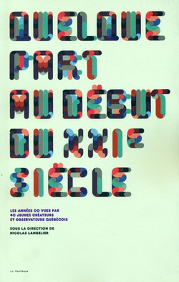
Dans ce livre collectif éclaté, 40 jeunes créateurs et observateurs québécois nous livrent leur vision très personnelle de la première décennie du XXIe siècle. Nouvelle, essai, bande dessinée, illustration, poésie : profitant de la carte blanche qui leur était offerte, ils ont eu recours à des approches différentes pour tracer un portrait kaléidoscopique mais(...)
Title:
Quelque part au début du XXIe siècle
Actions:
Price:
$29.95
(available in store)
Summary:
Dans ce livre collectif éclaté, 40 jeunes créateurs et observateurs québécois nous livrent leur vision très personnelle de la première décennie du XXIe siècle. Nouvelle, essai, bande dessinée, illustration, poésie : profitant de la carte blanche qui leur était offerte, ils ont eu recours à des approches différentes pour tracer un portrait kaléidoscopique mais singulièrement cohérent de notre époque.
Form:
books
books
Publication:
December 2008, Montréal
December 2008, Montréal
Subject:
Canadian art
Canadian art
Form:
books
books
Actions:
Holdings:
Description:
199 pages : illustrations (some color), maps ; 26 cm
Description:
199 pages : illustrations (some color), maps ; 26 cm
Subject:
Publication:
London : Thames and Hudson, ©1980.
London : Thames and Hudson, ©1980.
Title:
The history of topographical maps : symbols, pictures and surveys / P.D.A. Harvey.
Actions:
Holdings:
Description:
199 pages : illustrations (some color), maps ; 26 cm
The history of topographical maps : symbols, pictures and surveys / P.D.A. Harvey.
Actions:
Holdings:
Description:
199 pages : illustrations (some color), maps ; 26 cm
Form:
books
books
Publication:
London : Thames and Hudson, ©1980.
London : Thames and Hudson, ©1980.
Form:
maps
maps
Actions:
Holdings:
Description:
31 leaves : maps ; 37 x 53 cm
Description:
31 leaves : maps ; 37 x 53 cm
Subject:
Publication:
Toronto : Oxford University Press, [1971]
Toronto : Oxford University Press, [1971]
Title:
Maps of the Prairie Provinces / editor, Thomas R. Weir ; Cartographer, Geoffrey Matthews.
Actions:
Holdings:
Description:
31 leaves : maps ; 37 x 53 cm
Maps of the Prairie Provinces / editor, Thomas R. Weir ; Cartographer, Geoffrey Matthews.
Actions:
Holdings:
Description:
31 leaves : maps ; 37 x 53 cm
Form:
maps
maps
Publication:
Toronto : Oxford University Press, [1971]
Toronto : Oxford University Press, [1971]
Form:
books
books
Actions:
Holdings:
Description:
217 pages : illustrations (some color), portraits ; 32 x 27 cm
Description:
217 pages : illustrations (some color), portraits ; 32 x 27 cm
Author:
Subject:
- Indian photographers Exhibitions.,
- Indigenous art Exhibitions.,
- Indigenous peoples Portraits.,
- Photography Social aspects Exhibitions.,
- Photography, Artistic.,
- Portrait photography.,
- Photographes des Peuples autochtones Expositions.,
- Art autochtone Expositions.,
- Photographie Aspect social Expositions.,
- Photographie artistique.,
- Portraits (Photographie),
- art photography.,
- ART / Indigenous Art of the Americas.,
- Indian photographers,
- Indigenous art,
- Indigenous peoples,
- Photography Social aspects,
- exhibition catalogs.,
- Exhibition catalogs,
- Portraits,
- Catalogues d'exposition.
(See more)
Publication:
Santa Fe, New Mexico : Radius Books ; Fort Worth, Texas : Amon Carter Museum of Art, [2022], ©2022
Santa Fe, New Mexico : Radius Books ; Fort Worth, Texas : Amon Carter Museum of Art, [2022], ©2022
Title:
Speaking with light : contemporary Indigenous photography / John Rohrbach, Will Wilson.
Actions:
Holdings:
Description:
217 pages : illustrations (some color), portraits ; 32 x 27 cm
Speaking with light : contemporary Indigenous photography / John Rohrbach, Will Wilson.
Actions:
Holdings:
Description:
217 pages : illustrations (some color), portraits ; 32 x 27 cm
Form:
books
books
Publication:
Santa Fe, New Mexico : Radius Books ; Fort Worth, Texas : Amon Carter Museum of Art, [2022], ©2022
Santa Fe, New Mexico : Radius Books ; Fort Worth, Texas : Amon Carter Museum of Art, [2022], ©2022
Subject:
- Indian photographers Exhibitions.,
- Indigenous art Exhibitions.,
- Indigenous peoples Portraits.,
- Photography Social aspects Exhibitions.,
- Photography, Artistic.,
- Portrait photography.,
- Photographes des Peuples autochtones Expositions.,
- Art autochtone Expositions.,
- Photographie Aspect social Expositions.,
- Photographie artistique.,
- Portraits (Photographie),
- art photography.,
- ART / Indigenous Art of the Americas.,
- Indian photographers,
- Indigenous art,
- Indigenous peoples,
- Photography Social aspects,
- exhibition catalogs.,
- Exhibition catalogs,
- Portraits,
- Catalogues d'exposition.
(See more)
Form:
books
books
Actions:
Holdings:
Description:
xiii, 383 pages : maps ; 28 cm
Description:
xiii, 383 pages : maps ; 28 cm
Author:
Subject:
- Bibliothèque nationale du Québec Catalogs.,
- Bibliothèque nationale du Québec Catalogues.,
- Bibliothèque nationale du Québec,
- Atlassen.,
- Kaarten (geografie),
- North America Maps Maps Bibliography.,
- Québec (Province) Maps Maps Bibliography.,
- Amérique du Nord Cartes Bibliographie Catalogues.,
- Nouvelle-France Cartes Bibliographie Catalogues.,
- North America,
- Québec,
- Catalogs,
- Maps.,
- Cartes géographiques.
(See more)
Publication:
Montréal : Ministère des affaires culturelles, Bibliothèque nationale du Québec, 1985.
Montréal : Ministère des affaires culturelles, Bibliothèque nationale du Québec, 1985.
Title:
Documents cartographiques depuis la découverte de lʼAmérique jusquʼà 1820 : inventaire sommaire / Pierre Lépine, Josée Berthelette.
Actions:
Holdings:
Description:
xiii, 383 pages : maps ; 28 cm
Documents cartographiques depuis la découverte de lʼAmérique jusquʼà 1820 : inventaire sommaire / Pierre Lépine, Josée Berthelette.
Actions:
Holdings:
Description:
xiii, 383 pages : maps ; 28 cm
Form:
books
books
Publication:
Montréal : Ministère des affaires culturelles, Bibliothèque nationale du Québec, 1985.
Montréal : Ministère des affaires culturelles, Bibliothèque nationale du Québec, 1985.
Subject:
- Bibliothèque nationale du Québec Catalogs.,
- Bibliothèque nationale du Québec Catalogues.,
- Bibliothèque nationale du Québec,
- Atlassen.,
- Kaarten (geografie),
- North America Maps Maps Bibliography.,
- Québec (Province) Maps Maps Bibliography.,
- Amérique du Nord Cartes Bibliographie Catalogues.,
- Nouvelle-France Cartes Bibliographie Catalogues.,
- North America,
- Québec,
- Catalogs,
- Maps.,
- Cartes géographiques.
(See more)
Form:
books
books
Actions:
Holdings:
Description:
xvi, 346 pages : illustrations ; 26 cm.
Description:
xvi, 346 pages : illustrations ; 26 cm.
Subject:
- Historisches Museum Frankfurt Museumspädagogik,
- Museums and schools.,
- Museums Environmental aspects.,
- Museums and schools Great Britain.,
- Museums Environmental aspects Great Britain.,
- Museums Educational aspects.,
- Museums Educational aspects Great Britain.,
- Musées et écoles.,
- Musées Aspect éducatif.,
- Musées et écoles Grande-Bretagne.,
- Musées Aspect éducatif Grande-Bretagne.,
- Musées Aspect de l'environnement.,
- Musées Aspect de l'environnement Grande-Bretagne.,
- 02.30 museology.,
- Museums.,
- Museumspädagogik,
- Museumkunde.,
- Musea.,
- Onderwijs.,
- Museus.,
- Educação em museus Grã-bretanha.,
- Ação educativa-cultural Grã-bretanha.,
- Great Britain,
- Museums -- Educational aspects,
- Museums and schools -- Great Britain,
- Museums -- Educational aspects -- Great Britain,
- musea,
- museums,
- scholen,
- schools,
- communicatie,
- communication,
- leren,
- learning,
- onderwijs,
- education,
- culturele uitingen,
- cultural exhibitions,
- tentoonstellingen,
- exhibitions,
- publiek,
- audiences,
- Arts (General),
- Education (General),
- Kunst (algemeen),
- Onderwijs (algemeen)
(See more)
Publication:
London ; New York : Routledge, 1999.
London ; New York : Routledge, 1999.
Title:
The educational role of the museum / edited by Eilean Hooper-Greenhill.
Actions:
Holdings:
Description:
xvi, 346 pages : illustrations ; 26 cm.
The educational role of the museum / edited by Eilean Hooper-Greenhill.
Actions:
Holdings:
Description:
xvi, 346 pages : illustrations ; 26 cm.
Form:
books
books
Publication:
London ; New York : Routledge, 1999.
London ; New York : Routledge, 1999.
Subject:
- Historisches Museum Frankfurt Museumspädagogik,
- Museums and schools.,
- Museums Environmental aspects.,
- Museums and schools Great Britain.,
- Museums Environmental aspects Great Britain.,
- Museums Educational aspects.,
- Museums Educational aspects Great Britain.,
- Musées et écoles.,
- Musées Aspect éducatif.,
- Musées et écoles Grande-Bretagne.,
- Musées Aspect éducatif Grande-Bretagne.,
- Musées Aspect de l'environnement.,
- Musées Aspect de l'environnement Grande-Bretagne.,
- 02.30 museology.,
- Museums.,
- Museumspädagogik,
- Museumkunde.,
- Musea.,
- Onderwijs.,
- Museus.,
- Educação em museus Grã-bretanha.,
- Ação educativa-cultural Grã-bretanha.,
- Great Britain,
- Museums -- Educational aspects,
- Museums and schools -- Great Britain,
- Museums -- Educational aspects -- Great Britain,
- musea,
- museums,
- scholen,
- schools,
- communicatie,
- communication,
- leren,
- learning,
- onderwijs,
- education,
- culturele uitingen,
- cultural exhibitions,
- tentoonstellingen,
- exhibitions,
- publiek,
- audiences,
- Arts (General),
- Education (General),
- Kunst (algemeen),
- Onderwijs (algemeen)
(See more)
Form:
books
books
Actions:
Holdings:
Description:
80 pages : illustrations (some color) maps, plans ; 18 x 22 cm
- Library main y 107098 | W6364 | Available
- Library main y 107099 | 11381 | Available
(See more)
Description:
80 pages : illustrations (some color) maps, plans ; 18 x 22 cm
Author:
Subject:
- City planning England London.,
- Urban renewal England London.,
- Public works England London.,
- Traffic engineering England London.,
- Urbanisme Angleterre Londres.,
- Rénovation urbaine Angleterre Londres.,
- Travaux publics Angleterre Londres.,
- City planning,
- HUMAN SETTLEMENTS.,
- London (England) Growth.,
- London (England) Maps.,
- England London,
- duitsland,
- germany,
- great britain,
- landgebruik,
- land use,
- bedrijfsvoering,
- management,
- regionale planning,
- regional planning,
- plattelandsontwikkeling,
- rural development,
- plattelandsplanning,
- rural planning,
- Regional Plans,
- Regionale plannen,
- Books.
(See more)
Publication:
West Drayton, Middlesex, England : Penguin Books, 1945.
West Drayton, Middlesex, England : Penguin Books, 1945.
Title:
The county of London plan / explained by E.J. Carter and Ernö Goldfinger.
Actions:
Holdings:
Description:
80 pages : illustrations (some color) maps, plans ; 18 x 22 cm
The county of London plan / explained by E.J. Carter and Ernö Goldfinger.
Actions:
Holdings:
- Library main y 107098 | W6364 | Available
- Library main y 107099 | 11381 | Available
(See more)
Description:
80 pages : illustrations (some color) maps, plans ; 18 x 22 cm
Form:
books
books
Publication:
West Drayton, Middlesex, England : Penguin Books, 1945.
West Drayton, Middlesex, England : Penguin Books, 1945.
Subject:
- City planning England London.,
- Urban renewal England London.,
- Public works England London.,
- Traffic engineering England London.,
- Urbanisme Angleterre Londres.,
- Rénovation urbaine Angleterre Londres.,
- Travaux publics Angleterre Londres.,
- City planning,
- HUMAN SETTLEMENTS.,
- London (England) Growth.,
- London (England) Maps.,
- England London,
- duitsland,
- germany,
- great britain,
- landgebruik,
- land use,
- bedrijfsvoering,
- management,
- regionale planning,
- regional planning,
- plattelandsontwikkeling,
- rural development,
- plattelandsplanning,
- rural planning,
- Regional Plans,
- Regionale plannen,
- Books.
(See more)
Form:
books
books
Actions:
Holdings:
Description:
[2], 22 pages : fol. XI plates (part double; including plan) ; 69 cm
Description:
[2], 22 pages : fol. XI plates (part double; including plan) ; 69 cm
Title:
Some account of the Cathedral Church of Exeter : illustrative of the plans, elevations and sections of that building.
Actions:
Holdings:
Description:
[2], 22 pages : fol. XI plates (part double; including plan) ; 69 cm
Some account of the Cathedral Church of Exeter : illustrative of the plans, elevations and sections of that building.
Actions:
Holdings:
Description:
[2], 22 pages : fol. XI plates (part double; including plan) ; 69 cm
Form:
books
books
Publication:
[London] : [Society of Antiquaries of London], [1797?]
[London] : [Society of Antiquaries of London], [1797?]


