2699 Results
Form:
books
books
Actions:
Holdings:
Description:
9 portfolios : illustrations, facsimiles, maps, portraits ; 41 x 57 cm + texts (9 volumes : illustrations, maps ; 25-40 cm)
- Library main m 285466 | ID:87-B4589 | index | Available
- Library main m 15471 | ID:87-B4589 | v. 1 plates | Available
- Library main m 15472 | ID:87-B4589 | v. 1 text | Available
- Library main m 15469 | ID:87-B4589 | v. 2 plates | Available
- Library main m 15470 | ID:87-B4589 | v. 2 text | Available
- Library main m 15467 | ID:87-B4589 | v. 3 plates | Available
- Library main m 15468 | ID:87-B4589 | v. 3 text | Available
- Library main m 15465 | ID:87-B4589 | v. 4 plates | Available
- Library main m 15466 | ID:87-B4589 | v. 4 text | Available
- Library main m 15464 | ID:87-B4589 | v. 5 plates | Available
- Library main m 15463 | ID:87-B4589 | v. 5 text | Available
- Library main m 214051 | ID:87-B4589 | v. 6 plates | Available
- Library main m 214052 | ID:87-B4589 | v. 6 text | Available
- Library main m 228661 | ID:87-B4589 | v. 7 plates | Available
- Library main m 258335 | ID:87-B4589 | v. 7 text | Available
- Library main m 258324 | ID:87-B4589 | v. 8 plates | Available
- Library main m 258325 | ID:87-B4589 | v. 8 text | Available
- Library main m 285464 | ID:87-B4589 | v. 9 plates | Available
- Library main m 285465 | ID:87-B4589 | v. 9 text | Available
(See more)
Description:
9 portfolios : illustrations, facsimiles, maps, portraits ; 41 x 57 cm + texts (9 volumes : illustrations, maps ; 25-40 cm)
Subject:
Publication:
Alphen aan den Rijn : Uitgeverij "Canaletto", 1986-2013.
Alphen aan den Rijn : Uitgeverij "Canaletto", 1986-2013.
Title:
Monumenta cartographica Neerlandica / Günter Schilder.
Actions:
Holdings:
Description:
9 portfolios : illustrations, facsimiles, maps, portraits ; 41 x 57 cm + texts (9 volumes : illustrations, maps ; 25-40 cm)
Monumenta cartographica Neerlandica / Günter Schilder.
Actions:
Holdings:
- Library main m 285466 | ID:87-B4589 | index | Available
- Library main m 15471 | ID:87-B4589 | v. 1 plates | Available
- Library main m 15472 | ID:87-B4589 | v. 1 text | Available
- Library main m 15469 | ID:87-B4589 | v. 2 plates | Available
- Library main m 15470 | ID:87-B4589 | v. 2 text | Available
- Library main m 15467 | ID:87-B4589 | v. 3 plates | Available
- Library main m 15468 | ID:87-B4589 | v. 3 text | Available
- Library main m 15465 | ID:87-B4589 | v. 4 plates | Available
- Library main m 15466 | ID:87-B4589 | v. 4 text | Available
- Library main m 15464 | ID:87-B4589 | v. 5 plates | Available
- Library main m 15463 | ID:87-B4589 | v. 5 text | Available
- Library main m 214051 | ID:87-B4589 | v. 6 plates | Available
- Library main m 214052 | ID:87-B4589 | v. 6 text | Available
- Library main m 228661 | ID:87-B4589 | v. 7 plates | Available
- Library main m 258335 | ID:87-B4589 | v. 7 text | Available
- Library main m 258324 | ID:87-B4589 | v. 8 plates | Available
- Library main m 258325 | ID:87-B4589 | v. 8 text | Available
- Library main m 285464 | ID:87-B4589 | v. 9 plates | Available
- Library main m 285465 | ID:87-B4589 | v. 9 text | Available
(See more)
Description:
9 portfolios : illustrations, facsimiles, maps, portraits ; 41 x 57 cm + texts (9 volumes : illustrations, maps ; 25-40 cm)
Form:
books
books
Publication:
Alphen aan den Rijn : Uitgeverij "Canaletto", 1986-2013.
Alphen aan den Rijn : Uitgeverij "Canaletto", 1986-2013.
Form:
books
books
Title:
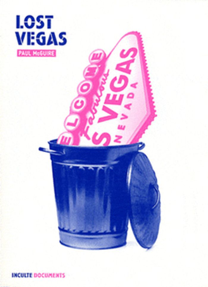
Paul McGuire : Lost Vegas
Paul McGuire : Lost Vegas
Actions:
Price:
$34.95
(available to order)
Summary:
« Où pouvait-on en une nuit : manger un steak pour une poignée de dollars, s’incruster dans un mariage mexicain, se faire plumer au black jack par un croupier nommé Dong, jouer au vidéo poker pendant treize heures d’affilée, siroter une piña colada servie dans une noix de coco, taxer une cigarette à une vieille de 85 ans sous aide respiratoire, foncer à bord d’une(...)
Title:
Paul McGuire : Lost Vegas
Actions:
Price:
$34.95
(available to order)
Summary:
« Où pouvait-on en une nuit : manger un steak pour une poignée de dollars, s’incruster dans un mariage mexicain, se faire plumer au black jack par un croupier nommé Dong, jouer au vidéo poker pendant treize heures d’affilée, siroter une piña colada servie dans une noix de coco, taxer une cigarette à une vieille de 85 ans sous aide respiratoire, foncer à bord d’une limousine aux frais de la princesse jusqu’au Spearmint Rhino, s’y frotter la queue contre une ex-Miss USA, dégueuler à l’arrière d’un taxi conduit par un ancien para, sniffer de la coke bas de gamme dans les toilettes du O’Sheas, et finir par trouver la carte miraculeuse, celle qui défonce la paire d’As de votre adversaire et vous fait gagner un tournoi de poker ? À Las Vegas, et nulle part ailleurs. » Derrière l’image de Las Vegas, métropole gigantesque aux néons luisants, se cache un visage blafard, celui des losers exsangues, des parieurs éreintés, des prostituées camées et des motels croulants. Dans Lost Vegas, le journaliste américain Paul McGuire raconte les arrière-cours du gaming business, les tricheries et les pactes faustiens des casinotiers, la réalité sordide d’une ville qui révèle plus qu’aucune autre la misère humaine.
Form:
books
books
Publication:
November 2012
November 2012
Subject:
Urban Theory
Urban Theory
Form:
books
books
Actions:
Holdings:
Description:
ix, 400 pages : illustrations (chiefly color), maps (chiefly color) ; 29 cm
Description:
ix, 400 pages : illustrations (chiefly color), maps (chiefly color) ; 29 cm
Author:
Subject:
Publication:
Chicago : University of Chicago Press, 2007, ©2007
Chicago : University of Chicago Press, 2007, ©2007
Title:
Maps : finding our place in the world / edited by James R. Akerman and Robert W. Karrow, Jr.
Actions:
Holdings:
Description:
ix, 400 pages : illustrations (chiefly color), maps (chiefly color) ; 29 cm
Maps : finding our place in the world / edited by James R. Akerman and Robert W. Karrow, Jr.
Actions:
Holdings:
Description:
ix, 400 pages : illustrations (chiefly color), maps (chiefly color) ; 29 cm
Form:
books
books
Publication:
Chicago : University of Chicago Press, 2007, ©2007
Chicago : University of Chicago Press, 2007, ©2007
Form:
books
books
Holdings:
Description:
148 pages : chiefly color illustrations ; 28 cm
Description:
148 pages : chiefly color illustrations ; 28 cm
Subject:
- Postcards Québec (Province) Montréal.,
- Cartes postales Québec (Province) Montréal.,
- Buildings,
- Postcards,
- Montréal (Québec) History 20th century Pictorial works.,
- Montréal (Québec) Buildings, structures, etc. Pictorial works.,
- Montréal (Québec) Histoire 20e siècle Ouvrages illustrés,
- Montréal (Québec) Constructions Ouvrages illustrés,
- Québec Montréal,
- Spiral bindings.,
- History,
- Illustrated works
(See more)
Publication:
Verdun, Quebec, Canada : Bird Bear Press, [2017], ©2017
Verdun, Quebec, Canada : Bird Bear Press, [2017], ©2017
Title:
Early Montreal postcards / by Gordon Brooks & Ronald G. Lafrenière.
Actions:
Holdings:
Description:
148 pages : chiefly color illustrations ; 28 cm
Early Montreal postcards / by Gordon Brooks & Ronald G. Lafrenière.
Actions:
Holdings:
Description:
148 pages : chiefly color illustrations ; 28 cm
Form:
books
books
Publication:
Verdun, Quebec, Canada : Bird Bear Press, [2017], ©2017
Verdun, Quebec, Canada : Bird Bear Press, [2017], ©2017
Subject:
- Postcards Québec (Province) Montréal.,
- Cartes postales Québec (Province) Montréal.,
- Buildings,
- Postcards,
- Montréal (Québec) History 20th century Pictorial works.,
- Montréal (Québec) Buildings, structures, etc. Pictorial works.,
- Montréal (Québec) Histoire 20e siècle Ouvrages illustrés,
- Montréal (Québec) Constructions Ouvrages illustrés,
- Québec Montréal,
- Spiral bindings.,
- History,
- Illustrated works
(See more)
Form:
books
books
Actions:
Holdings:
Description:
148 pages : illustrations (some color), maps ; 43 cm
Description:
148 pages : illustrations (some color), maps ; 43 cm
Subject:
- Public housing Netherlands Amsterdam.,
- Architecture, Domestic Netherlands Amsterdam.,
- Logement social Pays-Bas Amsterdam.,
- Architecture, Domestic,
- Buildings,
- Public housing,
- Sociale woningbouw.,
- Amsterdam (Netherlands) Buildings, structures, etc.,
- Amsterdam (Netherlands) Maps.,
- Netherlands Amsterdam,
- Amsterdam Buildings, structures, etc,
- Amsterdam Maps,
- Architecture, Netherlands Amsterdam,
- Public Netherlands Amsterdam,
- Maps,
- Cartes géographiques.
(See more)
Publication:
Amsterdam : Amsterdamse Federatie van Woningcorporaties, [1992]
Amsterdam : Amsterdamse Federatie van Woningcorporaties, [1992]
Title:
Sociale woningbouw Amsterdam atlas = The Amsterdam social housing atlas / [red. Françoise Paulen and others].
Actions:
Holdings:
Description:
148 pages : illustrations (some color), maps ; 43 cm
Sociale woningbouw Amsterdam atlas = The Amsterdam social housing atlas / [red. Françoise Paulen and others].
Actions:
Holdings:
Description:
148 pages : illustrations (some color), maps ; 43 cm
Form:
books
books
Publication:
Amsterdam : Amsterdamse Federatie van Woningcorporaties, [1992]
Amsterdam : Amsterdamse Federatie van Woningcorporaties, [1992]
Subject:
- Public housing Netherlands Amsterdam.,
- Architecture, Domestic Netherlands Amsterdam.,
- Logement social Pays-Bas Amsterdam.,
- Architecture, Domestic,
- Buildings,
- Public housing,
- Sociale woningbouw.,
- Amsterdam (Netherlands) Buildings, structures, etc.,
- Amsterdam (Netherlands) Maps.,
- Netherlands Amsterdam,
- Amsterdam Buildings, structures, etc,
- Amsterdam Maps,
- Architecture, Netherlands Amsterdam,
- Public Netherlands Amsterdam,
- Maps,
- Cartes géographiques.
(See more)
Form:
books
books
Actions:
Holdings:
Description:
2 volumes : illustrations (some color), maps (some color) ; 29 cm
Description:
2 volumes : illustrations (some color), maps (some color) ; 29 cm
Subject:
- Cities and towns in art.,
- Art, Italian.,
- Art, European.,
- Cities and towns Italy Campania Maps.,
- Cartography Italy Campania History.,
- Art italien.,
- Art européen.,
- Cartographie Italie Campanie Histoire.,
- Cartography,
- Cities and towns,
- Campania (Italy) In art.,
- Campanie (Italie) Dans l'art.,
- Italy Campania,
- Art,
- History,
- Maps,
- Cartes géographiques.
(See more)
Publication:
[Naples] : Electa Napoli, ©2006-©2007.
[Naples] : Electa Napoli, ©2006-©2007.
Title:
Iconografia delle città in Campania / a cura di Cesare De Seta e Alfredo Buccaro.
Actions:
Holdings:
Description:
2 volumes : illustrations (some color), maps (some color) ; 29 cm
Iconografia delle città in Campania / a cura di Cesare De Seta e Alfredo Buccaro.
Actions:
Holdings:
Description:
2 volumes : illustrations (some color), maps (some color) ; 29 cm
Form:
books
books
Publication:
[Naples] : Electa Napoli, ©2006-©2007.
[Naples] : Electa Napoli, ©2006-©2007.
Subject:
- Cities and towns in art.,
- Art, Italian.,
- Art, European.,
- Cities and towns Italy Campania Maps.,
- Cartography Italy Campania History.,
- Art italien.,
- Art européen.,
- Cartographie Italie Campanie Histoire.,
- Cartography,
- Cities and towns,
- Campania (Italy) In art.,
- Campanie (Italie) Dans l'art.,
- Italy Campania,
- Art,
- History,
- Maps,
- Cartes géographiques.
(See more)
Form:
books
books
Actions:
Holdings:
Description:
xvii, 233 pages : illustrations ; 23 cm
- Library main 193758 | ID Z692.P65; ID:97-B48 | Available
- Library main 193759 | ID Z692.P65; ID:97-B48 | Available
(See more)
Description:
xvii, 233 pages : illustrations ; 23 cm
Author:
- Norman D. Stevens -- Katherine Hamilton-Smith -- Donald R. Brown -- Richard H. Engeman -- Lois R. Densky-Wolff -- Meredith Eliassen -- Martha McPhail -- Jack Robertson -- Alison M. Scott -- Claudia Hill -- Barbara L. Anderson -- Elena S. Danielson -- John K. Crellin and William H. Helfand -- Richard Saunders -- Loriene Roy -- Timothy D. Murray -- Jennifer Henderson -- Mary K. Mannix -- Jan Merrill-Oldham -- Chris Wolff -- Norman D. Stevens.,
- Stevens, Norman D.,
(See more)
Subject:
- Libraries Special collections United States Postcards.,
- Libraries and pictures United States.,
- Postcards United States.,
- Libraries and pictures.,
- Bibliothèques États-Unis Fonds spéciaux Cartes postales.,
- Bibliothèques et illustrations, images, etc. États-Unis.,
- Bibliothèques et illustrations, images, etc.,
- Bibliotecas Estados Unidos Colecciones especiales Tarjetas postales,
- Libraries Special collections,
- Postcards,
- Prentbriefkaarten.,
- Bibliotheekcollecties.,
- Bibliothèques Fonds spéciaux Non-livres.,
- Cartes postales États-Unis.,
- United States
(See more)
Publication:
New York : The Haworth Press, [1995], ©1995
New York : The Haworth Press, [1995], ©1995
Title:
Postcards in the library : invaluable visual resources / Norman D. Stevens, editor.
Actions:
Holdings:
Description:
xvii, 233 pages : illustrations ; 23 cm
Postcards in the library : invaluable visual resources / Norman D. Stevens, editor.
Actions:
Holdings:
- Library main 193758 | ID Z692.P65; ID:97-B48 | Available
- Library main 193759 | ID Z692.P65; ID:97-B48 | Available
(See more)
Description:
xvii, 233 pages : illustrations ; 23 cm
Form:
books
books
Publication:
New York : The Haworth Press, [1995], ©1995
New York : The Haworth Press, [1995], ©1995
Author:
- Norman D. Stevens -- Katherine Hamilton-Smith -- Donald R. Brown -- Richard H. Engeman -- Lois R. Densky-Wolff -- Meredith Eliassen -- Martha McPhail -- Jack Robertson -- Alison M. Scott -- Claudia Hill -- Barbara L. Anderson -- Elena S. Danielson -- John K. Crellin and William H. Helfand -- Richard Saunders -- Loriene Roy -- Timothy D. Murray -- Jennifer Henderson -- Mary K. Mannix -- Jan Merrill-Oldham -- Chris Wolff -- Norman D. Stevens.,
- Stevens, Norman D.,
(See more)
Subject:
- Libraries Special collections United States Postcards.,
- Libraries and pictures United States.,
- Postcards United States.,
- Libraries and pictures.,
- Bibliothèques États-Unis Fonds spéciaux Cartes postales.,
- Bibliothèques et illustrations, images, etc. États-Unis.,
- Bibliothèques et illustrations, images, etc.,
- Bibliotecas Estados Unidos Colecciones especiales Tarjetas postales,
- Libraries Special collections,
- Postcards,
- Prentbriefkaarten.,
- Bibliotheekcollecties.,
- Bibliothèques Fonds spéciaux Non-livres.,
- Cartes postales États-Unis.,
- United States
(See more)
Form:
books
books
Actions:
Holdings:
Description:
28 unnumbered pages : chiefly color illustrations ; 19 cm
Description:
28 unnumbered pages : chiefly color illustrations ; 19 cm
Author:
Subject:
- Postcards United States Specimens.,
- Motion picture theaters United States Pictorial works.,
- Vernacular architecture United States Pictorial works.,
- Theaters United States.,
- Motion picture theaters United States.,
- Postcards United States.,
- Cartes postales États-Unis.,
- Théâtres États-Unis.,
- Cinémas États-Unis.,
- Architecture vernaculaire États-Unis Ouvrages illustrés.,
- Motion picture theaters,
- Postcards,
- Theaters,
- Vernacular architecture,
- United States,
- photobooks.,
- postcards.,
- Illustrated works,
- Photobooks,
- Pictorial works,
- Specimens,
- Ouvrages illustrés.,
- Livres de photographies.,
- Cartes postales.
(See more)
Publication:
Washington, D.C. : The Preservation Press, [1988], Offset Printing: John D. Lucas Printing Company
Washington, D.C. : The Preservation Press, [1988], Offset Printing: John D. Lucas Printing Company
Title:
Picture palaces : past-age postcards : 24 authentic old postcards - ready to mail / National Trust for Historic Preservation, Curt Teich Postcard Collection, Lake County Museum ; introduction by David Naylor.
Actions:
Holdings:
Description:
28 unnumbered pages : chiefly color illustrations ; 19 cm
Picture palaces : past-age postcards : 24 authentic old postcards - ready to mail / National Trust for Historic Preservation, Curt Teich Postcard Collection, Lake County Museum ; introduction by David Naylor.
Actions:
Holdings:
Description:
28 unnumbered pages : chiefly color illustrations ; 19 cm
Form:
books
books
Publication:
Washington, D.C. : The Preservation Press, [1988], Offset Printing: John D. Lucas Printing Company
Washington, D.C. : The Preservation Press, [1988], Offset Printing: John D. Lucas Printing Company
Subject:
- Postcards United States Specimens.,
- Motion picture theaters United States Pictorial works.,
- Vernacular architecture United States Pictorial works.,
- Theaters United States.,
- Motion picture theaters United States.,
- Postcards United States.,
- Cartes postales États-Unis.,
- Théâtres États-Unis.,
- Cinémas États-Unis.,
- Architecture vernaculaire États-Unis Ouvrages illustrés.,
- Motion picture theaters,
- Postcards,
- Theaters,
- Vernacular architecture,
- United States,
- photobooks.,
- postcards.,
- Illustrated works,
- Photobooks,
- Pictorial works,
- Specimens,
- Ouvrages illustrés.,
- Livres de photographies.,
- Cartes postales.
(See more)
Form:
books
books
Actions:
Holdings:
Description:
596 pages : illustrations (some color), color maps (some folded) ; 32 cm.
Description:
596 pages : illustrations (some color), color maps (some folded) ; 32 cm.
Subject:
Publication:
Bogotá : Alcadía Mayor de Bogotá D.C., Corporación La Candelaria : Editorial Planeta Colombiana, 2006.
Bogotá : Alcadía Mayor de Bogotá D.C., Corporación La Candelaria : Editorial Planeta Colombiana, 2006.
Title:
Atlas histórico de Bogotá : 1911-1948 / [dirección de investigación, Alberto Escovar Wilson-White, Fundación Erigaie ; textos, Fundación Erigaie, William Rodríguez].
Actions:
Holdings:
Description:
596 pages : illustrations (some color), color maps (some folded) ; 32 cm.
Atlas histórico de Bogotá : 1911-1948 / [dirección de investigación, Alberto Escovar Wilson-White, Fundación Erigaie ; textos, Fundación Erigaie, William Rodríguez].
Actions:
Holdings:
Description:
596 pages : illustrations (some color), color maps (some folded) ; 32 cm.
Form:
books
books
Publication:
Bogotá : Alcadía Mayor de Bogotá D.C., Corporación La Candelaria : Editorial Planeta Colombiana, 2006.
Bogotá : Alcadía Mayor de Bogotá D.C., Corporación La Candelaria : Editorial Planeta Colombiana, 2006.
Form:
maps
maps
Actions:
Holdings:
Description:
1 map on 6 sheets : color ; sheets 34 x 31 cm
Description:
1 map on 6 sheets : color ; sheets 34 x 31 cm
Subject:
- Fire risk assessment British Columbia Vancouver Maps.,
- Real property British Columbia Vancouver Maps.,
- Assurance-incendie Colombie-Britannique Vancouver Plans.,
- Plans cadastraux Colombie-Britannique Vancouver.,
- Assurance-incendie Colombie-Britannique Vancouver Cartes.,
- Fire risk assessment.,
- Real property.,
- Vancouver (B.C.) Maps.,
- Vancouver (C.-B.) Plans.,
- British Columbia Vancouver.,
- Fire insurance maps.,
- Maps.
(See more)
Publication:
[Toronto?] : Underwriters' Survey Bureau, [1962]
[Toronto?] : Underwriters' Survey Bureau, [1962]
Title:
Insurance plan of the city of Vancouver. Volume 14 : plan dated July 1962.
Actions:
Holdings:
Description:
1 map on 6 sheets : color ; sheets 34 x 31 cm
Insurance plan of the city of Vancouver. Volume 14 : plan dated July 1962.
Actions:
Holdings:
Description:
1 map on 6 sheets : color ; sheets 34 x 31 cm
Form:
maps
maps
Publication:
[Toronto?] : Underwriters' Survey Bureau, [1962]
[Toronto?] : Underwriters' Survey Bureau, [1962]
Subject:
- Fire risk assessment British Columbia Vancouver Maps.,
- Real property British Columbia Vancouver Maps.,
- Assurance-incendie Colombie-Britannique Vancouver Plans.,
- Plans cadastraux Colombie-Britannique Vancouver.,
- Assurance-incendie Colombie-Britannique Vancouver Cartes.,
- Fire risk assessment.,
- Real property.,
- Vancouver (B.C.) Maps.,
- Vancouver (C.-B.) Plans.,
- British Columbia Vancouver.,
- Fire insurance maps.,
- Maps.
(See more)