537 Results
Level of archival description:
Sub-series
Sub-series
Title:
Domestic Commissions
Domestic Commissions
Reference number:
CI001.S1.D2
Description:
Hubert and Charles Rohault de Fleury received domestic commissions for both urban housing -hôtel particuliers and apartment houses- and rural dwellings -châteaux, country houses and estates. Hubert also executed designs for furniture and garden pavilions. Hubert' work is characterized by restrained classical exteriors and luxurious Empire style interiors; both Charles' exteriors and interiors, especially those for Hôtels Sauvage and Soltykoff, reflect the exuberance of the Second Empire. The CCA albums include drawings from all stages of the design process but with an emphasis on design development drawings. Hubert's albums contain cost calculations and estimates, notes and letters. In general, the drawings by Charles are from a more developed phase of design than Hubert's; Hubert's commissions are more varied than Charles'. The austere classicism of Hubert's domestic work reflects the prevailing taste of the day and reveals the strong influence of his teacher, Jean Nicholas Louis Durand. The compostional effect of the houses' façades relies on the shape and rhythm of the fenestration and the geometric division by string courses and occasionally, pilasters. Columns are used infrequently as is decorative stonework. The plans are symmetrical and modular. This approach to design is especially evident in the series of proposals for a country house for comte Treilhard (DR1974:0002:034:001-082) and in a group of unidentified designs for houses (DR1974:0002:035:001-034), all of which illustrate an emphasis on plan in the design process and a distinct approach to the composition of the elevations, both derived from Durand. Hubert's domestic work was also influenced by Palladio (see especially DR1974:0002:038:001-029). The interiors and furniture designed by Hubert are typical of the Empire style (1). The drawings in the CCA collection illustrate the materials, palette and ornamental motifs of the period. The garden structures in Hubert's albums are more fanciful than his houses and are either Rustic, Chinoiserie or classical in style (2). His garden designs follow the contemporary French trend for "jardins anglais" with winding paths and naturalistic placement of the vegetation, sometimes in combination with more formal French gardens (3). One of the most comprehensively documented domestic project by Hubert is the Rohault de Fleury House (12-14 rue d'Aguesseau; 1824). The CCA collection contains an interesting series of preliminary drawings for alternate proposals for this house, a number of highly finished wash drawings (including the interior decorative scheme) for the final scheme (DR1974:0002:011:001-08) and several earlier (ca. 1806) proposals (DR1974:0002:035:001-034). The Domaine de la Vallée album (DR1974:0002:025:001-059) is notable for the range of subject matter included as well as for the insights into the character of a working country estate in the nineteenth century. The proposed modifications encompassed both functional (a bridge, a levee, granaries and stables) and aesthetic improvements, such as ornamental garden temples. The renovation of the house also exhibits both functional and aesthetic improvements. (1) Examples of Hubert's interiors and furniture can be found in albums, DR1974:0002:007:001-068, DR1974:0002:011:001-089, DR1974:0002:025:001-059, DR1974:0002:030:001-065 and DR1974:0002:035:001-034. (2) The best examples of his pavilions are found in album, DR1974:0002:038:001-029 with other examples in albums, DR1974:0002:025:001-059, DR1974:0002:030:001-065 and DR1974:0002:035:001-034. (3) Examples are found in albums, DR1974:0002:035:001-034 and DR1974:0002 :025:001-059. Also of note are drawings, DR1974:0002:007:007 and DR1974:0002:007:068.
People:
Date:
1802-[1840]
1802-[1840]
Title:
Domestic Commissions
CI001.S1.D2
Description:
Hubert and Charles Rohault de Fleury received domestic commissions for both urban housing -hôtel particuliers and apartment houses- and rural dwellings -châteaux, country houses and estates. Hubert also executed designs for furniture and garden pavilions. Hubert' work is characterized by restrained classical exteriors and luxurious Empire style interiors; both Charles' exteriors and interiors, especially those for Hôtels Sauvage and Soltykoff, reflect the exuberance of the Second Empire. The CCA albums include drawings from all stages of the design process but with an emphasis on design development drawings. Hubert's albums contain cost calculations and estimates, notes and letters. In general, the drawings by Charles are from a more developed phase of design than Hubert's; Hubert's commissions are more varied than Charles'. The austere classicism of Hubert's domestic work reflects the prevailing taste of the day and reveals the strong influence of his teacher, Jean Nicholas Louis Durand. The compostional effect of the houses' façades relies on the shape and rhythm of the fenestration and the geometric division by string courses and occasionally, pilasters. Columns are used infrequently as is decorative stonework. The plans are symmetrical and modular. This approach to design is especially evident in the series of proposals for a country house for comte Treilhard (DR1974:0002:034:001-082) and in a group of unidentified designs for houses (DR1974:0002:035:001-034), all of which illustrate an emphasis on plan in the design process and a distinct approach to the composition of the elevations, both derived from Durand. Hubert's domestic work was also influenced by Palladio (see especially DR1974:0002:038:001-029). The interiors and furniture designed by Hubert are typical of the Empire style (1). The drawings in the CCA collection illustrate the materials, palette and ornamental motifs of the period. The garden structures in Hubert's albums are more fanciful than his houses and are either Rustic, Chinoiserie or classical in style (2). His garden designs follow the contemporary French trend for "jardins anglais" with winding paths and naturalistic placement of the vegetation, sometimes in combination with more formal French gardens (3). One of the most comprehensively documented domestic project by Hubert is the Rohault de Fleury House (12-14 rue d'Aguesseau; 1824). The CCA collection contains an interesting series of preliminary drawings for alternate proposals for this house, a number of highly finished wash drawings (including the interior decorative scheme) for the final scheme (DR1974:0002:011:001-08) and several earlier (ca. 1806) proposals (DR1974:0002:035:001-034). The Domaine de la Vallée album (DR1974:0002:025:001-059) is notable for the range of subject matter included as well as for the insights into the character of a working country estate in the nineteenth century. The proposed modifications encompassed both functional (a bridge, a levee, granaries and stables) and aesthetic improvements, such as ornamental garden temples. The renovation of the house also exhibits both functional and aesthetic improvements. (1) Examples of Hubert's interiors and furniture can be found in albums, DR1974:0002:007:001-068, DR1974:0002:011:001-089, DR1974:0002:025:001-059, DR1974:0002:030:001-065 and DR1974:0002:035:001-034. (2) The best examples of his pavilions are found in album, DR1974:0002:038:001-029 with other examples in albums, DR1974:0002:025:001-059, DR1974:0002:030:001-065 and DR1974:0002:035:001-034. (3) Examples are found in albums, DR1974:0002:035:001-034 and DR1974:0002 :025:001-059. Also of note are drawings, DR1974:0002:007:007 and DR1974:0002:007:068.
Level of archival description:
File 2
File 2
Date:
1802-[1840]
1802-[1840]
People:
Title:
Cambridge
Cambridge
Actions:
Reference number:
PH1979:0600.01:001-036
Description:
This album comprises 28 albumen silver prints of monuments of Cambridge and the following description of views of Cambridge could apply to this album: "These views of Cambrige focus primarily on the University's great medieval colleges untouched by the additions, renovations and accretions of the twentieth century, but also document the uncluttered nature of the city itself in the third quarter of the nineteenth century. Sprouting gargoyles vie for attention with gothic pinnacles, graceful bridges reflect themselves in the River Cam, and top-hatted gentlemen stroll through the snowy lanes of winter while labourers, messengers and apprentices confront the camera's gaze." (Cambridge Book and Print Gallery). The monuments depicted are the following: Jesus College. New Buildings; Cambridge Divinity Schools; Queen's College Entrance Gate; St. John's Chapel, from Trinity Backs (Summer); St. John's Chapel, from Trinity Backs (Winter); St. John's College. Bridge of Sighs; Queen's Bridge; Queen's Gardens; Pembroke College; Catherine's College; Emanuel College; Magdelen College; St. Peters College; Dowing College; Cains College. Old Gateway; Sidney College; Trinity Hall; The Round Church; Senate House and Library; and Fitzwilliam Museum.
People:
Subject:
architecture
architecture
Date:
ca. 1880
ca. 1880
Title:
Cambridge
Actions:
PH1979:0600.01:001-036
Description:
This album comprises 28 albumen silver prints of monuments of Cambridge and the following description of views of Cambridge could apply to this album: "These views of Cambrige focus primarily on the University's great medieval colleges untouched by the additions, renovations and accretions of the twentieth century, but also document the uncluttered nature of the city itself in the third quarter of the nineteenth century. Sprouting gargoyles vie for attention with gothic pinnacles, graceful bridges reflect themselves in the River Cam, and top-hatted gentlemen stroll through the snowy lanes of winter while labourers, messengers and apprentices confront the camera's gaze." (Cambridge Book and Print Gallery). The monuments depicted are the following: Jesus College. New Buildings; Cambridge Divinity Schools; Queen's College Entrance Gate; St. John's Chapel, from Trinity Backs (Summer); St. John's Chapel, from Trinity Backs (Winter); St. John's College. Bridge of Sighs; Queen's Bridge; Queen's Gardens; Pembroke College; Catherine's College; Emanuel College; Magdelen College; St. Peters College; Dowing College; Cains College. Old Gateway; Sidney College; Trinity Hall; The Round Church; Senate House and Library; and Fitzwilliam Museum.
Date:
ca. 1880
ca. 1880
People:
Subject:
architecture
architecture
Level of archival description:
Project
Project
Reference number:
AP178.S1.1968.PR03
Description:
This project series documents the Arranjo Urbanístico para a Av. D. Afonso Henriques, in Porto, Portugal. The avenue is also known as Avenida da Ponte. While the records were held in the office’s archives this project was assigned the number 32/60. The office assigned the date 1968 for this project. The project consisted of an urban plan for this historic part of the city. It was done in relation to the Edifício de Escritórios na Av. D. Afonso Henriques (see project series AP178.S1.1968.PR02 described in this fonds). In the 1940s, demolition created a rupture with the remaining buildings, including the Porto Cathedral. Since the 1950s, there have been several studies and proposals to rearrange this part of the city. Siza’s plan was the first to be accepted by the city council in 1968. The project consisted of a new layout for the Avenue D. Afonso Henriques, the connection between the Luis I Bridge to the D. Pedro Square and the São Bento Railway Station. The intention of the project was also to reduce traffic. The project was not realized. Siza also proposed a new design in 2001 for the site across the avenue from this one, known as Avenida da Ponte II. This included a museum, library, stores, parking, and houses. This project related to the building Casa Dos 24 Fernando Távora. The scheme was not realized. Documenting the Arranjo Urbanistico are studies and site plans. For correspondence, project documentation and drawings related to this project see project series Edifício de Escritórios na Av. D. Afonso Henriques, Avenida da Ponte AP178.S1.1968.PR02.
People:
Date:
1968
1968
Title:
Arranjo Urbanístico para a Av. D. Afonso Henriques, Avenida da Ponte, [Urban planning for Av. D. Afonso Henriques, "Avenida da Ponte"], Porto, Portugal (1968)
Actions:
AP178.S1.1968.PR03
Description:
This project series documents the Arranjo Urbanístico para a Av. D. Afonso Henriques, in Porto, Portugal. The avenue is also known as Avenida da Ponte. While the records were held in the office’s archives this project was assigned the number 32/60. The office assigned the date 1968 for this project. The project consisted of an urban plan for this historic part of the city. It was done in relation to the Edifício de Escritórios na Av. D. Afonso Henriques (see project series AP178.S1.1968.PR02 described in this fonds). In the 1940s, demolition created a rupture with the remaining buildings, including the Porto Cathedral. Since the 1950s, there have been several studies and proposals to rearrange this part of the city. Siza’s plan was the first to be accepted by the city council in 1968. The project consisted of a new layout for the Avenue D. Afonso Henriques, the connection between the Luis I Bridge to the D. Pedro Square and the São Bento Railway Station. The intention of the project was also to reduce traffic. The project was not realized. Siza also proposed a new design in 2001 for the site across the avenue from this one, known as Avenida da Ponte II. This included a museum, library, stores, parking, and houses. This project related to the building Casa Dos 24 Fernando Távora. The scheme was not realized. Documenting the Arranjo Urbanistico are studies and site plans. For correspondence, project documentation and drawings related to this project see project series Edifício de Escritórios na Av. D. Afonso Henriques, Avenida da Ponte AP178.S1.1968.PR02.
Level of archival description:
Project
Project
Date:
1968
1968
People:
Form:
exhibitions
exhibitions
Title:
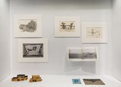
Starting From... Travel
Starting From... Travel
Actions:
Description:
Interpreting the subject of travel to distant places, the exhibition charts an expanded notion of travel that spans imaginary journeys, strange sites, vanishing points, floating and portable houses, endless caves, swirling diamond domes, tombs, crypts and catacombs, tunnel adventures, formal studies, technical innovation, cultural imagination, and experimental(...)
Interpreting the subject of travel to distant places, the exhibition charts an expanded notion of travel that spans imaginary journeys, strange sites, vanishing points, floating and portable houses, endless caves, swirling diamond domes, tombs, crypts and catacombs, tunnel adventures, formal studies, technical innovation, cultural imagination, and experimental(...)
Location:
Hall cases
Hall cases
Date:
3 December 2008 to 1 May 2009
3 December 2008 to 1 May 2009
Title:
Starting From... Travel
Actions:
Description:
Interpreting the subject of travel to distant places, the exhibition charts an expanded notion of travel that spans imaginary journeys, strange sites, vanishing points, floating and portable houses, endless caves, swirling diamond domes, tombs, crypts and catacombs, tunnel adventures, formal studies, technical innovation, cultural imagination, and experimental(...)
Form:
exhibitions
exhibitions
Date:
3 December 2008 to
1 May 2009
3 December 2008 to
1 May 2009
Location:
Hall cases
Hall cases
Level of archival description:
Project
Project
Reference number:
AP143.S4.D65
Description:
File documents the unexecuted project for the University Art Museum, Long Beach, California. Material in this file was produced between 1986 and 1988. California State University, Long Beach (CSULB), commissioned Eisenman/Robertson Architects to design an art museum adjacent to the main campus entrance. The 67,500-square-foot building was to comprise four galleries, a black-box theater, an auditorium, a cafe, conference rooms, a library, offices, preparation spaces, and storage vaults. The project, sited on a 23-acre arboretum, included landscaping; terraced sculpture courtyards, botanical gardens, and a two-acre pond. Eisenman linked the northern and southern parts of the arboretum by an elevated public walkway through the museum. Sets of drawings were presented on 8 and 30 April, 2 June, and 5 Aug. In the first design phase Eisenman explores the cartographic figures which form the basis of his artificial excavation when superposed: a series of sketches establishes the analogical relationships which fix the relative scales of the plans and produce the superpositions; another series contextualizes the superposed figures by placing them within the museum site (DR1987:0859:087-090). The second phase concerns the building; the working model shows the building carved out of a square pit, from which spring an oil derrick and a reconstruction of a recreational pier (Rainbow Pier, 1920s) used here as circulatory bridge (DR1987:0859:160). In the third phase the architect systematizes his archeological procedure by using five significant cartographic dates - 1849, 1889, 1949, 1989, 2049 - each corresponding to a specific superposition (see DR1987:0859:274-277). In the fourth phase, Eisenman simplifies the superposition of 2049 to a few iconic colour-coded forms: ranch (green), ranch house (blue), campus site (red), and water forms (river and pond) (gold). Material for the fourth phase includes three relief models, four presentation drawings, and a model (property of the CSULB) (relief models: DR1987:0859:001-003; drawings: DR1987:0859:004-008). Eisenman "inhabits" his artifical archeology by detailed planning of interior spaces, and gives substance to the cartographic traces in a series of sketch sections, perspectives, and working models. Working models reveal how the central "canal" area gradually became the museum's access point (DR1987:0859:484-490); the museum, galleries, offices, and preparation areas are on one side of this deep cut, while the cafeteria and black-box theater are on the other. The upper level was to house offices, meeting rooms, and the library. File contains audiovisual material, conceptual drawings, design development drawings, presentation drawings, reference drawings, working drawings, photographic materials, and textual records.
People:
Date:
1986-1988
1986-1988
Title:
University Art Museum
Actions:
AP143.S4.D65
Description:
File documents the unexecuted project for the University Art Museum, Long Beach, California. Material in this file was produced between 1986 and 1988. California State University, Long Beach (CSULB), commissioned Eisenman/Robertson Architects to design an art museum adjacent to the main campus entrance. The 67,500-square-foot building was to comprise four galleries, a black-box theater, an auditorium, a cafe, conference rooms, a library, offices, preparation spaces, and storage vaults. The project, sited on a 23-acre arboretum, included landscaping; terraced sculpture courtyards, botanical gardens, and a two-acre pond. Eisenman linked the northern and southern parts of the arboretum by an elevated public walkway through the museum. Sets of drawings were presented on 8 and 30 April, 2 June, and 5 Aug. In the first design phase Eisenman explores the cartographic figures which form the basis of his artificial excavation when superposed: a series of sketches establishes the analogical relationships which fix the relative scales of the plans and produce the superpositions; another series contextualizes the superposed figures by placing them within the museum site (DR1987:0859:087-090). The second phase concerns the building; the working model shows the building carved out of a square pit, from which spring an oil derrick and a reconstruction of a recreational pier (Rainbow Pier, 1920s) used here as circulatory bridge (DR1987:0859:160). In the third phase the architect systematizes his archeological procedure by using five significant cartographic dates - 1849, 1889, 1949, 1989, 2049 - each corresponding to a specific superposition (see DR1987:0859:274-277). In the fourth phase, Eisenman simplifies the superposition of 2049 to a few iconic colour-coded forms: ranch (green), ranch house (blue), campus site (red), and water forms (river and pond) (gold). Material for the fourth phase includes three relief models, four presentation drawings, and a model (property of the CSULB) (relief models: DR1987:0859:001-003; drawings: DR1987:0859:004-008). Eisenman "inhabits" his artifical archeology by detailed planning of interior spaces, and gives substance to the cartographic traces in a series of sketch sections, perspectives, and working models. Working models reveal how the central "canal" area gradually became the museum's access point (DR1987:0859:484-490); the museum, galleries, offices, and preparation areas are on one side of this deep cut, while the cafeteria and black-box theater are on the other. The upper level was to house offices, meeting rooms, and the library. File contains audiovisual material, conceptual drawings, design development drawings, presentation drawings, reference drawings, working drawings, photographic materials, and textual records.
Level of archival description:
File 65
File 65
Date:
1986-1988
1986-1988
People:
Form:
archives
Level of archival description:
Fonds
archives
Level of archival description:
Fonds
Actions:
Reference number:
AP186
Synopsis:
The Cloud 9 Villa Nurbs project records,1990s-2013, document the firm’s Villa Nurbs project, a private residence in Empuriabrava (Costa Brava), Spain. The archive consists of the firm’s total born-digital archive for the project, as well as physical materials in a number of formats, including drawings, textual records, slides, presentation materials, photographs, paintings, protoypes, material samples, and models.
People:
Date:
1990s-2013
1990s-2013
Title:
Cloud 9 Villa Nurbs project records
Actions:
AP186
Synopsis:
The Cloud 9 Villa Nurbs project records,1990s-2013, document the firm’s Villa Nurbs project, a private residence in Empuriabrava (Costa Brava), Spain. The archive consists of the firm’s total born-digital archive for the project, as well as physical materials in a number of formats, including drawings, textual records, slides, presentation materials, photographs, paintings, protoypes, material samples, and models.
Form:
archives
Level of archival description:
Fonds
archives
Level of archival description:
Fonds
Date:
1990s-2013
1990s-2013
People:
Form:
photographs
photographs
Title:
Our Old Home
Our Old Home
Actions:
Reference number:
PH1979:0602.02
Description:
Nathaniel Hawthorne was born in 1804 in Salem, Massachusetts. He started writing seriously in 1846 and spent the years 1853 to 1857 in England as the American Consul in Liverpool. The collection of essays that constitute 'Our Old Home' comes from the journals he kept during his stay in England. After spending two years in Italy he returned to the United States and completed his final novel, 'The Marble Faun' and 'Our Old Home'. This 594-page book comprises 14 photogravures, one engraving, a Title page and a Contents and list of illustrations and Index : Title page: Our Old Home by Nathaniel Hawthorne annotated with passages from the author's note-book, and illustrated with photogravures Volume II. Cambridge. Printed at the Riverside Press. MDCCCXCI. Verso of title page: Copyright, 1863 by Nathaniel Hawthorne Copyright, 1870 By Sophia Hawthorne Copyright, 1883, 1890 By Houghton, Mifflin & Co. All rights reserved Two Hundred and Fifty Copies Printed No. 69 Contents and list of Illustrations: [Photogravures executed by A.W. Elson & Co. Boston] Lord Nelson Frontispiece NEAR OXFORD Blenheim The Thames at Oxford from Folly Bridge Magdalen College, Oxford, from the Cherwell SOME OF THE HAUNTS OF BURNS Robert Burns Burn's Birthplace, Alloway Parish, near Ayr The Auld Brig o' Doon, Ayr Alloway Kirk A LONDON SUBURB A Country House The Houses of Parliament UP THE THAMES London Bridge Tower of London, showing Traitor's Gate St. Paul's Cathedral Poets' Corner, Westminster Abbey OUTSIDE GLIMPSES OF ENGLISH POVERTY An English Almshouse CIVIC BANQUETS Index
People:
Subject:
architecture
architecture
Date:
1891
1891
Title:
Our Old Home
Actions:
PH1979:0602.02
Description:
Nathaniel Hawthorne was born in 1804 in Salem, Massachusetts. He started writing seriously in 1846 and spent the years 1853 to 1857 in England as the American Consul in Liverpool. The collection of essays that constitute 'Our Old Home' comes from the journals he kept during his stay in England. After spending two years in Italy he returned to the United States and completed his final novel, 'The Marble Faun' and 'Our Old Home'. This 594-page book comprises 14 photogravures, one engraving, a Title page and a Contents and list of illustrations and Index : Title page: Our Old Home by Nathaniel Hawthorne annotated with passages from the author's note-book, and illustrated with photogravures Volume II. Cambridge. Printed at the Riverside Press. MDCCCXCI. Verso of title page: Copyright, 1863 by Nathaniel Hawthorne Copyright, 1870 By Sophia Hawthorne Copyright, 1883, 1890 By Houghton, Mifflin & Co. All rights reserved Two Hundred and Fifty Copies Printed No. 69 Contents and list of Illustrations: [Photogravures executed by A.W. Elson & Co. Boston] Lord Nelson Frontispiece NEAR OXFORD Blenheim The Thames at Oxford from Folly Bridge Magdalen College, Oxford, from the Cherwell SOME OF THE HAUNTS OF BURNS Robert Burns Burn's Birthplace, Alloway Parish, near Ayr The Auld Brig o' Doon, Ayr Alloway Kirk A LONDON SUBURB A Country House The Houses of Parliament UP THE THAMES London Bridge Tower of London, showing Traitor's Gate St. Paul's Cathedral Poets' Corner, Westminster Abbey OUTSIDE GLIMPSES OF ENGLISH POVERTY An English Almshouse CIVIC BANQUETS Index
Form:
photographs
photographs
Date:
1891
1891
People:
Subject:
architecture
architecture
Level of archival description:
Project
Project
Title:
BTDB Computer
BTDB Computer
Reference number:
AP144.S2.D70
Description:
File documents the executed project for an office building to house the computer facilities of the British Transport Docks Board (BTDB) at Bulls Bridge and Hayes Road, in Southall, Ealing, England. The building has few doors and no corridors, rooms for computers, data control and preparation, and offices for engineers, programmers, and analysts. The client anticipated a 20% expansion of facilities during the life-cycle of the building and Cedric Price developed designs for "expanding" the building without interrupting computer services which were to run 24 hours a day. Design included interior walls that can be dismounted and reinstalled, a raised flexible floor system, and an exterior cladding system that allowed for an interchange between opaque and transparent panels. Existing conditions material includes an ordinance survey (1963) and floor plans for an unidentified building. Design development and working drawings include site plans, floor plans, sections, elevations, and construction details. The plans show: circulation patterns and relationships between areas; a series of alternate floor plans for computer room expansion; connections between original and expanded services; the computer room and equipment; furniture layout; framing and structure; and plans for acoustic and visual barriers. Also included are axonometric drawings of the phased development/expansion of the structure; design validation charts which measure projected "required" design elements against observation and investigation; environmental control charts exploring alternate proposals for illumination, ventilation, air, temperature, and acoustic control of certain areas, and diagrammatic sections showing environmental controls for air intake, returns and circulation; project requirements charts; project task sequencing diagrams; perspective drawings; elevations and sections for an illuminated sign; and details and wall sections for the exterior cladding. Twenty-nine individual and 60 sets of reprographic copies are stamped "issued contractor". Material for publication includes: details, site plans, floor plans and exterior elevations, b/w post-construction photographs, and a photo collage. Some material from this file was published in: Price, Cedric, "ECHOES: Environment Controlled Human Operational Enclosed Spaces", 'Architectural Design' (October 1969), 547-552; "Cedric Price Supplement No. 2", 'Architectural Design', vol. 41, (January 1971), 25; Price, Cedric, 'Cedric Price-Works II' (London: Architectural Press, 1984), 72, 82-83, 112, 113. Material in this file was produced between 1966 and 1984, but predominantly between 1968 and 1973. Sandy Brown appears as the acoustics consultant and Zisman, Bowyer & Partners appear as the services consultants in this file. File contains design development drawings, working drawings, reference drawings, photographic materials, and textual records.
People:
Date:
1966-1984, predominant 1968-1973
1966-1984, predominant 1968-1973
Title:
BTDB Computer
Actions:
AP144.S2.D70
Description:
File documents the executed project for an office building to house the computer facilities of the British Transport Docks Board (BTDB) at Bulls Bridge and Hayes Road, in Southall, Ealing, England. The building has few doors and no corridors, rooms for computers, data control and preparation, and offices for engineers, programmers, and analysts. The client anticipated a 20% expansion of facilities during the life-cycle of the building and Cedric Price developed designs for "expanding" the building without interrupting computer services which were to run 24 hours a day. Design included interior walls that can be dismounted and reinstalled, a raised flexible floor system, and an exterior cladding system that allowed for an interchange between opaque and transparent panels. Existing conditions material includes an ordinance survey (1963) and floor plans for an unidentified building. Design development and working drawings include site plans, floor plans, sections, elevations, and construction details. The plans show: circulation patterns and relationships between areas; a series of alternate floor plans for computer room expansion; connections between original and expanded services; the computer room and equipment; furniture layout; framing and structure; and plans for acoustic and visual barriers. Also included are axonometric drawings of the phased development/expansion of the structure; design validation charts which measure projected "required" design elements against observation and investigation; environmental control charts exploring alternate proposals for illumination, ventilation, air, temperature, and acoustic control of certain areas, and diagrammatic sections showing environmental controls for air intake, returns and circulation; project requirements charts; project task sequencing diagrams; perspective drawings; elevations and sections for an illuminated sign; and details and wall sections for the exterior cladding. Twenty-nine individual and 60 sets of reprographic copies are stamped "issued contractor". Material for publication includes: details, site plans, floor plans and exterior elevations, b/w post-construction photographs, and a photo collage. Some material from this file was published in: Price, Cedric, "ECHOES: Environment Controlled Human Operational Enclosed Spaces", 'Architectural Design' (October 1969), 547-552; "Cedric Price Supplement No. 2", 'Architectural Design', vol. 41, (January 1971), 25; Price, Cedric, 'Cedric Price-Works II' (London: Architectural Press, 1984), 72, 82-83, 112, 113. Material in this file was produced between 1966 and 1984, but predominantly between 1968 and 1973. Sandy Brown appears as the acoustics consultant and Zisman, Bowyer & Partners appear as the services consultants in this file. File contains design development drawings, working drawings, reference drawings, photographic materials, and textual records.
Level of archival description:
File 70
File 70
Date:
1966-1984, predominant 1968-1973
1966-1984, predominant 1968-1973
People:
Form:
archives
Level of archival description:
Fonds
archives
Level of archival description:
Fonds
Reference number:
CP138
Synopsis:
The Gordon Matta-Clark collection documents the personal and professional activities of Gordon Matta-Clark through his correspondence, texts, library, artwork and films, created predominantly between 1969 and 1978. Additionally the collection contains correspondence and photographs collected by Anne Alpert, Matta-Clark's mother, and documentation on his work collected by his widow Jane Crawford following his death.
People:
Date:
1914-2008
1914-2008
Title:
Gordon Matta-Clark collection
Actions:
CP138
Synopsis:
The Gordon Matta-Clark collection documents the personal and professional activities of Gordon Matta-Clark through his correspondence, texts, library, artwork and films, created predominantly between 1969 and 1978. Additionally the collection contains correspondence and photographs collected by Anne Alpert, Matta-Clark's mother, and documentation on his work collected by his widow Jane Crawford following his death.
Form:
archives
Level of archival description:
Collection
archives
Level of archival description:
Collection
Date:
1914-2008
1914-2008
People:
Form:
photographs
photographs
Actions:
Reference number:
ARCH193290
Description:
Excavation, rock excavation, crushing plant, screen units, drafts tube formwork for power house, draft tubes, mucking machine in tunnel, channel, joy drill, mobile crane, batching plant, tunnel work, conduit tunnel, shaft sinking, cribwork, suspended drilling, photos of movement and placing intake form for headblock #6, headblock #6 and #7, aerial view of tailrace, bailey bridges, powerhouse, photos of flood during strike, steel liners going into powerhouse, generators shafts, turbines, lowering rotor into final position, control room, blasting the plug, general view of tailrace from powerhouse, generator start-up, tailrace at low tide, permanent equipment in powerhouse (also Gilles Leonard later mayor of Baie Comeau).
People:
Date:
entre avril et novembre 1956
entre avril et novembre 1956
Title:
Album de photographies relatives au barrage McCormick, Rivière Manicouagan, à l'ouest de Baie Comeau, Québec
Actions:
ARCH193290
Description:
Excavation, rock excavation, crushing plant, screen units, drafts tube formwork for power house, draft tubes, mucking machine in tunnel, channel, joy drill, mobile crane, batching plant, tunnel work, conduit tunnel, shaft sinking, cribwork, suspended drilling, photos of movement and placing intake form for headblock #6, headblock #6 and #7, aerial view of tailrace, bailey bridges, powerhouse, photos of flood during strike, steel liners going into powerhouse, generators shafts, turbines, lowering rotor into final position, control room, blasting the plug, general view of tailrace from powerhouse, generator start-up, tailrace at low tide, permanent equipment in powerhouse (also Gilles Leonard later mayor of Baie Comeau).
Form:
photographs
photographs
Date:
entre avril et novembre 1956
entre avril et novembre 1956
People: