109 Résultats
Classification:
livres
livres
Titre:
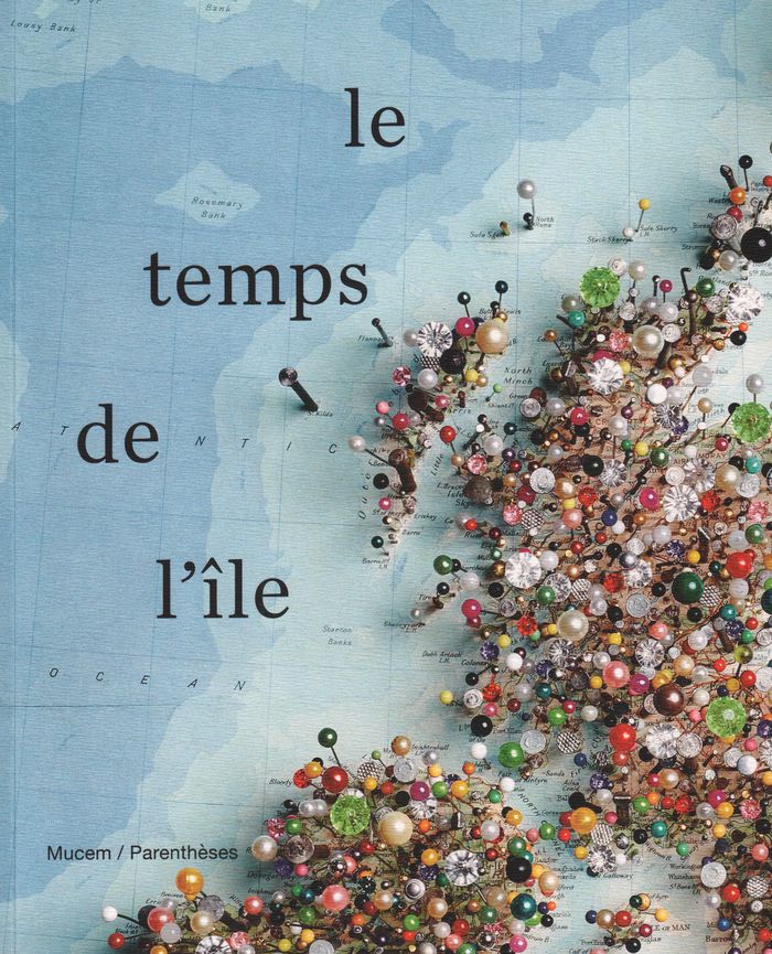
Le temps de l'île
Le temps de l'île
Actions:
Prix:
$67.95
(disponible sur commande)
Résumé:
Hommage aux îles dans les arts. En tant que lieu périphérique et marginal figurant l'autre et l'ailleurs, l'espace îlien interroge les savoirs, les sociétés, la philosophie, le cinéma, la poésie ou encore la politique.
$67.95
(disponible sur commande)
Résumé:
Hommage aux îles dans les arts. En tant que lieu périphérique et marginal figurant l'autre et l'ailleurs, l'espace îlien interroge les savoirs, les sociétés, la philosophie, le cinéma, la poésie ou encore la politique.
Publication:
août 2019
août 2019
Titre:
Le temps de l'île
Actions:
Prix:
$67.95
(disponible sur commande)
Résumé:
Hommage aux îles dans les arts. En tant que lieu périphérique et marginal figurant l'autre et l'ailleurs, l'espace îlien interroge les savoirs, les sociétés, la philosophie, le cinéma, la poésie ou encore la politique.
Le temps de l'île
Actions:
Prix:
$67.95
(disponible sur commande)
Résumé:
Hommage aux îles dans les arts. En tant que lieu périphérique et marginal figurant l'autre et l'ailleurs, l'espace îlien interroge les savoirs, les sociétés, la philosophie, le cinéma, la poésie ou encore la politique.
Classification:
livres
livres
Publication:
août 2019
août 2019
Classification:
livres
livres
Actions:
Prix:
$131.00
(disponible sur commande)
Résumé:
In the late nineteenth century, Charles Booth’s landmark social and economic survey found that 35 percent of Londoners were living in abject poverty. Booth’s team of social investigators interviewed Londoners from all walks of life, recording their comments, together with their own unrestrained remarks and statistical information, in 450 notebooks. Their findings formed(...)
Publication:
novembre 2019
novembre 2019
Titre:
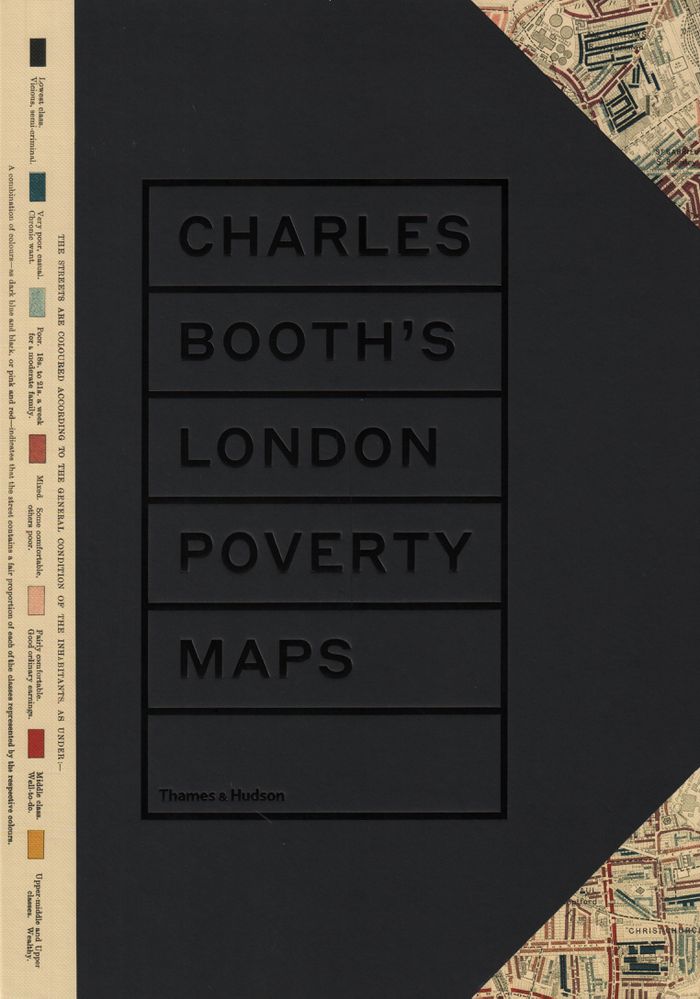
Charles Booth's London poverty maps: a landmark reasessment of Booth's social survey
Actions:
Prix:
$131.00
(disponible sur commande)
Résumé:
In the late nineteenth century, Charles Booth’s landmark social and economic survey found that 35 percent of Londoners were living in abject poverty. Booth’s team of social investigators interviewed Londoners from all walks of life, recording their comments, together with their own unrestrained remarks and statistical information, in 450 notebooks. Their findings formed the basis of Booth’s colour-coded social mapping (from vicious and semi-criminal to wealthy) and his seventeen-volume survey "Inquiry into the Life and Labour of the People of London, 1886–1903". Organized into six geographical sections, "Charles Booth’s London poverty map"s presents the hand-coloured preparatory and printed social mapping of London. Accompanying the maps are reproductions of pages from the original notebooks, containing anecdotes and observations too judgmental for Booth to include in his final published survey. An introduction by professor Mary S. Morgan clarifies the aims and methodology of Booth’s survey and six themed essays contextualize the the survey’s findings, accompanied by evocative period photographs.
Classification:
livres
livres
Publication:
novembre 2019
novembre 2019
Classification:
livres
livres
Titre:
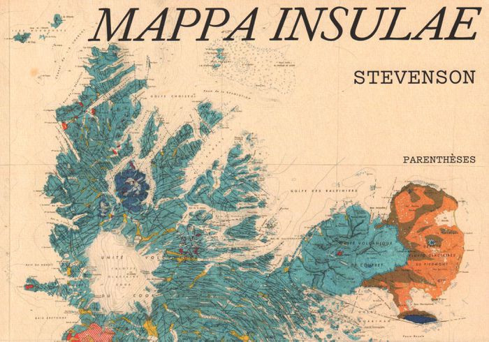
Mappa insulae
Mappa insulae
Actions:
Prix:
$35.95
(disponible sur commande)
Résumé:
Dans l'univers sans fin des cartes, les cartes d'îles possèdent un charme tout particulier. Les deux mondes, des cartes et des îles, s'y croisent, laissant émerger des formes riches et colorées. Cinq artistes, collectionneurs, chercheurs ont formé le collectif Stevenson pour en explorer et en célébrer les beautés, les incongruités, les fantaisies autant que la précision(...)
Titre:
Mappa insulae
Actions:
Prix:
$35.95
(disponible sur commande)
Résumé:
Dans l'univers sans fin des cartes, les cartes d'îles possèdent un charme tout particulier. Les deux mondes, des cartes et des îles, s'y croisent, laissant émerger des formes riches et colorées. Cinq artistes, collectionneurs, chercheurs ont formé le collectif Stevenson pour en explorer et en célébrer les beautés, les incongruités, les fantaisies autant que la précision et la finesse. De la mise en commun de leurs trésors cartographiques chinés, dénichés, inhumés et patiemment amassés, est né Mappa insulae. Les îles s'y montrent parfois dans leur isolement absolu, cerclées d'une épaisseur bleue qui les sépare du reste du monde ; parfois en archipel, éparpillées "comme autant de pépins crachés dans l'eau" ; parfois encore simplement suggérées, récifs tapis sous des noms calligraphiés sur les flots. De carte en carte, d'île en île, de pensées en poèmes, nous voilà embarqués pour une traversée érudite et insolite.
Classification:
livres
livres
Publication:
septembre 2019
septembre 2019
Classification:
livres
livres
Actions:
Prix:
$100.00
(disponible sur commande)
Résumé:
In the past decade, Rebecca Solnit, Rebecca Snedeker, and Joshua Jelly-Schapiro—aided by local writers, artists, historians, urbanists, ethnographers, and cartographers—have compiled three atlases that have radically changed the way we think about place. Each atlas provides a vivid, complex look at the multi-faceted nature of a city—San Francisco, New Orleans, and New(...)
Titre:
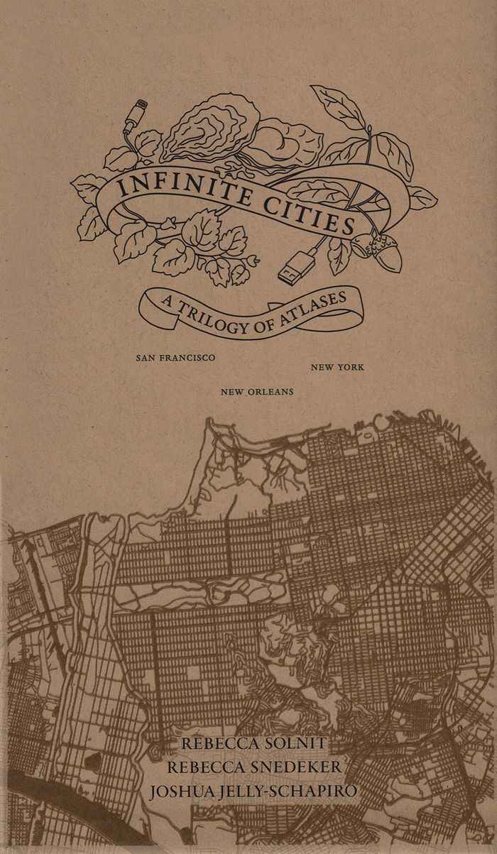
Inifinite cities: a trilogy of Atlases. San Francisco, New Orleans, New York
Actions:
Prix:
$100.00
(disponible sur commande)
Résumé:
In the past decade, Rebecca Solnit, Rebecca Snedeker, and Joshua Jelly-Schapiro—aided by local writers, artists, historians, urbanists, ethnographers, and cartographers—have compiled three atlases that have radically changed the way we think about place. Each atlas provides a vivid, complex look at the multi-faceted nature of a city—San Francisco, New Orleans, and New York—as experienced by its different inhabitants, replete with the celebrations and contradictions that make up urban life.
Classification:
livres
livres
Publication:
septembre 2019
septembre 2019
Classification:
livres
livres
Titre:
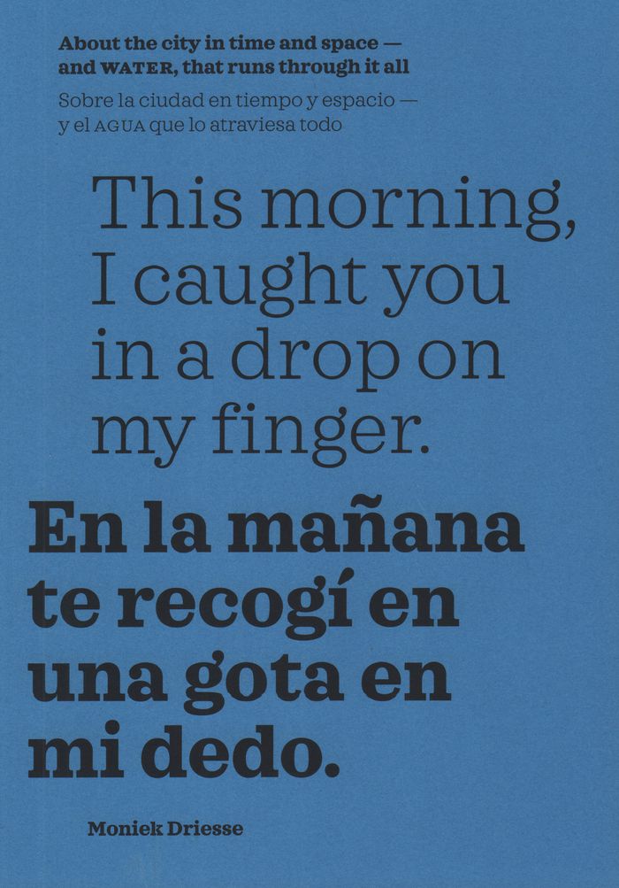
This morning, I caught you in a drop on my finger: about the city in time and space, and water
This morning, I caught you in a drop on my finger: about the city in time and space, and water
Actions:
Prix:
$39.95
(disponible sur commande)
Résumé:
Memories carried by water drench our biographies and shared history. In this book, edited and curated by Moniek Driesse, the past, present, and future imaginaries that govern our relationship with water are permitted to draw maps that can serve as tools for urban administrators, researchers, and citizens who live the reality determined by them. With this approach,(...)
Titre:
This morning, I caught you in a drop on my finger: about the city in time and space, and water
Actions:
Prix:
$39.95
(disponible sur commande)
Résumé:
Memories carried by water drench our biographies and shared history. In this book, edited and curated by Moniek Driesse, the past, present, and future imaginaries that govern our relationship with water are permitted to draw maps that can serve as tools for urban administrators, researchers, and citizens who live the reality determined by them. With this approach, long-term memories carried by the urban landscape reflect into possible narratives of hope for the future. The focus is on Mexico City, where rivers have turned into highways and subterranean basins are drying out, presenting new dangers to the city.
Classification:
livres
livres
Publication:
janvier 2020
janvier 2020
Classification:
livres
livres

Prix:
$48.95
(disponible sur commande)
Résumé:
Carried out by designers Moniek Driesse and Annelys de Vet, along with Analía Solomonoff, the Subjective Atlas of Mexico is part of a series of previous subjective atlases where a varied group of artists, designers and photographers who choose personal topics as a starting point to map their cultural identity. Each were asked: what makes a Mexican? what are our likenesses(...)
Publication:
juin 2012
juin 2012
Titre:
Atlas subjectivo de México / subjective atlas of Mexico
Actions:
Prix:
$48.95
(disponible sur commande)
Résumé:
Carried out by designers Moniek Driesse and Annelys de Vet, along with Analía Solomonoff, the Subjective Atlas of Mexico is part of a series of previous subjective atlases where a varied group of artists, designers and photographers who choose personal topics as a starting point to map their cultural identity. Each were asked: what makes a Mexican? what are our likenesses and what differences do we share? Through its pages the scope of Mexico as a country limited by its borders and its latitudes suddenly vanishes and everyday practices take on new meaning. We can find Mexico reflected in the world, and the world reflected in Mexico. A DVD is included.
Classification:
livres
livres
Publication:
juin 2012
juin 2012
Classification:
livres
livres
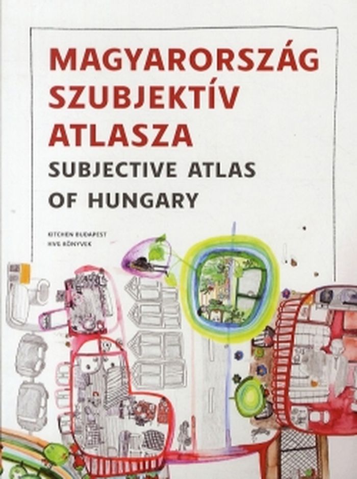
Titre:
Subjective atlas of Hungary
Subjective atlas of Hungary
Actions:
Prix:
$36.95
(disponible sur commande)
Résumé:
Is it possible to draw a portrait of contemporary Hungary with only one pencil, held by many? Could we map this country at all with its controversial optimism and pessimism, proud and poetry in one single book? Fifty young visual authors were invited by new media lab Kitchen and Dutch designer Annelys de Vet to put their homeland in perspective. Together they shed light(...)
Titre:
Subjective atlas of Hungary
Actions:
Prix:
$36.95
(disponible sur commande)
Résumé:
Is it possible to draw a portrait of contemporary Hungary with only one pencil, held by many? Could we map this country at all with its controversial optimism and pessimism, proud and poetry in one single book? Fifty young visual authors were invited by new media lab Kitchen and Dutch designer Annelys de Vet to put their homeland in perspective. Together they shed light on the Hungarian spirit, today, from the most characteristic vernacular buildings to waterside houses and recycled fences, from wine spritzer and salty sticks to vegetable gardens and sold-out products.
Classification:
livres
livres
Publication:
juin 2012
juin 2012
Classification:
livres
livres
Prix:
$85.00
(disponible sur commande)
Résumé:
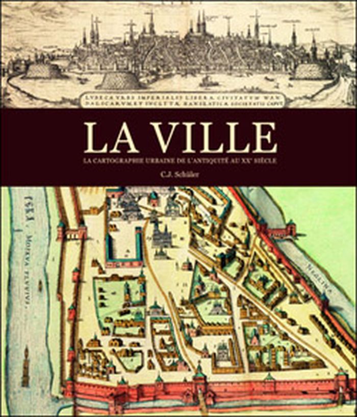
La ville a offert de multiples visages depuis son apparition en Mésopotamie et dans la vallée de l'Indus, voici environ 10 000 ans, et héberge aujourd'hui la moitié de l'humanité. L'appréhension du milieu urbain fut toutefois progressive et plurielle. Les quelque 200 cartes de la collection exceptionnelle de la Royal Geographical Society nous montrent comment l'homme a(...)
$85.00
(disponible sur commande)
Résumé:
La ville a offert de multiples visages depuis son apparition en Mésopotamie et dans la vallée de l'Indus, voici environ 10 000 ans, et héberge aujourd'hui la moitié de l'humanité. L'appréhension du milieu urbain fut toutefois progressive et plurielle. Les quelque 200 cartes de la collection exceptionnelle de la Royal Geographical Society nous montrent comment l'homme a(...)
Titre:
La ville: la cartographie urbaine de l'antiquité au XXe siècle
Actions:
Prix:
$85.00
(disponible sur commande)
Résumé:
La ville a offert de multiples visages depuis son apparition en Mésopotamie et dans la vallée de l'Indus, voici environ 10 000 ans, et héberge aujourd'hui la moitié de l'humanité. L'appréhension du milieu urbain fut toutefois progressive et plurielle. Les quelque 200 cartes de la collection exceptionnelle de la Royal Geographical Society nous montrent comment l'homme a imaginé, puis dessiné la ville. Par les tablettes en terre cuite des Babyloniens aux plans très précis du milieu du XXe siècle, en passant par les peintures et les enluminures médiévales, ce livre nous entraîne dans les cités, les bourgs et les métropoles de différentes époques.
Classification:
livres
livres
Publication:
septembre 2012
septembre 2012
Classification:
livres
livres
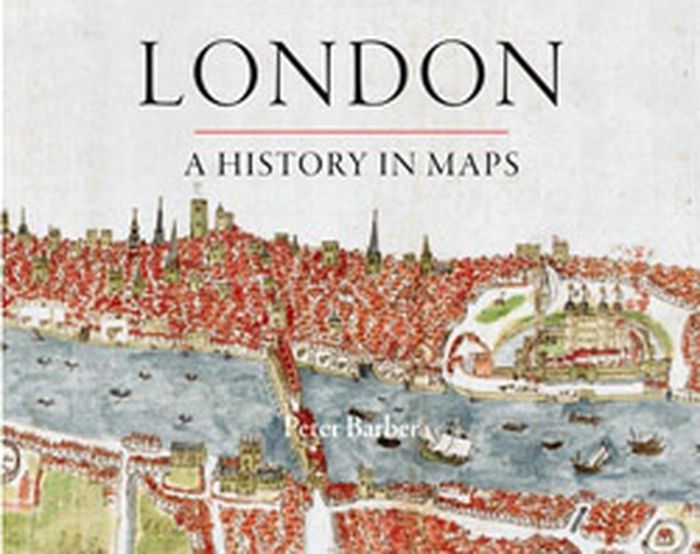
Titre:
London: a history in maps
London: a history in maps
Actions:
Prix:
$49.95
(disponible sur commande)
Résumé:
Over the past two thousand years London has developed from a small town into one of the world's largest and most dynamic cities. This book charts that growth and the city's transformation through hundreds of maps culled from the collection of the British Library's Map Library. Including official documents, individual endeavors, hand-drawn renditions, and technologically(...)
Titre:
London: a history in maps
Actions:
Prix:
$49.95
(disponible sur commande)
Résumé:
Over the past two thousand years London has developed from a small town into one of the world's largest and most dynamic cities. This book charts that growth and the city's transformation through hundreds of maps culled from the collection of the British Library's Map Library. Including official documents, individual endeavors, hand-drawn renditions, and technologically advanced replicas, these maps represent a variety of perspectives. Utilitarian maps show the city as it is and serve to elucidate its inner workings, while carefully wrought plans show the city as it was envisioned. This book reveals the inside story of the creation, growth, and change of London.
Classification:
livres
livres
Publication:
septembre 2012
septembre 2012
Classification:
livres
livres
Titre:
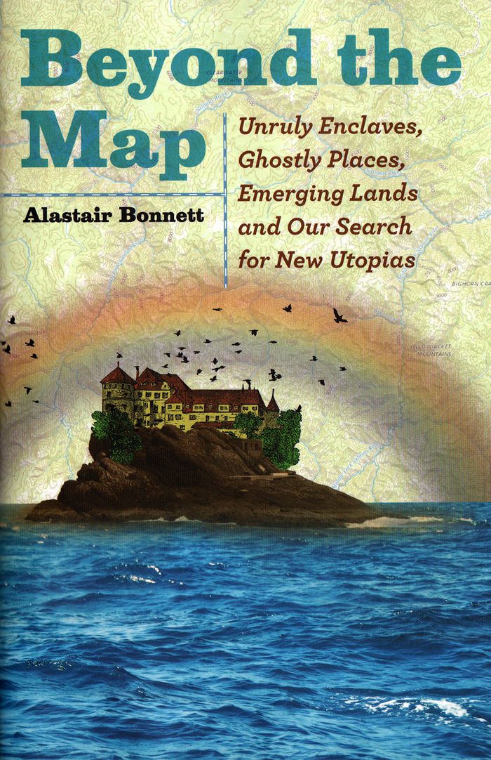
Beyond the map: unruly enclaves, ghostly places, emerging lands and our search for new utopias
Beyond the map: unruly enclaves, ghostly places, emerging lands and our search for new utopias
Actions:
Prix:
$34.50
(disponible sur commande)
Résumé:
In "Beyond the Map", Bonnett presents stories of the world’s most extraordinary spaces—many unmarked on any official map—all of which challenge our assumptions about what we know—or think we know—about our world. As cultural, religious and political boundaries ebb and flow with each passing day, traditional maps unravel and fragment. With the same adventurous spirit he(...)
Titre:
Beyond the map: unruly enclaves, ghostly places, emerging lands and our search for new utopias
Actions:
Prix:
$34.50
(disponible sur commande)
Résumé:
In "Beyond the Map", Bonnett presents stories of the world’s most extraordinary spaces—many unmarked on any official map—all of which challenge our assumptions about what we know—or think we know—about our world. As cultural, religious and political boundaries ebb and flow with each passing day, traditional maps unravel and fragment. With the same adventurous spirit he effused in the acclaimed Unruly Places, Bonnett takes us to thirty-nine incredible spots around the globe to explore these changing boundaries and stimulate our geographical imagination. Some are tied to disruptive contemporary political turbulence, such as the rise of ISIL, Russia’s incursions into Ukraine and the Brexit vote in the United Kingdom. Others explore the secret places not shown on Google Earth or reflect fast-changing landscapes.
Classification:
livres
livres
Publication:
avril 2018
avril 2018