109 Résultats
Classification:
livres
livres
Titre:
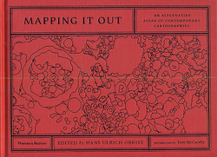
Mapping it out
Mapping it out
Actions:
Prix:
$57.00
(disponible sur commande)
Résumé:
Over 130 leading lights from different fields artists, architects, writers and designers, geographers, mathematicians, computer pioneers, scientists make sense of exterior and interior worlds through highly personal and imaginative maps and charts. Some have translated scientific data into simplified visual language, while others have condensed vast social, political or(...)
Titre:
Mapping it out
Actions:
Prix:
$57.00
(disponible sur commande)
Résumé:
Over 130 leading lights from different fields artists, architects, writers and designers, geographers, mathematicians, computer pioneers, scientists make sense of exterior and interior worlds through highly personal and imaginative maps and charts. Some have translated scientific data into simplified visual language, while others have condensed vast social, political or natural forms into concise diagrams. Many have reworked existing maps to subvert their original purpose or to present an alternative view of reality. Others play with the maps commitment to truth by plotting invented worlds and charting imaginative flights of fancy. In the introduction, acclaimed novelist Tom McCarthy reflects on the relationship between maps, literature and knowledge, while Hans Ulrich Obrist closes the book by considering the territory of maps from the perspective of the arts and philosophy.
Classification:
livres
livres
Publication:
juin 2014
juin 2014
Classification:
livres
livres
Actions:
Prix:
$54.95
(disponible sur commande)
Résumé:
The twentieth century was a golden age of mapmaking, an era of cartographic boom. Maps proliferated and permeated almost every aspect of daily life, not only chronicling geography and history but also charting and conveying myriad political and social agendas. Here Tim Bryars and Tom Harper select one hundred maps from the millions printed, drawn, or otherwise constructed(...)
Titre:
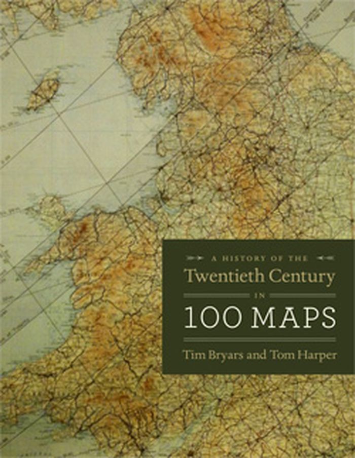
A history of the twentieth century in 100 maps
Actions:
Prix:
$54.95
(disponible sur commande)
Résumé:
The twentieth century was a golden age of mapmaking, an era of cartographic boom. Maps proliferated and permeated almost every aspect of daily life, not only chronicling geography and history but also charting and conveying myriad political and social agendas. Here Tim Bryars and Tom Harper select one hundred maps from the millions printed, drawn, or otherwise constructed during the twentieth century and recount through them a narrative of the century’s key events and developments.
Classification:
livres
livres
Publication:
octobre 2014
octobre 2014
Classification:
livres
livres
Titre:
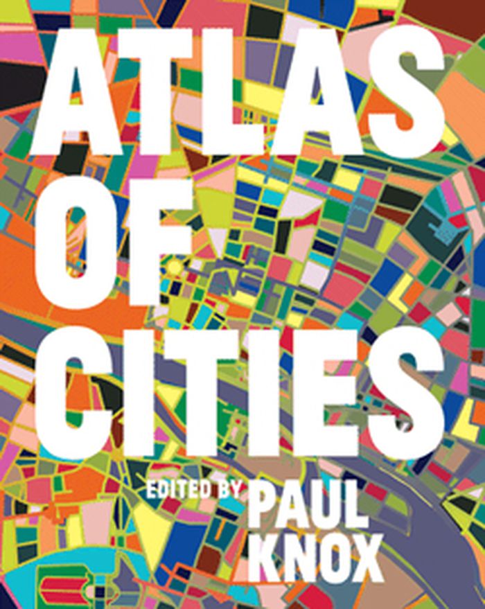
Atlas of cities
Atlas of cities
Actions:
Prix:
$63.95
(disponible sur commande)
Résumé:
More than half the world's population lives in cities, and that proportion is expected to rise to three-quarters by 2050. Urbanization is a global phenomenon, but the way cities are developing, the experience of city life, and the prospects for the future of cities vary widely from region to region. The Atlas of Cities presents a unique taxonomy of cities that looks at(...)
Titre:
Atlas of cities
Actions:
Prix:
$63.95
(disponible sur commande)
Résumé:
More than half the world's population lives in cities, and that proportion is expected to rise to three-quarters by 2050. Urbanization is a global phenomenon, but the way cities are developing, the experience of city life, and the prospects for the future of cities vary widely from region to region. The Atlas of Cities presents a unique taxonomy of cities that looks at different aspects of their physical, economic, social, and political structures; their interactions with each other and with their hinterlands; the challenges and opportunities they present; and where cities might be going in the future.
Classification:
livres
livres
Publication:
septembre 2014
septembre 2014
Classification:
livres
livres
Titre:
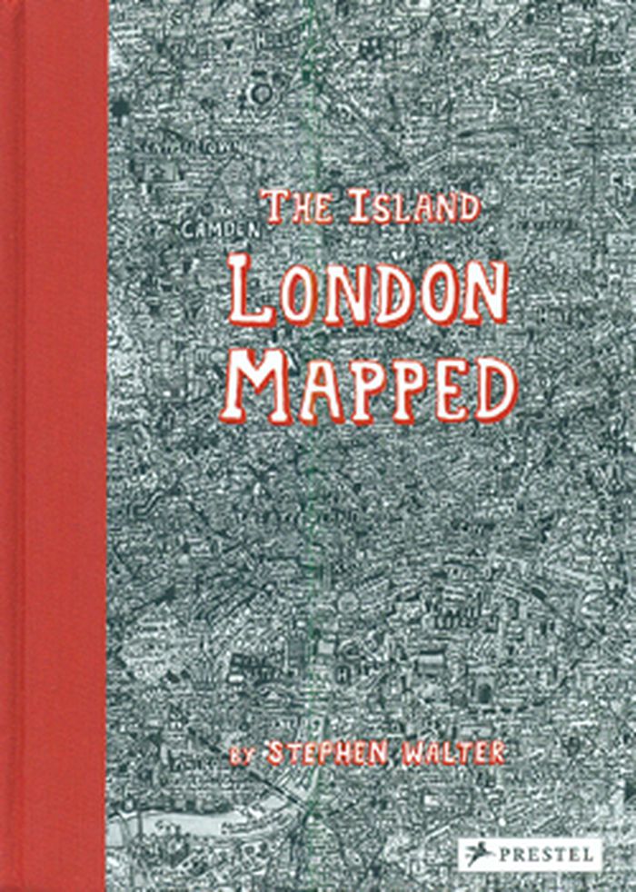
The island: London mapped
The island: London mapped
Actions:
Prix:
$38.95
(disponible sur commande)
Résumé:
London's streets, built up over more than two thousand years, are a maze of history, cultures and stories. In his fantastically detailed maps of the city, Stephen Walter translates these elements into a tangle of insightful yet humorous words and symbols that make up a complex of hidden meanings and wider contradictions. Testament to Walter's skill and importance as a(...)
Titre:
The island: London mapped
Actions:
Prix:
$38.95
(disponible sur commande)
Résumé:
London's streets, built up over more than two thousand years, are a maze of history, cultures and stories. In his fantastically detailed maps of the city, Stephen Walter translates these elements into a tangle of insightful yet humorous words and symbols that make up a complex of hidden meanings and wider contradictions. Testament to Walter's skill and importance as a cartographer, his groundbreaking, oversized map The Island was one of only two works by contemporary artists to feature in the seminal Magnificent Maps exhibition held at the British Library in 2010, the other by Grayson Perry and was exhibited together with some of the most important maps in history, such as Pierre Desceliers's 1550 world map.
Classification:
livres
livres
Publication:
février 2015
février 2015
Classification:
livres
livres
Titre:
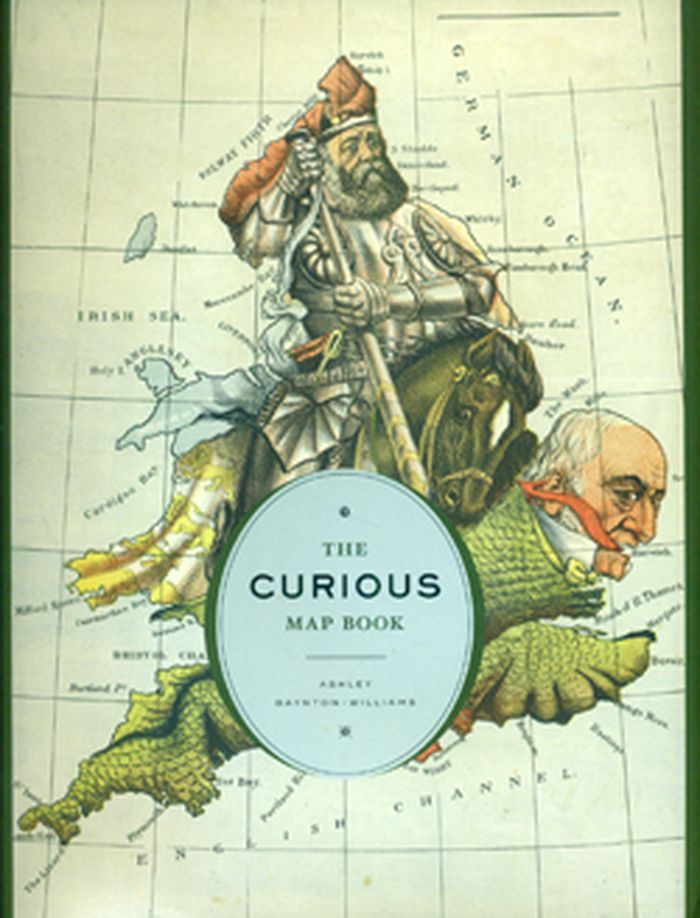
The Curious Map Book
The Curious Map Book
Actions:
Prix:
$54.95
(disponible sur commande)
Résumé:
Over the centuries, maps have served many varied purposes; far from mere guides for reaching a destination, they are unique artistic forms, aides in planning commercial routes, literary devices for illuminating a story. Accuracy—or inaccuracy—of maps has been the make-or-break factor in countless military battles throughout history. They have graced the walls of homes,(...)
Publication:
octobre 2015
octobre 2015
Titre:
The Curious Map Book
Actions:
Prix:
$54.95
(disponible sur commande)
Résumé:
Over the centuries, maps have served many varied purposes; far from mere guides for reaching a destination, they are unique artistic forms, aides in planning commercial routes, literary devices for illuminating a story. Accuracy—or inaccuracy—of maps has been the make-or-break factor in countless military battles throughout history. They have graced the walls of homes, bringing prestige and elegance to their owners. They track the mountains, oceans, and stars of our existence. Maps help us make sense of our worlds both real and imaginary—they bring order to the seeming chaos of our surroundings. With The Curious Map Book, Ashley Baynton-Williams gathers a chronologically ordered variety of cartographic gems, mainly from the vast collection of the British Library
Classification:
livres
livres
Publication:
octobre 2015
octobre 2015
Classification:
livres
livres
Actions:
Prix:
$118.95
(disponible sur commande)
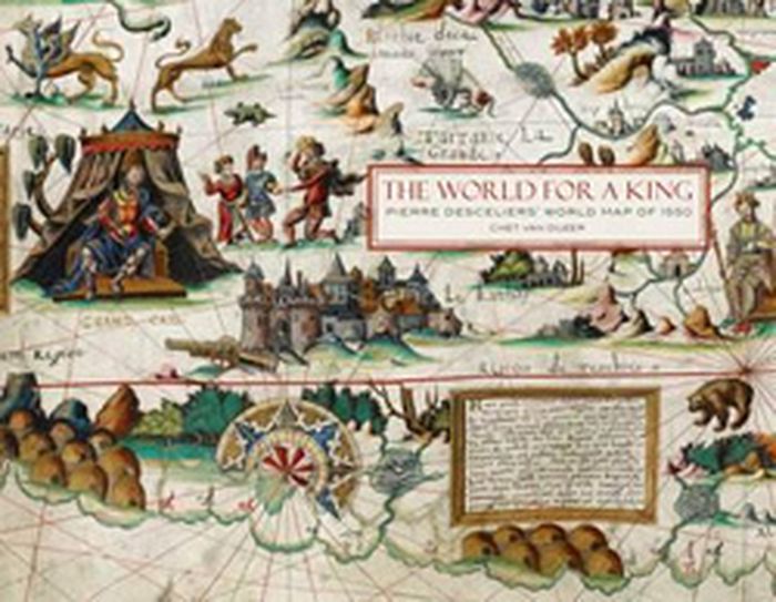
Résumé:
Maps of the Dieppe school, commissioned for wealthy households rather than for use in navigation, often presented explorers’ latest discoveries alongside fantastical creatures and allusions to myth. In 1550 cartographer Pierre Desceliers presented to France’s King Henry II one such map, a work of extraordinary beauty and value showing the world as it was known at the(...)
$118.95
(disponible sur commande)
Résumé:
Maps of the Dieppe school, commissioned for wealthy households rather than for use in navigation, often presented explorers’ latest discoveries alongside fantastical creatures and allusions to myth. In 1550 cartographer Pierre Desceliers presented to France’s King Henry II one such map, a work of extraordinary beauty and value showing the world as it was known at the(...)
Titre:
The world for a king: Pierre Desceliers map of 1550
Actions:
Prix:
$118.95
(disponible sur commande)
Résumé:
Maps of the Dieppe school, commissioned for wealthy households rather than for use in navigation, often presented explorers’ latest discoveries alongside fantastical creatures and allusions to myth. In 1550 cartographer Pierre Desceliers presented to France’s King Henry II one such map, a work of extraordinary beauty and value showing the world as it was known at the time. This map, one of the most important of the Dieppe school, includes descriptions of French attempts to colonize Canada and the conquest of Peru by the Spanish in addition to descriptions of the legendary king Prester John in Ethiopia and a race of Amazons in Russia.
Classification:
livres
livres
Publication:
octobre 2015
octobre 2015
Classification:
livres
livres
Titre:
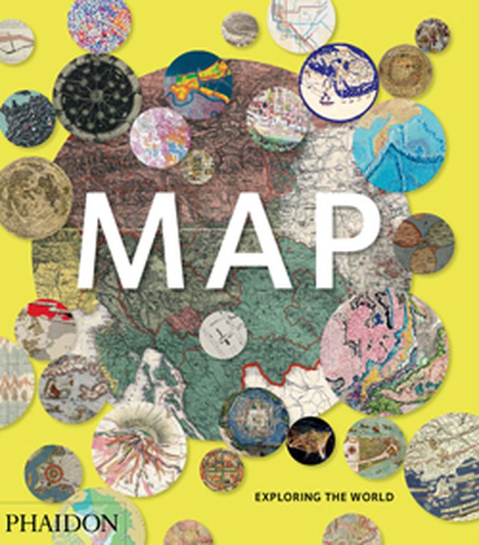
Map: exploring the world
Map: exploring the world
Actions:
Prix:
$69.95
(disponible sur commande)
Résumé:
Map: Exploring the World brings together more than 300 maps from the birth of cartography to cutting-edge digital maps of the twenty-fist century. The book reveals how the history of our attempts to make flat representations of the world has been full of beauty, ingenuity and innovation.
Titre:
Map: exploring the world
Actions:
Prix:
$69.95
(disponible sur commande)
Résumé:
Map: Exploring the World brings together more than 300 maps from the birth of cartography to cutting-edge digital maps of the twenty-fist century. The book reveals how the history of our attempts to make flat representations of the world has been full of beauty, ingenuity and innovation.
Classification:
livres
livres
Publication:
septembre 2015
septembre 2015
Classification:
livres
livres
Actions:
Prix:
$72.00
(disponible sur commande)
Résumé:
In our age of visual storytelling, cartography has become more prevalent and innovative. Maps can be illustrated by hand for magazine stories or display in the home or customized for screens of mobile devices that can guide us on urban safaris or isolated hikes. Mind the Map is a showcase that reflects the broad range of work now being created by a new generation(...)
Publication:
septembre 2015
septembre 2015
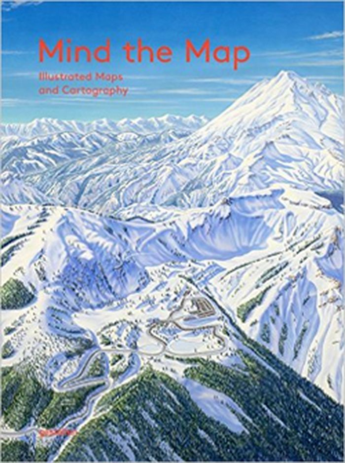
Titre:
Mind the map: illustrated maps and cartography
Actions:
Prix:
$72.00
(disponible sur commande)
Résumé:
In our age of visual storytelling, cartography has become more prevalent and innovative. Maps can be illustrated by hand for magazine stories or display in the home or customized for screens of mobile devices that can guide us on urban safaris or isolated hikes. Mind the Map is a showcase that reflects the broad range of work now being created by a new generation of mapmakers from around the world including classically legible maps, artistic experiments, editorial illustrations, city views, vacation guides, and global overviews.
Classification:
livres
livres
Publication:
septembre 2015
septembre 2015
Classification:
livres
livres

Actions:
Prix:
$115.00
(disponible sur commande)
Résumé:
The Netherlands is the most densely urbanised country in Europe. Its crowded landscape of greater and smaller, older and younger towns was formed in the course of a millennium. What were the roots of this urban landscape, and how did it develop? What do the urbanisation histories of the Netherlands and the rest of Europe have in common, and how do they differ? This book(...)
Publication:
décembre 2015
décembre 2015
Titre:
Atlas of the Dutch urban landscape
Actions:
Prix:
$115.00
(disponible sur commande)
Résumé:
The Netherlands is the most densely urbanised country in Europe. Its crowded landscape of greater and smaller, older and younger towns was formed in the course of a millennium. What were the roots of this urban landscape, and how did it develop? What do the urbanisation histories of the Netherlands and the rest of Europe have in common, and how do they differ? This book contains a comprehensive synthesis of a millennium of spatial development in the Netherlands. Series of maps, photos and paintings clearly illustrate processes of growth, stagnation and decline in Dutch towns and place them in an international perspective.
Classification:
livres
livres
Publication:
décembre 2015
décembre 2015