109 Résultats
Classification:
livres
livres
Titre:
Modern Oxford map
Modern Oxford map
Actions:
Prix:
$17.00
(disponible en magasin)
Résumé:
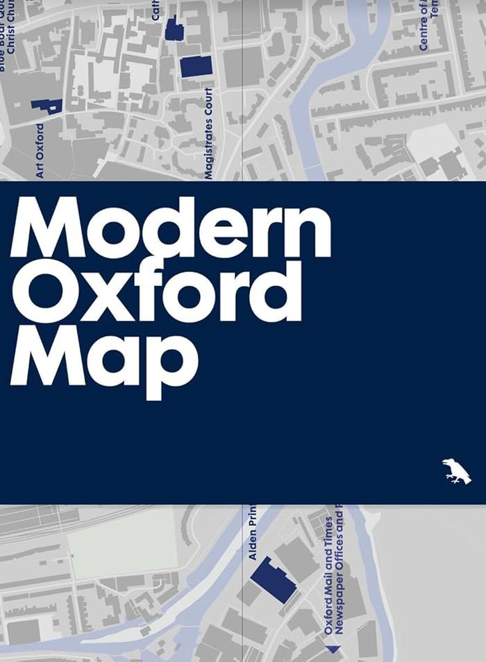
Our ''Modern Oxford Map'' curates the city’s finest Modernist and Brutalist architecture through a selection of 50 buildings, with an introduction and descriptions by architectural historian Robin Wilson and original photography by Nigel Green. Amidst Oxford’s celebrated historic architecture, you’ll be surprised by the diversity of its Modernist and Brutalist buildings,(...)
$17.00
(disponible en magasin)
Résumé:
Our ''Modern Oxford Map'' curates the city’s finest Modernist and Brutalist architecture through a selection of 50 buildings, with an introduction and descriptions by architectural historian Robin Wilson and original photography by Nigel Green. Amidst Oxford’s celebrated historic architecture, you’ll be surprised by the diversity of its Modernist and Brutalist buildings,(...)
Publication:
septembre 2024
septembre 2024
Titre:
Modern Oxford map
Actions:
Prix:
$17.00
(disponible en magasin)
Résumé:
Our ''Modern Oxford Map'' curates the city’s finest Modernist and Brutalist architecture through a selection of 50 buildings, with an introduction and descriptions by architectural historian Robin Wilson and original photography by Nigel Green. Amidst Oxford’s celebrated historic architecture, you’ll be surprised by the diversity of its Modernist and Brutalist buildings, which range from architectures of radical new form-making and geometric composition in concrete, innovative mixed-use developments, as well as carefully crafted, contextual interventions into the existing historic fabric.
Classification:
livres
livres
Publication:
septembre 2024
septembre 2024
Classification:
livres
livres
Actions:
Prix:
$38.95
(disponible en magasin)
Résumé:
When Ursula K. Le Guin started writing a new story, she would begin by drawing a map. "The Word for World" presents a selection of these images by the celebrated author, many of which have never been published before, to consider how her imaginary worlds enable us to re-envision our own. Le Guin’s maps offer journeys of consciousness beyond conventional cartography,(...)
Titre:
The word for world: The maps of Ursula K. Leguin
Actions:
Prix:
$38.95
(disponible en magasin)
Résumé:
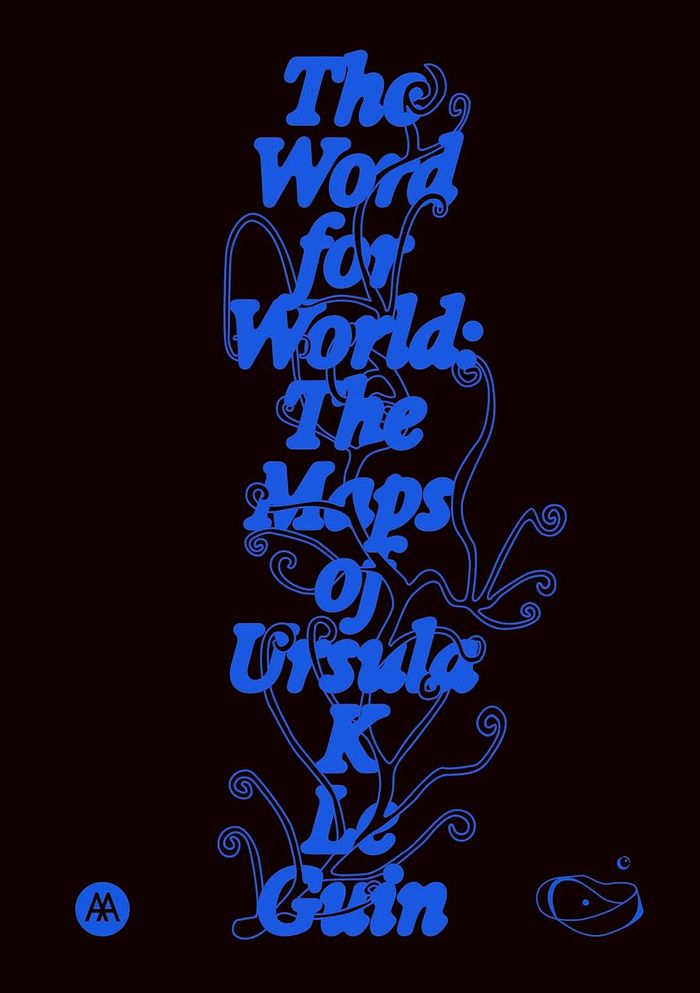
When Ursula K. Le Guin started writing a new story, she would begin by drawing a map. "The Word for World" presents a selection of these images by the celebrated author, many of which have never been published before, to consider how her imaginary worlds enable us to re-envision our own. Le Guin’s maps offer journeys of consciousness beyond conventional cartography, from the Rorschach-like archipelagos of Earthsea to the talismanic maps of "Always Coming Home." Rather than remaining within known terrain, they open up paradigms of knowledge, exemplified by the map’s edges and how a map is read, made and re-made, together. "The Word for World" brings her maps together with poems, stories, interviews, recipes and essays by contributors from a variety of perspectives to enquire into the relationship between worlds and how they are represented and imagined.
The word for world: The maps of Ursula K. Leguin
Actions:
Prix:
$38.95
(disponible en magasin)
Résumé:
When Ursula K. Le Guin started writing a new story, she would begin by drawing a map. "The Word for World" presents a selection of these images by the celebrated author, many of which have never been published before, to consider how her imaginary worlds enable us to re-envision our own. Le Guin’s maps offer journeys of consciousness beyond conventional cartography, from the Rorschach-like archipelagos of Earthsea to the talismanic maps of "Always Coming Home." Rather than remaining within known terrain, they open up paradigms of knowledge, exemplified by the map’s edges and how a map is read, made and re-made, together. "The Word for World" brings her maps together with poems, stories, interviews, recipes and essays by contributors from a variety of perspectives to enquire into the relationship between worlds and how they are represented and imagined.
Classification:
livres
livres
Publication:
décembre 2025
décembre 2025
Classification:
livres
livres
Titre:
Art Deco Paris map
Art Deco Paris map
Actions:
Prix:
$18.95
(disponible sur commande)
Résumé:
Découvrez des exemples saisissants d'architecture et de décoration Art déco dans tout Paris avec ce guide bilingue. Il comprend une carte, des détails sur 50 bâtiments, une introduction de Robin Wilson et des photographies inédites de Nigel Green. / Discover striking examples of Art Deco architecture and decoration throughout Paris with this bilingual guide; featuring(...)
Titre:
Art Deco Paris map
Actions:
Prix:
$18.95
(disponible sur commande)
Résumé:
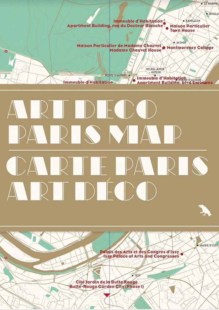
Découvrez des exemples saisissants d'architecture et de décoration Art déco dans tout Paris avec ce guide bilingue. Il comprend une carte, des détails sur 50 bâtiments, une introduction de Robin Wilson et des photographies inédites de Nigel Green. / Discover striking examples of Art Deco architecture and decoration throughout Paris with this bilingual guide; featuring a map, details of 50 buildings, an introduction by Robin Wilson and original photography by Nigel Green. ''Art Deco Paris Map'' is Blue Crow Media’s latest Paris guide after maps dedicated to Brutalism, Modernism, the Métro and the city’s great trees.
Art Deco Paris map
Actions:
Prix:
$18.95
(disponible sur commande)
Résumé:
Découvrez des exemples saisissants d'architecture et de décoration Art déco dans tout Paris avec ce guide bilingue. Il comprend une carte, des détails sur 50 bâtiments, une introduction de Robin Wilson et des photographies inédites de Nigel Green. / Discover striking examples of Art Deco architecture and decoration throughout Paris with this bilingual guide; featuring a map, details of 50 buildings, an introduction by Robin Wilson and original photography by Nigel Green. ''Art Deco Paris Map'' is Blue Crow Media’s latest Paris guide after maps dedicated to Brutalism, Modernism, the Métro and the city’s great trees.
Classification:
livres
livres
Publication:
juin 2025
juin 2025
Classification:
livres
livres
Actions:
Prix:
$18.95
(disponible sur commande)
Résumé:
Jody Burton and Avril Nanton identify and reveal London’s most significant Black historical landmarks. Featuring fifty locations, descriptions, original photography, and an introduction to the history and impact of Black people in London, from the Roman era to Black Lives Matter, "Black History London Map" provides unique insight into an essential component of historical(...)
Publication:
août 2025
août 2025
Titre:
Black history New York map: Guide to Black historical landmarks in New York City
Actions:
Prix:
$18.95
(disponible sur commande)
Résumé:
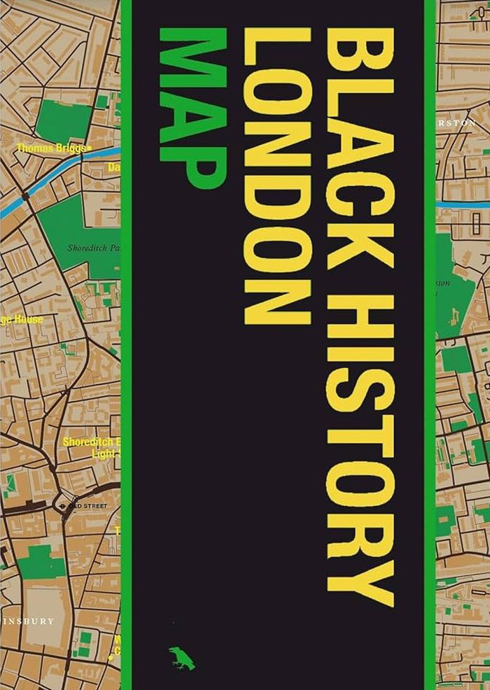
Jody Burton and Avril Nanton identify and reveal London’s most significant Black historical landmarks. Featuring fifty locations, descriptions, original photography, and an introduction to the history and impact of Black people in London, from the Roman era to Black Lives Matter, "Black History London Map" provides unique insight into an essential component of historical and modern London. Featuring original photography by Jake Green.
Black history New York map: Guide to Black historical landmarks in New York City
Actions:
Prix:
$18.95
(disponible sur commande)
Résumé:
Jody Burton and Avril Nanton identify and reveal London’s most significant Black historical landmarks. Featuring fifty locations, descriptions, original photography, and an introduction to the history and impact of Black people in London, from the Roman era to Black Lives Matter, "Black History London Map" provides unique insight into an essential component of historical and modern London. Featuring original photography by Jake Green.
Classification:
livres
livres
Publication:
août 2025
août 2025
Classification:
livres
livres
Prix:
$18.95
(disponible en magasin)
Résumé:
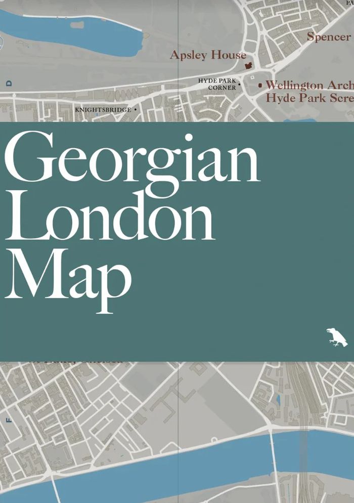
Celebrate and explore one of London’s iconic architectural eras with "Georgian London Map." Written by scholar and author Owen Hopkins, with original photography by Will Scott, the map identifies a broad variety of 18th and early 19th century buildings and squares embodying Georgian architecture. "Georgian London Map" is our latest title focused on London architecture and(...)
$18.95
(disponible en magasin)
Résumé:
Celebrate and explore one of London’s iconic architectural eras with "Georgian London Map." Written by scholar and author Owen Hopkins, with original photography by Will Scott, the map identifies a broad variety of 18th and early 19th century buildings and squares embodying Georgian architecture. "Georgian London Map" is our latest title focused on London architecture and(...)
Titre:
Georgian London Map: Guide to London's Georgian era architecture
Actions:
Prix:
$18.95
(disponible en magasin)
Résumé:
Celebrate and explore one of London’s iconic architectural eras with "Georgian London Map." Written by scholar and author Owen Hopkins, with original photography by Will Scott, the map identifies a broad variety of 18th and early 19th century buildings and squares embodying Georgian architecture. "Georgian London Map" is our latest title focused on London architecture and design, following maps dedicated to the works of Wren and Hawksmoor, and a series of 20th and 21st century guides.
Classification:
livres
livres
Publication:
juin 2025
juin 2025
Classification:
livres
livres
Actions:
Prix:
$18.95
(disponible sur commande)
Résumé:
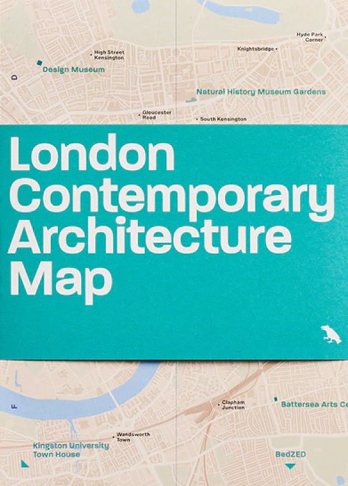
Explore highlights of contemporary architecture built across London from 2000 to 2025 with this two-sided map by Olly Wainwright. The map features 50 projects, from museums and major redevelopments to social housing and urban gardens, alongside an introduction, building details and original photography.
$18.95
(disponible sur commande)
Résumé:
Explore highlights of contemporary architecture built across London from 2000 to 2025 with this two-sided map by Olly Wainwright. The map features 50 projects, from museums and major redevelopments to social housing and urban gardens, alongside an introduction, building details and original photography.
Titre:
London contemporary architecture Map
Actions:
Prix:
$18.95
(disponible sur commande)
Résumé:
Explore highlights of contemporary architecture built across London from 2000 to 2025 with this two-sided map by Olly Wainwright. The map features 50 projects, from museums and major redevelopments to social housing and urban gardens, alongside an introduction, building details and original photography.
Classification:
livres
livres
Publication:
juin 2025
juin 2025
Classification:
livres
livres
Actions:
Prix:
$18.95
(disponible en magasin)
Résumé:
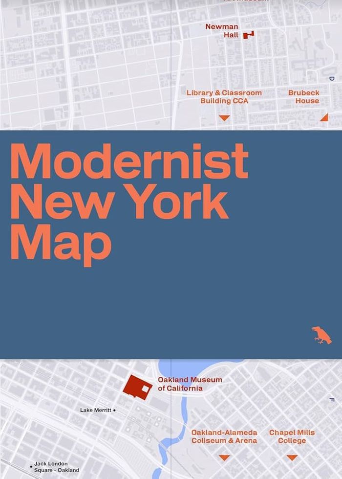
Explore New York City’s rich legacy of modernist architecture with this beautifully designed, two-sided map guide by Allison C. Meier, featuring original photography by Jason Woods. Showcasing iconic buildings by visionaries such as Philip Johnson, Ludwig Mies van der Rohe, Frank Lloyd Wright, Eero Saarinen and I.M. Pei, the guide details buildings, architects, years(...)
$18.95
(disponible en magasin)
Résumé:
Explore New York City’s rich legacy of modernist architecture with this beautifully designed, two-sided map guide by Allison C. Meier, featuring original photography by Jason Woods. Showcasing iconic buildings by visionaries such as Philip Johnson, Ludwig Mies van der Rohe, Frank Lloyd Wright, Eero Saarinen and I.M. Pei, the guide details buildings, architects, years(...)
Titre:
Modernist New York Map: Guide to 20th century modern architecture in New York City
Actions:
Prix:
$18.95
(disponible en magasin)
Résumé:
Explore New York City’s rich legacy of modernist architecture with this beautifully designed, two-sided map guide by Allison C. Meier, featuring original photography by Jason Woods. Showcasing iconic buildings by visionaries such as Philip Johnson, Ludwig Mies van der Rohe, Frank Lloyd Wright, Eero Saarinen and I.M. Pei, the guide details buildings, architects, years built and addresses. Discover works by pioneers like Louis Kahn, Marcel Breuer, Vertner Woodson Tandy and more. With an engaging introduction to 20th-century architecture in NYC, this guide is an essential companion for design enthusiasts, architects and urban explorers alike.
Classification:
livres
livres
Publication:
juillet 2025
juillet 2025
Classification:
livres
livres
Titre:
Mappa Mundi
Mappa Mundi
Actions:
Prix:
$46.95
(disponible en magasin)
Résumé:
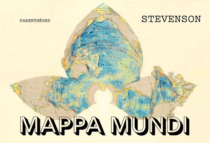
Cartographier le monde, c’est plus que le mesurer : c’est l’imaginer, le raconter, le discuter. De la mappemonde médiévale aux planisphères numériques, ce florilège traverse époques et cultures pour montrer comment une image plane peut embrasser l’inconnu, dire le pouvoir, nourrir la science, la foi et les rêves de voyage. Projections, mythes, symboles : le monde s’y(...)
$46.95
(disponible en magasin)
Résumé:
Cartographier le monde, c’est plus que le mesurer : c’est l’imaginer, le raconter, le discuter. De la mappemonde médiévale aux planisphères numériques, ce florilège traverse époques et cultures pour montrer comment une image plane peut embrasser l’inconnu, dire le pouvoir, nourrir la science, la foi et les rêves de voyage. Projections, mythes, symboles : le monde s’y(...)
Publication:
décembre 2025
décembre 2025
Titre:
Mappa Mundi
Actions:
Prix:
$46.95
(disponible en magasin)
Résumé:
Cartographier le monde, c’est plus que le mesurer : c’est l’imaginer, le raconter, le discuter. De la mappemonde médiévale aux planisphères numériques, ce florilège traverse époques et cultures pour montrer comment une image plane peut embrasser l’inconnu, dire le pouvoir, nourrir la science, la foi et les rêves de voyage. Projections, mythes, symboles : le monde s’y déforme et se révèle tout à la fois. « Mappa Mundi » souligne la force des images et la nécessité de décrypter les cartes… sans oublier de faire une place à la poésie.
Classification:
livres
livres
Publication:
décembre 2025
décembre 2025
Classification:
livres
livres
Titre:
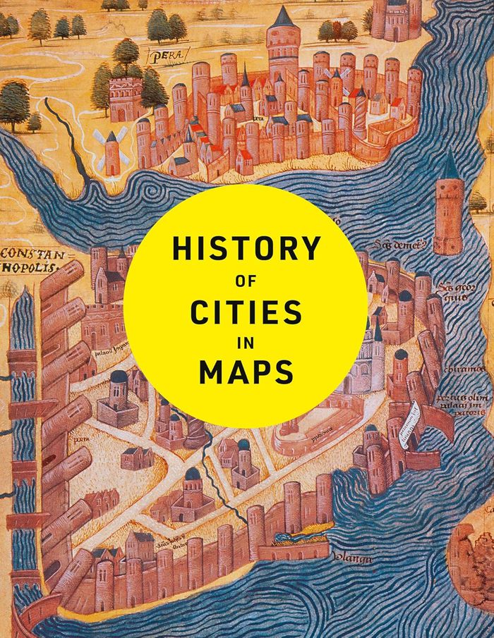
History of cities in maps
History of cities in maps
Actions:
Prix:
$50.00
(disponible en magasin)
Résumé:
The city: a concept nearly as old as history itself, it is a paradox of human innovation and intervention, order and conflict. From ancient civilizations to modern-day metropolises, maps have played a crucial role in urban progress. This book explores the development of cities through more than 70 captivating maps. Each map in this beautifully designed volume gives a(...)
Titre:
History of cities in maps
Actions:
Prix:
$50.00
(disponible en magasin)
Résumé:
The city: a concept nearly as old as history itself, it is a paradox of human innovation and intervention, order and conflict. From ancient civilizations to modern-day metropolises, maps have played a crucial role in urban progress. This book explores the development of cities through more than 70 captivating maps. Each map in this beautifully designed volume gives a unique visual representation of and historical context to the city it surveys. Spanning more than 9,000 years, this book expertly curates more than 70 historical maps which tell the fascinating story of human civilization: from cities founded on sacred places, ideas and power, to early examples of town planning and later innovations such as skyscrapers and urban transport.
Classification:
livres
livres
Publication:
janvier 2025
janvier 2025
Classification:
livres
livres
Prix:
$44.00
(disponible sur commande)
Résumé:
The life and legend of New York City, from the size of its skyscrapers to the ways of its inhabitants, is vividly captured in this collection of more than 250 maps, cross sections, ?owcharts, tables, board games, cartoons and infographics, and other unique diagrams spanning 150 years. Superstars such as Saul Steinberg, Maira Kalman, Christoph Niemann, Roz Chast, and(...)
Publication:
avril 2021
avril 2021
Titre:
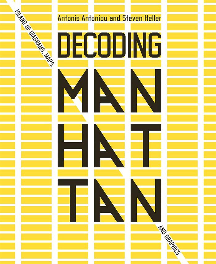
Decoding Manhattan: island of diagrams, maps, and graphics
Actions:
Prix:
$44.00
(disponible sur commande)
Résumé:
The life and legend of New York City, from the size of its skyscrapers to the ways of its inhabitants, is vividly captured in this collection of more than 250 maps, cross sections, ?owcharts, tables, board games, cartoons and infographics, and other unique diagrams spanning 150 years. Superstars such as Saul Steinberg, Maira Kalman, Christoph Niemann, Roz Chast, and Milton Glaser butt up against the unsung heroes of the popular press in a book that is made not only for lovers of New York but also for anyone who enjoys or works with information design.
Classification:
livres
livres
Publication:
avril 2021
avril 2021