109 Résultats
Classification:
livres
livres
Prix:
$85.00
(disponible sur commande)
Résumé:
La ville a offert de multiples visages depuis son apparition en Mésopotamie et dans la vallée de l'Indus, voici environ 10 000 ans, et héberge aujourd'hui la moitié de l'humanité. L'appréhension du milieu urbain fut toutefois progressive et plurielle. Les quelque 200 cartes de la collection exceptionnelle de la Royal Geographical Society nous montrent comment l'homme a(...)
Titre:
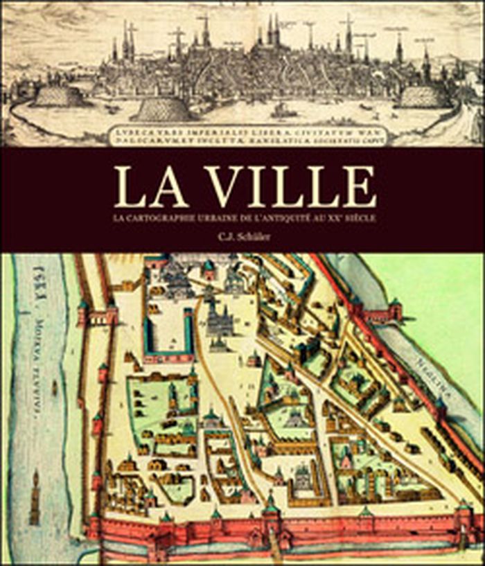
La ville: la cartographie urbaine de l'antiquité au XXe siècle
Actions:
Prix:
$85.00
(disponible sur commande)
Résumé:
La ville a offert de multiples visages depuis son apparition en Mésopotamie et dans la vallée de l'Indus, voici environ 10 000 ans, et héberge aujourd'hui la moitié de l'humanité. L'appréhension du milieu urbain fut toutefois progressive et plurielle. Les quelque 200 cartes de la collection exceptionnelle de la Royal Geographical Society nous montrent comment l'homme a imaginé, puis dessiné la ville. Par les tablettes en terre cuite des Babyloniens aux plans très précis du milieu du XXe siècle, en passant par les peintures et les enluminures médiévales, ce livre nous entraîne dans les cités, les bourgs et les métropoles de différentes époques.
Classification:
livres
livres
Publication:
septembre 2012
septembre 2012
Classification:
livres
livres
Titre:
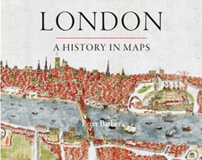
London: a history in maps
London: a history in maps
Actions:
Prix:
$49.95
(disponible sur commande)
Résumé:
Over the past two thousand years London has developed from a small town into one of the world's largest and most dynamic cities. This book charts that growth and the city's transformation through hundreds of maps culled from the collection of the British Library's Map Library. Including official documents, individual endeavors, hand-drawn renditions, and technologically(...)
Titre:
London: a history in maps
Actions:
Prix:
$49.95
(disponible sur commande)
Résumé:
Over the past two thousand years London has developed from a small town into one of the world's largest and most dynamic cities. This book charts that growth and the city's transformation through hundreds of maps culled from the collection of the British Library's Map Library. Including official documents, individual endeavors, hand-drawn renditions, and technologically advanced replicas, these maps represent a variety of perspectives. Utilitarian maps show the city as it is and serve to elucidate its inner workings, while carefully wrought plans show the city as it was envisioned. This book reveals the inside story of the creation, growth, and change of London.
Classification:
livres
livres
Publication:
septembre 2012
septembre 2012
Classification:
livres
livres
Actions:
Prix:
$95.00
(disponible sur commande)
Résumé:
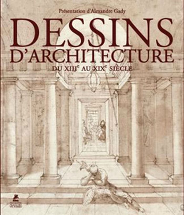
Les illustrations de cet ouvrage entraînent les lecteurs du Moyen Âge au XIXe siècle, sur les traces des bâtisseurs, architectes, décorateurs, utopistes ou simples témoins d'un passé dont ne subsistent parfois que des ruines. Ils ont pour noms Villard de Honnecourt, Jacques Androuet du Cerceau, Etienne Dupérac, Palladio, le Bernin, Borromini, Viollet-le-Duc, entre autres.
$95.00
(disponible sur commande)
Résumé:
Les illustrations de cet ouvrage entraînent les lecteurs du Moyen Âge au XIXe siècle, sur les traces des bâtisseurs, architectes, décorateurs, utopistes ou simples témoins d'un passé dont ne subsistent parfois que des ruines. Ils ont pour noms Villard de Honnecourt, Jacques Androuet du Cerceau, Etienne Dupérac, Palladio, le Bernin, Borromini, Viollet-le-Duc, entre autres.
Titre:
Dessins d'architecture, du Moyen-Âge au XIXe siècle
Actions:
Prix:
$95.00
(disponible sur commande)
Résumé:
Les illustrations de cet ouvrage entraînent les lecteurs du Moyen Âge au XIXe siècle, sur les traces des bâtisseurs, architectes, décorateurs, utopistes ou simples témoins d'un passé dont ne subsistent parfois que des ruines. Ils ont pour noms Villard de Honnecourt, Jacques Androuet du Cerceau, Etienne Dupérac, Palladio, le Bernin, Borromini, Viollet-le-Duc, entre autres.
Classification:
livres
livres
Publication:
novembre 2012
novembre 2012
Classification:
livres
livres
Titre:
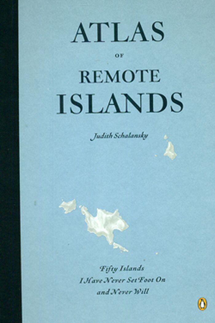
Atlas of remote islands
Atlas of remote islands
Actions:
Prix:
$35.00
(disponible en magasin)
Résumé:
There are still places on earth that are unknown. This publication captures fifty islands that are far away in every sense-from the mainland, from people, from airports, and from holiday brochures. Author Judith Schalansky used historic events and scientific reports as a springboard for each island, providing information on its distance from the mainland, whether its(...)
Titre:
Atlas of remote islands
Actions:
Prix:
$35.00
(disponible en magasin)
Résumé:
There are still places on earth that are unknown. This publication captures fifty islands that are far away in every sense-from the mainland, from people, from airports, and from holiday brochures. Author Judith Schalansky used historic events and scientific reports as a springboard for each island, providing information on its distance from the mainland, whether its inhabited, its features, and the stories that have shaped its lore.
Classification:
livres
livres
Publication:
octobre 2010
octobre 2010
Classification:
livres
livres

Titre:
Denis Wood: Everything sings
Denis Wood: Everything sings
Actions:
Prix:
$31.00
(disponible sur commande)
Résumé:
With artful wit and rigor, cartographer Denis Wood has written numerous books (including the influential bestseller The Power of Maps) that reorient his readers not only to our neighborhoods, homes and bodies, but also to our own very human instinct to understand where we live by mapmaking. At the heart of Wood's investigations is a near-legendary endeavor: the Boylan(...)
Titre:
Denis Wood: Everything sings
Actions:
Prix:
$31.00
(disponible sur commande)
Résumé:
With artful wit and rigor, cartographer Denis Wood has written numerous books (including the influential bestseller The Power of Maps) that reorient his readers not only to our neighborhoods, homes and bodies, but also to our own very human instinct to understand where we live by mapmaking. At the heart of Wood's investigations is a near-legendary endeavor: the Boylan Heights maps, begun in 1982, and now published in Everything Sings. Surveying his century-old, half-square mile neighborhood Boylan Heights in Raleigh, North Carolina, Wood began by paring away the inessential "map crap" (scale, orientation, street grids) and, in searching for the revelatory in the unmapped and the unmappable, he ended up plotting such phenomena as radio waves permeating the air, the light cast by street lights and Halloween pumpkins on porches. Wood's maps accumulate into a multi-layered story about one neighborhood that tells the larger story of what constitutes the places we call home. With an introduction by Ira Glass.
Classification:
livres
livres
Publication:
février 2011
février 2011
Classification:
livres
livres
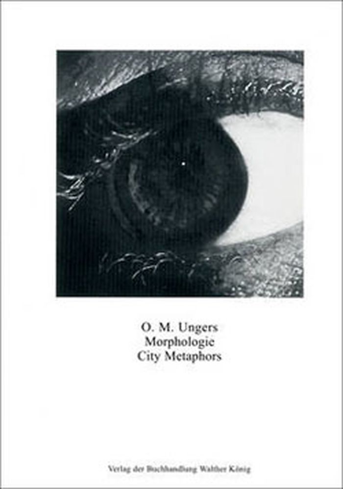
Titre:
Morphologie: city metaphors
Morphologie: city metaphors
Actions:
Prix:
$39.95
(disponible en magasin)
Résumé:
First published in 1982, German architect Oswald Mathias Ungers' ''City metaphors'' juxtaposes more than 100 various city maps throughout history with images of flora and fauna and other images from science and nature. Ungers assigns each a title- a single descriptive word printed in both English and German. In Ungers' vision, the divisions of Venice are transformed into(...)
Titre:
Morphologie: city metaphors
Actions:
Prix:
$39.95
(disponible en magasin)
Résumé:
First published in 1982, German architect Oswald Mathias Ungers' ''City metaphors'' juxtaposes more than 100 various city maps throughout history with images of flora and fauna and other images from science and nature. Ungers assigns each a title- a single descriptive word printed in both English and German. In Ungers' vision, the divisions of Venice are transformed into a handshake and the 1809 plan of St Gallen becomes a womb. Ungers writes in his foreword, “Without a comprehensive vision reality will appear as a mass of unrelated phenomenon and meaningless facts, in other words, totally chaotic. In such a world it would be like living in a vacuum; everything would be of equal importance; nothing could attract our attention; and there would be no possibility to utilize the mind.” A classic of creative cartography and visual thinking, ''City metaphors'' is also an experiment in conscious vision-building.
Classification:
livres
livres
Publication:
juillet 2011
juillet 2011
Classification:
livres
livres
Prix:
$33.95
(disponible sur commande)
Résumé:
Atlas: Geography, Architecture and Change in an Interdependent World helps readers find their way through the practical and ethical challenges presented by globalisation and global environmental change. This publication combines recent thinking on human geography and architecture on global environmental change issues, setting out to develop a reinterpretation of(...)
Publication:
février 2012
février 2012
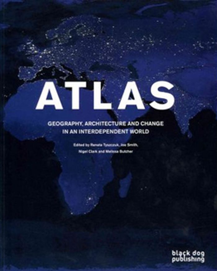
Titre:
Atlas: geography, architecture and change in an independent world
Actions:
Prix:
$33.95
(disponible sur commande)
Résumé:
Atlas: Geography, Architecture and Change in an Interdependent World helps readers find their way through the practical and ethical challenges presented by globalisation and global environmental change. This publication combines recent thinking on human geography and architecture on global environmental change issues, setting out to develop a reinterpretation of cartography and a reframing of sustainability. The aim is to find a re-drawing of the earth and the making of new maps. With a focus on the growth and remaking of cities it offers an innovative mix of essays and shorter texts, original artworks and distinctive re-mappings. The Atlas arises out of a collaboration between scholars and practitioners from architecture and human geography.
Classification:
livres
livres
Publication:
février 2012
février 2012
Classification:
livres
livres
Actions:
Prix:
$52.95
(disponible sur commande)
Résumé:
In the seventeenth century, a map of the plague suggested a radical idea—that the disease was carried and spread by humans. In the nineteenth century, maps of cholera cases were used to prove its waterborne nature. More recently, maps charting the swine flu pandemic caused worldwide panic and sent shockwaves through the medical community. In Disease Maps, Tom Koch(...)
Titre:
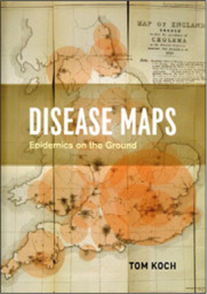
Disease maps: epidemics on the ground
Actions:
Prix:
$52.95
(disponible sur commande)
Résumé:
In the seventeenth century, a map of the plague suggested a radical idea—that the disease was carried and spread by humans. In the nineteenth century, maps of cholera cases were used to prove its waterborne nature. More recently, maps charting the swine flu pandemic caused worldwide panic and sent shockwaves through the medical community. In Disease Maps, Tom Koch contends that to understand epidemics and their history we need to think about maps of varying scale, from the individual body to shared symptoms evidenced across cities, nations, and the world. Disease Maps begins with a brief review of epidemic mapping today and a detailed example of its power. Koch then traces the early history of medical cartography, including pandemics such as European plague and yellow fever, and the advancements in anatomy, printing, and world atlases that paved the way for their mapping. Moving on to the scourge of the nineteenth century—cholera—Koch considers the many choleras argued into existence by the maps of the day, including a new perspective on John Snow’s science and legacy. Finally, Koch addresses contemporary outbreaks such as AIDS, cancer, and H1N1, and reaches into the future, toward the coming epidemics.
Classification:
livres
livres
Publication:
août 2011
août 2011
Classification:
livres
livres
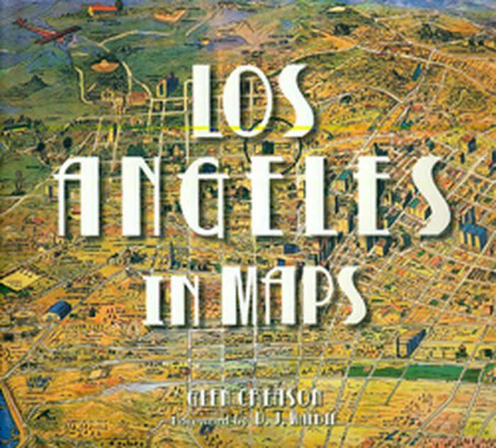
Titre:
Los Angeles in maps
Los Angeles in maps
Actions:
Prix:
$60.00
(disponible sur commande)
Résumé:
An illustrated cartographic history of the City of Angels from the colonial era to the present. Los Angeles inhabits a place of the mind as much as it does a physical geographic space. Through seventy reproductions of seminal and historic documents, Los Angeles in Maps presents the evolution of this almost mythical place. Maps featured include historic Spanish explorers’(...)
Titre:
Los Angeles in maps
Actions:
Prix:
$60.00
(disponible sur commande)
Résumé:
An illustrated cartographic history of the City of Angels from the colonial era to the present. Los Angeles inhabits a place of the mind as much as it does a physical geographic space. Through seventy reproductions of seminal and historic documents, Los Angeles in Maps presents the evolution of this almost mythical place. Maps featured include historic Spanish explorers’ charts from as early as 1791, as well as more recent topographic surveys, tourist guides, real estate maps, bird’s-eye views, and more. Like the course of the Los Angeles River, the book winds through essential terrain: the discovery of oil, the rise of Hollywood, the streetcar system, Los Angeles Harbor, earthquakes, sprawl, and splendor.
Classification:
livres
livres
Publication:
octobre 2010
octobre 2010
Classification:
livres
livres
Actions:
Prix:
$54.95
(disponible sur commande)
Résumé:
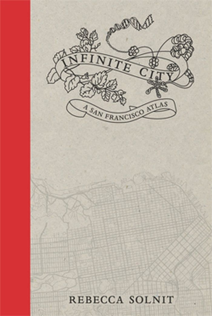
Infinite City, Rebecca Solnit’s reinvention of the traditional atlas, examines the many layers of meaning in one place, the San Francisco Bay Area. Aided by artists, writers, cartographers, and twenty-two gorgeous color maps, each of which illuminates the city and its surroundings as experienced by different inhabitants.
$54.95
(disponible sur commande)
Résumé:
Infinite City, Rebecca Solnit’s reinvention of the traditional atlas, examines the many layers of meaning in one place, the San Francisco Bay Area. Aided by artists, writers, cartographers, and twenty-two gorgeous color maps, each of which illuminates the city and its surroundings as experienced by different inhabitants.
Publication:
novembre 2010
novembre 2010
Titre:
Infinite city: a San Francisco atlas
Actions:
Prix:
$54.95
(disponible sur commande)
Résumé:
Infinite City, Rebecca Solnit’s reinvention of the traditional atlas, examines the many layers of meaning in one place, the San Francisco Bay Area. Aided by artists, writers, cartographers, and twenty-two gorgeous color maps, each of which illuminates the city and its surroundings as experienced by different inhabitants.
Classification:
livres
livres
Publication:
novembre 2010
novembre 2010