109 Résultats
Classification:
livres
livres
Titre:
Cartographies of time
Cartographies of time
Actions:
Prix:
$60.00
(disponible sur commande)
Résumé:
This book is the first comprehensive history of graphic representations of time in Europe and the United States from 1450 to the present. The authors have crafted a lively history featuring fanciful characters and unexpected twists and turns. From medieval manuscripts to websites, this book features a wide variety of timelines that in their own unique ways—curving,(...)
Publication:
mars 2010
mars 2010
Titre:
Cartographies of time
Actions:
Prix:
$60.00
(disponible sur commande)
Résumé:
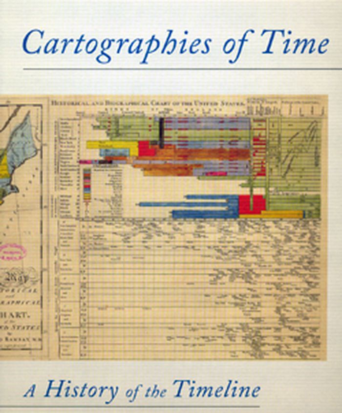
This book is the first comprehensive history of graphic representations of time in Europe and the United States from 1450 to the present. The authors have crafted a lively history featuring fanciful characters and unexpected twists and turns. From medieval manuscripts to websites, this book features a wide variety of timelines that in their own unique ways—curving, crossing, branching—defy conventional thinking about the form. A fifty-four-foot-long timeline from 1753 is mounted on a scroll and encased in a protective box. Another timeline uses the different parts of the human body to show the genealogies of Jesus Christ and the rulers of Saxony.
Cartographies of time
Actions:
Prix:
$60.00
(disponible sur commande)
Résumé:
This book is the first comprehensive history of graphic representations of time in Europe and the United States from 1450 to the present. The authors have crafted a lively history featuring fanciful characters and unexpected twists and turns. From medieval manuscripts to websites, this book features a wide variety of timelines that in their own unique ways—curving, crossing, branching—defy conventional thinking about the form. A fifty-four-foot-long timeline from 1753 is mounted on a scroll and encased in a protective box. Another timeline uses the different parts of the human body to show the genealogies of Jesus Christ and the rulers of Saxony.
Classification:
livres
livres
Publication:
mars 2010
mars 2010
Classification:
livres
livres

Actions:
Prix:
$34.95
(disponible sur commande)
Résumé:
this book is a reinvention of the traditional atlas, one that provides a complex look at the multi-faceted nature of New Orleans, a city replete with contradictions. More than twenty essays assemble a chorus voices, including geographers, scholars of sugar and bananas, the city's remarkable musicians, prison activists, environmentalists, Arab and Native voices, and local(...)
Publication:
octobre 2013
octobre 2013
Titre:
Unfathomable city : a New Orleans atlas
Actions:
Prix:
$34.95
(disponible sur commande)
Résumé:
this book is a reinvention of the traditional atlas, one that provides a complex look at the multi-faceted nature of New Orleans, a city replete with contradictions. More than twenty essays assemble a chorus voices, including geographers, scholars of sugar and bananas, the city's remarkable musicians, prison activists, environmentalists, Arab and Native voices, and local experts, as well as the coauthors’ contributions.
Classification:
livres
livres
Publication:
octobre 2013
octobre 2013
Classification:
livres
livres
Titre:
The social atlas of Europe
The social atlas of Europe
Actions:
Prix:
$53.60
(disponible en magasin)
Résumé:
This publication reconsiders European identity through its many different facets: economy, culture, history, and human and physical geography, visualizing Europe and its people in a more fluid way, without artificial national boundaries. It utilizes the latest available demographic, social, and economic data through state-of-the-art geographical information systems and(...)
Publication:
juin 2014
juin 2014
Titre:
The social atlas of Europe
Actions:
Prix:
$53.60
(disponible en magasin)
Résumé:
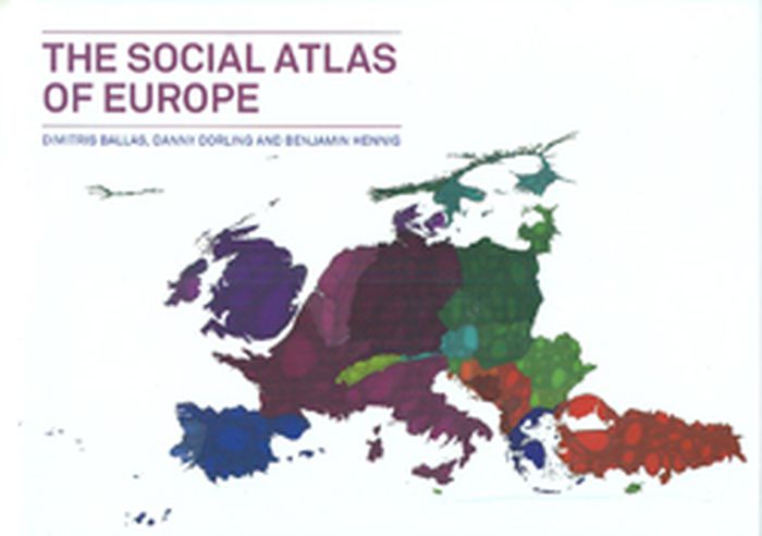
This publication reconsiders European identity through its many different facets: economy, culture, history, and human and physical geography, visualizing Europe and its people in a more fluid way, without artificial national boundaries. It utilizes the latest available demographic, social, and economic data through state-of-the-art geographical information systems and new cartography techniques that were invented specifically for this work.
The social atlas of Europe
Actions:
Prix:
$53.60
(disponible en magasin)
Résumé:
This publication reconsiders European identity through its many different facets: economy, culture, history, and human and physical geography, visualizing Europe and its people in a more fluid way, without artificial national boundaries. It utilizes the latest available demographic, social, and economic data through state-of-the-art geographical information systems and new cartography techniques that were invented specifically for this work.
Classification:
livres
livres
Publication:
juin 2014
juin 2014
Classification:
livres
livres
Actions:
Prix:
$32.00
(disponible sur commande)
Résumé:
The acclaimed geographer Denis Wood has written numerous books (including the influential bestseller The Power of Maps) that reorient his readers to our neighborhoods, homes and bodies. At the heart of Wood’s investigations is a near-legendary endeavor: the Boylan Heights maps, begun in 1982, and first presented in Everything Sings (2010). This second edition includes(...)
Titre:
Denis Wood : everything sings, maps for a narrative atlas, 2nd revised edition
Actions:
Prix:
$32.00
(disponible sur commande)
Résumé:
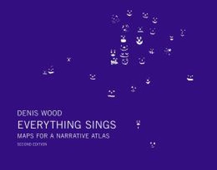
The acclaimed geographer Denis Wood has written numerous books (including the influential bestseller The Power of Maps) that reorient his readers to our neighborhoods, homes and bodies. At the heart of Wood’s investigations is a near-legendary endeavor: the Boylan Heights maps, begun in 1982, and first presented in Everything Sings (2010). This second edition includes eight new maps (including one of barking dogs!), other new visual material plus original essays by Ander Monson and Albert Mobilio and an interview with Blake Butler.
Denis Wood : everything sings, maps for a narrative atlas, 2nd revised edition
Actions:
Prix:
$32.00
(disponible sur commande)
Résumé:
The acclaimed geographer Denis Wood has written numerous books (including the influential bestseller The Power of Maps) that reorient his readers to our neighborhoods, homes and bodies. At the heart of Wood’s investigations is a near-legendary endeavor: the Boylan Heights maps, begun in 1982, and first presented in Everything Sings (2010). This second edition includes eight new maps (including one of barking dogs!), other new visual material plus original essays by Ander Monson and Albert Mobilio and an interview with Blake Butler.
Classification:
livres
livres
Publication:
juin 2013
juin 2013
Classification:
livres
livres
Prix:
$42.95
(disponible sur commande)
Résumé:
The maps in this book are drawn with satellites, assembled with pixels radioed from outer space, and constructed from statistics; they record situations of intense conflict and express fundamental transformations in our ways of seeing and of experiencing space. These maps are built with GPS, remote sensing satellites,or GIS: digital spatial hardware and software designed(...)
Titre:
Close up at a distance: mapping, technology and politics
Actions:
Prix:
$42.95
(disponible sur commande)
Résumé:
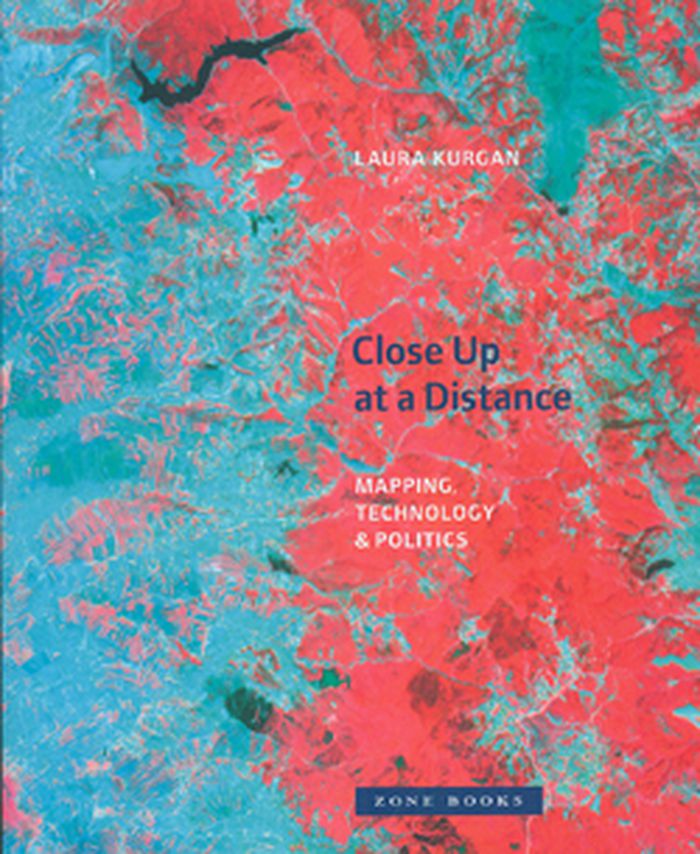
The maps in this book are drawn with satellites, assembled with pixels radioed from outer space, and constructed from statistics; they record situations of intense conflict and express fundamental transformations in our ways of seeing and of experiencing space. These maps are built with GPS, remote sensing satellites,or GIS: digital spatial hardware and software designed for such military and governmental uses as reconnaissance, secrecy, monitoring, ballistics, the census, and national security. Rather than shying away from the politics and complexities of their intended uses, Laura Kurgan attempts to illuminate them. Poised at the intersection of art, architecture, activism, and geography, her analysis uncovers the implicit biases of the new views, the means of recording information they present, and the new spaces they have opened up.
Close up at a distance: mapping, technology and politics
Actions:
Prix:
$42.95
(disponible sur commande)
Résumé:
The maps in this book are drawn with satellites, assembled with pixels radioed from outer space, and constructed from statistics; they record situations of intense conflict and express fundamental transformations in our ways of seeing and of experiencing space. These maps are built with GPS, remote sensing satellites,or GIS: digital spatial hardware and software designed for such military and governmental uses as reconnaissance, secrecy, monitoring, ballistics, the census, and national security. Rather than shying away from the politics and complexities of their intended uses, Laura Kurgan attempts to illuminate them. Poised at the intersection of art, architecture, activism, and geography, her analysis uncovers the implicit biases of the new views, the means of recording information they present, and the new spaces they have opened up.
Classification:
livres
livres
Publication:
mars 2013
mars 2013
Classification:
livres
livres

Actions:
Prix:
$64.95
(disponible sur commande)
Résumé:
In this book, Karen O'Rourke explores a series of walking/mapping projects by contemporary artists. Some chart "emotional GPS"; some use GPS for creating "datascapes" while others use their legs to do "speculative mapping." Many work with scientists, designers, and engineers. O'Rourke offers close readings of these works -- many of which she was able to experience(...)
Publication:
mars 2013
mars 2013
Titre:
Walking and mapping: artists as cartographers
Actions:
Prix:
$64.95
(disponible sur commande)
Résumé:
In this book, Karen O'Rourke explores a series of walking/mapping projects by contemporary artists. Some chart "emotional GPS"; some use GPS for creating "datascapes" while others use their legs to do "speculative mapping." Many work with scientists, designers, and engineers. O'Rourke offers close readings of these works -- many of which she was able to experience firsthand -- and situates them in relation to landmark works from the past half-century. She shows that the infinitesimal details of each of these projects take on more significance in conjunction with others. Together, they form a new entity, a dynamic whole greater than the sum of its parts. By alternating close study of selected projects with a broader view of their place in a bigger picture, Walking and Mapping itself maps a complex phenomena.
Classification:
livres
livres
Publication:
mars 2013
mars 2013
Classification:
livres
livres

Titre:
Mapping Manhattan
Mapping Manhattan
Actions:
Prix:
$21.95
(disponible sur commande)
Résumé:
Armed with hundreds of blank maps she had printed by hand, Becky Cooper walked Manhattan from end to end. She asked the strangers to “map their Manhattan” and to mail the personalized maps back to her. Soon, her P.O. box was filled with a cartography of intimate narratives: past loves, lost homes, childhood memories, comical moments, and surprising confessions.
Titre:
Mapping Manhattan
Actions:
Prix:
$21.95
(disponible sur commande)
Résumé:
Armed with hundreds of blank maps she had printed by hand, Becky Cooper walked Manhattan from end to end. She asked the strangers to “map their Manhattan” and to mail the personalized maps back to her. Soon, her P.O. box was filled with a cartography of intimate narratives: past loves, lost homes, childhood memories, comical moments, and surprising confessions.
Classification:
livres
livres
Publication:
avril 2013
avril 2013
Classification:
livres
livres
Prix:
$65.00
(disponible sur commande)
Résumé:
A Map of the World is a collection of work by a new generation of designers, illustrators, and mapmakers. This work showcases specific regions, characterizes local scenes, generates moods, and tells stories beyond sheer navigation. From accurate and surprisingly detailed representations to personal, naïve, and modernistic interpretations, the featured projects from around(...)
Publication:
février 2013
février 2013
Titre:
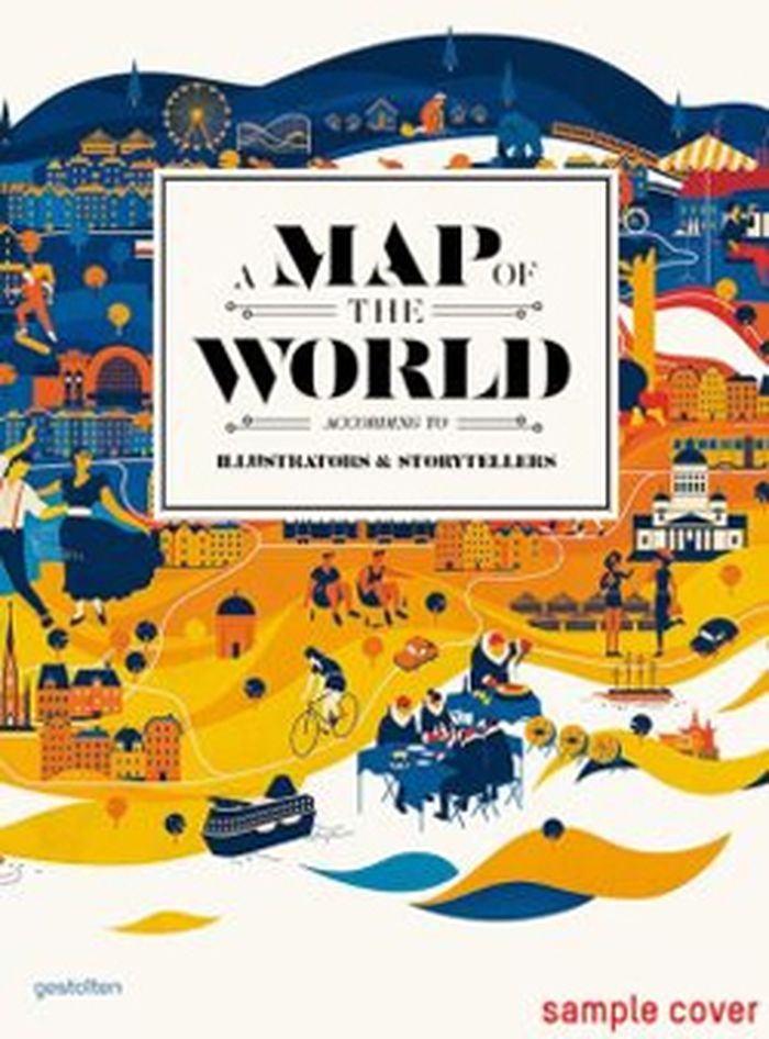
A map of the world, according to illustrators & storytellers
Actions:
Prix:
$65.00
(disponible sur commande)
Résumé:
A Map of the World is a collection of work by a new generation of designers, illustrators, and mapmakers. This work showcases specific regions, characterizes local scenes, generates moods, and tells stories beyond sheer navigation. From accurate and surprisingly detailed representations to personal, naïve, and modernistic interpretations, the featured projects from around the world range from maps and atlases inspired by classic forms to cartographic experiments and editorial illustrations.
Classification:
livres
livres
Publication:
février 2013
février 2013
Classification:
livres
livres
Actions:
Prix:
$39.95
(disponible sur commande)
Résumé:
"Mappamundi" rassemble une trentaine d'artistes qui interrogent la représentation cartographique. Ces visions d'artistes sont regroupées en trois temps : le corps - les cartes renouent avec les sensations et l'expérience physiques du monde ; le combat - des instruments de pouvoir deviennent outils de contestation ; le conte - les cartes utilitaires sont détrônées par(...)
Titre:
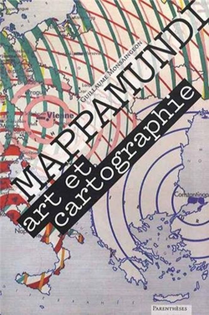
Mappamundi : art et cartographie
Actions:
Prix:
$39.95
(disponible sur commande)
Résumé:
"Mappamundi" rassemble une trentaine d'artistes qui interrogent la représentation cartographique. Ces visions d'artistes sont regroupées en trois temps : le corps - les cartes renouent avec les sensations et l'expérience physiques du monde ; le combat - des instruments de pouvoir deviennent outils de contestation ; le conte - les cartes utilitaires sont détrônées par l'imaginaire et la fiction. Un essai sur les relations entre art et cartographie précède les " portraits du monde " sélectionnés dans "Mappamundi".
Classification:
livres
livres
Publication:
mai 2013
mai 2013
Classification:
livres
livres

Actions:
Prix:
$18.00
(disponible sur commande)
Résumé:
Following the history of maps from the early explorers’ maps and the medieval Mappa Mundi to Google Maps and the satellite renderings on our smartphones, Garfield explores the unique way that maps relate and realign our history — and reflect the best and worst of what makes us human.
Titre:
On the map : a mind-expanding exploration of the way the world looks
Actions:
Prix:
$18.00
(disponible sur commande)
Résumé:
Following the history of maps from the early explorers’ maps and the medieval Mappa Mundi to Google Maps and the satellite renderings on our smartphones, Garfield explores the unique way that maps relate and realign our history — and reflect the best and worst of what makes us human.
Classification:
livres
livres
Publication:
novembre 2013
novembre 2013