115 Résultats
Classification:
livres
livres
Actions:
Prix:
$42.50
(disponible sur commande)
Résumé:
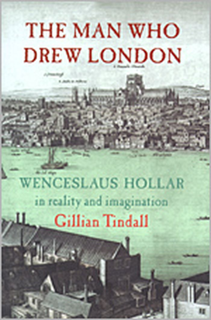
A young engraver making a precarious living wandering around Europe, Hollar was employed by an English lord who took him to London, where he became known for his fashion plates, maps and panoramas. This book traces the story of the artist/engraver who drew London before and after the Great Fire of 1666.
$42.50
(disponible sur commande)
Résumé:
A young engraver making a precarious living wandering around Europe, Hollar was employed by an English lord who took him to London, where he became known for his fashion plates, maps and panoramas. This book traces the story of the artist/engraver who drew London before and after the Great Fire of 1666.
Titre:
The man who drew London : Wenceslaus Hollar in reality and imagination
Actions:
Prix:
$42.50
(disponible sur commande)
Résumé:
A young engraver making a precarious living wandering around Europe, Hollar was employed by an English lord who took him to London, where he became known for his fashion plates, maps and panoramas. This book traces the story of the artist/engraver who drew London before and after the Great Fire of 1666.
Classification:
livres
livres
Publication:
janvier 1900, London
janvier 1900, London
Sujet:
Dessin d’architecture
Dessin d’architecture
Classification:
livres
livres
Titre:
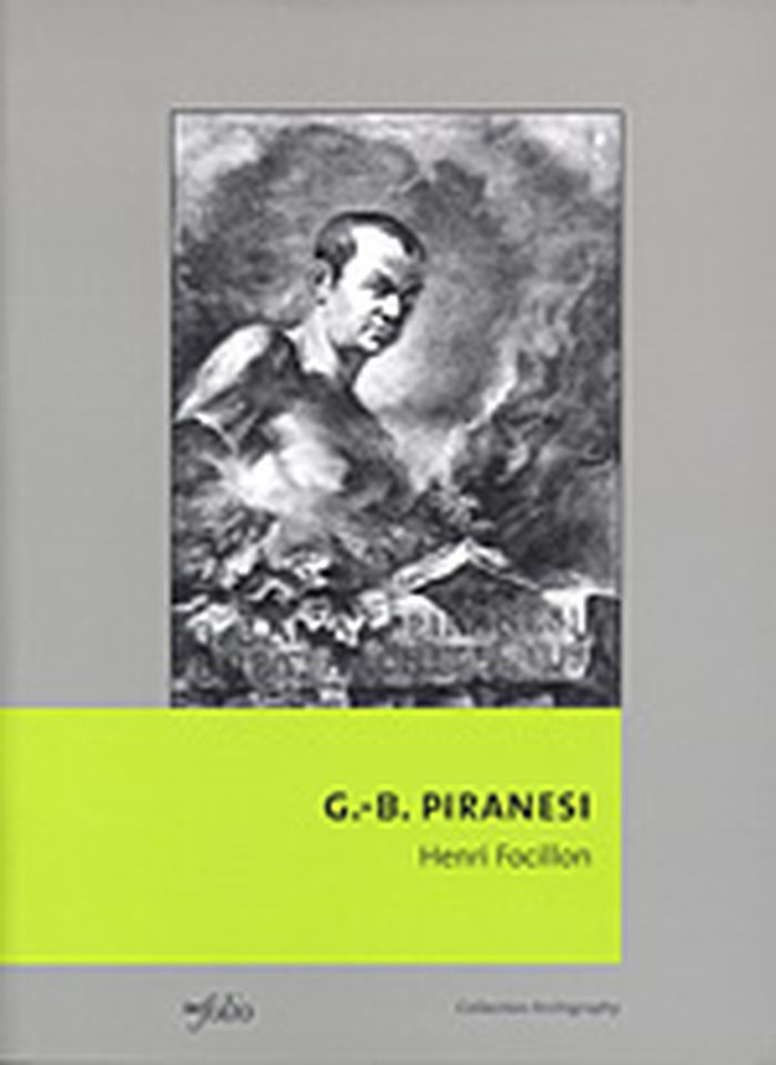
Giovanni-Batista Piranesi
Giovanni-Batista Piranesi
Actions:
Prix:
$48.95
(disponible sur commande)
Résumé:
Publié pour la première fois en 1918, cet ouvrage consacré à l’architecte-graveur Giovanni-Battista Piranesi ( Mestre 1720 – Rome 1778 ) est plus qu’une biographie. Il s’agit d’une véritable étude de la société italienne et romaine au XVIIIe siècle qui, sur bien des points, fait encore autorité aujourd’hui. Fils d’un tailleur de pierre vénitien, Giovanni-Battista Piranesi(...)
Titre:
Giovanni-Batista Piranesi
Actions:
Prix:
$48.95
(disponible sur commande)
Résumé:
Publié pour la première fois en 1918, cet ouvrage consacré à l’architecte-graveur Giovanni-Battista Piranesi ( Mestre 1720 – Rome 1778 ) est plus qu’une biographie. Il s’agit d’une véritable étude de la société italienne et romaine au XVIIIe siècle qui, sur bien des points, fait encore autorité aujourd’hui. Fils d’un tailleur de pierre vénitien, Giovanni-Battista Piranesi reçut une formation d’architecte. Passionné par l’antiquité romaine, il accompagna, alors âgé de vingt ans, l’ambassadeur de Venise auprès du Saint-Siège à Rome. Il put alors satisfaire à loisir sa passion et parfaire sa formation auprès des maîtres romains. Lors de ce séjour, il s’initia à la gravure, art qu’il pratiqua sa vie durant, gravant des vues de Rome où les ruines antiques sont omniprésentes. Sa formation d’architecte et son œil passionné d’amateur d’antiquités offrent à notre regard ébahi une profusion d’œuvres qu’il publia dans plusieurs recueils. Ses talents d’architecte furent peu sollicités. C’est principalement la famille des Rezzonico, Vénitiens comme lui et dont fut issu le pape Clément XIII, qui lui permit d’exercer sa profession. Il fut notamment l’architecte de la restauration du prieuré des chevaliers de Malte à Rome et de son église, Sainte-Marie-Aventine.
Classification:
livres
livres
Publication:
avril 2003, Gollion
avril 2003, Gollion
Sujet:
Dessin d’architecture
Dessin d’architecture
Classification:
livres
livres
Actions:
Prix:
$115.00
(disponible sur commande)
Résumé:
The discovery of and excavations at Pompeii in the second half of the eighteenth century not only provided historians with a trove of information about ancient Roman civilization but also fired artists' imaginations and inaugurated the vogue for the "Pompeian style" that so influenced the West in the nineteenth century. This book reproduces, along with commentary, "Le(...)
Sujet:
Dessin d’architecture
Dessin d’architecture
Publication:
septembre 2002, Los Angeles
septembre 2002, Los Angeles
Titre:
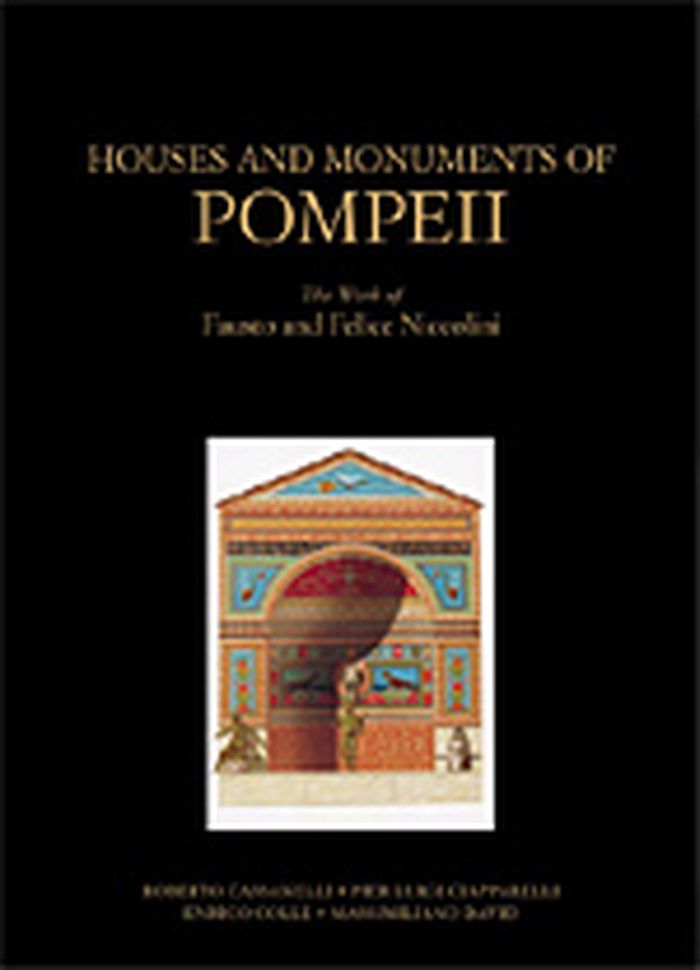
Houses and monuments of Pompeii : the works fo Fausto and Felice Niccolini
Actions:
Prix:
$115.00
(disponible sur commande)
Résumé:
The discovery of and excavations at Pompeii in the second half of the eighteenth century not only provided historians with a trove of information about ancient Roman civilization but also fired artists' imaginations and inaugurated the vogue for the "Pompeian style" that so influenced the West in the nineteenth century. This book reproduces, along with commentary, "Le case i monumenti di Pompeii" (1854) of Fausto and Felice Niccolini, the first work to present completely and systematically all the public and private buildings so far excavated in Pompeii. It features the wondrous watercolors the Niccolinis created to document Pompeii and is thus a beautiful and essential tool in understanding the excavated remains themselves and how the modern archaeologists perceived and recorded the ancient world. These reproduced drawings of the excavations are accompanied by texts that explain the documents by the Niccolinis, as well as the evolution of the Pompeian style in Europe, the pictorial representation of Pompeii in the nineteenth century from engravings to photographs, and the evolving styles of archaeological documentation.
Classification:
livres
livres
Publication:
septembre 2002, Los Angeles
septembre 2002, Los Angeles
Sujet:
Dessin d’architecture
Dessin d’architecture
Classification:
livres
livres
Actions:
Prix:
$115.00
(disponible sur commande)
Résumé:
Traditionally a critical component of the education of any architect was to draw the ruins of ancient Rome, reconstructing either from ancient sources or, more often, pure fantasy, what the original structures must have looked like. From this training emerged generations of architects imbued with the aesthetic ideals that would form the Neoclassical and Beaux-Arts(...)
Sujet:
Dessin d’architecture
Dessin d’architecture
Publication:
septembre 2002, Los Angeles
septembre 2002, Los Angeles
Titre:
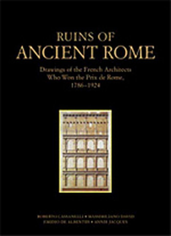
Ruins of Ancient Rome : the drawings of French architects who won the Prix de Rome 1786-1924
Actions:
Prix:
$115.00
(disponible sur commande)
Résumé:
Traditionally a critical component of the education of any architect was to draw the ruins of ancient Rome, reconstructing either from ancient sources or, more often, pure fantasy, what the original structures must have looked like. From this training emerged generations of architects imbued with the aesthetic ideals that would form the Neoclassical and Beaux-Arts building styles. Drawings of the ruins of ancient Rome made by French "Prix de Rome" architects from 1786 through 1924 are reproduced. Accompanied by text that explains how the Prix de Rome was awarded and the significance of the prize in the history of architecture, as well as how the study of ancient models formed the basis for nineteenth- and early twentieth-century architectural styles, these drawings provide an understanding of how the modern imagination recorded and transformed ancient fragments into a modern architectural idiom.
Classification:
livres
livres
Publication:
septembre 2002, Los Angeles
septembre 2002, Los Angeles
Sujet:
Dessin d’architecture
Dessin d’architecture
Classification:
livres
livres
Prix:
$79.95
(disponible sur commande)
Résumé:
Envisioning Architecture, the first in a series of three titles showcasing selected works from The Museum of Modern Art's superlative architecture and design collection, features a wide variety of drawings by great architects of the modern period, from early masters such as Frank Lloyd Wright, Le Corbusier, and Ludwig Mies van der Rohe to contemporary practitioners(...)
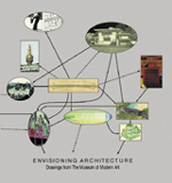
Titre:
Envisioning architecture : drawings from the Museum of Modern Art
Actions:
Prix:
$79.95
(disponible sur commande)
Résumé:
Envisioning Architecture, the first in a series of three titles showcasing selected works from The Museum of Modern Art's superlative architecture and design collection, features a wide variety of drawings by great architects of the modern period, from early masters such as Frank Lloyd Wright, Le Corbusier, and Ludwig Mies van der Rohe to contemporary practitioners including Frank Gehry, Zaha Hadid, Rem Koolhaas, and others. Revealing the range of aesthetic viewpoints in architecture since the late 19th century, these drawings also cumulatively trace the development of the field, almost incidentally making the crucial point that in this increasingly technological age, the age-old discipline of drawing is as vital and inventive as ever. The book opens with an exploration of the relatively brief history of collecting architectural drawings, whose practice dates back little farther than the 16th century.
Classification:
livres
livres
Publication:
octobre 2001, New York
octobre 2001, New York
Sujet:
Dessin d’architecture
Dessin d’architecture
Classification:
livres
livres
Actions:
Prix:
$67.50
(disponible sur commande)
Résumé:
"Artists' Impressions in Architectural Design" looks at the the ways in which architects have represented their designs for clients and the public, both historically and contemporarily. It covers the period from the 15th to the 21st century. Featuring some of the best known buildings by the best known architects, this book places the technological development of today in(...)
Sujet:
Dessin d’architecture
Dessin d’architecture
Publication:
septembre 2002, London and New York
septembre 2002, London and New York
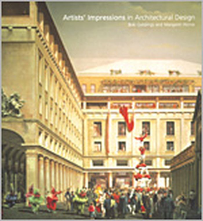
Titre:
Artists' impressions in architectural design
Actions:
Prix:
$67.50
(disponible sur commande)
Résumé:
"Artists' Impressions in Architectural Design" looks at the the ways in which architects have represented their designs for clients and the public, both historically and contemporarily. It covers the period from the 15th to the 21st century. Featuring some of the best known buildings by the best known architects, this book places the technological development of today in context with the historical heritage of the past.
Classification:
livres
livres
Publication:
septembre 2002, London and New York
septembre 2002, London and New York
Sujet:
Dessin d’architecture
Dessin d’architecture
Classification:
livres
livres
Prix:
$55.00
(disponible en magasin)
Résumé:
The Gothic era produced some of the Western world’s most imposing structures, today icons of the European cityscape. Unlike buildings from the Renaissance onward, these medieval works are rarely discussed as the products of the ingenious, innovative contributions of individual architects. This book challenges that common perception by asserting the significant impact of(...)
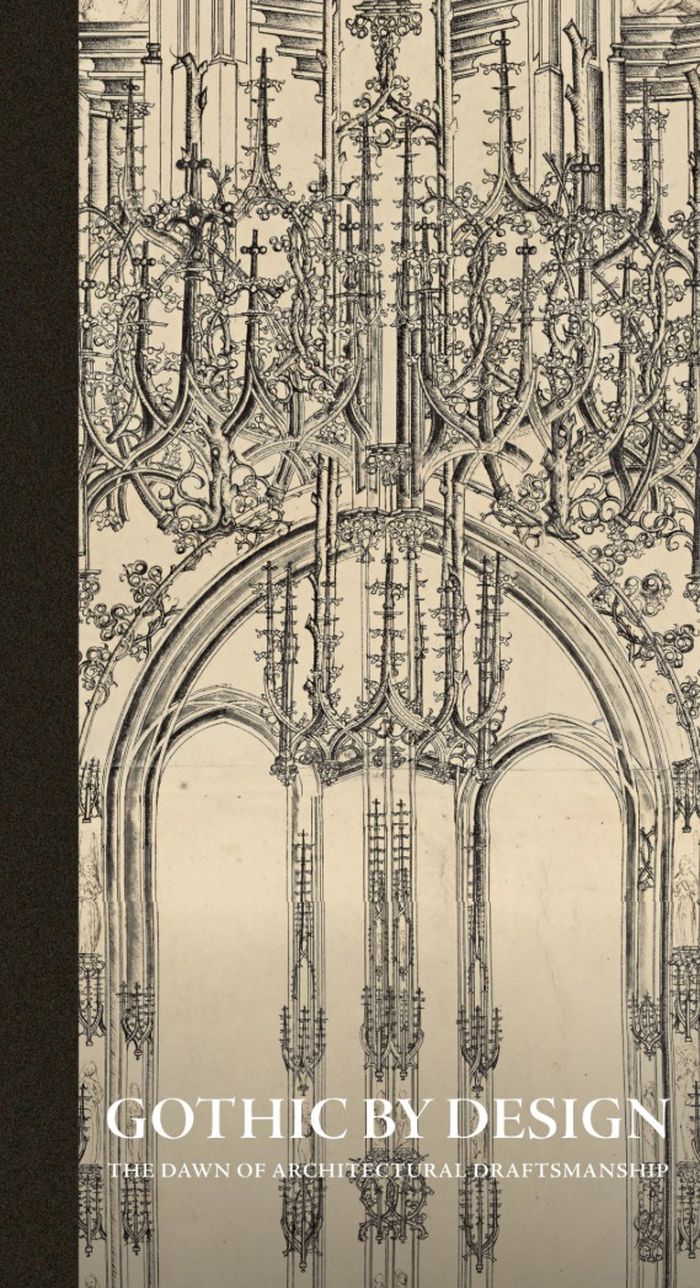
Titre:
Gothic by design: The dawn of architectural draftsmanship
Actions:
Prix:
$55.00
(disponible en magasin)
Résumé:
The Gothic era produced some of the Western world’s most imposing structures, today icons of the European cityscape. Unlike buildings from the Renaissance onward, these medieval works are rarely discussed as the products of the ingenious, innovative contributions of individual architects. This book challenges that common perception by asserting the significant impact of draftsmanship on the development of the Gothic style from the twelfth to early sixteenth century. The rediscovery of a little-known corpus of architectural drawings and prints reveals the crucial role of drawings in the development of complex and visually appealing structures—from monumental stone cathedrals to small liturgical objects. "Gothic by design" includes surprising ties to contemporary concerns, showing how these works on paper functioned on and off the building site, established the basis for modern concepts of artistic identity and intellectual property, and provided evidence of the long afterlife of Gothic design strategies and their potential use today in sustainable architecture.
Classification:
livres
livres
Publication:
mai 2026
mai 2026
Sujet:
Dessin d’architecture
Dessin d’architecture
Classification:
livres
livres
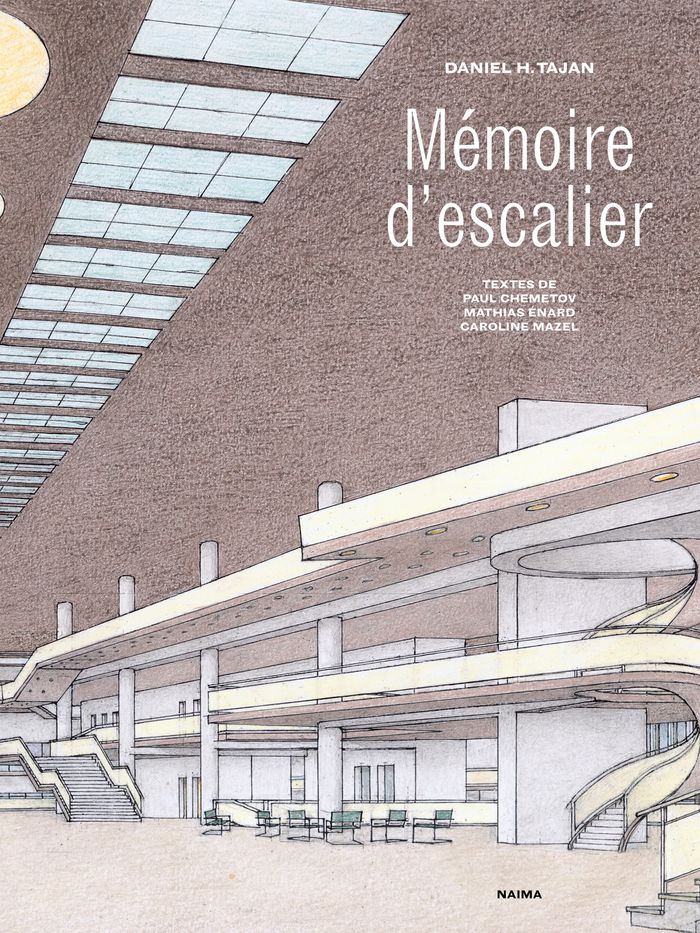
Titre:
Mémoire d'escalier
Mémoire d'escalier
Actions:
Prix:
$39.95
(disponible sur commande)
Résumé:
Une promenade subjective invite nos yeux à apprécier la convivialité de chacun de ces espaces mais aussi à éveiller un appétit de connaissance objective. Une technique rudimentaire, quelques crayons de couleur, révèle des points de vue sensibles autant que calculés, pas nécessairement accessibles à la photo ou au dessin informatique. Une courte légende bien tournée,(...)
Sujet:
Dessin d’architecture
Dessin d’architecture
Publication:
avril 2025
avril 2025
Titre:
Mémoire d'escalier
Actions:
Prix:
$39.95
(disponible sur commande)
Résumé:
Une promenade subjective invite nos yeux à apprécier la convivialité de chacun de ces espaces mais aussi à éveiller un appétit de connaissance objective. Une technique rudimentaire, quelques crayons de couleur, révèle des points de vue sensibles autant que calculés, pas nécessairement accessibles à la photo ou au dessin informatique. Une courte légende bien tournée, anecdote amusante ou commentaire érudit, prolonge la mise en perspective de chacun des dessins. L'auteur nous embarque dans son mémoire d'architecte. Car Mémoire d'escalier est un véritable traité d'emmarchement. « Séparer deux surfaces par trois marches dans un même volume, c'est nier le cloisonnement en gardant distinctes les fonctions, donc multiplier les relations et les possibles ». Un manifeste pour la « rencontre, impure et donc féconde, du plan avec l'élévation » nous dit Énard par le croisement borgesien de l'escalier avec la bibliothèque. Un bréviaire d'architecture.
Classification:
livres
livres
Publication:
avril 2025
avril 2025
Sujet:
Dessin d’architecture
Dessin d’architecture
Classification:
livres
livres
Actions:
Prix:
$120.00
(disponible sur commande)
Résumé:
Whether from military necessity or unbridled curiosity, mapmakers since early antiquity have attempted to represent the configuration of the land about them. The Greeks paid homage to the landscape and struck its image on their coins. Medieval scholars viewed the (...)
Sujet:
Dessin d’architecture
Dessin d’architecture
Publication:
octobre 1999, New York
octobre 1999, New York
Titre:
Infinite perspectives : two thousand years of three-dimensional mapmaking
Actions:
Prix:
$120.00
(disponible sur commande)
Résumé:
Whether from military necessity or unbridled curiosity, mapmakers since early antiquity have attempted to represent the configuration of the land about them. The Greeks paid homage to the landscape and struck its image on their coins. Medieval scholars viewed the highest elevations as a boundary between the physical and the spiritual; the images they created of their sacred shrines and historic sites were drawn atop simple caricatures of mountains. Leonardo da Vinci's maps of Tuscany and other more realistic representations of landforms appeared during the Renaissance, thanks to a wealth of scientific study and new artistic methods. In the modern era, new techniques were invented as attempts to portray the three-dimensional world on a flat surface became more sophisticated. Hachuring, a system that involves shading with fine parallel or crossed lines, was developed with the use of copper plates; contour lines slowly replaced this technique in the nineteenth century. Lithography allowed for the introduction of color to the printing process, and multi-color tints were used to impart a sense of elevation. Aerial and satellite photography and the dawn of the digital era have yielded maps of unprecedented realism; today's computer technology allows planetary surfaces to be portrayed in three dimensions with a precision unimaginable to previous generations of mapmakers. "Infinite Perspectives" traces the artistic and scientific evolution of topographic representation from its origins to the present. Over 80 colour plates of some of the most significant maps ever made detail important advances in the portrayal of three dimensions in map form. The final section of the book contains 20 plates presenting a revolutionary cartographic technique that allows viewers wearing ordinary 3D glasses to view planetary surfaces without distortion. This invention, developed by the authors with Dr. Russell Ambroziak and named Infinite Perspective Projection, is currently in use by NASA and the Department of Defense. Included are maps of Mars, the Grand Canyon, and Mount McKinley, as well as one large fold-out map, suitable for framing; two pairs of the necessary 3D viewing glasses are also provided.
Classification:
livres
livres
Publication:
octobre 1999, New York
octobre 1999, New York
Sujet:
Dessin d’architecture
Dessin d’architecture
Classification:
livres
livres
Prix:
$102.00
(disponible sur commande)
Résumé:
This sequel to our highly acclaimed title "An Atlas of Rare City Maps" collects over 100 views dating between 1835 and 1902, showing the streets, buildings, churches, bridges, waterways, and surrounding(...)
$102.00
(disponible sur commande)
Résumé:
This sequel to our highly acclaimed title "An Atlas of Rare City Maps" collects over 100 views dating between 1835 and 1902, showing the streets, buildings, churches, bridges, waterways, and surrounding(...)
Titre:
Bird's eye view : historic lithographs of North American cities
Actions:
Prix:
$102.00
(disponible sur commande)
Résumé:
This sequel to our highly acclaimed title "An Atlas of Rare City Maps" collects over 100 views dating between 1835 and 1902, showing the streets, buildings, churches, bridges, waterways, and surrounding countryside of North American towns, ranging from burgeoning metropolitan centers to small logging towns and mining camps. Baltimore, Brooklyn, Denver, Indianapolis, Memphis, Montreal, New Orleans, Pittsburgh, Seattle, Syracuse, and Washington are just a few of the cities presented in this collection. The exquisite colour and fine detail of these bird's eye views have been reproduced in all their original glory; also included is an introduction by John W. Reps providing a background on the artistic process and on urban development in the nineteenth century.
Classification:
livres
livres
Publication:
octobre 1998, New York
octobre 1998, New York
Sujet:
Dessin d’architecture
Dessin d’architecture