109 Résultats
Classification:
livres
livres
Actions:
Prix:
$67.95
(disponible sur commande)
Résumé:
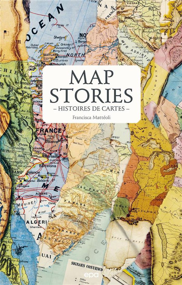
Parcourant le monde à travers de magnifiques cartes de toutes provenances et de toutes époques, l’écrivaine de voyage Francisca Mattéoli nous offre une aventure géographique étonnante en une vingtaine de récits sur les lieux qui l’inspirent ou l’ont marquée lors de ses voyages.
$67.95
(disponible sur commande)
Résumé:
Parcourant le monde à travers de magnifiques cartes de toutes provenances et de toutes époques, l’écrivaine de voyage Francisca Mattéoli nous offre une aventure géographique étonnante en une vingtaine de récits sur les lieux qui l’inspirent ou l’ont marquée lors de ses voyages.
Titre:
Map stories / Histoires de cartes
Actions:
Prix:
$67.95
(disponible sur commande)
Résumé:
Parcourant le monde à travers de magnifiques cartes de toutes provenances et de toutes époques, l’écrivaine de voyage Francisca Mattéoli nous offre une aventure géographique étonnante en une vingtaine de récits sur les lieux qui l’inspirent ou l’ont marquée lors de ses voyages.
Classification:
livres
livres
Publication:
février 2023
février 2023
Classification:
livres
livres
Titre:
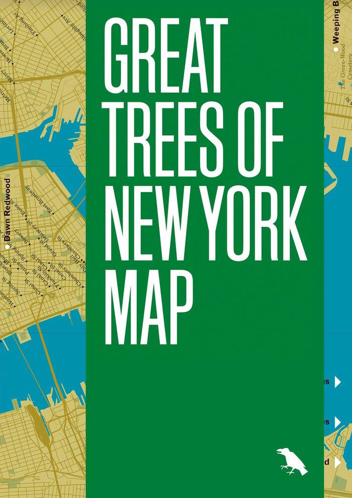
Great trees of New York map
Great trees of New York map
Actions:
Prix:
$18.95
(disponible en magasin)
Résumé:
This is a guide to 50 of the oldest, rarest, strangest, and most historic trees across New York City’s five boroughs, from the 350-year-old “Alley Pond Giant” in Queens to the wizened Camperdown elm in Prospect Park. This two-sided companion includes a map, an introduction and descriptions by Allison C. Meier, and original photography by Colin Montgomery.
Publication:
mai 2021
mai 2021
Titre:
Great trees of New York map
Actions:
Prix:
$18.95
(disponible en magasin)
Résumé:
This is a guide to 50 of the oldest, rarest, strangest, and most historic trees across New York City’s five boroughs, from the 350-year-old “Alley Pond Giant” in Queens to the wizened Camperdown elm in Prospect Park. This two-sided companion includes a map, an introduction and descriptions by Allison C. Meier, and original photography by Colin Montgomery.
Classification:
livres
livres
Publication:
mai 2021
mai 2021
Classification:
livres
livres
Titre:
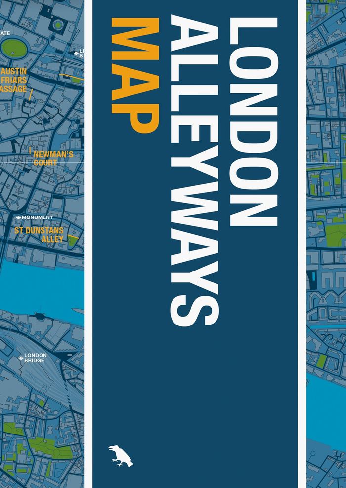
London alleyways map
London alleyways map
Actions:
Prix:
$18.95
(disponible en magasin)
Résumé:
London's alleyways have a habit of leading to unexpected places. They act as the city’s library: echoing the routes of trade, lost rivers, burial roads, disputed boundaries, tracks of animals and people. They hold the stories of a city that otherwise can no longer be seen. This map is your entry point to this story.
Publication:
octobre 2022
octobre 2022
Titre:
London alleyways map
Actions:
Prix:
$18.95
(disponible en magasin)
Résumé:
London's alleyways have a habit of leading to unexpected places. They act as the city’s library: echoing the routes of trade, lost rivers, burial roads, disputed boundaries, tracks of animals and people. They hold the stories of a city that otherwise can no longer be seen. This map is your entry point to this story.
Classification:
livres
livres
Publication:
octobre 2022
octobre 2022
Classification:
livres
livres
Titre:
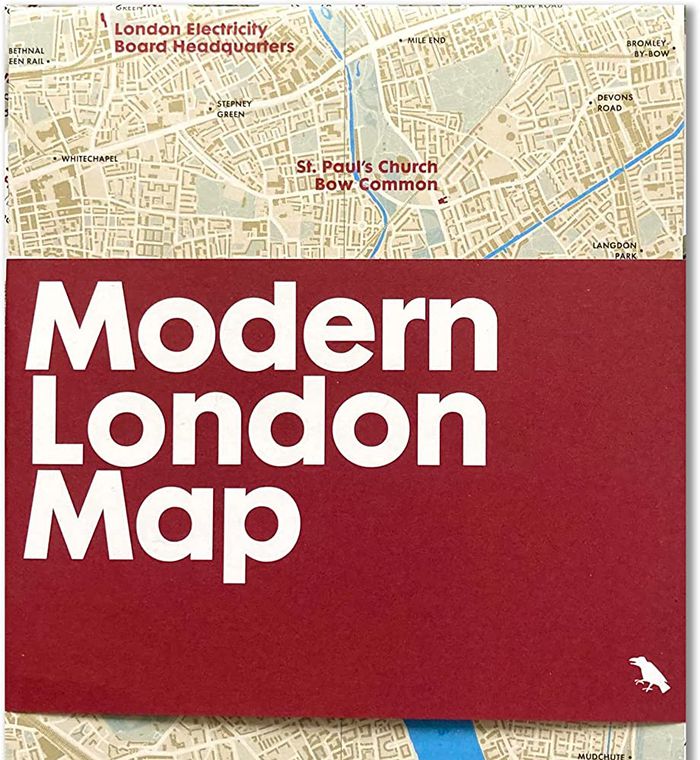
Modern London map
Modern London map
Actions:
Prix:
$14.00
(disponible sur commande)
Résumé:
Explore extraordinary examples of Modern architecture built across London between 1930 and 1960 with this two-sided map. Featuring over fifty buildings, from social housing to churches and the Festival Hall, this guide includes original photography by Nigel Green and building details and an introduction by Robin Wilson.
Titre:
Modern London map
Actions:
Prix:
$14.00
(disponible sur commande)
Résumé:
Explore extraordinary examples of Modern architecture built across London between 1930 and 1960 with this two-sided map. Featuring over fifty buildings, from social housing to churches and the Festival Hall, this guide includes original photography by Nigel Green and building details and an introduction by Robin Wilson.
Classification:
livres
livres
Publication:
octobre 2022
octobre 2022
Classification:
livres
livres
Titre:
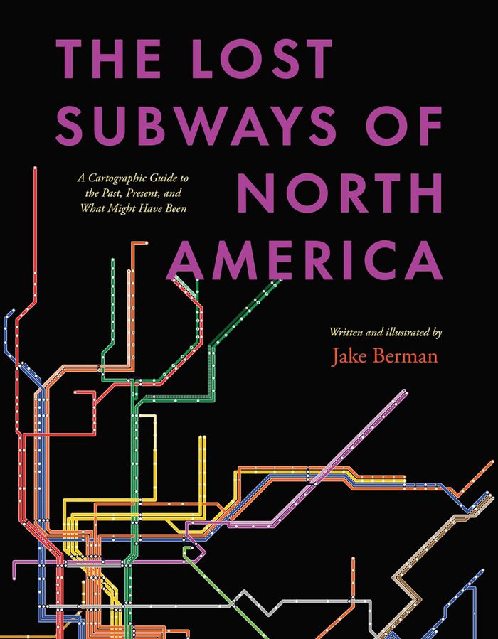
The lost subways of North America: A Cartographic guide to the past, present, what might have been
The lost subways of North America: A Cartographic guide to the past, present, what might have been
Actions:
Prix:
$51.95
(disponible en magasin)
Résumé:
Every driver in North America shares one miserable, soul-sucking universal experience—being stuck in traffic. But things weren’t always like this. Why is it that the mass transit systems of most cities in the United States and Canada are now utterly inadequate? ''The lost subways of North America'' offers a new way to consider this eternal question, with a strikingly(...)
Titre:
The lost subways of North America: A Cartographic guide to the past, present, what might have been
Actions:
Prix:
$51.95
(disponible en magasin)
Résumé:
Every driver in North America shares one miserable, soul-sucking universal experience—being stuck in traffic. But things weren’t always like this. Why is it that the mass transit systems of most cities in the United States and Canada are now utterly inadequate? ''The lost subways of North America'' offers a new way to consider this eternal question, with a strikingly visual—and fun—journey through past, present, and unbuilt urban transit. Using meticulous archival research, cartographer and artist Jake Berman has successfully plotted maps of old train networks covering twenty-three North American metropolises, ranging from New York City’s Civil War–era plan for a steam-powered subway under Fifth Avenue to the ultramodern automated Vancouver SkyTrain and the thousand-mile electric railway system of pre–World War II Los Angeles. He takes us through colorful maps of old, often forgotten streetcar lines, lost ideas for never-built transit, and modern rail systems—drawing us into the captivating transit histories of US and Canadian cities. Berman combines vintage styling with modern printing technology to create a sweeping visual history of North American public transit and urban development. With more than one hundred original maps, accompanied by essays on each city’s urban development, this book presents a fascinating look at North American rapid transit systems.
Classification:
livres
livres
Publication:
novembre 2023
novembre 2023
Classification:
livres
livres
Actions:
Prix:
$82.50
(disponible sur commande)
Résumé:
Piloting a single-engine biplane high above Washington D.C. in 1920, the intrepid inventor and aviation pioneer Sherman Fairchild first tested his custom-built sky camera, effectively founding the aerial photography company that would bear his name. Roaming America's skies for the next 40 years, the photographers of the Fairchild Aerial Survey Company documented nearly(...)
Publication:
octobre 2001, New York
octobre 2001, New York
Titre:
Cities from the sky : an aerial portrait of America
Actions:
Prix:
$82.50
(disponible sur commande)
Résumé:
Piloting a single-engine biplane high above Washington D.C. in 1920, the intrepid inventor and aviation pioneer Sherman Fairchild first tested his custom-built sky camera, effectively founding the aerial photography company that would bear his name. Roaming America's skies for the next 40 years, the photographers of the Fairchild Aerial Survey Company documented nearly every major city in the United States. Their images, bot maplike shots from high above and low-angle raking views, form a definitive portrait of the American landscape. By the 1970s, the Fairchild archive was scattered across the country. Painstakingly reassembled for this book, the images (many of which have never been seen before) are brought together here for the first time. This large-format book collects over 125 extraordinary images taken between the 1920s and the 1960s. The photographs, valued both as works of art and as tools for urban historians, often capture historic moments: the Capitol Building during Franklin Delano Roosevelt's first inauguration and Yankee Stadium during Don Larsen's perfect game in the 1956 World Series. Others depict architectural lands: the Empire State Building, the Statue of Liberty, the Washington Monument, Hoover Dam, and Alcatraz, to name a few.
Classification:
livres
livres
Publication:
octobre 2001, New York
octobre 2001, New York
Classification:
livres
livres
Prix:
$60.00
(disponible en magasin)
Résumé:
Before GPS systems and Google Maps were invented, folded paper maps and guidebooks were always our trusty companions while on the road. While paper maps are becoming increasingly obsolete, there is more to cartography than just bearings and scales. Illustrated maps hone the ability to bring a place to life through vivid drawings, leaving a unique impression filled with(...)
Titre:
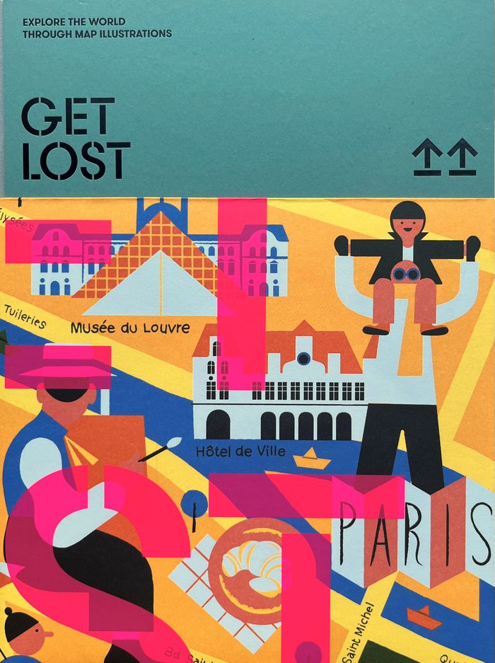
Get lost: Explore the world through map illustrations
Actions:
Prix:
$60.00
(disponible en magasin)
Résumé:
Before GPS systems and Google Maps were invented, folded paper maps and guidebooks were always our trusty companions while on the road. While paper maps are becoming increasingly obsolete, there is more to cartography than just bearings and scales. Illustrated maps hone the ability to bring a place to life through vivid drawings, leaving a unique impression filled with the illustrator's own experiences. From iconic landmarks to hidden shortcuts, ''GET LOST'' takes readers on a journey by allowing them to explore new places through the eyes of illustrators.
Classification:
livres
livres
Publication:
décembre 2023
décembre 2023
Classification:
livres
livres
Titre:
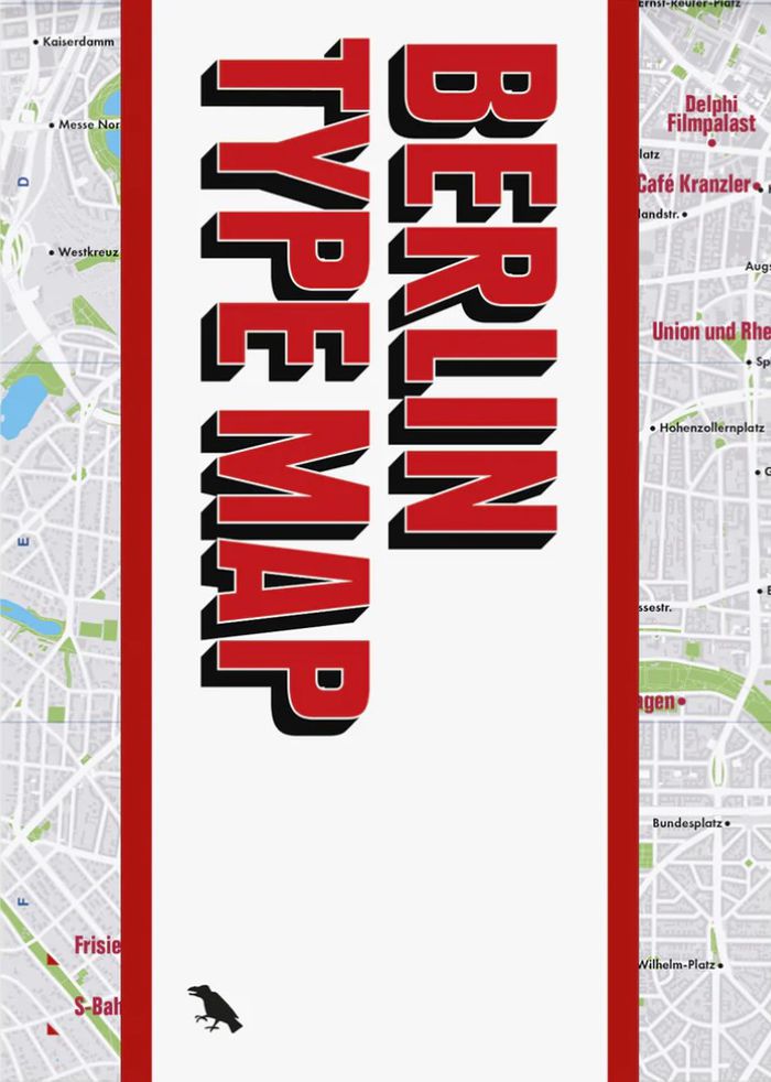
Berlin type map
Berlin type map
Actions:
Prix:
$17.00
(disponible en magasin)
Résumé:
Berlin is a paradise for fans of urban typography, from ornate pre-war inscriptions to elegant neon letters and psychedelic U-Bahn stations. The Berlin Type Map collects fifty of the city’s finest signs, with an introduction, descriptions and photographs by author and historian Jesse Simon. This guide is an essential companion for anyone wishing to rediscover this(...)
Titre:
Berlin type map
Actions:
Prix:
$17.00
(disponible en magasin)
Résumé:
Berlin is a paradise for fans of urban typography, from ornate pre-war inscriptions to elegant neon letters and psychedelic U-Bahn stations. The Berlin Type Map collects fifty of the city’s finest signs, with an introduction, descriptions and photographs by author and historian Jesse Simon. This guide is an essential companion for anyone wishing to rediscover this fascinating city through the lens of its letterforms. Perfect for a walking tour or framing, this map opens to A2 and folds to A5 and is protected by a wide band.
Classification:
livres
livres
Publication:
septembre 2024
septembre 2024
Classification:
livres
livres
Titre:
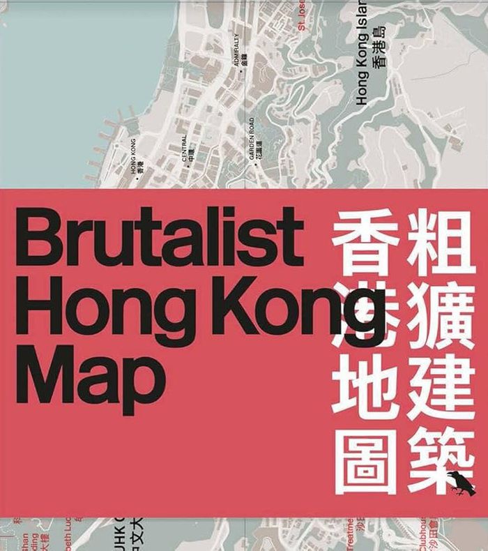
Brutalist Hong Kong
Brutalist Hong Kong
Actions:
Prix:
$20.00
(disponible en magasin)
Résumé:
This bilingual, two-sided map features forty examples of Brutalist architecture across Hong Kong, from the early 1960s to 1980s. Research led by Bob Pang, with photography by Kevin Mak. Well known for its soaring skyscrapers, Hong Kong's bold Brutalist tradition had largely gone unnoticed until recently thanks to the research of architect and author Bob Pang. Our(...)
Titre:
Brutalist Hong Kong
Actions:
Prix:
$20.00
(disponible en magasin)
Résumé:
This bilingual, two-sided map features forty examples of Brutalist architecture across Hong Kong, from the early 1960s to 1980s. Research led by Bob Pang, with photography by Kevin Mak. Well known for its soaring skyscrapers, Hong Kong's bold Brutalist tradition had largely gone unnoticed until recently thanks to the research of architect and author Bob Pang. Our latest map, presents Pang's research in a concise and usable manner, alongside stunning photography by Kevin Mak. The map is in English and Cantonese. The map's distinctive design is ideal for walking tours or displaying as a wall poster.
Classification:
livres
livres
Publication:
juin 2025
juin 2025
Classification:
livres
livres
Actions:
Prix:
$18.95
(disponible sur commande)
Résumé:
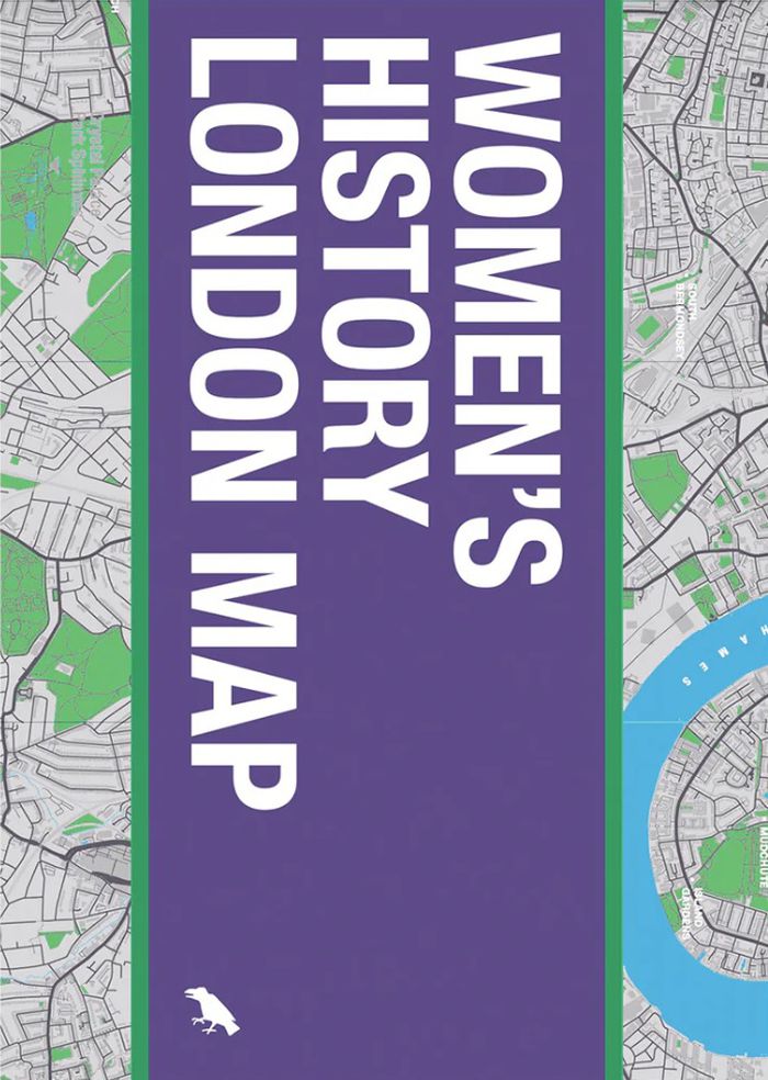
Explore London through the lens of women’s history. The new Women’s History London Map highlights 50 statues, sculptures, blue plaques, gravestones, buildings and monuments – dedicated to women such as Millicent Garrett Fawcett, Virginia Woolf, Aphra Benn, Ada Lovelace and Phillis Wheatley. With an introduction and descriptions by Katie Wignall, author, city history tour(...)
$18.95
(disponible sur commande)
Résumé:
Explore London through the lens of women’s history. The new Women’s History London Map highlights 50 statues, sculptures, blue plaques, gravestones, buildings and monuments – dedicated to women such as Millicent Garrett Fawcett, Virginia Woolf, Aphra Benn, Ada Lovelace and Phillis Wheatley. With an introduction and descriptions by Katie Wignall, author, city history tour(...)
Titre:
Women's history of London map
Actions:
Prix:
$18.95
(disponible sur commande)
Résumé:
Explore London through the lens of women’s history. The new Women’s History London Map highlights 50 statues, sculptures, blue plaques, gravestones, buildings and monuments – dedicated to women such as Millicent Garrett Fawcett, Virginia Woolf, Aphra Benn, Ada Lovelace and Phillis Wheatley. With an introduction and descriptions by Katie Wignall, author, city history tour guide and Londoner, and original photography by Jo Underhill, the map guide is a companion to begin exploring the lives of some of London’s most impactful women, and to inspire the next generation to continue their work.
Classification:
livres
livres
Publication:
juin 2024
juin 2024