108 Résultats
Classification:
livres
livres
Titre:
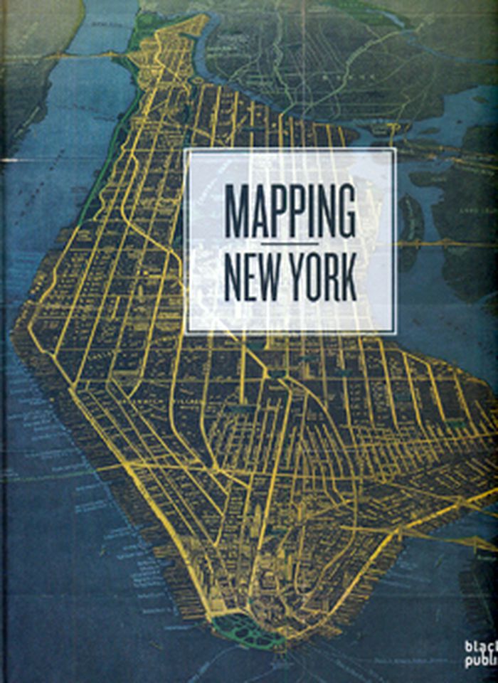
Mapping New York
Mapping New York
Actions:
Prix:
$49.95
(disponible sur commande)
Résumé:
A beautifully illustrated book with distinctive maps dating back to the 16th Century, when New York was known as New Amsterdam and founded by the Dutch as a commercial trading post, right up to the present day. Mapping New York provides a pictorial history of the city – both documenting it as a leader in commerce and as one of the most built up urban areas in the world.(...)
Titre:
Mapping New York
Actions:
Prix:
$49.95
(disponible sur commande)
Résumé:
A beautifully illustrated book with distinctive maps dating back to the 16th Century, when New York was known as New Amsterdam and founded by the Dutch as a commercial trading post, right up to the present day. Mapping New York provides a pictorial history of the city – both documenting it as a leader in commerce and as one of the most built up urban areas in the world. This book focuses on maps from the 20th and 21st century, thematically arranged with maps on population, military, water, transport, commerce, crime, as well as planning and developing maps, and boundaries of the five boroughs. Featuring well known graphics such as the New York City subway map, artists’ representations include Claes Oldenburg’s Soft Manhattan #1: Postal Codes from 1966 and the poem, “Manhattan,” in the shape of the city by Howard Horowitz.
Classification:
livres
livres
Publication:
octobre 2009
octobre 2009
Classification:
livres
livres
Actions:
Prix:
$126.95
(disponible sur commande)
Résumé:
In winter 2006, under the stewardship of philosopher Wolfgang Scheppe, a collective of students from the IUAV University in Venice fanned out to subject their city to a forensic structural mapping. Out of this fieldwork, conducted in the Situationist psychogeography tradition, there developed a three-year urban project that produced an enormous archive comprising tens of(...)
Titre:
Migropolis: Venice, atlas of a global situation
Actions:
Prix:
$126.95
(disponible sur commande)
Résumé:
In winter 2006, under the stewardship of philosopher Wolfgang Scheppe, a collective of students from the IUAV University in Venice fanned out to subject their city to a forensic structural mapping. Out of this fieldwork, conducted in the Situationist psychogeography tradition, there developed a three-year urban project that produced an enormous archive comprising tens of thousands of photographs, case studies, movement profiles and statistic data. From this archive, Venice, sited as it is at the junction of three migration corridors, emerges as a classic instance of the increasingly globalized city in which a decimated inner-city population meets armies of tourists and a parallel economy supported by illegal immigrants. In a map that cleverly branches out into visual essays, written essays, data maps and interviews, the globalized territory of Venice is microscopically dissected and defined as an urban metaphor, the city becoming an “atlas of a global situation.”
Classification:
livres
livres
Publication:
octobre 2009
octobre 2009
Classification:
livres
livres
Titre:
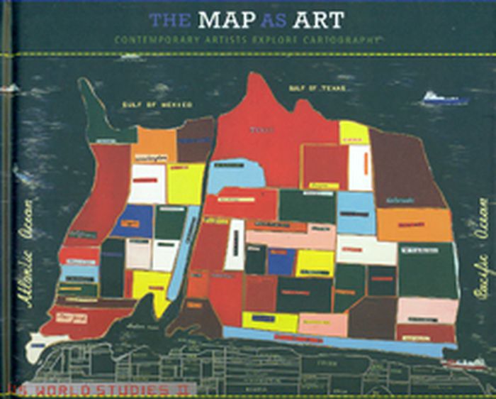
The map as art
The map as art
Actions:
Prix:
$55.00
(disponible sur commande)
Résumé:
Maps can be simple tools, comfortable in their familiar form. Or they can lead to different destinations: places turned upside down or inside out, territories riddled with marks understood only by their maker, realms connected more to the interior mind than to the exterior world. These are the places of artists' maps, that happy combination of information and illusion(...)
Titre:
The map as art
Actions:
Prix:
$55.00
(disponible sur commande)
Résumé:
Maps can be simple tools, comfortable in their familiar form. Or they can lead to different destinations: places turned upside down or inside out, territories riddled with marks understood only by their maker, realms connected more to the interior mind than to the exterior world. These are the places of artists' maps, that happy combination of information and illusion that flourishes in basement studios and downtown galleries alike. It is little surprise that, in an era of globalized politics, culture, and ecology, contemporary artists are drawn to maps to express their visions. Using paint, salt, souvenir tea towels, or their own bodies, map artists explore a world free of geographical constraints. In The Map as Art, Harmon collects 360 colorful, map-related artistic visions by artists such as Ed Ruscha, Julian Schnabel, Olafur Eliasson, Maira Kalman, William Kentridge, and Vik Muniz and more.
Classification:
livres
livres
Publication:
novembre 2009
novembre 2009
Classification:
livres
livres
Actions:
Prix:
$54.95
(disponible sur commande)
Résumé:
The twentieth century was a golden age of mapmaking, an era of cartographic boom. Maps proliferated and permeated almost every aspect of daily life, not only chronicling geography and history but also charting and conveying myriad political and social agendas. Here Tim Bryars and Tom Harper select one hundred maps from the millions printed, drawn, or otherwise constructed(...)
Titre:
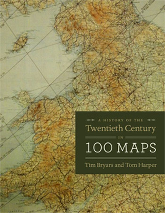
A history of the twentieth century in 100 maps
Actions:
Prix:
$54.95
(disponible sur commande)
Résumé:
The twentieth century was a golden age of mapmaking, an era of cartographic boom. Maps proliferated and permeated almost every aspect of daily life, not only chronicling geography and history but also charting and conveying myriad political and social agendas. Here Tim Bryars and Tom Harper select one hundred maps from the millions printed, drawn, or otherwise constructed during the twentieth century and recount through them a narrative of the century’s key events and developments.
Classification:
livres
livres
Publication:
octobre 2014
octobre 2014
Classification:
livres
livres
Titre:
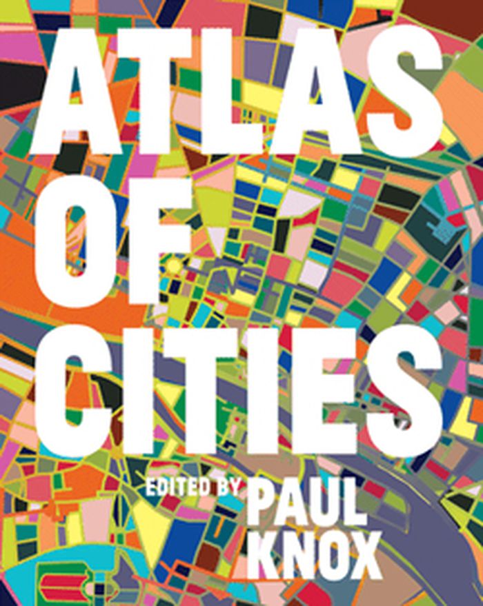
Atlas of cities
Atlas of cities
Actions:
Prix:
$63.95
(disponible sur commande)
Résumé:
More than half the world's population lives in cities, and that proportion is expected to rise to three-quarters by 2050. Urbanization is a global phenomenon, but the way cities are developing, the experience of city life, and the prospects for the future of cities vary widely from region to region. The Atlas of Cities presents a unique taxonomy of cities that looks at(...)
Titre:
Atlas of cities
Actions:
Prix:
$63.95
(disponible sur commande)
Résumé:
More than half the world's population lives in cities, and that proportion is expected to rise to three-quarters by 2050. Urbanization is a global phenomenon, but the way cities are developing, the experience of city life, and the prospects for the future of cities vary widely from region to region. The Atlas of Cities presents a unique taxonomy of cities that looks at different aspects of their physical, economic, social, and political structures; their interactions with each other and with their hinterlands; the challenges and opportunities they present; and where cities might be going in the future.
Classification:
livres
livres
Publication:
septembre 2014
septembre 2014
Classification:
livres
livres
Titre:
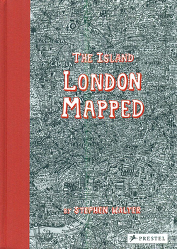
The island: London mapped
The island: London mapped
Actions:
Prix:
$38.95
(disponible sur commande)
Résumé:
London's streets, built up over more than two thousand years, are a maze of history, cultures and stories. In his fantastically detailed maps of the city, Stephen Walter translates these elements into a tangle of insightful yet humorous words and symbols that make up a complex of hidden meanings and wider contradictions. Testament to Walter's skill and importance as a(...)
Titre:
The island: London mapped
Actions:
Prix:
$38.95
(disponible sur commande)
Résumé:
London's streets, built up over more than two thousand years, are a maze of history, cultures and stories. In his fantastically detailed maps of the city, Stephen Walter translates these elements into a tangle of insightful yet humorous words and symbols that make up a complex of hidden meanings and wider contradictions. Testament to Walter's skill and importance as a cartographer, his groundbreaking, oversized map The Island was one of only two works by contemporary artists to feature in the seminal Magnificent Maps exhibition held at the British Library in 2010, the other by Grayson Perry and was exhibited together with some of the most important maps in history, such as Pierre Desceliers's 1550 world map.
Classification:
livres
livres
Publication:
février 2015
février 2015
Classification:
livres
livres
Actions:
Prix:
$34.95
(disponible sur commande)
Résumé:
this book is a reinvention of the traditional atlas, one that provides a complex look at the multi-faceted nature of New Orleans, a city replete with contradictions. More than twenty essays assemble a chorus voices, including geographers, scholars of sugar and bananas, the city's remarkable musicians, prison activists, environmentalists, Arab and Native voices, and local(...)
Publication:
octobre 2013
octobre 2013
Titre:
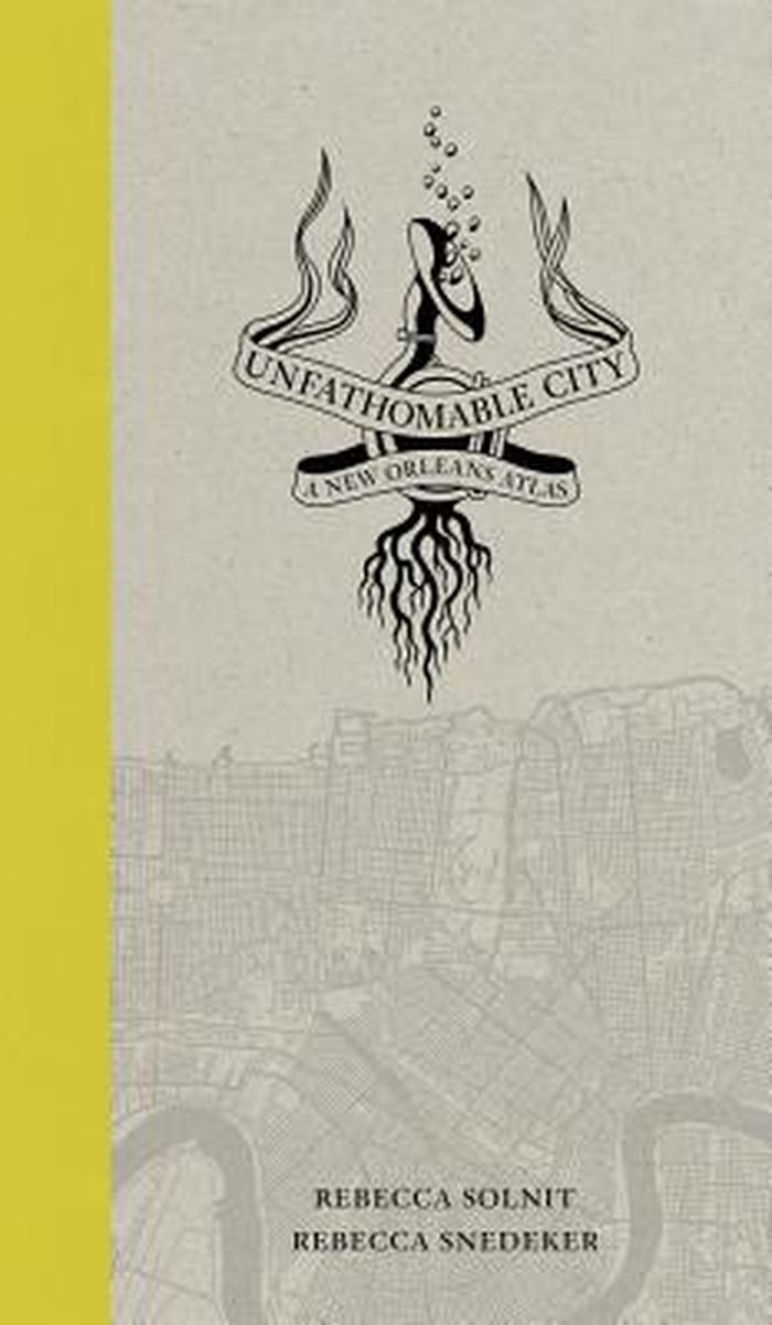
Unfathomable city : a New Orleans atlas
Actions:
Prix:
$34.95
(disponible sur commande)
Résumé:
this book is a reinvention of the traditional atlas, one that provides a complex look at the multi-faceted nature of New Orleans, a city replete with contradictions. More than twenty essays assemble a chorus voices, including geographers, scholars of sugar and bananas, the city's remarkable musicians, prison activists, environmentalists, Arab and Native voices, and local experts, as well as the coauthors’ contributions.
Classification:
livres
livres
Publication:
octobre 2013
octobre 2013
Classification:
livres
livres
Titre:
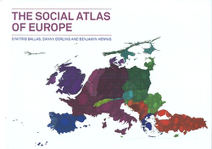
The social atlas of Europe
The social atlas of Europe
Actions:
Prix:
$53.60
(disponible en magasin)
Résumé:
This publication reconsiders European identity through its many different facets: economy, culture, history, and human and physical geography, visualizing Europe and its people in a more fluid way, without artificial national boundaries. It utilizes the latest available demographic, social, and economic data through state-of-the-art geographical information systems and(...)
Publication:
juin 2014
juin 2014
Titre:
The social atlas of Europe
Actions:
Prix:
$53.60
(disponible en magasin)
Résumé:
This publication reconsiders European identity through its many different facets: economy, culture, history, and human and physical geography, visualizing Europe and its people in a more fluid way, without artificial national boundaries. It utilizes the latest available demographic, social, and economic data through state-of-the-art geographical information systems and new cartography techniques that were invented specifically for this work.
Classification:
livres
livres
Publication:
juin 2014
juin 2014
Classification:
livres
livres
Titre:
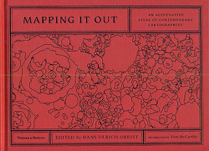
Mapping it out
Mapping it out
Actions:
Prix:
$57.00
(disponible sur commande)
Résumé:
Over 130 leading lights from different fields artists, architects, writers and designers, geographers, mathematicians, computer pioneers, scientists make sense of exterior and interior worlds through highly personal and imaginative maps and charts. Some have translated scientific data into simplified visual language, while others have condensed vast social, political or(...)
Titre:
Mapping it out
Actions:
Prix:
$57.00
(disponible sur commande)
Résumé:
Over 130 leading lights from different fields artists, architects, writers and designers, geographers, mathematicians, computer pioneers, scientists make sense of exterior and interior worlds through highly personal and imaginative maps and charts. Some have translated scientific data into simplified visual language, while others have condensed vast social, political or natural forms into concise diagrams. Many have reworked existing maps to subvert their original purpose or to present an alternative view of reality. Others play with the maps commitment to truth by plotting invented worlds and charting imaginative flights of fancy. In the introduction, acclaimed novelist Tom McCarthy reflects on the relationship between maps, literature and knowledge, while Hans Ulrich Obrist closes the book by considering the territory of maps from the perspective of the arts and philosophy.
Classification:
livres
livres
Publication:
juin 2014
juin 2014
Classification:
livres
livres
Actions:
Prix:
$34.95
(disponible sur commande)
Résumé:
Maps need not just show continents and oceans: there are maps to heaven and hell; to happiness and despair; maps of moods, matrimony, and mythological places. With over 100 maps from artists, cartographers, and explorers, You are Here gives the reader a breath-taking view of worlds, both real and imaginary.
Publication:
novembre 2003, New York
novembre 2003, New York
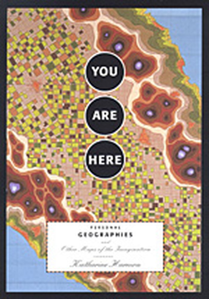
Titre:
You are here : personal geographies and other maps of the imagination
Actions:
Prix:
$34.95
(disponible sur commande)
Résumé:
Maps need not just show continents and oceans: there are maps to heaven and hell; to happiness and despair; maps of moods, matrimony, and mythological places. With over 100 maps from artists, cartographers, and explorers, You are Here gives the reader a breath-taking view of worlds, both real and imaginary.
Classification:
livres
livres
Publication:
novembre 2003, New York
novembre 2003, New York