108 Résultats
Classification:
livres
livres
Titre:
Écrits cartographiques
Écrits cartographiques
Actions:
Prix:
$22.95
(disponible sur commande)
Résumé:
'Écrits cartographiques' rassemble les écrits cartographiques majeurs, pour une part inédits, d’Élisée Reclus et de ses proches collaborateurs, Paul Reclus, Charles Perron et Franz Schrader. Aujourd’hui, plus que jamais, nous avons besoin d’une cartographie capable de donner à sentir et percevoir l’unité terrestre, en son tout et en ses parties. Les objets (globes,(...)
Titre:
Écrits cartographiques
Actions:
Prix:
$22.95
(disponible sur commande)
Résumé:
'Écrits cartographiques' rassemble les écrits cartographiques majeurs, pour une part inédits, d’Élisée Reclus et de ses proches collaborateurs, Paul Reclus, Charles Perron et Franz Schrader. Aujourd’hui, plus que jamais, nous avons besoin d’une cartographie capable de donner à sentir et percevoir l’unité terrestre, en son tout et en ses parties. Les objets (globes, cartes, reliefs) conçus et imaginés par Reclus et ses proches l’ont été dans ce but.
Classification:
livres
livres
Publication:
janvier 2016
janvier 2016
Classification:
livres
livres
Actions:
Prix:
$131.00
(disponible sur commande)
Résumé:
In the late nineteenth century, Charles Booth’s landmark social and economic survey found that 35 percent of Londoners were living in abject poverty. Booth’s team of social investigators interviewed Londoners from all walks of life, recording their comments, together with their own unrestrained remarks and statistical information, in 450 notebooks. Their findings formed(...)
Publication:
novembre 2019
novembre 2019
Titre:
Charles Booth's London poverty maps: a landmark reasessment of Booth's social survey
Actions:
Prix:
$131.00
(disponible sur commande)
Résumé:
In the late nineteenth century, Charles Booth’s landmark social and economic survey found that 35 percent of Londoners were living in abject poverty. Booth’s team of social investigators interviewed Londoners from all walks of life, recording their comments, together with their own unrestrained remarks and statistical information, in 450 notebooks. Their findings formed the basis of Booth’s colour-coded social mapping (from vicious and semi-criminal to wealthy) and his seventeen-volume survey "Inquiry into the Life and Labour of the People of London, 1886–1903". Organized into six geographical sections, "Charles Booth’s London poverty map"s presents the hand-coloured preparatory and printed social mapping of London. Accompanying the maps are reproductions of pages from the original notebooks, containing anecdotes and observations too judgmental for Booth to include in his final published survey. An introduction by professor Mary S. Morgan clarifies the aims and methodology of Booth’s survey and six themed essays contextualize the the survey’s findings, accompanied by evocative period photographs.
Classification:
livres
livres
Publication:
novembre 2019
novembre 2019
Classification:
livres
livres
Titre:
Mappa insulae
Mappa insulae
Actions:
Prix:
$35.95
(disponible sur commande)
Résumé:
Dans l'univers sans fin des cartes, les cartes d'îles possèdent un charme tout particulier. Les deux mondes, des cartes et des îles, s'y croisent, laissant émerger des formes riches et colorées. Cinq artistes, collectionneurs, chercheurs ont formé le collectif Stevenson pour en explorer et en célébrer les beautés, les incongruités, les fantaisies autant que la précision(...)
Titre:
Mappa insulae
Actions:
Prix:
$35.95
(disponible sur commande)
Résumé:
Dans l'univers sans fin des cartes, les cartes d'îles possèdent un charme tout particulier. Les deux mondes, des cartes et des îles, s'y croisent, laissant émerger des formes riches et colorées. Cinq artistes, collectionneurs, chercheurs ont formé le collectif Stevenson pour en explorer et en célébrer les beautés, les incongruités, les fantaisies autant que la précision et la finesse. De la mise en commun de leurs trésors cartographiques chinés, dénichés, inhumés et patiemment amassés, est né Mappa insulae. Les îles s'y montrent parfois dans leur isolement absolu, cerclées d'une épaisseur bleue qui les sépare du reste du monde ; parfois en archipel, éparpillées "comme autant de pépins crachés dans l'eau" ; parfois encore simplement suggérées, récifs tapis sous des noms calligraphiés sur les flots. De carte en carte, d'île en île, de pensées en poèmes, nous voilà embarqués pour une traversée érudite et insolite.
Classification:
livres
livres
Publication:
septembre 2019
septembre 2019
Classification:
livres
livres
Actions:
Prix:
$100.00
(disponible sur commande)
Résumé:
In the past decade, Rebecca Solnit, Rebecca Snedeker, and Joshua Jelly-Schapiro—aided by local writers, artists, historians, urbanists, ethnographers, and cartographers—have compiled three atlases that have radically changed the way we think about place. Each atlas provides a vivid, complex look at the multi-faceted nature of a city—San Francisco, New Orleans, and New(...)
Titre:
Inifinite cities: a trilogy of Atlases. San Francisco, New Orleans, New York
Actions:
Prix:
$100.00
(disponible sur commande)
Résumé:
In the past decade, Rebecca Solnit, Rebecca Snedeker, and Joshua Jelly-Schapiro—aided by local writers, artists, historians, urbanists, ethnographers, and cartographers—have compiled three atlases that have radically changed the way we think about place. Each atlas provides a vivid, complex look at the multi-faceted nature of a city—San Francisco, New Orleans, and New York—as experienced by its different inhabitants, replete with the celebrations and contradictions that make up urban life.
Classification:
livres
livres
Publication:
septembre 2019
septembre 2019
Classification:
livres
livres
Titre:
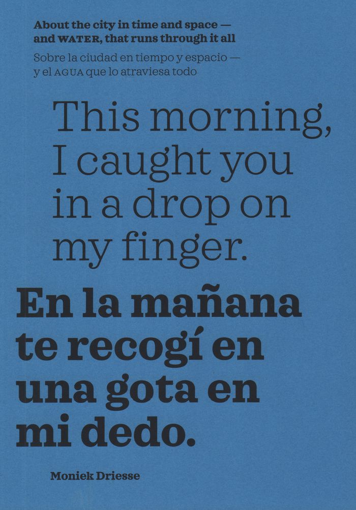
This morning, I caught you in a drop on my finger: about the city in time and space, and water
This morning, I caught you in a drop on my finger: about the city in time and space, and water
Actions:
Prix:
$39.95
(disponible sur commande)
Résumé:
Memories carried by water drench our biographies and shared history. In this book, edited and curated by Moniek Driesse, the past, present, and future imaginaries that govern our relationship with water are permitted to draw maps that can serve as tools for urban administrators, researchers, and citizens who live the reality determined by them. With this approach,(...)
Titre:
This morning, I caught you in a drop on my finger: about the city in time and space, and water
Actions:
Prix:
$39.95
(disponible sur commande)
Résumé:
Memories carried by water drench our biographies and shared history. In this book, edited and curated by Moniek Driesse, the past, present, and future imaginaries that govern our relationship with water are permitted to draw maps that can serve as tools for urban administrators, researchers, and citizens who live the reality determined by them. With this approach, long-term memories carried by the urban landscape reflect into possible narratives of hope for the future. The focus is on Mexico City, where rivers have turned into highways and subterranean basins are drying out, presenting new dangers to the city.
Classification:
livres
livres
Publication:
janvier 2020
janvier 2020
Classification:
livres
livres
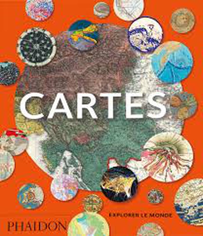
Titre:
Cartes
Cartes
Actions:
Prix:
$35.00
(disponible sur commande)
Résumé:
Cet ouvrage réunit plus de 250 cartes, de la naissance de la cartographie aux cartes numériques avant-gardistes du XXIe siècle. Ces exemples reflètent les nombreuses raisons pour lesquelles on réalise des cartes : pour trouver son chemin, revendiquer un droit de propriété, encourager la colonisation ou afficher sa puissance politique. Sélectionnées par un panel de(...)
Titre:
Cartes
Actions:
Prix:
$35.00
(disponible sur commande)
Résumé:
Cet ouvrage réunit plus de 250 cartes, de la naissance de la cartographie aux cartes numériques avant-gardistes du XXIe siècle. Ces exemples reflètent les nombreuses raisons pour lesquelles on réalise des cartes : pour trouver son chemin, revendiquer un droit de propriété, encourager la colonisation ou afficher sa puissance politique. Sélectionnées par un panel de conservateurs, d’universitaires et de collectionneurs, les cartes, présentées par paires, se répondent ou se distinguent. La sélection inclut des cartes du monde entier, par les plus grands noms de la cartographie ou par des cartographes moins connus.
Classification:
livres
livres
Publication:
mars 2020
mars 2020
Classification:
livres
livres
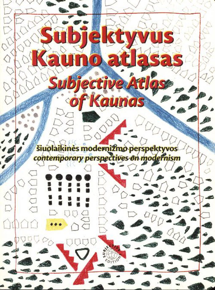
Titre:
Subjective atlas of Kaunas
Subjective atlas of Kaunas
Actions:
Prix:
$48.00
(disponible sur commande)
Résumé:
Between 1919 and 1940, Kaunas served as Lithuania’s temporary capital, triggering a massive boom in construction that greatly increased its urban area. For this instalment of the Subjective Atlas series, a group of almost 40 creative residents mapped the contemporary identity of Kaunas through their personal interests, experiences, and domesticity, visualising the(...)
Titre:
Subjective atlas of Kaunas
Actions:
Prix:
$48.00
(disponible sur commande)
Résumé:
Between 1919 and 1940, Kaunas served as Lithuania’s temporary capital, triggering a massive boom in construction that greatly increased its urban area. For this instalment of the Subjective Atlas series, a group of almost 40 creative residents mapped the contemporary identity of Kaunas through their personal interests, experiences, and domesticity, visualising the heritage and history of Lithuania’s second-largest city. The book highlights a surprising collection of urban, natural, and everyday spaces and artefacts, inviting readers to reflect on how this material and immaterial modernist heritage is perceived or observed, appreciated or disliked, ignored or associated with.
Classification:
livres
livres
Publication:
mars 2022
mars 2022
Classification:
livres
livres
Actions:
Prix:
$35.95
(disponible sur commande)
Résumé:
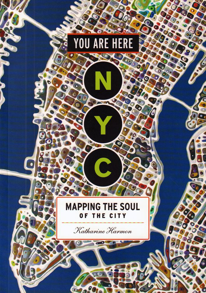
Maps are magical. Every graphic, like every story, has a point of view, and New York is rife with mapmaking possibilities, thick with mythology, and glutted with history. "You are here: NYC" assembles some two hundred maps charting every inch and facet of the five boroughs, depicting New Yorks of past and present, and a city that never was. "A nightclub map of Harlem"(...)
$35.95
(disponible sur commande)
Résumé:
Maps are magical. Every graphic, like every story, has a point of view, and New York is rife with mapmaking possibilities, thick with mythology, and glutted with history. "You are here: NYC" assembles some two hundred maps charting every inch and facet of the five boroughs, depicting New Yorks of past and present, and a city that never was. "A nightclub map of Harlem"(...)
Titre:
You are here : NYC mapping the soul of a city
Actions:
Prix:
$35.95
(disponible sur commande)
Résumé:
Maps are magical. Every graphic, like every story, has a point of view, and New York is rife with mapmaking possibilities, thick with mythology, and glutted with history. "You are here: NYC" assembles some two hundred maps charting every inch and facet of the five boroughs, depicting New Yorks of past and present, and a city that never was. "A nightclub map of Harlem" traces a boozy night from the Radium and the Cotton Club to the Savoy and then the Lafayette; "Wonders of New York" pinpoints three hundred sites of interest, including the alleged location of Captain Kidd's buried treasure; the Ghostbusters subway map plots the route from Astral Projections Place to Stay Puft Street; and a rejected proposal of ornate topiaries illustrates a Central Park that might have been. This sequel to the best-selling You Are Here includes original essays by Bob Mankoff, Maria Popova, Sarah Boxer, and Rebecca Cooper, among others.
Classification:
livres
livres
Publication:
novembre 2016
novembre 2016
Classification:
livres
livres
Actions:
Prix:
$38.95
(disponible sur commande)
Résumé:
''Nonstop Metropolis'', the culminating volume in a trilogy of atlases, conveys innumerable unbound experiences of New York City through twenty-six imaginative maps and informative essays. Bringing together the insights of dozens of experts—from linguists to music historians, ethnographers, urbanists, and environmental journalists—amplified by cartographers, artists, and(...)
Publication:
octobre 2016
octobre 2016
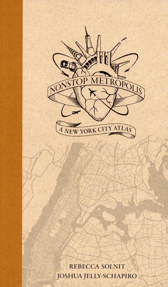
Titre:
Nonstop metropolis: a New York City atlas
Actions:
Prix:
$38.95
(disponible sur commande)
Résumé:
''Nonstop Metropolis'', the culminating volume in a trilogy of atlases, conveys innumerable unbound experiences of New York City through twenty-six imaginative maps and informative essays. Bringing together the insights of dozens of experts—from linguists to music historians, ethnographers, urbanists, and environmental journalists—amplified by cartographers, artists, and photographers, it explores all five boroughs of New York City and parts of nearby New Jersey. We are invited to travel through Manhattan’s playgrounds, from polyglot Queens to many-faceted Brooklyn, and from the resilient Bronx to the mystical kung fu hip-hop mecca of Staten Island.
Classification:
livres
livres
Publication:
octobre 2016
octobre 2016
Classification:
livres
livres
Actions:
Prix:
$38.99
(disponible en magasin)
Résumé:
It is perhaps the eighth wonder of our world that despite modern mapping and satellite photography our planet continues to surprise us. Hidden lairs beneath layers of rock, forgotten cities rising out of deserted lands and even mankind's own feats of engineering eccentricity lie in the most unusual of destinations. Travis Elborough goes in search of the obscure and(...)
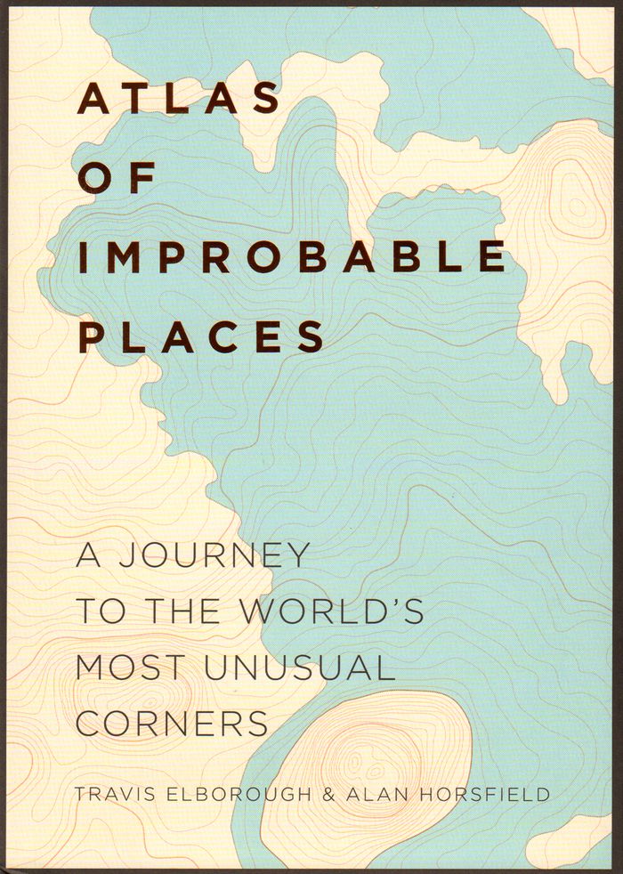
Titre:
Atlas of improbable places: a journey to the world's most unusual corners
Actions:
Prix:
$38.99
(disponible en magasin)
Résumé:
It is perhaps the eighth wonder of our world that despite modern mapping and satellite photography our planet continues to surprise us. Hidden lairs beneath layers of rock, forgotten cities rising out of deserted lands and even mankind's own feats of engineering eccentricity lie in the most unusual of destinations. Travis Elborough goes in search of the obscure and bizarre, the beautiful and estranged. Taking in the defiant relics of ancient cities such as Ani, a once thriving metropolis lost to conquered lands, and the church tower of San Juan Parangaricuto, that miraculously stands as the sole survivor of a town sunk by lava. Through the labyrinths of Berlin and Beijing - underground realms dug for refuge, espionage and even, as Canada's Moose Jaw, used as the playground for gangsters trading liquor and money over cards. Never forgetting the freaks and wonders of nature's own unusual masterpieces: the magical underground river shaped like a dragon's mouth in the Philippines and the floating world of Palmerston. With beautiful maps and stunning photography illustrating each destination, Atlas of Improbable Places is a fascinating voyage to the world's most incredible destinations. As the Island of Dolls and the hauntingly titled Door to Hell - an inextinguishable fire pit - attest, mystery is never far away. The truths and myths behind their creation are as varied as the destinations themselves. Standing as symbols of worship, testaments to kingships or even the strange and wonderful traditions of old and new, these curious places are not just extraordinary sights but reflections on man's own relationship with the world around us
Classification:
livres
livres
Publication:
octobre 2016
octobre 2016