ARCH279656
1978
ARCH279657
1978
ARCH279648
1983
ARCH279649
ca. 1978
photographies
CD035.S1.1979.PR01.005.2
1978
photographies
1978
cartes
CD035.S1.1979.PR01.006
Description:
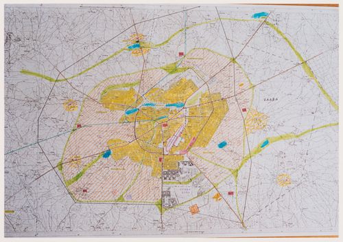
Documents previously stored in a box labelled "BEEKER / OUAGA / SDAV 2000 / HASKOOING" / 1983-1985". Includes maps for the aerial photographs shoots, maps of vacants and occupied lots and maps of infrastructure for wateraccess and electricity.
2000
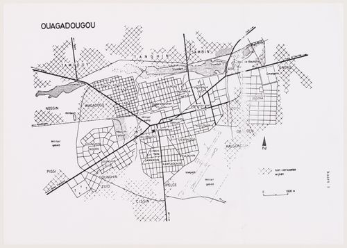
Survey maps of the Ouagadougou area, Burkina Faso
Actions:
CD035.S1.1979.PR01.006
Description:
Documents previously stored in a box labelled "BEEKER / OUAGA / SDAV 2000 / HASKOOING" / 1983-1985". Includes maps for the aerial photographs shoots, maps of vacants and occupied lots and maps of infrastructure for wateraccess and electricity.
cartes
2000
photographies
CD035.S1.1979.PR01.025
1988
photographies
1988
photographies
CD035.S1.1979.PR01.027
Description:
Also contains the aerial survey maps.
ca. 1979
Aerial photographs of the Ouagadougou area, Burkina Faso
Actions:
CD035.S1.1979.PR01.027
Description:
Also contains the aerial survey maps.
photographies
ca. 1979
photographies
CD035.S1.1979.PR01.030
1990s
Photographs of spontaneous neighbourhoods of Ouagadougou, Burkina Faso
Actions:
CD035.S1.1979.PR01.030
photographies
1990s
ARCH279652
1990s
