2698 Résultats
Classification:
livres
livres
Actions:
Exemplaires:
Description:
1 microfilm reel : maps ; 35 mm
- Bibliothèque study room microform 124155 | ID CAN MFM; ID:85-B21334 | 1 MICROFILM REEL | Disponible
Description:
1 microfilm reel : maps ; 35 mm
Auteur:
Sujet:
- Real property Québec (Province) Sorel.,
- Real property Québec (Province) Richelieu (County),
- Biens réels Québec (Province) Sorel.,
- Biens réels Québec (Province) Richelieu (Comté),
- Real property.,
- Sorel (Sorel-Tracy, Québec) Maps.,
- Richelieu (Québec : County) Maps.,
- Sorel (Sorel-Tracy, Québec) Cartes.,
- Richelieu (Québec : Comté) Cartes.,
- Québec Sorel.,
- Québec Richelieu (County),
- Maps.
Publication:
[Montréal] : Bibliothèque nationale du Québec, 1984.
[Montréal] : Bibliothèque nationale du Québec, 1984.
Titre:
Atlas of the town of Sorel and county of Richelieu, province of Quebec : from actual surveys, based upon the cadastral plans deposited in the office of the Departement of Crown Lands / by and under the supervision of H.W. Hopkins.
Actions:
Exemplaires:
Description:
1 microfilm reel : maps ; 35 mm
Atlas of the town of Sorel and county of Richelieu, province of Quebec : from actual surveys, based upon the cadastral plans deposited in the office of the Departement of Crown Lands / by and under the supervision of H.W. Hopkins.
Actions:
Exemplaires:
- Bibliothèque study room microform 124155 | ID CAN MFM; ID:85-B21334 | 1 MICROFILM REEL | Disponible
Description:
1 microfilm reel : maps ; 35 mm
Classification:
livres
livres
Publication:
[Montréal] : Bibliothèque nationale du Québec, 1984.
[Montréal] : Bibliothèque nationale du Québec, 1984.
Auteur:
Sujet:
- Real property Québec (Province) Sorel.,
- Real property Québec (Province) Richelieu (County),
- Biens réels Québec (Province) Sorel.,
- Biens réels Québec (Province) Richelieu (Comté),
- Real property.,
- Sorel (Sorel-Tracy, Québec) Maps.,
- Richelieu (Québec : County) Maps.,
- Sorel (Sorel-Tracy, Québec) Cartes.,
- Richelieu (Québec : Comté) Cartes.,
- Québec Sorel.,
- Québec Richelieu (County),
- Maps.
Classification:
livres
livres
Actions:
Exemplaires:
Description:
84 pages : illustrations, maps (some color) ; 31 cm.
Description:
84 pages : illustrations, maps (some color) ; 31 cm.
Auteur:
Sujet:
- London (England) Maps.,
- England London,
- England, London Historical geography.,
- England, London Maps.,
- Maps,
- Cartes géographiques.
Publication:
London : London Topographical Society, 1999.
London : London Topographical Society, 1999.
Titre:
Ward maps of the city of London.
Actions:
Exemplaires:
Description:
84 pages : illustrations, maps (some color) ; 31 cm.
Ward maps of the city of London.
Actions:
Exemplaires:
Description:
84 pages : illustrations, maps (some color) ; 31 cm.
Classification:
livres
livres
Publication:
London : London Topographical Society, 1999.
London : London Topographical Society, 1999.
Auteur:
Sujet:
- London (England) Maps.,
- England London,
- England, London Historical geography.,
- England, London Maps.,
- Maps,
- Cartes géographiques.
Classification:
livres
livres
Actions:
Exemplaires:
Description:
327 pages : illustrations (some color), maps, plans ; 31 cm
Description:
327 pages : illustrations (some color), maps, plans ; 31 cm
Auteur:
Sujet:
- Real property Italy Tuscany Maps History.,
- Real property.,
- Italy Tuscany.,
- Maps.,
- Cartes géographiques.
Publication:
Firenze : Cassa di Risparmio, 1978.
Firenze : Cassa di Risparmio, 1978.
Titre:
Cabrei in Toscana : raccolte di mappe, prospetti e vedute ; sec. XVI-sec. XIX / Leonardo Ginori Lisci.
Actions:
Exemplaires:
Description:
327 pages : illustrations (some color), maps, plans ; 31 cm
Cabrei in Toscana : raccolte di mappe, prospetti e vedute ; sec. XVI-sec. XIX / Leonardo Ginori Lisci.
Actions:
Exemplaires:
Description:
327 pages : illustrations (some color), maps, plans ; 31 cm
Classification:
livres
livres
Publication:
Firenze : Cassa di Risparmio, 1978.
Firenze : Cassa di Risparmio, 1978.
Auteur:
Sujet:
- Real property Italy Tuscany Maps History.,
- Real property.,
- Italy Tuscany.,
- Maps.,
- Cartes géographiques.
Classification:
cartes
cartes
Actions:
Exemplaires:
Description:
1 map : color ; 42 x 60 cm, folded in sleeve 21 x 15 cm
Description:
1 map : color ; 42 x 60 cm, folded in sleeve 21 x 15 cm
Auteur:
Sujet:
- Signs and signboards Germany Berlin Maps.,
- Signs and signboards Germany Berlin Design and construction Maps.,
- Architecture Decoration Germany Berlin Maps.,
- thematic maps.,
- tourist maps.,
- Thematic maps.,
- Tourist maps.,
- Cartes thématiques.,
- Cartes touristiques.
Publication:
[London, England] : Blue Crow Media, [2024], [Brighton, England] : Generation Press, ©2024
[London, England] : Blue Crow Media, [2024], [Brighton, England] : Generation Press, ©2024
Titre:
Berlin type map / written and photographed by Jesse Simon ; design by Tuomi.
Actions:
Exemplaires:
Description:
1 map : color ; 42 x 60 cm, folded in sleeve 21 x 15 cm
Berlin type map / written and photographed by Jesse Simon ; design by Tuomi.
Actions:
Exemplaires:
Description:
1 map : color ; 42 x 60 cm, folded in sleeve 21 x 15 cm
Classification:
cartes
cartes
Publication:
[London, England] : Blue Crow Media, [2024], [Brighton, England] : Generation Press, ©2024
[London, England] : Blue Crow Media, [2024], [Brighton, England] : Generation Press, ©2024
Auteur:
Sujet:
- Signs and signboards Germany Berlin Maps.,
- Signs and signboards Germany Berlin Design and construction Maps.,
- Architecture Decoration Germany Berlin Maps.,
- thematic maps.,
- tourist maps.,
- Thematic maps.,
- Tourist maps.,
- Cartes thématiques.,
- Cartes touristiques.
Classification:
cartes
cartes
Actions:
Exemplaires:
Description:
2 maps on 1 sheet : illustrations ; 49 x 64 cm folded to 25 x 12 cm
Description:
2 maps on 1 sheet : illustrations ; 49 x 64 cm folded to 25 x 12 cm
Auteur:
Sujet:
- Montréal (Québec) Maps.,
- Montréal (Québec) Plans.,
- Québec Montréal,
- Maps.,
- Cartes géographiques.
Publication:
Montréal : Oligny Pub., [between 1955 and 1960]
Montréal : Oligny Pub., [between 1955 and 1960]
Titre:
Montreal, Paris of the New World.
Actions:
Exemplaires:
Description:
2 maps on 1 sheet : illustrations ; 49 x 64 cm folded to 25 x 12 cm
Montreal, Paris of the New World.
Actions:
Exemplaires:
Description:
2 maps on 1 sheet : illustrations ; 49 x 64 cm folded to 25 x 12 cm
Classification:
cartes
cartes
Publication:
Montréal : Oligny Pub., [between 1955 and 1960]
Montréal : Oligny Pub., [between 1955 and 1960]
Auteur:
Sujet:
- Montréal (Québec) Maps.,
- Montréal (Québec) Plans.,
- Québec Montréal,
- Maps.,
- Cartes géographiques.
Classification:
livres
livres
Prix:
$44.95
(disponible sur commande)
Résumé:
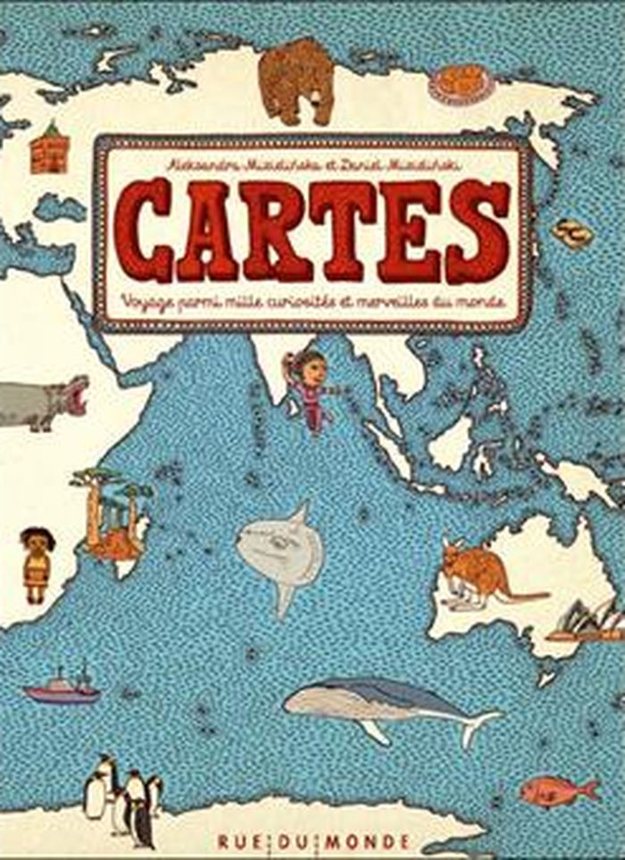
En quelque 4 000 vignettes, cet album nous raconte la richesse du monde à la manière des cartes illustrées des grands explorateurs des siècles passés. Chacune de ces images est une invitation à en savoir davantage sur tous ces ailleurs et à aller à la rencontre des autres. 50 cartes, 40 pays provenant des 6 continents, des milliers d'informations essentielles ou insolites.
$44.95
(disponible sur commande)
Résumé:
En quelque 4 000 vignettes, cet album nous raconte la richesse du monde à la manière des cartes illustrées des grands explorateurs des siècles passés. Chacune de ces images est une invitation à en savoir davantage sur tous ces ailleurs et à aller à la rencontre des autres. 50 cartes, 40 pays provenant des 6 continents, des milliers d'informations essentielles ou insolites.
Titre:
Cartes: voyage parmi mille curiosités et merveilles du monde
Actions:
Prix:
$44.95
(disponible sur commande)
Résumé:
En quelque 4 000 vignettes, cet album nous raconte la richesse du monde à la manière des cartes illustrées des grands explorateurs des siècles passés. Chacune de ces images est une invitation à en savoir davantage sur tous ces ailleurs et à aller à la rencontre des autres. 50 cartes, 40 pays provenant des 6 continents, des milliers d'informations essentielles ou insolites.
Classification:
livres
livres
Publication:
mai 2013
mai 2013
Sujet:
Littérature jeunesse
Littérature jeunesse
Classification:
livres
livres
Actions:
Exemplaires:
Description:
288 pages : illustrations, maps ; 31 cm
Description:
288 pages : illustrations, maps ; 31 cm
Auteur:
Sujet:
- England Maps.,
- Great Britain History Elizabeth, 1558-1603 Maps.,
- Great Britain History James I, 1603-1625 Maps.,
- Angleterre Cartes.,
- Grande-Bretagne Histoire 1603-1625 (Jacques Ier) Cartes.,
- England,
- Great Britain,
- Great Britain Maps,
- Great Britain History Elizabeth, 1558-1603,
- Great Britain History James I, 1603-1625,
- England, 1596-1611 - Maps - Facsimilies - Collections,
- History,
- Maps
Publication:
London, England : Pavilion Michael Joseph, ©1988.
London, England : Pavilion Michael Joseph, ©1988.
Titre:
The counties of Britain : a Tudor atlas / by John Speed ; introduction by Nigel Nicolson ; county commentaries by Alasdair Hawkyard.
Actions:
Exemplaires:
Description:
288 pages : illustrations, maps ; 31 cm
The counties of Britain : a Tudor atlas / by John Speed ; introduction by Nigel Nicolson ; county commentaries by Alasdair Hawkyard.
Actions:
Exemplaires:
Description:
288 pages : illustrations, maps ; 31 cm
Classification:
livres
livres
Publication:
London, England : Pavilion Michael Joseph, ©1988.
London, England : Pavilion Michael Joseph, ©1988.
Auteur:
Sujet:
- England Maps.,
- Great Britain History Elizabeth, 1558-1603 Maps.,
- Great Britain History James I, 1603-1625 Maps.,
- Angleterre Cartes.,
- Grande-Bretagne Histoire 1603-1625 (Jacques Ier) Cartes.,
- England,
- Great Britain,
- Great Britain Maps,
- Great Britain History Elizabeth, 1558-1603,
- Great Britain History James I, 1603-1625,
- England, 1596-1611 - Maps - Facsimilies - Collections,
- History,
- Maps
Classification:
livres
livres
Actions:
Exemplaires:
Description:
xii, 210 pages, 8 unnumbered pages of plates : illustrations (some color), maps ; 26 cm
Description:
xii, 210 pages, 8 unnumbered pages of plates : illustrations (some color), maps ; 26 cm
Auteur:
Sujet:
- Early maps History.,
- Cartography History.,
- Geography, Medieval.,
- Space and time Maps.,
- Geography, Medieval Maps.,
- Cartographie Histoire.,
- Géographie médiévale.,
- Géographie médiévale Cartes.,
- Cartes anciennes Histoire.,
- Cartography,
- Kartografie,
- Weltbild,
- Kartograf,
- Cartografie.,
- Wereldbeeld.,
- Cartografen.,
- Geschichte 500-1500.,
- World. History of cartography. [literature] 1997.,
- Maps.,
- facsimiles (reproductions),
- History,
- Early maps.,
- Facsimiles.,
- Cartes anciennes.,
- Fac-similés.
Publication:
London : British Library, 1997.
London : British Library, 1997.
Titre:
Mapping time and space : how medieval mapmakers viewed their world / Evelyn Edson.
Actions:
Exemplaires:
Description:
xii, 210 pages, 8 unnumbered pages of plates : illustrations (some color), maps ; 26 cm
Mapping time and space : how medieval mapmakers viewed their world / Evelyn Edson.
Actions:
Exemplaires:
Description:
xii, 210 pages, 8 unnumbered pages of plates : illustrations (some color), maps ; 26 cm
Classification:
livres
livres
Publication:
London : British Library, 1997.
London : British Library, 1997.
Auteur:
Sujet:
- Early maps History.,
- Cartography History.,
- Geography, Medieval.,
- Space and time Maps.,
- Geography, Medieval Maps.,
- Cartographie Histoire.,
- Géographie médiévale.,
- Géographie médiévale Cartes.,
- Cartes anciennes Histoire.,
- Cartography,
- Kartografie,
- Weltbild,
- Kartograf,
- Cartografie.,
- Wereldbeeld.,
- Cartografen.,
- Geschichte 500-1500.,
- World. History of cartography. [literature] 1997.,
- Maps.,
- facsimiles (reproductions),
- History,
- Early maps.,
- Facsimiles.,
- Cartes anciennes.,
- Fac-similés.
Classification:
cartes
cartes
Actions:
Exemplaires:
Description:
1 map : color ; 42 x 60 cm, folded to 21 x 15 cm in paper band 10 x 16 cm
Description:
1 map : color ; 42 x 60 cm, folded to 21 x 15 cm in paper band 10 x 16 cm
Auteur:
- Blue Crow Media Ltd.,,
- Kim, Hyon-Sob,,
- Choi, Yongjoon,,
- Supergroup Studios (Firm),,
- OpenStreetMap (Project),
Sujet:
- Concrete construction Korea (South) Seoul Maps.,
- Brutalism (Architecture) Korea (South) Seoul Maps.,
- Concrete construction,
- Brutalism (Architecture),
- Seoul (Korea) Maps.,
- Korea (South) Seoul,
- thematic maps.,
- tourist maps.,
- Tourist maps,
- Thematic maps,
- Maps,
- Cartes thématiques.,
- Cartes touristiques.
Publication:
[London, England] : Blue Crow Media, [2019], [Brighton, England] : Generation Press
[London, England] : Blue Crow Media, [2019], [Brighton, England] : Generation Press
Titre:
Concrete Seoul map = 콘크리트 서울지도 / edited by Hyon-Sob Kim ; photography by Yongjoon Choi ; design by Supergroup Studios ; map data from OpenStreetMap. Concrete Seoul map = K'onk'ŭrit'ŭ sŏulchido / edited by Hyon-Sob Kim ; photography by Yongjoon Choi ; design by Supergroup Studios ; map data from OpenStreetMap.
Actions:
Exemplaires:
Description:
1 map : color ; 42 x 60 cm, folded to 21 x 15 cm in paper band 10 x 16 cm
Classification:
cartes
cartes
Publication:
[London, England] : Blue Crow Media, [2019], [Brighton, England] : Generation Press
[London, England] : Blue Crow Media, [2019], [Brighton, England] : Generation Press
Auteur:
- Blue Crow Media Ltd.,,
- Kim, Hyon-Sob,,
- Choi, Yongjoon,,
- Supergroup Studios (Firm),,
- OpenStreetMap (Project),
Sujet:
- Concrete construction Korea (South) Seoul Maps.,
- Brutalism (Architecture) Korea (South) Seoul Maps.,
- Concrete construction,
- Brutalism (Architecture),
- Seoul (Korea) Maps.,
- Korea (South) Seoul,
- thematic maps.,
- tourist maps.,
- Tourist maps,
- Thematic maps,
- Maps,
- Cartes thématiques.,
- Cartes touristiques.
Classification:
livres
livres
Actions:
Exemplaires:
Description:
iii, 20 p. ; 28 cm.
Description:
iii, 20 p. ; 28 cm.
Auteur:
Sujet:
- Canada Mortgage and Housing Corporation.,
- Société canadienne d'hypothèques et de logement.,
- Housing policy Canada.,
- Construction industry Canada.,
- Logement Politique gouvernementale Canada.,
- Construction Industrie Canada.,
- Construction industry,
- Housing policy,
- Canada
Publication:
Winnipeg : Institute of Urban Studies, University of Winnipeg, 1989.
Winnipeg : Institute of Urban Studies, University of Winnipeg, 1989.
Titre:
CMHC and the building industry : forty years of partnership / edited by Tom Carter.
Actions:
Exemplaires:
Description:
iii, 20 p. ; 28 cm.
CMHC and the building industry : forty years of partnership / edited by Tom Carter.
Actions:
Exemplaires:
Description:
iii, 20 p. ; 28 cm.
Classification:
livres
livres
Publication:
Winnipeg : Institute of Urban Studies, University of Winnipeg, 1989.
Winnipeg : Institute of Urban Studies, University of Winnipeg, 1989.
Auteur:
Sujet:
- Canada Mortgage and Housing Corporation.,
- Société canadienne d'hypothèques et de logement.,
- Housing policy Canada.,
- Construction industry Canada.,
- Logement Politique gouvernementale Canada.,
- Construction Industrie Canada.,
- Construction industry,
- Housing policy,
- Canada