2698 Résultats
Classification:
livres
livres
Titre:
Roma in cartolina : i monumenti e la città fra cronaca e immagine (1895-1945) / Enrico Guidoni.
Roma in cartolina : i monumenti e la città fra cronaca e immagine (1895-1945) / Enrico Guidoni.
Actions:
Exemplaires:
Description:
282 pages : illustrations (some color) ; 32 cm
Description:
282 pages : illustrations (some color) ; 32 cm
Auteur:
Sujet:
- Postcards Italy Rome.,
- Cartes postales Italie Rome.,
- Postcards,
- Bildband,
- Rome (Italy) Pictorial works.,
- Rome (Italie) Ouvrages illustrés.,
- Italy Rome,
- Rom,
- Illustrated works
Publication:
Roma : Edizioni Kappa, ©1984.
Roma : Edizioni Kappa, ©1984.
Titre:
Roma in cartolina : i monumenti e la città fra cronaca e immagine (1895-1945) / Enrico Guidoni.
Actions:
Exemplaires:
Description:
282 pages : illustrations (some color) ; 32 cm
Roma in cartolina : i monumenti e la città fra cronaca e immagine (1895-1945) / Enrico Guidoni.
Actions:
Exemplaires:
Description:
282 pages : illustrations (some color) ; 32 cm
Classification:
livres
livres
Publication:
Roma : Edizioni Kappa, ©1984.
Roma : Edizioni Kappa, ©1984.
Auteur:
Sujet:
- Postcards Italy Rome.,
- Cartes postales Italie Rome.,
- Postcards,
- Bildband,
- Rome (Italy) Pictorial works.,
- Rome (Italie) Ouvrages illustrés.,
- Italy Rome,
- Rom,
- Illustrated works
Classification:
cartes
cartes
Actions:
Exemplaires:
Description:
1 map on 23 sheets : color ; sheets 34 x 31 cm
Description:
1 map on 23 sheets : color ; sheets 34 x 31 cm
Auteur:
Sujet:
- Fire risk assessment Ontario Hamilton Maps.,
- Fire risk assessment Ontario Ancaster Maps.,
- Real property Ontario Hamilton Maps.,
- Real property Ontario Ancaster Maps.,
- Assurance-incendie Ontario Hamilton Plans.,
- Assurance-incendie Ontario Ancaster Plans.,
- Plans cadastraux Ontario Hamilton.,
- Plans cadastraux Ontario Ancaster.,
- Assurance-incendie Ontario Hamilton Cartes.,
- Assurance-incendie Ontario Ancaster Cartes.,
- Fire risk assessment.,
- Real property.,
- Hamilton (Ont.) Maps.,
- Ancaster (Ont.) Maps.,
- Hamilton (Ont.) Plans.,
- Ancaster (Ont.) Plans.,
- Ontario Ancaster.,
- Ontario Hamilton.,
- Fire insurance maps.,
- Maps.
Publication:
[Toronto?] : Underwriters' Survey Bureau, [1960]
[Toronto?] : Underwriters' Survey Bureau, [1960]
Titre:
Insurance plan of the city of Hamilton. Volume 5 : including town of Ancaster : plan dated October, 1960.
Actions:
Exemplaires:
Description:
1 map on 23 sheets : color ; sheets 34 x 31 cm
Insurance plan of the city of Hamilton. Volume 5 : including town of Ancaster : plan dated October, 1960.
Actions:
Exemplaires:
Description:
1 map on 23 sheets : color ; sheets 34 x 31 cm
Classification:
cartes
cartes
Publication:
[Toronto?] : Underwriters' Survey Bureau, [1960]
[Toronto?] : Underwriters' Survey Bureau, [1960]
Auteur:
Sujet:
- Fire risk assessment Ontario Hamilton Maps.,
- Fire risk assessment Ontario Ancaster Maps.,
- Real property Ontario Hamilton Maps.,
- Real property Ontario Ancaster Maps.,
- Assurance-incendie Ontario Hamilton Plans.,
- Assurance-incendie Ontario Ancaster Plans.,
- Plans cadastraux Ontario Hamilton.,
- Plans cadastraux Ontario Ancaster.,
- Assurance-incendie Ontario Hamilton Cartes.,
- Assurance-incendie Ontario Ancaster Cartes.,
- Fire risk assessment.,
- Real property.,
- Hamilton (Ont.) Maps.,
- Ancaster (Ont.) Maps.,
- Hamilton (Ont.) Plans.,
- Ancaster (Ont.) Plans.,
- Ontario Ancaster.,
- Ontario Hamilton.,
- Fire insurance maps.,
- Maps.
Classification:
livres
livres
Actions:
Exemplaires:
Description:
264 pages : illustrations ; 24 cm
- Bibliothèque study room canada 198085 | NA4475.C2 C3 1983a | Disponible
- Bibliothèque main canada 198084 | NA4475.C2 C3 1983a | Disponible
Description:
264 pages : illustrations ; 24 cm
Auteur:
- Early Canadian court houses. French.,
- Carter, Margaret.,
- Parks Canada. National Historic Parks and Sites Branch.
Sujet:
- Courthouses Canada Guidebooks.,
- Courthouses Canada.,
- Architecture Canada History.,
- Palais de justice Canada.,
- Architecture Canada Histoire.,
- Palais de justice Canada Guides.,
- Architecture,
- Courthouses,
- Bâtiments publics Canada.,
- Canada,
- History,
- Guidebooks
Publication:
[Ottawa] : Direction des lieux et des parcs historiques nationaux, Parcs Canada Environnement Canada, 1983.
[Ottawa] : Direction des lieux et des parcs historiques nationaux, Parcs Canada Environnement Canada, 1983.
Titre:
Les Premiers palais de justice au Canada / sous la direction de Margaret Carter.
Actions:
Exemplaires:
Description:
264 pages : illustrations ; 24 cm
Les Premiers palais de justice au Canada / sous la direction de Margaret Carter.
Actions:
Exemplaires:
- Bibliothèque study room canada 198085 | NA4475.C2 C3 1983a | Disponible
- Bibliothèque main canada 198084 | NA4475.C2 C3 1983a | Disponible
Description:
264 pages : illustrations ; 24 cm
Classification:
livres
livres
Publication:
[Ottawa] : Direction des lieux et des parcs historiques nationaux, Parcs Canada Environnement Canada, 1983.
[Ottawa] : Direction des lieux et des parcs historiques nationaux, Parcs Canada Environnement Canada, 1983.
Auteur:
- Early Canadian court houses. French.,
- Carter, Margaret.,
- Parks Canada. National Historic Parks and Sites Branch.
Sujet:
- Courthouses Canada Guidebooks.,
- Courthouses Canada.,
- Architecture Canada History.,
- Palais de justice Canada.,
- Architecture Canada Histoire.,
- Palais de justice Canada Guides.,
- Architecture,
- Courthouses,
- Bâtiments publics Canada.,
- Canada,
- History,
- Guidebooks
Classification:
livres
livres
Actions:
Exemplaires:
Description:
239 pages : illustrations (some color), color maps, portraits ; 31 cm
- Bibliothèque main 316516 | 316516 | 1 | Disponible
- Bibliothèque main 316516-1 | 316516 | 1 | Related Ephemera | Disponible
Description:
239 pages : illustrations (some color), color maps, portraits ; 31 cm
Auteur:
- Cultural Atlas of Africa. Dutch.,
- Murray, Jocelyn, 1929-,
- Speake, Graham, 1946-,
- Aken, A. R. A. van,
Sujet:
- Civilization,
- Africa Civilization.,
- Africa History.,
- Africa Maps.,
- Afrique Civilisation.,
- Afrique Histoire.,
- Afrique Cartes.,
- Africa,
- History,
- Maps
Publication:
Amsterdam ; Brussel : Elsevier, [1984], ©1984
Amsterdam ; Brussel : Elsevier, [1984], ©1984
Titre:
Atlas van Afrika / samengesteld door Jocelyn Murray ; redactie, Graham Speake ; vertaling en bewerking, A. R. A. van Aken [and 5 others].
Actions:
Exemplaires:
Description:
239 pages : illustrations (some color), color maps, portraits ; 31 cm
Atlas van Afrika / samengesteld door Jocelyn Murray ; redactie, Graham Speake ; vertaling en bewerking, A. R. A. van Aken [and 5 others].
Actions:
Exemplaires:
- Bibliothèque main 316516 | 316516 | 1 | Disponible
- Bibliothèque main 316516-1 | 316516 | 1 | Related Ephemera | Disponible
Description:
239 pages : illustrations (some color), color maps, portraits ; 31 cm
Classification:
livres
livres
Publication:
Amsterdam ; Brussel : Elsevier, [1984], ©1984
Amsterdam ; Brussel : Elsevier, [1984], ©1984
Auteur:
- Cultural Atlas of Africa. Dutch.,
- Murray, Jocelyn, 1929-,
- Speake, Graham, 1946-,
- Aken, A. R. A. van,
Sujet:
- Civilization,
- Africa Civilization.,
- Africa History.,
- Africa Maps.,
- Afrique Civilisation.,
- Afrique Histoire.,
- Afrique Cartes.,
- Africa,
- History,
- Maps
Classification:
livres
livres
Actions:
Exemplaires:
Description:
viii, 144 pages : illustrations (some color), maps (chiefly color) ; 29 cm
Description:
viii, 144 pages : illustrations (some color), maps (chiefly color) ; 29 cm
Auteur:
Sujet:
- Cartography History.,
- World maps.,
- Cartographie Histoire.,
- Cartes du monde.,
- Cartography,
- Weltkarte,
- Kartografie,
- Wereldkaarten.,
- Nonfiction.,
- world maps.,
- History
Publication:
London : British Library, 2010.
London : British Library, 2010.
Titre:
The image of the world : 20 centuries of world maps / Peter Whitfield.
Actions:
Exemplaires:
Description:
viii, 144 pages : illustrations (some color), maps (chiefly color) ; 29 cm
The image of the world : 20 centuries of world maps / Peter Whitfield.
Actions:
Exemplaires:
Description:
viii, 144 pages : illustrations (some color), maps (chiefly color) ; 29 cm
Classification:
livres
livres
Publication:
London : British Library, 2010.
London : British Library, 2010.
Auteur:
Sujet:
- Cartography History.,
- World maps.,
- Cartographie Histoire.,
- Cartes du monde.,
- Cartography,
- Weltkarte,
- Kartografie,
- Wereldkaarten.,
- Nonfiction.,
- world maps.,
- History
Classification:
cartes
cartes
Actions:
Exemplaires:
Description:
1 map : color ; 42 x 60 cm, folded to 21 x 15 cm in paper band 10 x 16 cm
Description:
1 map : color ; 42 x 60 cm, folded to 21 x 15 cm in paper band 10 x 16 cm
Auteur:
- Blue Crow Media Ltd.,,
- Mulazzani, Marco,,
- Pegorin, Elisa,,
- Chemollo, Alessandra,,
- Supergroup Studios (Firm),
Sujet:
- Architecture Italy Venice History Maps.,
- Architecture Italy History 20th century Maps.,
- Architecture Italy History 21st century Maps.,
- Architecture, Modern 20th century Maps.,
- Architecture, Modern 21st century Maps.,
- Architecture, Modern,
- Architecture,
- Venice (Italy) Maps.,
- Italy,
- Italy Venice,
- thematic maps.,
- tourist maps.,
- Tourist maps,
- Thematic maps,
- History,
- Maps,
- Cartes thématiques.,
- Cartes touristiques.
Publication:
[London, England] : Blue Crow Media, [2021], [Brighton, England] : printed by Generation Press, ©2021
[London, England] : Blue Crow Media, [2021], [Brighton, England] : printed by Generation Press, ©2021
Titre:
Modern Venice Map = Mappa di Venezia moderna / edited by Marco Mulazzani with Elisa Pegorin ; photography by Alessandra Chemollo ; design by Supergroup Studios.
Actions:
Exemplaires:
Description:
1 map : color ; 42 x 60 cm, folded to 21 x 15 cm in paper band 10 x 16 cm
Modern Venice Map = Mappa di Venezia moderna / edited by Marco Mulazzani with Elisa Pegorin ; photography by Alessandra Chemollo ; design by Supergroup Studios.
Actions:
Exemplaires:
Description:
1 map : color ; 42 x 60 cm, folded to 21 x 15 cm in paper band 10 x 16 cm
Classification:
cartes
cartes
Publication:
[London, England] : Blue Crow Media, [2021], [Brighton, England] : printed by Generation Press, ©2021
[London, England] : Blue Crow Media, [2021], [Brighton, England] : printed by Generation Press, ©2021
Auteur:
- Blue Crow Media Ltd.,,
- Mulazzani, Marco,,
- Pegorin, Elisa,,
- Chemollo, Alessandra,,
- Supergroup Studios (Firm),
Sujet:
- Architecture Italy Venice History Maps.,
- Architecture Italy History 20th century Maps.,
- Architecture Italy History 21st century Maps.,
- Architecture, Modern 20th century Maps.,
- Architecture, Modern 21st century Maps.,
- Architecture, Modern,
- Architecture,
- Venice (Italy) Maps.,
- Italy,
- Italy Venice,
- thematic maps.,
- tourist maps.,
- Tourist maps,
- Thematic maps,
- History,
- Maps,
- Cartes thématiques.,
- Cartes touristiques.
Classification:
livres
livres
Actions:
Prix:
$40.95
(disponible sur commande)
Résumé:
Aujourd'hui, nous pouvons nous réjouir que Dunkerque tienne sa place parmi les principaux sites industriels et énergétiques français et européens en encourageant, grâce à l'impulsion collective, le développement d'autres secteurs économiques, commerces, services aux personnes et aux entreprises, tourisme ou encore productions agricoles et plus récemment biocarburants.(...)
Titre:
Dunkerque : l'aventure urbaine
Actions:
Prix:
$40.95
(disponible sur commande)
Résumé:
Aujourd'hui, nous pouvons nous réjouir que Dunkerque tienne sa place parmi les principaux sites industriels et énergétiques français et européens en encourageant, grâce à l'impulsion collective, le développement d'autres secteurs économiques, commerces, services aux personnes et aux entreprises, tourisme ou encore productions agricoles et plus récemment biocarburants. Nous tenons, également, tout en favorisant ce développement économique générateur d'emplois, à maîtriser réellement les problèmes liés à l'environnement dans une démarche de développement durable où, là aussi, responsables politiques et économiques font converger leurs actions vers un mieux-vivre [...] Dunkerque a une superbe carte à jouer dans l'Europe et dans le monde. Nous osons l'ouverture vers nos voisins belges, britanniques et plus généralement vers nos autres partenaires qui coopèrent déjà avec le port, l'université, les entreprises ou les associations dunkerquoises.
Classification:
livres
livres
Publication:
novembre 2006, La Tour d'Aigues
novembre 2006, La Tour d'Aigues
Sujet:
Théorie de l’urbanisme
Théorie de l’urbanisme
Classification:
livres
livres
Actions:
Prix:
$79.95
(disponible en magasin)
Résumé:
Fondée en 1870, la Samaritaine est l’un des bâtiments les plus emblématiques de Paris présentant un subtil mélange d’Art déco et d’Art nouveau. En parallèle d’une grande campagne de production d’œuvres réalisées par une cinquantaine d’artistes, la Samaritaine a donné carte blanche aux photographes Pierre-Olivier Deschamps et Vladimir Vasilev, qui ont pu accéder au(...)
Sujet:
Photographie par région
Photographie par région
Publication:
avril 2022
avril 2022
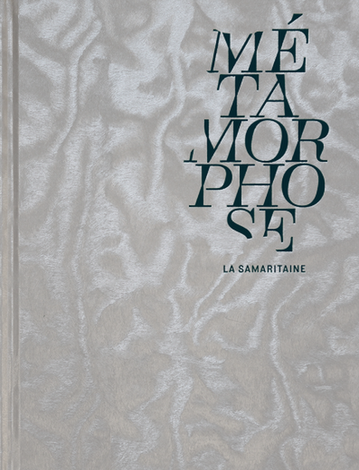
Titre:
Métamorphose : La Samaritaine
Actions:
Prix:
$79.95
(disponible en magasin)
Résumé:
Fondée en 1870, la Samaritaine est l’un des bâtiments les plus emblématiques de Paris présentant un subtil mélange d’Art déco et d’Art nouveau. En parallèle d’une grande campagne de production d’œuvres réalisées par une cinquantaine d’artistes, la Samaritaine a donné carte blanche aux photographes Pierre-Olivier Deschamps et Vladimir Vasilev, qui ont pu accéder au chantier entre 2015 et 2020, et suivre la métamorphose du bâtiment. Ce chantier est donc devenu pendant cinq ans le terrain de jeu des deux artistes. Pierre-Olivier Deschamps s’est intéressé à l’architecture, aux variations d’échelles et aux couleurs, extraordinaires, que le chaos organisé du chantier a créées. Vladimir Vasilev, quant à lui, s’est intéressé à la fois au chantier ainsi qu’aux hommes et aux femmes qui s’activaient dans cette fourmilière, offrant un visage aux multiples facettes à cette transformation.
Classification:
livres
livres
Publication:
avril 2022
avril 2022
Sujet:
Photographie par région
Photographie par région
Classification:
cartes
cartes
Actions:
Exemplaires:
Description:
1 atlas (13 pages) : color maps ; 19 x 27 cm
Description:
1 atlas (13 pages) : color maps ; 19 x 27 cm
Auteur:
- Reitz, F. H.,
- Oberlander, H. Peter, 1922-2008,,
- British Overseas Airways Corporation,
Sujet:
- British Overseas Airways Corporation Maps.,
- British Overseas Airways Corporation,
- Airways Maps.,
- Routes aériennes Cartes.,
- airline maps.,
- Airways,
- Atlases.,
- Maps
Publication:
[London] : British Overseas Airways Corporation, [1957?]
[London] : British Overseas Airways Corporation, [1957?]
Titre:
BOAC route map. no. 3 : Britain, Middle East, East Africa, South Africa, West Africa / cartography by F.H. Reitz, M.S.I.A.
Actions:
Exemplaires:
Description:
1 atlas (13 pages) : color maps ; 19 x 27 cm
BOAC route map. no. 3 : Britain, Middle East, East Africa, South Africa, West Africa / cartography by F.H. Reitz, M.S.I.A.
Actions:
Exemplaires:
Description:
1 atlas (13 pages) : color maps ; 19 x 27 cm
Classification:
cartes
cartes
Publication:
[London] : British Overseas Airways Corporation, [1957?]
[London] : British Overseas Airways Corporation, [1957?]
Auteur:
- Reitz, F. H.,
- Oberlander, H. Peter, 1922-2008,,
- British Overseas Airways Corporation,
Sujet:
- British Overseas Airways Corporation Maps.,
- British Overseas Airways Corporation,
- Airways Maps.,
- Routes aériennes Cartes.,
- airline maps.,
- Airways,
- Atlases.,
- Maps
Classification:
livres
livres
Actions:
Exemplaires:
Description:
271 pages : illustrations ; 25 cm
Description:
271 pages : illustrations ; 25 cm
Auteur:
Sujet:
- Urban renewal Switzerland Lausanne.,
- City planning Switzerland Lausanne.,
- Rénovation urbaine Suisse Lausanne.,
- City planning.,
- Urban renewal.,
- Switzerland Lausanne.
Publication:
Lausanne : En bas, ©2012.
Lausanne : En bas, ©2012.
Titre:
Luttes-ô-Flon : une reconversion urbaine lausannoise mouvementée, 1984-2012 / Urs Zuppinger, Agneta Zuppinger, Alain Faucherre.
Actions:
Exemplaires:
Description:
271 pages : illustrations ; 25 cm
Luttes-ô-Flon : une reconversion urbaine lausannoise mouvementée, 1984-2012 / Urs Zuppinger, Agneta Zuppinger, Alain Faucherre.
Actions:
Exemplaires:
Description:
271 pages : illustrations ; 25 cm
Classification:
livres
livres
Publication:
Lausanne : En bas, ©2012.
Lausanne : En bas, ©2012.
Auteur:
Sujet:
- Urban renewal Switzerland Lausanne.,
- City planning Switzerland Lausanne.,
- Rénovation urbaine Suisse Lausanne.,
- City planning.,
- Urban renewal.,
- Switzerland Lausanne.