11982 Résultats
Classification:
livres
livres
Actions:
Prix:
$45.00
(disponible sur commande)
Résumé:
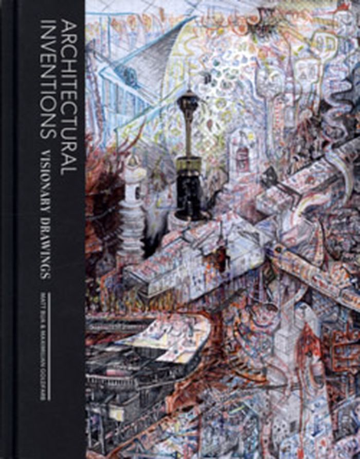
Born out of the drawingbuilding.org online archive, Architectural Inventions presents a visual study of impossible or speculative structures that exist only on paper. Soliciting the work of architects, designers, and artists, Maximilian Goldfarb and Matt Bua have gathered an array of works that convey architectural alternatives, through products, expansions, or critiques(...)
$45.00
(disponible sur commande)
Résumé:
Born out of the drawingbuilding.org online archive, Architectural Inventions presents a visual study of impossible or speculative structures that exist only on paper. Soliciting the work of architects, designers, and artists, Maximilian Goldfarb and Matt Bua have gathered an array of works that convey architectural alternatives, through products, expansions, or critiques(...)
Titre:
Architectural inventions : visionary drawings
Actions:
Prix:
$45.00
(disponible sur commande)
Résumé:
Born out of the drawingbuilding.org online archive, Architectural Inventions presents a visual study of impossible or speculative structures that exist only on paper. Soliciting the work of architects, designers, and artists, Maximilian Goldfarb and Matt Bua have gathered an array of works that convey architectural alternatives, through products, expansions, or critiques of our inhabited environments.
Classification:
livres
livres
Publication:
novembre 2012
novembre 2012
Sujet:
Dessin d’architecture
Dessin d’architecture
Classification:
livres
livres
Actions:
Prix:
$83.00
(disponible sur commande)
Résumé:
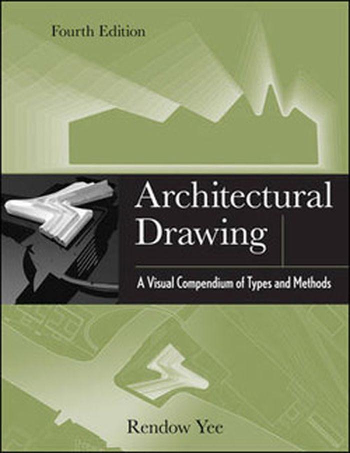
The classic architectural drawing compendium—now in a richly updated edition. Today's most comprehensive compendium of architectural drawing types and methods, both hand drawn and computer generated, Architectural Drawing: A Visual Compendium of Types and Methods remains a one-of-a-kind visual reference and an outstanding source of guidance and inspiration for(...)
$83.00
(disponible sur commande)
Résumé:
The classic architectural drawing compendium—now in a richly updated edition. Today's most comprehensive compendium of architectural drawing types and methods, both hand drawn and computer generated, Architectural Drawing: A Visual Compendium of Types and Methods remains a one-of-a-kind visual reference and an outstanding source of guidance and inspiration for(...)
Titre:
Architectural drawing : a visual compedium of types and methods (fourth edition)
Actions:
Prix:
$83.00
(disponible sur commande)
Résumé:
The classic architectural drawing compendium—now in a richly updated edition. Today's most comprehensive compendium of architectural drawing types and methods, both hand drawn and computer generated, Architectural Drawing: A Visual Compendium of Types and Methods remains a one-of-a-kind visual reference and an outstanding source of guidance and inspiration for students and professionals at every level. This fourth Edition has been thoroughly updated to reflect the growing influence of digital drawing.
Classification:
livres
livres
Publication:
août 2012
août 2012
Sujet:
Dessin d’architecture
Dessin d’architecture
Classification:
livres
livres
Actions:
Prix:
$34.95
(disponible en magasin)
Résumé:
This publication is a cultural history of the first three decades of the panorama, a three-hundred-sixty-degree visual medium patented by the British artist Robert Barker in 1787. Denise Blake Oleksijczuk demonstrates the complexity of the panoramas’ history and cultural impact, exploring specific exhibits and reconstructing the relationships between the paintings, their(...)
Titre:
The first panoramas : visions of British imperialism
Actions:
Prix:
$34.95
(disponible en magasin)
Résumé:
This publication is a cultural history of the first three decades of the panorama, a three-hundred-sixty-degree visual medium patented by the British artist Robert Barker in 1787. Denise Blake Oleksijczuk demonstrates the complexity of the panoramas’ history and cultural impact, exploring specific exhibits and reconstructing the relationships between the paintings, their accompanying printed guides, and the collective experiences of different audiences.
Classification:
livres
livres
Publication:
juin 2011
juin 2011
Sujet:
Dessin d’architecture
Dessin d’architecture
Classification:
livres
livres
Titre:
Architects' sketchbooks
Architects' sketchbooks
Actions:
Prix:
$55.00
(disponible sur commande)
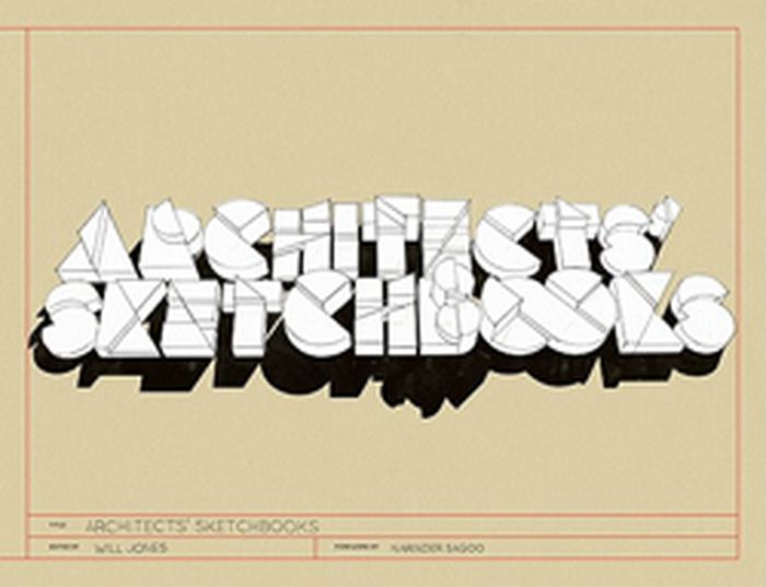
Résumé:
The resurgence of drawing is not merely a retrograde trend, but an affirmation of the continued importance of sketching as part of the design process. Architects' Sketchbooks presents pages from the private sketchbooks of a wide international spectrum of architects, who use drawing to express their spatial ideas while revealing their unique thought processes. Sketches(...)
$55.00
(disponible sur commande)
Résumé:
The resurgence of drawing is not merely a retrograde trend, but an affirmation of the continued importance of sketching as part of the design process. Architects' Sketchbooks presents pages from the private sketchbooks of a wide international spectrum of architects, who use drawing to express their spatial ideas while revealing their unique thought processes. Sketches(...)
Titre:
Architects' sketchbooks
Actions:
Prix:
$55.00
(disponible sur commande)
Résumé:
The resurgence of drawing is not merely a retrograde trend, but an affirmation of the continued importance of sketching as part of the design process. Architects' Sketchbooks presents pages from the private sketchbooks of a wide international spectrum of architects, who use drawing to express their spatial ideas while revealing their unique thought processes. Sketches from some 85 architects and studios are featured, including Will Alsop, Architects Atelier Ryo Abe, Shigeru Ban, Elemental, Thom Faulders, Norman Foster, Carlos Jiménez, Alessandro Mendini and Office dA. Their works range from simple line drawings and clear perspectives to more abstract, artistic compositions, from quick freehand to measured mapping, from spontaneous squiggles on scrap paper to careful drawings on art paper. Accompanying texts by editor Will Jones include comments by the architects and profile how they use sketches to help evolve their initial inspirations and concepts into more developed ideas, revealing the artistry behind the built world.
Classification:
livres
livres
Publication:
avril 2011
avril 2011
Sujet:
Dessin d’architecture
Dessin d’architecture
Classification:
livres
livres
Actions:
Prix:
$54.95
(disponible sur commande)
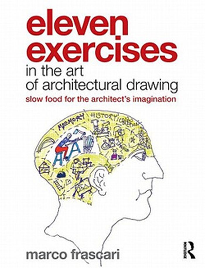
Résumé:
This book deals with the critical nature and crucial role of architectural drawings. A manual which is essentially not a manual; it is an elucidation of an elegant manner for practising architecture. Organized around eleven exercises, the book does not emphasize speed, nor incorporate many timesaving tricks typical of drawing books, but rather proposes a slow,(...)
$54.95
(disponible sur commande)
Résumé:
This book deals with the critical nature and crucial role of architectural drawings. A manual which is essentially not a manual; it is an elucidation of an elegant manner for practising architecture. Organized around eleven exercises, the book does not emphasize speed, nor incorporate many timesaving tricks typical of drawing books, but rather proposes a slow,(...)
Titre:
Eleven exercises in the art of architectural drawing
Actions:
Prix:
$54.95
(disponible sur commande)
Résumé:
This book deals with the critical nature and crucial role of architectural drawings. A manual which is essentially not a manual; it is an elucidation of an elegant manner for practising architecture. Organized around eleven exercises, the book does not emphasize speed, nor incorporate many timesaving tricks typical of drawing books, but rather proposes a slow, meditative process for construing drawings and for drawing constructing thoughts.
Classification:
livres
livres
Publication:
mars 2011
mars 2011
Sujet:
Dessin d’architecture
Dessin d’architecture
Classification:
livres
livres
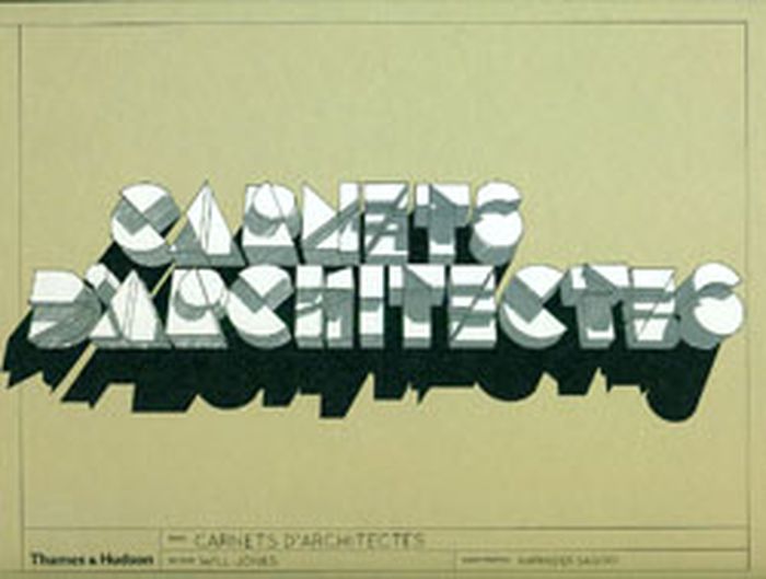
Titre:
Carnets d'architectes
Carnets d'architectes
Actions:
Prix:
$74.95
(disponible sur commande)
Résumé:
La plupart des ouvrages consacrés à l'architecture présentent des projets aboutis, que ce soit sous forme de dessins finalisés, souvent réalisés par ordinateur, de maquettes finales ou même de photographies de la construction achevée. Cependant ces différentes visualisations ne disent rien du processus de conception du projet, rien de sa véritable genèse. Or croquis,(...)
Titre:
Carnets d'architectes
Actions:
Prix:
$74.95
(disponible sur commande)
Résumé:
La plupart des ouvrages consacrés à l'architecture présentent des projets aboutis, que ce soit sous forme de dessins finalisés, souvent réalisés par ordinateur, de maquettes finales ou même de photographies de la construction achevée. Cependant ces différentes visualisations ne disent rien du processus de conception du projet, rien de sa véritable genèse. Or croquis, ébauches, esquisses et dessins préliminaires jouent un rôle primordial dans la création architecturale, et c'est souvent dans ces premiers traits tracés sur la feuille que naît le concept directeur du projet à venir. Le présent ouvrage nous invite à un fascinant voyage au coeur même de la création architecturale en donnant à voir, souvent pour la première fois, les carnets de croquis de 85 architectes.
Classification:
livres
livres
Publication:
mars 2011
mars 2011
Sujet:
Dessin d’architecture
Dessin d’architecture
Classification:
livres
livres
Actions:
Prix:
$52.95
(disponible sur commande)
Résumé:
La perspective est une technique indispensable pour l'artiste comme pour le graphiste, mais elle paraît souvent un peu rébarbative et difficile à assimiler. Le dessin de perspective par l'exemple propose une approche résolument pédagogique qui laisse à chacun le loisir de progresser à son rythme en trouvant les explications qu'il recherche. Que vous soyez artiste(...)
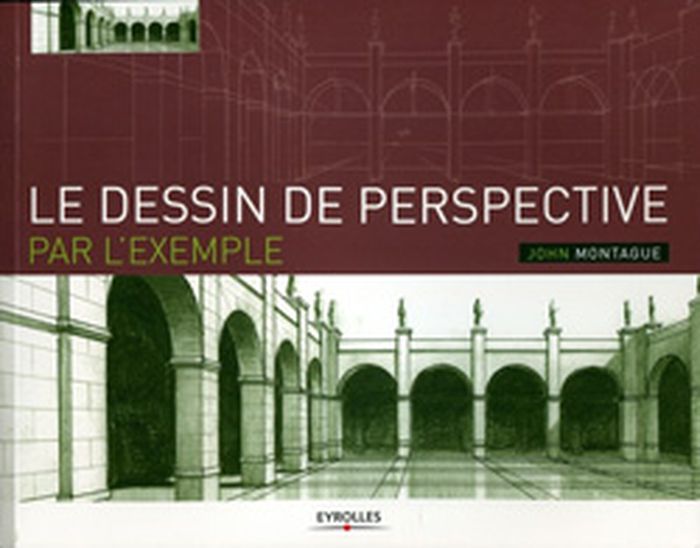
Titre:
Le dessin de perspective par l'example
Actions:
Prix:
$52.95
(disponible sur commande)
Résumé:
La perspective est une technique indispensable pour l'artiste comme pour le graphiste, mais elle paraît souvent un peu rébarbative et difficile à assimiler. Le dessin de perspective par l'exemple propose une approche résolument pédagogique qui laisse à chacun le loisir de progresser à son rythme en trouvant les explications qu'il recherche. Que vous soyez artiste confirmé ou amateur, designer, graphiste, vous trouverez dans ces pages matière à vous perfectionner. Après un bref historique de la représentation des volumes à travers les siècles, vous commencerez par bâtir des perspectives simples d'après nature. Progressivement, vous découvrirez les perspectives à deux ou trois points de fuite, et la représentation de volumes de plus en plus complexes. Puis vous apprendrez à renforcer les perspectives en jouant sur les ombres et la lumière, à donner une idée de l'échelle en ajoutant des personnages, à appliquer des trames et des textures aux objets. Agrémenté de nombreux exemples et d'illustrations détaillant pas à pas la construction des perspectives, ce livre deviendra vite votre référence absolue. Avec plus de 600 dessins et schémas, la mise en pages aérée a été conçue pour vous permettre d'annoter les pages et d'ajouter vos propres croquis et commentaires.
Classification:
livres
livres
Publication:
février 2011
février 2011
Sujet:
Dessin d’architecture
Dessin d’architecture
Classification:
livres
livres
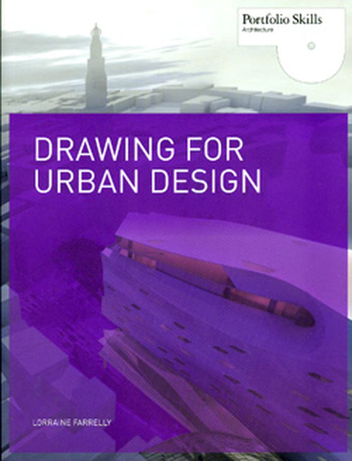
Titre:
Drawing for urban design
Drawing for urban design
Actions:
Prix:
$35.00
(disponible sur commande)
Résumé:
Drawing for Urban Design explores a wide range of ways to represent the city, from freehand sketching to computer models. This book provides an introduction to these techniques while explaining the processes associated with describing and designing urban environments — it is a visual handbook for representing the contemporary city.
Titre:
Drawing for urban design
Actions:
Prix:
$35.00
(disponible sur commande)
Résumé:
Drawing for Urban Design explores a wide range of ways to represent the city, from freehand sketching to computer models. This book provides an introduction to these techniques while explaining the processes associated with describing and designing urban environments — it is a visual handbook for representing the contemporary city.
Classification:
livres
livres
Publication:
mai 2011
mai 2011
Sujet:
Dessin d’architecture
Dessin d’architecture
Classification:
livres
livres
Actions:
Prix:
$45.95
(disponible sur commande)
Résumé:
This catalogue is dedicated to works on paper by the German Romantic artist (1774-1840) and offers a revealing perspective on the function of drawing in his creative process while also making apparent the substantive beauty of his works. Chosen from among major European museums and private collections - most of which have rarely been exhibited - these works of delicate(...)
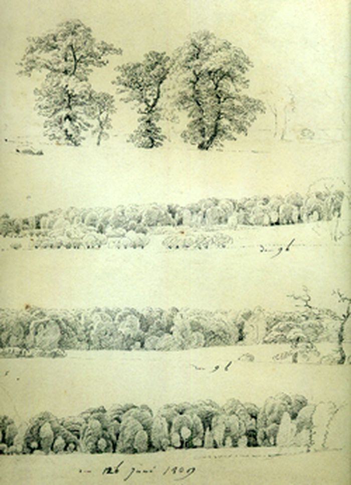
Titre:
Caspar David Friedrich: the art of drawing
Actions:
Prix:
$45.95
(disponible sur commande)
Résumé:
This catalogue is dedicated to works on paper by the German Romantic artist (1774-1840) and offers a revealing perspective on the function of drawing in his creative process while also making apparent the substantive beauty of his works. Chosen from among major European museums and private collections - most of which have rarely been exhibited - these works of delicate beauty, meticulously rendered en plein air, were subsequently utilized by the artist as components of a modern system of pictorial architecture with which he constructed, far from nature - in his studio - the sublime landscapes that have made him the most celebrated painter of German Romanticism.
Classification:
livres
livres
Publication:
janvier 2010
janvier 2010
Sujet:
Dessin d’architecture
Dessin d’architecture
Classification:
livres
livres
Prix:
$65.00
(disponible en magasin)
Résumé:
Burkhalter Sumi Architects were founded in Zurich in 1984. Their list of realised projects for public and private clients includes a wide range of tasks: workspaces, hotels and housing structures, urban development master-planning, conversions of disused industrial buildings. Series of sections and construction drawings minutely document a built object and its(...)
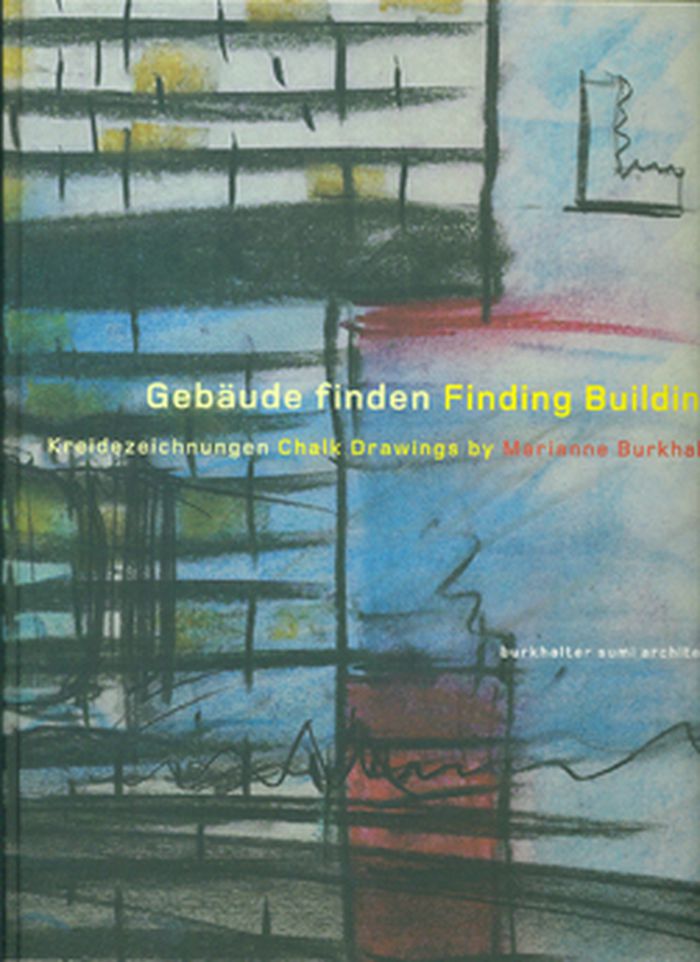
Titre:
Finding buildings: chalk drawings by Marianne Burkhalter
Actions:
Prix:
$65.00
(disponible en magasin)
Résumé:
Burkhalter Sumi Architects were founded in Zurich in 1984. Their list of realised projects for public and private clients includes a wide range of tasks: workspaces, hotels and housing structures, urban development master-planning, conversions of disused industrial buildings. Series of sections and construction drawings minutely document a built object and its production. Sections of facades illustrate the interrelation between construction and architectural expression. Finding Buildings presents drawings for twenty projects, built and unrealiesd, from the past ten years.
Classification:
livres
livres
Publication:
février 2010
février 2010
Sujet:
Dessin d’architecture
Dessin d’architecture