2699 Résultats
Classification:
cartes
cartes
Actions:
Exemplaires:
Description:
1 map on <4> sheets : color ; sheets 34 x 31 cm
Description:
1 map on <4> sheets : color ; sheets 34 x 31 cm
Auteur:
Sujet:
- Fire risk assessment Manitoba Thompson Maps.,
- Real property Manitoba Thompson Maps.,
- Assurance-incendie Manitoba Thompson Plans.,
- Plans cadastraux Manitoba Thompson.,
- Assurance-incendie Manitoba Thompson Cartes.,
- Fire risk assessment.,
- Real property.,
- Thompson (Man.) Maps.,
- Thompson (Man.) Plans.,
- Manitoba Thompson.,
- Fire insurance maps.,
- Maps.
Publication:
[Toronto] : Underwriters' Survey Bureau, [1961]
[Toronto] : Underwriters' Survey Bureau, [1961]
Titre:
Insurance plan of the town of Thompson, Man., population 1,800 : plan dated April 1961.
Actions:
Exemplaires:
Description:
1 map on <4> sheets : color ; sheets 34 x 31 cm
Insurance plan of the town of Thompson, Man., population 1,800 : plan dated April 1961.
Actions:
Exemplaires:
Description:
1 map on <4> sheets : color ; sheets 34 x 31 cm
Classification:
cartes
cartes
Publication:
[Toronto] : Underwriters' Survey Bureau, [1961]
[Toronto] : Underwriters' Survey Bureau, [1961]
Auteur:
Sujet:
- Fire risk assessment Manitoba Thompson Maps.,
- Real property Manitoba Thompson Maps.,
- Assurance-incendie Manitoba Thompson Plans.,
- Plans cadastraux Manitoba Thompson.,
- Assurance-incendie Manitoba Thompson Cartes.,
- Fire risk assessment.,
- Real property.,
- Thompson (Man.) Maps.,
- Thompson (Man.) Plans.,
- Manitoba Thompson.,
- Fire insurance maps.,
- Maps.
Classification:
cartes
cartes
Titre:
Insurance plan of the city of Regina. Volume 1 : plan dated June 1957, partially revised June 1963.
Insurance plan of the city of Regina. Volume 1 : plan dated June 1957, partially revised June 1963.
Actions:
Exemplaires:
Description:
1 map on <13> sheets : color ; sheets 34 x 31 cm
Description:
1 map on <13> sheets : color ; sheets 34 x 31 cm
Auteur:
Sujet:
- Fire risk assessment Saskatchewan Regina Maps.,
- Real property Saskatchewan Regina Maps.,
- Assurance-incendie Saskatchewan Regina Plans.,
- Plans cadastraux Saskatchewan Regina.,
- Assurance-incendie Saskatchewan Regina Cartes.,
- Fire risk assessment.,
- Real property.,
- Regina (Sask.) Maps.,
- Regina (Sask.) Plans.,
- Saskatchewan Regina.,
- Fire insurance maps.,
- Maps.
Publication:
Toronto : Underwriters' Survey Bureau, [1957-1963]
Toronto : Underwriters' Survey Bureau, [1957-1963]
Titre:
Insurance plan of the city of Regina. Volume 1 : plan dated June 1957, partially revised June 1963.
Actions:
Exemplaires:
Description:
1 map on <13> sheets : color ; sheets 34 x 31 cm
Insurance plan of the city of Regina. Volume 1 : plan dated June 1957, partially revised June 1963.
Actions:
Exemplaires:
Description:
1 map on <13> sheets : color ; sheets 34 x 31 cm
Classification:
cartes
cartes
Publication:
Toronto : Underwriters' Survey Bureau, [1957-1963]
Toronto : Underwriters' Survey Bureau, [1957-1963]
Auteur:
Sujet:
- Fire risk assessment Saskatchewan Regina Maps.,
- Real property Saskatchewan Regina Maps.,
- Assurance-incendie Saskatchewan Regina Plans.,
- Plans cadastraux Saskatchewan Regina.,
- Assurance-incendie Saskatchewan Regina Cartes.,
- Fire risk assessment.,
- Real property.,
- Regina (Sask.) Maps.,
- Regina (Sask.) Plans.,
- Saskatchewan Regina.,
- Fire insurance maps.,
- Maps.
Classification:
livres
livres
Exemplaires:
Description:
xi, 206 pages, 1 plate : illustrations, maps (1 color) ; 23 cm
Description:
xi, 206 pages, 1 plate : illustrations, maps (1 color) ; 23 cm
Auteur:
Sujet:
- Nervo, Amado,
- Blutiger Jupiter Musikgruppe Europa,
- European fiction 19th century Maps.,
- Historical fiction 19th century Maps.,
- Literary landmarks.,
- Literary landmarks England London Maps.,
- Literary landmarks France Paris Maps.,
- Books and reading Europe History 19th century.,
- Space and time in literature History 19th century.,
- Roman européen 19e siècle Atlas.,
- Roman historique 19e siècle Atlas.,
- Écrivains Résidences et lieux familiers.,
- Écrivains Résidences et lieux familiers Angleterre Londres Atlas.,
- Écrivains Résidences et lieux familiers France Paris Atlas.,
- Livres et lecture Europe Histoire 19e siècle.,
- Écrivains Résidences et lieux familiers Angleterre Londres Cartes.,
- Écrivains Résidences et lieux familiers France Paris Cartes.,
- Rutas literarias Europa Mapas,
- Books and reading,
- European fiction,
- Historical fiction,
- Space and time in literature,
- Geografie,
- Schauplatz,
- Roman,
- Romans.,
- Geografische aspecten.,
- England London,
- Europe,
- France Paris,
- Europa,
- History,
- Maps,
- Cartes géographiques.
Publication:
London ; New York : Verso, 1998.
London ; New York : Verso, 1998.
Titre:
Atlas of the European novel, 1800-1900 / Franco Moretti.
Actions:
Exemplaires:
Description:
xi, 206 pages, 1 plate : illustrations, maps (1 color) ; 23 cm
Atlas of the European novel, 1800-1900 / Franco Moretti.
Actions:
Exemplaires:
Description:
xi, 206 pages, 1 plate : illustrations, maps (1 color) ; 23 cm
Classification:
livres
livres
Publication:
London ; New York : Verso, 1998.
London ; New York : Verso, 1998.
Auteur:
Sujet:
- Nervo, Amado,
- Blutiger Jupiter Musikgruppe Europa,
- European fiction 19th century Maps.,
- Historical fiction 19th century Maps.,
- Literary landmarks.,
- Literary landmarks England London Maps.,
- Literary landmarks France Paris Maps.,
- Books and reading Europe History 19th century.,
- Space and time in literature History 19th century.,
- Roman européen 19e siècle Atlas.,
- Roman historique 19e siècle Atlas.,
- Écrivains Résidences et lieux familiers.,
- Écrivains Résidences et lieux familiers Angleterre Londres Atlas.,
- Écrivains Résidences et lieux familiers France Paris Atlas.,
- Livres et lecture Europe Histoire 19e siècle.,
- Écrivains Résidences et lieux familiers Angleterre Londres Cartes.,
- Écrivains Résidences et lieux familiers France Paris Cartes.,
- Rutas literarias Europa Mapas,
- Books and reading,
- European fiction,
- Historical fiction,
- Space and time in literature,
- Geografie,
- Schauplatz,
- Roman,
- Romans.,
- Geografische aspecten.,
- England London,
- Europe,
- France Paris,
- Europa,
- History,
- Maps,
- Cartes géographiques.
Classification:
livres
livres
Actions:
Exemplaires:
Description:
446 pages : illustrations ; 28 cm
Description:
446 pages : illustrations ; 28 cm
Auteur:
Sujet:
- City planning Italy Milan History 20th century.,
- Reconstruction (1939-1951) Italy Milan.,
- Reconstruction, 1939-1951 Italie Milan.,
- Reconstruction (1939-1951),
- City planning,
- Milan (Italy) Maps.,
- Italy Milan,
- Maps,
- History,
- Cartes géographiques.
Publication:
Cinisello Balsamo, Milano : Silvana editoriale, [2016]
Cinisello Balsamo, Milano : Silvana editoriale, [2016]
Titre:
Milano 1946 : alle origini della ricostruzione : la città bombardata, il censimento urbanistico, gli studi per il nuovo piano, le questioni di tutela / a cura di Gianfranco Pertot e Roberta Ramella ; con scritti di Ludovica Barassi, Paolo Bossi, Gianfranco Pertot, Roberta Ramella, Renzo Riboldazzi ; e una testimonianza di Alessandro Tutino.
Actions:
Exemplaires:
Description:
446 pages : illustrations ; 28 cm
Classification:
livres
livres
Publication:
Cinisello Balsamo, Milano : Silvana editoriale, [2016]
Cinisello Balsamo, Milano : Silvana editoriale, [2016]
Auteur:
Sujet:
- City planning Italy Milan History 20th century.,
- Reconstruction (1939-1951) Italy Milan.,
- Reconstruction, 1939-1951 Italie Milan.,
- Reconstruction (1939-1951),
- City planning,
- Milan (Italy) Maps.,
- Italy Milan,
- Maps,
- History,
- Cartes géographiques.
Classification:
cartes
cartes
Actions:
Exemplaires:
Description:
1 view : color ; 67 x 99 cm, folded in cover 35 x 17 cm
Description:
1 view : color ; 67 x 99 cm, folded in cover 35 x 17 cm
Auteur:
Sujet:
- Geography, Medieval Ukraine Kyïv Maps.,
- Géographie médiévale Ukraine Kiev Cartes.,
- Geography, Medieval.,
- Kyïv (Ukraine) Aerial views.,
- Ukraine Kyïv.,
- bird's-eye views.,
- aerial views.,
- bird's-eye perspectives.,
- Aerial views.,
- Maps.,
- Vues aériennes.
Publication:
[Kiev?] : Vyd-vo "Mystet︠s︡tvo", 1988.
[Kiev?] : Vyd-vo "Mystet︠s︡tvo", 1988.
Titre:
Kyïv 10-13 stolitʹ, karta-rekonstrukt︠s︡ii︠a︡ / Aleksandr Ivanovich Kutovoĭ, Viktor Abramovich Rozenberg ; avtor predislovii︠a︡ doktor iskusstvovedenii︠a︡ Grigoriĭ Nikonovich Logvin.
Actions:
Exemplaires:
Description:
1 view : color ; 67 x 99 cm, folded in cover 35 x 17 cm
Kyïv 10-13 stolitʹ, karta-rekonstrukt︠s︡ii︠a︡ / Aleksandr Ivanovich Kutovoĭ, Viktor Abramovich Rozenberg ; avtor predislovii︠a︡ doktor iskusstvovedenii︠a︡ Grigoriĭ Nikonovich Logvin.
Actions:
Exemplaires:
Description:
1 view : color ; 67 x 99 cm, folded in cover 35 x 17 cm
Classification:
cartes
cartes
Publication:
[Kiev?] : Vyd-vo "Mystet︠s︡tvo", 1988.
[Kiev?] : Vyd-vo "Mystet︠s︡tvo", 1988.
Auteur:
Sujet:
- Geography, Medieval Ukraine Kyïv Maps.,
- Géographie médiévale Ukraine Kiev Cartes.,
- Geography, Medieval.,
- Kyïv (Ukraine) Aerial views.,
- Ukraine Kyïv.,
- bird's-eye views.,
- aerial views.,
- bird's-eye perspectives.,
- Aerial views.,
- Maps.,
- Vues aériennes.
Classification:
livres
livres
Actions:
Exemplaires:
Description:
83 p. : ill., 2 folded maps ; 23 cm.
Description:
83 p. : ill., 2 folded maps ; 23 cm.
Auteur:
Sujet:
- Land settlement Québec (Province),
- Colonisation intérieure Québec (Province),
- Land settlement,
- Economic history,
- Travel,
- Abitibi (Québec) Description and travel.,
- Abitibi (Québec) Maps.,
- Abitibi (Québec) History.,
- Abitibi (Québec) Economic conditions.,
- Abitibi (Québec) Histoire.,
- Abitibi (Québec) Conditions économiques.,
- Abitibi (Québec) Descriptions et voyages.,
- Abitibi (Québec) Cartes.,
- Québec,
- Québec Abitibi,
- History,
- Maps
Publication:
Québec : Ministère de la colonisation, 1950.
Québec : Ministère de la colonisation, 1950.
Titre:
Un royaume vous attend : l'Abitibi / Ministère de la colonisation.
Actions:
Exemplaires:
Description:
83 p. : ill., 2 folded maps ; 23 cm.
Un royaume vous attend : l'Abitibi / Ministère de la colonisation.
Actions:
Exemplaires:
Description:
83 p. : ill., 2 folded maps ; 23 cm.
Classification:
livres
livres
Publication:
Québec : Ministère de la colonisation, 1950.
Québec : Ministère de la colonisation, 1950.
Auteur:
Sujet:
- Land settlement Québec (Province),
- Colonisation intérieure Québec (Province),
- Land settlement,
- Economic history,
- Travel,
- Abitibi (Québec) Description and travel.,
- Abitibi (Québec) Maps.,
- Abitibi (Québec) History.,
- Abitibi (Québec) Economic conditions.,
- Abitibi (Québec) Histoire.,
- Abitibi (Québec) Conditions économiques.,
- Abitibi (Québec) Descriptions et voyages.,
- Abitibi (Québec) Cartes.,
- Québec,
- Québec Abitibi,
- History,
- Maps
Classification:
cartes
cartes
Actions:
Exemplaires:
Description:
1 map : color ; 60 x 42 cm, folded to 15 x 21 cm in paper band 21 x 10 cm
Description:
1 map : color ; 60 x 42 cm, folded to 15 x 21 cm in paper band 21 x 10 cm
Auteur:
- Supergroup Studios (Firm),,
- Meier, Allison C. (Allison Christine), 1985-,
- Montgomery, Colin,,
- Blue Crow Media Ltd.,
Sujet:
- Trees New York (State) New York Maps.,
- Historic trees New York (State) New York Maps.,
- Historic trees,
- Trees,
- New York (State) New York,
- thematic maps.,
- Thematic maps,
- Maps,
- Cartes thématiques.
Publication:
[London] : Blue Crow Media, [2021], ©2021
[London] : Blue Crow Media, [2021], ©2021
Titre:
Great trees of New York map / texts by Allison Meier ; photography by Colin Montgomery ; design by Supergroup Studios.
Actions:
Exemplaires:
Description:
1 map : color ; 60 x 42 cm, folded to 15 x 21 cm in paper band 21 x 10 cm
Great trees of New York map / texts by Allison Meier ; photography by Colin Montgomery ; design by Supergroup Studios.
Actions:
Exemplaires:
Description:
1 map : color ; 60 x 42 cm, folded to 15 x 21 cm in paper band 21 x 10 cm
Classification:
cartes
cartes
Publication:
[London] : Blue Crow Media, [2021], ©2021
[London] : Blue Crow Media, [2021], ©2021
Auteur:
- Supergroup Studios (Firm),,
- Meier, Allison C. (Allison Christine), 1985-,
- Montgomery, Colin,,
- Blue Crow Media Ltd.,
Sujet:
- Trees New York (State) New York Maps.,
- Historic trees New York (State) New York Maps.,
- Historic trees,
- Trees,
- New York (State) New York,
- thematic maps.,
- Thematic maps,
- Maps,
- Cartes thématiques.
Classification:
livres
livres
Actions:
Exemplaires:
Description:
303 pages : illustrations (some color), maps (some color) ; 36 cm
Description:
303 pages : illustrations (some color), maps (some color) ; 36 cm
Auteur:
- Atlas van de verstedelijking in Nederland. English.,
- Rutte, Reinout,,
- Abrahamse, Jaap Evert,,
- Technische Hogeschool Delft. Afdeling Bouwkunde,,
- Netherlands. Ministerie van Onderwijs, Cultuur en Wetenschappen,
Sujet:
- City planning Netherlands History.,
- City planning Netherlands History Maps.,
- Urbanization Netherlands History.,
- Urbanization Netherlands History Maps.,
- Urbanisation Pays-Bas Histoire.,
- City planning,
- Urbanization,
- Netherlands,
- History,
- Maps,
- Cartes géographiques.
Publication:
Bussum, The Netherlands : THOTH Publishers, [2016], ©2016
Bussum, The Netherlands : THOTH Publishers, [2016], ©2016
Titre:
Atlas of the Dutch urban landscape : a millennium of spatial development / editors, Reinout Rutte, Jaap Evert Abrahamse ; text, Jaap Evert Abrahamse, Marcel IJsselstijn, Yvonne van Mil, Hans Renes, Reinout Rutte ; maps, Otto Diesfeldt, Marcel IJsselstijn, Menne Kosian, Yvonne van Mil, Iskandar Pané, Arnoud de Waaijer.
Actions:
Exemplaires:
Description:
303 pages : illustrations (some color), maps (some color) ; 36 cm
Classification:
livres
livres
Publication:
Bussum, The Netherlands : THOTH Publishers, [2016], ©2016
Bussum, The Netherlands : THOTH Publishers, [2016], ©2016
Auteur:
- Atlas van de verstedelijking in Nederland. English.,
- Rutte, Reinout,,
- Abrahamse, Jaap Evert,,
- Technische Hogeschool Delft. Afdeling Bouwkunde,,
- Netherlands. Ministerie van Onderwijs, Cultuur en Wetenschappen,
Sujet:
- City planning Netherlands History.,
- City planning Netherlands History Maps.,
- Urbanization Netherlands History.,
- Urbanization Netherlands History Maps.,
- Urbanisation Pays-Bas Histoire.,
- City planning,
- Urbanization,
- Netherlands,
- History,
- Maps,
- Cartes géographiques.
Classification:
livres
livres
Actions:
Prix:
$35.95
(disponible en magasin)
Résumé:
Abandoned shopping carts are everywhere, and yet we know so little about them. Where do they come from? Why are they there? Their complexity and history baffle even the most careful urban explorer. Thankfully, artist Julian Montague has created a comprehensive and well-documented taxonomy with ''The stray shopping carts of Eastern North America''. Spanning(...)
Titre:
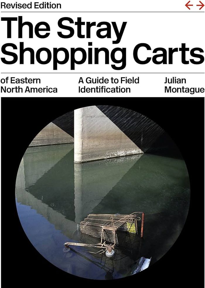
The stray shopping carts of Eastern North America: a guide to field identification
Actions:
Prix:
$35.95
(disponible en magasin)
Résumé:
Abandoned shopping carts are everywhere, and yet we know so little about them. Where do they come from? Why are they there? Their complexity and history baffle even the most careful urban explorer. Thankfully, artist Julian Montague has created a comprehensive and well-documented taxonomy with ''The stray shopping carts of Eastern North America''. Spanning thirty-three categories from damaged, fragment, and plow crush to plaza drift and bus stop discard, it is a tonic for times defined increasingly by rhetoric and media and less by the plain objects and facts of the real world. Montague’s incomparable documentation of this common feature of the urban landscape helps us see the natural and man-made worlds—and perhaps even ourselves—anew.
Classification:
livres
livres
Publication:
octobre 2023
octobre 2023
Sujet:
Monographies photo
Monographies photo
Classification:
cartes
cartes
Actions:
Exemplaires:
Description:
1 map on 29 sheets : color ; sheets 34 x 31 cm
Description:
1 map on 29 sheets : color ; sheets 34 x 31 cm
Auteur:
Sujet:
- Fire risk assessment Ontario Barrie Maps.,
- Real property Ontario Barrie Maps.,
- Assurance-incendie Ontario Barrie Plans.,
- Plans cadastraux Ontario Barrie.,
- Assurance-incendie Ontario Barrie Cartes.,
- Fire risk assessment.,
- Real property.,
- Barrie (Ont.) Maps.,
- Barrie (Ont.) Plans.,
- Ontario Barrie.,
- Fire insurance maps.,
- Maps.
Publication:
Toronto : Canadian Underwriters' Association, [1971-1972]
Toronto : Canadian Underwriters' Association, [1971-1972]
Titre:
Insurance plan of the city of Barrie, Ont., population 26,000 : plan dated May, 1971.
Actions:
Exemplaires:
Description:
1 map on 29 sheets : color ; sheets 34 x 31 cm
Insurance plan of the city of Barrie, Ont., population 26,000 : plan dated May, 1971.
Actions:
Exemplaires:
Description:
1 map on 29 sheets : color ; sheets 34 x 31 cm
Classification:
cartes
cartes
Publication:
Toronto : Canadian Underwriters' Association, [1971-1972]
Toronto : Canadian Underwriters' Association, [1971-1972]
Auteur:
Sujet:
- Fire risk assessment Ontario Barrie Maps.,
- Real property Ontario Barrie Maps.,
- Assurance-incendie Ontario Barrie Plans.,
- Plans cadastraux Ontario Barrie.,
- Assurance-incendie Ontario Barrie Cartes.,
- Fire risk assessment.,
- Real property.,
- Barrie (Ont.) Maps.,
- Barrie (Ont.) Plans.,
- Ontario Barrie.,
- Fire insurance maps.,
- Maps.