2699 Résultats
Classification:
livres
livres
Actions:
Exemplaires:
Description:
vii, 199 pages : illustrations (some color) ; 27 cm
Description:
vii, 199 pages : illustrations (some color) ; 27 cm
Auteur:
- Christraud M. Geary and Virginia-Lee Webb -- Howard Woody -- Robert W. Rydell -- Patricia C. Albers -- Ellen Handy -- Virginia-Lee Webb -- Christraud M. Geary.,
- Geary, Christraud M.,,
- Webb, Virginia-Lee,
Sujet:
- Postcards History 19th century Themes, motives.,
- Postcards History 20th century Themes, motives.,
- Postcards Themes, motives,
- Außereuropäische Kultur,
- Bildpostkarte,
- Geschichte,
- Bildband,
- 1895-1915,
- picture postcards.,
- postcards.,
- Postcards,
- History,
- Cartes postales.
Publication:
Washington [D.C.] : Smithsonian Institution Press, [1998], ©1998
Washington [D.C.] : Smithsonian Institution Press, [1998], ©1998
Titre:
Delivering views : distant cultures in early postcards / edited by Christraud M. Geary and Virginia-Lee Webb.
Actions:
Exemplaires:
Description:
vii, 199 pages : illustrations (some color) ; 27 cm
Delivering views : distant cultures in early postcards / edited by Christraud M. Geary and Virginia-Lee Webb.
Actions:
Exemplaires:
Description:
vii, 199 pages : illustrations (some color) ; 27 cm
Classification:
livres
livres
Publication:
Washington [D.C.] : Smithsonian Institution Press, [1998], ©1998
Washington [D.C.] : Smithsonian Institution Press, [1998], ©1998
Auteur:
- Christraud M. Geary and Virginia-Lee Webb -- Howard Woody -- Robert W. Rydell -- Patricia C. Albers -- Ellen Handy -- Virginia-Lee Webb -- Christraud M. Geary.,
- Geary, Christraud M.,,
- Webb, Virginia-Lee,
Sujet:
- Postcards History 19th century Themes, motives.,
- Postcards History 20th century Themes, motives.,
- Postcards Themes, motives,
- Außereuropäische Kultur,
- Bildpostkarte,
- Geschichte,
- Bildband,
- 1895-1915,
- picture postcards.,
- postcards.,
- Postcards,
- History,
- Cartes postales.
Classification:
livres
livres
Actions:
Exemplaires:
Description:
56 pages : illustrations ; 25 cm
Description:
56 pages : illustrations ; 25 cm
Auteur:
Sujet:
- Roy, William, 1726-1790.,
- Roy, William 1726-1790,
- Military topography History Exhibitions.,
- Military maps Exhibitions.,
- Topographie militaire Histoire Expositions.,
- Cartes militaires Expositions.,
- Exhibitions - Cartography. [Literature].,
- Classical antiquities,
- Military maps,
- Military topography,
- Surveys,
- Kartografie,
- Landesaufnahme,
- Landmeetkunde.,
- Ordnance Survey.,
- Maps, Military Exhibitions.,
- Great Britain Antiquities, Roman Exhibitions.,
- Great Britain Surveys Exhibitions.,
- Great Britain. [Literature] 1977.,
- Great Britain,
- Großbritannien,
- Great Britain // Ordnance Survey History,
- Map Library British Library Catalogs,
- Maps.,
- Exhibition catalogs.,
- History
Publication:
London : British Museum Publications Ltd, 1977.
London : British Museum Publications Ltd, 1977.
Titre:
William Roy, 1726-1790 : pioneer of the Ordnance Survey / Yolande O'Donoghue.
Actions:
Exemplaires:
Description:
56 pages : illustrations ; 25 cm
William Roy, 1726-1790 : pioneer of the Ordnance Survey / Yolande O'Donoghue.
Actions:
Exemplaires:
Description:
56 pages : illustrations ; 25 cm
Classification:
livres
livres
Publication:
London : British Museum Publications Ltd, 1977.
London : British Museum Publications Ltd, 1977.
Auteur:
Sujet:
- Roy, William, 1726-1790.,
- Roy, William 1726-1790,
- Military topography History Exhibitions.,
- Military maps Exhibitions.,
- Topographie militaire Histoire Expositions.,
- Cartes militaires Expositions.,
- Exhibitions - Cartography. [Literature].,
- Classical antiquities,
- Military maps,
- Military topography,
- Surveys,
- Kartografie,
- Landesaufnahme,
- Landmeetkunde.,
- Ordnance Survey.,
- Maps, Military Exhibitions.,
- Great Britain Antiquities, Roman Exhibitions.,
- Great Britain Surveys Exhibitions.,
- Great Britain. [Literature] 1977.,
- Great Britain,
- Großbritannien,
- Great Britain // Ordnance Survey History,
- Map Library British Library Catalogs,
- Maps.,
- Exhibition catalogs.,
- History
Classification:
cartes
cartes
Actions:
Exemplaires:
Description:
1 map on 8 sheets : color ; sheets 34 x 31 cm
Description:
1 map on 8 sheets : color ; sheets 34 x 31 cm
Auteur:
Sujet:
- Fire risk assessment Québec (Province) Sainte-Anne-de-Bellevue Maps.,
- Real property Québec (Province) Sainte-Anne-de-Bellevue Maps.,
- Assurance-incendie Québec (Province) Sainte-Anne-de-Bellevue Cartes.,
- Plans cadastraux Québec (Province) Sainte-Anne-de-Bellevue.,
- Fire risk assessment,
- Real property,
- Sainte-Anne-de-Bellevue (Québec) Maps.,
- Sainte-Anne-de-Bellevue (Québec) Plans.,
- Québec Sainte-Anne-de-Bellevue,
- fire insurance maps.,
- Fire insurance maps,
- Maps,
- Plans d'assurance incendie.
Publication:
Toronto : The Bureau, [1959]
Toronto : The Bureau, [1959]
Titre:
Insurance plan of the town of Ste. Anne de Bellevue, Que., population 3,700 : plan dated November 1959 / compiled and issued by Underwriter's Survey Bureau, Limited.
Actions:
Exemplaires:
Description:
1 map on 8 sheets : color ; sheets 34 x 31 cm
Insurance plan of the town of Ste. Anne de Bellevue, Que., population 3,700 : plan dated November 1959 / compiled and issued by Underwriter's Survey Bureau, Limited.
Actions:
Exemplaires:
Description:
1 map on 8 sheets : color ; sheets 34 x 31 cm
Classification:
cartes
cartes
Publication:
Toronto : The Bureau, [1959]
Toronto : The Bureau, [1959]
Auteur:
Sujet:
- Fire risk assessment Québec (Province) Sainte-Anne-de-Bellevue Maps.,
- Real property Québec (Province) Sainte-Anne-de-Bellevue Maps.,
- Assurance-incendie Québec (Province) Sainte-Anne-de-Bellevue Cartes.,
- Plans cadastraux Québec (Province) Sainte-Anne-de-Bellevue.,
- Fire risk assessment,
- Real property,
- Sainte-Anne-de-Bellevue (Québec) Maps.,
- Sainte-Anne-de-Bellevue (Québec) Plans.,
- Québec Sainte-Anne-de-Bellevue,
- fire insurance maps.,
- Fire insurance maps,
- Maps,
- Plans d'assurance incendie.
Classification:
cartes
cartes
Actions:
Exemplaires:
Description:
1 map on 13 sheets : color ; sheets 34 x 31 cm
Description:
1 map on 13 sheets : color ; sheets 34 x 31 cm
Auteur:
Sujet:
- Fire risk assessment Québec (Province) Chambly Maps.,
- Real property Québec (Province) Chambly Maps.,
- Assurance-incendie Québec (Province) Chambly Cartes.,
- Plans cadastraux Québec (Province) Saint-Lambert.,
- Fire risk assessment,
- Real property,
- Chambly (Québec) Maps.,
- Saint-Lambert (Chambly, Québec) Maps.,
- Saint-Lambert (Chambly, Québec) Plans.,
- Chambly (Québec) Plans.,
- Québec Chambly,
- Québec Chambly Saint-Lambert,
- fire insurance maps.,
- Fire insurance maps,
- Maps,
- Plans d'assurance incendie.
Publication:
Toronto : Underwriters' Survey Bureau, [1953]
Toronto : Underwriters' Survey Bureau, [1953]
Titre:
Insurance plan of the city of St. Lambert, Quebec, embracing the towns of Lemoyne and Preville, population, St. Lambert 10,000, Lemoyne 4,000, Preville 125 : plan dated December 1958.
Actions:
Exemplaires:
Description:
1 map on 13 sheets : color ; sheets 34 x 31 cm
Insurance plan of the city of St. Lambert, Quebec, embracing the towns of Lemoyne and Preville, population, St. Lambert 10,000, Lemoyne 4,000, Preville 125 : plan dated December 1958.
Actions:
Exemplaires:
Description:
1 map on 13 sheets : color ; sheets 34 x 31 cm
Classification:
cartes
cartes
Publication:
Toronto : Underwriters' Survey Bureau, [1953]
Toronto : Underwriters' Survey Bureau, [1953]
Auteur:
Sujet:
- Fire risk assessment Québec (Province) Chambly Maps.,
- Real property Québec (Province) Chambly Maps.,
- Assurance-incendie Québec (Province) Chambly Cartes.,
- Plans cadastraux Québec (Province) Saint-Lambert.,
- Fire risk assessment,
- Real property,
- Chambly (Québec) Maps.,
- Saint-Lambert (Chambly, Québec) Maps.,
- Saint-Lambert (Chambly, Québec) Plans.,
- Chambly (Québec) Plans.,
- Québec Chambly,
- Québec Chambly Saint-Lambert,
- fire insurance maps.,
- Fire insurance maps,
- Maps,
- Plans d'assurance incendie.
Classification:
cartes
cartes
Actions:
Exemplaires:
Description:
1 map on 8 sheets : color ; sheets 34 x 31 cm
Description:
1 map on 8 sheets : color ; sheets 34 x 31 cm
Auteur:
Sujet:
- Fire insurance Québec (Province) Saint-Gabriel-de-Brandon.,
- Real property Québec (Province) Saint-Gabriel-de-Brandon Maps.,
- Assurance-incendie Québec (Province) Saint-Gabriel-de-Brandon Cartes.,
- Plans cadastraux Québec (Province) Saint-Gabriel-de-Brandon.,
- Assurance-incendie Québec (Province) Saint-Gabriel-de-Brandon.,
- Fire insurance,
- Real property,
- Saint-Gabriel-de-Brandon (Québec) Maps.,
- Saint-Gabriel-de-Brandon (Québec) Plans.,
- Québec Saint-Gabriel-de-Brandon,
- fire insurance maps.,
- Fire insurance maps,
- Maps,
- Plans d'assurance incendie.
Publication:
Toronto : Underwriters' Survey Bureau, [1955]
Toronto : Underwriters' Survey Bureau, [1955]
Titre:
Insurance plan of the village of St. Gabriel de Brandon, Que., population 3,400 : plan dated June 1955.
Actions:
Exemplaires:
Description:
1 map on 8 sheets : color ; sheets 34 x 31 cm
Insurance plan of the village of St. Gabriel de Brandon, Que., population 3,400 : plan dated June 1955.
Actions:
Exemplaires:
Description:
1 map on 8 sheets : color ; sheets 34 x 31 cm
Classification:
cartes
cartes
Publication:
Toronto : Underwriters' Survey Bureau, [1955]
Toronto : Underwriters' Survey Bureau, [1955]
Auteur:
Sujet:
- Fire insurance Québec (Province) Saint-Gabriel-de-Brandon.,
- Real property Québec (Province) Saint-Gabriel-de-Brandon Maps.,
- Assurance-incendie Québec (Province) Saint-Gabriel-de-Brandon Cartes.,
- Plans cadastraux Québec (Province) Saint-Gabriel-de-Brandon.,
- Assurance-incendie Québec (Province) Saint-Gabriel-de-Brandon.,
- Fire insurance,
- Real property,
- Saint-Gabriel-de-Brandon (Québec) Maps.,
- Saint-Gabriel-de-Brandon (Québec) Plans.,
- Québec Saint-Gabriel-de-Brandon,
- fire insurance maps.,
- Fire insurance maps,
- Maps,
- Plans d'assurance incendie.
Classification:
cartes
cartes
Actions:
Exemplaires:
Description:
1 map on 6 sheets : color ; sheets 34 x 31 cm
Description:
1 map on 6 sheets : color ; sheets 34 x 31 cm
Auteur:
Sujet:
- Fire risk assessment Québec (Province) Beauceville Maps.,
- Real property Québec (Province) Beauceville.,
- Real property Québec (Province) Beauceville Maps.,
- Assurance-incendie Québec (Province) Beauceville Cartes.,
- Plans cadastraux Québec (Province) Beauceville.,
- Biens réels Québec (Province) Beauceville.,
- Fire risk assessment,
- Real property,
- Beauceville (Québec) Maps.,
- Beauceville-Est (Québec) Maps.,
- Beauceville (Québec) Plans.,
- Beauceville-Est (Québec) Plans.,
- Québec Beauceville,
- fire insurance maps.,
- Fire insurance maps,
- Maps,
- Plans d'assurance incendie.
Publication:
Toronto : Underwriters' Survey Bureau, [1952]
Toronto : Underwriters' Survey Bureau, [1952]
Titre:
Insurance plan of the towns of Beauceville, Beauceville Est., Que., population Beauceville 1,100, Beauceville Est. 1,580 : plan dated July 1952.
Actions:
Exemplaires:
Description:
1 map on 6 sheets : color ; sheets 34 x 31 cm
Insurance plan of the towns of Beauceville, Beauceville Est., Que., population Beauceville 1,100, Beauceville Est. 1,580 : plan dated July 1952.
Actions:
Exemplaires:
Description:
1 map on 6 sheets : color ; sheets 34 x 31 cm
Classification:
cartes
cartes
Publication:
Toronto : Underwriters' Survey Bureau, [1952]
Toronto : Underwriters' Survey Bureau, [1952]
Auteur:
Sujet:
- Fire risk assessment Québec (Province) Beauceville Maps.,
- Real property Québec (Province) Beauceville.,
- Real property Québec (Province) Beauceville Maps.,
- Assurance-incendie Québec (Province) Beauceville Cartes.,
- Plans cadastraux Québec (Province) Beauceville.,
- Biens réels Québec (Province) Beauceville.,
- Fire risk assessment,
- Real property,
- Beauceville (Québec) Maps.,
- Beauceville-Est (Québec) Maps.,
- Beauceville (Québec) Plans.,
- Beauceville-Est (Québec) Plans.,
- Québec Beauceville,
- fire insurance maps.,
- Fire insurance maps,
- Maps,
- Plans d'assurance incendie.
Classification:
cartes
cartes
Actions:
Exemplaires:
Description:
1 map on 32 sheets : color ; sheets 34 x 31 cm
Description:
1 map on 32 sheets : color ; sheets 34 x 31 cm
Auteur:
Sujet:
- Fire risk assessment Ontario Metropolitan Toronto Maps.,
- Fire risk assessment Scarborough (Toronto, Ont.) Maps.,
- Real property Ontario Metropolitan Toronto Maps.,
- Real property Scarborough (Toronto, Ont.) Maps.,
- Assurance-incendie Ontario Metropolitan Toronto Plans.,
- Assurance-incendie Ontario Scarborough Plans.,
- Plans cadastraux Ontario Metropolitan Toronto.,
- Plans cadastraux Ontario Scarborough.,
- Fire risk assessment.,
- Real property.,
- Metropolitan Toronto (Ont.) Maps.,
- Scarborough (Toronto, Ont.) Maps.,
- Toronto, Agglomération de (Ont.) Cartes.,
- Scarborough (Ont.) Plans.,
- Ontario Scarborough.,
- Fire insurance maps.,
- Maps.
Publication:
Toronto : Canadian Underwriters' Association, Plan Division, [1969]
Toronto : Canadian Underwriters' Association, Plan Division, [1969]
Titre:
Insurance plan of the municipality of Metropolitan Toronto. Volume 21 : (borough of Scarborough) plan dated February 1969.
Actions:
Exemplaires:
Description:
1 map on 32 sheets : color ; sheets 34 x 31 cm
Insurance plan of the municipality of Metropolitan Toronto. Volume 21 : (borough of Scarborough) plan dated February 1969.
Actions:
Exemplaires:
Description:
1 map on 32 sheets : color ; sheets 34 x 31 cm
Classification:
cartes
cartes
Publication:
Toronto : Canadian Underwriters' Association, Plan Division, [1969]
Toronto : Canadian Underwriters' Association, Plan Division, [1969]
Auteur:
Sujet:
- Fire risk assessment Ontario Metropolitan Toronto Maps.,
- Fire risk assessment Scarborough (Toronto, Ont.) Maps.,
- Real property Ontario Metropolitan Toronto Maps.,
- Real property Scarborough (Toronto, Ont.) Maps.,
- Assurance-incendie Ontario Metropolitan Toronto Plans.,
- Assurance-incendie Ontario Scarborough Plans.,
- Plans cadastraux Ontario Metropolitan Toronto.,
- Plans cadastraux Ontario Scarborough.,
- Fire risk assessment.,
- Real property.,
- Metropolitan Toronto (Ont.) Maps.,
- Scarborough (Toronto, Ont.) Maps.,
- Toronto, Agglomération de (Ont.) Cartes.,
- Scarborough (Ont.) Plans.,
- Ontario Scarborough.,
- Fire insurance maps.,
- Maps.
Classification:
livres
livres
Titre:
Again, a time machine : from distribution to archive / edited by Gavin Everall and Jane Rolo.
Again, a time machine : from distribution to archive / edited by Gavin Everall and Jane Rolo.
Actions:
Exemplaires:
Description:
224 pages : illustrations (some color) ; 26 cm
Description:
224 pages : illustrations (some color) ; 26 cm
Auteur:
- Everall, Gavin,,
- Rolo, Jane,,
- Langdon, James (Graphic designer),,
- Book Works (Organization)
Sujet:
- Book Works (Organization),
- Conceptual art Exhibitions.,
- Art conceptuel Expositions.,
- Art and Design.,
- Conceptual art,
- Druckwerk,
- Sprache,
- Schriftlichkeit,
- Concept-art,
- Artists' books - Bibliography.,
- Exhibition catalogues.,
- artists' books (books),
- Artists' books,
- Exhibition catalogs,
- Livres d'artistes.
Publication:
[London] : Book Works, 2012.
[London] : Book Works, 2012.
Titre:
Again, a time machine : from distribution to archive / edited by Gavin Everall and Jane Rolo.
Actions:
Exemplaires:
Description:
224 pages : illustrations (some color) ; 26 cm
Again, a time machine : from distribution to archive / edited by Gavin Everall and Jane Rolo.
Actions:
Exemplaires:
Description:
224 pages : illustrations (some color) ; 26 cm
Classification:
livres
livres
Publication:
[London] : Book Works, 2012.
[London] : Book Works, 2012.
Auteur:
- Everall, Gavin,,
- Rolo, Jane,,
- Langdon, James (Graphic designer),,
- Book Works (Organization)
Sujet:
- Book Works (Organization),
- Conceptual art Exhibitions.,
- Art conceptuel Expositions.,
- Art and Design.,
- Conceptual art,
- Druckwerk,
- Sprache,
- Schriftlichkeit,
- Concept-art,
- Artists' books - Bibliography.,
- Exhibition catalogues.,
- artists' books (books),
- Artists' books,
- Exhibition catalogs,
- Livres d'artistes.
Classification:
livres
livres
Titre:
One red dot
One red dot
Actions:
Prix:
$22.99
(disponible sur commande)
Résumé:
A pop-up book for children of all ages. A stunning tour de force of pop-up sculpture. Find the one red dot in each of ten original art works.
$22.99
(disponible sur commande)
Résumé:
A pop-up book for children of all ages. A stunning tour de force of pop-up sculpture. Find the one red dot in each of ten original art works.
Titre:
One red dot
Actions:
Prix:
$22.99
(disponible sur commande)
Résumé:
A pop-up book for children of all ages. A stunning tour de force of pop-up sculpture. Find the one red dot in each of ten original art works.
One red dot
Actions:
Prix:
$22.99
(disponible sur commande)
Résumé:
A pop-up book for children of all ages. A stunning tour de force of pop-up sculpture. Find the one red dot in each of ten original art works.
Classification:
livres
livres
Publication:
octobre 2005
octobre 2005
Classification:
livres
livres
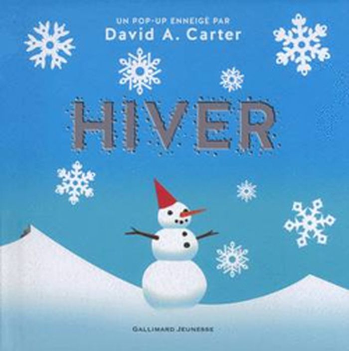
Titre:
Hiver
Hiver
Actions:
Prix:
$27.95
(disponible sur commande)
Résumé:
La neige tombe doucement du ciel, la nature se repose et quelques animaux pointent le bout de leur nez... c'est l'hiver ! Après sa magnifique série d'albums abstraits, David A. Carter nous propose cette nouvelle série sur les saisons.
$27.95
(disponible sur commande)
Résumé:
La neige tombe doucement du ciel, la nature se repose et quelques animaux pointent le bout de leur nez... c'est l'hiver ! Après sa magnifique série d'albums abstraits, David A. Carter nous propose cette nouvelle série sur les saisons.
Titre:
Hiver
Actions:
Prix:
$27.95
(disponible sur commande)
Résumé:
La neige tombe doucement du ciel, la nature se repose et quelques animaux pointent le bout de leur nez... c'est l'hiver ! Après sa magnifique série d'albums abstraits, David A. Carter nous propose cette nouvelle série sur les saisons.
Hiver
Actions:
Prix:
$27.95
(disponible sur commande)
Résumé:
La neige tombe doucement du ciel, la nature se repose et quelques animaux pointent le bout de leur nez... c'est l'hiver ! Après sa magnifique série d'albums abstraits, David A. Carter nous propose cette nouvelle série sur les saisons.
Classification:
livres
livres
Publication:
novembre 2015
novembre 2015
Sujet:
Littérature jeunesse
Littérature jeunesse