705 Résultats
Classification:
livres
livres
Actions:
Exemplaires:
Description:
[4], xvi, 1021 pages : illustrations, maps ; 21 cm
- Bibliothèque main canada 192620 | ID G70.2.G5 CAN; ID:97-B3703 | Disponible
Description:
[4], xvi, 1021 pages : illustrations, maps ; 21 cm
Auteur:
- Canadian Institute of Geomatics.,
- Canadian Centre for Surveying.,
- Canada. Inter-Agency Committee on Geomatics.,
- Canada. Surveys, Mapping and Remote Sensing Sector.,
- Canadian Conference on GIS (1993 : Ottawa, Ont.)
Sujet:
- Canadian Conference on GIS (1993 : Ottawa, Ont.),
- Conférence canadienne sur les SIG (1993 : Ottawa, Ont.),
- Canadian Conference on GIS,
- Geographic information systems Congresses.,
- Systèmes d'information géographique Congrès.,
- Geographic information systems,
- Proceedings.,
- Conference papers and proceedings
Publication:
Ottawa : Canadian Institute of Geomatics = L'Association canadienne des sciences géomatiques, [1993?]
Ottawa : Canadian Institute of Geomatics = L'Association canadienne des sciences géomatiques, [1993?]
Titre:
The Canadian conference on GIS, 1993 : proceedings : international conference, March 23-25, 1993, Ottawa, Canada / [organized by the Surveys, Mapping and Remote Sensing Sector, EMR Canada in cooperation with the Canadian Institute of Geomatics and the Inter-Agency Committee on Geomatics = La conférence canadien sur les SIG, 1993 : actes : conférence internationale du 23 au 25 mars 1993, Ottawa, Canada / [conférence organisée par le Secteur des levés, de la cartographie et de la télédétection, EMR Canada en collaboration avec Association canadienne des sciences géomatiques et le Comité mixte des organismes intéressés à la géomatique].
Actions:
Exemplaires:
Description:
[4], xvi, 1021 pages : illustrations, maps ; 21 cm
The Canadian conference on GIS, 1993 : proceedings : international conference, March 23-25, 1993, Ottawa, Canada / [organized by the Surveys, Mapping and Remote Sensing Sector, EMR Canada in cooperation with the Canadian Institute of Geomatics and the Inter-Agency Committee on Geomatics = La conférence canadien sur les SIG, 1993 : actes : conférence internationale du 23 au 25 mars 1993, Ottawa, Canada / [conférence organisée par le Secteur des levés, de la cartographie et de la télédétection, EMR Canada en collaboration avec Association canadienne des sciences géomatiques et le Comité mixte des organismes intéressés à la géomatique].
Actions:
Exemplaires:
- Bibliothèque main canada 192620 | ID G70.2.G5 CAN; ID:97-B3703 | Disponible
Description:
[4], xvi, 1021 pages : illustrations, maps ; 21 cm
Classification:
livres
livres
Publication:
Ottawa : Canadian Institute of Geomatics = L'Association canadienne des sciences géomatiques, [1993?]
Ottawa : Canadian Institute of Geomatics = L'Association canadienne des sciences géomatiques, [1993?]
Auteur:
- Canadian Institute of Geomatics.,
- Canadian Centre for Surveying.,
- Canada. Inter-Agency Committee on Geomatics.,
- Canada. Surveys, Mapping and Remote Sensing Sector.,
- Canadian Conference on GIS (1993 : Ottawa, Ont.)
Sujet:
- Canadian Conference on GIS (1993 : Ottawa, Ont.),
- Conférence canadienne sur les SIG (1993 : Ottawa, Ont.),
- Canadian Conference on GIS,
- Geographic information systems Congresses.,
- Systèmes d'information géographique Congrès.,
- Geographic information systems,
- Proceedings.,
- Conference papers and proceedings
Classification:
livres
livres
Actions:
Exemplaires:
Description:
4 unnumbered pages, 203 pages : illustrations (chiefly color), maps (chiefly color), plans (chiefly color) ; 24 cm
Description:
4 unnumbered pages, 203 pages : illustrations (chiefly color), maps (chiefly color), plans (chiefly color) ; 24 cm
Auteur:
- Thün, Geoffrey, 1967-,
- Velikov, Kathy,,
- Ripley, Colin (Professor of architecture),,
- McTavish, Dan,,
- Fishman, Robert, 1946-,
- McMorrough, John,,
- University of Michigan. A. Alfred Taubman College of Architecture + Urban Planning,
Sujet:
- City planning Great Lakes Region (North America),
- Urban policy Great Lakes Region (North America),
- City planning Great Lakes (North America),
- Politique urbaine Grands Lacs, Région des (Amérique du Nord),
- City planning,
- Great Lakes Region (North America) Maps.,
- Great Lakes Region (North America) Pictorial works.,
- Grands Lacs, Région des (Amérique du Nord) Ouvrages illustrés.,
- Great Lakes,
- Exhibition publications.
Publication:
Zürich : Park Books, [2015], ©2015
Zürich : Park Books, [2015], ©2015
Titre:
Infra eco logi urbanism : a project for the Great Lakes megaregion / Geoffrey Thün, Kathy Velikov, Colin Ripley, Dan McTavish ; [with contributions from Robert Fishman and John McMorrough].
Actions:
Exemplaires:
Description:
4 unnumbered pages, 203 pages : illustrations (chiefly color), maps (chiefly color), plans (chiefly color) ; 24 cm
Classification:
livres
livres
Publication:
Zürich : Park Books, [2015], ©2015
Zürich : Park Books, [2015], ©2015
Auteur:
- Thün, Geoffrey, 1967-,
- Velikov, Kathy,,
- Ripley, Colin (Professor of architecture),,
- McTavish, Dan,,
- Fishman, Robert, 1946-,
- McMorrough, John,,
- University of Michigan. A. Alfred Taubman College of Architecture + Urban Planning,
Sujet:
- City planning Great Lakes Region (North America),
- Urban policy Great Lakes Region (North America),
- City planning Great Lakes (North America),
- Politique urbaine Grands Lacs, Région des (Amérique du Nord),
- City planning,
- Great Lakes Region (North America) Maps.,
- Great Lakes Region (North America) Pictorial works.,
- Grands Lacs, Région des (Amérique du Nord) Ouvrages illustrés.,
- Great Lakes,
- Exhibition publications.
Classification:
livres
livres
Actions:
Exemplaires:
Description:
viii, 380 pages : illustrations (chiefly color), maps (chiefly color) ; 25 x 32 cm
Description:
viii, 380 pages : illustrations (chiefly color), maps (chiefly color) ; 25 x 32 cm
Auteur:
Sujet:
- Cartography History.,
- Cartographie Histoire.,
- Cartography,
- Historical geography,
- Stadtplan,
- Vedute,
- Historisk geografi.,
- Historiska kartor.,
- London (England) History Maps.,
- London (England) Historical geography Maps.,
- England London Dalston,
- England London,
- England, London Maps.,
- England, London Historical geography.,
- London,
- Maps.,
- History,
- Cartes géographiques.
Publication:
London : The London Topographical Society in association with the British Library, 2012.
London : The London Topographical Society in association with the British Library, 2012.
Titre:
London : a history in maps / by Peter Barber ; with notes on the engravers by Laurence Worms ; edited by Roger Cline and Ann Saunders.
Actions:
Exemplaires:
Description:
viii, 380 pages : illustrations (chiefly color), maps (chiefly color) ; 25 x 32 cm
London : a history in maps / by Peter Barber ; with notes on the engravers by Laurence Worms ; edited by Roger Cline and Ann Saunders.
Actions:
Exemplaires:
Description:
viii, 380 pages : illustrations (chiefly color), maps (chiefly color) ; 25 x 32 cm
Classification:
livres
livres
Publication:
London : The London Topographical Society in association with the British Library, 2012.
London : The London Topographical Society in association with the British Library, 2012.
Auteur:
Sujet:
- Cartography History.,
- Cartographie Histoire.,
- Cartography,
- Historical geography,
- Stadtplan,
- Vedute,
- Historisk geografi.,
- Historiska kartor.,
- London (England) History Maps.,
- London (England) Historical geography Maps.,
- England London Dalston,
- England London,
- England, London Maps.,
- England, London Historical geography.,
- London,
- Maps.,
- History,
- Cartes géographiques.
Classification:
cartes
cartes
Actions:
Exemplaires:
Description:
1 atlas (208 pages) : color illustrations, color maps ; 32 cm
Description:
1 atlas (208 pages) : color illustrations, color maps ; 32 cm
Auteur:
- Gambi, Lucio.,
- Galleria delle carte geografiche in Vaticano. English,
- Tucker, Paul, 1956-
Sujet:
- Cartography Italy History.,
- Mural painting and decoration, Italian Vatican City 16th century.,
- Decoration and ornament, Architectural Vatican City.,
- Cartographie Italie Histoire.,
- Décoration et ornement architecturaux Vatican.,
- Cartography,
- Decoration and ornament, Architectural,
- Mural painting and decoration, Italian,
- Italy Maps Early works to 1800.,
- Italy,
- Vatican City,
- Early works,
- History,
- Maps,
- Cartes géographiques.
Publication:
New York : George Braziller, 1997.
New York : George Braziller, 1997.
Titre:
The gallery of maps in the Vatican / Lucio Gambi ; translated by Paul Tucker.
Actions:
Exemplaires:
Description:
1 atlas (208 pages) : color illustrations, color maps ; 32 cm
The gallery of maps in the Vatican / Lucio Gambi ; translated by Paul Tucker.
Actions:
Exemplaires:
Description:
1 atlas (208 pages) : color illustrations, color maps ; 32 cm
Classification:
cartes
cartes
Publication:
New York : George Braziller, 1997.
New York : George Braziller, 1997.
Auteur:
- Gambi, Lucio.,
- Galleria delle carte geografiche in Vaticano. English,
- Tucker, Paul, 1956-
Sujet:
- Cartography Italy History.,
- Mural painting and decoration, Italian Vatican City 16th century.,
- Decoration and ornament, Architectural Vatican City.,
- Cartographie Italie Histoire.,
- Décoration et ornement architecturaux Vatican.,
- Cartography,
- Decoration and ornament, Architectural,
- Mural painting and decoration, Italian,
- Italy Maps Early works to 1800.,
- Italy,
- Vatican City,
- Early works,
- History,
- Maps,
- Cartes géographiques.
Classification:
cartes
cartes
Actions:
Exemplaires:
Description:
viii, 88 pages : facsimiles, chiefly maps ; 31 cm
Description:
viii, 88 pages : facsimiles, chiefly maps ; 31 cm
Auteur:
- Rocque, John, -1762.,
- Plan of the cities of London and Westminster, and Borough of Southwark, with the contiguous buildings,
- Hyde, Ralph.,
- Guildhall Library (London, England)
Sujet:
- Cartography England London History.,
- Early maps Facsimiles.,
- Views Facsimiles.,
- Cartographie Angleterre Londres Histoire.,
- Cartes anciennes Fac-similés.,
- Vues Fac-similés.,
- Cartography,
- Early maps,
- Maps,
- Travel,
- Views,
- London (England) Description and travel Maps.,
- London (England) Maps Early works to 1800.,
- Southwark (London, England) Maps Early works to 1800.,
- Westminster (London, England) Maps Early works to 1800.,
- England London,
- England London Southwark,
- England London Westminster,
- Early works,
- Facsimiles,
- History
Publication:
Lympne Castle : Harry Margary : in association with Guildhall Library, London, 1981.
Lympne Castle : Harry Margary : in association with Guildhall Library, London, 1981.
Titre:
The A to Z of Georgian London / introductory notes by Ralph Hyde.
Actions:
Exemplaires:
Description:
viii, 88 pages : facsimiles, chiefly maps ; 31 cm
The A to Z of Georgian London / introductory notes by Ralph Hyde.
Actions:
Exemplaires:
Description:
viii, 88 pages : facsimiles, chiefly maps ; 31 cm
Classification:
cartes
cartes
Publication:
Lympne Castle : Harry Margary : in association with Guildhall Library, London, 1981.
Lympne Castle : Harry Margary : in association with Guildhall Library, London, 1981.
Auteur:
- Rocque, John, -1762.,
- Plan of the cities of London and Westminster, and Borough of Southwark, with the contiguous buildings,
- Hyde, Ralph.,
- Guildhall Library (London, England)
Sujet:
- Cartography England London History.,
- Early maps Facsimiles.,
- Views Facsimiles.,
- Cartographie Angleterre Londres Histoire.,
- Cartes anciennes Fac-similés.,
- Vues Fac-similés.,
- Cartography,
- Early maps,
- Maps,
- Travel,
- Views,
- London (England) Description and travel Maps.,
- London (England) Maps Early works to 1800.,
- Southwark (London, England) Maps Early works to 1800.,
- Westminster (London, England) Maps Early works to 1800.,
- England London,
- England London Southwark,
- England London Westminster,
- Early works,
- Facsimiles,
- History
Classification:
livres
livres
Actions:
Exemplaires:
Description:
xiv, 231 pages : illustrations (some color), maps (some color) ; 27 cm
Description:
xiv, 231 pages : illustrations (some color), maps (some color) ; 27 cm
Auteur:
- Abby Smith Rumsey -- Caroline Winterer and Kären Wigen -- William Rankin -- Kären Wigen -- Richard A. Pegg -- Barbara E. Mundy -- Veronica Della Dora -- Daniel Rosenberg -- Caroline Winterer -- Susan Schulten -- James R. Akerman.,
- Wigen, Kären, 1958-,
- Winterer, Caroline, 1966-,
- David Rumsey Map Center,
Sujet:
- Cartography History Congresses.,
- Time in cartography Congresses.,
- Cartographie Histoire Congrès.,
- TECHNOLOGY & ENGINEERING / Cartography.,
- Time in cartography,
- Cartography,
- Congress,
- Conference papers (document genres),
- proceedings (reports),
- Conference papers and proceedings,
- History,
- Actes de congrès.
Publication:
Chicago : The University of Chicago Press, 2020., ©2020
Chicago : The University of Chicago Press, 2020., ©2020
Titre:
Time in maps : from the Age of Discovery to our digital era / edited by Kären Wigen and Caroline Winterer.
Actions:
Exemplaires:
Description:
xiv, 231 pages : illustrations (some color), maps (some color) ; 27 cm
Time in maps : from the Age of Discovery to our digital era / edited by Kären Wigen and Caroline Winterer.
Actions:
Exemplaires:
Description:
xiv, 231 pages : illustrations (some color), maps (some color) ; 27 cm
Classification:
livres
livres
Publication:
Chicago : The University of Chicago Press, 2020., ©2020
Chicago : The University of Chicago Press, 2020., ©2020
Auteur:
- Abby Smith Rumsey -- Caroline Winterer and Kären Wigen -- William Rankin -- Kären Wigen -- Richard A. Pegg -- Barbara E. Mundy -- Veronica Della Dora -- Daniel Rosenberg -- Caroline Winterer -- Susan Schulten -- James R. Akerman.,
- Wigen, Kären, 1958-,
- Winterer, Caroline, 1966-,
- David Rumsey Map Center,
Sujet:
- Cartography History Congresses.,
- Time in cartography Congresses.,
- Cartographie Histoire Congrès.,
- TECHNOLOGY & ENGINEERING / Cartography.,
- Time in cartography,
- Cartography,
- Congress,
- Conference papers (document genres),
- proceedings (reports),
- Conference papers and proceedings,
- History,
- Actes de congrès.
Classification:
livres
livres
Titre:
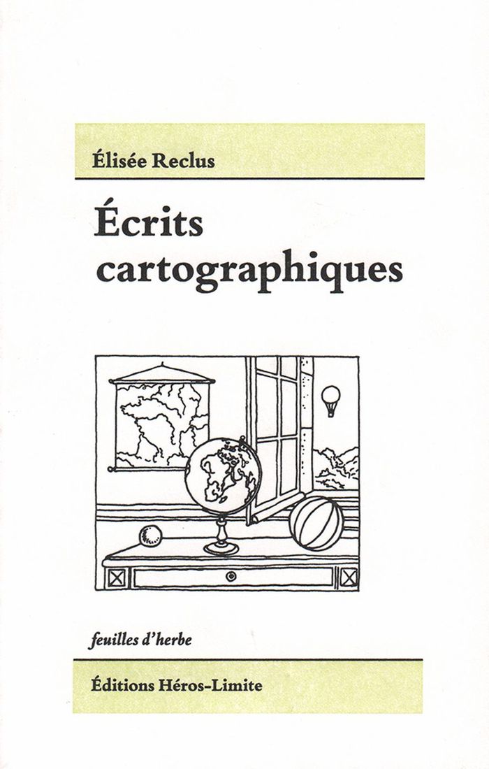
Écrits cartographiques
Écrits cartographiques
Actions:
Prix:
$22.95
(disponible sur commande)
Résumé:
'Écrits cartographiques' rassemble les écrits cartographiques majeurs, pour une part inédits, d’Élisée Reclus et de ses proches collaborateurs, Paul Reclus, Charles Perron et Franz Schrader. Aujourd’hui, plus que jamais, nous avons besoin d’une cartographie capable de donner à sentir et percevoir l’unité terrestre, en son tout et en ses parties. Les objets (globes,(...)
Titre:
Écrits cartographiques
Actions:
Prix:
$22.95
(disponible sur commande)
Résumé:
'Écrits cartographiques' rassemble les écrits cartographiques majeurs, pour une part inédits, d’Élisée Reclus et de ses proches collaborateurs, Paul Reclus, Charles Perron et Franz Schrader. Aujourd’hui, plus que jamais, nous avons besoin d’une cartographie capable de donner à sentir et percevoir l’unité terrestre, en son tout et en ses parties. Les objets (globes, cartes, reliefs) conçus et imaginés par Reclus et ses proches l’ont été dans ce but.
Classification:
livres
livres
Publication:
janvier 2016
janvier 2016
Classification:
livres
livres
Actions:
Description:
1 online resource
Auteur:
- Van Isacker, Travis,,
- Michel, Stanislas,,
- Anderson, Bridget,,
- Milivojevic, Sanja,,
- Heller, Charles,,
- Le Viavant, Mathilde,,
- Alexandroff, Nico,,
- Kretzschmar, Jelka,,
- Library Stack,
Sujet:
- Space (Architecture),
- Border security.,
- Cartography.,
- Drone aircraft.,
- Remote-sensing images.,
- Violence.,
- Espace (Architecture),
- Sécurité frontalière.,
- Cartographie.,
- Images-satellite.,
- cartography (discipline),
- violence.,
- Creative Nonfiction.,
- Records (Documents),
- Criticism, interpretation, etc.
Publication:
[Place of publication not identified] : Border Forensics, 2026.
[Place of publication not identified] : Border Forensics, 2026.
Classification:
livres
livres
Publication:
[Place of publication not identified] : Border Forensics, 2026.
[Place of publication not identified] : Border Forensics, 2026.
Auteur:
- Van Isacker, Travis,,
- Michel, Stanislas,,
- Anderson, Bridget,,
- Milivojevic, Sanja,,
- Heller, Charles,,
- Le Viavant, Mathilde,,
- Alexandroff, Nico,,
- Kretzschmar, Jelka,,
- Library Stack,
Sujet:
- Space (Architecture),
- Border security.,
- Cartography.,
- Drone aircraft.,
- Remote-sensing images.,
- Violence.,
- Espace (Architecture),
- Sécurité frontalière.,
- Cartographie.,
- Images-satellite.,
- cartography (discipline),
- violence.,
- Creative Nonfiction.,
- Records (Documents),
- Criticism, interpretation, etc.
Classification:
livres
livres
Actions:
Exemplaires:
Description:
255 pages : illustrations (chiefly color) ; 24 x 26 cm
Description:
255 pages : illustrations (chiefly color) ; 24 x 26 cm
Auteur:
Sujet:
- Ruscha, Edward, 1937-,
- Schnabel, Julian, 1951-,
- Eliasson, Olafur, 1967-,
- Kentridge, William, 1955-,
- Muniz, Vik, 1961-,
- Maps in art Exhibitions.,
- Cartography in art Exhibitions.,
- Cartes géographiques dans l'art Expositions.,
- Cartographie dans l'art Expositions.,
- Art and Design.,
- Cartography in art,
- Maps in art,
- Kartografie,
- Kunst,
- Kartor i konsten utställningskataloger.,
- Maps,
- Contemporary art,
- Cartography,
- Modern art,
- exhibition catalogs.,
- Exhibition catalogs,
- Catalogues d'exposition.
Publication:
New York, New York : Princeton Architectural Press, 2009.
New York, New York : Princeton Architectural Press, 2009.
Titre:
The map as art : contemporary artists explore cartography / Katharine Harmon ; with essays by Gayle Clemans.
Actions:
Exemplaires:
Description:
255 pages : illustrations (chiefly color) ; 24 x 26 cm
The map as art : contemporary artists explore cartography / Katharine Harmon ; with essays by Gayle Clemans.
Actions:
Exemplaires:
Description:
255 pages : illustrations (chiefly color) ; 24 x 26 cm
Classification:
livres
livres
Publication:
New York, New York : Princeton Architectural Press, 2009.
New York, New York : Princeton Architectural Press, 2009.
Auteur:
Sujet:
- Ruscha, Edward, 1937-,
- Schnabel, Julian, 1951-,
- Eliasson, Olafur, 1967-,
- Kentridge, William, 1955-,
- Muniz, Vik, 1961-,
- Maps in art Exhibitions.,
- Cartography in art Exhibitions.,
- Cartes géographiques dans l'art Expositions.,
- Cartographie dans l'art Expositions.,
- Art and Design.,
- Cartography in art,
- Maps in art,
- Kartografie,
- Kunst,
- Kartor i konsten utställningskataloger.,
- Maps,
- Contemporary art,
- Cartography,
- Modern art,
- exhibition catalogs.,
- Exhibition catalogs,
- Catalogues d'exposition.
Classification:
livres
livres
Actions:
Exemplaires:
Description:
xii, 378 pages : illustrations ; 24 cm
Description:
xii, 378 pages : illustrations ; 24 cm
Auteur:
Sujet:
- City planning Tanzania Zanzibar History.,
- Sociology, Urban Tanzania Zanzibar History.,
- Sociologie urbaine Tanzanie Zanzibar Histoire.,
- British colonies.,
- City planning.,
- Sociology, Urban.,
- Kolonialstadt,
- Stadtplanung,
- Städtebau,
- Zanzibar History.,
- Great Britain Colonies Africa History.,
- Zanzibar Histoire.,
- Grande-Bretagne Colonies Afrique Histoire.,
- Africa.,
- Tanzania Zanzibar.,
- Sansibar,
- History.
Publication:
Bloomington : Indiana University Press, ©2011.
Bloomington : Indiana University Press, ©2011.
Titre:
Urban design, chaos, and colonial power in Zanzibar / William Cunningham Bissell.
Actions:
Exemplaires:
Description:
xii, 378 pages : illustrations ; 24 cm
Urban design, chaos, and colonial power in Zanzibar / William Cunningham Bissell.
Actions:
Exemplaires:
Description:
xii, 378 pages : illustrations ; 24 cm
Classification:
livres
livres
Publication:
Bloomington : Indiana University Press, ©2011.
Bloomington : Indiana University Press, ©2011.
Auteur:
Sujet:
- City planning Tanzania Zanzibar History.,
- Sociology, Urban Tanzania Zanzibar History.,
- Sociologie urbaine Tanzanie Zanzibar Histoire.,
- British colonies.,
- City planning.,
- Sociology, Urban.,
- Kolonialstadt,
- Stadtplanung,
- Städtebau,
- Zanzibar History.,
- Great Britain Colonies Africa History.,
- Zanzibar Histoire.,
- Grande-Bretagne Colonies Afrique Histoire.,
- Africa.,
- Tanzania Zanzibar.,
- Sansibar,
- History.