771 Résultats
Classification:
livres
livres
Actions:
Exemplaires:
Description:
608 pages : illustrations (some color) ; 24 cm
Description:
608 pages : illustrations (some color) ; 24 cm
Auteur:
- Vishmidt, Marina, 1976-,
- Grojs, Boris, 1947-,
- Metahaven (Design studio),
- Jan van Eyck Akademie.
Sujet:
- Industrial design Europe.,
- Corporate image Europe.,
- Design Europe.,
- Entreprises Image Europe.,
- Corporate image,
- Industrial design,
- Varumärken.,
- Europe,
- Metahaven
Publication:
Baden : Lars Müller ; Maastricht : Jan van Eyck Academie, ©2010.
Baden : Lars Müller ; Maastricht : Jan van Eyck Academie, ©2010.
Titre:
Uncorporate identity / ed. by Metahaven & Marina Vishmidt ; contributions by Boris Groys [and others].
Actions:
Exemplaires:
Description:
608 pages : illustrations (some color) ; 24 cm
Uncorporate identity / ed. by Metahaven & Marina Vishmidt ; contributions by Boris Groys [and others].
Actions:
Exemplaires:
Description:
608 pages : illustrations (some color) ; 24 cm
Classification:
livres
livres
Publication:
Baden : Lars Müller ; Maastricht : Jan van Eyck Academie, ©2010.
Baden : Lars Müller ; Maastricht : Jan van Eyck Academie, ©2010.
Auteur:
- Vishmidt, Marina, 1976-,
- Grojs, Boris, 1947-,
- Metahaven (Design studio),
- Jan van Eyck Akademie.
Sujet:
- Industrial design Europe.,
- Corporate image Europe.,
- Design Europe.,
- Entreprises Image Europe.,
- Corporate image,
- Industrial design,
- Varumärken.,
- Europe,
- Metahaven
Classification:
livres
livres
Titre:
They left their mark : surveyors and their role in the settlement of Ontario / John L. Ladell.
They left their mark : surveyors and their role in the settlement of Ontario / John L. Ladell.
Actions:
Exemplaires:
Description:
312 pages : illustrations, maps, portraits ; 23 x 29 cm
- Bibliothèque main canada 119020 | ID TA523.O5 L3 CAN; ID:95-B1745 | Disponible
Description:
312 pages : illustrations, maps, portraits ; 23 x 29 cm
Auteur:
Sujet:
- Surveyors Ontario History.,
- Surveying Ontario History.,
- Géomètres Ontario Histoire.,
- Arpentage Ontario Histoire.,
- Surveying and mapping coverage. [Literature].,
- History of cartography. [Literature].,
- Surveying.,
- Surveyors.,
- Surveys.,
- Ontario Surveys History.,
- Ontario Levés Histoire.,
- Ontario (Province) [Literature] 1993.,
- Ontario (Province) Land settlement. [Literature] 1993.,
- Ontario.,
- Canada, Ontario Land and property.,
- Canada, Ontario Historical geography.,
- Canada, Ontario Occupations.,
- Surveying History,
- History.
Publication:
Toronto : Dundurn Press, 1993.
Toronto : Dundurn Press, 1993.
Titre:
They left their mark : surveyors and their role in the settlement of Ontario / John L. Ladell.
Actions:
Exemplaires:
Description:
312 pages : illustrations, maps, portraits ; 23 x 29 cm
They left their mark : surveyors and their role in the settlement of Ontario / John L. Ladell.
Actions:
Exemplaires:
- Bibliothèque main canada 119020 | ID TA523.O5 L3 CAN; ID:95-B1745 | Disponible
Description:
312 pages : illustrations, maps, portraits ; 23 x 29 cm
Classification:
livres
livres
Publication:
Toronto : Dundurn Press, 1993.
Toronto : Dundurn Press, 1993.
Auteur:
Sujet:
- Surveyors Ontario History.,
- Surveying Ontario History.,
- Géomètres Ontario Histoire.,
- Arpentage Ontario Histoire.,
- Surveying and mapping coverage. [Literature].,
- History of cartography. [Literature].,
- Surveying.,
- Surveyors.,
- Surveys.,
- Ontario Surveys History.,
- Ontario Levés Histoire.,
- Ontario (Province) [Literature] 1993.,
- Ontario (Province) Land settlement. [Literature] 1993.,
- Ontario.,
- Canada, Ontario Land and property.,
- Canada, Ontario Historical geography.,
- Canada, Ontario Occupations.,
- Surveying History,
- History.
Classification:
audio
audio
Actions:
Description:
1 online resource.
Auteur:
Sujet:
Publication:
[Place of publication not identified] : Critical Design Lab, 2020.
[Place of publication not identified] : Critical Design Lab, 2020.
Classification:
audio
audio
Publication:
[Place of publication not identified] : Critical Design Lab, 2020.
[Place of publication not identified] : Critical Design Lab, 2020.
Auteur:
Sujet:
Classification:
livres
livres

Titre:
Mapping tourism
Mapping tourism
Actions:
Prix:
$24.95
(disponible sur commande)
Résumé:
At first glance, the relationships among tourists, tourism maps, and the spaces of tourism seem straightforward enough: tourists use maps to find their way to and through the sites of history, culture, nature, or recreation represented there. Less apparent is how tourism maps and those using them construct such spaces and identities. As the essays in "Mapping Tourism"(...)
Sujet:
Théorie de l’urbanisme
Théorie de l’urbanisme
Publication:
avril 2003, Minneapolis
avril 2003, Minneapolis
Titre:
Mapping tourism
Actions:
Prix:
$24.95
(disponible sur commande)
Résumé:
At first glance, the relationships among tourists, tourism maps, and the spaces of tourism seem straightforward enough: tourists use maps to find their way to and through the sites of history, culture, nature, or recreation represented there. Less apparent is how tourism maps and those using them construct such spaces and identities. As the essays in "Mapping Tourism" clearly demonstrate, the extraordinary interactions of work with leisure and the everyday with the exotic make tourism maps ideal sites for exploring the contested construction of place and identity. Construction sites in the "New Berlin," Alabama's civil rights trail, Québec City, a California ghost town, and Bangkok's sex trade are among the spaces the essays examine. Taken together, these essays allow us to see tourist space as it truly is: contested, ever changing, and replete with issues of power.
Classification:
livres
livres
Publication:
avril 2003, Minneapolis
avril 2003, Minneapolis
Sujet:
Théorie de l’urbanisme
Théorie de l’urbanisme
Classification:
livres
livres
Actions:
Sujet:
- Architectural criticism,
- Architecture,
- Cartography,
- Cosmology,
- Cybernetics,
- Ecology,
- Film criticism,
- Earth sciences,
- Natural Resources,
- Text
Publication:
The Avery Review 2016
The Avery Review 2016
Classification:
livres
livres
Publication:
The Avery Review 2016
The Avery Review 2016
Sujet:
- Architectural criticism,
- Architecture,
- Cartography,
- Cosmology,
- Cybernetics,
- Ecology,
- Film criticism,
- Earth sciences,
- Natural Resources,
- Text
Classification:
livres
livres
Actions:
Exemplaires:
Description:
xx, 151 pages : illustrations, maps ; 24 cm
- Bibliothèque main 216133 | DA683 .A76 2000 | Disponible
- Bibliothèque main 216132 | DA683 .A76 2000 | Disponible
Description:
xx, 151 pages : illustrations, maps ; 24 cm
Auteur:
Sujet:
- City and town life England London History 19th century.,
- City planning England London History 19th century.,
- Architecture England London History.,
- Vie urbaine Angleterre Londres Histoire 19e siècle.,
- Architecture Angleterre Londres Histoire.,
- Architecture.,
- City and town life.,
- City planning.,
- Manners and customs.,
- Stadtleben,
- Städtebau,
- Bouwkunst.,
- Stadscultuur.,
- City planning Great Britain History 19th century.,
- Architecture England London 19th century.,
- London (England) Social life and customs 19th century.,
- London (England) History 19th century.,
- Londres (Angleterre) Mœurs et coutumes 19e siècle.,
- England London.,
- London,
- London (England) City planning 19th century.,
- History.
Publication:
Aldershot, Hants ; Burlington, Vt. : Ashgate, ©2000.
Aldershot, Hants ; Burlington, Vt. : Ashgate, ©2000.
Titre:
Re-presenting the metropolis : architecture, urban experience, and social life in London, 1800-1840 / Dana Arnold.
Actions:
Exemplaires:
Description:
xx, 151 pages : illustrations, maps ; 24 cm
Re-presenting the metropolis : architecture, urban experience, and social life in London, 1800-1840 / Dana Arnold.
Actions:
Exemplaires:
- Bibliothèque main 216133 | DA683 .A76 2000 | Disponible
- Bibliothèque main 216132 | DA683 .A76 2000 | Disponible
Description:
xx, 151 pages : illustrations, maps ; 24 cm
Classification:
livres
livres
Publication:
Aldershot, Hants ; Burlington, Vt. : Ashgate, ©2000.
Aldershot, Hants ; Burlington, Vt. : Ashgate, ©2000.
Auteur:
Sujet:
- City and town life England London History 19th century.,
- City planning England London History 19th century.,
- Architecture England London History.,
- Vie urbaine Angleterre Londres Histoire 19e siècle.,
- Architecture Angleterre Londres Histoire.,
- Architecture.,
- City and town life.,
- City planning.,
- Manners and customs.,
- Stadtleben,
- Städtebau,
- Bouwkunst.,
- Stadscultuur.,
- City planning Great Britain History 19th century.,
- Architecture England London 19th century.,
- London (England) Social life and customs 19th century.,
- London (England) History 19th century.,
- Londres (Angleterre) Mœurs et coutumes 19e siècle.,
- England London.,
- London,
- London (England) City planning 19th century.,
- History.
Classification:
livres
livres
Actions:
Exemplaires:
Description:
xix, 517 pages : illustrations, maps, plans ; 24 cm
Description:
xix, 517 pages : illustrations, maps, plans ; 24 cm
Auteur:
- International Association for People-Environment Studies. Conference (13th : 1994 : Manchester, England),
- Martin S. Symes -- Ilhan Tekeli -- Lucien Kroll -- Roderick Lawrence and Claude Raffestin -- Osuade Oyediran -- Vacit Imamoglu -- Aytanga Dener -- Maria Cristina Dias Lay and Antonio Tarcisio da Luz Reis -- Cristiane Rose de Siqueira Duarte -- Henry Sanoff -- Philip J. Hubbard -- David Doughty and Wolf Zwirner -- Arthur E. Stamps III -- Gilles Barbey -- Maria Montero y Lopez Lena and Alejandro Muniz Campos -- Susan J. Neary -- Anne Vernez Moudon and Marion Ryan -- Ruth A. Rae -- Barry Jackson -- Zuhal Ulusoy -- Andreas Cebulla -- Cecilia Wong -- Vesselina Troeva -- Nazan Aydin-Wheater and Gaye Culcuoglu -- Leanne G. Rivlin -- J. F. Coeterier -- Mirilia Bonnes, Antonio Aiello and Rita Grazia Ardone -- Mats Lieberg -- Marino Bonaiuto, Mirilia Bonnes and Anna Rita Mazzotta -- Yoshiki Nakamura, Kiwamu Maki and Masao Inui -- Frank E. Brown -- Peter Dickens -- John Zacharias -- Gary W. Evans, Stephen J. Lepore and Alex Schroeder -- R. J. Lamb, A. T. Purcell, E. Mainardi Peron and S. Falchero -- Svetlana E. Gabidulina -- Ryuzo Ohno and Miki Kondo -- Joachim Wolschke-Buhlman and Gert Groening -- Gert Groening and Uwe Schneider -- Swati Chattopadhyay -- Mervyn Busteed and Rob Hodgson -- Helen B. Armstrong -- Annick Germain, Bernadette Blanc, Johanne Charbonneau and Francine Dansereau -- Edwin Brierley -- Joost van Andel.,
- Neary, S. J. (Susan J.),
- Symes, Martin.,
- Brown, F. E. (Frank E.)
Sujet:
- Cities and towns Congresses.,
- City planning Congresses.,
- Housing Congresses.,
- Urban renewal Congresses.,
- Villes Congrès.,
- Design urbain Congrès.,
- Logement Congrès.,
- Rénovation urbaine Congrès.,
- Écologie urbaine Congrès.,
- Cities and towns,
- City planning,
- Housing,
- Urban renewal,
- Stadsgeografie.,
- Stadsplanning.,
- Cities,
- Congresses.,
- Proceedings.,
- Conference papers and proceedings
Publication:
London : E & FN Spon, 1994.
London : E & FN Spon, 1994.
Titre:
The urban experience : a people environment perspective : proceedings of the 13th conference of the International Association for People - Environment Studies held on 13-15 July 1994 / edited by S.J. Neary, M.S. Symes and F.E. Brown.
Actions:
Exemplaires:
Description:
xix, 517 pages : illustrations, maps, plans ; 24 cm
Classification:
livres
livres
Publication:
London : E & FN Spon, 1994.
London : E & FN Spon, 1994.
Auteur:
- International Association for People-Environment Studies. Conference (13th : 1994 : Manchester, England),
- Martin S. Symes -- Ilhan Tekeli -- Lucien Kroll -- Roderick Lawrence and Claude Raffestin -- Osuade Oyediran -- Vacit Imamoglu -- Aytanga Dener -- Maria Cristina Dias Lay and Antonio Tarcisio da Luz Reis -- Cristiane Rose de Siqueira Duarte -- Henry Sanoff -- Philip J. Hubbard -- David Doughty and Wolf Zwirner -- Arthur E. Stamps III -- Gilles Barbey -- Maria Montero y Lopez Lena and Alejandro Muniz Campos -- Susan J. Neary -- Anne Vernez Moudon and Marion Ryan -- Ruth A. Rae -- Barry Jackson -- Zuhal Ulusoy -- Andreas Cebulla -- Cecilia Wong -- Vesselina Troeva -- Nazan Aydin-Wheater and Gaye Culcuoglu -- Leanne G. Rivlin -- J. F. Coeterier -- Mirilia Bonnes, Antonio Aiello and Rita Grazia Ardone -- Mats Lieberg -- Marino Bonaiuto, Mirilia Bonnes and Anna Rita Mazzotta -- Yoshiki Nakamura, Kiwamu Maki and Masao Inui -- Frank E. Brown -- Peter Dickens -- John Zacharias -- Gary W. Evans, Stephen J. Lepore and Alex Schroeder -- R. J. Lamb, A. T. Purcell, E. Mainardi Peron and S. Falchero -- Svetlana E. Gabidulina -- Ryuzo Ohno and Miki Kondo -- Joachim Wolschke-Buhlman and Gert Groening -- Gert Groening and Uwe Schneider -- Swati Chattopadhyay -- Mervyn Busteed and Rob Hodgson -- Helen B. Armstrong -- Annick Germain, Bernadette Blanc, Johanne Charbonneau and Francine Dansereau -- Edwin Brierley -- Joost van Andel.,
- Neary, S. J. (Susan J.),
- Symes, Martin.,
- Brown, F. E. (Frank E.)
Sujet:
- Cities and towns Congresses.,
- City planning Congresses.,
- Housing Congresses.,
- Urban renewal Congresses.,
- Villes Congrès.,
- Design urbain Congrès.,
- Logement Congrès.,
- Rénovation urbaine Congrès.,
- Écologie urbaine Congrès.,
- Cities and towns,
- City planning,
- Housing,
- Urban renewal,
- Stadsgeografie.,
- Stadsplanning.,
- Cities,
- Congresses.,
- Proceedings.,
- Conference papers and proceedings
Classification:
livres
livres
Actions:
Prix:
$29.95
(disponible sur commande)
Résumé:
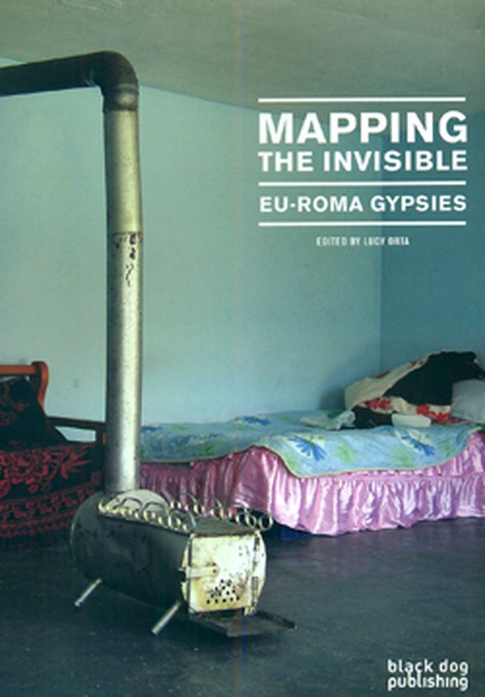
Mapping the Invisible: EU-Roma Gypsies takes the reader on a visual journey across Europe with a focus on its fastest-growing ethnic minority: the Roma. This publication is the result of a unique partnership called EU-ROMA formed by a group of architects, designers and artists wishing to raise awareness to the diversity and richness of the Roma people. The book shows us(...)
$29.95
(disponible sur commande)
Résumé:
Mapping the Invisible: EU-Roma Gypsies takes the reader on a visual journey across Europe with a focus on its fastest-growing ethnic minority: the Roma. This publication is the result of a unique partnership called EU-ROMA formed by a group of architects, designers and artists wishing to raise awareness to the diversity and richness of the Roma people. The book shows us(...)
Titre:
Mapping the invisible: EU Roma gypsies
Actions:
Prix:
$29.95
(disponible sur commande)
Résumé:
Mapping the Invisible: EU-Roma Gypsies takes the reader on a visual journey across Europe with a focus on its fastest-growing ethnic minority: the Roma. This publication is the result of a unique partnership called EU-ROMA formed by a group of architects, designers and artists wishing to raise awareness to the diversity and richness of the Roma people. The book shows us the EU-ROMA projects conducted together with the gypsy communities in Romania, Greece, Italy and the UK.
Classification:
livres
livres
Publication:
août 2010
août 2010
Sujet:
Monographies photo
Monographies photo
Classification:
livres
livres
Actions:
Exemplaires:
Description:
xliv, 461 pages ; 27 cm.
Description:
xliv, 461 pages ; 27 cm.
Auteur:
Sujet:
- Architecture and society.,
- Architects and community.,
- Architecture et société.,
- Relations architectes-collectivité.
Publication:
New York, NY : Routledge, 2018., ©2018
New York, NY : Routledge, 2018., ©2018
Titre:
The Routledge companion to architecture and social engagement / edited by Farhan Karim.
Actions:
Exemplaires:
Description:
xliv, 461 pages ; 27 cm.
The Routledge companion to architecture and social engagement / edited by Farhan Karim.
Actions:
Exemplaires:
Description:
xliv, 461 pages ; 27 cm.
Classification:
livres
livres
Publication:
New York, NY : Routledge, 2018., ©2018
New York, NY : Routledge, 2018., ©2018
Auteur:
Sujet:
- Architecture and society.,
- Architects and community.,
- Architecture et société.,
- Relations architectes-collectivité.
Classification:
livres
livres

Titre:
Mapping Manhattan
Mapping Manhattan
Actions:
Prix:
$21.95
(disponible sur commande)
Résumé:
Armed with hundreds of blank maps she had printed by hand, Becky Cooper walked Manhattan from end to end. She asked the strangers to “map their Manhattan” and to mail the personalized maps back to her. Soon, her P.O. box was filled with a cartography of intimate narratives: past loves, lost homes, childhood memories, comical moments, and surprising confessions.
Titre:
Mapping Manhattan
Actions:
Prix:
$21.95
(disponible sur commande)
Résumé:
Armed with hundreds of blank maps she had printed by hand, Becky Cooper walked Manhattan from end to end. She asked the strangers to “map their Manhattan” and to mail the personalized maps back to her. Soon, her P.O. box was filled with a cartography of intimate narratives: past loves, lost homes, childhood memories, comical moments, and surprising confessions.
Classification:
livres
livres
Publication:
avril 2013
avril 2013