705 Résultats
Classification:
livres
livres
Actions:
Prix:
$63.95
(disponible sur commande)
Résumé:
Instructive, amusing, colorful—pictorial maps have been used and admired since the first medieval cartographer put pen to paper depicting mountains and trees across countries, people and objects around margins, and sea monsters in oceans. More recent generations of pictorial map artists have continued that traditional mixture of whimsy and fact, combining cartographic(...)
Titre:
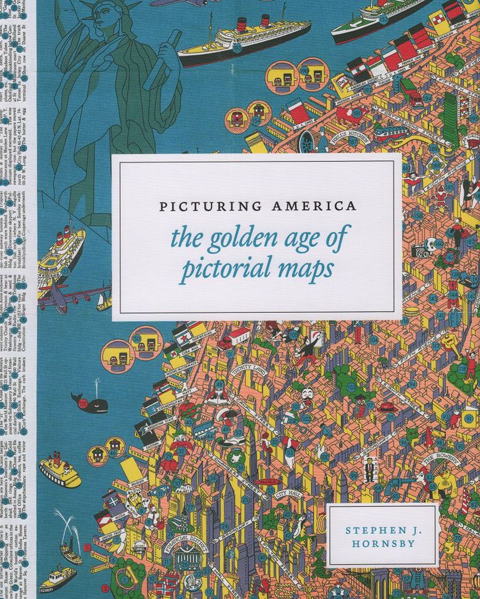
Picturing America: the golden age of pictorial maps
Actions:
Prix:
$63.95
(disponible sur commande)
Résumé:
Instructive, amusing, colorful—pictorial maps have been used and admired since the first medieval cartographer put pen to paper depicting mountains and trees across countries, people and objects around margins, and sea monsters in oceans. More recent generations of pictorial map artists have continued that traditional mixture of whimsy and fact, combining cartographic elements with text and images and featuring bold and arresting designs, bright and cheerful colors, and lively detail. In the United States, the art form flourished from the 1920s through the 1970s, when thousands of innovative maps were mass-produced for use as advertisements and decorative objects—the golden age of American pictorial maps. "Picturing America" is the first book to showcase this vivid and popular genre of maps. Geographer Stephen J. Hornsby gathers together 158 delightful pictorial jewels, most drawn from the extensive collections of the Library of Congress. In his informative introduction, Hornsby outlines the development of the cartographic form, identifies several representative artists, describes the process of creating a pictorial map, and considers the significance of the form in the history of Western cartography. Organized into six thematic sections, "Picturing America" covers a vast swath of the pictorial map tradition during its golden age, ranging from “Maps to Amuse” to “Maps for War.” Hornsby has unearthed the most fascinating and visually striking maps the United States has to offer: Disney cartoon maps, college campus maps, kooky state tourism ads, World War II promotional posters, and many more.
Classification:
livres
livres
Publication:
mars 2017
mars 2017
Classification:
livres
livres
Titre:
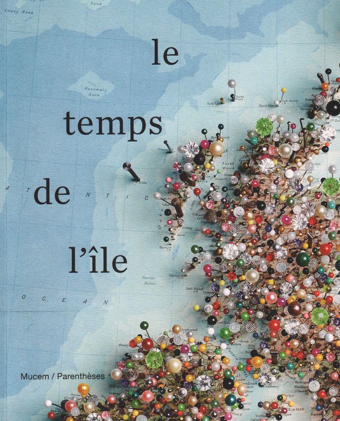
Le temps de l'île
Le temps de l'île
Actions:
Prix:
$67.95
(disponible sur commande)
Résumé:
Hommage aux îles dans les arts. En tant que lieu périphérique et marginal figurant l'autre et l'ailleurs, l'espace îlien interroge les savoirs, les sociétés, la philosophie, le cinéma, la poésie ou encore la politique.
$67.95
(disponible sur commande)
Résumé:
Hommage aux îles dans les arts. En tant que lieu périphérique et marginal figurant l'autre et l'ailleurs, l'espace îlien interroge les savoirs, les sociétés, la philosophie, le cinéma, la poésie ou encore la politique.
Publication:
août 2019
août 2019
Titre:
Le temps de l'île
Actions:
Prix:
$67.95
(disponible sur commande)
Résumé:
Hommage aux îles dans les arts. En tant que lieu périphérique et marginal figurant l'autre et l'ailleurs, l'espace îlien interroge les savoirs, les sociétés, la philosophie, le cinéma, la poésie ou encore la politique.
Le temps de l'île
Actions:
Prix:
$67.95
(disponible sur commande)
Résumé:
Hommage aux îles dans les arts. En tant que lieu périphérique et marginal figurant l'autre et l'ailleurs, l'espace îlien interroge les savoirs, les sociétés, la philosophie, le cinéma, la poésie ou encore la politique.
Classification:
livres
livres
Publication:
août 2019
août 2019
Classification:
livres
livres
Actions:
Prix:
$131.00
(disponible sur commande)
Résumé:
In the late nineteenth century, Charles Booth’s landmark social and economic survey found that 35 percent of Londoners were living in abject poverty. Booth’s team of social investigators interviewed Londoners from all walks of life, recording their comments, together with their own unrestrained remarks and statistical information, in 450 notebooks. Their findings formed(...)
Publication:
novembre 2019
novembre 2019
Titre:
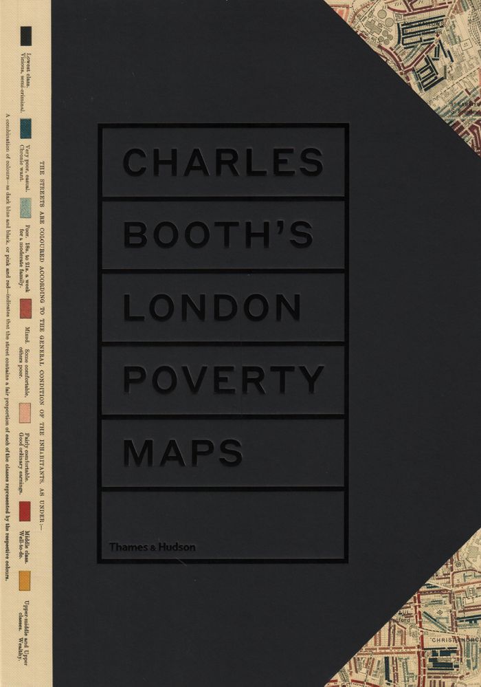
Charles Booth's London poverty maps: a landmark reasessment of Booth's social survey
Actions:
Prix:
$131.00
(disponible sur commande)
Résumé:
In the late nineteenth century, Charles Booth’s landmark social and economic survey found that 35 percent of Londoners were living in abject poverty. Booth’s team of social investigators interviewed Londoners from all walks of life, recording their comments, together with their own unrestrained remarks and statistical information, in 450 notebooks. Their findings formed the basis of Booth’s colour-coded social mapping (from vicious and semi-criminal to wealthy) and his seventeen-volume survey "Inquiry into the Life and Labour of the People of London, 1886–1903". Organized into six geographical sections, "Charles Booth’s London poverty map"s presents the hand-coloured preparatory and printed social mapping of London. Accompanying the maps are reproductions of pages from the original notebooks, containing anecdotes and observations too judgmental for Booth to include in his final published survey. An introduction by professor Mary S. Morgan clarifies the aims and methodology of Booth’s survey and six themed essays contextualize the the survey’s findings, accompanied by evocative period photographs.
Classification:
livres
livres
Publication:
novembre 2019
novembre 2019
Classification:
livres
livres
Titre:
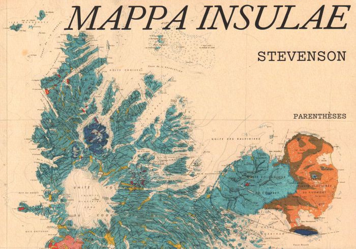
Mappa insulae
Mappa insulae
Actions:
Prix:
$35.95
(disponible sur commande)
Résumé:
Dans l'univers sans fin des cartes, les cartes d'îles possèdent un charme tout particulier. Les deux mondes, des cartes et des îles, s'y croisent, laissant émerger des formes riches et colorées. Cinq artistes, collectionneurs, chercheurs ont formé le collectif Stevenson pour en explorer et en célébrer les beautés, les incongruités, les fantaisies autant que la précision(...)
Titre:
Mappa insulae
Actions:
Prix:
$35.95
(disponible sur commande)
Résumé:
Dans l'univers sans fin des cartes, les cartes d'îles possèdent un charme tout particulier. Les deux mondes, des cartes et des îles, s'y croisent, laissant émerger des formes riches et colorées. Cinq artistes, collectionneurs, chercheurs ont formé le collectif Stevenson pour en explorer et en célébrer les beautés, les incongruités, les fantaisies autant que la précision et la finesse. De la mise en commun de leurs trésors cartographiques chinés, dénichés, inhumés et patiemment amassés, est né Mappa insulae. Les îles s'y montrent parfois dans leur isolement absolu, cerclées d'une épaisseur bleue qui les sépare du reste du monde ; parfois en archipel, éparpillées "comme autant de pépins crachés dans l'eau" ; parfois encore simplement suggérées, récifs tapis sous des noms calligraphiés sur les flots. De carte en carte, d'île en île, de pensées en poèmes, nous voilà embarqués pour une traversée érudite et insolite.
Classification:
livres
livres
Publication:
septembre 2019
septembre 2019
Classification:
livres
livres
Actions:
Prix:
$100.00
(disponible sur commande)
Résumé:
In the past decade, Rebecca Solnit, Rebecca Snedeker, and Joshua Jelly-Schapiro—aided by local writers, artists, historians, urbanists, ethnographers, and cartographers—have compiled three atlases that have radically changed the way we think about place. Each atlas provides a vivid, complex look at the multi-faceted nature of a city—San Francisco, New Orleans, and New(...)
Titre:
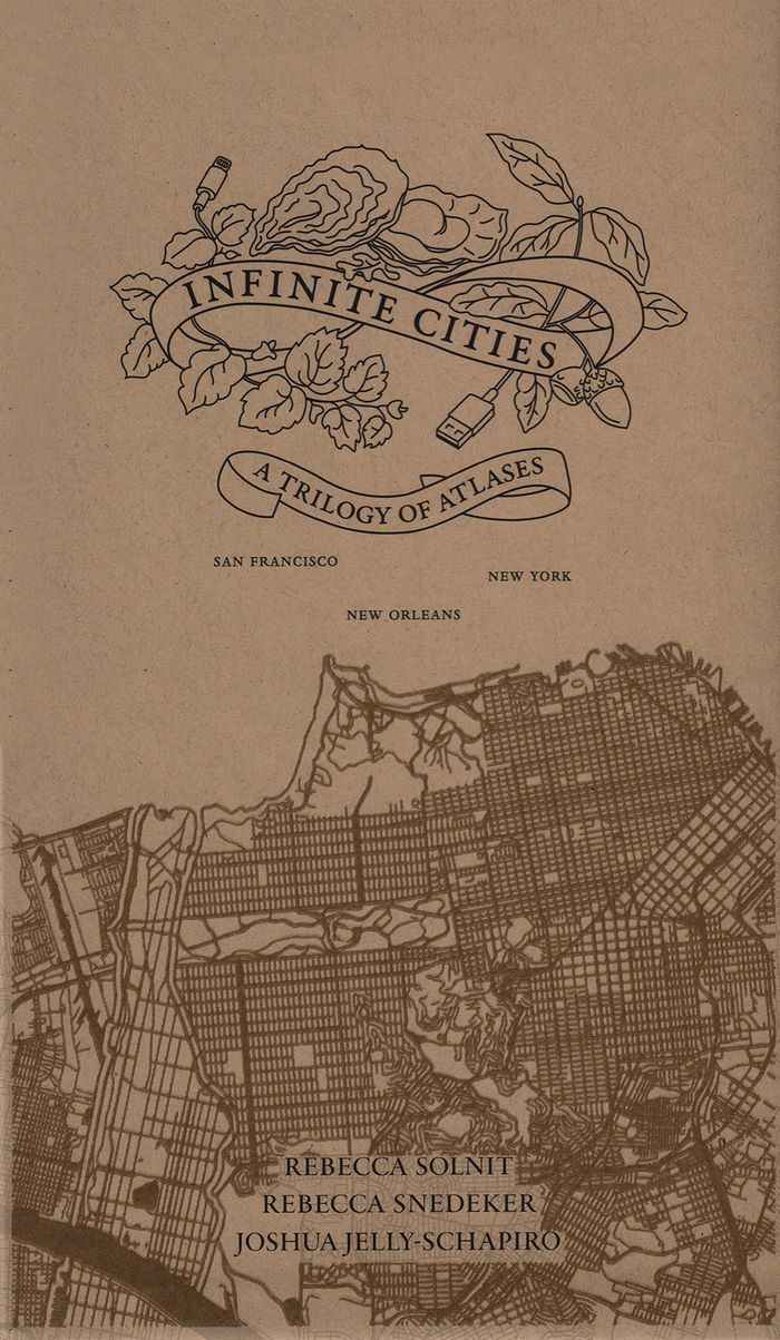
Inifinite cities: a trilogy of Atlases. San Francisco, New Orleans, New York
Actions:
Prix:
$100.00
(disponible sur commande)
Résumé:
In the past decade, Rebecca Solnit, Rebecca Snedeker, and Joshua Jelly-Schapiro—aided by local writers, artists, historians, urbanists, ethnographers, and cartographers—have compiled three atlases that have radically changed the way we think about place. Each atlas provides a vivid, complex look at the multi-faceted nature of a city—San Francisco, New Orleans, and New York—as experienced by its different inhabitants, replete with the celebrations and contradictions that make up urban life.
Classification:
livres
livres
Publication:
septembre 2019
septembre 2019
Classification:
livres
livres
Titre:
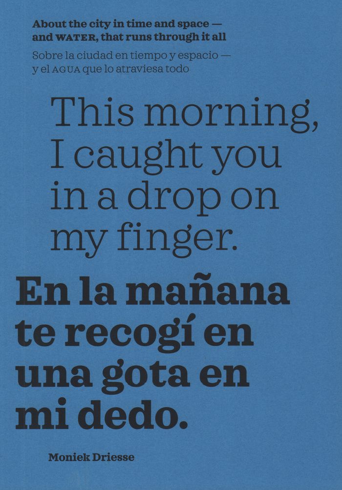
This morning, I caught you in a drop on my finger: about the city in time and space, and water
This morning, I caught you in a drop on my finger: about the city in time and space, and water
Actions:
Prix:
$39.95
(disponible sur commande)
Résumé:
Memories carried by water drench our biographies and shared history. In this book, edited and curated by Moniek Driesse, the past, present, and future imaginaries that govern our relationship with water are permitted to draw maps that can serve as tools for urban administrators, researchers, and citizens who live the reality determined by them. With this approach,(...)
Titre:
This morning, I caught you in a drop on my finger: about the city in time and space, and water
Actions:
Prix:
$39.95
(disponible sur commande)
Résumé:
Memories carried by water drench our biographies and shared history. In this book, edited and curated by Moniek Driesse, the past, present, and future imaginaries that govern our relationship with water are permitted to draw maps that can serve as tools for urban administrators, researchers, and citizens who live the reality determined by them. With this approach, long-term memories carried by the urban landscape reflect into possible narratives of hope for the future. The focus is on Mexico City, where rivers have turned into highways and subterranean basins are drying out, presenting new dangers to the city.
Classification:
livres
livres
Publication:
janvier 2020
janvier 2020
Classification:
livres
livres
Titre:
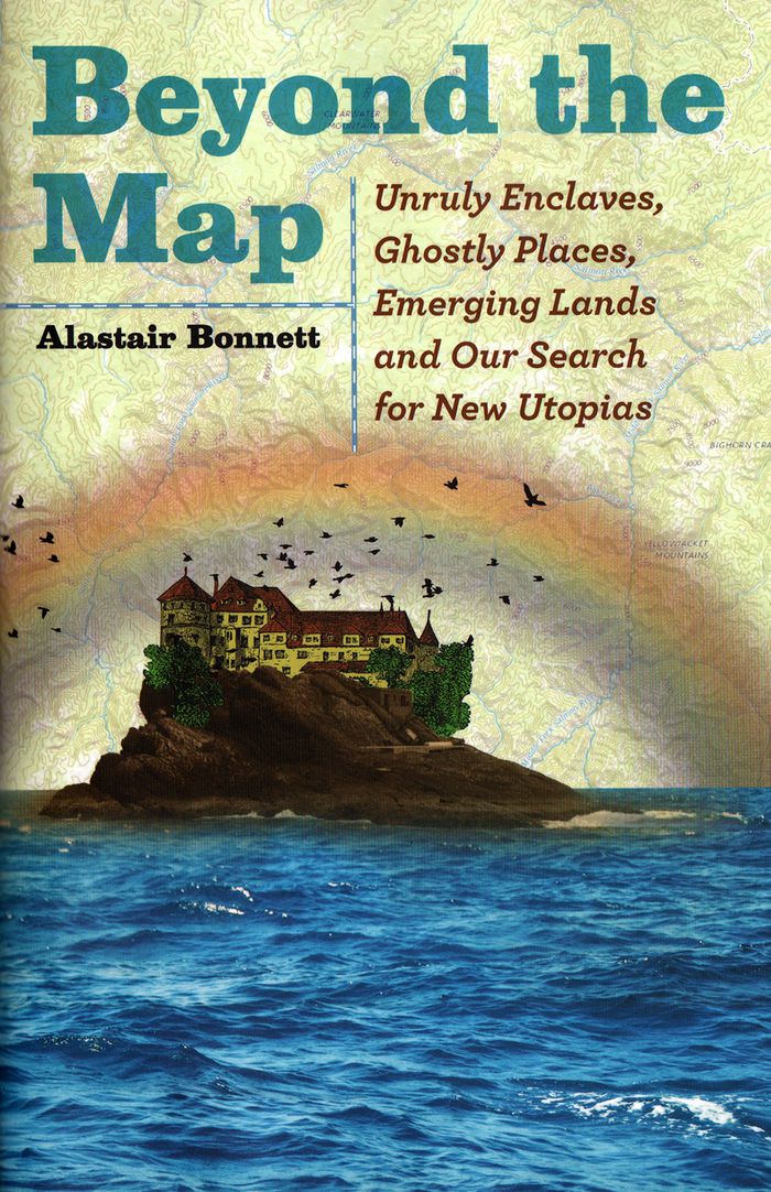
Beyond the map: unruly enclaves, ghostly places, emerging lands and our search for new utopias
Beyond the map: unruly enclaves, ghostly places, emerging lands and our search for new utopias
Actions:
Prix:
$34.50
(disponible sur commande)
Résumé:
In "Beyond the Map", Bonnett presents stories of the world’s most extraordinary spaces—many unmarked on any official map—all of which challenge our assumptions about what we know—or think we know—about our world. As cultural, religious and political boundaries ebb and flow with each passing day, traditional maps unravel and fragment. With the same adventurous spirit he(...)
Titre:
Beyond the map: unruly enclaves, ghostly places, emerging lands and our search for new utopias
Actions:
Prix:
$34.50
(disponible sur commande)
Résumé:
In "Beyond the Map", Bonnett presents stories of the world’s most extraordinary spaces—many unmarked on any official map—all of which challenge our assumptions about what we know—or think we know—about our world. As cultural, religious and political boundaries ebb and flow with each passing day, traditional maps unravel and fragment. With the same adventurous spirit he effused in the acclaimed Unruly Places, Bonnett takes us to thirty-nine incredible spots around the globe to explore these changing boundaries and stimulate our geographical imagination. Some are tied to disruptive contemporary political turbulence, such as the rise of ISIL, Russia’s incursions into Ukraine and the Brexit vote in the United Kingdom. Others explore the secret places not shown on Google Earth or reflect fast-changing landscapes.
Classification:
livres
livres
Publication:
avril 2018
avril 2018
Classification:
livres
livres
Actions:
Prix:
$30.00
(disponible sur commande)
Résumé:
First published in 1991, "How to Lie with Maps" revealed how the choices mapmakers make—consciously or unconsciously—mean that every map inevitably presents only one of many possible stories about the places it depicts. Fully updated for the digital age, this new edition examines the myriad ways that technology offers new opportunities for cartographic mischief,(...)
Titre:
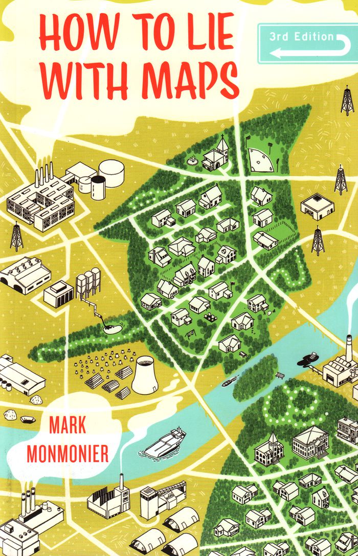
How to lie with maps, 3rd edition
Actions:
Prix:
$30.00
(disponible sur commande)
Résumé:
First published in 1991, "How to Lie with Maps" revealed how the choices mapmakers make—consciously or unconsciously—mean that every map inevitably presents only one of many possible stories about the places it depicts. Fully updated for the digital age, this new edition examines the myriad ways that technology offers new opportunities for cartographic mischief, deception, and propaganda. While retaining the same brevity, range, and humor as its predecessors, this third edition includes significant updates throughout as well as new chapters on image maps, prohibitive cartography, and online maps. It also includes an expanded section of color images and an updated list of sources for further reading.
Classification:
livres
livres
Publication:
avril 2018
avril 2018
Classification:
livres
livres
Actions:
Prix:
$35.95
(disponible sur commande)
Résumé:
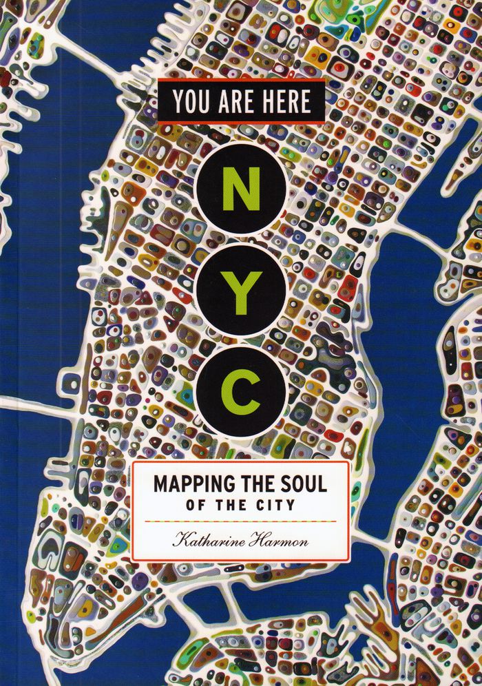
Maps are magical. Every graphic, like every story, has a point of view, and New York is rife with mapmaking possibilities, thick with mythology, and glutted with history. "You are here: NYC" assembles some two hundred maps charting every inch and facet of the five boroughs, depicting New Yorks of past and present, and a city that never was. "A nightclub map of Harlem"(...)
$35.95
(disponible sur commande)
Résumé:
Maps are magical. Every graphic, like every story, has a point of view, and New York is rife with mapmaking possibilities, thick with mythology, and glutted with history. "You are here: NYC" assembles some two hundred maps charting every inch and facet of the five boroughs, depicting New Yorks of past and present, and a city that never was. "A nightclub map of Harlem"(...)
Titre:
You are here : NYC mapping the soul of a city
Actions:
Prix:
$35.95
(disponible sur commande)
Résumé:
Maps are magical. Every graphic, like every story, has a point of view, and New York is rife with mapmaking possibilities, thick with mythology, and glutted with history. "You are here: NYC" assembles some two hundred maps charting every inch and facet of the five boroughs, depicting New Yorks of past and present, and a city that never was. "A nightclub map of Harlem" traces a boozy night from the Radium and the Cotton Club to the Savoy and then the Lafayette; "Wonders of New York" pinpoints three hundred sites of interest, including the alleged location of Captain Kidd's buried treasure; the Ghostbusters subway map plots the route from Astral Projections Place to Stay Puft Street; and a rejected proposal of ornate topiaries illustrates a Central Park that might have been. This sequel to the best-selling You Are Here includes original essays by Bob Mankoff, Maria Popova, Sarah Boxer, and Rebecca Cooper, among others.
Classification:
livres
livres
Publication:
novembre 2016
novembre 2016
Classification:
livres
livres
Actions:
Prix:
$38.95
(disponible sur commande)
Résumé:
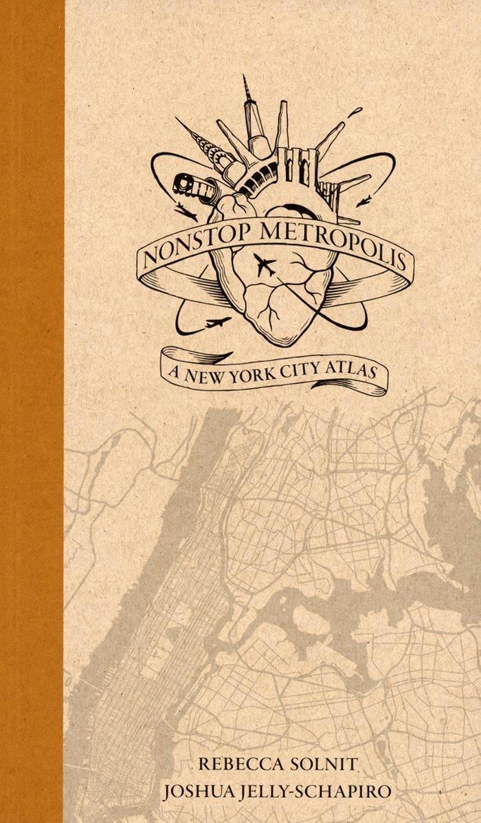
''Nonstop Metropolis'', the culminating volume in a trilogy of atlases, conveys innumerable unbound experiences of New York City through twenty-six imaginative maps and informative essays. Bringing together the insights of dozens of experts—from linguists to music historians, ethnographers, urbanists, and environmental journalists—amplified by cartographers, artists, and(...)
$38.95
(disponible sur commande)
Résumé:
''Nonstop Metropolis'', the culminating volume in a trilogy of atlases, conveys innumerable unbound experiences of New York City through twenty-six imaginative maps and informative essays. Bringing together the insights of dozens of experts—from linguists to music historians, ethnographers, urbanists, and environmental journalists—amplified by cartographers, artists, and(...)
Publication:
octobre 2016
octobre 2016
Titre:
Nonstop metropolis: a New York City atlas
Actions:
Prix:
$38.95
(disponible sur commande)
Résumé:
''Nonstop Metropolis'', the culminating volume in a trilogy of atlases, conveys innumerable unbound experiences of New York City through twenty-six imaginative maps and informative essays. Bringing together the insights of dozens of experts—from linguists to music historians, ethnographers, urbanists, and environmental journalists—amplified by cartographers, artists, and photographers, it explores all five boroughs of New York City and parts of nearby New Jersey. We are invited to travel through Manhattan’s playgrounds, from polyglot Queens to many-faceted Brooklyn, and from the resilient Bronx to the mystical kung fu hip-hop mecca of Staten Island.
Classification:
livres
livres
Publication:
octobre 2016
octobre 2016