705 Résultats
Classification:
livres
livres
Titre:
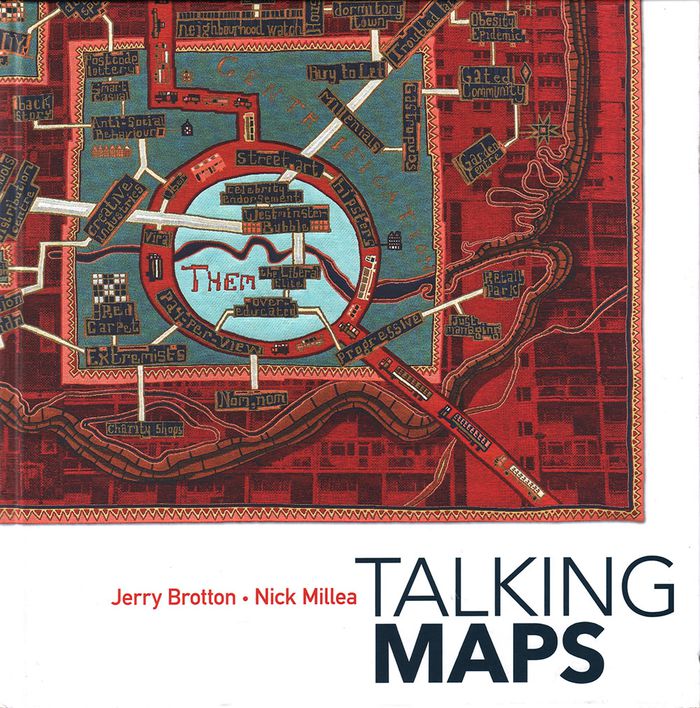
Talking maps
Talking maps
Actions:
Prix:
$74.95
(disponible sur commande)
Résumé:
Every map tells a story. Some provide a narrative for travelers, explorers, and surveyors or offer a visual account of changes to people’s lives and surroundings, while others tell imaginary tales, transporting us to fictional worlds created by writers and artists. In turn, maps generate more stories, taking users on new journeys in search of knowledge and adventure. By(...)
Publication:
novembre 2019
novembre 2019
Titre:
Talking maps
Actions:
Prix:
$74.95
(disponible sur commande)
Résumé:
Every map tells a story. Some provide a narrative for travelers, explorers, and surveyors or offer a visual account of changes to people’s lives and surroundings, while others tell imaginary tales, transporting us to fictional worlds created by writers and artists. In turn, maps generate more stories, taking users on new journeys in search of knowledge and adventure. By telling the stories behind the artifacts and those generated by them, "Talking Maps " reveals how each map is not just a tool for navigation but also a worldly proposal that helps us to understand who we are by describing where we are.
Classification:
livres
livres
Publication:
novembre 2019
novembre 2019
Classification:
livres
livres
Prix:
$70.00
(disponible sur commande)
Résumé:
This is the first book to catalog comparative maps and tableaux that visualize the heights and lengths of the world's mountains and rivers. Produced predominantly in the nineteenth century, these maps emerged out of the tide of exploration and scientific developments in measuring techniques. Beginning with the work of explorer Alexander von Humboldt, these historic(...)
Publication:
septembre 2019
septembre 2019
Titre:
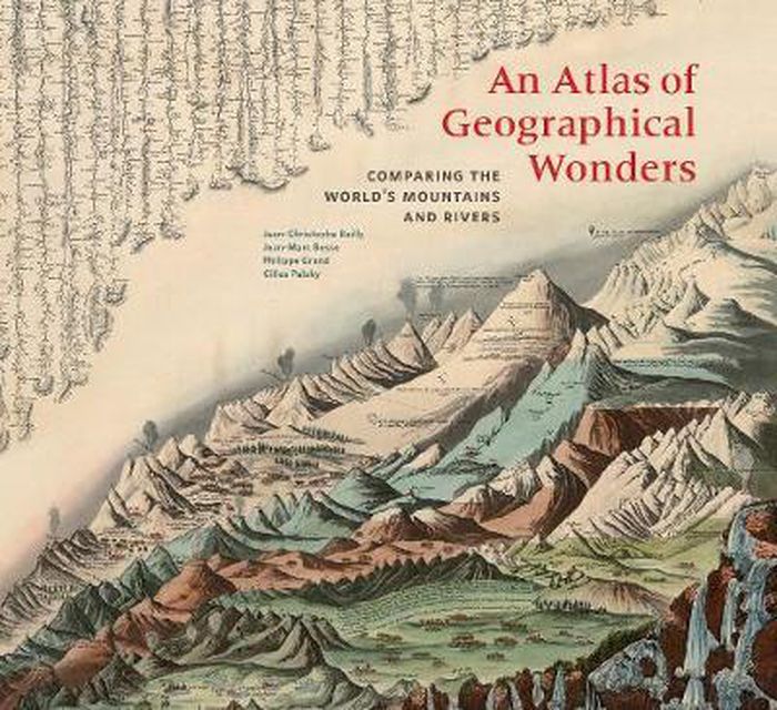
An atlas of geographical wonders: from mountaintops to riverbeds
Actions:
Prix:
$70.00
(disponible sur commande)
Résumé:
This is the first book to catalog comparative maps and tableaux that visualize the heights and lengths of the world's mountains and rivers. Produced predominantly in the nineteenth century, these maps emerged out of the tide of exploration and scientific developments in measuring techniques. Beginning with the work of explorer Alexander von Humboldt, these historic drawings reveal a world of artistic and imaginative difference. Many of them give way—and with visible joy—to the power of fantasy in a mesmerizing array of realistic and imaginary forms. Most of the maps are from the David Rumsey Historical Map Collection at Stanford University.
Classification:
livres
livres
Publication:
septembre 2019
septembre 2019
Classification:
livres
livres
Prix:
$20.95
(disponible sur commande)
Résumé:
Sean C. Jackson has been illustrating and exploring mazes for his own enjoyment for more than 30 years. Inspired by art, architecture, and the natural world, his colorfully detailed mazes offer imaginative and meditative journeys through village streets, garden vistas, island habitats, castle grounds, scenic towns, and gravity-defying surreal situations—each encouraging(...)
Titre:
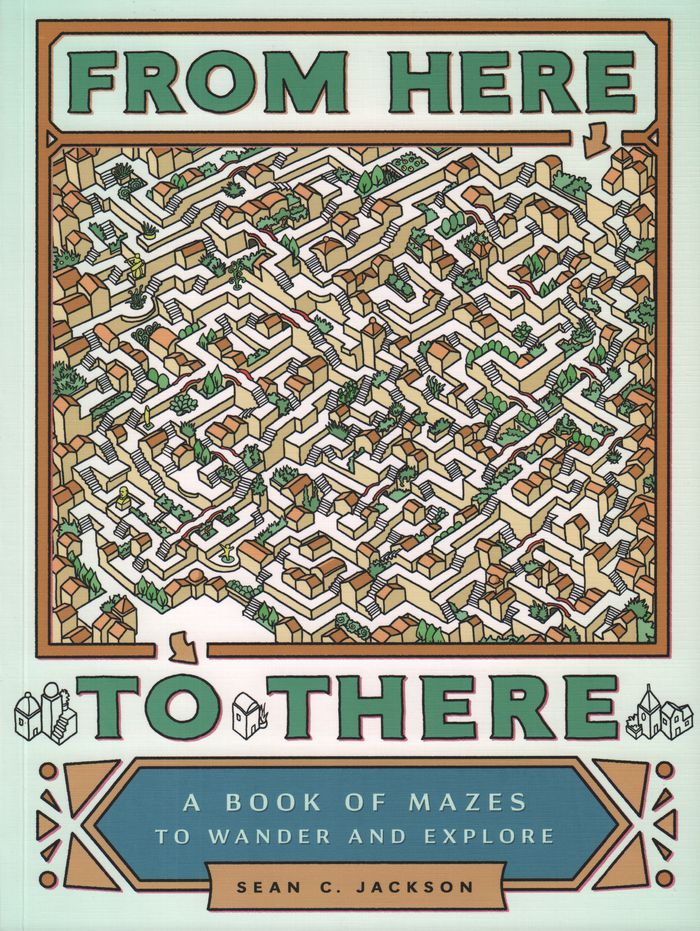
From here to there : a book of mazes to wander and explore
Actions:
Prix:
$20.95
(disponible sur commande)
Résumé:
Sean C. Jackson has been illustrating and exploring mazes for his own enjoyment for more than 30 years. Inspired by art, architecture, and the natural world, his colorfully detailed mazes offer imaginative and meditative journeys through village streets, garden vistas, island habitats, castle grounds, scenic towns, and gravity-defying surreal situations—each encouraging the mind to wander while following the paths. This large-format collection features nearly 50 absorbing single-page and full-spread mazes, sequenced with increasing complexity, and includes inventive bonuses such as mazes with two paths to follow and a maze that runs on the inside covers from front to back. Solutions are provided, but for those seeking mindful activity or hours of puzzle decoding entertainment, getting there will be half the fun.
Classification:
livres
livres
Publication:
février 2017
février 2017
Classification:
livres
livres
Actions:
Prix:
$50.00
(disponible sur commande)
Résumé:
This collection of maps explores the unique personalities of 28 cities around the world, shedding light on the strange and marvelous ways in which humans interact with the places they call home. Artist and creative cartographer Adam Dant dissects Manhattan in an anatomical diagram, traces the form of a Picasso nude in the streets of Monaco, and transforms the(...)
Titre:
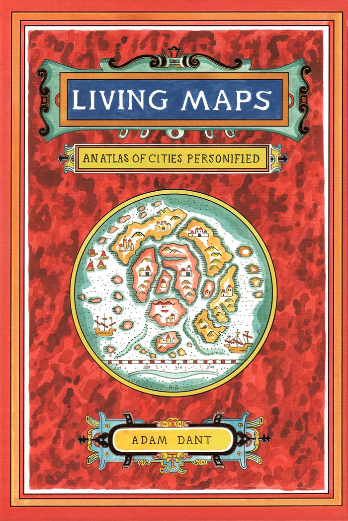
Living maps: an atlas of cities personified
Actions:
Prix:
$50.00
(disponible sur commande)
Résumé:
This collection of maps explores the unique personalities of 28 cities around the world, shedding light on the strange and marvelous ways in which humans interact with the places they call home. Artist and creative cartographer Adam Dant dissects Manhattan in an anatomical diagram, traces the form of a Picasso nude in the streets of Monaco, and transforms the crisscrossing paths of boats on the Bosporus into the nerves of Istanbul. Dant draws on the history, culture, and geography of each city and on the beguiling aesthetic of antique maps to create gorgeous works of cartographic art. Witty, insightful, and adorned with a gold foil–stamped cover, this book will capture the imaginations of travelers, map enthusiasts, history buffs, and dreamers.
Classification:
livres
livres
Publication:
octobre 2018
octobre 2018
Classification:
livres
livres
Actions:
Prix:
$42.99
(disponible sur commande)
Résumé:
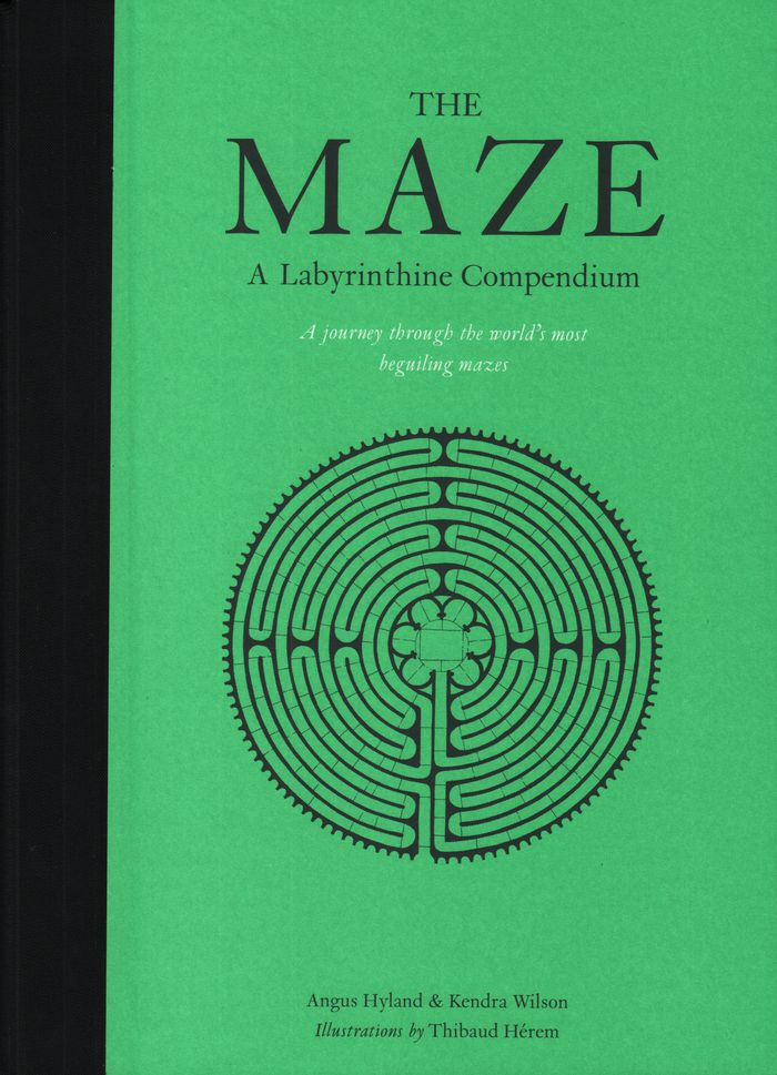
Mazes have been a part of civilization for at least 4,000 years, and there are more being built now than ever before. What is it about these magical life-size puzzles that continues to intrigue us? The illustrations represent 60 real and imagined mazes from around the world, with a bird’s eye view of each maze. Each maze is also accompanied by a short history.
$42.99
(disponible sur commande)
Résumé:
Mazes have been a part of civilization for at least 4,000 years, and there are more being built now than ever before. What is it about these magical life-size puzzles that continues to intrigue us? The illustrations represent 60 real and imagined mazes from around the world, with a bird’s eye view of each maze. Each maze is also accompanied by a short history.
Publication:
septembre 2018
septembre 2018
Titre:
The maze: a labyrinthine compendium
Actions:
Prix:
$42.99
(disponible sur commande)
Résumé:
Mazes have been a part of civilization for at least 4,000 years, and there are more being built now than ever before. What is it about these magical life-size puzzles that continues to intrigue us? The illustrations represent 60 real and imagined mazes from around the world, with a bird’s eye view of each maze. Each maze is also accompanied by a short history.
Classification:
livres
livres
Publication:
septembre 2018
septembre 2018
Classification:
livres
livres
Titre:
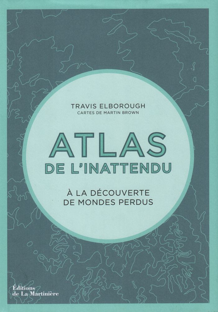
Atlas de l'inattendu
Atlas de l'inattendu
Actions:
Prix:
$57.95
(disponible sur commande)
Résumé:
Dans cette atlas, Travis Elborough poursuit son exploration mondiale des lieux inattendus, des bizarreries architecturales et autres curiosités de notre planète. À partir des cartes de Martin Brown et de documents photographiques, il cultive notre goût de l'insolite et du voyage. Des villages flottants du lac Titicaca aux arbres biscornus de Slope Point en(...)
Titre:
Atlas de l'inattendu
Actions:
Prix:
$57.95
(disponible sur commande)
Résumé:
Dans cette atlas, Travis Elborough poursuit son exploration mondiale des lieux inattendus, des bizarreries architecturales et autres curiosités de notre planète. À partir des cartes de Martin Brown et de documents photographiques, il cultive notre goût de l'insolite et du voyage. Des villages flottants du lac Titicaca aux arbres biscornus de Slope Point en Nouvelle-Zélande, des hauteurs vertigineuses d'un monastère taoïste à l'écho souterrain d'une grotte aux coquillages, Travis Elborough nous raconte un monde insoupçonné.
Classification:
livres
livres
Publication:
décembre 2018
décembre 2018
Classification:
livres
livres
Titre:
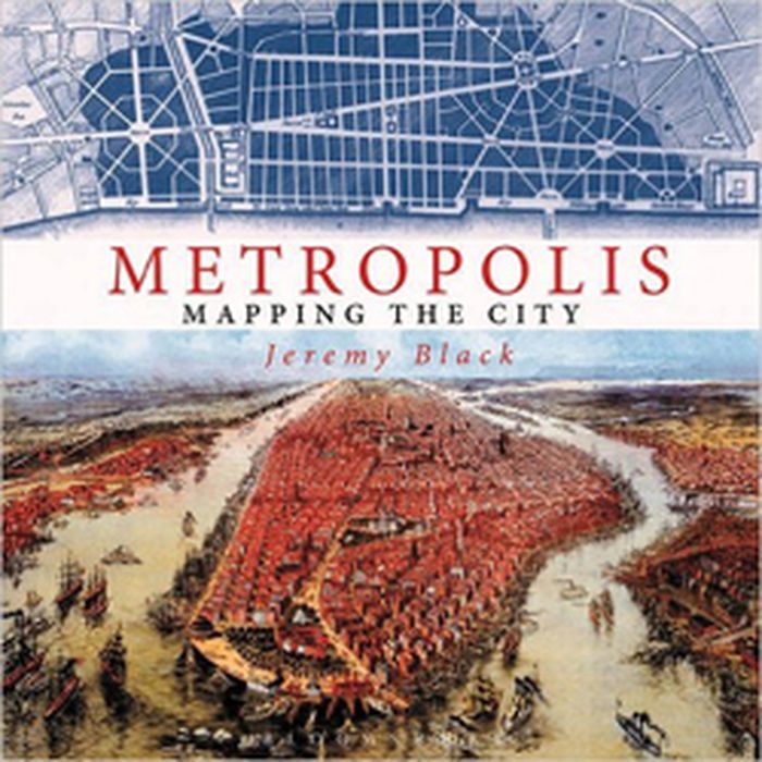
Metropolis: mapping the city
Metropolis: mapping the city
Actions:
Prix:
$63.95
(disponible sur commande)
Résumé:
This volume looks at the development of the mapping and representation of the city revealing how we organize the urban space. From skyline profiles, bird's eye views and panoramas, to the schematic maps of transport networks and road layouts to help us navigate, and statistical maps that can provide information on human aspirations, cities can reveal themselves in many(...)
Titre:
Metropolis: mapping the city
Actions:
Prix:
$63.95
(disponible sur commande)
Résumé:
This volume looks at the development of the mapping and representation of the city revealing how we organize the urban space. From skyline profiles, bird's eye views and panoramas, to the schematic maps of transport networks and road layouts to help us navigate, and statistical maps that can provide information on human aspirations, cities can reveal themselves in many ways. Focusing on key points in the development of urban representation and including visions of the future of how we would be living today, this enlightening book illustrates some of the oldest, youngest, liveliest, and most contested cities in the world
Classification:
livres
livres
Publication:
novembre 2015
novembre 2015
Classification:
livres
livres

Actions:
Prix:
$59.95
(disponible sur commande)
Résumé:
Parcourant le monde à travers des cartes de toutes provenances et de toutes époques, l'écrivain de voyage Francisca Mattéoli raconte une vingtaine d'histoires étonnantes sur la géographie des lieux pour comprendre comment les endroits les plus magiques de la planète ont été révélés au plus grand nombre. De la route 66 avec les premiers colons, en passant par la découverte(...)
Titre:
Map stories. Histoires de cartes
Actions:
Prix:
$59.95
(disponible sur commande)
Résumé:
Parcourant le monde à travers des cartes de toutes provenances et de toutes époques, l'écrivain de voyage Francisca Mattéoli raconte une vingtaine d'histoires étonnantes sur la géographie des lieux pour comprendre comment les endroits les plus magiques de la planète ont été révélés au plus grand nombre. De la route 66 avec les premiers colons, en passant par la découverte tardive de Petra ou des Maldives, c'est un voyage dans le temps et dans l'espace pour mieux appréhender le monde tel qu'on le connaît aujourd'hui et la place que nous y avons.
Classification:
livres
livres
Publication:
décembre 2015
décembre 2015
Classification:
livres
livres
Actions:
Prix:
$32.00
(disponible sur commande)
Résumé:
The acclaimed geographer Denis Wood has written numerous books (including the influential bestseller The Power of Maps) that reorient his readers to our neighborhoods, homes and bodies. At the heart of Wood’s investigations is a near-legendary endeavor: the Boylan Heights maps, begun in 1982, and first presented in Everything Sings (2010). This second edition includes(...)
Titre:
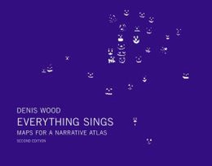
Denis Wood : everything sings, maps for a narrative atlas, 2nd revised edition
Actions:
Prix:
$32.00
(disponible sur commande)
Résumé:
The acclaimed geographer Denis Wood has written numerous books (including the influential bestseller The Power of Maps) that reorient his readers to our neighborhoods, homes and bodies. At the heart of Wood’s investigations is a near-legendary endeavor: the Boylan Heights maps, begun in 1982, and first presented in Everything Sings (2010). This second edition includes eight new maps (including one of barking dogs!), other new visual material plus original essays by Ander Monson and Albert Mobilio and an interview with Blake Butler.
Classification:
livres
livres
Publication:
juin 2013
juin 2013
Classification:
livres
livres
Prix:
$42.95
(disponible sur commande)
Résumé:
The maps in this book are drawn with satellites, assembled with pixels radioed from outer space, and constructed from statistics; they record situations of intense conflict and express fundamental transformations in our ways of seeing and of experiencing space. These maps are built with GPS, remote sensing satellites,or GIS: digital spatial hardware and software designed(...)
Titre:
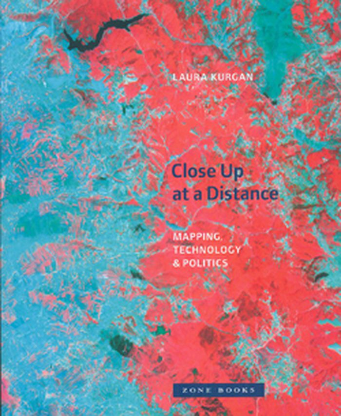
Close up at a distance: mapping, technology and politics
Actions:
Prix:
$42.95
(disponible sur commande)
Résumé:
The maps in this book are drawn with satellites, assembled with pixels radioed from outer space, and constructed from statistics; they record situations of intense conflict and express fundamental transformations in our ways of seeing and of experiencing space. These maps are built with GPS, remote sensing satellites,or GIS: digital spatial hardware and software designed for such military and governmental uses as reconnaissance, secrecy, monitoring, ballistics, the census, and national security. Rather than shying away from the politics and complexities of their intended uses, Laura Kurgan attempts to illuminate them. Poised at the intersection of art, architecture, activism, and geography, her analysis uncovers the implicit biases of the new views, the means of recording information they present, and the new spaces they have opened up.
Classification:
livres
livres
Publication:
mars 2013
mars 2013