705 Résultats
Classification:
cartes
cartes
Actions:
Exemplaires:
Description:
1 atlas (128 unnumbered pages) : color maps ; 17 cm
Description:
1 atlas (128 unnumbered pages) : color maps ; 17 cm
Auteur:
Sujet:
- Paris (France) Maps.,
- Paris (France) Miscellanea Maps.,
- thematic maps.,
- atlases.,
- Thematic maps.,
- Atlases.,
- Cartes thématiques.,
- Atlas.
Publication:
[Paris] : Le Tripode, 2024.
[Paris] : Le Tripode, 2024.
Titre:
Atlas inutile de Paris / Vincent Périat.
Actions:
Exemplaires:
Description:
1 atlas (128 unnumbered pages) : color maps ; 17 cm
Atlas inutile de Paris / Vincent Périat.
Actions:
Exemplaires:
Description:
1 atlas (128 unnumbered pages) : color maps ; 17 cm
Classification:
cartes
cartes
Publication:
[Paris] : Le Tripode, 2024.
[Paris] : Le Tripode, 2024.
Auteur:
Sujet:
- Paris (France) Maps.,
- Paris (France) Miscellanea Maps.,
- thematic maps.,
- atlases.,
- Thematic maps.,
- Atlases.,
- Cartes thématiques.,
- Atlas.
Classification:
cartes
cartes
Exemplaires:
Description:
1 map : colour ; 38 x 53 cm, folded to 27 x 19 cm
Description:
1 map : colour ; 38 x 53 cm, folded to 27 x 19 cm
Auteur:
Sujet:
- Florence (Italy) Maps.,
- Italy Florence,
- tourist maps.,
- Maps,
- Tourist maps.,
- Cartes touristiques.
Publication:
Firenze : Edizioni S. Becocci, 1985.
Firenze : Edizioni S. Becocci, 1985.
Titre:
Firenze : Florence = Florence = Florenz = Florencia.
Actions:
Exemplaires:
Description:
1 map : colour ; 38 x 53 cm, folded to 27 x 19 cm
Firenze : Florence = Florence = Florenz = Florencia.
Actions:
Exemplaires:
Description:
1 map : colour ; 38 x 53 cm, folded to 27 x 19 cm
Classification:
cartes
cartes
Publication:
Firenze : Edizioni S. Becocci, 1985.
Firenze : Edizioni S. Becocci, 1985.
Auteur:
Sujet:
- Florence (Italy) Maps.,
- Italy Florence,
- tourist maps.,
- Maps,
- Tourist maps.,
- Cartes touristiques.
Classification:
livres
livres
Actions:
Exemplaires:
Description:
x, 58 pages ; 30 cm
- Bibliothèque cataloguing office 18911 | PO4854 CAT; ID:87-B6171 | Disponible
Description:
x, 58 pages ; 30 cm
Auteur:
- International Federation of Library Associations and Institutions. Joint Working Group on the International Standard Bibliographic Description for Cartographic Materials.
Sujet:
- International Standard Bibliographic Description for Cartographic Materials.,
- Cataloging of cartographic materials Standards.,
- Descriptive cataloging Standards.,
- International Standard Bibliographic Description.,
- Descriptive cataloging.,
- Cataloging Maps.,
- Description bibliographique internationale normalisée.,
- Description bibliographique.,
- Catalogage Cartes.,
- Catalogage Documents cartographiques Normes.,
- Description bibliographique Normes.,
- descriptive cataloging.,
- Map librarianship - Cataloguing and classification. [Literature].,
- Cataloging,
- IFLA.,
- international.,
- standard.,
- cataloguing.,
- FIAB.,
- norme.,
- catalogage.,
- internacional.,
- norma.,
- catalogación.,
- Maps Descriptive cataloguing Standards,
- Maps,
- recommendation.,
- map.,
- reference.,
- recommandation.,
- carte géographique.,
- référence bibliographique.,
- recomendación.,
- mapa.,
- referencia.
Publication:
London : IFLA International Office for UBC, 1977.
London : IFLA International Office for UBC, 1977.
Titre:
ISBD (CM) : International Standard Bibliographic Description for Cartographic Materials / recommended by the Joint Working Group on the International Standard Bibliographic Description for Cartographic Materials set up by the IFLA Committee on Cataloguing and the IFLA Sub-section of Geography and Map Libraries.
Actions:
Exemplaires:
Description:
x, 58 pages ; 30 cm
ISBD (CM) : International Standard Bibliographic Description for Cartographic Materials / recommended by the Joint Working Group on the International Standard Bibliographic Description for Cartographic Materials set up by the IFLA Committee on Cataloguing and the IFLA Sub-section of Geography and Map Libraries.
Actions:
Exemplaires:
- Bibliothèque cataloguing office 18911 | PO4854 CAT; ID:87-B6171 | Disponible
Description:
x, 58 pages ; 30 cm
Classification:
livres
livres
Publication:
London : IFLA International Office for UBC, 1977.
London : IFLA International Office for UBC, 1977.
Auteur:
- International Federation of Library Associations and Institutions. Joint Working Group on the International Standard Bibliographic Description for Cartographic Materials.
Sujet:
- International Standard Bibliographic Description for Cartographic Materials.,
- Cataloging of cartographic materials Standards.,
- Descriptive cataloging Standards.,
- International Standard Bibliographic Description.,
- Descriptive cataloging.,
- Cataloging Maps.,
- Description bibliographique internationale normalisée.,
- Description bibliographique.,
- Catalogage Cartes.,
- Catalogage Documents cartographiques Normes.,
- Description bibliographique Normes.,
- descriptive cataloging.,
- Map librarianship - Cataloguing and classification. [Literature].,
- Cataloging,
- IFLA.,
- international.,
- standard.,
- cataloguing.,
- FIAB.,
- norme.,
- catalogage.,
- internacional.,
- norma.,
- catalogación.,
- Maps Descriptive cataloguing Standards,
- Maps,
- recommendation.,
- map.,
- reference.,
- recommandation.,
- carte géographique.,
- référence bibliographique.,
- recomendación.,
- mapa.,
- referencia.
Classification:
livres
livres
Prix:
$45.95
(disponible sur commande)
Résumé:
On connaît Guy Debord pour avoir été poète, cinéaste, artiste, théoricien révolutionnaire, directeur de revue et fondateur de mouvements d’avant-garde. Mais il fut surtout stratège. Qu’entend-on par là? Que la poésie, le cinéma, la théorie, et l’avant-garde furent pour lui les moyens employés dans le cadre d’un conflit contre la société de son temps. Un objet en(...)
Titre:
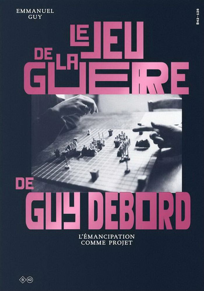
Le jeu de la guerre de Guy Debord : l'émancipation comme projet
Actions:
Prix:
$45.95
(disponible sur commande)
Résumé:
On connaît Guy Debord pour avoir été poète, cinéaste, artiste, théoricien révolutionnaire, directeur de revue et fondateur de mouvements d’avant-garde. Mais il fut surtout stratège. Qu’entend-on par là? Que la poésie, le cinéma, la théorie, et l’avant-garde furent pour lui les moyens employés dans le cadre d’un conflit contre la société de son temps. Un objet en particulier, Le Jeu de la guerre, dont la vocation était d’aiguiser le sens stratégique et la conscience d’une incessante guerre à mener, répond de cet objectif. Debord conçoit dans le milieu des années 1950 un jeu, qui se présente sous la forme d’un plateau quadrillé et de pions représentant les diverses unités d’une armée, qu’il pratique et cherche à diffuser tout au long de sa vie. En tant que modélisation de la guerre, le jeu permet de retrouver la charge critique des recherches situationnistes sur l’espace, la cartographie, les labyrinthes et le ludique en général. À l’heure où le design – qu’il soit d’objets, de systèmes, d’interfaces ou d’expérience – tend à envahir les discours et englober de plus en plus de champs de l’activité créative, technique, sociale et économique, et où l’art peine à penser les conditions de sa validité émancipatrice, Emmanuel Guy propose à travers cette analyse une relecture de l’œuvre critique de Guy Debord sous l’angle de la stratégie. Tiré de sa thèse de doctorat, ce livre offre un regard nouveau sur la vie de l’un des plus grands intellectuels de la deuxième moitié du XXe siècle.
Classification:
livres
livres
Publication:
novembre 2020
novembre 2020
Sujet:
Théorie de l’art
Théorie de l’art
Classification:
cartes
cartes
Actions:
Exemplaires:
Description:
1 atlas (85 unnumbered leaves) : all maps ; 45 cm
- Bibliothèque cage m 180686 | G1115 (ID:98-M18) | c. 2 | Disponible
- Bibliothèque cage m 180685 | G1115 (ID:98-M18) | c. 1 | Disponible
Description:
1 atlas (85 unnumbered leaves) : all maps ; 45 cm
Auteur:
- Devine, Thomas (Draughtsman),,
- Matthews, George, approximately 1816-1864,,
- Canada. Crown Lands Department.,
- G. Matthews' Lith. (Firm),
Sujet:
- Counties Maps.,
- Québec (Province) Maps.,
- Ontario Maps.,
- Québec (Province) Administrative and political divisions Maps.,
- Ontario Administrative and political divisions Maps.,
- Ontario,
- Québec,
- Atlases.,
- atlases.,
- Atlas.
Publication:
[Montreal] : [Matthews' Lith.], [184-?]
[Montreal] : [Matthews' Lith.], [184-?]
Titre:
[Atlas consisting of 43 numbered maps of the counties in Quebec, and 42 unnumbered maps of the counties in Ontario].
Actions:
Exemplaires:
Description:
1 atlas (85 unnumbered leaves) : all maps ; 45 cm
[Atlas consisting of 43 numbered maps of the counties in Quebec, and 42 unnumbered maps of the counties in Ontario].
Actions:
Exemplaires:
- Bibliothèque cage m 180686 | G1115 (ID:98-M18) | c. 2 | Disponible
- Bibliothèque cage m 180685 | G1115 (ID:98-M18) | c. 1 | Disponible
Description:
1 atlas (85 unnumbered leaves) : all maps ; 45 cm
Classification:
cartes
cartes
Publication:
[Montreal] : [Matthews' Lith.], [184-?]
[Montreal] : [Matthews' Lith.], [184-?]
Auteur:
- Devine, Thomas (Draughtsman),,
- Matthews, George, approximately 1816-1864,,
- Canada. Crown Lands Department.,
- G. Matthews' Lith. (Firm),
Sujet:
- Counties Maps.,
- Québec (Province) Maps.,
- Ontario Maps.,
- Québec (Province) Administrative and political divisions Maps.,
- Ontario Administrative and political divisions Maps.,
- Ontario,
- Québec,
- Atlases.,
- atlases.,
- Atlas.
Classification:
cartes
cartes
Actions:
Exemplaires:
Description:
1 map : color ; 60 x 42 cm, folded to 15 x 21 cm in paper band 21 x 10 cm
Description:
1 map : color ; 60 x 42 cm, folded to 15 x 21 cm in paper band 21 x 10 cm
Auteur:
- Supergroup Studios (Firm),,
- Meier, Allison C. (Allison Christine), 1985-,
- Montgomery, Colin,,
- Blue Crow Media Ltd.,
Sujet:
- Trees New York (State) New York Maps.,
- Historic trees New York (State) New York Maps.,
- Historic trees,
- Trees,
- New York (State) New York,
- thematic maps.,
- Thematic maps,
- Maps,
- Cartes thématiques.
Publication:
[London] : Blue Crow Media, [2021], ©2021
[London] : Blue Crow Media, [2021], ©2021
Titre:
Great trees of New York map / texts by Allison Meier ; photography by Colin Montgomery ; design by Supergroup Studios.
Actions:
Exemplaires:
Description:
1 map : color ; 60 x 42 cm, folded to 15 x 21 cm in paper band 21 x 10 cm
Great trees of New York map / texts by Allison Meier ; photography by Colin Montgomery ; design by Supergroup Studios.
Actions:
Exemplaires:
Description:
1 map : color ; 60 x 42 cm, folded to 15 x 21 cm in paper band 21 x 10 cm
Classification:
cartes
cartes
Publication:
[London] : Blue Crow Media, [2021], ©2021
[London] : Blue Crow Media, [2021], ©2021
Auteur:
- Supergroup Studios (Firm),,
- Meier, Allison C. (Allison Christine), 1985-,
- Montgomery, Colin,,
- Blue Crow Media Ltd.,
Sujet:
- Trees New York (State) New York Maps.,
- Historic trees New York (State) New York Maps.,
- Historic trees,
- Trees,
- New York (State) New York,
- thematic maps.,
- Thematic maps,
- Maps,
- Cartes thématiques.
Classification:
cartes
cartes
Actions:
Exemplaires:
Description:
1 map : color ; 60 x 42 cm, folded to 15 x 21 cm in paper band 10 x 16 cm
Description:
1 map : color ; 60 x 42 cm, folded to 15 x 21 cm in paper band 10 x 16 cm
Auteur:
- Supergroup Studios (Firm),,
- Bell, Vanessa (Travel writer),,
- Rojas, Javier Agustin,,
- Blue Crow Media Ltd.,
Sujet:
- Brutalism (Architecture) Argentina Buenos Aires Maps.,
- Brutalism (Architecture),
- Buenos Aires (Argentina) Buildings, structures, etc. Maps.,
- Buenos Aires (Argentina) Maps.,
- Argentina Buenos Aires,
- thematic maps.,
- Maps,
- Thematic maps,
- Cartes thématiques.
Publication:
[London] : Blue Crow Media, [2022], ©2022
[London] : Blue Crow Media, [2022], ©2022
Titre:
Mapa brutalista de Buenos Aires = Brutalist Buenos Aires map / text by Vanessa Bell ; photography by Javier Agustin Rojas ; design by Supergroup Studios.
Actions:
Exemplaires:
Description:
1 map : color ; 60 x 42 cm, folded to 15 x 21 cm in paper band 10 x 16 cm
Mapa brutalista de Buenos Aires = Brutalist Buenos Aires map / text by Vanessa Bell ; photography by Javier Agustin Rojas ; design by Supergroup Studios.
Actions:
Exemplaires:
Description:
1 map : color ; 60 x 42 cm, folded to 15 x 21 cm in paper band 10 x 16 cm
Classification:
cartes
cartes
Publication:
[London] : Blue Crow Media, [2022], ©2022
[London] : Blue Crow Media, [2022], ©2022
Auteur:
- Supergroup Studios (Firm),,
- Bell, Vanessa (Travel writer),,
- Rojas, Javier Agustin,,
- Blue Crow Media Ltd.,
Sujet:
- Brutalism (Architecture) Argentina Buenos Aires Maps.,
- Brutalism (Architecture),
- Buenos Aires (Argentina) Buildings, structures, etc. Maps.,
- Buenos Aires (Argentina) Maps.,
- Argentina Buenos Aires,
- thematic maps.,
- Maps,
- Thematic maps,
- Cartes thématiques.
Classification:
cartes
cartes
Actions:
Exemplaires:
Description:
1 map : color ; 42 x 60 cm, folded to 21 x 15 cm in paper band 10 x 16 cm
Description:
1 map : color ; 42 x 60 cm, folded to 21 x 15 cm in paper band 10 x 16 cm
Auteur:
- Supergroup Studios (Firm),,
- Wilson, Robin, 1971-,
- Green, Nigel (Photographer),
- Blue Crow Media Ltd.,
Sujet:
- Modern movement (Architecture) England London 20th century Maps.,
- Modern movement (Architecture),
- England London,
- thematic maps.,
- Maps,
- Thematic maps,
- Cartes thématiques.
Publication:
[London] : Blue Crow Media, [2022], ©2022
[London] : Blue Crow Media, [2022], ©2022
Titre:
Modern London map / edited by Robin Wilson ; photography by Nigel Green ; design by Supergroup Studios.
Actions:
Exemplaires:
Description:
1 map : color ; 42 x 60 cm, folded to 21 x 15 cm in paper band 10 x 16 cm
Modern London map / edited by Robin Wilson ; photography by Nigel Green ; design by Supergroup Studios.
Actions:
Exemplaires:
Description:
1 map : color ; 42 x 60 cm, folded to 21 x 15 cm in paper band 10 x 16 cm
Classification:
cartes
cartes
Publication:
[London] : Blue Crow Media, [2022], ©2022
[London] : Blue Crow Media, [2022], ©2022
Auteur:
- Supergroup Studios (Firm),,
- Wilson, Robin, 1971-,
- Green, Nigel (Photographer),
- Blue Crow Media Ltd.,
Sujet:
- Modern movement (Architecture) England London 20th century Maps.,
- Modern movement (Architecture),
- England London,
- thematic maps.,
- Maps,
- Thematic maps,
- Cartes thématiques.
Classification:
cartes
cartes
Exemplaires:
Description:
1 atlas (157 pages) : color illustrations, color maps ; 27 cm
Description:
1 atlas (157 pages) : color illustrations, color maps ; 27 cm
Auteur:
Sujet:
- Curiosities and wonders Geography Atlases.,
- Boundaries Miscellanea Atlases.,
- Curiosités et merveilles Géographie Atlas.,
- Frontières Miscellanées Atlas.,
- atlases.,
- world atlases.,
- Atlases,
- Scientific atlases,
- World atlases,
- Atlas.,
- Atlas mondiaux.
Publication:
[Versailles] : Éditions Jonglez, [2022], ©2022
[Versailles] : Éditions Jonglez, [2022], ©2022
Titre:
Atlas des curiosités géographiques / Vitali Vitaliev.
Actions:
Exemplaires:
Description:
1 atlas (157 pages) : color illustrations, color maps ; 27 cm
Atlas des curiosités géographiques / Vitali Vitaliev.
Actions:
Exemplaires:
Description:
1 atlas (157 pages) : color illustrations, color maps ; 27 cm
Classification:
cartes
cartes
Publication:
[Versailles] : Éditions Jonglez, [2022], ©2022
[Versailles] : Éditions Jonglez, [2022], ©2022
Auteur:
Sujet:
- Curiosities and wonders Geography Atlases.,
- Boundaries Miscellanea Atlases.,
- Curiosités et merveilles Géographie Atlas.,
- Frontières Miscellanées Atlas.,
- atlases.,
- world atlases.,
- Atlases,
- Scientific atlases,
- World atlases,
- Atlas.,
- Atlas mondiaux.
Classification:
cartes
cartes
Actions:
Exemplaires:
Description:
1 atlas (57 pages) : color maps ; 26 cm
Description:
1 atlas (57 pages) : color maps ; 26 cm
Auteur:
Sujet:
- Atlases Pakistan.,
- Erde.,
- Pakistan Maps.,
- Pakistan,
- world atlases.,
- Atlases,
- Maps,
- World atlases,
- Atlas mondiaux.
Publication:
Karachi : Oxford University Press, 1959.
Karachi : Oxford University Press, 1959.
Titre:
Oxford school atlas for Pakistan / advisory editors, Dr. Kazi S. Ahmad, Head of the Department of Geography, University of the Panjab, Dr. Nafis Ahmad, Head of the Department of Geography, Dacca University.
Actions:
Exemplaires:
Description:
1 atlas (57 pages) : color maps ; 26 cm
Oxford school atlas for Pakistan / advisory editors, Dr. Kazi S. Ahmad, Head of the Department of Geography, University of the Panjab, Dr. Nafis Ahmad, Head of the Department of Geography, Dacca University.
Actions:
Exemplaires:
Description:
1 atlas (57 pages) : color maps ; 26 cm
Classification:
cartes
cartes
Publication:
Karachi : Oxford University Press, 1959.
Karachi : Oxford University Press, 1959.
Auteur:
Sujet:
- Atlases Pakistan.,
- Erde.,
- Pakistan Maps.,
- Pakistan,
- world atlases.,
- Atlases,
- Maps,
- World atlases,
- Atlas mondiaux.